Grassland Information
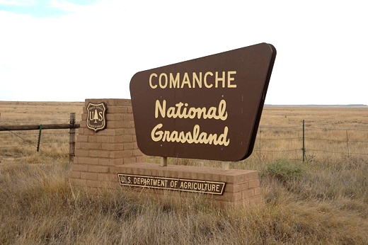
The Comanche National Grassland (NG) is comprised of 435,319 acres and located in southeast Colorado. Overall administration is provided by the Pike and San Isabel National Forests supervisor office, Rocky Mountain Region. There is one developed campground.
The Comanche National Grassland (NG) has two sections - the Timpas Unit near La Junta, CO and the Carrizo Unit near Springfield, CO. Both are a patchwork of federal, state, and private land but the Timpas Unit is closer to the large population centers of Pueblo and Trindad, CO while the Carrizo Unit is more rural with Springfield the only major concentration of population. The Carrizo Unit is also more fragmented. The topography of both units vary from steep canyons with a few trees in the southern portion to flat or gently rolling slopes covered by sage, yucca, and cactus to the north. This variation of topography provides a variety of recreational opportunities from camping to wildlife viewing, including hiking, scenic drives, star-gazing, hunting, bird-watching, and so much more.
The Comanche NG was settled in the 1800s under a variety of "Homestead Acts," which opened the land to people, generally farmers, and helped to settle the west. A prolonged period of drought in the late 1920s into the 1930s caused some homesteads on sub-marginal farmland (a location receiving 15 or less inches of annual moisture) to literally dry up. During this time, Congress established the Land Utilization Program (LUP) which bought homesteads from bankrupt private owners and returned it to public land status. In the 1950s, the LUP holdings were assigned to the USDA Forest Service who was tasked with management of these sub-marginal lands. Over the years the Forest Service has established some twenty National Grasslands, including Comanche, from sub-marginal lands. "The designation of the area as National Grassland is not a description of the area as much as a statement of policy and effort to restore the area to a multiple of uses and benefits."
One indicator of Forest Service success can be seen in the vast agriculture efforts scattered throughout the Comanche. It is hard to imagine this grassland was in the heart of the 1930s Great American Dust Bowl. Although the farming techniques have improved since those hard times, the climate has not changed. The land is still as susceptible to winds and lack of moisture. The Timpas Unit is located in the Rocky Mountain "rainshadow" and receives, on average, about five inches less of rain than does the Carrizo Unit, which gets 17 inches annually. Driving through the Comanche NG, it is apparent the co-operative efforts of the farmers, ranchers, and Forest Service have helped the land recover.
The scenery of the Comanche isn't as dramatic as in the Rocky Mountains but history abounds here more so than in the distant mountains. Evidence, American Indians occupied the area, can be found in rock art in both grassland units and cliff faces in the canyons. Some of the rock art may be as old as 8,000 years and some is so new that it depicts horses which arrived with the Spanish in the 16th century. Vogel Canyon and Picket Wire Canyon are just two of numerous locations where the public is invited to discover examples of rock art. (Remember, all rock art and any other artifact is considered to be part of our fragile, irreplaceable legacy. Do not touch or remove.)
From the 1820s onward, wagon trains loaded with goods for New Mexico (known than as Old Mexico) followed the Santa Fe Trail. A small section of the trail, from the Sierra Vista Overlook (GPS - N37 51.679, W103 43.840) passed Timpas Picnic Area to Iron Springs Information Site (GPS - N37 41.620, W103 54.803), is open to the public. The old wagon trail can be found by following the limestone markers.
Among the first non-Indian settlers on the grassland was a group of eleven New Mexico families who settled in 1871 along the Purgatory River (a.k.a. Picket Wire Canyon) in the Timpas unit. During the same year, Eugene and Mary Rourke established a ranch nearby in the canyon. Visitors can take a Ranger-led auto tour of Picket Wire Canyon (fee and reservations required). Some of the sites on the auto tour are the ruins of old homesteads such as Dolores Mission and the historic, renovated Rourke Ranch; one of the largest dinosaur track-ways in the world; and one of many ancient rock art sites in the canyon.
Other locations with rock art are Picture and Carrizo canyons are in the Carrizo unit. One feature common to both locations is a dependable water source. This means good wildlife viewing opportunities. Wildlife on the grassland includes Pronghorn, Prairie dogs, Lesser prairie chickens, Mule deer, Elk, Wild turkey, Golden eagle, Swift fox and 328 species of birds. Both Picture and Carrizo canyons are also good for star-gazing although some might find the two solitary outdoor lights from a ranch several miles north of Carrizo Canyon a distraction.
The only publicly accessible Lesser Prairie Chicken lek in Colorado is in the Comanche NG. The lek is often closed due to the decline of the prairie chicken population so call ahead for current status.
Perhaps a primary reason for visiting the Comanche is a sense of isolation. Anywhere else in Colorado, there are many other visitors on the trail or in a campground. The Comanche has few of the former and none of the latter. About the closest thing to a "developed" campground is at Picket Wire Canyon trailhead, called Withers Canyon Trailhead, and several picnic areas that allow dispersed overnight camping. A few suggested dispersed campsites are displayed in the main page for this grassland. However, most areas of the grassland are open to dispersed camping. The Motor Vehicle Use Map (MVUM), available from ranger district offices, identifies routes where dispersed camping with a vehicle is permitted and there are many. The only restriction is you must park your vehicle within one vehicle length off the designated route.
There is much to see and even more to do on the Comanche National Grassland. You can: (1) experience the history of the American Indian in the rock art of Carrizo Canyon Picnic Area and the Santa Fe trail at Timpas Picnic Area; (2) walk with the dinosaurs on the Picket Wire Canyon Auto Tour; (3) star gaze at the Picture Canyon Picnic Area; (4) observe wildlife at Vogel Canyon Picnic Area; and (5) enjoy the solitude of a place well off the beaten track.
ADDRESSES
SUPERVISOR ADDRESS
2840 Kachina Drive
Pueblo, Colorado 81008
719-553-1400

RANGER DISTRICT ADDRESS
Carrizo
27204 US Highway 287
P.O. Box 127
Springfield, Colorado 81073
719-523-6591 |