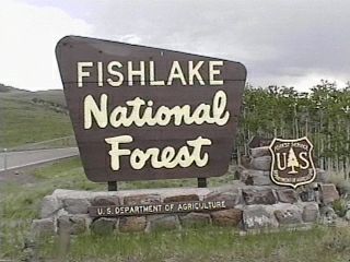
Forest Information
The Fishlake National Forest is comprised of 1,434,592 acres and is divided into five geographic locations (one of which is located in Dixie National Forest) all located in central Utah. There are 27 developed campgrounds of which 15 meet the selection criteria. Three of the campgrounds are located in Dixie National Forest, but administered by Fishlake National Forest, Fremont River Ranger District.
Fishlake National Forest is a forest with many faces. To the east, where the bright blue sky meets the crystal blue of water, is the forest's namesake - Fish Lake. To the west are the weird and fanciful formations of Castle Rock in historic Clear Creek Canyon. The north and the south hold the surprise of lush riparian areas in canyons that lead to sagebrush plains. Dotted with various camping locations for car, tent, recreactional vehicle (RV) motorhome camping enthusiasts, it is all connected by a variety of trails for foot, horse, mountain bike, and ATV.
There are fewer natural lakes in Utah than manmade, which is one of the reasons Fish Lake is so special. Established as a protected reserve by President McKinley in 1899, Fish Lake Basin has developed into a very popular source for recreational opportunities. Supporting the excellent fishing and a network of foot and horse trails are six campgrounds. The level of campground development varies from the near-rustic parking lot design and minimal services of Piute campground to hot showers, flush toilets and aspen-shaded campsites of Mackinaw campground. At about the midway point between Fish Lake and Johnson Valley Reservoir is Frying Pan campground. Its sunny sites provide views of the valley and surrounding mountains. Doctor Creek campground, the closest to the western entrance to Fish Lake Basin, features some lakeshore sites suitable for large rigs and an RV dump station. For those who want to enjoy the area from the top of their horse, Tasha Equestrian campground is the place. The spruce shaded sites and easy access to an extensive trail system make this a pleasant place for both riders and horse. Privately operated resorts, co located with the Forest Service campgrounds, offer a variety of services from laundromats and cafes, for a "cook's-night-out," to boat rentals and bait and an alternative to "roughing-it" at a Forest Service campground.
To the east of I-15 and south of I-70 is Capitol Reef National Park. To the west of the Park is State Rt. 12 that climbs up Boulder Mountain where pull-outs and overlooks provide a stunning view of the Park. Atop Boulder Mountain, there are three developed campgrounds - Singletree, Pleasant Creek and Oak Creek. Singletree campground features a delightful, although challenging for some, hike down to the Singletree Waterfalls, where cascading droplets of cold water fall more then twenty feet and provide a cool and refreshing treat for the hiker. Although located in Dixie National Forest, all three campgrounds are administered by Fishlake National Forest, Fremont River Ranger District office.
To the north, in the Canyon Mountains, is another Oak Creek campground (not to be confussed with Oak Creek campground, above). The mixture of Gamble oak, cottonwood, and various types of maple make this a colorful campground in the autumn. Oak Creek campground has two sections. One section stretches along the Creek with camp sites tucked into a dense growth of vegetation. The other section is a circle with a grass area in the middle making it perfect for large groups. However, it is the wondrous geology surrounding the campground that makes Oak Creek a favorite with geology classes. The fishing and hiking is pretty good, too.
At the southern end of Fishlake National Forest stand the towering Tushar Mountains. Reaching heights of 12,000-feet, the Tushar Mountains contain several auto loop roads, lots of opportunities for hiking, fishing, mountain biking, or just plain relaxing at one of three developed campgrounds located in the mountain's shady depths. Driving up Beaver Canyon on State Route 153, Little Cottonwood campground is the first and closest to Beaver, Utah. With its many cottonwood trees, long paved aprons, and the Beaver River providing a pleasantly tranquil atmosphere, Little Cottonwood is very popular with recreational vehicle enthusiasts. Higher up in the Tushar Mountains, along Forest Service Rt. 137, canoeists will enjoy exploring Kents Lake and returning to a warm campfire and a spacious campsite at Kents
Lake campground. Still further up Forest Service Rt. 137 is a small campground hugging a mountainside above Anderson Meadow Reservoir named Anderson Meadow. From this campground, visitors with high clearance vehicles can explore the mysteries and wonders found even deeper in the Tushar Mountains range.
Once watershed and range management issues dominated the thinking of Fishlake National Forest. Today these issues are joined by a wide variety of others, including those related to recreation, preservation of heritage, and wildlife. But these issues do not distract from the beauty of this National Forest. With a topography ranging from sand desert to cool conifer forests, the mirror surface of Fish Lake to maple, oak, and cottonwood lined rivers in deep, shadowy canyon bottoms, Fishlake National Forest has a great deal to offer for solo campers and as a place for a family camping vacation. Come and discover it for yourself.
ADDRESSES
SUPERVISOR ADDRESS
115 East 900 North
Richfield, Utah 84701
435-896-9233

RANGER DISTRICT ADDRESSES
Beaver
575 South Main St.
Beaver, Utah 84713
435-438-2436

Fillmore
390 South Main St.
Fillmore, Utah 84631
435-896-1010

Fremont River
138 South Main St.
Loa, Utah 84747
435-836-2800

Richfield
115 East 900 North
Richfield, Utah 84701
435-896-9233 |