Forest Information
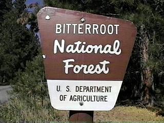
The Bitterroot National Forest is located in west central Montana and east central Idaho. It is comprised of 464,108 acres in Idaho and 1,116,447 acres in Montana for a total of about 1,580,555 acres. There are 21 developed campgrounds, 10 of which met the selection criteria. None of the selected campgrounds are in Idaho.
The Bitterroot National Forest is a forest of strong contrast with sub-alpine woodland, open grassy areas, crystal blue lakes and streams, and majestic glaciated mountains. The Forest arches through the gentle western slopes of the Sapphire Mountain Range and across to the rugged, dramatic Bitterroot Mountain Range into Idaho. The source of the crystal clear headwaters for both the Bitterroot and Selway Rivers, the Bitterroot National Forest has more to offer than water based activities. Almost half of the Forest is part of Anaconda-Pintler, Selway-Bitterroot, and Frank Church-River of No Return Wildernesses and feature outstanding hiking and backpacking opportunities. Fishing, wildlife viewing, photography, and many more recreational opportunities are available in this Forest.
Camping locations vary as greatly as the landscape. There is "dispersed" camping permitted throughout the Bitterroot National Forest, where a camper simply finds a camp site with all the campers is looking for (such sites are not included in this campground review). Tenting and car camping locations are found in near pristine forests as well as in Forest Service campgrounds designed to include motorhome and recreation vehicle camping. With so much pristine land awaiting exploration, diverse recreational opportunities abound in the Forest.
The primary route to the Bitterroot National Forest is U.S. Highway 93, along which travelers can observe the geological forces that formed the Forest. Just south of Darby, MT is a spectacular view of Trapper Peak with its glacial carved bowl. Just north of Darby are colorful bluffs of crudely layered white and yellowish volcanic rock, some 50 millions years old. A hike through Lost Horse Canyon offers spectacular views of this 70 to 90 million year old mass of rock called the Idaho Batholith, thought to be more than 10,000 square miles in size. Anywhere along U.S. 93 there are vantage points to observe the 25 degree angled, smooth surfaced eastern edge of the Bitterroot Range. This phenomena is thought to have been caused by the tops of the Bitterroot Range shearing off while moving across the valley to become, what we call today, the Sapphire Range.
Besides the geological features that contribute to the range of recreational opportunities found in here, the Bitterroot National Forest has retained bits of its human history. For generations, following the migrating wildlife, Native Americans used the Bitterroot Valley as a natural corridor for their seasonal movements. This Valley was, also, the route used in 1877 by the Nez Perce in their flight from confinement on a reservation. Little evidence remains of the Nez Perce flight, but evidence of Native Peoples' annual migrations can be found in the string of "Indian Trees." The People would stripped the bark from Ponderosa pine trees to eat the sweet cambium, or inner bark. Because these strips never encircled the tree, the method did not kill the trees. Examples of these special trees are found at Indian Trees and Alta campgrounds and elsewhere throughout the Forest. Although some might see Indian Trees and Alta campgrounds as "rustic" or primitive, each offers a wilderness camping locations without the inconvenience.
The Forest Service's involvement in the health and management of the Bitterroot National Forest and Valley can be seen in the number and age of Forest Service structures. Many have been preserved to help the Forest's visitors understand a way of life and the Forest's ecology. Two locations that are most accessible are the West Fork and Darby Ranger District Offices. The Darby Visitor Information Center was the first Darby District Ranger Station in the Bitterroot and is preserved today much as it looked long ago. Helpful and knowledgeable volunteers at the Darby Visitor Information Center can answer a variety of questions about the Forest, its history and the recreation opportunities found there.
Most of the Bitterroot National Forest's developed campgrounds might be considered rustic as they offer only good drinking water and vault toilets. However, the Lake Como Recreation Area, with expanded facilities that include a campground (Lake Como) with electric and water hook-ups, is as near an RV resort found in any Forest. A part of the Lake Como Recreation Area is the Rock Creek Horse Camp, the Forest's only developed campground designed for equestrian campers. A very difference camping experience is available at Three Frogs, the three of the Recreation's campgrounds. While Three Frogs has sites for motorhome/RV camping, this campground is well suited to tent and car camping. With view of the Lake and visits from moose and other wildlife, Three Frogs campground rounds out the Recreation Area diverse camping facilities.
Perhaps the most interesting campground in the Bitterroot National Forest is Dr. Charles Waters Memorial campground. Located where sagebrush grassland communities intersperse with stands ponderosa pine and a little creek run though it, visitors to this campground can explore the area using a 1-mile interpretive trail (name unknown). Hawks soar high above the exploring visitors while meadowlarks, bluebirds, and sparrows provide a merry chorus. The 0.5-mile Charles Water Nature Trail features a better chance for visitors to see mammals such as deer and elk. And a 2.5-mile fire ecology trail gives one an idea of the relationship between fire and the forest.
Winter, summer, spring or fall, the Bitterroot National Forest has something for everyone to enjoy. From the drier Bitterroot Valley to the moist higher elevations with stands of Douglas fir, Birch and Alder, the Forest provides habitats for a robust population of mule deer, white-tailed deer, elk, bighorn sheep, mountain goat, mountain lion, moose, and black bears. Ideal for the wildlife watcher, the Forest also offers summertime opportunities for hiking and riding on more than 1600 miles of trails, rafting and kayaking, rock climbing in the Stevensville Ranger District, and fishing in one of many pristine rivers and lakes. With such diversity, the Bitterroot National Forest welcomes visitors to come and explore.
ADDRESSES
SUPERVISOR ADDRESS
1801 N. First St.
Hamilton, Montana 59840
406-363-7100

RANGER DISTRICT ADDRESSES
Darby
712 N. Main
Darby, Montana 59829
406-821-3913

Stevensville
88 Main St.
Stevensville, Montana 59870
406-777-5461

Sula
712 N. Main
Darby, Montana 59829
406-821-3913

West Fork
6735 W. Fork Rd.
Darby, Montana 59829
406-821-3269 |