Campground List
CAMPGROUND NAME: Big Biloxi
VISIT DATE: 02/04/1997
UPDATE DATE: 2/14/2025
STATE: Mississippi
REGION: Southern
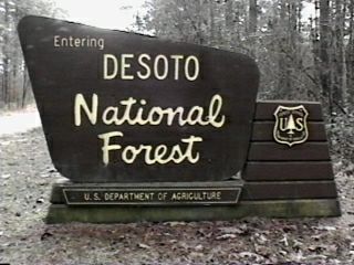
RANGER DISTRICT: DeSoto
NEAREST CITY/TOWN: Gulfport
RESERVATIONS: No
DIRECTIONS:
From Gulfport, MS, at the intersection of I-10 and U.S. Rt. 49,
take Rt. 49 north 9.3 miles to Big Biloxi sign (DeSoto Park Rd.).
Turn left onto De Soto Park Rd. and go 0.5 miles to campground
sign. Turn left into campground.
GENERAL COMMENTS:
The elevation is 50 feet.
The campground has three unnamed overlapping loops. Most sites
are on the outside of the loops nestled among Longleaf pine and
native hardwoods. The large middle loop offers only limited
shade and poor privacy between campsites. It has a pavilion with
a few camp sites nearby on a manicured grass meadow large enough
for a variety of games. The two other smaller loops offer more
shade and privacy. Adjacent to the Big Biloxi River, where
canoeing is a major activity, the campground has an informal swim
area but requires wading across the river to reach a fine gravel
beach. Gas and groceries are available on State Rt. 49.
The campground is well located for a variety of day trips to the
Gulf coast and its beaches, as well as attractions found in
places along the coast like Biloxi, Gulfport, and Ocean Springs.
SEASONS
Open Seasonal: Yes
Open All Year: Yes
Seasonal Comment:
May 1 through October 31 - 14 days maximum stay
November 1 through April 30 - 30 days maximum stay
NOTE: 2/14/2025 - Campground temporarily closed until further notice
due to an interruption of water service. Contact ranger district office
for latest status.
RATE AND MAXIMUM STAY PERMITTED
Rate: $20 per day (Senior/Access Pass - $13 per day)
Maximum Stay Permitted (days): 14 & 30
CAMPGROUND SITE CONFIGURATION
No. RV Sites: 0
No. Tent Sites: 0
No. Combined Sites (Tent or RV): 25
Total Sites: 25
Tent Pads: Yes
Open Sites: Yes
Wooded Sites: Yes
No. Tables on Sites: 25
No. Grilles on Sites: 25
Equestrian Camping: No
RV INFORMATION
No. Full Hookups (includes waste): 0
No. Water and Electric Only: 25
No. Water Only: 0
No. Electric Only: 0
No. RV Pull Throughs: 0
Waste Station: Yes
Potable Water at Waste Station: Yes
Average Parking Apron Size: 12' X 42'
Comments:
The parking aprons are paved.
FACILITIES
Vaults: No
Flush Toilets: Yes
Hot Showers: Yes
Wheelchair Friendly Toilets: Yes
Public Phone: No
Playground: No
No. Water Spigots (non-site): 0
Comments:
The showers are wheelchair friendly.
WATER SPORTS
Lake: No
Swimming (provided): No
Sailing: No
Boat Ramp: No
Boat Carry Down Access: Yes
Power Boating: No
Boating (no power): Yes
Water Skiing: No
Rafting (whitewater): No
Kayaking (whitewater): No
Comments:
Canoeing on the Big Biloxi River.
HIKING
Unnamed trail located between sites 7 & 8 (foot only) - 0.75
miles
FISHING
Bass, Bream and Channel catfish

CAMPGROUND NAME: Cypress Creek Landing
VISIT DATE: 02/04/1997
UPDATE DATE: 2/14/2025
STATE: Mississippi
REGION: Southern
RANGER DISTRICT: DeSoto
NEAREST CITY/TOWN: Wiggins
RESERVATIONS: No
DIRECTIONS:
In Wiggins, MS, at the intersection of State Rts. 26 and 29, take
Rt. 29 north 16.3 miles to Cypress Creek sign (Snider Rd). Turn
right onto Snider Rd. and go 0.7 miles to a "Y" intersection.
Bear left onto a wide single lane (no turnouts) and go 2.9 miles
to campground sign. Turn right onto a dirt road (Forest Rt.
305B) and go 1.5 miles into campground.
GENERAL COMMENTS:
The elevation is 100 ft.
The campground has a short spur leading into a large loop near
the Black Creek Wilderness with some sites overlooking the Black
Creek National Scenic River. A grass understory means limited
privacy between sites. The 33 miles of Black Creek meanders through
the area with tree and flowering shrubs hanging over the banks.
Twenty-one miles of the river are designated as the only National
Scenic River in Mississippi. The campground is well suited for use
by people exploring Black Creek. Towering, mature magnolia and a
mixture of native Mississippi hardwoods and pine provide shade. Each
campsite has a lantern pole.
Note: No alcohol is permitted in the campground.
SEASONS
Open Seasonal: No
Open All Year: Yes
NOTE: 2/14/2025 - Campground temporarily closed due to water main break
and storm damage. Boat landing remains open. Contact ranger district
office for latest status.
RATE AND MAXIMUM STAY PERMITTED
Rate: $7 per day
Maximum Stay Permitted (days): 14
CAMPGROUND SITE CONFIGURATION
No. RV Sites: 0
No. Tent Sites: 0
No. Combined Sites (Tent or RV): 14
Total Sites: 14
Tent Pads: Yes
Open Sites: Yes
Wooded Sites: Yes
No. Tables on Sites: 14
No. Grilles on Sites: 14
Equestrian Camping: No
RV INFORMATION
Hookups: None
No. RV Pull Throughs: 0
Waste Station: No
Average Parking Apron Size: See RV comments
Comments:
The parking aprons are dirt and gravel, irregular in shape and a
challenge to identify.
FACILITIES
Vaults: No
Flush Toilets: Yes
Hot Showers: Yes
Wheelchair Friendly Toilets: Yes
Public Phone: No
Playground: No
No. Water Spigots (non-site): 1
No. Threaded: 1
WATER SPORTS
Lake: No
Swimming (provided): No
Sailing: No
Boat Ramp: No
Boat Carry Down Access: Yes
Power Boating: No
Boating (no power): Yes
Water Skiing: No
Rafting (whitewater): No
Kayaking (whitewater): No
Comments:
Canoeing on the Black Creek National Scenic River. Contact the
ranger district office about outfitters and canoe rentals. Put-
in/carry down access is just before the campground's entrance.
HIKING - No
FISHING
Bass, Bream and Channel catfish
CAMPGROUND NAME: Long Leaf Horse Trail
VISIT DATE: 02/03/1997
UPDATE DATE: 1/14/2025
STATE: Mississippi
REGION: Southern
RANGER DISTRICT: Chickasawhay
NEAREST CITY/TOWN: Laurel
RESERVATIONS: No
DIRECTIONS:
From Laurel, MS, take State Rt. 15 south 7.9 miles to Long Leaf
Horse Trail sign (George Boutwell Rd.). Turn left onto George
Boutwell Rd. and go 1.9 miles to horse silhouette sign (Forest
Rt. 201). Turn right onto Rt. 201 and go 4.5 miles to another
horse silhouette sign (Forest Rt. 213). Turn right onto Rt. 213
and go 0.5 miles to campground.
GENERAL COMMENTS:
The elevation is 140 ft.
The campground, adjacent to Gator Pond, is situated in long-leaf pine
woods. Located at the mid-point of the 11 mile, self-guided, Gavin
Forest Education Auto Tour, the campground is a nice place for a
break. However, folks are discovering this quiet little spot and staying
for more than lunch. There is a hitching post at each site. Besides
horseback riders, the Long Leaf Horse Trail is popular with mountain
bikers and training for Ultra runners.
SEASONS
Open Seasonal: No
Open All Year: Yes
RATE AND MAXIMUM STAY PERMITTED
Rate: $3 per day
Maximum Stay Permitted (days): 14
CAMPGROUND SITE CONFIGURATION
No. RV Sites: 0
No. Tent Sites: 0
No. Combined Sites (Tent or RV): 17
Total Sites: 17
Tent Pads: Yes
Open Sites: Yes
Wooded Sites: Yes
No. Tables on Sites: 17
No. Grilles on Sites: 17
Equestrian Camping: Yes
RV INFORMATION
Hookups: None
No. RV Pull Throughs: 6
Waste Station: No
Largest Parking Apron Size: 17' X 47'
Comments:
Sites are very basic with gravel and dirt parking aprons.
BATH AND SHOWER FACILITIES
Vaults: Yes
Flush Toilets: No
Hot Showers: No
OTHER FACILITIES
Playground: No
Public Phone: No
No. Water Spigots (non-site): 0
No. Threaded: 0
Wheelchair Friendly Toilets: Yes
WATER SPORTS
Lake: Yes
Swimming (provided): No
Sailing: No
Boat Ramp: No
Boat Carry Down Access: Yes
Power Boating: Yes
Boating (no power): Yes
Water Skiing: No
Rafting (whitewater): No
Kayaking (whitewater): No
Comments:
Power boats limited to electric motors.
HIKING
Long Leaf Horse Trail - 3 loops: 6, 11 and 25 miles. Trail is
multi-use for horses, mountain bikers and training for Ultra
runners.
Note: There is a $3 fee to all to use this trail.
FISHING - Yes
Comments:
Bass, Blue gill and catfish.
CAMPGROUND NAME: Turkey Fork
VISIT DATE: 02/03/1997
UPDATE DATE: 1/14/2025
STATE: Mississippi
REGION: Southern
RANGER DISTRICT: Chickasawhay
NEAREST CITY/TOWN: Sand Hill
RESERVATIONS: No
DIRECTIONS:
In Sand Hill, MS, at the intersection of State Rts. 42 and 63,
take Rt. 62 south 4.2 miles to Turkey Fork sign. Turn left at
sign onto Indian Hill Rd. and go 3.1 miles to another campground
sign. Turn left at sign and go 0.7 miles to still another
campground sign. Turn right at his sign and immediately left
into campground. Walk-in tent sites are on the right while the
section with hookups is 0.9 miles further into campground.
GENERAL COMMENTS:
The elevation is 300 ft.
The campground has two unnamed sections located in a mixed
hardwood and pine forest with some sites overlooking Turkey Fork
Lake. The section closest to the campground's entrance is all
walk-in tent only campsites. These sites are nestled in pine and
with a heavy middle and understory, have good privacy. The walk-
in tent section is close to the day use area and must use its
bathroom facilities and water spigots. The section with hookups
features sites with nice views of the lake and several have walk-
down access to the lake. Some parking aprons have a steep slope
and might require the use of the tent pad located at the rear end
of the apron. All campsites have lantern poles. There is
separate parking area in campground for extra vehicles and boat
trailers.
This is alligator country; practice caution around water, especially
with small dogs
SEASONS
Open Seasonal: No
Open All Year: Yes
RATE AND MAXIMUM STAY PERMITTED
Rate: $7 per day - no hookups
$20 per day - elec. & water hookups
Maximum Stay Permitted (days): 14
CAMPGROUND SITE CONFIGURATION
No. RV Sites: 0
No. Tent Sites: 8
No. Combined Sites (Tent or RV): 20
Total Sites: 28
Tent Pads: Yes
Open Sites: Yes
Wooded Sites: Yes
No. Tables on Sites: 28
No. Grilles on Sites: 28
Equestrian Camping: No
RV INFORMATION
No. Full Hookups (includes waste): 0
No. Water and Electric Only: 20
No. Water Only: 0
No. Electric Only: 0
No. RV Pull Throughs: 0
Waste Station: Yes
Potable Water at Waste Station: Yes
Average Parking Apron Size: 14' X 50'
Comments:
The parking aprons are paved.
FACILITIES
Vaults: No
Flush Toilets: Yes
Hot Showers: Yes
Wheelchair Friendly Toilets: Yes
Public Phone: No
Playground: No
No. Water Spigots (non-site): 0
WATER SPORTS
Lake: Yes
Swimming (provided): Yes
Sailing: Yes
Boat Ramp: Yes
Boat Carry Down Access: No
Power Boating: Yes
Boating (no power): Yes
Water Skiing: Yes
Rafting (whitewater): No
Kayaking (whitewater): No
Comments:
Turkey Fork Lake is 250 acres. Water skiing limited to the hours
of 10:00 AM to 6:00 PM. Jet skis are not permitted. The boat
ramp is located on the east side of the lake. There are two swim
beaches - one on the west side of the lake in the day use area
and the other on the east side next to the boat ramp.
HIKING
Turkey Fork Trail (foot only) - 0.75 miles
FISHING
Bass, Blue Gill and Channel catfish
|