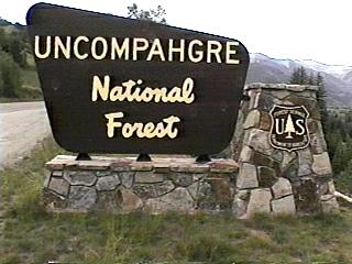
Campground List
CAMPGROUND NAME: Amphitheater

VISIT DATE: 07/11/1999

UPDATE DATE: 10/27/2025

STATE: Colorado

REGION: Rocky Mountain

RANGER DISTRICT: Ouray

NEAREST CITY/TOWN: Ouray

RESERVATIONS: 1-877-444-6777 or make on-line reservation

DIRECTIONS:
In Ouray, CO, off US Rt. 550 (south end of town), turn at
campground sign and go 1 mile to campground entrance.

GENERAL COMMENTS:
The elevation is 8,400 ft.

The campground is located on the side of a mountain above Ouray.
It is tightly designed with loops and spurs among Gambel oaks and
mixed conifers.  There is a scenic overlook from the campground
of Ouray and the "Amphitheater," which was formed by a volcanic
explosion.  A nice day trip is into Ouray for the small mountain
town feel and gift shopping.  There is also a hot spring in the
town.  Firewood is available for a fee.

The campground is best suited for tenters, but RVrs can utilize
sites 3 through 15; take the second right and follow the
"trailer" signs.  The total RV length should not exceed 35 feet.

This is bear country; practice safe food storage techniques.

SEASONS
Open Seasonal: Yes
Open All Year: No

Seasonal Comment:
Open May 31 through September 30 - weather dependent

RATE AND MAXIMUM STAY PERMITTED
Rate: $28 per day
Maximum Stay Permitted (days): 7

CAMPGROUND SITE CONFIGURATION
No. RV Sites: 0
No. Tent Sites: 19
No. Combined Sites (Tent or RV): 11

   Total Sites: 30

Tent Pads: Yes
Open Sites: No
Wooded Sites: Yes
Equestrian Camping: No

No. Tables on Sites: 30
No. Grilles on Sites: 30

RV INFORMATION
Hookups: None
No. RV Pull Throughs: 2
Waste Station: No
Average Parking Apron Size: 10' X 34'

Comments:
The parking aprons are dirt.  See the General Comments about RV
size.

FACILITIES
Vaults: Yes
Flush Toilets: No
Hot Showers: No
Wheelchair Friendly Toilets: No

Public Phone: No
Playground: No
No. Water Spigots (non-site): 7
  No. Threaded: 1

WATER SPORTS - None

HIKING
Upper Cascade Falls Trail #213 (foot) - 2 miles

FISHING - No

CAMPGROUND NAME: Beaver Lake

VISIT DATE: 07/19/1999

UPDATE DATE: 10/27/2025

STATE: Colorado

REGION: Rocky Mountain

RANGER DISTRICT: Ouray


NEAREST CITY/TOWN: Cimarron

RESERVATIONS: No

DIRECTIONS:
From Cimarron, CO, take US Rt. 50 east 2.2 miles to Forest
Access/Silver Jack Reservoir sign.  Turn right onto gravel road
and go 6.1 miles to an intersection (RDP 77).  Bear left onto RDP
77 (dirt - rocky and rough in places) and go 9.9 miles to
campground sign.  Turn right at sign into campground.

GENERAL COMMENTS:
The elevation is 8,300 ft.

The campground is on one side of Beaver Lake with camping sites
nestled under spruce trees.  Some sites have view of lake, open
meadow and towering cliffs, while tent sites, located on a dead
end spur, are nicely secluded.  The campground has robust
population of chipmunks and ducks.  There are limited groceries
available at El Rancho Cimarron, a short distance north of
campground on RDP 77.  Firewood is available for a fee.

SEASONS
Open Seasonal: Yes
Open All Year: No

Seasonal Comment:
Open May 23 through October 1 - weather dependent.

RATE AND MAXIMUM STAY PERMITTED
Rate: $14 per day
Maximum Stay Permitted (days): 14

CAMPGROUND SITE CONFIGURATION
No. RV Sites: 0
No. Tent Sites: 4
No. Combined Sites (Tent or RV): 6

   Total Sites: 10

Tent Pads: No
Open Sites: Yes
Wooded Sites: Yes
Equestrian Camping: No

No. Tables on Sites: 10
No. Grilles on Sites: 10

RV INFORMATION
Hookups: None
No. RV Pull Throughs: 0
Waste Station: No
Average Parking Apron Size: 12' X 35'

Comments:
The parking aprons are gravel and dirt.  There is a waste station
available at the Cimarron campground (National Park Service) in
Cimarron, CO - no fee.

FACILITIES
Vaults: Yes
Flush Toilets: No
Hot Showers: No
Wheelchair Friendly Toilets: No

Public Phone: No
Playground: No
No. Water Spigots (non-site): 2
  No. Threaded: 0

Comments:
Hot showers available at El Rancho Cimarron - fee is $4 with
towel, $3.50 without.

WATER SPORTS
Lake: Yes
Swimming (provided): No
Sailing: No
Boat Ramp: No
Boat Carry Down Access: Yes
Power Boating: No
Boating (no power): Yes
Water Skiing: No
Rafting (whitewater): No
Kayaking (whitewater): No

Comments:
Beaver Lake is 2 acres.

HIKING
Beaver Lake Shoreline Trail (foot - wheelchair friendly) - 0.75
miles.

FISHING
Brown and Rainbow trout

CAMPGROUND NAME: Big Cimarron

VISIT DATE: 07/19/1999

UPDATE DATE: 10/27/2025

STATE: Colorado

REGION: Rocky Mountain

RANGER DISTRICT: Ouray


NEAREST CITY/TOWN: Cimarron

RESERVATIONS: No

DIRECTIONS:
From Cimarron, CO, take US Rt. 50 east 2.2 miles to Forest
Access/Silver Jack Reservoir sign.  Turn right onto gravel road
and go 6.1 miles to an intersection (RDP 77).  Bear left onto RDP
77 (dirt - rocky and rough in places) and go 9.5 miles to
campground sign.  Turn right at sign into campground.

GENERAL COMMENTS:
The elevation is 8,600 ft.

The campground stretches along the Big Cimarron River with about
half the camping sites adjacent to the river.  The sites are
shaded by a mix of spruce and Cottonwood trees.  There are public
horse corrals across from campground.  Firewood is available for a fee.

This is bear country; practice safe food storage techniques.

SEASONS
Open Seasonal: Yes
Open All Year: No

Seasonal Comment:
Open May 23 through October 1 - weather dependent

RATE AND MAXIMUM STAY PERMITTED
Rate: $14 per day
Maximum Stay Permitted (days): 14

CAMPGROUND SITE CONFIGURATION
No. RV Sites: 0
No. Tent Sites: 4
No. Combined Sites (Tent or RV): 8

   Total Sites: 12

Tent Pads: No
Open Sites: No
Wooded Sites: Yes
Equestrian Camping: Yes

No. Tables on Sites: 12
No. Grilles on Sites: 12

RV INFORMATION
Hookups: None
No. RV Pull Throughs: 0
Waste Station: No
Average Parking Apron Size: 15' X 40'

Comments:
The parking aprons are gravel, dirt and rock.
There is a waste station at the Cimarron campground (National Park
Service) in Cimarron, CO - no fee.

FACILITIES
Vaults: Yes
Flush Toilets: No
Hot Showers: No
Wheelchair Friendly Toilets: No

Public Phone: No
Playground: No
No. Water Spigots (non-site): 0
  No. Threaded: 0

Comments:
Water is available 2 miles south at Silver Jack campground.

WATER SPORTS - Nearby Silver Jack Reservoir offers
boating, swimming and fishing.None

HIKING - No

FISHING
Rainbow and Brown trout

CAMPGROUND NAME: Matterhorn

VISIT DATE: 07/11/1999

UPDATE DATE: 10/27/2025

STATE: Colorado

REGION: Rocky Mountain

RANGER DISTRICT: Norwood


NEAREST CITY/TOWN: Telluride

RESERVATIONS: 1-877-444-6777 or make on-line reservation

DIRECTIONS:
From Telluride, CO, take State Rt. 145 west 2.8 miles to where
Rt. 145 splits left to Rico, CO.  Turn left at Rico sign and go
9.3 miles to campground sign.  Turn left at sign into campground.

GENERAL COMMENTS:
The elevation is 9,480 ft.

The campground is a single loop adjacent to State Rt. 145.  Most
sites, on outside of loop, are heavily wooded.  Sites on inside
of loop are open.  Most sites have pleasant views, but the walk-
in tent sites in particular having an unobstructed, panoramic
view of the mountains.  All sites have lantern poles.  Firewood
is available for a fee.  The campground is convenient to
Telluride, its shops and a cook's night out.

SEASONS
Open Seasonal: Yes
Open All Year: No

Seasonal Comment:
Open June 5 through September 30

RATE AND MAXIMUM STAY PERMITTED
Rate: $26 per day - no hookups
$40 per day - full hookups
Maximum Stay Permitted (days): 7

CAMPGROUND SITE CONFIGURATION
No. RV Sites: 0
No. Tent Sites: 3
No. Combined Sites (Tent or RV): 25

   Total Sites: 28

Tent Pads: Yes
Open Sites: Yes
Wooded Sites: Yes
Equestrian Camping: No

No. Tables on Sites: 28
No. Grilles on Sites: 28

RV INFORMATION
No. Full Hookups (includes waste): 8
No. Water and Electric Only: 0
No. Water Only: 0
No. Electric Only: 0

No. RV Pull Throughs: 5
Waste Station: No
Average Parking Apron Size: 14' X 50'

Comments:
Paved and gravel aprons.

FACILITIES
Vaults: Yes
Flush Toilets: Yes
Hot Showers: Yes
Wheelchair Friendly Toilets: Yes

Public Phone: No
Playground: No
No. Water Spigots (non-site): 3
  No. Threaded: 1

Comments:
The showers are wheelchair friendly.

WATER SPORTS - None

HIKING - No

FISHING - No

CAMPGROUND NAME: Silver Jack

VISIT DATE: 07/19/1999

UPDATE DATE: 10/27/2025

STATE: Colorado

REGION: Rocky Mountain

RANGER DISTRICT: Ouray


NEAREST CITY/TOWN: Cimarron

RESERVATIONS: 1-877-444-6777 or  make on-line reservation

DIRECTIONS:
From Cimarron, CO, take US Rt. 50 east 2.2 miles to Forest
Access/Silver Jack Reservoir sign.  Turn right onto gravel road
and go 6.1 miles to an intersection (RDP 77).  Bear left onto RDP
77 (dirt - rocky and rough in places) and go 11.2 miles to
campground sign.  Turn right at sign and go 0.3 miles to
campground.

GENERAL COMMENTS:
The elevation is 9,000 ft.

This attractive campground is composed of three loops - Chipeta,
Ouray and Sapinero.  Each loop is heavily wooded with Aspen and
a few spruce trees and an understory of tall grass and
wildflowers.  This vegetation provides a lacy shade to the
camping sites.  The campground is convenient to the Silver Jack
Reservoir and a network of trails around the Cimarron Ridge.
Firewood is available for a fee.

This is bear country; practice safe food storage techniques.

SEASONS
Open Seasonal: Yes
Open All Year: No

Seasonal Comment:
Open June 20 through September 30.

RATE AND MAXIMUM STAY PERMITTED
Rate: $20 per day - no hookups
$30 per day - w/ electric hookups
Maximum Stay Permitted (days): 14

CAMPGROUND SITE CONFIGURATION
No. RV Sites: 0
No. Tent Sites: 0
No. Combined Sites (Tent or RV): 58

   Total Sites: 58

Tent Pads: No
Open Sites: Yes
Wooded Sites: Yes
Equestrian Camping: No

No. Tables on Sites: 58
No. Grilles on Sites: 58

RV INFORMATION
Hookups: None
No. RV Pull Throughs: 30
Waste Station: No
Average Parking Apron Size: 12' X 53'

Comments:
The parking aprons are paved.  There is a waste station at the
Cimarron campground (National Park Service) in Cimarron, CO - no
fee.

FACILITIES
Vaults: Yes
Flush Toilets: No
Hot Showers: No
Wheelchair Friendly Toilets: Yes

Public Phone: No
Playground: No
No. Water Spigots (non-site): 7
  No. Threaded: 1

Comments:
The threaded spigot is located adjacent to site #50.  There is no
wheelchair friendly vault in the Sapinero loop.  Hot showers are
available for a fee at the El Rancho Cimarron.

WATER SPORTS - None

Comments:
The 300-acre Silver Jack Reservoir (no motors) is 1.9 miles south
of the campground on Forest Rt. 858

HIKING - No

FISHING - No

Comments:
The nearby Silver Jack Reservoir has Rainbow and Brown trout.

CAMPGROUND NAME: Sunshine

VISIT DATE: 07/08/1999

UPDATE DATE: 10/27/2025

STATE: Colorado

REGION: Rocky Mountain

RANGER DISTRICT: Norwood

NEAREST CITY/TOWN: Telluride

RESERVATIONS: No

DIRECTIONS:
From Telluride, CO, take State Rt. 145 west 2.8 miles to where
Rt. 145 splits left to Rico, CO.  Turn left at Rico sign and go 5
miles to campground sign.  Turn right into campground.

GENERAL COMMENTS:
The elevation is 9,560 ft.

The campground is a single loop among Aspen with grass
understory and has a dispersed camping feel.  The campground is
convenient to Telluride, its shops and a cook's night out.

SEASONS
Open Seasonal: Yes
Open All Year: No

Seasonal Comment:
Open May 23 through October 7

RATE AND MAXIMUM STAY PERMITTED
Rate: $28 per day
NOTE: Scan and Pay used for on-site payments through Rec.gov app.
Load and setup app before arrival.
Maximum Stay Permitted (days): 14

CAMPGROUND SITE CONFIGURATION
No. RV Sites: 0
No. Tent Sites: 2
No. Combined Sites (Tent or RV): 13

   Total Sites: 15

Tent Pads: No
Open Sites: Yes
Wooded Sites: Yes
Equestrian Camping: No

No. Tables on Sites: 12
No. Grilles on Sites: 13

RV INFORMATION
Hookups: None
No. RV Pull Throughs: 0
Waste Station: No
Average Parking Apron Size: 10.5' X 35'

Comments:
The parking aprons are gravel.  The interior road is narrow and
rough.  The loop is tear-drop shape making a second pass for RVrs
impossible.

FACILITIES
Vaults: Yes
Flush Toilets: No
Hot Showers: No
Wheelchair Friendly Toilets: No

Public Phone: No
Playground: No
No. Water Spigots (non-site): 2
  No. Threaded: 1

WATER SPORTS - None

HIKING - No

FISHING - No

CAMPGROUND NAME: Woods Lake

VISIT DATE: 5/25/2009

UPDATE DATE: 2/26/2026

STATE: Colorado

REGION: Rocky Mountain

RANGER DISTRICT: Norwood

NEAREST CITY/TOWN: Placerville

RESERVATIONS: No

DIRECTIONS:
From Placerville, CO, take State Rt. 145 east 2.4 miles to Forest
Rt. 618 (Falls Creek Rd.).  Turn right onto Falls Creek Rd. and
go 7.4 miles to Forest Rt. 621.  Turn onto Rt. 621 and go 1.2
miles to campground.

NOTE: Generally, follow signs to Woods Lake.  After 3.7 miles,
Forest Rt. 618 becomes a gravel, two-lane road.

GENERAL COMMENTS:
The elevation is 9,400 ft.

NOTE: The campground was upgraded from dispersed to developed
after the authors completed their research of the Uncompahgre
National Forest.  All information is provided by the Norwood
Ranger District Office.

The campground, located 0.4 miles from Woods Lake and 0.75 miles
from Lizard Head Wilderness, is situated in a thick stand of
Aspen.  It is comprised of three loops, one of which is designed
for horses.  This horse loop has a corral with five paddocks and
a watering trough.  A large parking lot is available for parking
horse trailers.  The campground is an excellent base camp for
hikers and equestrians to access the Lizard Head Wilderness.
Mountain bikers and motorized dirt bikers can take on the
challenges of the 11.5-mile Wilson Mesa Trail.  There are
incredible views looking south from the campground of mountains
in Lizard Head Wilderness.  And, of course, the "quaking" leaves
and majestic fall colors from the Aspen, add to the draw of this
campground.

Enjoy the quaint, picturesque mountain town of Telluride, CO for
shopping and a cook's night out - about 13.4 miles east on State
Rt. 145 from the Falls Creek Rd. intersection.

SEASONS
Open Seasonal: Yes
Open All Year: No

Seasonal Comment:
Open May 23 through October 1 - weather dependent

RATE AND MAXIMUM STAY PERMITTED
Rate: $20 per day
$22 per day - equestrian campers
Maximum Stay Permitted (days): 14

CAMPGROUND SITE CONFIGURATION
No. RV Sites: 0
No. Tent Sites: 0
No. Combined Sites (Tent or RV): 41

   Total Sites: 41

Tent Pads: Yes
Open Sites: No
Wooded Sites: Yes
Equestrian Camping: YesNo

No. Tables on Sites: 41
No. Grilles on Sites: 41

RV INFORMATION
Hookups: None
No. RV Pull Throughs: 0
Waste Station: No
Average Parking Apron Size: See RV Comments

Comments:
The parking aprons are gravel and all are about the same size -
12' X 45'.

FACILITIES
Vaults: Yes
Flush Toilets: No
Hot Showers: No
Wheelchair Friendly Toilets: Yes

Public Phone: No
Playground: No
No. Water Spigots (non-site): 4
  No. Threaded: 4

WATER SPORTS
Lake: Yes
Swimming (provided): No
Sailing: No
Boat Ramp: No
Boat Carry Down Access: No
Power Boating: Yes
Boating (no power): Yes
Water Skiing: No
Rafting (whitewater): No
Kayaking (whitewater): No

Comments:
Woods Lake is about 20 acres.

HIKING
Woods Lake Trail #406 (foot and horse) - 4.5 miles
Lone Cone Trail #426 (foot and horse) - 10.5 miles
Wilson Mesa Trail #421 (foot, mountain bike, dirt bike & horse) -
11.5 miles

NOTE: Woods Lake Trail travels through the Lizard Head
Wilderness.  Lone Cone Trail accesses northern sections of the
Wilderness.

FISHING
Rainbow and cutthroat trout
|