Forest Information
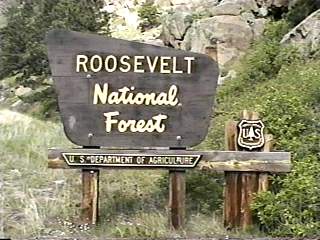
The Roosevelt National Forest, comprised of 808,419 acres, is
located in northern Colorado, north of Denver. It is administered jointly with
the Arapaho National Forest. Of the total developed campgrounds,
22 meet the selection criteria.
Hugging the northern and eastern boundary of the Rocky Mountain National Park, the Roosevelt National Forests offers visitors a wide variety of recreational opportunities. Camping, hiking, kayaking, fishing, hunting, skiing, or just driving for pleasure through this popular scenic area, all can be found here.
The Roosevelt National Forest contains four separate areas designated Wilderness: Rawah, Neota, Comanche Peak, and Cache la Poudre (pooh-der). These Wilderness areas offer hundreds of miles of hiking and horse trails through habitats that ranges from Ponderosa pine and Aspen forests to alpine tundra. Remember, special regulations apply in these areas so their native ecosystems can survive. Regulations prohibit the use of mechanized or wheeled transport or machinery. And some areas will require permits for disperse camping. This is a type of camping in an undeveloped area. Undeveloped camping locations are not included in this campground review. Check with the local Forest Service Office for more information about the Wildernesses and camping regulations. While very popular with backpackers and trail riders, the Wilderness areas have, conveniently located nearby, developed campgrounds for those who prefer a Wildernesses camping experience without hardship.
Brown's Park and Tunnel campgrounds offer excellent access to the Rawah Wilderness. While both campgrounds are adjacent to the Wilderness, Brown's Park has a more rustic feel to it and better suited to car and tent camping enthusiasts. Tunnel campground is only a short drive from some good Mackinaw trout fishing at Chambers Lake making it popular with anglers.
Long Draw and Tom Bennett campgrounds offer spectacular views of the Comanche Peak Wilderness and the Rocky Mountain National Park. Both these campgrounds might be considered rustic with only the most basic of necessities. Nestled in dense woods with spacious sites, these campgrounds are a wilderness experience without the hike. Plus, both are near trail heads accessing the Wilderness and the Rocky Mountain National Park.
About 0.2 miles out of Tom Bennett campground is the Emmaline Lake Trail, #854. The first 0.7 miles of this trail is through a burnt over lodgepole pine forest (1994, Pingree Park Fire). This portion of the trail is sunny and warm and provides an interesting view of Lodgepole pine regrowth after the fire. Bright and varied wild flowers, knee high Lodgepole pines, and head tall Aspen line the trail to about 9,000 feet. Then, the trail enters a lush forest of mixed conifers and soon the hiker must decide whether to continue straight to Emmaline Lake and the Cirque Meadows or head for the Rocky Mountain National Park. These are the tough choices that must be made while hiking in the Roosevelt National Forest.
If a Roosevelt National Forest visitor is interested in recreation that centers on water, there are a variety of activities along the Cache la Poudre Wild and Scenic River and several very pretty lakes. Thirty miles of the Cache la Poudre ("hiding place for powder") River are classified Wild and 45 miles are classified Recreational. Seven put-ins and take-outs dot the shores of this river for whitewater enthusiasts with as many campgrounds. The level of development found in these campgrounds range from recreational vehicle (RV) and motorhome-friendly Mountain Park campground with electric hook-ups and hot showers to the wilderness-like experience of the Ansel
Watrous campground. Because the Cache la Poudre River corridor does experience very high weekend use, Jacks Gulch campground, located 6.3 miles south of the River on County Route 63E, was built to relieve this pressure. Featuring a loop with electric hook-ups, a separate equestrian loop, and a popular trail head, Jacks Gulch remains relatively undiscovered.
Around the Red Feather Lakes area, north of the Cache la Poudre River, are Bellaire Lake , Dowdy Lake, and West Lake campgrounds. With campsites hugging West and Dowdy lakes' shore, campers can shore fish or explore the shoreline from their canoe. A short, paved walkway leads campers from the campground to a boardwalk with fishing platforms on Bellaire Lake. The strange sight of an angler in a "belly-boat" will often greet walkers of Bellaire Lake's boardwalk. Most of the lakes on the Roosevelt National Forest are used to store run-off for drinking and irrigation by the Front Range communities. And these lakes are no exception. Visitors should expect, as the summer season progresses, to see water levels drop, thus limiting canoeing and fishing opportunities.
The Roosevelt National Forest began as part of the Medicine Bow Forest Reserve in 1897. Some 13 years later, the area was renamed the Colorado National Forest. In 1932 President Herbert Hoover renamed the Forest for President Theodore Roosevelt, the person most responsible for creating the National Forest System. While much has changed all around the Roosevelt National Forest since its establishment, the Forest continues to honor the vision of Teddy Roosevelt. It may take less time to reach the Forest today but visitors still can enjoy solitude and challenges, spectacular vistas, abundant and varied wildlife and a wide assortment of recreational opportunities envisioned by people like President Teddy Roosevelt.
ADDRESSES
SUPERVISOR ADDRESS
2150 Centre Ave.
Bldg. E
Fort Collins, Colorado 80526
970-295-6600

RANGER DISTRICT ADDRESSES
Boulder
2140 Yarmouth Ave.
Boulder, Colorado 80301
970-295-6600

Canyon Lakes
2150 Centre Ave.
Bldg. E
Fort Collins, Colorado 80526
970-295-6600 |