CAMPGROUND NAME: Aspen Glade
VISIT DATE: 06/24/1999
UPDATE DATE: 12/9/2025
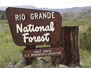
STATE: Colorado
REGION: Rocky Mountain
RANGER DISTRICT: Conejos Peak
NEAREST CITY/TOWN: Antonito
RESERVATIONS: 1-877-444-6777 or make on-line reservation
DIRECTIONS:
From Antonito, CO, take US Rt. 285 south 0.3 miles to State Rt.
17. Continue straight on Rt. 17 and go 15.4 miles to campground
sign. Turn left at sign and go 0.2 miles to campground.
GENERAL COMMENTS:
The elevation is 8,500 ft.
The campground is composed of three loops - A, B, and C. Loop A
(unmarked) is on the left when entering the campground and
lightly wooded with Ponderosa pines. Loop B is marked and is
also lightly wooded with Ponderosa pines. Loop C (also unmarked)
is adjacent to the fast-moving Conejos River. It is below Loops
A and B and heavily wooded with tall, mature spruce. The
understory for all loops is grass and pine needles. The smell of
Ponderosa is evident in Loops A and B and one can hear the river
throughout the campground. This is a pleasant and attractive
campground that is excellent for both the transient and
destination camper.
See and Do: A good day trip is the Cambres and Toltec Scenic Railroad
steam) which offers a 64-mile journey through abandoned mining towns.
One access to the train is at Antonito, CO, about 13 miles from
the campground. Call (888) 286-2737 for information and
reservations.
This is bear country; practice safe food storage techniques.
SEASONS
Open Seasonal: Yes
Open All Year: No
Seasonal Comment:
Open May 23 through August 31
RATE AND MAXIMUM STAY PERMITTED
Rate: $29 per day - single
$58 per day - double
Maximum Stay Permitted (days): 14
CAMPGROUND SITE CONFIGURATION
No. RV Sites: 0
No. Tent Sites: 3
No. Combined Sites (Tent or RV): 29
Total Sites: 32
Tent Pads: No
Open Sites: Yes
Wooded Sites: Yes
Equestrian Camping: No
No. Tables on Sites: 32
No. Grilles on Sites: 32
RV INFORMATION
Hookups: None
No. RV Pull Throughs: 10
Waste Station: No
Average Parking Apron Size: 17' X 41'
Comments:
The parking aprons are gravel. Loop C is tear-drop shape
requiring RVrs to go up to Loops A and B in order to make second
pass through Loop C. Loops A & B will accommodate any size RV.
There is a waste station avaiilable for a fee at Conjos River
Campground (private) about 2.9 miles east of campground on State Rt. 17.
FACILITIES
Vaults: Yes
Flush Toilets: No
Hot Showers: No
Wheelchair Friendly Toilets: Yes
Public Phone: No
Playground: No
No. Water Spigots (non-site): 5
No. Threaded: 4
WATER SPORTS - None
HIKING - No
FISHING
Rainbow trout (stocked)

CAMPGROUND NAME: Beaver Creek
VISIT DATE: 08/04/1999
UPDATE DATE: 10/3/2025
STATE: Colorado
REGION: Rocky Mountain
RANGER DISTRICT: Divide
NEAREST CITY/TOWN: South Fork
RESERVATIONS: No
DIRECTIONS:
In South Fork, CO, at intersection of State Rt. 149 and US Rt.
160, take Rt. 160 west 1.4 miles to Beaver Creek Rd. sign. Turn
left at sign onto Beaver Creek Rd. and go 3.1 miles to campground
sign. Turn right at sign and go 0.1 miles to another campground
sign. Turn left into campground.
GENERAL COMMENTS:
The elevation is 8,400 ft.
The campground strectches along Beaver Creek among mixed
conifers. With little understory, privacy between sites is
minimal. The nearby Beaver Creek Reservoir features a boat ramp
and fishing for Brown, Brook and Rainbow trout and Kokanee
salmon. Firewood is available for a fee.
This is bear country; practice safe food storage techniques.
SEASONS
Open Seasonal: Yes
Open All Year: No
Seasonal Comment:
Open Memorial Day weekend through Labor Day
RATE AND MAXIMUM STAY PERMITTED
Rate: $27 per day - single
$54 per day - double
Maximum Stay Permitted (days): 14
CAMPGROUND SITE CONFIGURATION
No. RV Sites: 0
No. Tent Sites: 4
No. Combined Sites (Tent or RV): 15
Total Sites: 19
Tent Pads: No
Open Sites: Yes
Wooded Sites: Yes
Equestrian Camping: No
No. Tables on Sites: 19
No. Grilles on Sites: 19
RV INFORMATION
Hookups: None
No. RV Pull Throughs: 3
Waste Station: No
Average Parking Apron Size: 15' X 35'
Comments:
The parking aprons are gravel. There is an RV waste station next
to the Rainbow Grocery at intersection of US Rt. 160 and State
Rt. 149 in South Fork, CO - no fee.
FACILITIES
Vaults: Yes
Flush Toilets: No
Hot Showers: No
Wheelchair Friendly Toilets: No
Public Phone: No
Playground: No
No. Water Spigots (non-site): 2
No. Threaded: 0
Comments:
The water spigots are hand pumps.
WATER SPORTS - None
HIKING - No
FISHING
Rainbow trout
CAMPGROUND NAME: Big Meadows
VISIT DATE: 08/04/1999
UPDATE DATE: 10/3/2025
STATE: Colorado
REGION: Rocky Mountain
RANGER DISTRICT: Divide
NEAREST CITY/TOWN: South Fork
RESERVATIONS: 1-877-444-6777 or make on-line reservation
DIRECTIONS:
In South Fork, CO, at intersection of State Rt. 149 and US Rt.
160, take Rt. 160 west 11.6 miles to Big Meadows Reservoir sign.
Turn right at sign and go 1.4 miles to "Y" intersection (Forest
Rt. 410). Bear left onto Rt. 410 and go 0.4 miles into
campground.
GENERAL COMMENTS:
The elevation is 9,500 ft.
The campground meanders up a mountainside above Big Meadows Reservoir
in a series of overlapping loops. Removal of hazard trees in 2013 has
opened the campground up providing great views but seriously limiting
shade. It is suggested campers bring their own shade. The removal of
confers has also encouraged wonderful displays of wildflowers and
invigorated the Aspens. The boat ramp and Archuleta Trail are co-located
across the reservoir from the campground. Firewood is available for a fee.
This is bear country; practice safe food storage techniques.
SEASONS
Open Seasonal: Yes
Open All Year: No
Seasonal Comment:
Open May 23 through August 31
RATE AND MAXIMUM STAY PERMITTED
Rate: $29 per day - single
$58 per day - double
Maximum Stay Permitted (days): 14
CAMPGROUND SITE CONFIGURATION
No. RV Sites: 0
No. Tent Sites: 0
No. Combined Sites (Tent or RV): 36
Total Sites: 36
Tent Pads: Yes
Open Sites: Yes
Wooded Sites: No
Equestrian Camping: No
No. Tables on Sites: 36
No. Grilles on Sites: 36
RV INFORMATION
Hookups: None
No. RV Pull Throughs: 7
Waste Station: No
Average Parking Apron Size: 15' X 45'
Comments:
The parking aprons are gravel. The pull-throughs can accommodate
any size RV.
FACILITIES
Vaults: Yes
Flush Toilets: No
Hot Showers: No
Wheelchair Friendly Toilets: Yes
Public Phone: No
Playground: No
No. Water Spigots (non-site): 5
No. Threaded: 5
WATER SPORTS
Lake: Yes
Swimming (provided): No
Sailing: No
Boat Ramp: Yes
Boat Carry Down Access: No
Power Boating: Yes
Boating (no power): Yes
Water Skiing: No
Rafting (whitewater): No
Kayaking (whitewater): No
Comments:
Big Meadows Reservoir is 600 acres and is a no-wake lake.
HIKING
Cascade Falls Trail (foot) - 0.25 miles
Lakeshor trail (foot) - 1.5 miles
Archuleta Trail #839 (horse and foot) - 6 miles
accesses the Weminuche Wilderness
FISHING
Rainbow, Brown and Brook Trout
There is a fishing pier.
CAMPGROUND NAME: Bristol Head
VISIT DATE: 08/02/1999
UPDATE DATE: 12/10/2025
STATE: Colorado
REGION: Rocky Mountain
RANGER DISTRICT: Divide
NEAREST CITY/TOWN: Creede
RESERVATIONS: No
DIRECTIONS:
From Creede, CO, take State Rt. 149 south (toward Lake City) 21.6
miles to North Clear Creek Road sign (Forest Rt. 510). Turn
right at sign onto Rt. 510 (gravel) and go 0.3 miles to
campground sign. Turn right at sign into campground.
GENERAL COMMENTS:
The elevation is 9,500 ft.
The campground (formerly named Bristol View) stretches 0.6 miles
along a "bench" (a level area) above South Clear Creek. The grassy
field between camping sites and creek are dotted with wild flowers.
Every site has a view of towering mountains. Spruce and Aspen line
the meadow and provide some shade. The campground is an excellent
area for viewing wild life, especially moose. Firewood is available
for a fee.
This is bear country; practice safe food storage techniques.
SEASONS
Open Seasonal: Yes
Open All Year: No
Seasonal Comment:
Open Memorial Day weekend through Labor Day
RATE AND MAXIMUM STAY PERMITTED
Rate: $26 per day
Maximum Stay Permitted (days): 14
CAMPGROUND SITE CONFIGURATION
No. RV Sites: 0
No. Tent Sites: 0
No. Combined Sites (Tent or RV): 15
Total Sites: 15
Tent Pads: No
Open Sites: Yes
Wooded Sites: No
Equestrian Camping: No
No. Tables on Sites: 15
No. Grilles on Sites: 15
RV INFORMATION
Hookups: None
No. RV Pull Throughs: 12
Waste Station: No
Average Parking Apron Size: 15' X 52'
Comments:
The parking aprons are rock and dirt.
Mineral County RV Dump Station in Creede, CO on Airport Road just
off State Rt 149. $10 fee, no potable water. Open May 15 to
October 15 - weather dependent. GPS: N37 49.518, W106 54.986
FACILITIES
Vaults: Yes
Flush Toilets: No
Hot Showers: No
Wheelchair Friendly Toilets: No
Public Phone: No
Playground: No
No. Water Spigots (non-site): 1
No. Threaded: 0
Comments:
The water spigot is a hand pump.
WATER SPORTS - None
HIKING
South Creek Falls Overlook (foot) - 0.1 miles
FISHING
Rainbow trout (stocked)
CAMPGROUND NAME: Buffalo Pass
VISIT DATE: 08/05/1999
UPDATE DATE: 10/3/2025
STATE: Colorado
REGION: Rocky Mountain
RANGER DISTRICT: Saguache
NEAREST CITY/TOWN: Saguache
RESERVATIONS: No
DIRECTIONS:
In Saguache, CO, at intersection of State Rt. 114 and US Rt. 285,
take Rt. 114 west 26.7 miles to campground sign. Turn left at
sign onto a single lane dirt road and go 0.6 miles to the
campground.
GENERAL COMMENTS:
The elevation is 9,000 ft.
The campground is pack it in, pack it out and comprised of a
single large loop, surrounded by a grass meadow, in a Ponderosa
pine grove. The sites are large and well spaced with sites #16,
17 and 18 on a dead-end spur with no turn around. The open areas
are dotted with wild flowers. It is convenient to State Rt. 114
for an overnight stay.
This is bear country; practice safe food storage techniques.
SEASONS
Open Seasonal: Yes
Open All Year: No
Seasonal Comment:
Open mid-May through mid-November
RATE AND MAXIMUM STAY PERMITTED
Rate: $10 per day
Maximum Stay Permitted (days): 14
CAMPGROUND SITE CONFIGURATION
No. RV Sites: 0
No. Tent Sites: 3
No. Combined Sites (Tent or RV): 20
Total Sites: 23
Tent Pads: No
Open Sites: Yes
Wooded Sites: Yes
Equestrian Camping: No
No. Tables on Sites: 0
No. Grilles on Sites: 22
RV INFORMATION
Hookups: None
No. RV Pull Throughs: 1
Waste Station: No
Average Parking Apron Size: 12' X 52'
Comments:
The parking aprons are gravel.
FACILITIES
Vaults: Yes
Flush Toilets: No
Hot Showers: No
Wheelchair Friendly Toilets: No
Public Phone: No
Playground: No
No. Water Spigots (non-site): 0
WATER SPORTS - None
HIKING - No
FISHING - No
CAMPGROUND NAME: Cathedral
VISIT DATE: 08/03/1999
UPDATE DATE: 12/11/2025
STATE: Colorado
REGION: Rocky Mountain
RANGER DISTRICT: Divide
NEAREST CITY/TOWN: South Fork
RESERVATIONS: No
DIRECTIONS:
From South Fork, CO, take US Rt. 160 east 5.3 miles to Embargo
Creek Rd. and County Rt. 18 signs. Turn left onto Rt. 18 and go
1.4 miles to a "T" intersection (County Rt. 15). Turn right onto
Rt. 15 and go 0.3 miles to another "T" intersection (County Rt.
65). Turn left onto Rt. 65 and go 3.2 miles to "Y" intersection
(Forest Rt. 640/650). Bear left onto Rt. 640 (dirt, single lane
with no turnouts) and go 7.6 miles to campground sign. Turn
right at sign into campground.
NOTE: The majority of the county routes are dirt.
GENERAL COMMENTS:
The elevation is 9,400 ft.
The campground is composed of two large loops along Cathedral
Creek. The left hand loop features a large meadow and a few open
sites. The right hand loop has a dense Aspen and spruce
(including Blue) woods and a more rustic feel. John Charles
Fremont's winter camp is nearby. He attempted an ill-fated
expedition across the Rocky Mountains for a transcontinental
railroad route in late 1848.
SEASONS
Open Seasonal: Yes
Open All Year: Yes
Seasonal Comment:
Open year-round - weather dependent
RATE AND MAXIMUM STAY PERMITTED
Rate: $10 per day
Maximum Stay Permitted (days): 14
CAMPGROUND SITE CONFIGURATION
No. RV Sites: 0
No. Tent Sites: 4
No. Combined Sites (Tent or RV): 25
Total Sites: 29
Tent Pads: No
Open Sites: Yes
Wooded Sites: Yes
Equestrian Camping: No
No. Tables on Sites: 29
No. Grilles on Sites: 29
RV INFORMATION
Hookups: None
No. RV Pull Throughs: 8
Waste Station: No
Average Parking Apron Size: 13' X 49'
Comments:
The parking aprons are dirt and the interior road is rough.
There is an RV waste station next to the Rainbow Grocery at
intersection of US Rt. 160 and State Rt. 149 in South Fork, CO -
no fee. Another one is Mineral County RV Dump Station in Creede, CO
on Airport Road just off State Rt 149. $10 fee, no potable water.
Open May 15 to October 15 - weather dependent.
GPS: N37 49.518, W106 54.986
FACILITIES
Vaults: Yes
Flush Toilets: No
Hot Showers: No
Wheelchair Friendly Toilets: No
Public Phone: No
Playground: No
No. Water Spigots (non-site): 0
Comments:
The water spigot is a hand pump and is located in the right hand
loop.
WATER SPORTS - None
HIKING
Cathedral Lake Trail #794 (foot, horse & mountain bike) - 3.5
miles
FISHING
Rainbow trout (stocked)
CAMPGROUND NAME: Cross Creek
VISIT DATE: 08/04/1999
UPDATE DATE: 11/22/2025
STATE: Colorado
REGION: Rocky Mountain
RANGER DISTRICT: Divide
NEAREST CITY/TOWN: South Fork
RESERVATIONS: No
DIRECTIONS:
In South Fork, CO, at intersection of State Rt. 149 and US Rt.
160, take Rt. 160 west 1.4 miles to Beaver Creek Rd. sign (Forest
Rt. 20). Turn left onto Beaver Creek Rd. and go 6.4 miles to
campground sign. Turn left at sign into campground.
NOTE: Forest Rt. 20 becomes gravel after 4 miles.
GENERAL COMMENTS:
The elevation is 8,800 ft.
The campground is located on the south end of Beaver Creek
Reservoir among spruce and fir trees. There are pleasant views
of the surrounding mountains.
This is bear country; practice safe food storage techniques.
SEASONS
Open Seasonal: Yes
Open All Year: Yes
Seasonal Comment:
Open year-round - weather dependent. Services provided
Memorial Day weekend through Labor Day.
RATE AND MAXIMUM STAY PERMITTED
Rate: $27 per day
Maximum Stay Permitted (days): 14
CAMPGROUND SITE CONFIGURATION
No. RV Sites: 0
No. Tent Sites: 5
No. Combined Sites (Tent or RV): 6
Total Sites: 11
Tent Pads: No
Open Sites: Yes
Wooded Sites: Yes
Equestrian Camping: No
No. Tables on Sites: 11
No. Grilles on Sites: 11
RV INFORMATION
Hookups: None
No. RV Pull Throughs: 0
Waste Station: No
Average Parking Apron Size: 17' X 35'
Comments:
The parking aprons are dirt. There is an RV waste station next
to the Rainbow Grocery at intersection of US Rt. 160 and State
Rt. 149 in South Fork, CO - no fee.
FACILITIES
Vaults: Yes
Flush Toilets: No
Hot Showers: No
Wheelchair Friendly Toilets: Yes
Public Phone: No
Playground: No
No. Water Spigots (non-site): 0
WATER SPORTS
Lake: Yes
Swimming (provided): No
Sailing: No
Boat Ramp: Yes
Boat Carry Down Access: No
Power Boating: Yes
Boating (no power): Yes
Water Skiing: No
Rafting (whitewater): No
Kayaking (whitewater): No
Comments:
Beaver Creek Reservoir is 300 acres - no wake
HIKING
Big Tree Trail (foot) - 0.3 miles
takes hiker to largest tree in forest - 66" in diameter
FISHING
Rainbow, Brook and Brown trout and Kokanee Salmon
CAMPGROUND NAME: Elk Creek
VISIT DATE: 06/22/1999
UPDATE DATE: 11/22/2025
STATE: Colorado
REGION: Rocky Mountain
RANGER DISTRICT: Conejos Peak
NEAREST CITY/TOWN: Antonito
RESERVATIONS: No
DIRECTIONS:
From Antonito, CO, take US Rt. 285 south 0.3 miles to State Rt.
17. Continue straight on Rt. 17 and go 22.6 miles to campground
sign. Turn right at sign onto dirt road and 0.1 miles to a "T"
intersection. Turn left and go 0.4 miles to a "Y" intersection.
Bear right and proceed into campground.
GENERAL COMMENTS:
The elevation is 8,500 ft.
The campground is composed of three loops, including one loop for
overflow camping. It is lightly wooded with spruce and some
Ponderosa pines. The understory is grass with some sites located
next to Elk Creek. The campground is convenient to the South San
Jaun Wilderness. Camping sites 29 through 42 are located in the
overflow loop. All other sites are side-by-side pull throughs
with no tables and only seven grilles. There is no restriction
on camping in the overflow loop. Firewood is available for a
fee.
See and Do: The campground is excellent for destination or transient
campers. Consider a day trip on the Cambres and Toltec Scenic Railroad
(steam) which offers a 64-mile journey through abandoned mining
towns. One access to the train is in Antonito, CO. Call (888)
286-2737 for more information and reservations.
This is bear country; practice safe food storage techniques.
SEASONS
Open Seasonal: Yes
Open All Year: No
Seasonal Comment:
Open Memorial Day weekend through Labor Day weekend
RATE AND MAXIMUM STAY PERMITTED
Rate: $29 per day.
NOTE: $2 per day additional fee on weekends and national holidays.
Maximum Stay Permitted (days): 14
CAMPGROUND SITE CONFIGURATION
No. RV Sites: 0
No. Tent Sites: 0
No. Combined Sites (Tent or RV): 44
Total Sites: 44
Tent Pads: No
Open Sites: Yes
Wooded Sites: Yes
Equestrian Camping: No
No. Tables on Sites: 30
No. Grilles on Sites: 37
RV INFORMATION
Hookups: None*
No. RV Pull Throughs: 20
Waste Station: No
Average Parking Apron Size: 17.5' X 45'
Comments:
The parking aprons are gravel. An RV waste station, with potable
water, is available for a fee at the Conejos River Campground
(private), 10.1 miles east of campground on State Rt. 17.
*NOTE: One electric hookup is available at the handicap campsite.
It is for handicapped campers only. Otherwise, the power is turned
off.
FACILITIES
Vaults: Yes
Flush Toilets: No
Hot Showers: No
Wheelchair Friendly Toilets: Yes
Public Phone: No
Playground: No
No. Water Spigots (non-site): 2
No. Threaded: 0
Comments:
The water spigots are hand pumps.
WATER SPORTS - None
HIKING - No
FISHING
Rainbow trout (stocked)
CAMPGROUND NAME: Highway Springs
VISIT DATE: 08/04/1999
UPDATE DATE: 10/3/2025
STATE: Colorado
REGION: Rocky Mountain
RANGER DISTRICT: Divide
NEAREST CITY/TOWN: South Fork
RESERVATIONS: No
DIRECTIONS:
In South Fork, CO, at intersection of State Rt. 149 and US Rt.
160, take Rt. 160 west 4.1 miles to campground sign. Turn left
into campground.
GENERAL COMMENTS:
The elevation is 8,400 ft.
This is an informal campground with two loops. The lower loop is
comprised of Aspen and a few Ponderosa pines and includes all the
tent sites. The upper loop circles a knoll above US Rt. 160 with
shade provided by mature Ponderosa pines. This loop also
provides excellent views of the surrounding area and mountains.
This is bear country; practice safe food storage techniques.
SEASONS
Open Seasonal: Yes
Open All Year: No
Seasonal Comment:
Open Memorial Day weekend through Labor Day
RATE AND MAXIMUM STAY PERMITTED
Rate: $23 per day
Maximum Stay Permitted (days): 14
CAMPGROUND SITE CONFIGURATION
No. RV Sites: 0
No. Tent Sites: 3
No. Combined Sites (Tent or RV): 9
Total Sites: 12
Tent Pads: No
Open Sites: Yes
Wooded Sites: Yes
Equestrian Camping: No
No. Tables on Sites: 12
No. Grilles on Sites: 12
RV INFORMATION
Hookups: None
No. RV Pull Throughs: 1
Waste Station: No
Average Parking Apron Size: 12' X 20'
Comments:
The parking aprons are gravel and the interior road is rough.
There is an RV waste station next to the Rainbow Grocery at
intersection of US Rt. 160 and State Rt. 149 in South Fork, CO -
no fee.
FACILITIES
Vaults: Yes
Flush Toilets: No
Hot Showers: No
Wheelchair Friendly Toilets: No
Public Phone: No
Playground: No
No. Water Spigots (non-site): 0
WATER SPORTS - None
HIKING - No
FISHING - No
CAMPGROUND NAME: Lake Fork
VISIT DATE: 06/22/1999
UPDATE DATE: 12/11/2025
STATE: Colorado
REGION: Rocky Mountain
RANGER DISTRICT: Conejos Peak
NEAREST CITY/TOWN: Antonito
RESERVATIONS: 1-877-444-6777 or make on-line reservation
DIRECTIONS:
From Antonito, CO, take US Rt. 285 south 0.3 miles to State Rt.
17. Continue straight on Rt. 17 and go 21.9 miles to Platoro
sign (Forest Rt. 250). Turn right at sign onto Rt. 250 (dirt)
and go 17.5 miles to campground sign. Turn left into campground.
GENERAL COMMENTS:
The elevation is 9,500 ft.
The campground, among Aspen and mixed conifer trees, is adjacent
to the fast-moving Conejos River with some sites overlooking the
river. It is convenient to several trails, the resort community
of Platoro and the Platoro Reservoir. Firewood is available for
a fee.
This is bear country; practice safe food storage techniques.
SEASONS
Open Seasonal: Yes
Open All Year: No
Seasonal Comment:
Open May 23 through August 31
RATE AND MAXIMUM STAY PERMITTED
Rate: $29 per day
NOTE: $2 per day additional fee on weekends and national holidays.
Maximum Stay Permitted (days): 14
CAMPGROUND SITE CONFIGURATION
No. RV Sites: 0
No. Tent Sites: 0
No. Combined Sites (Tent or RV): 18
Total Sites: 18
Tent Pads: No
Open Sites: Yes
Wooded Sites: Yes
Equestrian Camping: No
No. Tables on Sites: 18
No. Grilles on Sites: 18
RV INFORMATION
Hookups: None
No. RV Pull Throughs: 6
Waste Station: No
Average Parking Apron Size: 19' X 48'
Comments:
The parking aprons are gravel.
FACILITIES
Vaults: Yes
Flush Toilets: No
Hot Showers: No
Wheelchair Friendly Toilets: Yes
Public Phone: No
Playground: No
No. Water Spigots (non-site): 2
No. Threaded: 0
Comments:
The water spigots are hand pumps.
WATER SPORTS - None
HIKING - No
FISHING
Rainbow trout (stocked)
CAMPGROUND NAME: Marshall Park
VISIT DATE: 08/02/1999
UPDATE DATE: 12/11/2025
STATE: Colorado
REGION: Rocky Mountain
RANGER DISTRICT: Divide
NEAREST CITY/TOWN: Creede
RESERVATIONS: 1-877-444-6777 or make on-line reservation
DIRECTIONS:
From Creede, CO, take State Rt. 149 south (toward Lake City) 5.6
miles to Middle Creek Rd. sign. Turn left onto Middle Creek Rd.
and go 0.4 miles to campground.
GENERAL COMMENTS:
The elevation is 8,800 ft.
The campground stretches along the Rio Grande (river) with most
sites adjacent to the river. All the sites are open with little
privacy between sites. The Rio Grande is considered a Trophy
River. Camping sites 4 and 5 are on a dead end with no turn
around. Firewood is available for a fee.
This is bear country; practice safe food storage techniques.
SEASONS
Open Seasonal: Yes
Open All Year: No
Seasonal Comment:
Open May 23 through August 31
RATE AND MAXIMUM STAY PERMITTED
Rate: $26 per day
NOTE: $2 per day additional fee on weekends and national holidays.
Maximum Stay Permitted (days): 14
CAMPGROUND SITE CONFIGURATION
No. RV Sites: 0
No. Tent Sites: 2
No. Combined Sites (Tent or RV): 13
Total Sites: 15
Tent Pads: No
Open Sites: Yes
Wooded Sites: No
Equestrian Camping: No
No. Tables on Sites: 15
No. Grilles on Sites: 15
RV INFORMATION
Hookups: None
No. RV Pull Throughs: 7
Waste Station: No
Average Parking Apron Size: 13' X 50'
Comments:
The parking aprons are paved for pull-throughs; gravel for all
other aprons. Most of the pull-throughs will accommodate any
size RV.
Mineral County RV Dump Station in Creede, CO on Airport Road just
off State Rt 149. $10 fee, no potable water. Open May 15 to
October 15 - weather dependent. GPS: N37 49.518, W106 54.986
FACILITIES
Vaults: Yes
Flush Toilets: No
Hot Showers: No
Wheelchair Friendly Toilets: No
Public Phone: No
Playground: No
No. Water Spigots (non-site): 0
Comments:
The water spigot is a hand pump.
WATER SPORTS - None
HIKING - No
FISHING
Rainbow trout (stocked)
CAMPGROUND NAME: Mix Lake
VISIT DATE: 06/22/1999
UPDATE DATE: 12/11/2025
STATE: Colorado
REGION: Rocky Mountain
RANGER DISTRICT: Conejos Peak
NEAREST CITY/TOWN: Antonito
RESERVATIONS: No
DIRECTIONS:
From Antonito, CO, take US Rt. 285 south 0.3 miles to State Rt.
17. Continue straight on Rt. 17 and go 21.9 miles to Platoro
sign (Forest Rt. 250). Turn right at sign onto Rt. 250 (dirt)
and go 23.4 miles to Mix Lake sign. Turn left at sign and go 0.6
miles to campground.
GENERAL COMMENTS:
The elevation is 10,000 ft.
The campground meanders up and around a hillside to just above
Mix Lake. Some of the sites overlook the lake. While most sites
are open, the campground features several stands of large, mature
spruce and Aspen trees.
See and Do: The campground is convenient to the Platoro Reservoir which
offers a full range of water sports. The nearby resort community of
Platoro also offers boat and canoe rentals, trail rides, a cook's
night out and more.
This is bear country; practice safe food storage techniques.
SEASONS
Open Seasonal: Yes
Open All Year: No
Seasonal Comment:
Open Memorial Day through Labor Day
RATE AND MAXIMUM STAY PERMITTED
Rate: $26 per day
Maximum Stay Permitted (days): 14
CAMPGROUND SITE CONFIGURATION
No. RV Sites: 0
No. Tent Sites: 3
No. Combined Sites (Tent or RV): 18
Total Sites: 21
Tent Pads: No
Open Sites: Yes
Wooded Sites: Yes
Equestrian Camping: No
No. Tables on Sites: 21
No. Grilles on Sites: 21
RV INFORMATION
Hookups: None
No. RV Pull Throughs: 6
Waste Station: No
Average Parking Apron Size: 15' X 48'
Comments:
The parking aprons are gravel.
An RV waste station, with potable water, is available for a fee at
the Conejos River Campground (private), 12 miles west of Antonito, CO
on State Highway 17
FACILITIES
Vaults: Yes
Flush Toilets: No
Hot Showers: No
Wheelchair Friendly Toilets: No
Public Phone: No
Playground: No
No. Water Spigots (non-site): 5
No. Threaded: 2
Comments:
None
WATER SPORTS
Lake: Yes
Swimming (provided): No
Sailing: No
Boat Ramp: No
Boat Carry Down Access: No
Power Boating: No
Boating (no power): Yes
Water Skiing: No
Rafting (whitewater): No
Kayaking (whitewater): No
Comments:
Mix Lake is 25 acres. Nearby Platoro Reservoir offers full range
of water sports opportunities.
HIKING - No
FISHING
Rainbow trout (stocked)
CAMPGROUND NAME: Mogote
VISIT DATE: 06/24/1999
UPDATE DATE: 12/11/2025
STATE: Colorado
REGION: Rocky Mountain
RANGER DISTRICT: Conejos Peak
NEAREST CITY/TOWN: Antonito
RESERVATIONS: 1-877-444-6777 or make on-line reservation
DIRECTIONS:
From Antonito, CO, take US Rt. 285 south 0.3 miles to State Rt.
17. Continue straight on Rt. 17 and go 13.2 miles to campground
sign. Turn left at sign and go 0.3 miles to campground on right.
GENERAL COMMENTS:
The elevation is 8,400 ft.
The campground, among Ponderosa, Aspen, Spruce, Cottonwoods and
juniper trees, is composed of two loops - Upper and Lower. The
Lower Loop is adjacent to the fast-moving Conejos River with some
sites next to the river. This is a pleasant and attractive
campground that is excellent for both the transient and
destination camper.
See and Do: A good day trip is the Cambres and Toltec Scenic
Railroad (steam) which offers a 64-mile journey through abandoned
mining towns. One access to the train is at Antonito, CO, about 13
miles from the campground. Call (888)286-2737 for information and
reservations.
This is bear country; practice safe food storage techniques.
SEASONS
Open Seasonal: Yes
Open All Year: No
Seasonal Comment:
Open May 23 through August 31
RATE AND MAXIMUM STAY PERMITTED
Rate: $29 per day
NOTE: $2 per day additional fee on weekends and national holidays.
Maximum Stay Permitted (days): 14
CAMPGROUND SITE CONFIGURATION
No. RV Sites: 0
No. Tent Sites: 1
No. Combined Sites (Tent or RV): 39
Total Sites: 40
Tent Pads: No
Open Sites: Yes
Wooded Sites: Yes
Equestrian Camping: No
No. Tables on Sites: 40
No. Grilles on Sites: 40
RV INFORMATION
Hookups: None
No. RV Pull Throughs: 16
Waste Station: No
Average Parking Apron Size: 15' X 55'
Comments:
The parking aprons are gravel. Long pull-throughs can
accommodate any size RV.
There is an RV waste station available for a fee at at Conejos
River Campground (private) 12 miles west of Antonito, CO, on
State Highway 17.
FACILITIES
Vaults: Yes
Flush Toilets: No
Hot Showers: No
Wheelchair Friendly Toilets: Yes
Public Phone: No
Playground: No
No. Water Spigots (non-site): 6
No. Threaded: 5
Comments:
Only wheelchair friendly toilet is located in the Upper Loop.
Hot showers available for a fee at Conejos River Campground (private)
12 miles west of Antonito, Colorado, on State Highway 17.
WATER SPORTS - None
HIKING - No
FISHING
Rainbow trout (stocked)
CAMPGROUND NAME: North Clear Creek
VISIT DATE: 08/02/1999
UPDATE DATE: 12/11/2025
STATE: Colorado
REGION: Rocky Mountain
RANGER DISTRICT: Divide
NEAREST CITY/TOWN: Creede
RESERVATIONS: No
DIRECTIONS:
From Creede, CO, take State Rt. 149 south (toward Lake City) 21.6
miles to North Clear Creek Road sign (Forest Rt. 510). Turn
right at sign onto Rt. 510 (gravel) and go 2.1 miles to
campground sign. Turn right into campground.
GENERAL COMMENTS:
The elevation is 9,900 ft.
The campground, stretching along the North Clear Creek, is
composed of two loops among Aspen and spruce trees. It is
tranquil with grass and wild flower dotted meadows which provides
pleasant vistas from the camping sites. Firewood is provided for
a fee.
This is bear country; practice safe food storage techniques.
SEASONS
Open Seasonal: Yes
Open All Year: No
Seasonal Comment:
Open Memorial Day weekend through Labor Day
RATE AND MAXIMUM STAY PERMITTED
Rate: $26 per day - single
$52 per day - double
Maximum Stay Permitted (days): 14
CAMPGROUND SITE CONFIGURATION
No. RV Sites: 0
No. Tent Sites: 0
No. Combined Sites (Tent or RV): 21
Total Sites: 21
Tent Pads: No
Open Sites: Yes
Wooded Sites: Yes
Equestrian Camping: No
No. Tables on Sites: 21
No. Grilles on Sites: 21
RV INFORMATION
Hookups: None
No. RV Pull Throughs: 10
Waste Station: No
Average Parking Apron Size: 17' X 40'
Comments:
The parking aprons are gravel.
Mineral County RV Dump Station in Creede, CO on Airport Road just off State
Rt 149. $10 fee, no potable water. Open May 15 to October 15 - weather
dependent. GPS: N37 49.518, W106 54.986
FACILITIES
Vaults: Yes
Flush Toilets: No
Hot Showers: No
Wheelchair Friendly Toilets: No
Public Phone: No
Playground: No
No. Water Spigots (non-site): 1
No. Threaded: 0
Comments:
The water spigot is a hand pump.
WATER SPORTS - None
HIKING - No
FISHING
Rainbow (stocked) and Brook trout
CAMPGROUND NAME: North Crestone
VISIT DATE: 08/05/1999
UPDATE DATE: 10/3/2025
STATE: Colorado
REGION: Rocky Mountain
RANGER DISTRICT: Saguache
NEAREST CITY/TOWN: Crestone
RESERVATIONS: No
DIRECTIONS:
In Crestone, CO, at the intersection of Galena and Alder Streets,
take Alder St. north 1.3 miles to the campground.
GENERAL COMMENTS:
The elevation is 8,800 ft.
The campground stretches 0.7 miles up a mountain along North
Crestone Creek. It is rustic with camping sites nestled among
Aspen, juniper, fir and other riparian-loving trees. Because the
sites are so far apart each has a feeling of secluded wilderness
camping with few of the inconveniences. This pack it in/pack it out
campground is convenient to a public golf course and the interesting
village of Crestone.
This is bear country; practice safe food storage technique.
Use provided bear-proof food storage box.
SEASONS
Open Seasonal: Yes
Open All Year: No
Seasonal Comment:
Services provided May 19 through November 18
RATE AND MAXIMUM STAY PERMITTED
Rate: $10 per day
Maximum Stay Permitted (days): 14
CAMPGROUND SITE CONFIGURATION
No. RV Sites: 0
No. Tent Sites: 3
No. Combined Sites (Tent or RV): 9
Total Sites: 12
Tent Pads: No
Open Sites: Yes
Wooded Sites: Yes
Equestrian Camping: No
No. Tables on Sites: 12
No. Grilles on Sites: 12
RV INFORMATION
Hookups: None
No. RV Pull Throughs: 1
Waste Station: No
Average Parking Apron Size: 14' X 40'
Comments:
The parking aprons are dirt and rocky.
FACILITIES
Vaults: Yes
Flush Toilets: No
Hot Showers: No
Wheelchair Friendly Toilets: Yes
Public Phone: No
Playground: No
No. Water Spigots (non-site): 0
Comments:
The only wheelchair friendly vault is located near camping sites 1 and 2.
WATER SPORTS - None
HIKING
North Crestone Trail #744 (foot & horse) - 2 miles
Provides access to the Sangre de Cristo Wilderness and its
network of trails.
FISHING
Brook trout
CAMPGROUND NAME: Palisade
VISIT DATE: 08/02/1999
UPDATE DATE: 10/3/2025
STATE: Colorado
REGION: Rocky Mountain
RANGER DISTRICT: Divide
NEAREST CITY/TOWN: South Fork
RESERVATIONS: No
DIRECTIONS:
From South Fork, CO, take State Rt. 149 west 7.3 miles to
campground sign. Turn left into campground.
GENERAL COMMENTS:
The elevation is 8,300 ft.
The campground is a single loop plus a spur with most sites along
the Rio Grande side of loop. Some sites are open with no shade
while others are nestled under large Cottonwood trees. The Rio
Grande is considered a Trophy River and is very popular with
rafters. A parking area within the campground is used by local
rafting companies and groups can be seen (and heard) floating by
the campground several times a day. The campground is popular
with fishing folks as well as rafters; early afternoon arrival is
recommended.
SEASONS
Open Seasonal: Yes
Open All Year: Yes
Seasonal Comment:
Services provided Memorial Day through Labor Day.
RATE AND MAXIMUM STAY PERMITTED
Rate: $29 per day
Maximum Stay Permitted (days): 14
CAMPGROUND SITE CONFIGURATION
No. RV Sites: 0
No. Tent Sites: 0
No. Combined Sites (Tent or RV): 12
Total Sites: 12
Tent Pads: No
Open Sites: Yes
Wooded Sites: Yes
Equestrian Camping: No
No. Tables on Sites: 12
No. Grilles on Sites: 12
RV INFORMATION
Hookups: None
No. RV Pull Throughs: 4
Waste Station: No
Average Parking Apron Size: 14' X 44'
Comments:
The parking aprons are gravel. There is an RV waste station next
to the Rainbow Grocery at intersection of US Rt. 160 and State
Rt. 149 in South Fork, CO - no fee.
FACILITIES
Vaults: Yes
Flush Toilets: No
Hot Showers: No
Wheelchair Friendly Toilets: Yes
Public Phone: No
Playground: No
No. Water Spigots (non-site): 1
No. Threaded: 0
Comments:
The water spigot is a hand pump.
WATER SPORTS
Lake: No
Swimming (provided): No
Sailing: No
Boat Ramp: No
Boat Carry Down Access: Yes
Power Boating: No
Boating (no power): Yes
Water Skiing: No
Rafting (whitewater): Yes
Kayaking (whitewater): Yes
Comments:
Put-in for rafters and kayakers.
HIKING No
FISHING
Rainbow trout
CAMPGROUND NAME: Park Creek
VISIT DATE: 08/04/1999
UPDATE DATE: 10/6/2025
STATE: Colorado
REGION: Rocky Mountain
RANGER DISTRICT: Divide
NEAREST CITY/TOWN: South Fork
RESERVATIONS: No
DIRECTIONS:
In South Fork, CO, at intersection of State Rt. 149 and US Rt.
160, take Rt. 160 west 7.8 miles to Park Creek campground sign.
Turn left at sign into campground.
GENERAL COMMENTS:
The elevation is 9,500 ft.
The campground, pack it in, pack it out, stretches along Park
Creek among mature spruce. Many sites are adjacent to the creek.
With heavy understory, the campground has the feel of spacious
seclusion. Firewood is available for a fee.
This is bear country; practice safe food storage techniques.
SEASONS
Open Seasonal: Yes
Open All Year: No
Seasonal Comment:
Open Memorial Day weekend through Labor Day
RATE AND MAXIMUM STAY PERMITTED
Rate: $27 per day - single
$54 per day - double
Maximum Stay Permitted (days): 14
CAMPGROUND SITE CONFIGURATION
No. RV Sites: 0
No. Tent Sites: 0
No. Combined Sites (Tent or RV): 12
Total Sites: 12
Tent Pads: No
Open Sites: No
Wooded Sites: Yes
Equestrian Camping: No
No. Tables on Sites: 12
No. Grilles on Sites: 12
RV INFORMATION
Hookups: None
No. RV Pull Throughs: 4
Waste Station: No
Average Parking Apron Size: 13' X 34'
Comments:
The parking aprons are gravel. There is an RV waste station next
to the Rainbow Grocery at intersection of US Rt. 160 and State
Rt. 149 in South Fork, CO - no fee.
FACILITIES
Vaults: Yes
Flush Toilets: No
Hot Showers: No
Wheelchair Friendly Toilets: No
Public Phone: No
Playground: No
No. Water Spigots (non-site): 1
No. Threaded: 0
Comments:
The water spigot is a hand pump.
WATER SPORTS - None
HIKING - No
FISHING
Rainbow trout
CAMPGROUND NAME: Poso
VISIT DATE: 08/05/1999
UPDATE DATE: 10/6/2025
STATE: Colorado
REGION: Rocky Mountain
RANGER DISTRICT: Saguache
NEAREST CITY/TOWN: Saguache
RESERVATIONS: No
DIRECTIONS:
From Saguache, CO, take US Rt. 285 south 15.6 miles to La Garita
and County Rt. G signs. Turn right at signs onto Rt. G and go
6.3 miles to "Y" intersection (County Rt. 41G). Bear right onto
Rt. 41G and go 10.2 miles to another "Y" intersection (Forest Rt.
675). Bear left onto Rt. 675 (single lane with turnouts) and go
1.7 miles to campground sign. Turn left at sign into campground.
NOTE: After 3.5 miles, County Rt. 41G becomes dirt and narrows to
single-lane with turnouts after entering the National Forest.
GENERAL COMMENTS:
The elevation is 9,100 ft.
The campground, pack it in, pack it out, climbs up a hillside
above South Fork Creek among Spruce and very young Aspen trees.
The sites are rocky making the pitching of a tent a challenge.
The campground is convenient to a 4WD trail through Coolbroth
Canyon. Groceries are available at the La Garita Trading Post in
La Garita.
This is bear country; practice safe food storage techniques.
SEASONS
Open Seasonal: Yes
Open All Year: No
Seasonal Comment:
Open mid-May through mid-November
RATE AND MAXIMUM STAY PERMITTED
Rate: $10 per day
Maximum Stay Permitted (days): 14
CAMPGROUND SITE CONFIGURATION
No. RV Sites: 0
No. Tent Sites: 2
No. Combined Sites (Tent or RV): 8
Total Sites: 10
Tent Pads: No
Open Sites: Yes
Wooded Sites: Yes
Equestrian Camping: No
No. Tables on Sites: 10
No. Grilles on Sites: 10
RV INFORMATION
Hookups: None
No. RV Pull Throughs: 2
Waste Station: No
Average Parking Apron Size: 11' X 32'
Comments:
The parking aprons are grass and rocky.
FACILITIES
Vaults: Yes
Flush Toilets: No
Hot Showers: No
Wheelchair Friendly Toilets: No
Public Phone: No
Playground: No
No. Water Spigots (non-site): 1
No. Threaded: 0
Comments:
The water spigot is a hand pump.
WATER SPORTS - None
HIKING - No
FISHING
Brook and Cutthroat (catch & release) trout
CAMPGROUND NAME: River Hill
VISIT DATE: 08/02/1999
UPDATE DATE: 12/11/2025
STATE: Colorado
REGION: Rocky Mountain
RANGER DISTRICT: Divide
NEAREST CITY/TOWN: Creede
RESERVATIONS: 1-877-444-6777 or make on-line reservation
DIRECTIONS:
From Creede, CO, take State Rt. 149 south (toward Lake City) 19.3
miles to Rio Grande Reservoir sign (Forest Rt. 520). Turn
left at sign onto Rt. 520 and go 0.5 miles to "Y" intersection.
Bear left, staying on Rt. 520, on dirt road and go 9.3 miles to
campground sign. Turn left at sign and go 0.1 miles to
campground entrance.
GENERAL COMMENTS:
The elevation is 9,200 ft.
The campground, nestled among spruce and some Aspen, stretches
along Squaw Creek with only a few sites along its banks. All
camping sites have a view of spruce-covered mountains of the
Weminuche Wilderness. The campground features a campfire
interpretive program on Friday nights. Firewood is available for
a fee.
This is bear country; practice safe food storage techniques.
SEASONS
Open Seasonal: Yes
Open All Year: No
Seasonal Comment:
Open May 23 through August 31
RATE AND MAXIMUM STAY PERMITTED
Rate: $29 per day
NOTE: $2 per day additional fee on weekends and national holidays.
Maximum Stay Permitted (days): 14
CAMPGROUND SITE CONFIGURATION
No. RV Sites: 0
No. Tent Sites: 0
No. Combined Sites (Tent or RV): 19
Total Sites: 19
Tent Pads: No
Open Sites: No
Wooded Sites: Yes
Equestrian Camping: No
No. Tables on Sites: 19
No. Grilles on Sites: 19
RV INFORMATION
Hookups: None
No. RV Pull Throughs: 7
Waste Station: No
Average Parking Apron Size: 14' X 53'
Comments:
The parking aprons are gravel. Grey water disposal facilities
are located with the vault toilets.
Mineral County RV Dump Station in Creede, CO on Airport Road just
off State Rt 149. $10 fee, no potable water. Open May 15 to
October 15 - weather dependent. GPS: N37 49.518, W106 54.986
FACILITIES
Vaults: Yes
Flush Toilets: No
Hot Showers: No
Wheelchair Friendly Toilets: No
Public Phone: No
Playground: No
No. Water Spigots (non-site): 2
No. Threaded: 0
Comments:
The water spigots are hand pumps.
WATER SPORTS
Lake: No
Swimming (provided): No
Sailing: No
Boat Ramp: No
Boat Carry Down Access: No
Power Boating: No
Boating (no power): Yes
Water Skiing: No
Rafting (whitewater): No
Kayaking (whitewater): Yes
Comments:
Kayaking on Squaw Creek is possible.
HIKING - No
FISHING
Rainbow, Brook and Brown trout
CAMPGROUND NAME: Rock Creek
VISIT DATE: 06/23/1999
UPDATE DATE: 10/6/2025
STATE: Colorado
REGION: Rocky Mountain
RANGER DISTRICT: Divide
NEAREST CITY/TOWN: Monte Vista
RESERVATIONS: No
DIRECTIONS:
In Monte Vista, CO, take State Rt. 15 south 2.4 miles to Rock
Creek Campground/Forest Rt. 28 sign. Turn right onto Rt. 28 and
go 2.5 miles to a "T" intersection (County Rt. 28). Turn left
onto County Rt. 28 and go 12.1 miles to campground sign. Turn
left at sign into campground.
NOTE: County Rt. 28 becomes dirt after 3.1 miles and single-lane
in places.
GENERAL COMMENTS:
The elevation is 9,000 ft.
The campground is located alongside the fast-moving Rock Creek in
a stand of mature Aspen trees. The sound of the creek can be
heard throughout the campground with some sites located next to
the creek.
SEASONS
Open Seasonal: Yes
Open All Year: Yes
Seasonal Comment:
None
RATE AND MAXIMUM STAY PERMITTED
Rate: $10 per day
Maximum Stay Permitted (days): 14
CAMPGROUND SITE CONFIGURATION
No. RV Sites: 0
No. Tent Sites: 1
No. Combined Sites (Tent or RV): 11
Total Sites: 12
Tent Pads: No
Open Sites: Yes
Wooded Sites: Yes
Equestrian Camping: No
No. Tables on Sites: 10
No. Grilles on Sites: 12
RV INFORMATION
Hookups: None
No. RV Pull Throughs: 3
Waste Station: No
Average Parking Apron Size: 14' X 41'
Comments:
The parking aprons are grass and gravel.
FACILITIES
Vaults: Yes
Flush Toilets: No
Hot Showers: No
Wheelchair Friendly Toilets: No
Public Phone: No
Playground: No
No. Water Spigots (non-site): 0
WATER SPORTS - None
HIKING - No
FISHING
Rainbow trout (stocked)
CAMPGROUND NAME: Silver Thread
VISIT DATE: 08/02/1999
UPDATE DATE: 12/11/2025
STATE: Colorado
REGION: Rocky Mountain
RANGER DISTRICT: Divide
NEAREST CITY/TOWN: Creede
RESERVATIONS: No
DIRECTIONS:
From Creede, CO, take State Rt. 149 south (toward Lake City) 23
miles to campground sign. Turn right at sign into campground.
GENERAL COMMENTS:
The elevation is 9,500 ft.
The campground, just off State Rt. 149, is well suited for
overnight stays with many level pull-throughs. But, fishing in
South Clear Creek, nearby trails and the beauty of the area may
cause longer stays. Aspen provides shade for some of the
campground while spruce trees soften the surrounding hillsides.
Be sure to take the short trail to view South Clear Creek Falls.
This is bear country; practice safe food storage techniques.
SEASONS
Open Seasonal: Yes
Open All Year: Yes
Seasonal Comment:
Services provided Memorial Day through Labor Day
RATE AND MAXIMUM STAY PERMITTED
Rate: $26 per day
Maximum Stay Permitted (days): 14
CAMPGROUND SITE CONFIGURATION
No. RV Sites: 0
No. Tent Sites: 0
No. Combined Sites (Tent or RV): 11
Total Sites: 11
Tent Pads: No
Open Sites: Yes
Wooded Sites: Yes
Equestrian Camping: No
No. Tables on Sites: 11
No. Grilles on Sites: 11
RV INFORMATION
Hookups: None
No. RV Pull Throughs: 7
Waste Station: No
Average Parking Apron Size: 12' X 57'
Comments:
The parking aprons are gravel.
Mineral County RV Dump Station in Creede, CO on Airport Road just off
State Rt 149. $10 fee, no potable water. Open May 15 to October 15 -
weather dependent. GPS: N37 49.518, W106 54.986
FACILITIES
Vaults: Yes
Flush Toilets: No
Hot Showers: No
Wheelchair Friendly Toilets: No
Public Phone: No
Playground: No
No. Water Spigots (non-site): 2
No. Threaded: 2
Comments:
None
WATER SPORTS - None
HIKING
Falls Scenic Point Trail (foot)
Upper Trail - 0.1 miles
Lower Trail - 0.4 miles
The Upper Trail provides a panoramic view of the falls. The
Lower Trail gets up close to the falls.
FISHING
Brook and Rainbow trout
CAMPGROUND NAME: Spectacle Lake
VISIT DATE: 06/22/1999
UPDATE DATE: 11/22/2025
STATE: Colorado
REGION: Rocky Mountain
RANGER DISTRICT: Conejos Peak
NEAREST CITY/TOWN: Antonito
RESERVATIONS: No
DIRECTIONS:
From Antonito, CO, take US Rt. 285 south 0.3 miles to State Rt.
17. Continue straight on Rt. 17 and go 21.9 miles to Platoro
sign (Forest Rt. 250). At sign, turn right onto Rt. 250 (dirt)
and go 6.3 miles to campground sign. Turn left at sign into
campground.
GENERAL COMMENTS:
The elevation is 8,700 ft.
The campground, among scattered young spruce trees and across
road from Spectacle Lake, is within easy walking distance of the
fast-moving Conejos River. It is convenient to the South San
Juan Wilderness and a network of trails. Most sites have a
panoramic view of towering cliff walls.
This is bear country; practice safe food storage techniques.
SEASONS
Open Seasonal: Yes
Open All Year: No
Seasonal Comment:
Open Memorial Day weekend through Labor Day.
RATE AND MAXIMUM STAY PERMITTED
Rate: $26 - $30 per day
Maximum Stay Permitted (days): 14
CAMPGROUND SITE CONFIGURATION
No. RV Sites: 0
No. Tent Sites: 5
No. Combined Sites (Tent or RV): 19
Total Sites: 24
Tent Pads: No
Open Sites: Yes
Wooded Sites: Yes
Equestrian Camping: No
No. Tables on Sites: 24
No. Grilles on Sites: 24
RV INFORMATION
Hookups: None
No. RV Pull Throughs: 9
Waste Station: No
Average Parking Apron Size: 15' X 38'
Comments:
The parking aprons are gravel. There are grey water disposal
facilites near the vaults.
FACILITIES
Vaults: Yes
Flush Toilets: No
Hot Showers: No
Wheelchair Friendly Toilets: Yes
Public Phone: No
Playground: No
No. Water Spigots (non-site): 2
No. Threaded: 0
Comments:
The water spigots are hand pumps.
WATER SPORTS
Lake: Yes
Swimming (provided): No
Sailing: No
Boat Ramp: No
Boat Carry Down Access: No
Power Boating: No
Boating (no power): Yes
Water Skiing: No
Rafting (whitewater): No
Kayaking (whitewater): No
Comments:
Spectacle Lake is 2 acres.
HIKING - No
FISHING
Rainbow trout (stocked)
CAMPGROUND NAME: Storm King
VISIT DATE: 08/05/1999
UPDATE DATE: 10/6/2025
STATE: Colorado
REGION: Rocky Mountain
RANGER DISTRICT: Saguache
NEAREST CITY/TOWN: Saguache
RESERVATIONS: No
DIRECTIONS:
From Saguache, CO, take US Rt. 285 south 15.6 miles to La Garita
and County Rt. G signs. Turn right at signs onto Rt. G and go
6.3 miles to "Y" intersection (County Rt. 41G). Bear right onto
Rt. 41G and go 14.5 miles to campground sign. Turn right at sign
into campground.
NOTE: After 3.5 miles, County Rt. 41G becomes dirt and narrows to
single-lane with turnouts after entering the National Forest.
GENERAL COMMENTS:
The elevation is 9,400 ft.
The campground is pack it in, pack it out and wanders up a
hillside above Middle Fork Creek in a thick grove of Aspen and
wild roses. Some camping sites have a nice view of the other
side of valley. The sites are widely spaced for privacy. The
campground has a wild, rustic undiscovered feeling. Groceries
are available at the La Garita Trading Post in La Garita.
This is bear country; practice safe food storage techniques.
SEASONS
Open Seasonal: Yes
Open All Year: No
Seasonal Comment:
Open mid-May through mid-November
RATE AND MAXIMUM STAY PERMITTED
Rate: $10 per day
Maximum Stay Permitted (days): 14
CAMPGROUND SITE CONFIGURATION
No. RV Sites: 0
No. Tent Sites: 0
No. Combined Sites (Tent or RV): 11
Total Sites: 11
Tent Pads: No
Open Sites: Yes
Wooded Sites: Yes
Equestrian Camping: No
No. Tables on Sites: 11
No. Grilles on Sites: 11
RV INFORMATION
Hookups: None
No. RV Pull Throughs: 3
Waste Station: No
Average Parking Apron Size: 14' X 40'
Comments:
The parking aprons are grass and the interior road is rough.
FACILITIES
Vaults: Yes
Flush Toilets: No
Hot Showers: No
Wheelchair Friendly Toilets: No
Public Phone: No
Playground: No
No. Water Spigots (non-site): 1
No. Threaded: 0
Comments:
The water spigot is a hand pump.
WATER SPORTS - None
HIKING - No
FISHING
Brook and Cutthroat (catch and release) trout
CAMPGROUND NAME: Thirty-Mile
VISIT DATE: 08/02/1999
UPDATE DATE: 12/11/2025
STATE: Colorado
REGION: Rocky Mountain
RANGER DISTRICT: Divide
NEAREST CITY/TOWN: Creede
RESERVATIONS: 1-877-444-6777 or make on-line reservation
DIRECTIONS:
From Creede, CO, take State Rt. 149 south (toward Lake City) 19.3
miles to Rio Grande Reservoir sign (Forest Rt. 520). Turn left
onto Rt. 520 and go 0.5 miles to a "Y" intersection. Bear left
onto a dirt road, staying on Rt. 520, and go 10.8 miles to
campground sign. Turn left into campground.
GENERAL COMMENTS:
The elevation is 9,300 ft.
The campground stretches along Squaw Creek with some sites
overlooking the creek. All sites are nestled among mature spruce
or Aspen trees. The campground is adjacent to the Weminuche
Wilderness with two trailheads just below the Rio Grande
Reservoir. The campground is very popular with both fishermen
and hikers. Camping sites 24 through 26 are on a dead end.
Firewood is available for a fee.
This is bear country; practice safe food storage techniques.
SEASONS
Open Seasonal: Yes
Open All Year: No
Seasonal Comment:
Open May 23 through August 31
RATE AND MAXIMUM STAY PERMITTED
Rate: $29 per day - single
NOTE: $2 per day additional fee on weekends and national holidays.
Maximum Stay Permitted (days): 14
CAMPGROUND SITE CONFIGURATION
No. RV Sites: 0
No. Tent Sites: 0
No. Combined Sites (Tent or RV): 35
Total Sites: 35
Tent Pads: No
Open Sites: Yes
Wooded Sites: Yes
Equestrian Camping: No
No. Tables on Sites: 35
No. Grilles on Sites: 35
RV INFORMATION
Hookups: None
No. RV Pull Throughs: 11
Waste Station: No
Average Parking Apron Size: 13' X 51'
Comments:
The parking aprons are gravel. There are grey water dumping
facilities located with the vaults.
Mineral County RV Dump Station in Creede, CO on Airport Road just off
State Rt 149. $10 fee, no potable water. Open May 15 to October 15
- weather dependent. GPS: N37 49.518, W106 54.986
FACILITIES
Vaults: Yes
Flush Toilets: No
Hot Showers: No
Wheelchair Friendly Toilets: Yes
Public Phone: No
Playground: No
No. Water Spigots (non-site): 9
No. Threaded: 3
Comments:
Only wheelchair friendly vault is located at campground's
entrance.
WATER SPORTS
Lake: No
Swimming (provided): No
Sailing: No
Boat Ramp: No
Boat Carry Down Access: Yes
Power Boating: No
Boating (no power): Yes
Water Skiing: No
Rafting (whitewater): No
Kayaking (whitewater): Yes
Comments:
There is kayaking on Squaw Creek.
HIKING
Big Squaw Trail #814 (foot & horse) - 13 miles
Weminuche Trail #815 (foot & horse) - 14 miles
access to the Weminuche Wilderness
FISHING
Rainbow trout (stocked)
CAMPGROUND NAME: Trujillo Meadows
VISIT DATE: 06/24/1999
UPDATE DATE: 11/22/2025
STATE: New Mexico
REGION: Rocky Mountain
RANGER DISTRICT: Conejos Peak
NEAREST CITY/TOWN: Chama
RESERVATIONS: No
DIRECTIONS:
NOTE: Campground is physically located in Colorado.
In Chama, NM, take State Rt. 17 north 13 miles to Trujillo
Meadows Reservoir sign (in Colorado). Turn left at sign (dirt)
and go 0.1 miles to a "T" intersection and campground sign
(Forest Rt. 118). Turn right onto Rt. 118 and go 2.1 miles to
campground on right.
Alternate Route: From Antonito, CO, take US Rt. 285 south 0.3
miles to State Rt. 17. Continue straight onto Rt. 17 and go 35.2
miles to Trujillo Meadows Reservoir sign. Turn right at sign
(dirt) and go 0.1 miles to "T" intersection and campground sign
(Forest Rt. 118). Turn right onto Rt. 118 and go 2.1 miles to
campground on right.
GENERAL COMMENTS:
The elevation is 10,000 ft.
This pleasant and attractive campground, adjacent to a meadow
and above Trujillo Meadows Reservoir, is composed of two
sections - Upper and Lower. The vegetation is a mix of conifer
trees which are thick in parts of the campground. Sites 34
through 39 are in an inner loop which are not RV friendly.
There is an observation platform across from camping sites
40 and 41 to view a waterfall.
See and Do: Take a day trip on the Cambres and Toltec Scenic Railroad
(steam). This adventure is 64 miles through abandoned mining
towns and can be started in either Chama, NM or Antonito, CO.
Call (888) 286-2737 for information and reservations.
This is bear country; practice safe food storage techniques.
SEASONS
Open Seasonal: Yes
Open All Year: No
Seasonal Comment:
Open Memorial Day weekend through Labor Day.
RATE AND MAXIMUM STAY PERMITTED
Rate: $29 - $33 per day
Maximum Stay Permitted (days): 14
CAMPGROUND SITE CONFIGURATION
No. RV Sites: 0
No. Tent Sites: 13
No. Combined Sites (Tent or RV): 35
Total Sites: 48
Tent Pads: No
Open Sites: Yes
Wooded Sites: Yes
Equestrian Camping: No
No. Tables on Sites: 48
No. Grilles on Sites: 48
RV INFORMATION
Hookups: None
No. RV Pull Throughs: 5
Waste Station: No
Average Parking Apron Size: 14' X 57'
Comments:
The parking aprons are gravel and dirt. Water spigot with
threads is located across from camping site #18.
FACILITIES
Vaults: Yes
Flush Toilets: No
Hot Showers: No
Wheelchair Friendly Toilets: Yes
Public Phone: No
Playground: No
No. Water Spigots (non-site): 7
No. Threaded: 1
Comments:
The threaded spigot is located across from camping site #18.
WATER SPORTS
Lake: Yes
Swimming (provided): No
Sailing: No
Boat Ramp: Yes
Boat Carry Down Access: No
Power Boating: Yes
Boating (no power): Yes
Water Skiing: No
Rafting (whitewater): No
Kayaking (whitewater): No
Comments:
Trujillo Meadows Reservoir is 25 acres and is no-wake.
HIKING - No
FISHING
Rainbow trout (stocked)
CAMPGROUND NAME: Tucker Ponds
VISIT DATE: 08/04/1999
UPDATE DATE: 10/6/2025
STATE: Colorado
REGION: Rocky Mountain
RANGER DISTRICT: Divide
NEAREST CITY/TOWN: South Fork
RESERVATIONS: No
DIRECTIONS:
In South Fork, CO, at intersection of State Rt. 149 and US Rt.
160, take Rt. 160 west 13.5 miles to campground sign (Forest Rt.
390). Turn left at sign onto Rt. 390 (gravel) and go 2.7 miles
to another campground sign. Turn right at sign into campground.
NOTE: Forest Rt. 390 is single-lane with turnouts.
GENERAL COMMENTS:
The elevation is 9,600 ft.
The campground is a single loop in a dense grove of spruce trees
surrounding an open grass field. The campground has a lush
tropical feeling but elevation keeps the temperature cool. The
two Tucker Ponds are across the street from entrance to
campground and appear to be a good family fishing experience.
The trees are exceptionally healthy making the campground very
attractive.
This is bear country; practice safe food storage techniques.
SEASONS
Open Seasonal: Yes
Open All Year: No
Seasonal Comment:
Open Memorial Day weekend through Labor Day
RATE AND MAXIMUM STAY PERMITTED
Rate: $26 per day - single
$52 per day - double
Maximum Stay Permitted (days): 14
CAMPGROUND SITE CONFIGURATION
No. RV Sites: 0
No. Tent Sites: 1
No. Combined Sites (Tent or RV): 13
Total Sites: 14
Tent Pads: Yes
Open Sites: No
Wooded Sites: Yes
Equestrian Camping: No
No. Tables on Sites: 14
No. Grilles on Sites: 14
RV INFORMATION
Hookups: None
No. RV Pull Throughs: 6
Waste Station: No
Average Parking Apron Size: 11' X 40'
Comments:
The parking aprons are gravel. There is an RV waste station next
to the Rainbow Grocery at intersection of US Rt. 160 and State
Rt. 149 in South Fork, CO - no fee.
FACILITIES
Vaults: Yes
Flush Toilets: No
Hot Showers: No
Wheelchair Friendly Toilets: No
Public Phone: No
Playground: No
No. Water Spigots (non-site): 1
No. Threaded: 0
Comments:
The water spigot is a handpump.
WATER SPORTS
Lake: Yes
Swimming (provided): No
Sailing: No
Boat Ramp: No
Boat Carry Down Access: No
Power Boating: No
Boating (no power): No
Water Skiing: No
Rafting (whitewater): No
Kayaking (whitewater): No
Comments:
The Tucker Ponds are about 10 acres each.
HIKING - No
FISHING
Rainbow trout (stocked)
CAMPGROUND NAME: Upper Beaver
VISIT DATE: 08/04/1999
UPDATE DATE: 10/6/2025
STATE: Colorado
REGION: Rocky Mountain
RANGER DISTRICT: Divide
NEAREST CITY/TOWN: South Fork
RESERVATIONS: No
DIRECTIONS:
In South Fork, CO, at the intersection of State Rt. 149 and US
Rt. 160, take Rt. 160 west 1.4 miles to Beaver Creek Rd. sign
(Forest Rt. 20). Turn left at sign onto Beaver Creek Rd. and go
4 miles to campground on right.
GENERAL COMMENTS:
The elevation is 8,500 ft.
The campground is composed of two sections among Ponderosa pine.
Parking on several sites is side-by-side providing little privacy
between sites. The nearby Beaver Creek Reservoir features a boat
ramp and fishing for Brown, Brook and Rainbow trout and Kokanee
salmon.
This is bear country; practice safe food storage techniques.
Firewood is available for a fee.
SEASONS
Open Seasonal: Yes
Open All Year: No
Seasonal Comment:
Open Memorial Day weekend through Labor Day
RATE AND MAXIMUM STAY PERMITTED
Rate: $27 per day - single
$54 per day - double
Maximum Stay Permitted (days): 14
CAMPGROUND SITE CONFIGURATION
No. RV Sites: 0
No. Tent Sites: 0
No. Combined Sites (Tent or RV): 12
Total Sites: 12
Tent Pads: No
Open Sites: Yes
Wooded Sites: Yes
Equestrian Camping: No
No. Tables on Sites: 12
No. Grilles on Sites: 12
RV INFORMATION
Hookups: None
No. RV Pull Throughs: 0
Waste Station: No
Average Parking Apron Size: 14' X 37'
Comments:
The parking aprons are gravel. An RV waste station is located
next to the Rainbow Grocery at the intersection of US Rt. 160 and
State Rt. 149 in South Fork, CO - no fee.
FACILITIES
Vaults: Yes
Flush Toilets: No
Hot Showers: No
Wheelchair Friendly Toilets: Yes
Public Phone: No
Playground: No
No. Water Spigots (non-site): 2
No. Threaded: 0
Comments:
The water spigots are hand pumps.
WATER SPORTS - None
HIKING - No
FISHING
Rainbow trout