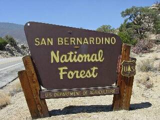
Campground List
CAMPGROUND NAME: Applewhite

VISIT DATE: 06/24/2002

UPDATE DATE: 4/2/2025

STATE: California

REGION: Pacific Southwest

RANGER DISTRICT: Front Creek / Lytle Creek

NEAREST CITY/TOWN: Fontana

RESERVATIONS: 1-877-444-6777 or  make on-line reservation

DIRECTIONS:
In Fontana, CA, at intersection of I-15 and Sierra Ave., take
Sierra Ave. north 7.6 miles to campground sign.  Turn right at
sign into campground.

GENERAL COMMENTS:
The elevation is 3,600 ft.

The campground is composed of two unnamed loops.  To the left of
the campground entrance is the smaller loop.  This loop has the
only pull-throughs and a few camp sites have views of Lytle Creek
Canyon.  The larger loop on the right has more shaded sites and
some sites have the longer parking aprons.  The campground has a
delightful mixture of conifer and deciduous trees, including
Coulter pine and mesquite.  As the story goes, the campground was
named after Colonel Applewhite, an early Mormon settler to the
San Bernardino area.  Lytle Creek is across from the campground
in the picnic area.

SEASONS
Open Seasonal: No
Open All Year: Yes

RATE AND MAXIMUM STAY PERMITTED
Rate: $15 per day - single
$20 per day - double
Maximum Stay Permitted (days): 5

CAMPGROUND SITE CONFIGURATION
No. RV Sites: 0
No. Tent Sites: 0
No. Combined Sites (Tent or RV): 41

   Total Sites: 41

Tent Pads: No
Open Sites: Yes
Wooded Sites: Yes

No. Tables on Sites: 41
No. Grilles on Sites: 41
Equestrian Camping:  No

RV INFORMATION
Hookups: None
No. RV Pull Throughs: 2
Waste Station: No
Average Parking Apron Size: 13' X 42'

Comments:
The parking aprons are paved.

FACILITIES
Vaults: No
Flush Toilets: Yes
Hot Showers: No
Wheelchair Friendly Toilets: No

Public Phone: Yes
Playground: No
No. Water Spigots (non-site): 9
  No. Threaded: 9

WATER SPORTS - None

HIKING - No

FISHING
Rainbow trout

CAMPGROUND NAME: Barton Flats

VISIT DATE: 06/14/2002

UPDATE DATE:  4/2/2025

STATE: California

REGION: Pacific Southwest

RANGER DISTRICT: Front Country

NEAREST CITY/TOWN: Big Bear City

RESERVATIONS: 1-877-444-6777 or make on-line reservation

DIRECTIONS:
In Big Bear City, CA, at the intersection of Greenspot Rd. and
Big Bear Blvd., take Greenspot Rd. (State Rt. 38) south 20.6
miles to campground sign.  Turn right at sign into campground.

GENERAL COMMENTS:
The elevation is 6,500 ft.

The campground, composed of two loops - Columbine and Lupine, is
configured like a "figure 8."  The camp sites in Lupine are
scattered among Ponderosa and Jeffrey pine and Incense cedars.
The sites tend to be terraced.  The Columbine Loop camp sites are
level and tucked in under Ponderosa and Jeffrey pines.  A few
Black oaks are scattered throughout the campground.  There is no
understory and no privacy between camp sites.  Interpretive
programs are available at Grayback Amphitheater on State Rt. 38
throughout summer months.  Firewood is available for a fee.
Limited groceries are available at Angelus Oak, CA, west of
campground on State Rt. 38.

SEASONS
Open Seasonal: Yes
Open All Year: No

Seasonal Comment:
Open March 21 through October 25

RATE AND MAXIMUM STAY PERMITTED
Rate: $36 per day - single
$71 per day - double

NOTE: $2 per day additional fee on national holidays.
Maximum Stay Permitted (days): 14

CAMPGROUND SITE CONFIGURATION
No. RV Sites: 0
No. Tent Sites: 0
No. Combined Sites (Tent or RV): 52

   Total Sites: 52

Tent Pads: No
Open Sites: Yes
Wooded Sites: Yes

No. Tables on Sites: 52
No. Grilles on Sites: 52
Equestrian Camping:  No

RV INFORMATION
Hookups: None
No. RV Pull Throughs: 0
Waste Station: Yes
Potable Water at Waste Station: Yes
Average Parking Apron Size: 14' X 48'

Comments:
The parking aprons are paved.  The RV waste station is available for
a fee.

FACILITIES
Vaults: No
Flush Toilets: Yes
Hot Showers: Yes
Wheelchair Friendly Toilets: Yes

Public Phone: No
Playground: No
No. Water Spigots (non-site): 13
  No. Threaded: 0

Comments:
The hot showers are located at Columbine Loop

WATER SPORTS - None

HIKING
Rio Monte Trail #1E28 (foot) - 2.5 miles
One mile connector to Santa Ana Trail #2E03 (foot & horse) - 36
miles

FISHING - No

CAMPGROUND NAME: Big Pine Flat

VISIT DATE: 06/15/2002

UPDATE DATE: 4/2/2025

STATE: California

REGION: Pacific Southwest

RANGER DISTRICT: Mountaintop

NEAREST CITY/TOWN: Big Bear Lake

RESERVATIONS: No

DIRECTIONS:
From Big Bear Lake, CA, take State Rt. 18 west 1.1 miles to a "T"
intersection.  Turn right at the intersection onto State Rt. 38
and go 3.3 miles to Butler Peak sign at intersection of North
Shore Dr. and Rim of the World Dr.  Turn left at sign onto Rim of
the World Dr. (which becomes Forest Rt. 3N14) and go 7 miles to
campground sign.  Turn left at sign into campground.

GENERAL COMMENTS:
The elevation is 6,900 ft.

The campground, composed of three unnamed spurs, is adjacent to
the 1999 Willow Fire Restoration Area; two major OHV trails; and
the historic Big Pine Flat Ranger Station, constructed by the
Civilian Conservation Corps (CCC) in the mid-1930s.  Each spur
has a tight turn-around making them a challenge for RVrs.  Camp
sites in two spurs are tucked into a stand of Ponderosa and
Jeffrey pines, have little understory (other then sagebrush) or
shade.  The third spur with camp sites 15, 16, and 17, is among
younger pines and a grass understory - recommended for tent
campers.  This is a good base camp for OHV enthusiasts.

This is bear country; practice safe food storage techniques.

SEASONS
Open Seasonal: Yes
Open All Year: No

Seasonal Comment:
Open April 18 through October 4

RATE AND MAXIMUM STAY PERMITTED
Rate: $29 per day
NOTE: $2 per day additional fee on national holiday weekends.

Maximum Stay Permitted (days): 14

CAMPGROUND SITE CONFIGURATION
No. RV Sites: 0
No. Tent Sites: 3
No. Combined Sites (Tent or RV): 16

   Total Sites: 19

Tent Pads: No
Open Sites: Yes
Wooded Sites: Yes

No. Tables on Sites: 19
No. Grilles on Sites: 19
Equestrian Camping:  No

RV INFORMATION
Hookups: None
No. RV Pull Throughs: 0
Waste Station: No
Average Parking Apron Size: 11' X 43'

Comments:
The parking aprons are dirt.  An RV waste station, with potable water,
is available at Serrano campground (Forest Service) - no fee
(with Forest Service campground receipt).

FACILITIES
Vaults: Yes
Flush Toilets: No
Hot Showers: No
Wheelchair Friendly Toilets: No

Public Phone: No
Playground: No
No. Water Spigots (non-site): 4
  No. Threaded: 2

Comments:
Availability of water is limited. Fill up before arrival.

WATER SPORTS - None

HIKING
Redonda Ridge Trail #1W17 (OHV) - 6 miles
White Mountain Trail #3N16 (OHV) - 5 miles

FISHING - No

CAMPGROUND NAME: Boulder Basin

VISIT DATE: 06/12/2002

UPDATE DATE:  4/2/2025

STATE: California

REGION: Pacific Southwest

RANGER DISTRICT: San Jacinto

NEAREST CITY/TOWN: Idyllwild

RESERVATIONS: 1-877-444-6777 or make on-line reservation

DIRECTIONS:
From Idyllwild, CA, take State Rt. 243 north 7.1 miles to Black
Mtn. Rd. sign (Forest Rt. 4S01).  Turn right at sign (hairpin
turn) onto Rt. 4S01 and go 4.9 miles to Boulder Basin campground
sign.  Turn left and go 0.5 miles to campground.

NOTE: Forest Rt. 4S01 is dirt, rough, narrow single-lane, and
winding.

GENERAL COMMENTS:
The elevation is 7,500 ft.

The campground has a "Q" configuration with camp sites on top of
the letter having a delightful vista while sites on either side
have tower boulders for a backdrop.  Magnificent Ponderosa and
Sugar pines and other conifers are found throughout the
campground.  This is a campground for hikers, mountain bikers,
bouldering enthusiasts, and anyone looking for quiet and solitude
- well worth the challenge of the road to the campground.  The Black
Mountain Lookout Tower is accessed via a trail from campground
and offers breathtaking views of the area.  The ground cover
throughout the campground is pine needles and various size pine
cones.  Privacy between camp sites is fair.

NOTE: Gas and limited groceries are available in the nearby
community of Pine Cove.

SEASONS
Open Seasonal: Yes
Open All Year: No

Seasonal Comment:
Open May 22 through October 27

RATE AND MAXIMUM STAY PERMITTED
Rate: $10 per day
Maximum Stay Permitted (days): 14

CAMPGROUND SITE CONFIGURATION
No. RV Sites: 0
No. Tent Sites: 34
No. Combined Sites (Tent or RV): 0

   Total Sites: 34

Tent Pads: No
Open Sites: Yes
Wooded Sites: Yes

No. Tables on Sites: 34
No. Grilles on Sites: 34
Equestrian Camping:  No

FACILITIES
Vaults: Yes
Flush Toilets: No
Hot Showers: No
Wheelchair Friendly Toilets: No

Public Phone: No
Playground: No
No. Water Spigots (non-site): 0
  No. Threaded: 0

WATER SPORTS - None

HIKING
Black Mountain Trail #2E35 (foot, horse, mountain bike) - 3.5
miles

FISHING - No

CAMPGROUND NAME: Dark Canyon

VISIT DATE: 06/12/2002

UPDATE DATE:  5/10/2025

STATE: California

REGION: Pacific Southwest

RANGER DISTRICT: San Jacinto

NEAREST CITY/TOWN: Idyllwild

RESERVATIONS: No

DIRECTIONS:
From Idyllwild, CA, take State Rt. 243 north 4.3 miles to
campground sign.  Turn right at sign and go 0.1 miles to another
campground sign (Forest Rt. 4S02).  Turn left at sign and go 0.7
miles to a "Y" intersection and campground sign.  Bear left and
go 1.6 miles to campground.

NOTE: Left at "Y" intersection is paved, but it is single-lane
(narrow in places), curvy, and steep.  Access to campground is
not recommended for large RVs - authors concur.

GENERAL COMMENTS:
The elevation is 5,900 ft.

The campground is a single loop through a stand of mature cedars,
Ponderosa pine, oaks, and a variety of other conifers.  This
overstory of trees provides lots of shade for the camp sites.
Although not a group campground, well cleared, spacious sites
make this campground nicely suited for large groups.

NOTE: Gas and limited groceries are available in the nearby
community of Pine Cove.

SEASONS
Open Seasonal: Yes
Open All Year: No

Seasonal Comment:
Open May 21 through September 5

NOTE: 5/1/2025 - Campground closed for the 2025 season. Contact
ranger district office for status.

RATE AND MAXIMUM STAY PERMITTED
Rate: $12 per day
NOTE: Scan and Pay used for on-site payments through Rec.gov app. Please
load app before arrival.
Maximum Stay Permitted (days): 14

CAMPGROUND SITE CONFIGURATION
No. RV Sites: 0
No. Tent Sites: 12
No. Combined Sites (Tent or RV): 0

   Total Sites: 12

Tent Pads: No
Open Sites: No
Wooded Sites: Yes

No. Tables on Sites: 12
No. Grilles on Sites: 12
Equestrian Camping:  No

RV INFORMATION
Hookups: None
No. RV Pull Throughs: 0
Waste Station: No
Average Parking Apron Size: N/A

Comments:
The parking aprons are paved.  Campground can accomodate
small recreational vehicles but best-suited to tent camping.

FACILITIES
Vaults: Yes
Flush Toilets: No
Hot Showers: No
Wheelchair Friendly Toilets: Yes

Public Phone: No
Playground: No
No. Water Spigots (non-site): 4
  No. Threaded: 1

WATER SPORTS - None

HIKING
Seven Pines Trail (foot and horse) - 3.8 miles

FISHING - No

CAMPGROUND NAME: Dogwood

VISIT DATE: 06/18/2002

UPDATE DATE:  4/2/2025

STATE: California

REGION: Pacific Southwest

RANGER DISTRICT: Mountaintop

NEAREST CITY/TOWN: Running Springs

RESERVATIONS: 1-877-444-6777 or make on-line reservation

DIRECTIONS:
From Running Springs, CA, take State Rt. 18 west 6.5 miles to
Blue Jay sign (0.3 miles past Rim of the World High School).
Turn right at Blue Jay sign and make another immediate right at
campground sign.  Go 0.3 miles to campground entrance.

GENERAL COMMENTS:
The elevation is 6000 ft.

The campground, composed of five loops - Sequoia, Cedar, Pine,
Oak, and Fir, is in a dense forest of cedar, Ponderosa and
Jeffrey pines, oak, and Douglas fir.  Originally designed for
tent camping, the campground has retained much of its old
character and challenges for RV campers.  Cedar, Fir and Sequoia
Loops are recommended for tent campers only.  Even pop-up tent
campers and slide-ins might have difficulty maneuvering these
loops.  The Pine and Oak Loops are best suited for RVs.  The lush
forest attracts lots of bird and wildlife for viewing.
Interpretive programs are provided on weekends throughout the
summer months.  Firewood is available for a fee.  Considered an
"all reservation" campground, reservations can be made at the
campground's entrance if sites are available, as well as on-line.

SEASONS
Open Seasonal: Yes
Open All Year: No

Seasonal Comment:
Open April 18 through October 25

RATE AND MAXIMUM STAY PERMITTED
Rate: $40 per day - single
$51 per day - single w/ electric hook-up
$79 per day - double

NOTE: $2 per day additional fee on national holidays. Credit
cards areaccepted.  Only checks of $50 or more are accepted.
Maximum Stay Permitted (days): 14

CAMPGROUND SITE CONFIGURATION
No. RV Sites: 0
No. Tent Sites: 49
No. Combined Sites (Tent or RV): 40

   Total Sites: 89

Tent Pads: No
Open Sites: No
Wooded Sites: Yes

No. Tables on Sites: 89
No. Grilles on Sites: 89
Equestrian Camping:  No

RV INFORMATION
No. Full Hookups (includes waste): 0
No. Water and Electric Only: 0
No. Water Only: 0
No. Electric Only: 18

No. RV Pull Throughs: 0
Waste Station: Yes
Potable Water at Waste Station: Yes
Average Parking Apron Size: 10' X 40'

Comments:
The parking aprons are paved.  Tight, narrow interior road limits
RV size and maneuverability.  Some parking aprons are slightly
longer but no wider.  Most camp sites will not accommodate slide-
outs.

FACILITIES
Vaults: No
Flush Toilets: Yes
Hot Showers: Yes
Wheelchair Friendly Toilets: Yes

Public Phone: Yes
Playground: No
No. Water Spigots (non-site): 15
  No. Threaded: 15

Comments:
The hot showers are wheelchair friendly.

WATER SPORTS - None

HIKING
Dogwood Trail (foot) - 0.75 miles
Enchanted Loop Nature Trail (foot) - 0.5 miles

FISHING - No

CAMPGROUND NAME: Fern Basin

VISIT DATE: 06/12/2002

UPDATE DATE: 4/2/2025

STATE: California

REGION: Pacific Southwest

RANGER DISTRICT: San Jacinto

NEAREST CITY/TOWN: Idyllwild

RESERVATIONS: 1-877-444-6777 or make on-line reservation

DIRECTIONS:
From Idyllwild, CA, take State Rt. 243 north 4.3 miles to
campground sign.  Turn right at sign and go 0.1 miles to another
campground sign (Forest Rt. 4S02).  Turn left at sign onto Rt.
4S02 and go 0.7 miles to a "Y" intersection and campground sign.
Continue straight on Rt. 4S02 for 0.3 miles to still another
campground sign.  Turn left at sign and go 0.1 miles into
campground.

GENERAL COMMENTS:
The elevation is 6,400 ft.

The campground is is a single loop meandering through a grove of
mixed oaks and some of the largest Manzanita "shrubs" the authors
have seen.  In addition, there are very mature Ponderosa pine,
cedar and other conifers scattered throughout the campground.
The tables and grilles are a bit of a walk from the parking
aprons at some camp sites.  This is a quiet campground, but lack
of understory reduces privacy to fair.  Gas and groceries are
available in the nearby community of Pine Cove.

SEASONS
Open Seasonal: Yes
Open All Year: No

Seasonal Comment:
Open May 22 through September 2

RATE AND MAXIMUM STAY PERMITTED
Rate: $10 per day
Maximum Stay Permitted (days): 14

CAMPGROUND SITE CONFIGURATION
No. RV Sites: 0
No. Tent Sites: 9
No. Combined Sites (Tent or RV): 13

   Total Sites: 22

Tent Pads: No
Open Sites: Yes
Wooded Sites: Yes

No. Tables on Sites: 22
No. Grilles on Sites: 22
Equestrian Camping:  No

RV INFORMATION
Hookups: None
No. RV Pull Throughs: 0
Waste Station: No
Average Parking Apron Size: 12' X 27'

Comments:
The parking aprons are paved, most of which are the same size.
Some camp sites have low overhanging branches.

FACILITIES
Vaults: Yes
Flush Toilets: No
Hot Showers: No
Wheelchair Friendly Toilets: No

Public Phone: No
Playground: No
No. Water Spigots (non-site): 0
  No. Threaded: 0

WATER SPORTS - None

HIKING - No

FISHING - No

CAMPGROUND NAME: Green Valley

VISIT DATE: 4/7/2004

UPDATE DATE: 4/2/2025

STATE: California

REGION: Pacific Southwest

RANGER DISTRICT: Mountaintop

NEAREST CITY/TOWN: Running Springs

RESERVATIONS: 1-877-444-6777 or make on-line reservation

DIRECTIONS:
From Running Springs, CA, take State Rt. 18 east 2.4 to Green
Valley Lake sign.  Turn left at sign and go 4.5 miles to
campground.

GENERAL COMMENTS:
The elevation is 7,200 ft.

The campground has three sections.  One is just past entrance to
campground which has open camp sites separated by willow and
Manzanita shrubs and has several walk-in tent sites.  Drive
through this section and along a ridge to another section dotted
with large Jeffrey pines and Douglas firs.  Oak trees add to this
section's canopy and shade and is more RV friendly.  The third
section is to the right of the campground's information board and
offers lots of shade from large Incense cedars, Douglas firs and
Jeffrey pines.  A serious dip at the beginning of this section
makes it the least RV friendly.  A few of this section's sites
overlook a seasonal creek lined by scrubby willows.

SEASONS
Open Seasonal: Yes
Open All Year: No

Seasonal Comment:
Open April 18 through October 25

RATE AND MAXIMUM STAY PERMITTED
Rate: $29 per day - single
$56 per day - double

NOTE: $2 per day additional fee on national holidays.
Maximum Stay Permitted (days): 14

CAMPGROUND SITE CONFIGURATION
No. RV Sites: 0
No. Tent Sites: 3
No. Combined Sites (Tent or RV): 34

   Total Sites: 37

Tent Pads: No
Open Sites: Yes
Wooded Sites: Yes

No. Tables on Sites: 37
No. Grilles on Sites: 37
Equestrian Camping:  No

RV INFORMATION
Hookups: None
No. RV Pull Throughs: 0
Waste Station: No
Average Parking Apron Size: 12' X 40'

Comments:
The parking aprons are paved.  Because of severe dip, trailers
are not recommended in section to right just before fee booth.

FACILITIES
Vaults: No
Flush Toilets: Yes
Hot Showers: No
Wheelchair Friendly Toilets: No

Public Phone: No
Playground: No
No. Water Spigots (non-site): 13
  No. Threaded: 6

WATER SPORTS - None

HIKING - No

FISHING - No

CAMPGROUND NAME: Hanna Flat

VISIT DATE: 06/15/2002

UPDATE DATE: 4/2/2025

STATE: California

REGION: Pacific Southwest

RANGER DISTRICT: Mountaintop

NEAREST CITY/TOWN: Big Bear Lake

RESERVATIONS: 1-877-444-6777 or make on-line reservation

DIRECTIONS:
From Big Bear Lake, CA, take State Rt. 18 west 1.1 miles to a "T"
intersection.  Turn right at the intersection onto State Rt. 38
and go 3.3 miles to Butler Peak sign at intersection of North
Shore Dr. and Rim of the World Dr.  Turn left at sign onto Rim of
the World Dr. (which becomes Forest Rt. 3N14) and go 2.4 miles to
campground sign.  Turn left at sign into campground.

NOTE: 4/2/2025 - Per Forest Service, portion of access road to campground is
extremely rough dirt road.

GENERAL COMMENTS:
The elevation is 7,200 ft.

The campground is composed of three unnamed paved loops.  The larger
loop, and more open, is north of entrance.  It is comprised of a
Manzanita and wild rose understory and pleasant mix of Ponderosa
and Jeffrey pines, oak and willow along a seasonal creek.  Two
smaller loops overlap and are better shaded by dense woods
similar to the other loops but includes Douglas fir and more oak
trees.  Except where Manzanita grows, privacy is minimal between
camp sites.  This campground attracts families of all sizes and
ages.  Firewood is available for a fee.

This is bear country; practice safe food storage techniques.

SEASONS
Open Seasonal: Yes
Open All Year: No

Seasonal Comment:
Open April 18 through October 25

RATE AND MAXIMUM STAY PERMITTED
Rate: $33 per day - single
$65 per day - double

NOTE: $2 per day additional fee on national holidays.
Maximum Stay Permitted (days): 14

CAMPGROUND SITE CONFIGURATION
No. RV Sites: 0
No. Tent Sites: 1
No. Combined Sites (Tent or RV): 85

   Total Sites: 86

Tent Pads: No
Open Sites: Yes
Wooded Sites: Yes

No. Tables on Sites: 86
No. Grilles on Sites: 86
Equestrian Camping:  No

RV INFORMATION
Hookups: None
No. RV Pull Throughs: 0
Waste Station: No
Average Parking Apron Size: 10' X 38'

Comments:
The interior roads and parking aprons are paved.  An RV waste station,
with potable water, is available at Serrano campground (Forest Service) - no
fee (with Forest Service campground receipt).

FACILITIES
Vaults: Yes
Flush Toilets: No
Hot Showers: No
Wheelchair Friendly Toilets: No

Public Phone: No
Playground: No
No. Water Spigots (non-site): 21
  No. Threaded: 0

WATER SPORTS - None

HIKING
Grey's Peak Trail #S.W. (foot & Mountain bike) - 3.5 miles
Unmarked trail leads to Coxcomb Creek (foot & mountain bike) - 10
miles
Access to the Pacific Creast Trail approximately 1.5 miles

FISHING - No

CAMPGROUND NAME: Heart Bar

VISIT DATE: 06/17/2002

UPDATE DATE:  4/2/2025

STATE: California

REGION: Pacific Southwest

RANGER DISTRICT: Front Country

NEAREST CITY/TOWN: Big Bear City

RESERVATIONS: 1-877-444-6777 or make on-line reservation

DIRECTIONS:
In Big Bear City, CA, at the intersection of Greenspot Rd. and
Big Bear Blvd., take Greenspot Rd. (State Rt. 38) south 15 miles
to campground sign.  Turn left at sign and go 0.2 miles to
campground on right.

GENERAL COMMENTS:
The elevation is 6,900 ft.

This pleasant campground is composed of five loops - Santa Ana,
Aspen, Group Camp, Grinnell Peak, and Sugarloaf.  The Group Camp
Loop is not included in this survey because it does not accept
individual families.  Sugarloaf and Grinnell Peak Loops are smaller
while Aspen is the largest.  Each loop enjoys a mixture of
Ponderosa and Jeffrey pine overstory with a sprinkling of fir,
junipers, and oak scattered about.  The understory ranges from
pine needles only to sagebrush.  Privacy between camp sites is
fair to good.  The campground is located on a ridge which
provides some camp sites with a view of surrounding mountains.
Firewood is available for a fee.

This is bear country; practice safe food storage techniques.

SEASONS
Open Seasonal: Yes
Open All Year: No

Seasonal Comment:
Open April 23 through October 11

NOTE: 4/2/2025 - This campground will remain closed throughout 2025
due to road damage caused by the Line fire. They hope to reopen it
in 2026. Contact ranger district office for status.

RATE AND MAXIMUM STAY PERMITTED
Rate: $29 per day - single
$56 per day = double
 $2 per day additional fee on national holiday weekends
Maximum Stay Permitted (days): 14

CAMPGROUND SITE CONFIGURATION
No. RV Sites: 0
No. Tent Sites: 0
No. Combined Sites (Tent or RV): 87

   Total Sites: 87

Tent Pads: No
Open Sites: Yes
Wooded Sites: Yes

No. Tables on Sites: 87
No. Grilles on Sites: 87
Equestrian Camping:  No

RV INFORMATION
Hookups: None
No. RV Pull Throughs: 1
Waste Station: No
Average Parking Apron Size: 12' X 48'

Comments:
The parking aprons are paved.  An RV waste station, with potable
water, is available at Barton Flats campground (Forest Service).
No fee with proof of paid fee at Barton Flats.

FACILITIES
Vaults: Yes
Flush Toilets: No
Hot Showers: No
Wheelchair Friendly Toilets: Yes

Public Phone: No
Playground: No
No. Water Spigots (non-site): 24
  No. Threaded: 24

WATER SPORTS - None

HIKING - No

FISHING - No

CAMPGROUND NAME: Holcomb Valley

VISIT DATE: 06/15/2002

UPDATE DATE: 5/10/2025

STATE: California

REGION: Pacific Southwest

RANGER DISTRICT: Mountaintop

NEAREST CITY/TOWN: Big Bear City

RESERVATIONS: No

DIRECTIONS:
In Big Bear City, CA, at intersection of Greenway Rd. and Big
Bear Blvd. (State Rt. 38), take Greenway Rd. 0.5 miles to
intersection of Greenway Rd. and North Shore Rd. (State Rt. 18).
Turn left onto North Shore Rd. and go 0.5 miles to Van Dusen Cyn
Rd sign.  Turn right at sign onto Van Dusen Cyn Rd. and go 4
miles to a "T" intersection (FRN16).  Turn left onto FRN16, then
right into campground.

NOTE: Except for the first 0.4 miles, Van Dusen Cyn Rd is a
rough, boulder-dotted, single-lane, dirt road.  NOT RV friendly.

GENERAL COMMENTS:
The elevation is 7,500 ft.

The campground meanders through a flat covered by mature
Ponderosa pine.  The interior road is "S" shaped.  There are a
few clusters of camp sites but most are widely spaced so privacy
is fair.  Along with mountain biking, rock climbing, 4X4 trails,
and solitude, gold panning are popular activity - check with Ranger
District Office for specific information.  A good day trip is the
Gold Fever Auto Tour.  The road is accessible directly from
campground.  Again, check with the Ranger District Office for information.

SEASONS
Open Seasonal: Yes
Open All Year: Yes

Seasonal Comment:
Services provide mid-May through October - weather dependent

May be inaccessible by automobile during winter; hiking in is okay.

RATE AND MAXIMUM STAY PERMITTED
Rate: $28 per day
Note: $2 additional fee on national holiday weekends

Maximum Stay Permitted (days): 14

CAMPGROUND SITE CONFIGURATION
No. RV Sites: 0
No. Tent Sites: 0
No. Combined Sites (Tent or RV): 18

   Total Sites: 18

Tent Pads: No
Open Sites: Yes
Wooded Sites: Yes

No. Tables on Sites: 18
No. Grilles on Sites: 18
Equestrian Camping:  No

RV INFORMATION
Hookups: None
No. RV Pull Throughs: 0
Waste Station: No
Average Parking Apron Size: 11' X 26'

Comments:
The parking aprons are dirt, all of which are about the same
size.  Tight turns, narrow, rough interior road and close-growing
trees, make maneuvering an RV difficult.  Recommend only pop-up
tent campers and slide-in RVs.

FACILITIES
Vaults: Yes
Flush Toilets: No
Hot Showers: No
Wheelchair Friendly Toilets: Yes

Public Phone: No
Playground: No
No. Water Spigots (non-site): 0
  No. Threaded: 0

WATER SPORTS - None

HIKING
Unnamed trail connects campground to Gold Fever Trail near Two
Gun Bill's Saloon.

FISHING - No

CAMPGROUND NAME: Marion Mountain

VISIT DATE: 06/12/2002

UPDATE DATE:  4/2/2025

STATE: California

REGION: Pacific Southwest

RANGER DISTRICT: San Jacinto

NEAREST CITY/TOWN: Idyllwild

RESERVATIONS: 1-877-444-6777 or make on-line reservation

DIRECTIONS:
From Idyllwild, CA, take State Rt. 243 north 4.3 miles to
campground sign.  Turn right at sign and go 0.1 miles to another
campground sign (Forest Rt. 4S02).  Turn left at sign and go 0.7
miles to a "Y" intersection and campground sign.  Continue
straight for 0.8 miles into campground.

NOTE: Last 0.8 miles is single-lane, steep roadway with
switchbacks and few turnouts.

GENERAL COMMENTS:
The elevation is 6,600 ft.

The campground, comprised of mature cedar and Ponderosa pines,
has two unnamed loops.  In general, this campground is best
suited for tenters and small RVs.  The loop to right of
campground's entrance is more open, has better views, and sites
that will accommodate RVs.  The loop to the left is very shady
with shorter parking aprons.  Most tables and grilles are a short
walk away from the parking apron.  The ground cover is mostly
pine needles and some grass.  Privacy between camp sites is fair.

SEASONS
Open Seasonal: Yes
Open All Year: No

Seasonal Comment:
Open May 22 through November 10

RATE AND MAXIMUM STAY PERMITTED
Rate: $10 per day
Maximum Stay Permitted (days): 14

CAMPGROUND SITE CONFIGURATION
No. RV Sites: 0
No. Tent Sites: 9
No. Combined Sites (Tent or RV): 15

   Total Sites: 24

Tent Pads: No
Open Sites: Yes
Wooded Sites: Yes

No. Tables on Sites: 24
No. Grilles on Sites: 24
Equestrian Camping:  No

RV INFORMATION
Hookups: None
No. RV Pull Throughs: 0
Waste Station: No
Average Parking Apron Size: 13' X 27'

Comments:
The parking aprons are paved and most are same size.

FACILITIES
Vaults: Yes
Flush Toilets: No
Hot Showers: No
Wheelchair Friendly Toilets: No

Public Phone: No
Playground: No
No. Water Spigots (non-site): 4
  No. Threaded: 0

Comments:
Check with Ranger District Office for status of potable water.

WATER SPORTS - None

HIKING
Marion Mountain Trail #2E14 (foot & horse) - 2.5 miles
    Provides access to network of trails in the San Jacinto
    Wilderness.

FISHING - No

CAMPGROUND NAME: North Shore

VISIT DATE: 06/18/2002

UPDATE DATE: 4/2/2025

STATE: California

REGION: Pacific Southwest

RANGER DISTRICT: Mountaintop

NEAREST CITY/TOWN: Running Springs

RESERVATIONS: 1-877-444-6777 or make on-line reservation

DIRECTIONS:
From Running Springs, CA, take State Rt. 18 west 5 miles to State
Rt. 173 sign.  Turn right at sign onto Rt. 173 and go 1.5 miles
to "Y" intersection.  Bear right, staying on Rt. 173, for 2.8
miles to Hospital Rd. sign.  Turn right at sign onto Hospital Rd.
and go 0.1 miles to campground sign.  Turn left at sign and go
0.1 miles to campground.

GENERAL COMMENTS:
The elevation is 5,300 ft.

The campground is a single loop with two dead-end spurs.  The
camp sites are tucked in among Gambel oaks, Jeffrey pines and
some huge Manzanita shrubs.  The campground is convenient to
Arrowhead Lake community.  This is a quiet campground during the
week, but becomes a hub of activity on weekends.  Firewood is
available for a fee.

SEASONS
Open Seasonal: Yes
Open All Year: No

Seasonal Comment:
Open April 18 through September 20

RATE AND MAXIMUM STAY PERMITTED
Rate: $29 per day - single
$56 per day - double

NOTE: $2 per day additional fee on national holidays.
Maximum Stay Permitted (days): 14

CAMPGROUND SITE CONFIGURATION
No. RV Sites: 0
No. Tent Sites: 13
No. Combined Sites (Tent or RV): 13

   Total Sites: 26

Tent Pads: No
Open Sites: Yes
Wooded Sites: Yes

No. Tables on Sites: 26
No. Grilles on Sites: 26
Equestrian Camping:  No

RV INFORMATION
Hookups: None
No. RV Pull Throughs: 2
Waste Station: No
Average Parking Apron Size: 10' X 30'

Comments:
The parking aprons are dirt and paved.  An RV waste station is available
for a fee at Dogwood campground (Forest Service).  Parking aprons are
all about the same size.  RVrs should not venture onto spurs.

FACILITIES
Vaults: No
Flush Toilets: Yes
Hot Showers: No
Wheelchair Friendly Toilets: No

Public Phone: No
Playground: No
No. Water Spigots (non-site): 5
  No. Threaded: 5

WATER SPORTS - None

HIKING
North Shore Trail #3W12 (foot and horse) - 1.7 miles
       connects to Deep Creek Trail

FISHING - No

CAMPGROUND NAME: Pineknot

VISIT DATE: 06/17/2002

UPDATE DATE: 4/2/2025

STATE: California

REGION: Pacific Southwest

RANGER DISTRICT: Mountaintop

NEAREST CITY/TOWN: Big Bear Lake

RESERVATIONS: 1-877-444-6777 or make on-line reservation

DIRECTIONS:
In Big Bear Lake, CA, at intersection of Big Bear Blvd. and
Summit Blvd., take Summit Blvd. south 0.4 miles to campground
sign.  Turn left at sign and go 0.1 miles to campground on right.

GENERAL COMMENTS:
The elevation is 7,000 ft.

The campground is composed of two overlapping loops at the base
of Snow Summit Ski Resort Mountain.  A dense stand of Jeffrey
pine, Douglas fir, and oak provide good shade to most camp sites.
Although a tempting campground for RVs, it is really best suited
for tent campers and a mecca for beginner and serious mountain
bike enthusiasts.  Also at the base of Snow Summit is the Team
Bear Mountain Bike Center which has mountain bikes for rent and
repair facilities.  The Center also holds organized competitive
races (downhill and cross-country) for amateur and professional
mountain bikers.  Some chair lifts on the mountain are fitted to
carry mountain bikes.

SEASONS
Open Seasonal: Yes
Open All Year: No

Seasonal Comment:
Open April 18 through October 25

RATE AND MAXIMUM STAY PERMITTED
Rate: $34 per day

NOTE: $2 per day additional fee on national holidays.
Maximum Stay Permitted (days): 14

CAMPGROUND SITE CONFIGURATION
No. RV Sites: 0
No. Tent Sites: 0
No. Combined Sites (Tent or RV): 47

   Total Sites: 47

Tent Pads: No
Open Sites: Yes
Wooded Sites: Yes

No. Tables on Sites: 47
No. Grilles on Sites: 47
Equestrian Camping:  No

RV INFORMATION
Hookups: None
No. RV Pull Throughs: 0
Waste Station: No
Average Parking Apron Size: 12'X38'

Comments:
The parking aprons are paved and all are about the same size.
Besides the apron size, the interior roads are tight and narrow which
severely limits RV maneuverability.  An RV waste station, with potable
water, is available at Serrano campground (Forest Service) - no
fee (with Forest Service campground receipt).

FACILITIES
Vaults: No
Flush Toilets: Yes
Hot Showers: No
Wheelchair Friendly Toilets: No

Public Phone: No
Playground: No
No. Water Spigots (non-site): 9
  No. Threaded: 5

Comments:
The threaded spigots are at the bathrooms.

WATER SPORTS - None

HIKING
A network of mountain bike trails are available at the Snow
Summit Ski Resort Mountain; see General Comments.

FISHING - No

CAMPGROUND NAME: Pinyon Flats

VISIT DATE: 06/11/2002

UPDATE DATE:   4/2/2025

STATE: California

REGION: Pacific Southwest

RANGER DISTRICT: San Jacinto

NEAREST CITY/TOWN: Idyllwild

RESERVATIONS: No

DIRECTIONS:
From Idyllwild, CA, take State Rt. 243 south 2.6 miles to a "Y"
intersection.  Bear left onto State Rt. 74 and go 21.7 miles to
campground sign.  Turn left at sign and go 0.1 miles to another
left and turn into campground.

GENERAL COMMENTS:
The elevation is 4,400 ft.

The campground is a single loop in Pinyon pines, juniper, yucca,
cactus and a few Honey mesquite.  Although the campground is
sparsely shaded, widely spaced camp sites provide good privacy.
About 1.9 miles east of campground, on State Rt. 74, is Cahuilla
Tewanet vista. At this vista is a self-guided, paved trail about
the Cahuilla Indians and the area.  Branching off from this
trail, is a trail leading into the Santa Rosa Wilderness.

SEASONS
Open Seasonal: No
Open All Year: Yes

RATE AND MAXIMUM STAY PERMITTED
Rate: $8 per day
Maximum Stay Permitted (days): 14

CAMPGROUND SITE CONFIGURATION
No. RV Sites: 0
No. Tent Sites: 0
No. Combined Sites (Tent or RV): 19

   Total Sites: 19

Tent Pads: No
Open Sites: Yes
Wooded Sites: No

No. Tables on Sites: 18
No. Grilles on Sites: 19
Equestrian Camping:  No

RV INFORMATION
Hookups: None
No. RV Pull Throughs: 0
Waste Station: No
Average Parking Apron Size: 10' X 37'

Comments:
The parking aprons are dirt - some are eroded.  The interior road
is dirt and rough.  An RV waste station, with no potable water,
is available for a fee at Lake Helmet State Park, 17.6 miles north
on State Rt. 74.

FACILITIES
Vaults: Yes
Flush Toilets: No
Hot Showers: No
Wheelchair Friendly Toilets: Yes

Public Phone: No
Playground: No
No. Water Spigots (non-site): 7
  No. Threaded: 0

WATER SPORTS - None

HIKING
Sawmill Trail (0.4 miles from campground) is comprised of:
        Cactus Spring Trail #5E01 (foot and horse)
        Sawmill Trail #5E03 (foot and horse)

Provides access to network of trails in Santa Rosa Wilderness.

FISHING - No

CAMPGROUND NAME: San Gorgonio

VISIT DATE: 06/14/2002

UPDATE DATE:  4/2/2025

STATE: California

REGION: Pacific Southwest

RANGER DISTRICT: Front Country

NEAREST CITY/TOWN: Big Bear City

RESERVATIONS: 1-877-444-6777 or make on-line reservation

DIRECTIONS:
In Big Bear City, CA, at the intersection of Greenspot Rd. and
Big Bear Blvd., take Greenspot Rd. (State Rt. 38) south 20.2
miles to campground sign.  Turn right into campground.

GENERAL COMMENTS:
The elevation is 6,600 ft.

The campground is composed of two loops - Cedar and Shady Oak.
Shady Oak is well named because mature Black oaks provide shade
to the camp sites.  Sites in this loop tend to be close together
providing little privacy.  On the other hand, camp sites in the
Cedar Loop provide a bit more privacy because the sites are a
little more widely spaced.  Overstory is composed of Black oak,
Jeffrey and Ponderosa pines.  All the pull-throughs are in Cedar
Loop.  Firewood is available for a fee.  Limited groceries are
available at Angelus Oak, CA, west of campground on State Rt. 38.

This is bear country; practice safe food storage techniques.

SEASONS
Open Seasonal: Yes
Open All Year: No

Seasonal Comment:
Open April 18 through September 20

RATE AND MAXIMUM STAY PERMITTED
Rate: $34 per day - single
$67 per day - double

NOTE: $2 per day additional fee on national holidays.
Maximum Stay Permitted (days): 14

CAMPGROUND SITE CONFIGURATION
No. RV Sites: 0
No. Tent Sites: 0
No. Combined Sites (Tent or RV): 54

   Total Sites: 54

Tent Pads: No
Open Sites: Yes
Wooded Sites: Yes

No. Tables on Sites: 54
No. Grilles on Sites: 54
Equestrian Camping:  No

RV INFORMATION
Hookups: None
No. RV Pull Throughs: 3
Waste Station: No
Average Parking Apron Size: 14' X 48'

Comments:
The parking aprons are paved.  An RV waste station with potable water, is
available for a fee at Barton Flats campground (Forest Service) 0.6 miles
west on State Rt. 38.

FACILITIES
Vaults: No
Flush Toilets: Yes
Hot Showers: Yes
Wheelchair Friendly Toilets: Yes

Public Phone: No
Playground: No
No. Water Spigots (non-site): 14
  No. Threaded: 0

Comments:
Wheelchair friendly toilets available in main bathhouse.

WATER SPORTS - None

HIKING
Rio Monte Trail #1E28 (foot) - 2.5 miles

FISHING - No

CAMPGROUND NAME: Serrano

VISIT DATE: 06/16/2002

UPDATE DATE: 4/2/2025

STATE: California

REGION: Pacific Southwest

RANGER DISTRICT: Mountaintop

NEAREST CITY/TOWN: Big Bear Lake

RESERVATIONS: 1-877-444-6777 or make on-line reservation

DIRECTIONS:
In Big Bear Lake, CA, at the intersection of Stanfield Cutoff and
Big Bear Blvd. (State Rt. 18 - on the east end of Big Bear Lake),
take Stanfield Cutoff 0.4 miles to a "T" intersection (State Rt.
38).  Turn left onto Rt. 38 and go 1.4 miles to campground sign.
Turn left at sign and go 0.1 miles to another campground sign.
Turn right at sign into campground.

GENERAL COMMENTS:
The elevation is 7,000 ft.

The campground, located within sight of and across the road from
Big Bear Lake, is composed of four loops - Summer Wind,
Snowberry, Evening Star, and Lake View.  The primary vegetation
in the campground is Ponderosa and Jeffery pine, and juniper.
The ground is sand/dirt with sagebrush on the roadsides.
Snowberry Loop has full hookups.  Except for some "handicap" camp
sites that have a water hookup, the remaining loops have no
hookups.  A few camp sites in the Lake View Loop do have a
marginal view of the lake.  Summer Wind Loop has the most variety
in topography while Evening Star has the most shade.  Privacy
ranges from minimal to fair.  The Alpine Pedal Path, a paved
walkway, just outside the campground, provides for a pleasant
morning and evening stroll; mountain bikes are also permitted.
The nearby Big Bear Discovery Center has a wealth of information;
the weekend interpretive programs are excellent and fun for the
whole family.  The campground is convenient to the towns of Big
Bear Lake and Big Bear City for exploring, shopping and a cook's
night out.  Across from the campground is the Lighthouse Trailer
Resort and Marina with limited groceries and boat rentals.  Considered
an "all reservation" campground, reservations can be made at the
campground's entrance if sites are available, as well as on-line.


SEASONS
Open Seasonal: Yes
Open All Year: No

Seasonal Comment:
Open March 7 through November 29

RATE AND MAXIMUM STAY PERMITTED
Rate: $44 per day - single w/ no hookups
$56 per day - single w/ electric hookups
$87 per day - double
NOTE: $2 per day (single) / $4 per day (double) additional fee on
national holidays.

Maximum Stay Permitted (days): 14

CAMPGROUND SITE CONFIGURATION
No. RV Sites: 0
No. Tent Sites: 0
No. Combined Sites (Tent or RV): 112

   Total Sites: 112

Tent Pads: No
Open Sites: Yes
Wooded Sites: Yes

No. Tables on Sites: 112
No. Grilles on Sites: 112
Equestrian Camping:  No

RV INFORMATION
No. Full Hookups (includes waste): 29
No. Water and Electric Only: 0
No. Water Only: 4
No. Electric Only: 0

No. RV Pull Throughs: 0
Waste Station: Yes
Potable Water at Waste Station: Yes
Average Parking Apron Size: 12' X 55'

Comments:
The parking aprons are paved.

FACILITIES
Vaults: No
Flush Toilets: Yes
Hot Showers: Yes
Wheelchair Friendly Toilets: Yes

Public Phone: Yes
Playground: No
No. Water Spigots (non-site): 20
  No. Threaded: 20

Comments:
Individual family style bathrooms are available and the showers
are wheelchair friendly.

WATER SPORTS - None

Comments:
Big Bear Lake has 22 miles of shoreline.  There is no direct
access from the campground.  East Launch Boat Ramp is the closest
access, 1.2 miles from campground.  All water sports are
available on the lake.

HIKING
Alpine Pedal Path (foot & mountain bike)
Cougar Crest Trail #1E22 (foot & mountain bike)

FISHING - No

Comments:
As with water sports, fishing is not directly accessible from the
campground.  But, about 1 mile away, lots of fish are available,
including: Rainbow trout, Large and Smallmouth bass, Blue and
Channel catfish, Carp, Bluegill, Pumpkinseed, and Black crappie.

CAMPGROUND NAME: South Fork

VISIT DATE: 06/14/2002

UPDATE DATE:  4/2/2025

STATE: California

REGION: Pacific Southwest

RANGER DISTRICT: Front Country

NEAREST CITY/TOWN: Big Bear City

RESERVATIONS: No

DIRECTIONS:
In Big Bear City, CA, at the intersection of Greenspot Rd. and
Big Bear Blvd., take Greenspot Rd. (State Rt. 38) south 17.7
miles to campground sign.  Turn left at sign into campground.

GENERAL COMMENTS:
The elevation is 6,500 ft.

The campground is a long loop that follows the Santa Anna River.
It has a "tail" section, separated by Santa Anna Creek, for tents
only; all are walk-ins.  Many of the camp sites have a view of
mountains and some overlook the river.  A delightful mixture of
cedars, pines, and firs provide ample shade and a restful
atmosphere.  Firewood is available for a fee.  Limited groceries
are available at Angelus Oak, CA, west of campground on State Rt.
38.

This is bear country; practice safe food storage techniques.

SEASONS
Open Seasonal: Yes
Open All Year: No

Seasonal Comment:
Open May 2 through September 27

RATE AND MAXIMUM STAY PERMITTED
Rate: $29 per day
$2 per day additional fee on national holiday weekends.

Maximum Stay Permitted (days): 14

CAMPGROUND SITE CONFIGURATION
No. RV Sites: 0
No. Tent Sites: 7
No. Combined Sites (Tent or RV): 17

   Total Sites: 24

Tent Pads: No
Open Sites: Yes
Wooded Sites: Yes

No. Tables on Sites: 24
No. Grilles on Sites: 24
Equestrian Camping:  No

RV INFORMATION
Hookups: None
No. RV Pull Throughs: 0
Waste Station: No
Average Parking Apron Size: 9.5' X 32'

Comments:
The parking aprons are paved.  An RV waste station with potable water, is
available for a fee at Barton Flats campground (Forest Service), 0.6 miles
west on State Rt. 38.

FACILITIES
Vaults: Yes
Flush Toilets: No
Hot Showers: No
Wheelchair Friendly Toilets: No

Public Phone: No
Playground: No
No. Water Spigots (non-site): 10
  No. Threaded: 0

WATER SPORTS - None

HIKING
Santa Anna River Trail #2E053 (foot & horse) - 36 miles
Lost Creek Trail #1E09 (foot & horse) - 2 miles
    provides access to a network of trails in the San Gorgonio Wilderness

FISHING
Rainbow trout

CAMPGROUND NAME: Wildhorse Family

VISIT DATE: 06/17/2002

UPDATE DATE:  4/3/2025

STATE: California

REGION: Pacific Southwest

RANGER DISTRICT: Front Country

NEAREST CITY/TOWN: Big Bear City

RESERVATIONS: 1-877-444-6777 or make on-line reservation

DIRECTIONS:
In Big Bear City, CA, at the intersection of Greenspot Rd. and
Big Bear Blvd., take Greenspot Rd. (State Rt. 38) south 15 miles
to Heart Bar campground sign.  Turn left at sign and go 0.6 miles
to campground sign.  Turn left into campground.

GENERAL COMMENTS:
The elevation is 7,000 ft.

The campground, also known as Wildhorse Equestrian Family, is a
single loop through a stand of juniper and Ponderosa pines.  Although
there are no horse facilities at each of the camp sites, there are
corrals/stalls provided in the center of the campground.  The
campground has the feel of wilderness camping but with amenities.
Firewood is available for a fee.  A horseshoe court is provided
next to bathroom.

Note: Campground is for equestrian campers only.

This is bear country; practice safe food storage techniques.

SEASONS
Open Seasonal: Yes
Open All Year: No

Seasonal Comment:
Open May 2 through September 20

NOTE: 4/2/2025 - This campground will remain closed throughout 2025 due
to road damage caused by the Line Fire. They hope to reopen it in 2026.
Contact ranger district office for status.

RATE AND MAXIMUM STAY PERMITTED
Rate: $35 per day - single
$69 per day - double

NOTE: $2 per day additional fee on national holidays.
Maximum Stay Permitted (days): 14

CAMPGROUND SITE CONFIGURATION
No. RV Sites: 0
No. Tent Sites: 0
No. Combined Sites (Tent or RV): 11

   Total Sites: 11

Tent Pads: No
Open Sites: No
Wooded Sites: Yes

No. Tables on Sites: 11
No. Grilles on Sites: 11
Equestrian Camping:  No

RV INFORMATION
Hookups: None
No. RV Pull Throughs: 0
Waste Station: No
Average Parking Apron Size: 14' X 59'

Comments:
The parking aprons are dirt.  An RV waste station with potable water,
is available for a fee at Barton Flats campground (Forest Service).

FACILITIES
Vaults: No
Flush Toilets: Yes
Hot Showers: Yes
Wheelchair Friendly Toilets: Yes

Public Phone: No
Playground: No
No. Water Spigots (non-site): 10
  No. Threaded: 8

Comments:
The shower is wheelchair friendly.  Threaded spigots are near
corrals.

WATER SPORTS - None

HIKING
Unmarked connector trail to Wildhorse Creek Trail #2E02 (foot,
horse & mountain bike) - 5.9 miles
Santa Ana River Trail #2E03 (foot, horse & mountain bike) - 36
miles

FISHING - No
|