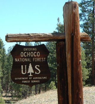
Campground List
CAMPGROUND NAME: Antelope Flat Reservoir

VISIT DATE: 07/16/2006

UPDATE DATE: 4/16/2026

STATE: Oregon

REGION: Pacific Northwest

RANGER DISTRICT: Lookout Mountain

NEAREST CITY/TOWN: Prineville

RESERVATIONS: No

DIRECTIONS:
In Prineville, OR at the intersection of US 26 (Main St) and S.
Combs Flat Rd, take S. Combs Flat Rd south 30 miles to Pine
Cr/Antelope Res sign.  Turn right at sign onto Forest Rt. 17
(gravel) and go 10.3 miles to an intersection.  Turn left and
immediately bear right at another intersection, staying on Forest
Rt 17, and go 3 miles to campground.

NOTE: Forest Rt. 17 is single lane with few turnouts.

GENERAL COMMENTS:
The elevation is 5,000 ft.

This pack it in/pack it out campground is a single loop in a
stand of Ponderosa pine and juniper above Antelope Reservoir.
None of the sites have a clear view of the water.  While the
campground has grass and sagebrush understory, close sites and
minimal middlestory provide poor privacy.  Most sites tend to be
sunny with lots of space for additional tents.

SEASONS
Open Seasonal: Yes
Open All Year: No

Seasonal Comment:
Open mid-May through October

RATE AND MAXIMUM STAY PERMITTED
Rate: $8 per day
Maximum Stay Permitted (days): 14

CAMPGROUND SITE CONFIGURATION
No. RV Sites: 0
No. Tent Sites: 0
No. Combined Sites (Tent or RV): 23

   Total Sites: 23

Tent Pads: No
Open Sites: Yes
Wooded Sites: Yes

No. Tables on Sites: 23
No. Grilles on Sites: 23
Equestrian Camping:  No

RV INFORMATION
Hookups: None
No. RV Pull Throughs: 2
Waste Station: No
Average Parking Apron Size: 13' X 45'

Comments:
The parking aprons are gravel.  Grey water disposal sites are
scattered throughout campground.

FACILITIES
Vaults: Yes
Flush Toilets: No
Hot Showers: No
Wheelchair Friendly Toilets: Yes

Public Phone: No
Playground: No
No. Water Spigots (non-site): 1
  No. Threaded: 0

Comments:
The water spigot is a handpump.

WATER SPORTS
Lake: Yes
Swimming (provided): No
Sailing: No
Boat Ramp: Yes
Boat Carry Down Access: No
Power Boating: Yes
Boating (no power): Yes
Water Skiing: No
Rafting (whitewater): No
Kayaking (whitewater): No

Comments:
Antelope Reservoir is 170 acres.

HIKING - No

FISHING
Rainbow trout

CAMPGROUND NAME: Deep Creek

VISIT DATE: 07/14/2006

UPDATE DATE: 4/22/2026

STATE: Oregon

REGION: Pacific Northwest

RANGER DISTRICT: Lookout Mountain

NEAREST CITY/TOWN: Prineville

RESERVATIONS: No

DIRECTIONS:
From Prineville, OR,  take US Rt. 26 east 14 miles to Ochoco R.S.
sign.  Turn right at sign and go 8.3 miles to Paulina sign.  Turn
right at sign onto Forest Rt. 42 and go 13.9 miles to another
Paulina sign. Turn left and go 9.4 miles to campground on right.

NOTE:  Entrance to campground is very steep.

GENERAL COMMENTS:
The elevation is 4,300 ft.

The campground is a spur with a loop in a stand of scattered
fragrant Ponderosa pine on Deep Creek and near the Wild and
Scenic North Fork Crooked River.  While the water is not
visible from the campground, it can be heard at some sites.  This
rustic pack it in, pack it out campground takes pride in its semi-
wilderness feel.  With only a grass understory and little
middlestory, privacy between sites is fair.

This is bear country; practice safe food storage techniques.

SEASONS
Open Seasonal: Yes
Open All Year: No

Seasonal Comment:
Open mid-May through October.

RATE AND MAXIMUM STAY PERMITTED
Rate: $8 per day
Maximum Stay Permitted (days): 14

CAMPGROUND SITE CONFIGURATION
No. RV Sites: 0
No. Tent Sites: 0
No. Combined Sites (Tent or RV): 13

   Total Sites: 13

Tent Pads: No
Open Sites: Yes
Wooded Sites: Yes

No. Tables on Sites: 13
No. Grilles on Sites: 13
Equestrian Camping:  No

RV INFORMATION
Hookups: None
No. RV Pull Throughs: 1
Waste Station: No
Average Parking Apron Size: 12' X 48'

Comments:
The parking aprons are gravel.

FACILITIES
Vaults: Yes
Flush Toilets: No
Hot Showers: No
Wheelchair Friendly Toilets: Yes

Public Phone: No
Playground: No
No. Water Spigots (non-site): 1
  No. Threaded: 0

WATER SPORTS - None

HIKING - No

FISHING
Redband trout

CAMPGROUND NAME: Ochoco Divide

VISIT DATE: 07/14/2006

UPDATE DATE: 4/22/2026

STATE: Oregon

REGION: Pacific Northwest

RANGER DISTRICT: Lookout Mountain

NEAREST CITY/TOWN: Prineville

RESERVATIONS: No

DIRECTIONS:
From Prineville, OR, take US Rt. 26 east 29 miles to campground on right.

GENERAL COMMENTS:
The elevation is 4,700 ft.

John Day Fossil Beds National Monument is 18 miles from campground.

The campground is a single loop that meanders over a hillside and
through a stand of mixed conifers including Ponderosa pine and
Douglas fir.  The campground has tons of shade, much privacy and
is convenient to US Rt. 26.  It features easy access and large
pull-throughs for a nice overnight stay.  The sites at the front of the
campground and closest to the highway, do have some traffic noise.
There is a tent campsite reserved for bicyclists.

SEASONS
Open Seasonal: Yes
Open All Year: No

Seasonal Comment:
Open May 15 through October 15

RATE AND MAXIMUM STAY PERMITTED
Rate: $20 per day
Maximum Stay Permitted (days): 14

CAMPGROUND SITE CONFIGURATION
No. RV Sites: 0
No. Tent Sites: 3
No. Combined Sites (Tent or RV): 21

   Total Sites: 24

Tent Pads: No
Open Sites: Yes
Wooded Sites: Yes

No. Tables on Sites: 24
No. Grilles on Sites: 24
Equestrian Camping:  No

RV INFORMATION
Hookups: None
No. RV Pull Throughs: 6
Waste Station: No
Average Parking Apron Size: See Comments

Comments:
The parking aprons are gravel and accommodate most any size RV.

FACILITIES
Vaults: Yes
Flush Toilets: No
Hot Showers: No
Wheelchair Friendly Toilets: Yes

Public Phone: No
Playground: No
No. Water Spigots (non-site): 0

WATER SPORTS - None

HIKING - No

FISHING - No

CAMPGROUND NAME: Sugar Creek

VISIT DATE: 07/13/2006

UPDATE DATE: 4/22/2026

STATE: Oregon

REGION: Pacific Northwest

RANGER DISTRICT: Paulina

NEAREST CITY/TOWN: Paulina

RESERVATIONS: No

DIRECTIONS:
From Paulina, OR, take County Rt. 112 east 3.6 miles to campground
sign.  Turn left after sign onto Beaver Cr. Rd and Forest Rt. 58
and go 7.3 miles to a "Y" intersection and campground sign.  Bear
right, staying on Rt 58, and go 1.3 miles to campground on
right.

GENERAL COMMENTS:
The elevation is 4,000 ft.

The campground is a single loop with one side along Sugar Creek
and the other stretching along a steep hillside.  Young (bark is
still dark) Ponderosa pine tower over campsites and provide
ample shade.  Separation between sites makes for good privacy.
This campground has character, is well cared for, and has a tranquil
feel.  It may be a long drive to this sweet (no pun intended)
little campground but it is well worth it.

SEASONS
Open Seasonal: Yes
Open All Year: No

Seasonal Comment:
Open mid-May through October - weather dependent

RATE AND MAXIMUM STAY PERMITTED
Rate: $8 per day
Maximum Stay Permitted (days): 14

CAMPGROUND SITE CONFIGURATION
No. RV Sites: 0
No. Tent Sites: 0
No. Combined Sites (Tent or RV): 17

   Total Sites: 17

Tent Pads: No
Open Sites: No
Wooded Sites: Yes

No. Tables on Sites: 17
No. Grilles on Sites: 17
Equestrian Camping:  No

RV INFORMATION
Hookups: None
No. RV Pull Throughs: 0
Waste Station: No
Average Parking Apron Size: 16' X 47'

Comments:
The parking aprons are paved and all about same size.  Grey water
waste disposal sites are scattered throughout campground.

FACILITIES
Vaults: Yes
Flush Toilets: No
Hot Showers: No
Wheelchair Friendly Toilets: Yes

Public Phone: No
Playground: No
No. Water Spigots (non-site): 2
  No. Threaded: 0

Comments:
The water spigots are handpumps.

WATER SPORTS - None

HIKING
Sugar Creek Trail #824 (foot, paved-wheelchair friendly) - 1.25 miles
   (leads to a swimming hole in Sugar Creek)

FISHING
Rainbow trout

CAMPGROUND NAME: Walton Lake

VISIT DATE: 07/14/2006

UPDATE DATE: 4/22/2026

STATE: Oregon

REGION: Pacific Northwest

RANGER DISTRICT: Lookout Mountain

NEAREST CITY/TOWN: Prineville

RESERVATIONS: 1-877-444-6777 or make on-line reservation

DIRECTIONS:
From Prineville, OR take US Rt. 26 east 14 miles to Ochoco R.S.
sign.  Turn right at sign and go 8.3 miles to Walton Lk sign.
Turn left onto Forest Rt. 22 and go 6.4 miles to campground sign.
Turn left at sign and go 0.1 miles to campground.

GENERAL COMMENTS:
The elevation is 5,200 ft.

The campground stretches around Walton Lake with sites tucked in
among a variety of conifers including Ponderosa pine, Douglas
fir, and Western larch (Tamarack).  Most of the tent sites are
walk-in and located on the Lake's north shore.  Although this
section's vaults are not wheelchair-friendly, it has ample
pressure water spigots.  The south shore section has one handpump
but its vaults are wheelchair-friendly.  The campsites in the
south shore section can accommodate tents and RVs.  Most sites in
the campground have a view of Walton Lake.

SEASONS
Open Seasonal: Yes
Open All Year: No

Seasonal Comment:
Open May 22 through October 3

RATE AND MAXIMUM STAY PERMITTED
Rate: $20 per day
Maximum Stay Permitted (days): 14

CAMPGROUND SITE CONFIGURATION
No. RV Sites: 0
No. Tent Sites: 21
No. Combined Sites (Tent or RV): 8

   Total Sites: 29

Tent Pads: No
Open Sites: Yes
Wooded Sites: Yes

No. Tables on Sites: 29
No. Grilles on Sites: 29
Equestrian Camping:  No

RV INFORMATION
Hookups: None
No. RV Pull Throughs: 1
Waste Station: No
Average Parking Apron Size: 12' X 40'

Comments:
The parking aprons are paved.  Grey water waste disposal stations
are found throughout campground.

FACILITIES
Vaults: Yes
Flush Toilets: No
Hot Showers: No
Wheelchair Friendly Toilets: Yes

Public Phone: No
Playground: No
No. Water Spigots (non-site): 1
  No. Threaded: 0

Comments:
The one water spigot is a handpump and is located in the
south section.

WATER SPORTS
Lake: Yes
Swimming (provided): No
Sailing: No
Boat Ramp: No
Boat Carry Down Access: Yes
Power Boating: Yes
Boating (no power): Yes
Water Skiing: No
Rafting (whitewater): No
Kayaking (whitewater): No

Comments:
Walton Lake is 18 acres. Power boats limited to electric motors.

HIKING
Round Mountain Trail #805A (foot, horse, and mountain bike) - 0.5
miles
Walton Lake Trail (foot) - 1mile

FISHING
Rainbow trout and catfish.
A wheelchair-friendly fishing pier is available.

CAMPGROUND NAME: Wildcat

VISIT DATE: 07/14/2006

UPDATE DATE: 4/22/2026

STATE: Oregon

REGION: Pacific Northwest

RANGER DISTRICT: Lookout Mountain

NEAREST CITY/TOWN: Prineville

RESERVATIONS: No

DIRECTIONS:
From Prineville, OR take US Rt. 26 east 7.2 miles to campground
sign.  Turn left at sign onto Mill Creek Rd and go 10.6 miles
to campground on right.

Note: Last 5.6 miles are on Forest Rt. 33 (gravel surface).

GENERAL COMMENTS:
The elevation is 3,700 ft.

The campground has two unnamed spurs reaching up and down Mill
Creek.  The Creek can be heard throughout campground.  The
upstream spur's sites are well-suited for recreational vehicles
while the downstream spur appears better for groups of tent
campers. Adjacent to Mill Creek Wilderness, the campground is a
good base camp for exploring.  Ponderosa pine and Douglas fir
provide most sites ample shade.

SEASONS
Open Seasonal: Yes
Open All Year: No

Seasonal Comment:
Open May 15 through October 15

RATE AND MAXIMUM STAY PERMITTED
Rate: $20 per day
Maximum Stay Permitted (days): 14

CAMPGROUND SITE CONFIGURATION
No. RV Sites: 0
No. Tent Sites: 0
No. Combined Sites (Tent or RV): 17

   Total Sites: 17

Tent Pads: No
Open Sites: Yes
Wooded Sites: Yes

No. Tables on Sites: 17
No. Grilles on Sites: 17
Equestrian Camping:  No

RV INFORMATION
Hookups: None
No. RV Pull Throughs: 0
Waste Station: No
Average Parking Apron Size: 14' X 50'

Comments:
The parking aprons are gravel.  Grey water waste disposal
sites are scattered throughout campground.

FACILITIES
Vaults: Yes
Flush Toilets: No
Hot Showers: No
Wheelchair Friendly Toilets: Yes

Public Phone: No
Playground: No
No. Water Spigots (non-site): 1
  No. Threaded: 0

Comments:
The water spigot is a handpump.

WATER SPORTS
Wading possible in Mill Creek

HIKING
Twin Pillar Trail #832 (foot and horse) - 8 miles
   provides access to a network of trails in the Mill Creek
   Wilderness

FISHING
Eastern brook trout

CAMPGROUND NAME: Wolf Creek

VISIT DATE: 07/13/2006

UPDATE DATE: 5/5/2026

STATE: Oregon

REGION: Pacific Northwest

RANGER DISTRICT: Paulina

NEAREST CITY/TOWN: Paulina

RESERVATIONS: No

DIRECTIONS:
From Paulina, OR, take County Rt. 112 east 3.6 miles to
campground sign.  Turn left after sign onto Beaver Cr. Rd./Forest
Rt. 58 and go 7.3 miles to "Y" intersection and campground sign.
Bear left onto Forest Rt. 42 and go 1.6 miles to an intersection.
Turn left, continuing left on Rt. 42, and go 0.2 miles to
campground on right.

GENERAL COMMENTS:
The elevation is 4,000 ft.

Wolf Creek campground and Wolf Creek Industrial campground have been
administratively merged as Wolf Creek campground. The original
campground has a loop and one spur in a stand of Ponderosa pine.  The
loop is near Forest Rt. 42 while the spur stretches along Wolf Creek.
The former Wolf Creek Industrial campground is a 6-site loop on the
other side of Wolf Creek on Forest Rt. 42.  The creek can be heard
throughout both sections of the campground.  Wading is possible in
the creek, especially along the spur.

SEASONS
Open Seasonal: Yes
Open All Year: No

Seasonal Comment:
Open mid-May through October - wether dependent

RATE AND MAXIMUM STAY PERMITTED
Rate: $6 per day
Maximum Stay Permitted (days): 14

CAMPGROUND SITE CONFIGURATION
No. RV Sites: 0
No. Tent Sites: 0
No. Combined Sites (Tent or RV): 16

   Total Sites: 16

Tent Pads: No
Open Sites: Yes
Wooded Sites: Yes

No. Tables on Sites: 16
No. Grilles on Sites: 16
Equestrian Camping:  No

RV INFORMATION
Hookups: None
No. RV Pull Throughs: 0
Waste Station: No
Average Parking Apron Size: 13' X 45'

Comments:
The parking aprons are dirt and gravel.  There are a pair
of grey water disposals stations in the campground.

FACILITIES
Vaults: Yes
Flush Toilets: No
Hot Showers: No
Wheelchair Friendly Toilets: Yes

Public Phone: No
Playground: No
No. Water Spigots (non-site): 0

WATER SPORTS
Wading possible in Wolf Creek

HIKING - No

FISHING - No
|