Campground List
CAMPGROUND NAME: Aspen Grove
VISIT DATE: 07/29/1998
UPDATE DATE: 6/17/2024
STATE: Montana
REGION: Northern
RANGER DISTRICT: Lincoln
NEAREST CITY/TOWN: Lincoln
RESERVATIONS: No
DIRECTIONS:
From Lincoln, MT, take State Rt. 200 east 6.5 miles to campground
sign. Turn right at sign, onto a gravel road, and go 0.5 miles
to campground.
NOTE: Campground entrance sign is partially hidden from view.
GENERAL COMMENTS:
The elevation is 4,800 ft.
The campground, composed of two loops stretching along the
Blackfoot River, is the only Forest Service campground between
Missoula and Great Falls along State Rt. 200. Cottonwood, aspen,
juniper, Lodgepole and Douglas fir provide shade and a diverse
habitat for a variety of birds - a delightful bird-watching
location. The understory is grass and sage.
SEASONS
Open Seasonal: Yes
Open All Year: No
Seasonal Comment:
Open Memorial Day weekend through Labor Day.
RATE AND MAXIMUM STAY PERMITTED
Rate: $18 per day
Maximum Stay Permitted (days): 14
CAMPGROUND SITE CONFIGURATION
No. RV Sites: 0
No. Tent Sites: 0
No. Combined Sites (Tent or RV): 18
Total Sites: 18
Tent Pads: No
Open Sites: Yes
Wooded Sites: Yes
No. Tables on Sites: 18
No. Grilles on Sites: 18
Equestrian Camping: No
RV INFORMATION
Hookups: None
No. RV Pull Throughs: 0
Waste Station: No
Average Parking Apron Size: 18' X 45'
Comments:
The parking aprons are gravel. There is RV waste station with
potable water available for a fee at the Conoco gas station
in Lincoln, MT.
FACILITIES
Vaults: Yes
Flush Toilets: No
Hot Showers: No
Wheelchair Friendly Toilets: Yes
Public Phone: No
Playground: No
No. Water Spigots: 7
No. Threaded: 0
WATER SPORTS - None
Comments:
Wading is possible in the Blackfoot River.
HIKING - No
FISHING
Brown, Cutthroat, Rainbow and Brook trout and Whitefish

CAMPGROUND NAME: Copper Creek
VISIT DATE: 07/30/1998
UPDATE DATE: 6/17/2024
STATE: Montana
REGION: Northern
RANGER DISTRICT: Lincoln
NEAREST CITY/TOWN: Lincoln
RESERVATIONS: No
DIRECTIONS:
From Lincoln, MT, take State Rt. 200 east 5.8 miles to Copper Crk
sign (Forest Rt. 330). Turn left onto Rt. 330 and go 8.5 miles
to campground sign. Turn right into campground.
NOTE: After 2.7 miles, Forest Rt. 330 becomes gravel and dirt.
GENERAL COMMENTS:
The elevation is 5,260 ft.
This is a sweet little picturesque campground across from
Snowbank Lake and along Copper Creek. The campground is one large
loop with the sites located among a variety of conifers. Although
Lodgepoles are plentiful, Douglas fir and spruce provide
additional texture. The campground is nicely located for day
trips into the Scapegoat Wilderness.
This is bear country; use safe food storage techniques.
SEASONS
Open Seasonal: Yes
Open All Year: No
Seasonal Comment:
Open Memorial Day weekend through Labor Day.
RATE AND MAXIMUM STAY PERMITTED
Rate: $15 per day
Maximum Stay Permitted (days): 14
CAMPGROUND SITE CONFIGURATION
No. RV Sites: 0
No. Tent Sites: 0
No. Combined Sites (Tent or RV): 10
Total Sites: 10
Tent Pads: No
Open Sites: No
Wooded Sites: Yes
No. Tables on Sites: 10
No. Grilles on Sites: 10
Equestrian Camping: No
RV INFORMATION
Hookups: None
No. RV Pull Throughs: 0
Waste Station: No
Average Parking Apron Size: 20' X 42'
Comments:
The parking aprons are gravel. There is RV waste station, with
potable water, available for a fee at the Conoco gas station in
Lincoln, MT.
FACILITIES
Vaults: Yes
Flush Toilets: No
Hot Showers: No
Wheelchair Friendly Toilets: Yes
Public Phone: No
Playground: No
No. Water Spigots: 1
No. Threaded: 0
Comments:
The water spigot is a hand pump.
WATER SPORTS
Lake: Yes
Swimming (provided): No
Sailing: No
Boat Ramp: No
Boat Carry Down Access: No
Power Boating: No
Boating (no power): Yes
Water Skiing: No
Rafting (whitewater): No
Kayaking (whitewater): No
Comments:
Snowbank Lake is 5 acres.
HIKING
Snowbank Trail (multi-use) - 10 miles
FISHING
Cutthroat Trout in Snowbank Lake
CAMPGROUND NAME: Cromwell-Dixon
VISIT DATE: 08/04/1998
UPDATE DATE: 6/17/2024
STATE: Montana
REGION: Northern
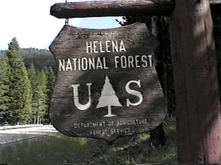
RANGER DISTRICT: Helena
NEAREST CITY/TOWN: Helena
RESERVATIONS: No
DIRECTIONS:
From Helena, MT, take US Rt. 12 west 13.7 miles to campground
sign on top of McDonald Pass. Turn left at sign and go 0.5 miles
to campground.
GENERAL COMMENTS:
The elevation is 6,260 ft.
The campground is located at McDonald Pass on the Continental
Divide. Some sites have scenic views of surrounding meadows,
valleys and mountains. It is convenient for campers traveling on
US Rt. 12.
This is bear country; practice safe food storage techniques.
SEASONS
Open Seasonal: Yes
Open All Year: No
Seasonal Comment:
Open May 15 weekend through Labor Day
RATE AND MAXIMUM STAY PERMITTED
Rate: $15 per day
Maximum Stay Permitted (days): 16
CAMPGROUND SITE CONFIGURATION
No. RV Sites: 0
No. Tent Sites: 0
No. Combined Sites (Tent or RV): 15
Total Sites: 15
Tent Pads: No
Open Sites: No
Wooded Sites: Yes
No. Tables on Sites: 15
No. Grilles on Sites: 15
Equestrian Camping: No
RV INFORMATION
Hookups: None
No. RV Pull Throughs: 1
Waste Station: No
Average Parking Apron Size: 14' X 62'
Comments:
The parking aprons are gravel.
FACILITIES
Vaults: Yes
Flush Toilets: No
Hot Showers: No
Wheelchair Friendly Toilets: Yes
Public Phone: No
Playground: No
No. Water Spigots: 3
No. Threaded: 0
WATER SPORTS - None
HIKING - No
Comments:
The Continental Divide Trail is about 0.25 miles from the
campground. Contact the Ranger District Office for details.
FISHING - No
CAMPGROUND NAME: Kading
VISIT DATE: 08/04/1998
UPDATE DATE: 6/17/2024
STATE: Montana
REGION: Northern
RANGER DISTRICT: Helena
NEAREST CITY/TOWN: Elliston
RESERVATIONS: No
DIRECTIONS:
From Elliston, MT, take US Rt. 12 east 0.6 miles to forest
"access" sign (Forest Rt. 227). Turn right onto Rt. 227 and go 3
miles to "Y" intersection. Bear right onto dirt and gravel
portion of Rt. 227 and go 9.8 miles to campground sign. Turn
left at sign into campground.
GENERAL COMMENTS:
The elevation is 5,700 ft.
The campground is pack it in, pack it out and adjacent to the
Little Blackfoot River in a large stand of Lodgepole pines. It
is well spread out providing good separation between sites.
There is a small corral located across from the entrance
to campground next to the Kading Guard Station and just below an
unmarked trail. A meadow next to the Guard Station appears to be
an area for spring wild flowers.
This is bear country; practice safe food storage techniques.
SEASONS
Open Seasonal: Yes
Open All Year: Yes
Seasonal Comment:
Services are provided only from Memorial Day weekend through
Labor Day.
RATE AND MAXIMUM STAY PERMITTED
Rate: $10 per day
Maximum Stay Permitted (days): 16
CAMPGROUND SITE CONFIGURATION
No. RV Sites: 0
No. Tent Sites: 0
No. Combined Sites (Tent or RV): 10
Total Sites: 10
Tent Pads: No
Open Sites: Yes
Wooded Sites: Yes
No. Tables on Sites: 10
No. Grilles on Sites: 10
Equestrian Camping: No
RV INFORMATION
Hookups: None
No. RV Pull Throughs: 0
Waste Station: No
Average Parking Apron Size: 17' X 29'
Comments:
The parking aprons are gravel.
FACILITIES
Vaults: Yes
Flush Toilets: No
Hot Showers: No
Wheelchair Friendly Toilets: No
Public Phone: No
Playground: No
No. Water Spigots: 0
Comments:
Water available at Kading rental cabin, located next to campground,
at GPS coord. N 46 25.783, W 112 28.817.
WATER SPORTS - None
Comments:
Wading is possible in Little Blackfoot Creek.
HIKING - No
Comments:
There is an unmarked trail across from entrance to campground
next to the Kading Guard Station.
FISHING
Brook Trout
CAMPGROUND NAME: Park Lake
VISIT DATE: 08/04/1998
UPDATE DATE: 6/17/2024
STATE: Montana
REGION: Northern
RANGER DISTRICT: Helena
NEAREST CITY/TOWN: Clancy
RESERVATIONS: No
DIRECTIONS:
In Clancy, MT, take Legal Linden Lane 0.1 miles to "T"
intersection. Turn right, following Park Lake sign, and go
north 7.3 miles to a "Y" intersection and Park Lake sign.
Bear right onto Forest Rt. 4009 and go 6.2 miles to campground.
NOTE: Paved roadway becomes dirt and gravel after 3.1 miles.
GENERAL COMMENTS:
The elevation is 6,400 ft.
The campground is located near Park Lake among Lodgepoles and
boulders. It appears newly renovated with limited seclusion
between sites. Park Lake seems ideal for canoers. There are
several disbursed campsites outside of campground that are
primarily for tenters.
This is bear country; practice safe food storage techniques.
SEASONS
Open Seasonal: Yes
Open All Year: No
Seasonal Comment:
Open Memorial Day weekend through Labor Day.
RATE AND MAXIMUM STAY PERMITTED
Rate: $15 per day
Maximum Stay Permitted (days): 16
CAMPGROUND SITE CONFIGURATION
No. RV Sites: 0
No. Tent Sites: 0
No. Combined Sites (Tent or RV): 22
Total Sites: 22
Tent Pads: No
Open Sites: No
Wooded Sites: Yes
No. Tables on Sites: 22
No. Grilles on Sites: 22
Equestrian Camping: No
RV INFORMATION
Hookups: None
No. RV Pull Throughs: 0
Waste Station: No
Average Parking Apron Size: 12' X 55'
Comments:
The parking aprons are paved.
FACILITIES
Vaults: Yes
Flush Toilets: No
Hot Showers: No
Wheelchair Friendly Toilets: Yes
Public Phone: No
Playground: No
No. Water Spigots: 2
No. Threaded: 0
Comments:
The water spigots are hand pumps.
WATER SPORTS
Lake: Yes
Swimming (provided): No
Sailing: No
Boat Ramp: No
Boat Carry Down Access: No
Power Boating: No
Boating (no power): Yes
Water Skiing: No
Rafting (whitewater): No
Kayaking (whitewater): No
Comments:
Park Lake is 5 acres.
HIKING - No
FISHING
Cutthroat and Grayling Trout
CAMPGROUND NAME: Skidway
VISIT DATE: 08/04/1998
UPDATE DATE: 6/17/2024
STATE: Montana
REGION: Northern
RANGER DISTRICT: Townsend
NEAREST CITY/TOWN: Townsend
RESERVATIONS: No
DIRECTIONS:
From Townsend, MT, take US Rt. 12 east 21.4 miles to campground
sign. Turn right at sign (mile marker 22) onto gravel road and
go 0.6 miles to another campground sign. Turn right at sign into
campground.
GENERAL COMMENTS:
The elevation is 5,500 ft.
The campground is composed of two loops along ridges among large,
mature Douglas fir and Aspen. Some sites have scenic view of
surrounding mountains. There is a nice variety of open and
secluded sites. Grassy meadows throughout campground suggest a
wild flower display in the spring and good wildlife viewing
during the summer.
This is bear country; practice safe food storage techniques.
SEASONS
Open Seasonal: Yes
Open All Year: No
Seasonal Comment:
Open May 1 through October 30.
RATE AND MAXIMUM STAY PERMITTED
Rate: $15 per day
Maximum Stay Permitted (days): 16
CAMPGROUND SITE CONFIGURATION
No. RV Sites: 0
No. Tent Sites: 0
No. Combined Sites (Tent or RV): 12
Total Sites: 12
Tent Pads: No
Open Sites: Yes
Wooded Sites: Yes
No. Tables on Sites: 12
No. Grilles on Sites: 12
Equestrian Camping: No
RV INFORMATION
Hookups: None
No. RV Pull Throughs: 3
Waste Station: No
Average Parking Apron Size: 12' X 46'
Comments:
The parking aprons are grass and gravel. There is RV waste
station, with potable water, available for a fee at the Conoco
gas station at intersection of US Rts. 287 and 12 in Townsend, MT.
FACILITIES
Vaults: Yes
Flush Toilets: No
Hot Showers: No
Wheelchair Friendly Toilets: Yes
Public Phone: No
Playground: No
No. Water Spigots: 1
No. Threaded: 0
Comments:
The water spigot is a hand pump and located in the lower loop.
WATER SPORTS - None
HIKING - No
FISHING - No
CAMPGROUND NAME: Vigilante
VISIT DATE: 08/02/1998
UPDATE DATE: 6/17/2024
STATE: Montana
REGION: Northern
RANGER DISTRICT: Helena
NEAREST CITY/TOWN: Helena
RESERVATIONS: No
DIRECTIONS:
In Helena, MT, at the intersection of Montana and Custer Avenues,
take Custer Ave. east 1.3 miles to a "Y" intersection. Bear left
at intersection onto York Rd. and go 24.3 miles to campground.
NOTE: York Rd. becomes gravel after 21 miles.
GENERAL COMMENTS:
The elevation is 4,400 ft.
The campground is pack it in, pack it out and located along Trout
Creek with a few sites overlooking the creek. The sites are
either nestled among Douglas fir and juniper or in small grassy
meadows.
This is bear country; practice safe food storage techniques.
SEASONS
Open Seasonal: Yes
Open All Year: Nos
Seasonal Comment:
Open Memorial Day weekend through Labor Day.
RATE AND MAXIMUM STAY PERMITTED
Rate: $15 per day
Maximum Stay Permitted (days): 16
CAMPGROUND SITE CONFIGURATION
No. RV Sites: 0
No. Tent Sites: 1
No. Combined Sites (Tent or RV): 17
Total Sites: 18
Tent Pads: No
Open Sites: Yes
Wooded Sites: Yes
No. Tables on Sites: 18
No. Grilles on Sites: 18
Equestrian camping: No
RV INFORMATION
Hookups: None
No. RV Pull Throughs: 0
Waste Station: No
Average Parking Apron Size: 18.5' X 38.5'
Comments:
The parking aprons are gravel and grass.
FACILITIES
Vaults: Yes
Flush Toilets: No
Hot Showers: No
Wheelchair Friendly Toilets: Yes
Public Phone: No
Playground: No
No. Water Spigots: 1
No. Threaded: 0
Comments:
The water spigot is a hand pump.
WATER SPORTS - None
HIKING
Hanging Valley Trail #247-248 (foot) - 12 miles
Trout Creek Canyon Trail #270 (foot) - 3 miles
First 0.75 miles is wheelchair friendly
FISHING
Brook Trout
|