Campground List
CAMPGROUND NAME: Albion Basin
VISIT DATE: 09/05/2000
UPDATE DATE: 7/30/2025
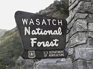
STATE: Utah
REGION: Intermountain
RANGER DISTRICT: Salt Lake
NEAREST CITY/TOWN: Sandy
RESERVATIONS: 1-877-444-6777 or make on-line reservation
DIRECTIONS:
In Sandy, UT, at intersection of US Rt. 89 (State St.) and 9400
South, take 9400 South east 6 miles to State Rt. 210. Turn right
onto Rt. 210 and go 11.2 miles to campground.
NOTE: The last 2.5 miles are on gravel road with drainage ditches
across the road, which could cause rear of a trailer to drag. A
part of State Rt. 210 is a very long pull - 9 percent grade up to
the gravel road.
GENERAL COMMENTS:
The elevation is 9,500 ft.
The campground is a single loop winding through clusters of Sub-
alpine fir in fields of wildflowers. This is a very scenic
campground with many sites offering magnificent views of the
surrounding mountain peaks. Moose and deer regularly visit the basin.
Mountain goats can be seen on nearby Devil's Castle, just south of the
campground. The campground is encircled by private residences and a ski
lift passes right through the campground. A few small group sites are
scattered throughout the campground - not counted in this survey.
The ski resorts of Alta and Snowbird are nearby.
NOTE: Except for seeing-eye and companion (licensed) dogs, dogs
are not permitted in the campground.
NOTE: 7/3/2025 - Alta Ski Area is building a new ski lift in and around
the Albion Basin Campground during the 2025 summer camping season.
Campers should expect to see increased vehicle traffic, construction
equipment, and audible construction work being done during the
2025 summer.
SEASONS
Open Seasonal: Yes
Open All Year: No
Seasonal Comment:
Open July 11 through September 13.
RATE AND MAXIMUM STAY PERMITTED
Rate: $28 per day - single
$56 per day - double
Note: No first come / first served sites.
Maximum Stay Permitted (days): 7
CAMPGROUND SITE CONFIGURATION
No. RV Sites: 0
No. Tent Sites: 3
No. Combined Sites (Tent or RV): 22
Total Sites: 25
Tent Pads: Yes
Open Sites: Yes
Wooded Sites: Yes
No. Tables on Sites: 23
No. Grilles on Sites: 21
Equestrian Camping: No
RV INFORMATION
Hookups: None
No. RV Pull Throughs: 0
Waste Station: No
Average Parking Apron Size: 10' X 30'
Comments:
The parking aprons are gravel. Parking aprons and interior road
show signs of erosion. Recommend only small RVs.
FACILITIES
Vaults: Yes
Flush Toilets: No
Hot Showers: No
Wheelchair Friendly Toilets: No
Public Phone: No
Playground: No
No. Water Spigots (non-site): 7
No. Threaded: 7
WATER SPORTS - None
HIKING
Cecret Lake Trail (foot) - 1 mile
Mountain biking is permitted at the nearby Alta and Snowbird ski
resorts.
FISHING - No

CAMPGROUND NAME: Beaver View
VISIT DATE: 09/07/2000
UPDATE DATE: 7/30/2025
STATE: Wyoming
REGION: Intermountain
RANGER DISTRICT: Mountain View-Evanston
NEAREST CITY/TOWN: Evanston
RESERVATIONS: No
DIRECTIONS:
From Evanston, WY, take State Rt. 150 (Mirror Lake Scenic Byway)
south 34.1 miles to campground sign. Turn left into campground.
GENERAL COMMENTS:
The elevation is 8,700 ft.
The campground, one of several along the Mirror Lake Scenic
Byway, is physically located in Utah. It is a single loop around
a large meadow with the camping sites tucked in between Lodgepole
pine. Most of the pull-throughs overlook the Hayden Fork of the
Bear River and most will accommodate any size RV. Some camping
sites are well separated providing good privacy. There is little
understory.
This is bear country; practice safe food storage techniques.
SEASONS
Open Seasonal: Yes
Open All Year: No
Seasonal Comment:
Open May 30 through September 20
RATE AND MAXIMUM STAY PERMITTED
Rate: $29 per day
NOTE: Scan and Pay used for on-site payments through Rec.gov app.
Load and setup app before arrival.
Maximum Stay Permitted (days): 14
CAMPGROUND SITE CONFIGURATION
No. RV Sites: 0
No. Tent Sites: 1
No. Combined Sites (Tent or RV): 16
Total Sites: 17
Tent Pads: No
Open Sites: Yes
Wooded Sites: Yes
No. Tables on Sites: 17
No. Grilles on Sites: 15
Equestrian Camping: No
RV INFORMATION
Hookups: None
No. RV Pull Throughs: 9
Waste Station: No
Average Parking Apron Size: 15' X 33'
Comments:
The parking aprons are gravel. Some pull-through camping sites
will accommodate any size RV. Depending on direction of travel,
there are two RV waste stations available. One is off State Rt.
150 (between mile markers 14 and 15 at Soapstone Basin sign) 0.2
miles down Forest Rt. 37. There is potable water and no fee.
The other is off State Rt. 150 (between mile markers 47 and 48)
0.2 miles down Lilly Lake Rd. There is potable water and no fee.
FACILITIES
Vaults: Yes
Flush Toilets: No
Hot Showers: No
Wheelchair Friendly Toilets: Yes
Public Phone: No
Playground: No
No. Water Spigots (non-site): 2
No. Threaded: 1
NOTE: 7/3/2025 - Campground is experiencing a temporary water outage.
Please bring all the water you'll need for your visit, including drinking
water. Contact ranger district for latest status.
WATER SPORTS - None
HIKING - No
FISHING
Rainbow and Cutthroat trout
CAMPGROUND NAME: Bountiful Peak
VISIT DATE: 09/04/2000
UPDATE DATE: 7/30/2025
STATE: Utah
REGION: Intermountain
RANGER DISTRICT: Salt Lake
NEAREST CITY/TOWN: Farmington
RESERVATIONS: No
DIRECTIONS:
In Farmington, UT, at intersection of State Rts. 227 and 106,
take Rt. 106 (State St.) south 0.1 miles to 100 East. Turn left
onto 100 East and go 8.8 miles to an intersection. Turn right
and go 0.6 miles to another intersection with a campground sign.
Continue straight through intersection and go 0.1 miles to an
unmarked road. Turn right at the road into the campground.
NOTE: After 2.3 miles, 100 East becomes narrow, steep, rocky and
winding.
GENERAL COMMENTS:
The elevation is 7,500 ft.
This is a tenters campground with a single loop at the base of
Bountiful Peak. The loop meanders its way from dense conifer
woods through Aspen to open meadows. Most of the camping sites
are tucked back away from the interior road behind a natural
screen of trees. The abundance of the Aspen should provide
excellent Fall colors. The campground is convenient to OHV
roadways. It is pack it in, pack it out. A good day trip is to
drive the Skyline Drive from Farmington to Bountiful, UT.
SEASONS
Open Seasonal: Yes
Open All Year: No
Seasonal Comment:
Open July 4 through September 1
RATE AND MAXIMUM STAY PERMITTED
Rate: $21.48 per day - single
$42.96 per day - double
Maximum Stay Permitted (days): 7
CAMPGROUND SITE CONFIGURATION
No. RV Sites: 0
No. Tent Sites: 30
No. Combined Sites (Tent or RV): 0
Total Sites: 30
Tent Pads: Yes
Open Sites: Yes
Wooded Sites: Yes
No. Tables on Sites: 30
No. Grilles on Sites: 14
Equestrian Camping: No
FACILITIES
Vaults: Yes
Flush Toilets: No
Hot Showers: No
Wheelchair Friendly Toilets: No
Public Phone: No
Playground: No
No. Water Spigots (non-site): 10
No. Threaded: 10
WATER SPORTS - None
HIKING
Farmington Flats
Chicken Creek (ATV & dirt bikes) - 2 miles
Arthurs Spur (4X4) - 1.5 miles
FISHING - No
CAMPGROUND NAME: Bridger Lake
VISIT DATE: 09/14/2000
UPDATE DATE: 7/30/2025
STATE: Wyoming
REGION: Intermountain
RANGER DISTRICT: Mountain View-Evanston
NEAREST CITY/TOWN: Mountain View
RESERVATIONS: 1-877-444-6777 or make on-line reservation
DIRECTIONS:
From Mountain View, WY, take State Rt. 410 south 6.5 miles to
Wasatch National Forest sign. Continue straight at this sign
onto a oil and gravel road and go 15.8 miles to campground sign.
Turn left at sign and go 0.5 miles to another campground sign.
Turn left at sign into campground.
NOTE: In 8.6 miles, after passing the forest sign, the road
becomes Forest Rt. 072. The road surface then becomes gravel and
dirt and rough in places.
GENERAL COMMENTS:
The elevation is 8,900 ft.
The campground, physically located in the Dead Horse ATV trail
area of Utah, is scenic and wanders along the west shore of
Bridger Lake. A Lily pad-encircled natural lake and large camping
sites are nestled into Lodgepole pine. Many of the camp sites
overlook the lake. The campground has two wheelchair friendly
camping sites adjacent to wheelchair friendly vaults. Many of
the parking aprons will accommodate any size RV. Although there
is almost no understory or middlestory, spacing between sites
provides good privacy. Bridger Lake appears to be a good canoeing
lake and with the fishing and hiking, is a nice family
campground. Wildlife viewing is possible.
SEASONS
Open Seasonal: Yes
Open All Year: No
Seasonal Comment:
Open June 13 through September 1
RATE AND MAXIMUM STAY PERMITTED
Rate: $26 per day - single
$57 per day - double
NOTE: Scan and Pay used for on-site payments through Rec.gov app.
Load and setup app before arrival.
Maximum Stay Permitted (days): 14
CAMPGROUND SITE CONFIGURATION
No. RV Sites: 0
No. Tent Sites: 0
No. Combined Sites (Tent or RV): 29
Total Sites: 29
Tent Pads: No
Open Sites: Yes
Wooded Sites: Yes
No. Tables on Sites: 29
No. Grilles on Sites: 29
Equestrian Camping: No
RV INFORMATION
Hookups: None
No. RV Pull Throughs: 1
Waste Station: No
Average Parking Apron Size: 14' X 56'
Comments:
The parking aprons are gravel and dirt. There is a Forest
Service RV waste station 0.1 miles past the Stateline campground
entrance (pass it on the way to Bridger Lake campground) on
Forest Rt. 072 - no fee and there is potable water.
FACILITIES
Vaults: Yes
Flush Toilets: No
Hot Showers: No
Wheelchair Friendly Toilets: Yes
Public Phone: No
Playground: No
No. Water Spigots (non-site): 6
No. Threaded: 2
WATER SPORTS
Lake: Yes
Swimming (provided): No
Sailing: No
Boat Ramp: Yes
Boat Carry Down Access: Yes
Power Boating: Yes
Boating (no power): Yes
Water Skiing: No
Rafting (whitewater): No
Kayaking (whitewater): No
Comments:
Bridger Lake is a 15-acre no-wake lake. There is minimal boat
trailer parking.
HIKING
Red Mountain Bike Trail (foot & mountain bike) - 2 miles
FISHING
Rainbow and Cutthroat trout
CAMPGROUND NAME: Butterfly Lake
VISIT DATE: 09/07/2000
UPDATE DATE: 7/30/2025
STATE: Utah
REGION: Intermountain
RANGER DISTRICT: Kamas
NEAREST CITY/TOWN: Kamas
RESERVATIONS: No
DIRECTIONS:
In Kamas, UT, at intersection of State Rt. 32 (Main St.) and
State Rt. 150 (Center St.), take Rt. 150 (Mirror Lake Scenic
Byway) east 34.6 miles to campground sign. Turn left at sign
into campground.
GENERAL COMMENTS:
The elevation is 10,300 ft.
This sweet little campground, one of several along the Mirror
Lake Scenic Byway, is configured like a loop on a stem. Walk-in
tent sites are located on the stem portion and are the closest
camping sites to the Lily pad-dotted Butterfly Lake. The
campground is in a dense stand of spruce and fir. However, the
sites on the loop portion are at the edge of a grass meadow with
limited shade. The towering and rugged Uinta Mountains provide a
spectacular vista from most of the sites. The High Uintas
Wilderness is less than a mile from the campground. Wildlife
viewing is possible from the campground.
This is bear country; practice safe food storage techniques.
SEASONS
Open Seasonal: Yes
Open All Year: No
Seasonal Comment:
Open May 30 through September 1 - weather dependent
RATE AND MAXIMUM STAY PERMITTED
Rate: $26 per day
NOTE: Scan and Pay used for on-site payments through Rec.gov app.
Load and setup app before arrival.
Maximum Stay Permitted (days): 7
CAMPGROUND SITE CONFIGURATION
No. RV Sites: 0
No. Tent Sites: 5
No. Combined Sites (Tent or RV): 15
Total Sites: 20
Tent Pads: No
Open Sites: Yes
Wooded Sites: Yes
No. Tables on Sites: 20
No. Grilles on Sites: 20
Equestrian Camping: No
RV INFORMATION
Hookups: None
No. RV Pull Throughs: 0
Waste Station: No
Average Parking Apron Size: 11' X 35'
Comments:
The parking aprons are gravel. Depending on direction of travel,
there are two RV waste stations available. One is off State Rt.
150 (between mile markers 14 and 15 at Soapstone Basin sign) 0.2
miles down Forest Rt. 37. There is potable water and no fee.
The other is off State Rt. 150 (between mile markers 47 and 48)
0.2 miles down Lilly Lake Rd. There is potable water and no fee.
FACILITIES
Vaults: Yes
Flush Toilets: No
Hot Showers: No
Wheelchair Friendly Toilets: No
Public Phone: No
Playground: No
No. Water Spigots (non-site): 5
No. Threaded: 5
WATER SPORTS
Lake: Yes
Swimming (provided): No
Sailing: No
Boat Ramp: No
Boat Carry Down Access: Yes
Power Boating: No
Boating (no power): Yes
Water Skiing: No
Rafting (whitewater): No
Kayaking (whitewater): No
Comments:
Butterfly Lake is 5.2 acres.
HIKING
The campground is convenient to the Highline Trail #083 which
accesses the High Uintas Wilderness and a network of trails.
FISHING
Rainbow and Albino trout
CAMPGROUND NAME: China Meadows Trailhead
VISIT DATE: 09/14/2000
UPDATE DATE: 7/30/2025
STATE: Wyoming
REGION: Intermountain
RANGER DISTRICT: Mountain View-Evanston
NEAREST CITY/TOWN: Mountain View
RESERVATIONS: No
DIRECTIONS:
From Mountain View, WY, take State Rt. 410 south 6.5 miles to
Wasatch National Forest sign. Continue straight at this sign
onto an oil and gravel road and go 18.5 miles to "campground" sign
at a "Y" intersection. Bear left at intersection and go 0.7
miles, past China Meadows campground, to "Trailhead" campground.
NOTE: In 8.6 miles, after passing the forest sign, the road
becomes Forest Rt. 072. The road surface then becomes gravel and
dirt and rough in places. There is no consistency in the
campground signs. One says "Trailhead" and another says "China
Meadows Trailhead." Whatever, the official name of the
campground is the latter.
GENERAL COMMENTS:
The elevation is 9,000 ft.
The campground, pack it in, pack it out and physically located in
Utah, has two sections - one for equestrian campers and the other
for non-equestrian campers. The equestrian section, next to the
trail head, consists of six camping sites that include hitching
rails, corrals and a loading platform. The non-equestrian
section curves around a large trail head parking area. Most of
the campground sites are nestled in a thick stand of Lodgepole
pine. The campground, about 0.5 miles from the northern side of
the High Uinta Wilderness, was constructed under a partnership
with local organizations and the Forest Service.
This is bear country; practice safe food storage techniques.
SEASONS
Open Seasonal: Yes
Open All Year: No
Seasonal Comment:
Open May 30 through September 1
RATE AND MAXIMUM STAY PERMITTED
Rate: $20 per day
NOTE: Scan and Pay used for on-site payments through Rec.gov app.
Load and setup app before arrival.
Maximum Stay Permitted (days): 14
CAMPGROUND SITE CONFIGURATION
No. RV Sites: 0
No. Tent Sites: 1
No. Combined Sites (Tent or RV): 13
Total Sites: 14
Tent Pads: No
Open Sites: Yes
Wooded Sites: Yes
No. Tables on Sites: 14
No. Grilles on Sites: 14
Equestrian Camping: Yes
RV INFORMATION
Hookups: None
No. RV Pull Throughs: 0
Waste Station: No
Average Parking Apron Size: 13' X 50'
Comments:
The parking aprons are gravel. There is a Forest Service RV
waste station 0.1 miles past the Stateline campground entrance
(pass it on the way to China Meadows Trailhead campground) on
Forest Rt. 072 - no fee and there is potable water.
FACILITIES
Vaults: Yes
Flush Toilets: No
Hot Showers: No
Wheelchair Friendly Toilets: Yes
Public Phone: No
Playground: No
No. Water Spigots (non-site): 0
Comments:
Potable water is available at the West Marsh Lake campground,
about 1.5 miles north on Forest Rt. 072. The only wheelchair
friendly toilet is located in the equestrian section.
WATER SPORTS - None
HIKING
Smith's Fork Trail #110 (foot & horse) - provides access to a
network of trails in the High Uinta Wilderness.
FISHING
Trout fishing is available from a pond at the China Meadows
campground (not included in author's research), 0.6 miles north
of campground on Forest Rt. 072.
CAMPGROUND NAME: Christmas Meadows
VISIT DATE: 09/07/2000
UPDATE DATE: 7/30/2025
STATE: Wyoming
REGION: Intermountain
RANGER DISTRICT: Mountain View-Evanston
NEAREST CITY/TOWN: Evanston
RESERVATIONS: 1-877-444-6777 or make on-line reservation
DIRECTIONS:
From Evanston, WY, take State Rt. 150 (Mirror Lake Scenic Byway)
south 30 miles to campground sign (Forest Rt. 057). Turn left at
sign onto Rt. 057 (gravel) and go 4.2 miles to campground.
NOTE: Forest Rt. 057 narrows to a rough and rocky single-lane
road.
GENERAL COMMENTS:
The elevation is 8,500 ft.
The campground, physically located in Utah and one of several
along the Mirror Lake Scenic Byway, is located on a knoll
overlooking Christmas Meadows above Stillwater Fork (river). The
campground is composed of new-growth Lodgepole pine and a few
Aspen trees. Each camping site has a scenic view of the
surrounding mountains and meadows. The campground is convenient
to the High Uintas Wilderness. Although horses are not permitted
in the campground, the nearby trail head has parking for trailers
and hitching rails.
This is bear country; practice safe food storage techniques.
SEASONS
Open Seasonal: Yes
Open All Year: No
Seasonal Comment:
Open June 13 through September 20
RATE AND MAXIMUM STAY PERMITTED
Rate: $29 per day
NOTE: Scan and Pay used for on-site payments through Rec.gov app.
Load and setup app before arrival.
Maximum Stay Permitted (days): 14
CAMPGROUND SITE CONFIGURATION
No. RV Sites: 0
No. Tent Sites: 0
No. Combined Sites (Tent or RV): 11
Total Sites: 11
Tent Pads: No
Open Sites: Yes
Wooded Sites: Yes
No. Tables on Sites: 11
No. Grilles on Sites: 11
Equestrian Camping: No
RV INFORMATION
Hookups: None
No. RV Pull Throughs: 0
Waste Station: No
Average Parking Apron Size: 14' X 41'
Comments:
The parking aprons are gravel. There is an RV waste station off
State Rt. 150 (between mile markers 47 and 48) 0.2 miles down
Lilly Lake Rd. There is potable water and no fee.
FACILITIES
Vaults: Yes
Flush Toilets: No
Hot Showers: No
Wheelchair Friendly Toilets: Yes
Public Phone: No
Playground: No
No. Water Spigots (non-site): 2
No. Threaded: 2
WATER SPORTS - None
HIKING
Christmas Meadows Trail #098 (foot & horse) - 3 miles
Trail accesses a network of trails in the High Uintas Wilderness.
FISHING
Rainbow, Cutthroat and Native trout
CAMPGROUND NAME: Cobblerest
VISIT DATE: 09/09/2000
UPDATE DATE: 7/30/2025
STATE: Utah
REGION: Intermountain
RANGER DISTRICT: Kamas
NEAREST CITY/TOWN: Kamas
RESERVATIONS: No
DIRECTIONS:
In Kamas, UT, at the intersection of State Rt. 32 (Main St.) and
State Rt. 150 (Center St.), take Rt. 150 (Mirror Lake Scenic
Byway) east 19.3 miles to campground sign. Turn right into
campground.
GENERAL COMMENTS:
The elevation is 8,200 ft.
The campground, sandwiched between the Mirror Lake Scenic Byway
and Provo River, is composed of two unnamed loops in a dense
stand of spruce, Lodgepole pine and White fir. Separation
between camping sites is good and along with heavy grass
understory and middlestory, makes privacy very good. Although the
entire campground is attractive, the loop to the right of the
entrance is especially pleasant mainly because of the dense
vegetation and shade. The flow of the Provo River diminishes
considerably as the summer progresses, limiting fishing
opportunities. Wildlife viewing is possible.
This is bear country; practice safe food storage techniques.
SEASONS
Open Seasonal: Yes
Open All Year: No
Seasonal Comment:
Open May 16 through September 6 - weather dependent
RATE AND MAXIMUM STAY PERMITTED
Rate: $29 per day
NOTE: Scan and Pay used for on-site payments through Rec.gov app.
Load and setup app before arrival.
Maximum Stay Permitted (days): 7
CAMPGROUND SITE CONFIGURATION
No. RV Sites: 0
No. Tent Sites: 0
No. Combined Sites (Tent or RV): 18
Total Sites: 18
Tent Pads: No
Open Sites: Yes
Wooded Sites: Yes
No. Tables on Sites: 18
No. Grilles on Sites: 18
Equestrian Camping: No
RV INFORMATION
Hookups: None
No. RV Pull Throughs: 2
Waste Station: No
Average Parking Apron Size: 11' X 30'
Comments:
The parking aprons are paved. Depending on direction of travel,
there are two RV waste stations available. One is off State Rt.
150 (between mile markers 14 and 15 at Soapstone Basin sign) 0.2
miles down Forest Rt. 37. There is potable water and no fee.
The other is off State Rt. 150 (between mile markers 47 and 48)
0.2 miles down Lilly Lake Rd. There is potable water and no fee.
FACILITIES
Vaults: Yes
Flush Toilets: No
Hot Showers: No
Wheelchair Friendly Toilets: No
Public Phone: No
Playground: No
No. Water Spigots (non-site): 3
No. Threaded: 3
WATER SPORTS - None
HIKING - No
FISHING - No
CAMPGROUND NAME: East Marsh Lake
VISIT DATE: 09/14/2000
UPDATE DATE: 7/30/2025
STATE: Wyoming
REGION: Intermountain
RANGER DISTRICT: Mountain View-Evanston
NEAREST CITY/TOWN: Mountain View
RESERVATIONS: 1-877-444-6777 or make on-line reservation
DIRECTIONS:
From Mountain View, WY, take State Rt. 410 south 6.5 miles to
Wasatch National Forest sign. Continue straight at this sign
onto an oil and gravel road and go 17.5 miles to campground sign.
Turn right at sign into campground.
NOTE: In 8.6 miles, after passing the forest sign, the road
becomes Forest Rt. 072. The road surface then becomes gravel and
dirt and rough in places.
GENERAL COMMENTS:
The elevation is 8,900 ft.
The campground, physically located in the Dead Horse ATV trail
head area of Utah, stretches out along the east shore of Marsh
Lake in Lodgepole pine. It is composed of two unnamed loops.
The loop to the left of the campground's entrance contains longer
parking aprons, but they are narrower than the aprons found in
the loop on the right. Most camping sites either are adjacent to
or have a view of the lake. Although Marsh Lake was built for
irrigation purposes, it is rarely drained and provides a scenic
backdrop to the campground. There is no understory and little
middlestory providing minimum privacy between camping sites.
West Marsh Lake campground is located across the lake.
This is bear country; practice safe food storage techniques.
SEASONS
Open Seasonal: Yes
Open All Year: No
Seasonal Comment:
Open June 13 through September 1 - weather dependent
RATE AND MAXIMUM STAY PERMITTED
Rate: $29 per day - Single
$56 per day - double
$86 per day - triple
NOTE: Scan and Pay used for on-site payments through Rec.gov app.
Load and setup app before arrival.
Maximum Stay Permitted (days): 14
CAMPGROUND SITE CONFIGURATION
No. RV Sites: 0
No. Tent Sites: 0
No. Combined Sites (Tent or RV): 20
Total Sites: 20
Tent Pads: No
Open Sites: No
Wooded Sites: Yes
No. Tables on Sites: 20
No. Grilles on Sites: 20
Equestrian Camping: No
RV INFORMATION
Hookups: None
No. RV Pull Throughs: 6
Waste Station: No
Average Parking Apron Size: 10' X 38'
Comments:
The parking aprons are dirt and gravel. There is a Forest
Service RV waste station 0.1 miles past the Stateline campground
entrance (pass it on the way to East Marsh Lake campground) on
Forest Rt. 072 - no fee and there is potable water.
FACILITIES
Vaults: Yes
Flush Toilets: No
Hot Showers: No
Wheelchair Friendly Toilets: No
Public Phone: No
Playground: No
No. Water Spigots (non-site): 3
No. Threaded: 3
WATER SPORTS
Lake: Yes
Swimming (provided): No
Sailing: No
Boat Ramp: No
Boat Carry Down Access: No
Power Boating: Yes
Boating (no power): Yes
Water Skiing: No
Rafting (whitewater): No
Kayaking (whitewater): No
Comments:
Marsh Lake is 33 acres and no-wake. Good canoeing lake. Boat
ramp with limited parking for trailers, is located at the West
Lake campground.
HIKING
China Lake Mountain Bike Trail (foot & mountain bike) - 2 miles
FISHING
Rainbow and Cutthroat trout
CAMPGROUND NAME: Hoop Lake
VISIT DATE: 09/15/2000
UPDATE DATE: 7/30/2025
STATE: Wyoming
REGION: Intermountain
RANGER DISTRICT: Mountain View-Evanston
NEAREST CITY/TOWN: Mountain View
RESERVATIONS: No
DIRECTIONS:
From Mountain View, WY, take State Rt. 414 east 21.5 miles to
Lonetree, WY. Just passed mile marker 122 on Rt. 414, turn right
onto County Rt. 290 (oiled gravel) and go 0.9 miles to an
intersection (County Rt. 291). Turn left onto Rt. 291 and go 5
miles to a "T" intersection. Turn right and go 2.8 miles to a
"Y" intersection and Hoop Lake sign (Forest Rt. 078). Bear left
at sign onto Rt. 078 and go 3.8 miles to another "Y"
intersection. Bear right and go 0.3 miles to campground.
NOTE: When County Rt. 291 crosses into Utah to the "T"
intersection, the road surface becomes native dirt, rutted and
single-lane with no turn-outs. From the "T" intersection on to
the campground, the road is again single-lane, rocky and rough.
Bring spare tire and changing tools. The last few miles of the
access roads are not RV friendly.
GENERAL COMMENTS:
The elevation is 8,900 ft.
The campground, attractive and physically located in Utah, is
composed of two unnamed loops. One is found in the upper portion
of the campground along the side of a hill in a dense stand of
Lodgepole pine and Aspen. Many of the sites overlook Hoop Lake
and some are adjacent to grassy meadows well suited for family
gatherings. Because of the dense vegetation in this loop,
privacy is very good between camping sites. The second loop or
lower portion is located across the earthen dam adjacent to the
lake and boat ramp. All the sites in this loop are in the open
with unobscured views of the lake.
Hoop Lake is used for irrigation meaning the water level will
decrease considerably during the course of the summer. The High
Uinta Wilderness is 0.5 miles from the campground.
SEASONS
Open Seasonal: Yes
Open All Year: No
Seasonal Comment:
Open May 30 through September 1
RATE AND MAXIMUM STAY PERMITTED
Rate: $24 per day
Maximum Stay Permitted (days): 14
CAMPGROUND SITE CONFIGURATION
No. RV Sites: 0
No. Tent Sites: 0
No. Combined Sites (Tent or RV): 43
Total Sites: 43
Tent Pads: No
Open Sites: Yes
Wooded Sites: Yes
No. Tables on Sites: 43
No. Grilles on Sites: 29
Equestrian Camping: No
RV INFORMATION
Hookups: None
No. RV Pull Throughs: 10
Waste Station: No
Average Parking Apron Size: 12' X 35'
Comments:
The parking aprons are dirt and "chipped" shale. An RV waste
station is located at Bullocks Food and Fuel on State Rt. 414 in
Mountain View, WY. The fee is $4 or free with gas fill-up - no
potable water.
FACILITIES
Vaults: Yes
Flush Toilets: No
Hot Showers: No
Wheelchair Friendly Toilets: Yes
Public Phone: No
Playground: No
No. Water Spigots (non-site): 9
No. Threaded: 6
WATER SPORTS
Lake: Yes
Swimming (provided): No
Sailing: No
Boat Ramp: Yes
Boat Carry Down Access: No
Power Boating: Yes
Boating (no power): Yes
Water Skiing: No
Rafting (whitewater): No
Kayaking (whitewater): No
Comments:
Hoop Lake is 200 acres and is no-wake. The boat ramp is
primitive.
HIKING
Burnt Ridge Trail #121 (foot and horse)
Kabell Lake Trail #122 (foot and horse)
Both trails access the High Uinta Wilderness and a network of
trails. The trail heads are located at the far side of the lower
loop on a road to the right of the boat ramp.
FISHING
Rainbow and Cutthroat trout
CAMPGROUND NAME: Ledgefork
VISIT DATE: 09/08/2000
UPDATE DATE: 7/30/2025
STATE: Utah
REGION: Intermountain
RANGER DISTRICT: Kamas
NEAREST CITY/TOWN: Oakley
RESERVATIONS: 1-877-444-6777 or make on-line reservation
DIRECTIONS:
In Oakley, UT, at intersection of State Rt. 32 and Weber Canyon
Rd., take Weber Canyon Rd. east 11.9 miles to Smith and Morehouse
Recreation Area sign. Turn right at sign onto gravel road and go
3.9 miles to campground.
GENERAL COMMENTS:
The elevation is 8,000 ft.
This attractive campground is composed of two sections -
Ledgefork 1 and Ledgefork 2. Ledgefork 1 loops and winds through
a dense forest of spruce and fir trees. Most of the camping
sites are nestled well into the trees and enjoy excellent
privacy. Ledgefork 2, although dotted by spruce and fir trees,
has a more open feel with sites next to meadows and in stands of
Lodgepole pine and Aspen. Both Smith-Morehouse and Box Elder
Creeks flow through the campground. Camping sites 37 through 39
and 51 through 54 are on dead-end spurs with no turnarounds.
Firewood is available for a fee.
This is bear country; practice safe food storage techniques.
SEASONS
Open Seasonal: Yes
Open All Year: No
Seasonal Comment:
Open June 6 through September 1
RATE AND MAXIMUM STAY PERMITTED
Rate: $31 per day - single
$62 per day - double
Maximum Stay Permitted (days): 7
CAMPGROUND SITE CONFIGURATION
No. RV Sites: 0
No. Tent Sites: 6
No. Combined Sites (Tent or RV): 65
Total Sites: 71
Tent Pads: No
Open Sites: Yes
Wooded Sites: Yes
No. Tables on Sites: 71
No. Grilles on Sites: 71
Equestrian Camping: No
RV INFORMATION
Hookups: None
No. RV Pull Throughs: 2
Waste Station: No
Average Parking Apron Size: 12' X 45'
Comments:
The parking aprons are paved.
FACILITIES
Vaults: Yes
Flush Toilets: No
Hot Showers: No
Wheelchair Friendly Toilets: Yes
Public Phone: No
Playground: No
No. Water Spigots (non-site): 15
No. Threaded: 13
Comments:
The wheelchair friendly vaults are across from sites 24 and 36.
WATER SPORTS - None
Comments:
The campground is convenient to the wakeless Smith and Morehouse
Reservoir with boat ramp.
HIKING
Smith-Morehouse Trail #001 (foot, horse & mountain bike) - 6.5
miles.
Trail connects with Lakes Country Mud Flat Area and extensive
network of trails.
FISHING - No
CAMPGROUND NAME: Lilly Lake
VISIT DATE: 09/09/2000
UPDATE DATE: 7/30/2025
STATE: Utah
REGION: Intermountain
RANGER DISTRICT: Kamas
NEAREST CITY/TOWN: Kamas
RESERVATIONS: 1-877-444-6777 or make on-line reservation
DIRECTIONS:
In Kamas, UT, at the intersection of State Rt. 32 (Main St.) and
State Rt. 150 (Center St.), take Rt. 150 (Mirror Lake Scenic
Byway) east 27 miles to campground sign. Turn left into
campground.
GENERAL COMMENTS:
The elevation is 9,900 ft.
The campground, attractive and one of several along the Mirror
Lake Scenic Byway, is a single loop around an Engelmann spruce
and Lodgepole pine covered knoll between Lilly and Teapot Lakes.
Most sites either are adjacent to or have a view of one of the
lakes or a Lilly-covered pond. Because of road-hugging trees and
tight turns, large RVs could have a problem negotiating the
campground's interior road. Wildlife viewing is possible.
This is bear country; practice safe food storage techniques.
SEASONS
Open Seasonal: Yes
Open All Year: No
Seasonal Comment:
Open June 13 through September 13 - weather dependent
RATE AND MAXIMUM STAY PERMITTED
Rate: $31 per day
NOTE: Scan and Pay used for on-site payments through Rec.gov app.
Load and setup app before arrival.
Maximum Stay Permitted (days): 7
CAMPGROUND SITE CONFIGURATION
No. RV Sites: 0
No. Tent Sites: 0
No. Combined Sites (Tent or RV): 13
Total Sites: 13
Tent Pads: No
Open Sites: No
Wooded Sites: Yes
No. Tables on Sites: 13
No. Grilles on Sites: 13
Equestrian Camping: No
RV INFORMATION
Hookups: None
No. RV Pull Throughs: 2
Waste Station: No
Average Parking Apron Size: 11' X 36'
Comments:
The parking aprons are paved. Depending on direction of travel,
there are two RV waste stations available. One is off State Rt.
150 (between mile markers 14 and 15 at Soapstone Basin sign) 0.2
miles down Forest Rt. 37. There is potable water and no fee.
The other is off State Rt. 150 (between mile markers 47 and 48)
0.2 miles down Lilly Lake Rd. There is potable water and no fee.
FACILITIES
Vaults: Yes
Flush Toilets: No
Hot Showers: No
Wheelchair Friendly Toilets: Yes
Public Phone: No
Playground: No
No. Water Spigots (non-site): 2
No. Threaded: 2
WATER SPORTS
Lake: Yes
Swimming (provided): No
Sailing: No
Boat Ramp: No
Boat Carry Down Access: Yes
Power Boating: No
Boating (no power): Yes
Water Skiing: No
Rafting (whitewater): No
Kayaking (whitewater): No
Comments:
Lilly Lake is 5.1 acres and Teapot Lake is 5 acres.
HIKING - No
FISHING
Rainbow trout
CAMPGROUND NAME: Little Lyman Lake
VISIT DATE: 09/13/2000
UPDATE DATE: 7/30/2025
STATE: Wyoming
REGION: Intermountain
RANGER DISTRICT: Mountain View-Evanston
NEAREST CITY/TOWN: Mountain View
RESERVATIONS: No
DIRECTIONS:
From Mountain View, WY, take State Rt. 140 south 12.9 miles to
Blacks Fork Access sign (County Rt. 271). Turn left at sign onto
Rt. 271 and go 13.1 miles to the forest boundary. Here, Rt. 271
becomes Forest Rt. 058. Continue on Rt. 058 for 5.9 miles to a
"Y" intersection. Bear right, staying on Rt. 058, and go 2.4
miles to an intersection. Turn right at intersection, continuing
on Rt. 058, and then immediately left onto Forest Rt. 070 for
0.5 miles to campground sign. Turn left at sign into campground.
NOTE: County Rt. 271 becomes an excellent dirt and gravel road in
1.7 miles. After 2.3 miles, Forest Rt. 058 changes from a smooth
dirt and gravel surface to rough and rocky.
GENERAL COMMENTS:
The elevation is 9,300 ft.
This is a sweet little campground that is physically located in
Utah and set above the natural Little Lyman Lake. Most of the
camping sites have a view of the lake and are among Lodgepole
pine. Wildlife viewing and frequent sightings of Osprey and
ducks make this a nice campground to just sit back and enjoy.
The drive to the campground is scenic especially in the Fall when
the Aspen leaves begin to change color.
SEASONS
Open Seasonal: Yes
Open All Year: No
Seasonal Comment:
Open May 30 through September 1 - weather dependent
RATE AND MAXIMUM STAY PERMITTED
Rate: $22 per day
NOTE: Scan and Pay used for on-site payments through Rec.gov app.
Load and setup app before arrival.
Maximum Stay Permitted (days): 14
CAMPGROUND SITE CONFIGURATION
No. RV Sites: 0
No. Tent Sites: 0
No. Combined Sites (Tent or RV): 10
Total Sites: 10
Tent Pads: No
Open Sites: No
Wooded Sites: Yes
No. Tables on Sites: 10
No. Grilles on Sites: 10
Equestrian Camping: No
RV INFORMATION
Hookups: None
No. RV Pull Throughs: 5
Waste Station: No
Average Parking Apron Size: 13' X 29'
Comments:
The parking aprons are dirt. There is an RV waste station at the
Bullocks Food and Fuel on State Rt. 414 in Mountain View, WY.
The fee is $4 or free with gas fill-up - no potable water.
FACILITIES
Vaults: Yes
Flush Toilets: No
Hot Showers: No
Wheelchair Friendly Toilets: Yes
Public Phone: No
Playground: No
No. Water Spigots (non-site): 2
No. Threaded: 2
WATER SPORTS
Lake: Yes
Swimming (provided): No
Sailing: No
Boat Ramp: No
Boat Carry Down Access: Yes
Power Boating: Yes
Boating (no power): Yes
Water Skiing: No
Rafting (whitewater): No
Kayaking (whitewater): No
Comments:
Little Lyman Lake is 5 acres and is no-wake.
HIKING - No
FISHING
Brook, Rainbow and Cutthroat trout
CAMPGROUND NAME: Lost Creek
VISIT DATE: 09/09/2000
UPDATE DATE: 8/6/2025
STATE: Utah
REGION: Intermountain
RANGER DISTRICT: Kamas
NEAREST CITY/TOWN: Kamas
RESERVATIONS: 1-877-444-6777 or make on-line reservation
DIRECTIONS:
In Kamas, UT, at the intersection of State Rt. 32 (Main St.) and
State Rt. 150 (Center St.), take Rt. 150 (Mirror Lake Scenic
Byway) east 27.2 miles to campground sign. Turn right into
campground.
GENERAL COMMENTS:
The elevation is 10,200 ft.
The campground, next to Lost Lake and one of several along the
Mirror Lake Scenic Byway, meanders across Engelmann spruce and
Lodgepole pine-covered knolls separated by grass meadows and Lost
Creek. The camping sites are generally well spaced and although
there is little to no middlestory, enjoy good privacy. The
campground is convenient to a number of glacier-carved lakes,
such as Washington, Trail and Lilly, which are the headwaters for
Provo, Weber and Bear Rivers. Traffic noise from State Rt. 150
is sometimes evident throughout the campground. Two camping
sites have a view of Lost Lake which is used for irrigation
purposes. Wildlife viewing is possible from the campground.
This is bear country; practice safe food storage techniques.
SEASONS
Open Seasonal: Yes
Open All Year: No
Seasonal Comment:
Open June 13 through September 13 - weather dependent
RATE AND MAXIMUM STAY PERMITTED
Rate: $31 per day
NOTE: Scan and Pay used for on-site payments through Rec.gov app.
Load and setup app before arrival.
Maximum Stay Permitted (days): 7
CAMPGROUND SITE CONFIGURATION
No. RV Sites: 0
No. Tent Sites: 0
No. Combined Sites (Tent or RV): 35
Total Sites: 35
Tent Pads: No
Open Sites: Yes
Wooded Sites: Yes
No. Tables on Sites: 34
No. Grilles on Sites: 35
Equestrian Camping: No
RV INFORMATION
Hookups: None
No. RV Pull Throughs: 10
Waste Station: No
Average Parking Apron Size: 11' X 35'
Comments:
The parking aprons are paved. Depending on direction of travel,
there are two RV waste stations available. One is off State Rt.
150 (between mile markers 14 and 15 at Soapstone Basin sign) 0.2
miles down Forest Rt. 37. There is potable water and no fee.
The other is off State Rt. 150 (between mile markers 47 and 48)
0.2 miles down Lilly Lake Rd. There is potable water and no fee.
FACILITIES
Vaults: Yes
Flush Toilets: No
Hot Showers: No
Wheelchair Friendly Toilets: No
Public Phone: No
Playground: No
No. Water Spigots (non-site): 7
No. Threaded: 6
WATER SPORTS
Lake: Yes
Swimming (provided): No
Sailing: No
Boat Ramp: No
Boat Carry Down Access: No
Power Boating: No
Boating (no power): Yes
Water Skiing: No
Rafting (whitewater): No
Kayaking (whitewater): No
Comments:
Lost Lake is 64 acres.
HIKING - No
FISHING
Rainbow trout
CAMPGROUND NAME: Lower Provo River
VISIT DATE: 09/11/2000
UPDATE DATE: 8/6/2025
STATE: Utah
REGION: Intermountain
RANGER DISTRICT: Kamas
NEAREST CITY/TOWN: Kamas
RESERVATIONS: 1-877-444-6777 or make on-line reservation
DIRECTIONS:
In Kamas, UT, at the intersection of State Rt. 32 (Main St.) and
State Rt. 150 (Center St.), take Rt. 150 (Mirror Lake Scenic
Byway) east 10.6 miles to Lower Provo sign. Turn right at sign
and go 0.7 miles to campground.
Gates open at 7am, close at 10pm.
GENERAL COMMENTS:
The elevation is 7,200 ft.
The campground, one of several along the Mirror Lake Scenic Byway
and adjacent to the North Fork Provo River, is a single loop through
pine, spruce and some young Aspen. Although not classified as a
seasonal or intermittent waterway, the river flow can be minimal and
fishing poor. Wildlife viewing is possible. The understory is grass
and separation between sites is adequate providing good separation
between camping sites.
This is bear country; practice safe food storage techniques.
SEASONS
Open Seasonal: Yes
Open All Year: No
Seasonal Comment:
Open May 23 through September 6 - weather dependent
RATE AND MAXIMUM STAY PERMITTED
Rate: $24 per day
NOTE: Scan and Pay used for on-site payments through Rec.gov app.
Load and setup app before arrival.
Maximum Stay Permitted (days): 7
CAMPGROUND SITE CONFIGURATION
No. RV Sites: 0
No. Tent Sites: 0
No. Combined Sites (Tent or RV): 10
Total Sites: 10
Tent Pads: No
Open Sites: Yes
Wooded Sites: Yes
No. Tables on Sites: 10
No. Grilles on Sites: 10
Equestrian Camping: No
RV INFORMATION
Hookups: None
No. RV Pull Throughs: 0
Waste Station: No
Average Parking Apron Size: 11' X 33'
Comments:
The parking aprons are dirt. There is an RV waste station off
State Rt. 150 (between mile markers 14 and 15 at Soapstone Basin
sign - 1 mile west of campground) 0.2 miles down Forest Rt. 37.
There is potable water and no fee.
FACILITIES
Vaults: Yes
Flush Toilets: No
Hot Showers: No
Wheelchair Friendly Toilets: No
Public Phone: No
Playground: No
No. Water Spigots (non-site): 2
No. Threaded: 2
WATER SPORTS - None
HIKING - No
Comments:
The campground is convenient to the Scenic Byway Trail (foot,
horse & mountain bike) - up to 8.5 miles.
FISHING - No
CAMPGROUND NAME: Meeks Cabin
VISIT DATE: 09/13/2000
UPDATE DATE: 8/6/2025
STATE: Wyoming
REGION: Intermountain
RANGER DISTRICT: Mountain View-Evanston
NEAREST CITY/TOWN: Mountain View
RESERVATIONS: No
DIRECTIONS:
From Mountain View, WY, take State Rt. 140 south 12.9 miles to
Blacks Fork Access sign (County Rt. 271). Turn left at sign onto
Rt. 271 and go 13.1 miles to the forest boundary - here, Rt. 271
becomes Forest Rt. 058. Continue on Rt. 058 for 2.3 miles to
campground sign. Turn left at sign and go 0.7 miles to
campground.
NOTE: County Rt. 271 becomes an excellent dirt and gravel road in
1.7 miles.
GENERAL COMMENTS:
The elevation is 8,800 ft.
The campground is a single loop above the Meeks Cabin Reservoir
in a stand of mature Lodgepole pine and Aspen. Some camping
sites overlook the reservoir. All pull-throughs are located on
the outside of the loop. An excellent understory and middlestory
provide good privacy between sites. Given excellent access
roads, large pull-throughs and double sites, the campground is
well suited for large RVs. The reservoir is used for irrigation
which results in a receding water level during the course of the
summer.
SEASONS
Open Seasonal: Yes
Open All Year: No
Seasonal Comment:
Open May 30 through September 1- weather dependent
RATE AND MAXIMUM STAY PERMITTED
Rate: $24 per day - single
$47 per day - double
NOTE: Scan and Pay used for on-site payments through Rec.gov app.
Load and setup app before arrival.
Maximum Stay Permitted (days): 14
CAMPGROUND SITE CONFIGURATION
No. RV Sites: 0
No. Tent Sites: 0
No. Combined Sites (Tent or RV): 24
Total Sites: 24
Tent Pads: No
Open Sites: Yes
Wooded Sites: Yes
No. Tables on Sites: 24
No. Grilles on Sites: 24
Equestrian Camping: No
RV INFORMATION
Hookups: None
No. RV Pull Throughs: 6
Waste Station: No
Average Parking Apron Size: 13' X 44'
Comments:
Some parking aprons are dirt and others are old asphalt. There
is an RV waste station at the Bullocks Food and Fuel on State Rt.
414 in Mountain View, WY. The fee is $4 or free with gas fill-up
- no potable water.
FACILITIES
Vaults: Yes
Flush Toilets: No
Hot Showers: No
Wheelchair Friendly Toilets: No
Public Phone: No
Playground: No
No. Water Spigots (non-site): 5
No. Threaded: 5
WATER SPORTS
Lake: Yes
Swimming (provided): No
Sailing: No
Boat Ramp: No
Boat Carry Down Access: No
Power Boating: Yes
Boating (no power): Yes
Water Skiing: No
Rafting (whitewater): No
Kayaking (whitewater): No
Comments:
Meeks Cabin Reservoir is 477 acres - no-wake lake
HIKING - No
FISHING
Rainbow and Cutthroat trout
CAMPGROUND NAME: Mirror Lake
VISIT DATE: 09/07/2000
UPDATE DATE: 8/6/2025
STATE: Utah
REGION: Intermountain
RANGER DISTRICT: Kamas
NEAREST CITY/TOWN: Kamas
RESERVATIONS: 1-877-444-6777 or make on-line reservation
DIRECTIONS:
In Kamus, UT, at intersection of State Rt. 32 (Main St.) and
State Rt. 150 (Center St.), take Rt. 150 (Mirror Lake Scenic
Byway) east 31.8 miles to campground sign. Turn right after sign
and go 0.5 miles to campground.
GENERAL COMMENTS:
The elevation is 10,200 ft.
The campground, one of several along the Mirror Lake Scenic
Byway, is composed of two sections - one for equestrian campers
and the other for non-equestrian campers. It is located above
the natural Mirror Lake, considered by some to be the most
beautiful mountain lake in Utah. The equestrian section is a
single loop through a spruce and rock-covered area. Some of the
sites have feed troughs but none have open space for corrals.
The non-equestrian section is large with five unnamed loops.
Some of the camping sites are terraced and all enjoy spruce and
fir-produced shade. Some of the sites in this section enjoy a
view of the lake. Every site in the campground has a fire ring
but no grilles. Instead, a pedestal cook stove platform (like
for a Coleman stove) is provided. Privacy between camping sites
is minimal. Interpretive programs are provided on the weekends
during the summer.
In the 1940s, the campground was the site of the Mirror Lake
Lodge with restaurant and cabins. It was a popular destination
resort until the 1960s when business began to fall off. The
lodge stayed open until 1976 when fire destroyed it.
This is bear country; practice safe food storage techniques.
SEASONS
Open Seasonal: Yes
Open All Year: No
Seasonal Comment:
Open July 4 through September 20 - weather dependent
RATE AND MAXIMUM STAY PERMITTED
Rate: $31 per day - single
$62 per day - double
$92 per day - triple
NOTE: Scan and Pay used for on-site payments through Rec.gov app.
Load and setup app before arrival.
Maximum Stay Permitted (days): 7
CAMPGROUND SITE CONFIGURATION
No. RV Sites: 0
No. Tent Sites: 0
No. Combined Sites (Tent or RV): 77
Total Sites: 77
Tent Pads: Yes
Open Sites: Yes
Wooded Sites: Yes
No. Tables on Sites: 77
No. Grilles on Sites: 0
Equestrian Camping: Yes
RV INFORMATION
Hookups: None
No. RV Pull Throughs: 11
Waste Station: No
Average Parking Apron Size: 13' X 40'
Comments:
The parking aprons are gravel. Depending on direction of travel,
there are two RV waste stations available. One is off State Rt.
150 (between mile markers 14 and 15 at Soapstone Basin sign) 0.2
miles down Forest Rt. 37. There is potable water and no fee.
The other is off State Rt. 150 (between mile markers 47 and 48)
0.2 miles down Lilly Lake Rd. There is potable water and no fee.
FACILITIES
Vaults: Yes
Flush Toilets: No
Hot Showers: No
Wheelchair Friendly Toilets: Yes
Public Phone: No
Playground: No
No. Water Spigots (non-site): 19
No. Threaded: 16
WATER SPORTS
Lake: Yes
Swimming (provided): No
Sailing: No
Boat Ramp: Yes
Boat Carry Down Access: Yes
Power Boating: No
Boating (no power): Yes
Water Skiing: No
Rafting (whitewater): No
Kayaking (whitewater): No
Comments:
Mirror Lake is 53.4 acres.
HIKING
North Fork Trail (foot & horse) - 7 miles
Connector trail to Highline Trail #083 (foot & horse) - 1 mile
Shoreline Trail (foot) - 1.5 miles
FISHING
Rainbow, Brook and Albino trout
CAMPGROUND NAME: Moosehorn
VISIT DATE: 09/09/2000
UPDATE DATE: 8/6/2025
STATE: Utah
REGION: Intermountain
RANGER DISTRICT: Kamas
NEAREST CITY/TOWN: Kamas
RESERVATIONS: 1-877-444-6777 or make on-line reservation
DIRECTIONS:
In Kamas, UT, at the intersection of State Rt. 32 (Main St.) and
State Rt. 150 (Center St.), take Rt. 150 (Mirror Lake Scenic
Byway) east 31.1 miles to campground sign. Turn left at sign
into campground.
GENERAL COMMENTS:
The elevation is 10,400 ft.
The campground, one of several along the Mirror Lake Scenic Byway
in the shadow of Bald Mountain, is composed of three unnamed
loops along the western shore of the glacier carved Moosehorn
Lake. The camping sites are tucked into stands of dense White
fir and other conifers. The pull-throughs tend to be tightly
configured. This is a pretty campground with excellent vistas of
the surrounding mountains. Although some sites are missing
grills, all have fire rings. Wildlife viewing is possible.
This is bear country; practice safe food storage techniques.
See and Do: Mirror Lake Scenic Byway, one of the most popular mountain
routes in the state with breathtaking scenery.
SEASONS
Open Seasonal: Yes
Open All Year: No
Seasonal Comment:
Open July 4 through September 20 - weather dependent
RATE AND MAXIMUM STAY PERMITTED
Rate: $31 per day
NOTE: Scan and Pay used for on-site payments through Rec.gov app.
Load and setup app before arrival.
Maximum Stay Permitted (days): 7
CAMPGROUND SITE CONFIGURATION
No. RV Sites: 0
No. Tent Sites: 3
No. Combined Sites (Tent or RV): 29
Total Sites: 32
Tent Pads: No
Open Sites: Yes
Wooded Sites: Yes
No. Tables on Sites: 32
No. Grilles on Sites: 27
Equestrian Camping: No
RV INFORMATION
Hookups: None
No. RV Pull Throughs: 9
Waste Station: No
Average Parking Apron Size: 13' X 29'
Comments:
The parking aprons are dirt. Depending on direction of travel,
there are two RV waste stations available. One is off State Rt.
150 (between mile markers 14 and 15 at Soapstone Basin sign) 0.2
miles down Forest Rt. 37. There is potable water and no fee.
The other is off State Rt. 150 (between mile markers 47 and 48)
0.2 miles down Lilly Lake Rd. There is potable water and no fee.
FACILITIES
Vaults: Yes
Flush Toilets: No
Hot Showers: No
Wheelchair Friendly Toilets: No
Public Phone: No
Playground: No
No. Water Spigots (non-site): 6
No. Threaded: 6
WATER SPORTS
Lake: Yes
Swimming (provided): No
Sailing: No
Boat Ramp: No
Boat Carry Down Access: Yes
Power Boating: No
Boating (no power): Yes
Water Skiing: No
Rafting (whitewater): No
Kayaking (whitewater): No
Comments:
Moosehorn Lake is 7.2 acres.
HIKING
Fehr Lake Trail #060 (foot, horse & mountain bike) - 1.2 miles
Convenient to Bald Mountain National Recreation Trail #053 (foot)
- 1.7 miles
FISHING
Rainbow and Albino trout
CAMPGROUND NAME: Redman
VISIT DATE: 03/08/2010
UPDATE DATE: 8/6/2025
STATE: Utah
REGION: Intermountain
RANGER DISTRICT: Salt Lake
NEAREST CITY/TOWN: Salt Lake City
RESERVATIONS: 1-877-444-6777 or make on-line reservation
DIRECTIONS:
In Salt Lake City, UT, at the intersection of State Rt. 210
(Wasatch Blvd) and State Rt. 190 (Big Cottonwood Cyn), take Rt.
190 (Big Cottonwood Cyn) east 13.3 miles to campground sign.
Turn right at sign into campground.
GENERAL COMMENTS:
The elevation is 8,300 ft.
NOTE: The Campground was under renovation at time of visit;
information provided by the Salt Lake Ranger District office.
The campground, composed of two unnamed sections, is heavily
wooded with mature spruce and fir and young Aspen trees in Big
Cottonwood Canyon. The section closest to highway has three
overlapping loops. The campsites in this section appear closer
together than those in the other section. The other section is
located across Big Cottonwood Creek and has two large loops. The
campground is considered "less popular" because it has a more
"rustic" feel than other campgrounds in Big Cottonwood Canyon.
It might be one of the better campgrounds for tent campers.
Located between the Solitude and Brighton Ski resorts where
mountain biking is permitted, this campground has the potential
of being discovered by "fat tire" enthusiasts. There are
numerous hiking trails nearby but none are at the campground.
Each campsite has a fire ring but no grilles. While not
included, there are campsites that will accommodate large, 50-
plus camper groups; contact the Ranger District office for more
information.
NOTE: Except for seeing-eye and companion (licensed) dogs, dogs
are not permitted in the campground.
SEASONS
Open Seasonal: Yes
Open All Year: No
Seasonal Comment:
Open June 13 through September 13
RATE AND MAXIMUM STAY PERMITTED
Rate: $33 per day - single
$67 per day - double
$96 per day - triple
NOTE: Scan and Pay used for on-site payments through Rec.gov app.
Load and setup app before arrival.
Maximum Stay Permitted (days): 7
CAMPGROUND SITE CONFIGURATION
No. RV Sites: 0
No. Tent Sites: 0
No. Combined Sites (Tent or RV): 41
Total Sites: 41
Tent Pads: Yes
Open Sites: No
Wooded Sites: Yes
No. Tables on Sites: 41
No. Grilles on Sites: 0
Equestrian Camping: No
RV INFORMATION
Hookups: None
No. RV Pull Throughs: 6
Waste Station: No
Potable Water at Waste Station: No
Average Parking Apron Size: 12' X 31'
Comments:
The parking aprons are gravel.
FACILITIES
Vaults: No
Flush Toilets: Yes
Hot Showers: No
Wheelchair Friendly Toilets: Yes
Public Phone: No
Playground: No
No. Water Spigots (non-site): 8
No. Threaded: 0
WATER SPORTS - None
HIKING - No
FISHING
Rainbow trout
CAMPGROUND NAME: Shady Dell
VISIT DATE: 09/11/2000
UPDATE DATE: 8/6/2025
STATE: Utah
REGION: Intermountain
RANGER DISTRICT: Kamas
NEAREST CITY/TOWN: Kamas
RESERVATIONS: No
DIRECTIONS:
In Kamas, UT, at the intersection of State Rt. 32 (Main St.) and
State Rt. 150 (Center St.), take Rt. 150 (Mirror Lake Scenic
Byway) east 17 miles to campground sign. Turn right at sign into
campground.
GENERAL COMMENTS:
The elevation is 8,200 ft.
The campground, one of several along the Mirror Lake Scenic
Byway, stretches along the Provo River and State Rt. 150 with
most camp sites adjacent or overlooking the river. The campground
entrance is shaded by a dense stand of mature spruce which soon
gives way to Lodgepole pine and Aspen trees. The sites are
widely spaced providing good privacy between sites. Traffic
noise from the lightly traveled Rt. 150 can be heard throughout
the campground. Although not classified as a seasonal or
intermittent waterway, the flow of the Provo River does slow
during the summer which limits fishing opportunities. The area
is considered a moose habitat, which might offer some sightings.
This is bear country; practice safe food storage techniques.
SEASONS
Open Seasonal: Yes
Open All Year: No
Seasonal Comment:
Open May 23 through October 18 - weather dependent
RATE AND MAXIMUM STAY PERMITTED
Rate: $29 per day - single
$57 per day - double
NOTE: Scan and Pay used for on-site payments through Rec.gov app.
Load and setup app before arrival.
Maximum Stay Permitted (days): 7
CAMPGROUND SITE CONFIGURATION
No. RV Sites: 0
No. Tent Sites: 0
No. Combined Sites (Tent or RV): 19
Total Sites: 19
Tent Pads: No
Open Sites: Yes
Wooded Sites: Yes
No. Tables on Sites: 19
No. Grilles on Sites: 19
Equestrian Camping: No
RV INFORMATION
Hookups: None
No. RV Pull Throughs: 4
Waste Station: No
Average Parking Apron Size: 12' X 39'
Comments:
The parking aprons are paved. There is an RV waste station off
State Rt. 150 (between mile markers 14 and 15 at Soapstone Basin
sign) 0.2 miles down Forest Rt. 37. There is potable water and
no fee.
FACILITIES
Vaults: Yes
Flush Toilets: No
Hot Showers: No
Wheelchair Friendly Toilets: Yes
Public Phone: No
Playground: No
No. Water Spigots (non-site): 6
No. Threaded: 6
WATER SPORTS - None
HIKING - No
FISHING - No
CAMPGROUND NAME: Shingle Creek
VISIT DATE: 09/08/2000
UPDATE DATE: 8/6/2025
STATE: Utah
REGION: Intermountain
RANGER DISTRICT: Kamas
NEAREST CITY/TOWN: Kamas
RESERVATIONS: No
DIRECTIONS:
In Kamas, UT, at the intersection of State Rt. 32 (Main St.) and
State Rt. 150 (Center St.), take Rt. 150 (Mirror Lake Scenic
Byway) east 9.6 miles to campground sign. Turn right into
campground.
GENERAL COMMENTS:
The elevation is 7,500 ft.
The campground, one of several along the Mirror Lake Scenic
Byway, is comprised of a single large loop. About half of the
camping sites are adjacent to an Aspen-dotted meadow. The other
half are tucked into a stand of mixed conifers. Because of the
nice level camping sites and long pull-throughs, the campground
is a convenient overnight stop. Beaver Creek flows nearby and
while it provides excellent wildlife viewing and plant-life
exploring, fishing opportunities are limited. The campground was
named for an 1870s shingle mill that operated nearby.
This is bear country; practice safe food storage techniques.
SEASONS
Open Seasonal: Yes
Open All Year: No
Seasonal Comment:
Open May 23 through September 20 - weather dependent
RATE AND MAXIMUM STAY PERMITTED
Rate: $21.73 per day
NOTE: Scan and Pay used for on-site payments through Rec.gov app.
Load and setup app before arrival.
Maximum Stay Permitted (days): 7
CAMPGROUND SITE CONFIGURATION
No. RV Sites: 0
No. Tent Sites: 6
No. Combined Sites (Tent or RV): 14
Total Sites: 20
Tent Pads: No
Open Sites: Yes
Wooded Sites: Yes
No. Tables on Sites: 20
No. Grilles on Sites: 20
Equestrian Camping: No
RV INFORMATION
Hookups: None
No. RV Pull Throughs: 9
Waste Station: No
Potable Water at Waste Station: No
Average Parking Apron Size: 12' X 35'
Comments:
The parking aprons are gravel and dirt. The pull-throughs will
accommodate large RVs. Because the loop has a tear-drop shape, a
second pass through is difficult.
Depending on direction of travel, there are two RV waste stations
available. One is off State Rt. 150 (between mile markers 14 and
15 at Soapstone Basin sign) 0.2 miles down Forest Rt. 37. There
is potable water and no fee. The other is off State Rt. 150
(between mile markers 47 and 48) 0.2 miles down Lilly Lake Rd.
There is potable water and no fee.
FACILITIES
Vaults: Yes
Flush Toilets: No
Hot Showers: No
Wheelchair Friendly Toilets: No
Public Phone: No
Playground: No
No. Water Spigots (non-site): 3
No. Threaded: 3
WATER SPORTS - None
HIKING - No
Comments:
The campground is convenient to the Shingle Creek Trail #069
(foot, horse & mountain bike) - 5.6 miles.
FISHING - No
CAMPGROUND NAME: Smith and Morehouse
VISIT DATE: 09/08/2000
UPDATE DATE: 8/6/2025
STATE: Utah
REGION: Intermountain
RANGER DISTRICT: Kamas
NEAREST CITY/TOWN: Oakley
RESERVATIONS: 1-877-444-6777 or make on-line reservation
DIRECTIONS:
In Oakley, UT, at intersection of State Rt. 32 and Weber Canyon
Rd., take Weber Canyon Rd. east 11.9 miles to Smith and Morehouse
Recreation Area sign. Turn right at sign onto gravel road and go
1.8 miles to campground sign. Turn left at sign into campground.
GENERAL COMMENTS:
The elevation is 7,700 ft.
The campground, located below the Smith and Morehouse Reservoir,
is composed of two loops and a spur with a loop turnaround. The
spur winds down a hillside from a dense stand of fir and spruce
past an open meadow to a stand of Lodgepole pine. The bottom of
this spur has the campground's longer parking aprons. One of the
loops is nearest the dam and fairly open with Aspen and a few
conifers. The second loop is between the spur and loop nearest
the dam and circles through a pleasantly mixed stand of conifers
and Aspen. Throughout the entire campground, the tables and
grilles are anchored in an asphalt pad which is often an
extension of the parking apron. The campground is open enough to
provide views of the surrounding mountains and wooded enough to
provide good privacy for most sites. Firewood is available for a
fee.
This is bear country; practice safe food storage techniques.
SEASONS
Open Seasonal: Yes
Open All Year: No
Seasonal Comment:
Open June 6 through September 20 - weather dependent
RATE AND MAXIMUM STAY PERMITTED
Rate: $31 per day
NOTE: Scan and Pay used for on-site payments through Rec.gov app.
Load / setup app before arrival.
Maximum Stay Permitted (days): 14
CAMPGROUND SITE CONFIGURATION
No. RV Sites: 0
No. Tent Sites: 0
No. Combined Sites (Tent or RV): 33
Total Sites: 33
Tent Pads: No
Open Sites: Yes
Wooded Sites: Yes
No. Tables on Sites: 33
No. Grilles on Sites: 33
Equestrian Camping: No
RV INFORMATION
Hookups: None
No. RV Pull Throughs: 3
Waste Station: No
Average Parking Apron Size: 12' X 43'
Comments:
The parking aprons are paved.
FACILITIES
Vaults: Yes
Flush Toilets: No
Hot Showers: No
Wheelchair Friendly Toilets: Yes
Public Phone: No
Playground: No
No. Water Spigots (non-site): 7
No. Threaded: 6
WATER SPORTS - None
Comments:
The campground is convenient to the wakeless Smith and Morehouse
Reservoir with boat ramp.
HIKING - No
FISHING - No
CAMPGROUND NAME: Soapstone
VISIT DATE: 09/10/2000
UPDATE DATE: 8/6/2025
STATE: Utah
REGION: Intermountain
RANGER DISTRICT: Kamas
NEAREST CITY/TOWN: Kamas
RESERVATIONS: 1-877-444-6777 or make on-line reservation
DIRECTIONS:
In Kamas, UT, at the intersection of State Rt. 32 (Main St.) and
State Rt. 150 (Center St.), take Rt. 150 (Mirror Lake Scenic
Byway) east 16 miles to campground sign. Turn right at sign into
campground.
GENERAL COMMENTS:
The elevation is 7,800 ft.
The campground, one of several along the Mirror Lake Scenic
Byway, is composed of two loops and a spur between State Rt. 150
and the Provo River. Between a pleasant mixture of Aspen, mixed
conifers, wild roses and willow bushes and good separation
between sites, the camping sites enjoy good privacy. However,
traffic noise from Rt. 150 is evident throughout the campground.
Several resident moose keep an eye on the campers. There is a
dike, constructed during the 1960s to protect the campground from
flooding, in the back of the eastern side of the campground.
Take a stroll along the dike and view the wildlife. The
intermittent flow of the river inhibits fishing opportunities.
This is bear country; practice safe food storage techniques.
SEASONS
Open Seasonal: Yes
Open All Year: No
Seasonal Comment:
Open May 23 through September 1 - weather dependent
RATE AND MAXIMUM STAY PERMITTED
Rate: $31 per day - single
$62 per day - double
$86 per day - triple
NOTE: Scan and Pay used for on-site payments through Rec.gov app.
Load / setup app before arrival.
Maximum Stay Permitted (days): 7
CAMPGROUND SITE CONFIGURATION
No. RV Sites: 0
No. Tent Sites: 3
No. Combined Sites (Tent or RV): 29
Total Sites: 32
Tent Pads: No
Open Sites: Yes
Wooded Sites: Yes
No. Tables on Sites: 32
No. Grilles on Sites: 32
Equestrian Camping: No
RV INFORMATION
Hookups: None
No. RV Pull Throughs: 0
Waste Station: No
Average Parking Apron Size: 12' X 40'
Comments:
The parking aprons are paved. There is an RV waste station off
State Rt. 150 (between mile markers 14 and 15 at Soapstone Basin
sign - 1 mile west of campground) 0.2 miles down Forest Rt. 37.
There is potable water and no fee.
FACILITIES
Vaults: Yes
Flush Toilets: No
Hot Showers: No
Wheelchair Friendly Toilets: No
Public Phone: No
Playground: No
No. Water Spigots (non-site): 11
No. Threaded: 11
WATER SPORTS - None
HIKING - No
FISHING - No
CAMPGROUND NAME: Spruces
VISIT DATE: 09/04/2000
UPDATE DATE: 8/6/2025
STATE: Utah
REGION: Intermountain
RANGER DISTRICT: Salt Lake
NEAREST CITY/TOWN: Salt Lake City
RESERVATIONS: 1-877-444-6777 or make on-line reservation
DIRECTIONS:
In Salt Lake City, UT, at the intersection of State Rt. 210
(Wasatch Blvd.) and State Rt. 190 (Big Cottonwood Cyn), take Rt.
190 east 10 miles to campground sign. Turn right at sign into
campground.
GENERAL COMMENTS:
The elevation is 7,400 ft.
The campground is composed of two unnamed sections informally
referred to as upper and lower. The lower section is comprised
of a loop and spur and is smaller than the upper section. This
section meanders through a denser stand of conifers and includes
a babbling brook. The parking aprons are shorter in the lower
section. The upper section has more open sites, longer parking
aprons and mature Aspen. Some of the camping sites in the upper
section are along Big Cottonwood Creek among some spruce and fir
trees. A few of the sites have no grilles but all have fire
rings. The sites in the upper section are well spaced and along
with a pleasantly thick understory and middlestory, privacy
between sites is excellent.
The tables and fire rings are anchored in an asphalt apron and
not all sites have tent pads. The campground is adjacent to
State Rt. 190, traffic noise from which can be distracting.
Mountain biking is available at the nearby Solitude and Brighton
ski resorts. A "resident" moose might be seen keeping an eye on
the campers. A ballfield, volleyball courts, horseshoe pits,
fishing and hiking make this an ideal campground for families.
NOTE: Except for seeing-eye and companion (licensed) dogs, dogs
are not permitted in the campground.
SEASONS
Open Seasonal: Yes
Open All Year: No
Seasonal Comment:
Open June 6 through September 20
RATE AND MAXIMUM STAY PERMITTED
Rate: $33 per day - single
$67 per day - double
$94 per day - triple
NOTE: Scan and Pay used for on-site payments through Rec.gov app.
Load / setup app before arrival.
Maximum Stay Permitted (days): 7
CAMPGROUND SITE CONFIGURATION
No. RV Sites: 0
No. Tent Sites: 2
No. Combined Sites (Tent or RV): 92
Total Sites: 94
Tent Pads: Yes
Open Sites: Yes
Wooded Sites: Yes
No. Tables on Sites: 94
No. Grilles on Sites: 89
Equestrian Camping: No
RV INFORMATION
Hookups: None
No. RV Pull Throughs: 10
Waste Station: No
Average Parking Apron Size: 11.5' X 40'
Comments:
The parking aprons are paved.
FACILITIES
Vaults: No
Flush Toilets: Yes
Hot Showers: No
Wheelchair Friendly Toilets: Yes
Public Phone: No
Playground: No
No. Water Spigots (non-site): 19
No. Threaded: 17
WATER SPORTS - None
HIKING
Days Fork Trail (foot & mountain bike) - 3.5 miles
Doughnut Falls Trail (foot & mountain bike) - 0.3 miles
FISHING
Rainbow trout
CAMPGROUND NAME: Stateline
VISIT DATE: 09/14/2000
UPDATE DATE: 8/6/2025
STATE: Wyoming
REGION: Intermountain
RANGER DISTRICT: Mountain View-Evanston
NEAREST CITY/TOWN: Mountain View
RESERVATIONS: 1-877-444-6777 or make on-line reservation
DIRECTIONS:
From Mountain View, WY, take State Rt. 410 south 6.5 miles to
Wasatch National Forest sign. Continue straight at this sign
onto an oil and gravel road and go 15.3 miles to campground sign.
Turn right at sign into campground.
NOTE: In 8.6 miles, after passing the forest sign, the road
becomes Forest Rt. 072. The road surface then becomes gravel and
dirt and rough in places.
GENERAL COMMENTS:
The elevation is 8,600 ft.
The campground, physically located in the Dead Horse ATV Trail
area of Utah and located on a bluff above the Stateline
Reservoir, is composed of one large loop with several lattice
interior roads crossing through the loop. Young Lodgepole pines
and Aspen provide minimal shade to camping sites. Some sites
have a view of the reservoir but others on the lattice-like
interior roads back up to one another giving these sites no
privacy. The reservoir is for irrigation which may cause the
water level to decrease during the summer.
This is bear country; practice safe food storage techniques.
SEASONS
Open Seasonal: Yes
Open All Year: No
Seasonal Comment:
Open June 13 through September 1
RATE AND MAXIMUM STAY PERMITTED
Rate: $29 per day - single
$56 per day - double
Maximum Stay Permitted (days): 14
CAMPGROUND SITE CONFIGURATION
No. RV Sites: 0
No. Tent Sites: 0
No. Combined Sites (Tent or RV): 40
Total Sites: 40
Tent Pads: No
Open Sites: Yes
Wooded Sites: Yes
No. Tables on Sites: 40
No. Grilles on Sites: 40
Equestrian Camping: No
RV INFORMATION
Hookups: None
No. RV Pull Throughs: 0
Waste Station: No
Average Parking Apron Size: 14' X 42'
Comments:
The parking aprons are gravel and paved. There is a Forest
Service RV waste station 0.1 miles north of campground on Forest
Rt. 072 - no fee and there is potable water.
FACILITIES
Vaults: Yes
Flush Toilets: No
Hot Showers: No
Wheelchair Friendly Toilets: Yes
Public Phone: No
Playground: No
No. Water Spigots (non-site): 5
No. Threaded: 5
WATER SPORTS
Lake: Yes
Swimming (provided): No
Sailing: No
Boat Ramp: Yes
Boat Carry Down Access: No
Power Boating: Yes
Boating (no power): Yes
Water Skiing: No
Rafting (whitewater): No
Kayaking (whitewater): No
Comments:
Stateline Reservoir is 250 acres.
HIKING - No
FISHING
Rainbow and Cutthroat trout
CAMPGROUND NAME: Stillwater
VISIT DATE: 09/07/2000
UPDATE DATE: 8/6/2025
STATE: Wyoming
REGION: Intermountain
RANGER DISTRICT: Mountain View-Evanston
NEAREST CITY/TOWN: Evanston
RESERVATIONS: 1-877-444-6777 or make on-line reservation
DIRECTIONS:
From Evanston, WY, take State Rt. 150 (Mirror Lake Scenic Byway)
south 30.3 miles to campground sign. Turn left at sign into
campground.
GENERAL COMMENTS:
The elevation is 8,500 ft.
The campground, physically located in Utah and one of several
along the Mirror Lake Scenic Byway, is composed of two loops and
a spur in a stand of Lodgepole pine between the Stillwater Fork
(river) and the Hayden Fork Bear River. Most camping sites are
either adjacent to a river or have a view of one of the two rivers.
The understory is grass. Ample separation between sites provides
good privacy.
SEASONS
Open Seasonal: Yes
Open All Year: No
Seasonal Comment:
Open May 30 through September 20
RATE AND MAXIMUM STAY PERMITTED
Rate: $29 per day
NOTE: Scan and Pay used for on-site payments through Rec.gov app.
Load / setup app before arrival.
Maximum Stay Permitted (days): 14
CAMPGROUND SITE CONFIGURATION
No. RV Sites: 0
No. Tent Sites: 0
No. Combined Sites (Tent or RV): 20
Total Sites: 20
Tent Pads: No
Open Sites: Yes
Wooded Sites: Yes
No. Tables on Sites: 20
No. Grilles on Sites: 19
Equestrian Camping: No
RV INFORMATION
Hookups: None
No. RV Pull Throughs: 1
Waste Station: No
Average Parking Apron Size: 12' X 42'
Comments:
The parking aprons are gravel. Depending on direction of travel,
there are two RV waste stations available. One is off State Rt.
150 (between mile markers 14 and 15 at Soapstone Basin sign) 0.2
miles down Forest Rt. 37. There is potable water and no fee.
The other is off State Rt. 150 (between mile markers 47 and 48)
0.2 miles down Lilly Lake Rd. There is potable water and no fee.
FACILITIES
Vaults: Yes
Flush Toilets: No
Hot Showers: No
Wheelchair Friendly Toilets: Yes
Public Phone: No
Playground: No
No. Water Spigots (non-site): 3
No. Threaded: 1
WATER SPORTS - None
HIKING - No
FISHING
Rainbow and Cutthroat trout
CAMPGROUND NAME: Sulphur
VISIT DATE: 09/07/2000
UPDATE DATE: 8/6/2025
STATE: Wyoming
REGION: Intermountain
RANGER DISTRICT: Mountain View-Evanston
NEAREST CITY/TOWN: Evanston
RESERVATIONS: 1-877-444-6777 or make on-line reservation
DIRECTIONS:
From Evanston, WY, take State Rt. 150 (Mirror Lake Scenic Byway)
south 32 miles to campground sign. Turn left at sign into
campground.
GENERAL COMMENTS:
The elevation is 9,000 ft.
The campground, physically located in Utah and one of several
along the Mirror Lake Scenic Byway, stretches out between State
Rt. 150 and the Hayden Fork Bear River. Although clusters
of Lodgepole pine and Engelmann Spruce are found throughout the
campground, it has an open and airy appearance. A few camping
sites overlook the river. Some of the pull-throughs can
accommodate any size RV. Although there is little understory and
middlestory, widely spaced camping sites offer good privacy.
SEASONS
Open Seasonal: Yes
Open All Year: No
Seasonal Comment:
Open June 13 through September 20
RATE AND MAXIMUM STAY PERMITTED
Rate: $29 per day - single
$56 per day - double
NOTE: Scan and Pay used for on-site payments through Rec.gov app.
Load / setup app before arrival.
Maximum Stay Permitted (days): 14
CAMPGROUND SITE CONFIGURATION
No. RV Sites: 0
No. Tent Sites: 1
No. Combined Sites (Tent or RV): 20
Total Sites: 21
Tent Pads: No
Open Sites: Yes
Wooded Sites: Yes
No. Tables on Sites: 21
No. Grilles on Sites: 21
Equestrian Camping: No
RV INFORMATION
Hookups: None
No. RV Pull Throughs: 12
Waste Station: No
Average Parking Apron Size: 13' X 45'
Comments:
The parking aprons are gravel. Depending on direction of travel,
there are two RV waste stations available. One is off State Rt.
150 (between mile markers 14 and 15 at Soapstone Basin sign) 0.2
miles down Forest Rt. 37. There is potable water and no fee.
The other is off State Rt. 150 (between mile markers 47 and 48)
0.2 miles down Lilly Lake Rd. There is potable water and no fee.
FACILITIES
Vaults: Yes
Flush Toilets: No
Hot Showers: No
Wheelchair Friendly Toilets: Yes
Public Phone: No
Playground: No
No. Water Spigots (non-site): 5
No. Threaded: 3
WATER SPORTS - None
HIKING - No
FISHING
Rainbow and Cutthroat trout
CAMPGROUND NAME: Tanners Flat
VISIT DATE: 09/05/2000
UPDATE DATE: 8/6/2025
STATE: Utah
REGION: Intermountain
RANGER DISTRICT: Salt Lake
NEAREST CITY/TOWN: Sandy
RESERVATIONS: 1-877-444-6777 or make on-line reservation
DIRECTIONS:
In Sandy, UT, at intersection of US Rt. 89 (State St.) and 9400
South, take 9400 South east 6 miles to State Rt. 210. Turn right
onto Rt. 210 and go 4.2 miles to campground sign. Turn right
into campground.
NOTE: 9400 South becomes State Rt. 209, but there is no sign
indicating the transition. The last 4 miles on State Rt. 210 is
a long, steep pull - 9 percent grade.
GENERAL COMMENTS:
The elevation is 7,100 ft.
The campground is composed of four unnamed loops in a heavy
riparian environment with spruce, fir and young deciduous trees.
There are camping sites in each loop adjacent to Little
Cottonwood Creek. Some camping sites have a stone cooking oven.
Heavy understory and middlestory provide excellent privacy
between camping sites. The campground is convenient to Salt Lake
City and is adjacent to Lone Peak and Twin Peaks Wildernesses.
Small group sites are scattered throughout the campground and are
not included in this survey. All the sites have fire rings, but
some have no grille. Firewood is provided for a fee.
NOTE: Except for seeing-eye and companion (licensed) dogs, dogs
are not permitted in the campground.
SEASONS
Open Seasonal: Yes
Open All Year: No
Seasonal Comment:
Open May 23 through September 20
RATE AND MAXIMUM STAY PERMITTED
Rate: $33 per day - single
$67 per day - double
NOTE: Scan and Pay used for on-site payments through Rec.gov app.
Load and setup app before arrival.
Maximum Stay Permitted (days): 7
CAMPGROUND SITE CONFIGURATION
No. RV Sites: 0
No. Tent Sites: 6
No. Combined Sites (Tent or RV): 26
Total Sites: 32
Tent Pads: Yes
Open Sites: No
Wooded Sites: Yes
No. Tables on Sites: 32
No. Grilles on Sites: 13
Equestrian Camping: No
RV INFORMATION
Hookups: None
No. RV Pull Throughs: 6
Waste Station: No
Average Parking Apron Size: 12' X 35'
Comments:
The parking aprons are paved.
FACILITIES
Vaults: Yes
Flush Toilets: Yes
Hot Showers: No
Wheelchair Friendly Toilets: Yes
Public Phone: No
Playground: No
No. Water Spigots (non-site): 7
No. Threaded: 4
NOTE: 7/3/2025 - Campground is experiencing a temporary water outage.
Please bring all the water you will need for your visit, including
drinking water. Contact ranger district for latest status.
WATER SPORTS - None
HIKING - No
FISHING
Brown, Brook, Cutthroat and Rainbow trout
CAMPGROUND NAME: Trial Lake
VISIT DATE: 09/09/2000
UPDATE DATE: 8/7/2025
STATE: Utah
REGION: Intermountain
RANGER DISTRICT: Kamas
NEAREST CITY/TOWN: Kamas
RESERVATIONS: 1-877-444-6777 or make on-line reservation
DIRECTIONS:
In Kamas, UT, at the intersection of State Rt. 32 (Main St.) and
State Rt. 150 (Center St.), take Rt. 150 (Mirror Lake Scenic
Byway) east 25.9 miles to a Trial Lake sign. Turn left at sign
and go 0.1 miles to a "Y" intersection. Bear right and go 0.2
miles to campground.
GENERAL COMMENTS:
The elevation is 10,000 ft.
The campground, one of several along the Mirror Lake Scenic Byway
and adjacent to Trial Lake, is comprised of two unnamed sections
(upper and lower) in Lodgepole pine, Engelmann spruce and a
few White fir. The lower section is the smallest and closest to
the lake with most camping sites having an unobscured view of the
lake. The upper section has all the pull-throughs some of which
are very large. Some of the sites overlook the lake. This is an
attractive campground with excellent vistas of the lake and
surrounding mountains. Wildlife viewing is possible.
This is bear country; practice safe food storage techniques.
SEASONS
Open Seasonal: Yes
Open All Year: No
Seasonal Comment:
Open July 4 through September 6 - weather dependent
RATE AND MAXIMUM STAY PERMITTED
Rate: $31 per day - single
$62 per day - double
NOTE: Scan and Pay used for on-site payments through Rec.gov app.
Load and setup app before arrival.
Maximum Stay Permitted (days): 7
CAMPGROUND SITE CONFIGURATION
No. RV Sites: 0
No. Tent Sites: 4
No. Combined Sites (Tent or RV): 55
Total Sites: 59
Tent Pads: No
Open Sites: Yes
Wooded Sites: Yes
No. Tables on Sites: 59
No. Grilles on Sites: 58
Equestrian Camping: No
RV INFORMATION
Hookups: None
No. RV Pull Throughs: 4
Waste Station: No
Average Parking Apron Size: 12' X 40'
Comments:
The parking aprons are paved. Depending on direction of travel,
there are two RV waste stations available. One is off State Rt.
150 (between mile markers 14 and 15 at Soapstone Basin sign) 0.2
miles down Forest Rt. 37. There is potable water and no fee.
The other is off State Rt. 150 (between mile markers 47 and 48)
0.2 miles down Lilly Lake Rd. There is potable water and no fee.
FACILITIES
Vaults: Yes
Flush Toilets: No
Hot Showers: No
Wheelchair Friendly Toilets: Yes
Public Phone: No
Playground: No
No. Water Spigots (non-site): 6
No. Threaded: 6
WATER SPORTS
Lake: Yes
Swimming (provided): No
Sailing: No
Boat Ramp: No
Boat Carry Down Access: Yes
Power Boating: No
Boating (no power): Yes
Water Skiing: No
Rafting (whitewater): No
Kayaking (whitewater): No
Comments:
Trial Lake is 69.3 acres. Boat carry-down access is from the
lower section.
HIKING - No
Comments:
The campground is convenient to Crystal Lake trail head and adjacent
to the Washington Lake campground.
FISHING
Rainbow, Brook and Albino trout
CAMPGROUND NAME: Washington Lake
VISIT DATE: 09/09/2000
UPDATE DATE: 8/6/2025
STATE: Utah
REGION: Intermountain
RANGER DISTRICT: Kamas
NEAREST CITY/TOWN: Kamas
RESERVATIONS: 1-877-444-6777 or make on-line reservation
DIRECTIONS:
In Kamas, UT, at the intersection of State Rt. 32 (Main St.) and
State Rt. 150 (Center St.), take Rt. 150 (Mirror Lake Scenic
Byway) east 25.9 miles to Trial Lake sign. Turn left at sign and
go 0.1 miles to "Y" intersection and Spring Canyon sign. Bear
left to Spring Canyon and go 0.6 miles to campground sign. Turn
right at sign and go 0.4 miles to campground on left.
GENERAL COMMENTS:
The elevation is 10,000 ft.
The campground, one of several along the Mirror Lake Scenic Byway
and on the northeastern shore of Washington Lake, is comprised of
a single loop dotted with Lodgepole pine. Although none of the
camping sites have a grille, each has fire ring and a pedestal
stand for a cook stove. Many of the sites are adjacent to or
overlook the lake. Washington Lake is used for irrigation which
may cause the water level to decrease during the course of the
summer. Wildlife viewing is possible.
The campground opened in 2000 and has that "raw" appearance which
should mellow with time. The fire ring, table and pedestal grille
are anchored in cement and adjacent to the parking aprons. For most
of the camping sites, the tent pad is well away, often below, the
parking apron. The rocky surface will make pitching a tent off
the provided tent pads mostly prohibitive.
This is bear country; practice safe food storage techniques.
SEASONS
Open Seasonal: Yes
Open All Year: No
Seasonal Comment:
Open June 27 through September 20 - weather dependent
RATE AND MAXIMUM STAY PERMITTED
Rate: $31 per day - single
$62 per day - double
NOTE: Scan and Pay used for on-site payments through Rec.gov app.
Load and setup app before arrival.
Maximum Stay Permitted (days): 7
CAMPGROUND SITE CONFIGURATION
No. RV Sites: 0
No. Tent Sites: 0
No. Combined Sites (Tent or RV): 39
Total Sites: 39
Tent Pads: Yes
Open Sites: Yes
Wooded Sites: No
No. Tables on Sites: 39
No. Grilles on Sites: 0
Equestrian Camping: No
RV INFORMATION
Hookups: None
No. RV Pull Throughs: 6
Waste Station: No
Average Parking Apron Size: 15' X 48'
Comments:
The parking aprons are paved. Some camping sites will
accommodate any size RV. There is a potable water tower for RVs
0.9 miles south of campground (or 0.2 miles from State Rt. 150
on access road to campground).
Depending on direction of travel, there are two RV waste stations
available. One is off State Rt. 150 (between mile markers 14 and
15 at Soapstone Basin sign) 0.2 miles down Forest Rt. 37. There
is potable water and no fee. The other is off State Rt. 150
(between mile markers 47 and 48) 0.2 miles down Lilly Lake Rd.
There is potable water and no fee.
FACILITIES
Vaults: Yes
Flush Toilets: No
Hot Showers: No
Wheelchair Friendly Toilets: Yes
Public Phone: No
Playground: No
No. Water Spigots (non-site): 0
Comments:
There is a water spigot 0.9 miles south of campground (or 0.2
miles from State Rt. 150 on access road to campground).
WATER SPORTS
Lake: Yes
Swimming (provided): No
Sailing: No
Boat Ramp: No
Boat Carry Down Access: Yes
Power Boating: No
Boating (no power): Yes
Water Skiing: No
Rafting (whitewater): No
Kayaking (whitewater): No
Comments:
Washington Lake is 100 acres.
HIKING
Crystal Lake Trail Head
Notch Mountain Trail #081 (foot & horse) - 9.1
miles
Lakes Country Trail #066 (foot & horse) - 4.4 miles
FISHING
Rainbow, Brook and Cutthroat trout
CAMPGROUND NAME: West Marsh Lake
VISIT DATE: 09/14/2000
UPDATE DATE: 8/7/2025
STATE: Wyoming
REGION: Intermountain
RANGER DISTRICT: Mountain View-Evanston
NEAREST CITY/TOWN: Mountain View
RESERVATIONS: 1-877-444-6777 or make on-line reservation
DIRECTIONS:
From Mountain View, WY, take State Rt. 410 south 6.5 miles to
Wasatch National Forest sign. Continue straight at this sign
onto an oil and gravel road and go 17.7 miles to campground sign.
Turn right at sign into campground.
NOTE: In 8.6 miles, after passing the forest sign, the road becomes
Forest Rt. 072. The road surface then becomes gravel and dirt and
rough in places.
GENERAL COMMENTS:
The elevation is 8,900 ft.
The campground, physically located in the Dead Horse ATV trail
head area of Utah, stretches out along the western shore of Marsh
Lake in Lodgepole pine and meadows. Most sites either are
adjacent to or have a view of the lake. A Lily pad covered pond
is located in the campground near site #27. Although Marsh Lake
was built for irrigation purposes, it is rarely drained and
provides a scenic backdrop to the campground. There is no
understory and little middlestory providing minimum privacy
between camping sites. East Marsh Lake campground is located
across the lake.
This is bear country; practice safe food storage techniques.
SEASONS
Open Seasonal: Yes
Open All Year: No
Seasonal Comment:
Open June 13 through September 1 - weather dependent
RATE AND MAXIMUM STAY PERMITTED
Rate: $29 per day - single
$56 per day - double
$86 per day - triple
NOTE: Scan and Pay used for on-site payments through Rec.gov app.
Load and setup app before arrival.
Maximum Stay Permitted (days): 14
CAMPGROUND SITE CONFIGURATION
No. RV Sites: 0
No. Tent Sites: 4
No. Combined Sites (Tent or RV): 8
Total Sites: 12
Tent Pads: No
Open Sites: Yes
Wooded Sites: Yes
No. Tables on Sites: 12
No. Grilles on Sites: 12
Equestrian Camping: No
RV INFORMATION
Hookups: None
No. RV Pull Throughs: 1
Waste Station: No
Average Parking Apron Size: 12' X 47'
Comments:
The parking aprons are gravel and dirt. Sites 22 through 24 are
not trailer friendly and sites 33 and 34 are on a dead end with
no turnaround. There is a Forest Service RV waste station 0.1
miles past the Stateline campground entrance (pass it on the way
to West Marsh Lake campground) on Forest Rt. 072 - no fee and
there is potable water.
FACILITIES
Vaults: Yes
Flush Toilets: No
Hot Showers: No
Wheelchair Friendly Toilets: No
Public Phone: No
Playground: No
No. Water Spigots (non-site): 1
No. Threaded: 0
WATER SPORTS
Lake: Yes
Swimming (provided): No
Sailing: No
Boat Ramp: Yes
Boat Carry Down Access: Yes
Power Boating: Yes
Boating (no power): Yes
Water Skiing: No
Rafting (whitewater): No
Kayaking (whitewater): No
Comments:
Marsh Lake is 33 acres and no-wake. Good canoeing lake. Minimal
parking for boat trailers.
HIKING
China Lake Mountain Bike Trail (foot and mountain bike) - 2 miles
FISHING
Rainbow and Cutthroat trout
CAMPGROUND NAME: Yellow Pine
VISIT DATE: 09/08/2000
UPDATE DATE: 8/7/2025
STATE: Utah
REGION: Intermountain
RANGER DISTRICT: Kamas
NEAREST CITY/TOWN: Kamas
RESERVATIONS: No
DIRECTIONS:
In Kamas, UT, at the intersection of State Rt. 32 (Main St.) and
State Rt. 150 (Center St.), take Rt. 150 (Mirror Lake Scenic
Byway) east 6.8 miles to campground sign. Turn left at sign into
campground.
GENERAL COMMENTS:
The elevation is 7,200 ft.
The campground, one of several along the Mirror Lake Scenic
Byway, is composed of two unnamed loops in an interesting mixture
of Ponderosa and Lodgepole pine, Gamble oak and juniper. There
are also Aspen trees and Manzanita and Elderberry shrubs.
Although the camping sites are widely spaced, the lack of
middlestory restricts privacy to fair. Rocky ground at the
camping sites can make pitching a tent somewhat of a challenge.
This is bear country; practice safe food storage techniques.
SEASONS
Open Seasonal: Yes
Open All Year: No
Seasonal Comment:
Open May 16 through September 6 - weather dependent
RATE AND MAXIMUM STAY PERMITTED
Rate: $24 per day
NOTE: Scan and Pay used for on-site payments through Rec.gov app.
Load and setup app before arrival.
Maximum Stay Permitted (days): 7
CAMPGROUND SITE CONFIGURATION
No. RV Sites: 0
No. Tent Sites: 5
No. Combined Sites (Tent or RV): 27
Total Sites: 32
Tent Pads: No
Open Sites: Yes
Wooded Sites: Yes
No. Tables on Sites: 32
No. Grilles on Sites: 32
Equestrian Camping: No
RV INFORMATION
Hookups: None
No. RV Pull Throughs: 8
Waste Station: No
Average Parking Apron Size: 10' X 30'
Comments:
The parking aprons are dirt and gravel. Depending on direction
of travel, there are two RV waste stations available. One is off
State Rt. 150 (between mile markers 14 and 15 at Soapstone Basin
sign) 0.2 miles down Forest Rt. 37. There is potable water and
no fee. The other is off State Rt. 150 (between mile markers 47
and 48) 0.2 miles down Lilly Lake Rd. There is potable water and
no fee.
FACILITIES
Vaults: Yes
Flush Toilets: No
Hot Showers: No
Wheelchair Friendly Toilets: No
Public Phone: No
Playground: No
No. Water Spigots (non-site): 0
No. Threaded: 0
WATER SPORTS - None
HIKING
Yellow Pine Trail #063 (foot, horse & mountain bike) - 4 miles
Scenic Byway Trail (foot, horse & mountain bike) - 9 miles
FISHING - No
|