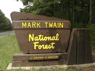
Campground List
CAMPGROUND NAME: Cobb Ridge

VISIT DATE: 09/06/1996

UPDATE DATE: 1/24/2024

STATE: Missouri

REGION: Eastern

RANGER DISTRICT: Ava/Cassville/Willow Springs

NEAREST CITY/TOWN: Chadwick

RESERVATIONS: 1-877-444-6777 or make on-line reservation

DIRECTIONS:
From Chadwick, MO, take State Rt. 125 south 1 mile to State Rt. H.
Turn right onto Rt. H and go 4 miles to campground sign.  Turn right
at sign and go 0.5 miles to campground on left.

GENERAL COMMENTS:
The elevation is 1,300 ft.

The campground is a series of overlapping loops (Loops A, B, C, D,
& E) meandering through oak-dominated woods over a rocky surface.
It is ATV/dirt bike oriented both types of which are permitted in
the campground.  The campground is well-designed for these types of
recreating.  A rail fence borders all the paved interior roads with
openings scattered here and there allowing access to the 70-miles of
ATV and dirt bike trails.  UTVs are not permitted.  One of the unique
features of the campground is Loop B is bisected by parallel parking
style pull-throughs.  Flush toilets and hot showers are located in
Loop A.  Night trail riding is permitted making this campground one
of constant activity.  The lack of middlestory and closeness of
campsites make privacy between campsites poor to good.  .

This is bear country; practice safe food storage techniques.

SEASONS
Open Seasonal: No
Open All Year: Yes

RATE AND MAXIMUM STAY PERMITTED
Rate: $15 per day - single no electric hookups
$25 per day - single electric hookups
Maximum Stay Permitted (days): 14

CAMPGROUND SITE CONFIGURATION
No. RV Sites: 0
No. Tent Sites: 5
No. Combined Sites (Tent or RV): 36

   Total Sites: 41

Tent Pads: No
Open Sites: Yes
Wooded Sites: Yes

No. Tables on Sites: 41
No. Grilles on Sites: 41
Equestrian Camping: No

RV INFORMATION
No. Full Hookups (includes waste): 0
No. Water and Electric Only: 0
No. Water Only: 0
No. Electric Only: 24

No. RV Pull Throughs: 18
Waste Station: No
Average Parking Apron Size: see RV comments

Comments:
The parking aprons are paved and many can accommodate any size RV.
Campsites in Loop B are parallel style pull-thoughs.  Threaded spigots
are located throughout campground.  An RV dump station with no potable
water is available for a fee at Ozark RV Park, 320 N 20th St, Ozark,
MO (N37 01.282, W093 13.875).

FACILITIES
Vaults: Yes
Flush Toilets: Yes
Hot Showers: Yes
Wheelchair Friendly Toilets: Yes

Public Phone: No
Playground: No
No. Water Spigots (non-site): 5
  No. Threaded: 5

WATER SPORTS None

HIKING
There are 70 miles of ATV/mountain bike trails directly accessible
from the campground.

FISHING No

CAMPGROUND NAME: Council Bluff Recreation Complex

VISIT DATE: 09/12/1996

UPDATE DATE: 1/24/2024

STATE: Missouri

REGION: Eastern

RANGER DISTRICT: Potosi/Fredericktown

NEAREST CITY/TOWN: Belgrade

RESERVATIONS: 1-877-444-6777 or make on-line reservation

DIRECTIONS:
NOTE: The campground does not have a sign

From Belgrade, MO, take State Rt. C west 3.8 miles to campground sign
(State Rt. DD).  Turn left onto Rt. DD and go south 6.7 miles to Forest
sign (Council Bluff Lake) campground.  Turn left at sign onto Forest Rt.
3001.  Follow Rt 3001 for 0.3 miles to a "Y" intersection.  Continue
Straight onto Forest Rt 3002 and go 1.4 miles into campground.

Alternative from Potosi: In Potosi, MO, at intersection of State Rts.
8 (Main St.) and P, take Rt. P south 14.9 miles to "y" intersection and
stop sign.  Bear right onto State Rt. C and go 0.2 miles to Council Bluff
Lake sign.  Turn left after sign onto State Rt. DD and go 6.7 miles to
another Council Bluff Lake sign.  Turn left at sign onto Forest Rt. 3001.
Follow Rt 3001 for 0.3 miles to a "Y" intersection.  Continue straight
onto Forest Rt 3002 and go 1.4 miles into campground.

GENERAL COMMENTS:
The elevation is 1,240 ft.

The Council Bluff Lake Recreation Complex consists of the 440 acre Council
Bluff Lake, Wild Boar Ridge campground, Chapel Hill beach and Beech Hollow
boat ramp.  The campground is a long narrow loop through a dense stand of
mixed hardwoods and some pines scattered here and there.  Each site has a
ramada or covered cooking area and lamp pole along with the usual table and
grille.  The tent-only campsites are all walk-in nicely secluded and not
convenient to a vault or drinking water.  None of the campsites have a view
of the lake.  The campground also has group campsites (not included in
campsite count) in the middle of the loop.  Contact the ranger district
office for more information on the group campsites.  Canoes are available
for rent at the Chapel Hill beach store as are firewood, ice, snacks, beach
toys and coin-operated hot showers.  Chapel Hill beach is 3.2 miles from
campground.  This campground is also known as "Wild Boar Ridge," "Council
Bluff Wild Boar Ridge" and "Wild Boar."

SEASONS
Open Seasonal: Yes
Open All Year: No

Seasonal Comment:
Open April 11 through October 28

RATE AND MAXIMUM STAY PERMITTED
Rate: $11 per day - single
$22 per day - double
Maximum Stay Permitted (days): 14

CAMPGROUND SITE CONFIGURATION
No. RV Sites: 0
No. Tent Sites: 9
No. Combined Sites (Tent or RV): 45

   Total Sites: 54

Tent Pads: Yes
Open Sites: No
Wooded Sites: Yes

No. Tables on Sites: 54
No. Grilles on Sites: 54
Equestrian Camping: No

RV INFORMATION
Hookups: None
No. RV Pull Throughs: 0
Waste Station: No
Average Parking Apron Size: 12' X 60'

Comments:
The parking aprons are gravel and all about the same size.

FACILITIES
Vaults: Yes
Flush Toilets: No
Hot Showers: Yes
Wheelchair Friendly Toilets: Yes

Public Phone: No
Playground: Yes
No. Water Spigots (non-site): 10
  No. Threaded: 5

Comments:
The showers are coin-operated and are located at the Chapel Hill beach.
The playground is also at the beach

NOTE: 01/24/2024 - Public water system at Wildboar Ridge campground inoperable
until further notice.  Contact ranger district office for status.

WATER SPORTS
Lake: Yes
Swimming (provided): Yes
Sailing: No
Boat Ramp: Yes
Boat Carry Down Access: No
Power Boating: Yes
Boating (no power): Yes
Water Skiing: No
Rafting (whitewater): No
Kayaking (whitewater): No

Comments:
Council Bluff Lake is 440 acres.  There is a fee at the Hollow Boat
Ramp to launch a boat.  Power boats are limited to 10HP.

HIKING
Council Bluff Lakeshore Trail (foot and mountain bike) - 12 miles
Ozark Trail/Lakeshore trail connector - (foot and mountain bike) -
3.5 miles

FISHING
Largemouth bass, Sunfish, Bluegill, Redear, Channel catfish and
Black crappies.

CAMPGROUND NAME: Float Camp

VISIT DATE: 09/09/1996

UPDATE DATE: 3/23/2024

STATE: Missouri

REGION: Eastern

RANGER DISTRICT: Doniphan/Eleven Point

NEAREST CITY/TOWN: Doniphan

RESERVATIONS: No

DIRECTIONS:
In Doniphan, MO, at intersection of State Rts. 160/21 and Y, take
Rt. Y north 3.9 miles to campground sign (Forest Rt. 3210).  Turn
left onto Rt. 3210 and go 0.4 miles into campground.

GENERAL COMMENTS:
The elevation is 300 ft.

The campground is a spur ending in a loop situated near the Current
River.  Campsites with electric hookups are located at the front of
the spur.  These campsites are spacious but a lack of middle story
provides poor privacy and limited shade.  The parking aprons on the
loop are shorter then the rest of the campground, but with large
shade trees, offers fair shade and privacy.  These campsite also
have a groomed grass understory.  No views of Current River are
available from any campsite.  A stoney beach on Current River is
accessed by a bridge located behind campsite 15.

SEASONS
Open Seasonal: Yes
Open All Year: No

Seasonal Comment:
Open April 1 through October 1 - weather dependent

RATE AND MAXIMUM STAY PERMITTED
Rate: $12 per day - single
$20 per day - single w/ electric hookups
$30 per day - double w/ electric hookups
Maximum Stay Permitted (days): 14

CAMPGROUND SITE CONFIGURATION
No. RV Sites: 0
No. Tent Sites: 0
No. Combined Sites (Tent or RV): 19

   Total Sites: 19

Tent Pads: No
Open Sites: Yes
Wooded Sites: Yes

No. Tables on Sites: 19
No. Grilles on Sites: 19
Equestrian Camping:

RV INFORMATION
No. Full Hookups (includes waste): 0
No. Water and Electric Only: 0
No. Water Only: 0
No. Electric Only: 8

No. RV Pull Throughs: 1
Waste Station: No
Average Parking Apron Size: 19' X 50'

Comments:
The parking aprons are paved.

FACILITIES
Vaults: Yes
Flush Toilets: No
Hot Showers: No
Wheelchair Friendly Toilets: Yes

Public Phone: No
Playground: Yes
No. Water Spigots (non-site): 3
  No. Threaded: 3

WATER SPORTS
Wading and canoeing possible in the Current River - boat landing is
at Dear Leap campground.  A sandy beach is located in the day use
area and a rocky stone beach is adjacent to campground.  Neither area
has designated swimming.  Contact the ranger district office for local
outfitters.

HIKING
Woodchuck Trail (foot) - 0.5 miles
  provides access to day use area
White Oak Trail (foot) - 1.5 miles

FISHING
Bass, crappie, catfish, perch and sunfish

CAMPGROUND NAME: Greer Crossing

VISIT DATE: 09/10/1996

UPDATE DATE: 3/23/2024

STATE: Missouri

REGION: Eastern

RANGER DISTRICT: Doniphan/Eleven Point

NEAREST CITY/TOWN: Alton

RESERVATIONS: No

DIRECTIONS:
In Alton, MO, at the intersection of US Rt. 160 and State Rt. 19,
take Rt. 19 north 9.4 miles, across the Current River bridge, to
campground sign (Forest Rt. 3188).  Turn right onto Rt. 3188 and
go 0.1 miles to campground on left.

NOTE:  The campground sign is not clearly visible from Rt. 19.

GENERAL COMMENTS:
The elevation is 400 ft.

The campground, in the Greer Crossing Recreation Area, is one large
loop through a stand of mature deciduous trees including oak and
hickory.  A dense under and middlestory gives the campground a jungle
or wilderness feel and excellent privacy between campsites.  The
towering overstory provides ample shade. The mix of trees suggests
great fall color.  The campsites are large and level; some are
suitable for multiple tents and have covered picnic tables (ramadas).
The campground is located on the Eleven Point National Scenic River,
very popular for canoeing and float trips.  Contact the district ranger
office for information about outfitters. The campground is located in
a flash flood area - be alert.

Just 1.5 miles south of the campground, on State Rt. 19, is Greer
Spring Trail.  The trail, 0.9 miles long one way, leads to the second
largest spring in Missouri.  It produces 220 million gallons of water
per day.  Click here for more information about Greer Spring.  Take a
lunch and enjoy the Spring.

On the way to Greer Spring Trail on State Rt. 19, is Greer Mill.  Built
in 1899, it operated as a grainery until 1920. It has been unoccupied
since then.  See detailed information about the mill in an application
to the U.S. Park Service for its inclusion as a National Historic
Place.

NOTE:  This is bear country; practice safe food storage techniques.

SEASONS
Open Seasonal: Yes
Open All Year: Yes

Seasonal Comment:
Services usually provided from April 1 through November 1 - weather permitting.
Contact ranger district office for status.

RATE AND MAXIMUM STAY PERMITTED
Rate: $10 per day - single
$15 per day - double
Maximum Stay Permitted (days): 14

CAMPGROUND SITE CONFIGURATION
No. RV Sites: 0
No. Tent Sites: 0
No. Combined Sites (Tent or RV): 19

   Total Sites: 19

Tent Pads: Yes
Open Sites: No
Wooded Sites: Yes

No. Tables on Sites: 19
No. Grilles on Sites: 19
Equestrian Camping: No

RV INFORMATION
Hookups: None
No. RV Pull Throughs: 2
Waste Station: No
Average Parking Apron Size: 19' X 50'

Comments:
The parking aprons are gravel and grass and all about the same size

FACILITIES
Vaults: Yes
Flush Toilets: No
Hot Showers: No
Wheelchair Friendly Toilets: No

Public Phone: Yes
Playground: No
No. Water Spigots (non-site): 2
  No. Threaded: 2

WATER SPORTS
Lake: No
Swimming (provided): No
Sailing: No
Boat Ramp: Yes
Boat Carry Down Access: No
Power Boating: No
Boating (no power): Yes
Water Skiing: No
Rafting (whitewater): No
Kayaking (whitewater): No

Comments:
Canoeing on the Eleven Point National Scenic River.

HIKING
McCormick-Greer Trail (foot, mountain bike, horse) - 14 miles

FISHING
Rainbow trout, Small Mouth bass, sunfish and catfish

CAMPGROUND NAME: Lane Spring

VISIT DATE: 09/04/1996

UPDATE DATE: 1/24/2024

STATE: Missouri

REGION: Eastern

RANGER DISTRICT: Houston/Rolla/Cedar Creek

NEAREST CITY/TOWN: Rolla

RESERVATIONS: No

DIRECTIONS:
In Rolla, MO, at the intersection of US Rt. 63 and State Rt. 72, take
Rt. 63 south 10.8 miles to campground sign.  Turn right at campground
sign onto Forest Rt. 1892 (paved) and go 1.2 miles to "Y" intersection.
Bear left and go 0.1 miles to campground.

NOTE: At 10.7 miles on US Rt. 63, slow down as turn onto Forest Rt.
1892 is immediately after a rise.

GENERAL COMMENTS:
The elevation is 800ft.

The campground is a single loop through dense woods of typical Missouri
hardwoods - towering sycamore, elm, and hackberry trees that blend with
Red-bud, Sweet gum and other deciduous trees.  The Little Piney Creek,
a Blue Ribbon Trout creek, winds past the campground.  Lane Springs,
where there is a small informal wadding area with a rocky beach, is in
the day use picnic area.  The heavy vegetation provides ample shade and
excellent privacy.  There are a couple of campsites on the creek but the
high bank and thick vegetation limits access or views directly to the
creek.  Each campsite has a lantern post and a trimmed grass area.  The
bubbling Lane Spring can be seen from an observation deck in the picnic
area.  Large grassy fields in the day use area are great for a variety of
games and the equipment in the playground should keep young ones
entertained for hours.

SEASONS
Open Seasonal: Yes
Open All Year: No

Seasonal Comment:
Open April 15 through October 31.

RATE AND MAXIMUM STAY PERMITTED
Rate: $8 per day - no hookups
$15 per day - electric hookups
Maximum Stay Permitted (days): 14

CAMPGROUND SITE CONFIGURATION
No. RV Sites: 0
No. Tent Sites: 0
No. Combined Sites (Tent or RV): 18

   Total Sites: 18

Tent Pads: No
Open Sites: No
Wooded Sites: Yes

No. Tables on Sites: 18
No. Grilles on Sites: 18
Equestrian Camping: No

RV INFORMATION
No. Full Hookups (includes waste): 0
No. Water and Electric Only: 0
No. Water Only: 0
No. Electric Only: 6

No. RV Pull Throughs: 2
Waste Station: No
Average Parking Apron Size: 10' X 46'

Comments:
The parking aprons are paved and level.  An RV waste station, with
potable water, is available for a fee south of the campground at
Three Springs RV campground located at 24125 US Rt. 63, Rolla, MO;
GPS coordinates: N37 44.764, W091 51.405

FACILITIES
Vaults: Yes
Flush Toilets: No
Hot Showers: No
Wheelchair Friendly Toilets: Yes

Public Phone: No
Playground: Yes
No. Water Spigots (non-site): 2
  No. Threaded: 0

WATER SPORTS
Wading in Little Piney Creek near Land Spring adjacent to day use
area

HIKING
Blossom Rock Trail (foot) - 1 mile
Cedar Bluff Trail (foot) - 1.5 miles

FISHING
Rainbow trout in the blue ribbon, Little Piney Creek

CAMPGROUND NAME: Loggers Lake

VISIT DATE: 09/12/1996

UPDATE DATE: 3/23/2024

STATE: Missouri

REGION: Eastern

RANGER DISTRICT: Salem

NEAREST CITY/TOWN: Bunker

RESERVATIONS: 1-877-444-6777 or make on-line reservation

DIRECTIONS:
In Bunker, MO, at the intersection of State Rts. 72 and A, take
Rt. A west 0.2 miles to campground sign (Lincoln Ave. - Forest
Rt. 2221).  Turn left at sign onto Lincoln Ave. and go 6.2 miles
to another campground sign (Forest Rt. 2193).  Turn left onto Rt.
2193  and go 1.1 miles (intermittently paved and gravel) to
campground.

NOTE: Lincoln Ave/Forest Rt. 2221 is gravel with severe washboard
surface.  There is a low-water bridge before campground's entrance.

GENERAL COMMENTS:
The elevation is 800 ft.

Most campsites are on the southeast shore of the spring-fed Loggers
Lake and overlook the lake.  The campground has two areas with very
different characteristics.  The first area stretches along the interior
road.  These campsite have "V" style parking aprons and ample shade
from the overstory provided by the mature trees of various specious
including short-leaf pine and oak. The second area is a large loop
over a large flat groomed grass field.  The campsites are open and
level and good for multiple tents. There are some large and attractive
Tulip poplars providing limited shade to these campsites.  Privacy is
fair between campsites.  Loggers Lake was built by the Civilian
Conservation Corp (CCC) in the late 1930s as a fishery.  The maturity
of the lake and vegetation make this an attractive campground.

NOTE:  This is bear country; practice safe food storage techniques.

SEASONS
Open Seasonal: Yes
Open All Year: No

Seasonal Comment:
Open April 4 through November 27

RATE AND MAXIMUM STAY PERMITTED
Rate: $15 per day
Maximum Stay Permitted (days): 14

CAMPGROUND SITE CONFIGURATION
No. RV Sites: 0
No. Tent Sites: 2
No. Combined Sites (Tent or RV): 12

   Total Sites: 14

Tent Pads: No
Open Sites: Yes
Wooded Sites: Yes

No. Tables on Sites: 14
No. Grilles on Sites: 14
Equestrian Camping: No

RV INFORMATION
Hookups: None
No. RV Pull Throughs: 0
Waste Station: No
Average Parking Apron Size: 12' X 37'

Comments:
The parking aprons are paved.  An RV waste station is available in
Salem, MO at The Commons, Dent County's fairgrounds off State Rt.
72 (N37 39.219, W091 34.265).

FACILITIES
Vaults: Yes
Flush Toilets: No
Hot Showers: No
Wheelchair Friendly Toilets: Yes

Public Phone: No
Playground: No
No. Water Spigots (non-site): 1
  No. Threaded: 1

WATER SPORTS
Lake: Yes
Swimming (provided): No
Sailing: No
Boat Ramp: Yes
Boat Carry Down Access: Yes
Power Boating: Yes
Boating (no power): Yes
Water Skiing: No
Rafting (whitewater): No
Kayaking (whitewater): No

Comments:
Loggers Lake is 22 acres.  Nice lake for canoeing.  Power boats are
limited to electric motors.  The beach is groomed grass but has no
designated swim area..

HIKING
Loggers Lake Nature Trail (foot) - 1.5 miles
Rock Spring Trail - (foot)  - 0.3 miles

FISHING
Largemouth bass, catfish, crappie, and bluegill

CAMPGROUND NAME: Marble Creek

VISIT DATE: 09/13/1996

UPDATE DATE: 3/23/2024

STATE: Missouri

REGION: Eastern

RANGER DISTRICT: Potosi/Fredericktown

NEAREST CITY/TOWN: Arcadia

RESERVATIONS: No

DIRECTIONS:
In Arcadia, MO, at the intersection of State Rts. 72 and 21, take
Rt. 21 south 1.4 miles to State Rt. E and a campground sign.  Turn
left at sign onto Rt. E and go 12.7 miles to campground on left.

GENERAL COMMENTS:
The elevation is 600 ft.

The campground, near the Crane section of the Ozark Trail, is a single
large loop through a dense forest of mixed hardwoods and pines.  Some
camp sites are adjacent to Marble Creek that more often than not, will
be heard rather than seen.  The understory at the campsites is groomed
grass but surrounding each campsite is a dense growth of vegetation
providing excellent privacy between most campsites.

Possible day trips are to the quaint and attractive town of Arcadia and
the old-fashion Ruble's Meat Market near intersection of Rts. 21 and E.

SEASONS
Open Seasonal: Yes
Open All Year: No

Seasonal Comment:
Open April 1 through October 31

RATE AND MAXIMUM STAY PERMITTED
Rate: $15 per day
Maximum Stay Permitted (days): 14

CAMPGROUND SITE CONFIGURATION
No. RV Sites: 0
No. Tent Sites: 9
No. Combined Sites (Tent or RV): 16

   Total Sites: 25

Tent Pads: Yes
Open Sites: No
Wooded Sites: Yes

No. Tables on Sites: 25
No. Grilles on Sites: 25
Equestrian Camping:

RV INFORMATION
Hookups: None
No. RV Pull Throughs: 0
Waste Station: No
Average Parking Apron Size: 11' X 45'

Comments:
Some parking aprons are paved, some are gravel; most are not level
with serious sloping and are in need of maintenance.

FACILITIES
Vaults: Yes
Flush Toilets: No
Hot Showers: No
Wheelchair Friendly Toilets: Yes

Public Phone: No
Playground: No
No. Water Spigots (non-site): 2
  No. Threaded: 2

WATER SPORTS
Wading possible in Marble Creek.

HIKING
Ozark Trail - section to Crane Lake is 8 miles and is open to
horseback
riding, mountain bikes and foot hiking.

FISHING
Smallmouth and Rock bass, perch, bluegill, Bullhead trout and
catfish

CAMPGROUND NAME: Markham Springs

VISIT DATE: 09/09/1996

UPDATE DATE: 11/23/2023

STATE: Missouri

REGION: Eastern

RANGER DISTRICT: Poplar Bluff

NEAREST CITY/TOWN: Williamsville

RESERVATIONS: 1-877-444-6777 or make on-line reservation

DIRECTIONS:
In Williamsville, MO, at the intersection of State Rts. A and 49, take
Rt. 49 2.8 miles to Markham Springs Recreation Area sign.  Turn left at
sign onto Forest Rt. 2997 and go 0.9 miles into campground.

NOTE: Recreation area sign is set back from road and not clearly visible
until just before turn into campground.

GENERAL COMMENTS:
The elevation is 300 ft.

The campground, located on Black River, has four sections named Pine,
Sycamore, Riverside, and Electric loops. The Electric Loop, as the name
implies, has the campgrounds only campsites with electric hookups.  It
is furthest from the River and has most of the campground's pull-through
campsites.  It is separation between campsites, rather than the groomed
grass understory, that provides good privacy.  Large deciduous trees,
such as Sweet Gum and oak, provide some shade.  The other three loops
have a few campsites that overlook the river and have no vaults.  However,
the steep bank discourages putting in from any of these campsites.  A
jungle-like under and middle-story provide good to excellent privacy
between campsites in these loops.  The mix of deciduous trees, including
Tulip poplar, Sweet gum, and various oaks, suggest nice fall colors.
Being so close to the Black River, flash flooding is a concern.  Adjacent
to the large day-use area is the Fuchs House, a two-acre mill pond, and a
wheelhouse.  All are historic and well-maintained.

At one time, Williamsville had three railroads.  Today, an occasional
passing train can be heard in the campground as a reminder of those bygone
days.  Today, the town offers campers with a Cook's-night-out and sponsored
festivals.

SEASONS
Open Seasonal: Yes
Open All Year: No

Seasonal Comment:
Open May 1 through October 1 - weather dependent

RATE AND MAXIMUM STAY PERMITTED
Rate: $10 per day - single (no elec. hookups)
$20 per day - double (no elec. hookups)
$17 per day - single (elec. hookups)
$34 per day - double (elec. hookups)
Maximum Stay Permitted (days): 14

CAMPGROUND SITE CONFIGURATION
No. RV Sites: 0
No. Tent Sites: 0
No. Combined Sites (Tent or RV): 50

   Total Sites: 50

Tent Pads: No
Open Sites: Yes
Wooded Sites: Yes

No. Tables on Sites: 49
No. Grilles on Sites: 50
Equestrian Camping: No

RV INFORMATION
No. Full Hookups (includes waste): 0
No. Water and Electric Only: 0
No. Water Only: 0
No. Electric Only: 11

No. RV Pull Throughs: 5
Waste Station: No
Average Parking Apron Size: See RV comments

Comments:
The parking aprons are gravel and dirt and many will accommodate
any size RV.  The only threaded spigot in the Recreation Area
is located in the Mill Pond Day Use Area's parking lot; there are
none in the campground.

FACILITIES
Vaults: Yes
Flush Toilets: No
Hot Showers: Yes
Wheelchair Friendly Toilets: Yes

Public Phone: No
Playground: No
No. Water Spigots (non-site): 6
  No. Threaded: 0

Comments:
The campground's only vault toilet is located in the Electric
Loop.

WATER SPORTS
Lake: No
Swimming (provided): No
Sailing: No
Boat Ramp: Yes
Boat Carry Down Access: Yes
Power Boating: Yes
Boating (no power): Yes
Water Skiing: No
Rafting (whitewater): No
Kayaking (whitewater): No

Comments:
Canoeing possible on Black River.  Contact ranger district office for
outfitters.

HIKING
Eagle Bluff Trail (foot) - 2.5 miles

FISHING
Largemouth and Smallmouth bass, Walleye and perch

CAMPGROUND NAME: North Fork

VISIT DATE: 09/07/1996

UPDATE DATE: 3/23/2024

STATE: Missouri

REGION: Eastern

RANGER DISTRICT: Ava/Cassville/Willow Springs

NEAREST CITY/TOWN: Dora

RESERVATIONS: No

DIRECTIONS:
In Dora, MO, at the intersection of State Rts. 181 and CC, take Rt. CC
east 4.1 miles to North Fork campground sign.  Turn right into
campground.

GENERAL COMMENTS:
The elevation is 600 ft.

The campground has three loops named Dogwood, Willow, and Pine, between
two day-use areas along the North Fork of White River.  These loops are
tight so anything over 30 ft. long will have a problem turning.
Campsites are tucked under a towering canopy of mixed deciduous trees,
suggesting nice fall foliage.  With groomed grass understory, spacing,
rather than vegetation provides good privacy.  Although the campground
stretches along the river, the dense vegetation hides the water and
prevents direct access.  However, the sounds of passing canoeists and
floaters can be heard.  The river has a Blue and Red trout section beyond
the campground.  The campground is located close to Devil's Backbone
Wilderness and is well situated for canoeing into the wilderness.  Contact
the ranger district office for information about outfitters.

This is bear country; practice safe food storage techniques..

SEASONS
Open Seasonal: Yes
Open All Year: No

Seasonal Comment:
Open May 1 through November 30

NOTE:  Water system is shut off October 15 - weather dependent

RATE AND MAXIMUM STAY PERMITTED
Rate: $10 per day - non-electric
$17 per day - electric & water
Maximum Stay Permitted (days): 14

CAMPGROUND SITE CONFIGURATION
No. RV Sites: 0
No. Tent Sites: 0
No. Combined Sites (Tent or RV): 19

   Total Sites: 19

Tent Pads: No
Open Sites: No
Wooded Sites: Yes

No. Tables on Sites: 19
No. Grilles on Sites: 19
Equestrian Camping: No

RV INFORMATION
No. Full Hookups (includes waste): 0
No. Water and Electric Only: 1
No. Water Only: 0
No. Electric Only: 0

No. RV Pull Throughs: 0
Waste Station: No
Average Parking Apron Size: 11' X 45'

Comments:
The parking aprons are paved.  Tight curves on the interior road will
make turning a challenge for large travel trailers and motorhomes.
An RV dump station with no potable water is available for a fee at
Ozark RV Park, 320 N 20th St, Ozark, MO (N37 01.282, W093 13.875).

FACILITIES
Vaults: Yes
Flush Toilets: No
Hot Showers: No
Wheelchair Friendly Toilets: No

Public Phone: Yes
Playground: No
No. Water Spigots (non-site): 3
  No. Threaded: 3

WATER SPORTS
Lake: No
Swimming (provided): No
Sailing: No
Boat Ramp: Yes
Boat Carry Down Access: Yes
Power Boating: No
Boating (no power): Yes
Water Skiing: No
Rafting (whitewater): Yes
Kayaking (whitewater): Yes

Comments:
Canoeing and wading in the North Fork of White River.  Although the
day-use area claims to have swim area, there is no designated swim
area. Contact ranger district office for local outfitters or check
the Mark Twain, Forest Service website.

HIKING
Ridge Runner trail (foot) - 12 miles
Blue Spring trail (foot) - 0.1 mile

FISHING
Rainbow trout, catfish, bass and Sunfish

CAMPGROUND NAME: Paddy Creek

VISIT DATE: 09/05/1996

UPDATE DATE: 3/23/2024

STATE: Missouri

REGION: Eastern

RANGER DISTRICT: Houston/Rolla/Cedar Creek

NEAREST CITY/TOWN: Licking

RESERVATIONS: No

DIRECTIONS:
In Licking, MO, at the intersection of State Rt. 32 and US Rt. 63,
take Rt. 32 west 12.9 miles to Paddy Creek campground sign.  Turn
right onto Paddy Crk. Rd (gravel) and go 6.6 miles to a "T"
intersection (just before a low water bridge).  Turn right onto
Campground Dr. and go 0.4 miles to campground.

Alternative, not recommended for RVs:  In Licking, MO, at the
intersection of State Rt. 32 and US Rt. 63, take State Rt. 32
west 3.8 miles to State Rt. N.  Turn right onto Rt. N and go 2.2
miles to State Rt. AF.  Turn left onto Rt. AF and go 8.9 miles to
Paddy Creek Recreation Area sign (Paddy Creek Rd.).  Turn left onto
Paddy Creek Rd. and go 1.8 miles to campground sign (Campground Rd.).
Turn left and proceed to campground.

NOTE: The last 4.5 miles is gravel, steep, and very curvy in places.

GENERAL COMMENTS:
The elevation is 800 ft.

This quiet, pretty campground stretches alongside Paddy Creek on
the eastern edge of Paddy Creek Wilderness Area in a stand of dense,
lush deciduous and conifer trees.  The variety of plants and trees
range from Redbud and oaks to cedar and hemlocks, providing ample
shade, excellent privacy, and could be a botanists delight.  The
assortment of vegetation suggests great fall foliage.  The campsites
have a trimmed grassy understory, great for tent campers and a
lantern pole.  Some campsites are adjacent to Paddy Creek but the
dense vegetation limits the view.  The riparian environment provided
by Paddy Creek means lots of birds and the creek's rocky bed offers
young rock hounds hours of exploration.

SEASONS
Open Seasonal: Yes
Open All Year: No

Seasonal Comment:
Open April 1 through December 1.

RATE AND MAXIMUM STAY PERMITTED
Rate: $15 per day
Maximum Stay Permitted (days): 14

CAMPGROUND SITE CONFIGURATION
No. RV Sites: 0
No. Tent Sites: 0
No. Combined Sites (Tent or RV): 23

   Total Sites: 23

Tent Pads: No
Open Sites: Yes
Wooded Sites: Yes

No. Tables on Sites: 22
No. Grilles on Sites: 20
Equestrian Camping: No

RV INFORMATION
Hookups: None
No. RV Pull Throughs: 0
Waste Station: No
Average Parking Apron Size: 10' X 47

Comments:
The parking aprons are paved and all about the same size.  An RV
waste station, with potable water, is available for a fee north of
the campground at Three Springs RV campground located at 24125 US
Rt. 63, Rolla, MO; GPS coordinates: N37 44.764, W091 51.405

FACILITIES
Vaults: Yes
Flush Toilets: No
Hot Showers: No
Wheelchair Friendly Toilets: Yes

Public Phone: No
Playground: No
No. Water Spigots (non-site): 0

WATER SPORTS
Wadding possible in Paddy Creek.

HIKING
Big Piney Trail (foot) - 17-mile circuit hike through Paddy Creek
Wilderness

FISHING No

CAMPGROUND NAME: Red Bluff

VISIT DATE: 09/12/1996

UPDATE DATE: 1/24/2024

STATE: Missouri

REGION: Eastern

RANGER DISTRICT: Potosi/Fredericktown

NEAREST CITY/TOWN: Viburnum

RESERVATIONS: 1-877-444-6777 or make on-line reservation

DIRECTIONS:
In Viburnum, MO, at the intersection of State Rts. 49 and Y, take
Rt. Y north 4.6 miles to a "Y" intersection and stop sign.  Bear left
at sign onto Rt. V and go 5.6 miles to a campground sign.  Turn right
at sign onto Forest Route 2011 and go 0.3 miles to Pines Overlook
section or continue 1 mile to main campground.

GENERAL COMMENTS:
The elevation is 700 ft.

The campground has two loops, a spur and a separate section named Pines
Overlook off the access road and before the main campground.  All
campsites are in mixed hardwoods including Tulip poplar and Sweet gum.
However, each of these campsites overlooks the lush Huzzah Creek valley.
Although campers in this section enjoy the fabulous valley view, they
must get their drinking water from the main campground, 0.7 mile north.
The two loops in the main campground are named Upper and Lower.  The
Lower loop stretches across a section of the Huzzah Creek flood plan and
many of the campsites with their gravel surface show the effects of
flooding; campers in the Lower Loop should stay alert to conditions.  The
Upper loop is actually a spur that ends in a little loop tucked back in
the woods.  The Upper loop has campsites with electric hook-ups and
several group campsites (not included in the research).  Each campsite
in the campground has a covered table (ramada) and lantern pole.  Few
campsites have a view of Huzzah Creek but all are within walking distance
of the water.  Wadding in Huzzah Creek, under the red bluffs, is very
popular as is floating the creek.  Firewood, ice, and limited camping
supplies are available for a fee.

Visit the Czar Fire Tower Station in Viburnum, MO.  Built in the 1930s
by the Civilian Conservation Corps (CCC), it and associated buildings
still stand.  Yet another example of CCC workmanship.

Some unique services provided by the CURRENT managers were a lending
library, kayaks for rent, and a nightly visit of an ice cream bicycle.

This is bear country; practice safe food storage techniques.

SEASONS
Open Seasonal: Yes
Open All Year: No

Seasonal Comment:
Open May 2 through October 28

RATE AND MAXIMUM STAY PERMITTED
Rate: $15 per day - single, no electric hookups
$25 per day - single, electric hookups
$25 per day - double, no electric hookups
$35 per day - double, electric hookups

NOTE:  No discount on electric surcharge.
Maximum Stay Permitted (days): 14

CAMPGROUND SITE CONFIGURATION
No. RV Sites: 0
No. Tent Sites: 0
No. Combined Sites (Tent or RV): 41

   Total Sites: 41

Tent Pads: Yes
Open Sites: Yes
Wooded Sites: Yes

No. Tables on Sites: 41
No. Grilles on Sites: 41
Equestrian Camping: No

RV INFORMATION
No. Full Hookups (includes waste): 0
No. Water and Electric Only: 0
No. Water Only: 0
No. Electric Only: 6

No. RV Pull Throughs: 0
Waste Station: No
Potable Water at Waste Station: No
Average Parking Apron Size: 12' X 59'

Comments:
Some parking aprons are gravel and others paved; many are not level.
Parking aprons in Lower loop are grass and gravel and poorly defined.

FACILITIES
Vaults: Yes
Flush Toilets: No
Hot Showers: No
Wheelchair Friendly Toilets: No

Public Phone: No
Playground: No
No. Water Spigots (non-site): 5
  No. Threaded: 4

WATER SPORTS
Wading in Huzzah Creek

HIKING
Red Bluff Trail (foot) - 1.1 mile loop

FISHING
Smallmouth and Rock bass, perch and Channel catfish

CAMPGROUND NAME: Silver Mines Recreation Area (RA)

VISIT DATE: 09/13/1996

UPDATE DATE: 1/24/2024

STATE: Missouri

REGION: Eastern

RANGER DISTRICT: Potosi/Fredericktown

NEAREST CITY/TOWN: Fredericktown

RESERVATIONS: 1-877-444-6777 or make on-line reservation

DIRECTIONS:
NOTE: Summit, Prospect, Spring Branch and Riverside are signed as
campgrounds.  However, they are actually loops within the Silver Mines
Recreation Area and are described as such in this Guide and the Mark
Twain official website.

In Fredericktown, MO, at the intersection of US Rt.67 and State Rt. 72,
take State Rt. 72 west 4.2 miles to a campground sign and State Rt. D.
Turn left onto Rt. D and go 2.8 miles to Summit/Prospect campgrounds sign.
Turn left at sign into Silver Mines Recreation Area.  Go 0.1 miles to
camping sign.  Turn right and go 0.4 miles to another campground sign.
Turn left into Summit and Prospect Loops.  Or continue straight for
another 0.4 miles to Spring Branch campground on right.  For the Riverside
loop, continue on Rt. D, passing Summit/Prospect campgrounds sign, for
another 0.3 miles to the Riverside sign.  Turn right at sign into the loop.

GENERAL COMMENTS:
The elevation 800 ft.

The Silver Mines Recreation Area (RA) is composed of four loops: Summit,
Prospect, Spring Branch, and Riverside.  These loops are identified as
"campgrounds" on signs.  Riverside is the closest loop to the St. Francis
River.  This river is the only whitewater river in Missouri that is at its
peak for kayaking in the spring.  Riverside is a single loop stretching
across a level grassy field, dotted with large shade trees and has the RA's
only campsites with electric hookups.  Spring Branch loop appears to be used
for over-flow and is under-maintained.  Most parking aprons are seriously
sloped, making them the least RV-friendly in the RA.  The interior moss-covered
road and lush understory with low branches from the overstory, gives this
loop a wilderness feel.  Summit and Prospect loops are connected and meander
through a dense stand of mixed hardwoods.  The separation between campsites
is ample and combined with the dense understory provides good to excellent
privacy.  These loops are furthest from the river but only one mile from the
Turkey Creek Picnic Area that is a good location to watch for kayakers.  In
the 1920s, the Silver Mines area yielded silver and tungsten ore.  Remnants
of the mines are still visible for exploration.  A possible day trip is
Millstream Garden Conservation Area and Trail.

The Silver Mines RA is the site where the Einstein Mining Co. began mining in
1877.  Two years later, the St. Francis River was dammed to drive a turbine
wheel for hauling and crushing ore.  Mining was for lead and silver and later
for tungsten.  Over 20 different minerals have been identified in this area.
One can hike to the dam on one side of the river and the remains of two mine
openings can be seen on the other.

This is bear country; practice safe food storage techniques.

SEASONS
Open Seasonal: Yes
Open All Year: No

Seasonal Comment:
Open March 7 through October 28

RATE AND MAXIMUM STAY PERMITTED
Rate: $15 per day - single, no electric hookups
$25 per day - single, electric hookups
$25 per day - double, no electric hookups
$35 per day - double, electric hookups

NOTE:  No discount on electric hookup surcharge.
Maximum Stay Permitted (days): 14

CAMPGROUND SITE CONFIGURATION
No. RV Sites: 0
No. Tent Sites: 0
No. Combined Sites (Tent or RV): 64

   Total Sites: 64

Tent Pads: Yes
Open Sites: Yes
Wooded Sites: Yes

No. Tables on Sites: 64
No. Grilles on Sites: 64
Equestrian Camping: No

RV INFORMATION
No. Full Hookups (includes waste): 0
No. Water and Electric Only: 0
No. Water Only: 0
No. Electric Only: 11

No. RV Pull Throughs: 0
Waste Station: No
Average Parking Apron Size: 15' X 48'

Comments:
The parking aprons in Riverside are paved.  In other loops, parking
aprons are paved or grass and gravel.  The electric hookup campsites
are located in the Riverside loop.

FACILITIES
Vaults: Yes
Flush Toilets: No
Hot Showers: No
Wheelchair Friendly Toilets: Yes

Public Phone: No
Playground: No
No. Water Spigots (non-site): 5
  No. Threaded: 2

WATER SPORTS
Lake: No
Swimming (provided): No
Sailing: No
Boat Ramp: No
Boat Carry Down Access: Yes
Power Boating: No
Boating (no power): No
Water Skiing: No
Rafting (whitewater): No
Kayaking (whitewater): Yes

Comments:
Wading and whitewater kayaking on the St. Francis River.

Whitewater kayaking enthusiasts from near and far come to the area in
the spring to participate in the Missouri Whitewater Championships.
Contact the Missouri Whitewater Association for more information at
http://missouriwhitewater.org/

HIKING
Einstein Mines Dam (foot) - up to 1 mile
Millstream Gardens (foot) - up to 1.2 miles

FISHING
Smallmouth and Rock bass, perch, bluegill and Bullhead trout

CAMPGROUND NAME: Sutton Bluff

VISIT DATE: 09/12/1996

UPDATE DATE: 1/24/2024

STATE: Missouri

REGION: Eastern

RANGER DISTRICT: Salem

NEAREST CITY/TOWN: Centerville

RESERVATIONS: 1-877-444-6777 or make on-line reservation

DIRECTIONS:
From Centerville, MO, take State Rt. 21/72 north 1.8 miles to
campground sign.  Turn left onto Karkaghne Scenic Drive (Trail of
Tears) after the sign and go 6.8 miles to another campground sign
(Forest Rt. 2236).  Turn left onto Rt. 2236 and go 2.5 miles to
still another campground sign.  Turn left into campground.

GENERAL COMMENTS:
The elevation is 600 ft.

The campground is one large loop meandering over hillsides in a stand
of mixed trees including Hickory and short-leaf pine with a groomed
grass understory.  Some sites are adjacent to the West Fork of Black
River but a thick understory of shrubs and vines blocks the view.  This
dense vegetation does provide for good to excellent privacy between
campsites..  At this point, the West Fork is relatively small - only
wadding is possible. Campsites closest to the campground's entrance are
more open and wider and many have double wide parking aprons.  The more
secluded campsites are located at the rear of the campground.  There are
also basketball and tetherball courts and a horseshoe pit.  Ice, firewood,
ice cream and snacks are available.  With 35 plus miles of ATV trails, the
campground is popular with ATVs and dirt bike enthusiasts.  However, since
an ATV can only be ridden in or out of the campground, it has a
family-friendly reputation.  Permits are required for ATVrs to use County
roads and the Forest's trail network.  Contact the ranger district office
for more information and where permits can be obtained.

On May 8, 2009, the campground and area around it was hit by a Derecho
hurricane (inland hurricane).  As a result, much of the vegetation was
destroyed.

SEASONS
Open Seasonal: Yes
Open All Year: No

Seasonal Comment:
Open March 28 through October 28.

RATE AND MAXIMUM STAY PERMITTED
Rate: Rate: $10 per day - single, no electric hookups
$20 per day - single, electric hookups
$20 per day - double, no electric hookups
$30 per day - double, electric hookups

NOTE:  No discount on surcharge.
Maximum Stay Permitted (days): 14

CAMPGROUND SITE CONFIGURATION
No. RV Sites: 0
No. Tent Sites: 0
No. Combined Sites (Tent or RV): 32

   Total Sites: 32

Tent Pads: Yes
Open Sites: Yes
Wooded Sites: Yes

No. Tables on Sites: 32
No. Grilles on Sites: 32
Equestrian Camping: No

RV INFORMATION
No. Full Hookups (includes waste): 0
No. Water and Electric Only: 0
No. Water Only: 0
No. Electric Only: 13

No. RV Pull Throughs: 3
Waste Station: No
Average Parking Apron Size: 13' X 45'

Comments:
The parking aprons are paved.  An RV waste station is available in
Salem, MO, at The Commons, Dent County Fairgrounds (N37 39.219,
W091 34.265)

FACILITIES
Vaults: Yes
Flush Toilets: Yes
Hot Showers: Yes
Wheelchair Friendly Toilets: Yes

Public Phone: Yes
Playground: No
No. Water Spigots (non-site): 4
  No. Threaded: 4

WATER SPORTS
Wading is possible in West Fork of Black River.

HIKING

The 30-mile Karkaghee Section of the 200-mile long Ozark Trail (foot,
horse, mtn. bike) is accessible from a trailhead about a half mile
from campground.

Thirty-five miles of ATV/dirt bike trails are available from
campground.

FISHING
Smallmouth bass

CAMPGROUND NAME: Watercress Spring

VISIT DATE: 09/10/1996

UPDATE DATE: 11/24/2023

STATE: Missouri

REGION: Eastern

RANGER DISTRICT: Doniphan/Eleven Point

NEAREST CITY/TOWN: Van Buren

RESERVATIONS: No

DIRECTIONS:
In Van Buren, MO, at the intersection of US Rt. 60 and James St., take
James St. 0.2 miles to a "T" intersection.  Turn right onto Main St
(Business 60) and go 0.2 miles to Ozark National Scenic Riverways sign.
Turn left at sign and go 0.5 miles into campground.

GENERAL COMMENTS:
The elevation is 400 ft.

The campground stretches along the Current River and although none of
the campsites have a view of the river, all are within walking distance
of it.  The understory at the campsites is groomed grass with hardwood
overstory providing a good amount of shade to most sites.  It is the
separation, not the vegetation, that provides good privacy between
campsites.  All the campsites are large and spacious and well suited for
multiple tent campers.  The Current River is a very popular float for the
whole family.  There are Civil War gun emplacements still visible up near
the ranger station.  Hike the Songbird Hiking Trail and see the Union
Army gun trenches.

SEASONS
Open Seasonal: Yes
Open All Year: No

Seasonal Comment:
Open May 1 through October 1

RATE AND MAXIMUM STAY PERMITTED
Rate: $10 per day - single
$20 per day - double
Maximum Stay Permitted (days): 14

CAMPGROUND SITE CONFIGURATION
No. RV Sites: 0
No. Tent Sites: 0
No. Combined Sites (Tent or RV): 17

   Total Sites: 17

Tent Pads: No
Open Sites: Yes
Wooded Sites: Yes

No. Tables on Sites: 17
No. Grilles on Sites: 17
Equestrian Camping:

RV INFORMATION
Hookups: None
No. RV Pull Throughs: 0
Waste Station: No
Average Parking Apron Size: 20' X 50'

Comments:
The parking aprons are paved.

FACILITIES
Vaults: Yes
Flush Toilets: Yes
Hot Showers: No
Wheelchair Friendly Toilets: Yes

Public Phone: No
Playground: No
No. Water Spigots (non-site): 3
  No. Threaded: 3

Comments:
Flush toilets and cold showers are located in the day use area.

WATER SPORTS
Lake: No
Swimming (provided): No
Sailing: No
Boat Ramp: Yes
Boat Carry Down Access: No
Power Boating: Yes
Boating (no power): Yes
Water Skiing: No
Rafting (whitewater): No
Kayaking (whitewater): No

Comments:
Canoeing and tubing on Current River.  Power boats are limited
to 40 HP.

HIKING
Songbird Hiking Trail - 1.2 miles.

FISHING
Smallmouth and Rock bass, Long Ear sunfish, and crappie
|