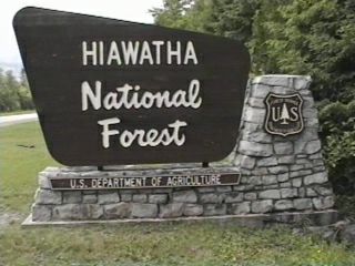
Campground List
CAMPGROUND NAME: Au Train Lake

VISIT DATE: 07/19/1996

UPDATE DATE:  11/21/2023

STATE: Michigan

REGION: Eastern

RANGER DISTRICT: Munising

NEAREST CITY/TOWN: Au Train

RESERVATIONS: 1-877-444-6777 or make on-line reservation

DIRECTIONS:
In Au Train, MI, take Rt. H3 south 4.2 miles to campground sign.
Turn left onto Buckbay Rd. (Forest Rt. 2276) and go 0.7 miles to
Campground Rd.  Turn left onto Campground Rd. and go 1.3 miles to
campground.

GENERAL COMMENTS:
The elevation is 440 ft.

The campground is a bisected loop on the south shore of Au Train
Lake adjacent to Buck Bay and Buck Bay Creek in heavily wooded
native deciduous trees.  The campground's boat ramp provides
access to water skiing, fishing and other water play.  Caneoing
is a popular activity.  There is a nice swimming beach and good
perch population for young people.  Day trips from the campground
include Pictured Rocks National Lakeshore, Rock River Falls, Lake
Superior charter fishing, and the North Country Trail.

Adjacent to the campground is the very special and unique Au
Train Songbird Trail. This is an audio-guided interpretive trail.
(Check with Munising Ranger District or campground host about
obtaining a "Trail Kit.") The trail winds through forest, fields,
lakeshore, and bog, while the audio tape provides the songs of
specific birds of the area.

SEASONS
Open Seasonal: Yes
Open All Year: No

Seasonal Comment:
Open May 17 through September 28

RATE AND MAXIMUM STAY PERMITTED
Rate: $24 per day
Maximum Stay Permitted (days): 14

CAMPGROUND SITE CONFIGURATION
No. RV Sites: 0
No. Tent Sites: 0
No. Combined Sites (Tent or RV): 36

   Total Sites: 36

Tent Pads: No
Group Tent Sites: No
Open Sites: No
Wooded Sites: Yes

No. Tables on Sites: 36
No. Grilles on Sites: 30

RV INFORMATION
Hookups: None
Group RV Sites: No
No. RV Pull Throughs: 0
Waste Station: No
Largest Parking Apron Size: 21' X 67'

Comments:
The parking aprons are dirt.  A Forest Service RV waste station
is located at Bay Furnace campground in Christmas, MI.

FACILITIES
Vaults: Yes
Flush Toilets: No
Hot Showers: No
Wheelchair Friendly Toilets: No

Public Phone: No
Playground: No
No. Water Spigots (non-site): 3
  No. Threaded: 2

WATER SPORTS
Lake: Yes
Swimming (provided): Yes
Sailing: Yes
Boat Ramp: Yes
Boat Carry Down Access: Yes
Power Boating: Yes
Boating (no power): Yes
Water Skiing: Yes
Rafting (whitewater): No
Kayaking (whitewater): Yes

Comments:
Lake Au Train is 830 acres.

HIKING
Au Train Songbird Trail (interpretive) - 2 miles.  See General
Comments.

FISHING
Walleye, Rock and Largemouth Bass and Perch


CAMPGROUND NAME: Bay Furnace

VISIT DATE: 07/18/1996

UPDATE DATE:  11/21/2023

STATE: Michigan

REGION: Eastern

RANGER DISTRICT: Munising

NEAREST CITY/TOWN: Munising

RESERVATIONS:  1-877-444-6777 or make on-line reservation

DIRECTIONS:
From Munising, MI, take State Rt. 28 west 4.1 miles to campground
sign (located in Christmas, MI) and turn right into campground.

GENERAL COMMENTS:
The elevation is 780 ft.

The campground is located on Bay Furnace at the southwest shore
of Lake Superior.  Composed of two loops in a stand of third or
fourth generation native deciduous trees, some sites overlook
Lake Superior while others are near Furnace Creek.  The
campground is known for spectacular sunrises and sunsets, and an
occasional display of northern lights.

From 1869 to 1877, this was the location of Onota, an iron
smelting town with a population of 500.  In 1877, the town was
destroyed by fire.  Only the iron kiln, located in the
campground's day use area, remains to provide some insight to
life in the past.

A delightful day trip is Grand Island.  Access to Grand Island is
via a 10-minute ferry ride.  It  was acquired by the Forest
Service in 1989 and designated the Grand Island National
Recreation Area (NRA).  The NRA is for hikers and mountain bikers
- no motorized vehicles permitted.  A 23-mile trail around the
Island's perimeter provides fabulous views, moderate physical
challenges, and quiet solitude to enjoy this unique NRA.  No
drinking water is available on the island.  Netting and
"industrial strength" insect repellent are recommended for the
robust population of black flies and mosquitoes.

SEASONS
Open Seasonal: Yes
Open All Year: No

Seasonal Comment:
Open May 17 through October 5

RATE AND MAXIMUM STAY PERMITTED
Rate: $24 per day
Maximum Stay Permitted (days): 14

CAMPGROUND SITE CONFIGURATION
No. RV Sites: 0
No. Tent Sites: 0
No. Combined Sites (Tent or RV): 50

   Total Sites: 50

Tent Pads: Yes
Group Tent Sites: No
Open Sites: Yes
Wooded Sites: Yes

No. Tables on Sites: 50
No. Grilles on Sites: 50

RV INFORMATION
Hookups: None
Group RV Sites: No
No. RV Pull Throughs: 0
Waste Station: Yes
Potable Water at Waste Station: Yes
Largest Parking Apron Size: 13.5' X 53'

Comments:
The parking aprons are dirt and grass.

FACILITIES
Vaults: Yes
Flush Toilets: No
Hot Showers: No
Wheelchair Friendly Toilets: Yes

Public Phone: No
Playground: No
No. Water Spigots (non-site): 6
  No. Threaded: 6

WATER SPORTS
Lake: Yes
Swimming (provided): No
Sailing: No
Boat Ramp: No
Boat Carry Down Access: Yes
Power Boating: No
Boating (no power): No
Water Skiing: No
Rafting (whitewater): No
Kayaking (whitewater): No

Comments:
Lake Superior offers most water sports, but there is no access
from campground.

HIKING
Lake Superior shoreline offers a pleasant area for strolls.

FISHING
Lake trout and salmon


CAMPGROUND NAME: Bay View

VISIT DATE: 07/15/1996

UPDATE DATE: 1/24/2024

STATE: Michigan

REGION: Eastern

RANGER DISTRICT: Sault Ste. Marie

NEAREST CITY/TOWN: Brimley

RESERVATIONS:  1-877-444-6777 or make on-line reservation

DIRECTIONS:
From Brimley, MI, take Forest Rt. 3150 (Lake Shore Dr.) west 16
miles to campground sign.  Turn right into campground.

GENERAL COMMENTS:
The elevation is 740 ft.

The campground stretches along the south shore of Lake Superior's
Whitefish Bay in a heavy stand of Aspen and birch.  Although
swimming is possible (for Polar bears), the long stretch of sandy
beach is ideal for leisurely strolls along Lake Superior.  Listen
for the woeful calls of loons.  Sunsets are fabulous.  This is an
older campground with lots of personality.

Day trips from the campground include several lighthouses on the
shores of Lake Superior, the town of Sault Ste. Marie, and
Pendills Creek Fish Hatchery.

SEASONS
Open Seasonal: Yes
Open All Year: No

Seasonal Comment:
Open May 23 through September 30

RATE AND MAXIMUM STAY PERMITTED
Rate: $22 per day
Maximum Stay Permitted (days): 14

CAMPGROUND SITE CONFIGURATION
No. RV Sites: 0
No. Tent Sites: 2
No. Combined Sites (Tent or RV): 23

   Total Sites: 25

Tent Pads: Yes
Open Sites: Yes
Wooded Sites: Yes

No. Tables on Sites: 25
No. Grilles on Sites: 25
Equestrian Camping:  No

RV INFORMATION
Hookups: None
No. RV Pull Throughs: 1
Waste Station: No
Largest Parking Apron Size: 13' X 62'

Comments:
The parking aprons are grass and dirt.  There is an RV waste
station at Brimley State Park.

FACILITIES
Vaults: Yes
Flush Toilets: No
Hot Showers: No
Wheelchair Friendly Toilets: No

Public Phone: No
Playground: No
No. Water Spigots (non-site): 2
  No. Threaded: 0

Comments:
The water spigots are hand pumps.

WATER SPORTS
Lake: Yes
Swimming (provided): No
Sailing: No
Boat Ramp: No
Boat Carry Down Access: Yes
Power Boating: No
Boating (no power): Yes
Water Skiing: No
Rafting (whitewater): No
Kayaking (whitewater): No

Comments:
Swimming and most water sports are available at Lake Superior,
but it is not accessible from campground.

HIKING
Lake Superior beaches offer great walks.

FISHING  - None but nearby smaller lakes and stream offer
good opportunities.


CAMPGROUND NAME: Brevoort Lake

VISIT DATE: 07/11/1996

UPDATE DATE: 1/24/2024

STATE: Michigan

REGION: Eastern

RANGER DISTRICT: St. Ignace

NEAREST CITY/TOWN: St. Ignace

RESERVATIONS: 1-877-444-6777 or make on-line reservation

DIRECTIONS:
From St. Ignace, MI, take US Rt. 2 west for 20 miles to Forest
Rt. 3108.  Turn right onto Rt. 3108 and go north for 1.2 miles to
campground.

GENERAL COMMENTS:
The elevation is 420 ft.

The campground stretches along the western shore of Brevoort Lake
with one loop located on a peninsula jutting into the lake and
Beodne Bay.  One of the most popular developed campgrounds in the
Ranger District, sites are large, relatively secluded, and nicely
wooded.  Many of the sites are on the shoreline and have direct
access to the water.  Sunbathing and swimming are available at
the campground's pleasant sandy beach.  Along with water play,
there is access to three trails (North County, Ridge, and Sand
Dunes) from the campground for hiking enthusiasts.  The
campground is convenient to Mackinac Island which is an
interesting day trip.

SEASONS
Open Seasonal: Yes
Open All Year: No

Seasonal Comment:
Open May 17 through September 3

RATE AND MAXIMUM STAY PERMITTED
Rate: $22 per day - single
$45 per day - double
Maximum Stay Permitted (days): 14

CAMPGROUND SITE CONFIGURATION
No. RV Sites: 0
No. Tent Sites: 1
No. Combined Sites (Tent or RV): 69

   Total Sites: 70

Tent Pads: Yes
Open Sites: No
Wooded Sites: Yes

No. Tables on Sites: 70
No. Grilles on Sites: 70
Equestrian Camping:  No

RV INFORMATION
Hookups: None
No. RV Pull Throughs: 5
Waste Station: Yes
Potable Water at Waste Station: Yes
Largest Parking Apron Size: 16' X 100'

Comments:
Parking aprons are gravel.

FACILITIES
Vaults: Yes
Flush Toilets: Yes
Hot Showers: No
Wheelchair Friendly Toilets: Yes

Public Phone: Yes
Playground: No
No. Water Spigots (non-site): 8
  No. Threaded: 0

WATER SPORTS
Lake: Yes
Swimming (provided): Yes
Sailing: Yes
Boat Ramp: Yes
Boat Carry Down Access: Yes
Power Boating: Yes
Boating (no power): Yes
Water Skiing: Yes
Rafting (whitewater): No
Kayaking (whitewater): No

Comments:
Brevoort Lake is 4,233 acres.  There is small sandy beach.  See
General Comments.

HIKING
Ridge Trail (interpretive) - 20 minutes
North Country National Scenic Trail

FISHING
Walleye, Smallmouth bass, Northern pike and perch


CAMPGROUND NAME: Camp 7 Lake

VISIT DATE: 07/17/1996

UPDATE DATE: 11/22/2023

STATE: Michigan

REGION: Eastern

RANGER DISTRICT: Manistique

NEAREST CITY/TOWN: Garden Corners

RESERVATIONS: 1-877-444-6777 or make on-line reservation

DIRECTIONS:
From Garden Corners, MI, take State Rt. 2 west 8.4 miles to
County Rt. H13 (Forest Rt. 13).  Turn right onto Rt. H13 and go
8.8 miles to County Rt. 442.  Turn right onto Rt. 442 and go 8
miles to campground on left.

GENERAL COMMENTS:
The elevation is 640 ft.

The campground has three unnamed overlapping loops on the east
shore of Camp 7 Lake.  Electric hookups are located in the center
and back loops.  With two boat ramps, a sandy beach for
swimming and sunbathing, and Rainbow trout for anglers, the
campground is most popular for water play.  This campground
shares Camp 7 Lake with a number of private residence in a forest
of mixed hardwoods.  Although most sites do not have grilles, all
have fire rings.  The 3-mile Van Winkle Nature Trail and a paved
walkway along the shore offer pleasant strolls for the family.  A Group
site is available at campground but not included in this survey.

SEASONS
Open Seasonal: Yes
Open All Year: No

Seasonal Comment:
Open May 17 through October 5

RATE AND MAXIMUM STAY PERMITTED
Rate: $24 per day - single, no electric hookups
$28 per day - single, electric hookups
$56 per day - double, electric hookups
Maximum Stay Permitted (days): 14

CAMPGROUND SITE CONFIGURATION
No. RV Sites: 0
No. Tent Sites: 0
No. Combined Sites (Tent or RV): 39

   Total Sites: 39

Tent Pads: Yes
Open Sites: No
Wooded Sites: Yes

No. Tables on Sites: 39
No. Grilles on Sites: 3
Equestrian Camping:  No

RV INFORMATION
No. Full Hookups (includes waste): 0
No. Water and Electric Only: 0
No. Water Only: 0
No. Electric Only: 12

No. RV Pull Throughs: 0
Waste Station: No
Largest Parking Apron Size: 14' X 86'

Comments:
The parking aprons are gravel and grass and some are paved.  Some
spigots are hand pumps.

FACILITIES
Vaults: Yes
Flush Toilets: No
Hot Showers: No
Wheelchair Friendly Toilets: Yes

Public Phone: No
Playground: No
No. Water Spigots (non-site): 7
  No. Threaded: 3

WATER SPORTS
Lake: Yes
Swimming (provided): Yes
Sailing: Yes
Boat Ramp: Yes
Boat Carry Down Access: No
Power Boating: Yes
Boating (no power): Yes
Water Skiing: No
Rafting (whitewater): No
Kayaking (whitewater): No

Comments:
Camp 7 Lake is 60 acres.  There are two boat ramps.  The beach is
small and sandy.

HIKING
Van Winkle Nature Trail - 2 miles

FISHING
Rainbow trout.  There is a fishing pier.


CAMPGROUND NAME: Carp River

VISIT DATE: 07/12/1996

UPDATE DATE:  1/24/2024

STATE: Michigan

REGION: Eastern

RANGER DISTRICT: St. Ignace

NEAREST CITY/TOWN: St. Ignace

RESERVATIONS: 1-877-444-6777 or make on-line reservation

DIRECTIONS:
From St. Ignace, MI, take Mackinac Trail north 9.0 miles to
campground on left.

GENERAL COMMENTS:
The elevation is 500 ft.

The campground, located on a bluff above Carp Wild and Scenic
River (Class II rapids and excellent fishing), has one loop.
Some sites overlook the river, all are nestled among
grand old trees.  This quiet campground is just off the Old
Mackinac Trail, H-63, and well situated as a base camp for
sightseeing the area. Suggested sights are Father Marquette
National Memorial, Michillmachinac History Society, and Machinac
Island.

SEASONS
Open Seasonal: Yes
Open All Year: No

Seasonal Comment:
Open May 17 through September 3

RATE AND MAXIMUM STAY PERMITTED
Rate: $22 per day.
Maximum Stay Permitted (days): 14

CAMPGROUND SITE CONFIGURATION
No. RV Sites: 0
No. Tent Sites: 0
No. Combined Sites (Tent or RV): 20

   Total Sites: 20

Tent Pads: Yes
Open Sites: No
Wooded Sites: Yes

No. Tables on Sites: 20
No. Grilles on Sites: 20
Equestrian Camping:  No

RV INFORMATION
Hookups: None
No. RV Pull Throughs: 4
Waste Station: No
Largest Parking Apron Size: 15.5' X 72'

Comments:
The parking aprons are gravel.  The water spigots are hand pumps.

FACILITIES
Vaults: Yes
Flush Toilets: No
Hot Showers: No
Wheelchair Friendly Toilets: Yes

Public Phone: No
Playground: No
No. Water Spigots (non-site): 3
  No. Threaded: 0

WATER SPORTS - None

Comments:
Kayaking and canoeing activities are available 4 miles from
campground.

HIKING - No

FISHING
Brown, Brook and Rainbow trout


CAMPGROUND NAME: Colwell Lake

VISIT DATE: 07/17/1996

UPDATE DATE: 1/24/2024

STATE: Michigan

REGION: Eastern

RANGER DISTRICT: Manistique

NEAREST CITY/TOWN: Shingleton

RESERVATIONS: 1-877-444-6777 or make on-line reservation

DIRECTIONS:
From Shingleton, MI, take State Rt. 94 south for 9.5 miles to
Clear Lake Rd. (Forest Rt. 2246).  Turn left onto Clear Lake Rd.
and proceed 0.5 miles to campground sign.  Turn left into
campground.

GENERAL COMMENTS:
The elevation is 620 ft.

The campground stretches along the southeastern shore of Colwell
Lake with most sites overlooking the water.  Lakeside sites are
less wooded than non-lakeside site. There are two walk-in sites
at the north end of the campground, just off Stutts Creek Trail.
This trail continues through the campground, between the
shoreline and the campsites.  Large sites, good fishing for the
whole family, boating and hiking opportunities, a pleasant beach,
dump station, a few sites with electric hook-ups, and convenient
location to Munising, Manistique and Rapid City, make this a
popular campground.

SEASONS
Open Seasonal: Yes
Open All Year: No

Seasonal Comment:
Open May 17 through October 5

RATE AND MAXIMUM STAY PERMITTED
Rate: $22 per day - single walk-in
$24 per day - single, no electric hookups
$28 per day - single, electric hookups
Maximum Stay Permitted (days): 14

CAMPGROUND SITE CONFIGURATION
No. RV Sites: 0
No. Tent Sites: 2
No. Combined Sites (Tent or RV): 32

   Total Sites: 34

Tent Pads: Yes
Open Sites: No
Wooded Sites: Yes

No. Tables on Sites: 34
No. Grilles on Sites: 34
Equestrian Camping:  No

RV INFORMATION
No. Full Hookups (includes waste): 0
No. Water and Electric Only: 0
No. Water Only: 0
No. Electric Only: 5

No. RV Pull Throughs: 2
Waste Station: Yes
Potable Water at Waste Station: Yes
Largest Parking Apron Size: 13.5' X 96'

Comments:
The parking aprons are paved and dirt.  The RV waste station is
available for a fee.

FACILITIES
Vaults: Yes
Flush Toilets: No
Hot Showers: No
Wheelchair Friendly Toilets: Yes

Public Phone: No
Playground: No
No. Water Spigots (non-site): 4
  No. Threaded: 3

WATER SPORTS
Lake: Yes
Swimming (provided): Yes
Sailing: Yes
Boat Ramp: Yes
Boat Carry Down Access: Yes
Power Boating: Yes
Boating (no power): Yes
Water Skiing: Yes
Rafting (whitewater): No
Kayaking (whitewater): No

Comments:
Colwell Lake is 140 acres.  Beach is sandy.

HIKING
Stutts Creek Trail - 2 miles

FISHING
Northern Pike, Largemouth Bass, Bluegill, Pumpkinseed and Perch
   A wheelchair friendly fishing pier is available.


CAMPGROUND NAME: Island Lake

VISIT DATE: 07/14/1996

UPDATE DATE:  11/22/2023

STATE: Michigan

REGION: Eastern

RANGER DISTRICT: Munising

NEAREST CITY/TOWN: Wetmore

RESERVATIONS: 1-877-444-6777 or  make on-line reservation

DIRECTIONS:
From Wetmore, MI, take County Rt. H13 south for 12 miles to
Forest Rt. 2268.  Turn right onto Rt. 2268 and go 2.1 miles to
campground sign.  Turn left onto Forest Rt. 2557 and go 0.8 miles
to campground.

GENERAL COMMENTS:
The elevation is 180 ft.

The campground, composed of two unnamed loops, is located on
Island Lake.  Some sites overlook the lake but most do not.
Canoeing and boating on this small lake are favorite activities.
Young anglers enjoy the healthy population of panfish.  A very
tranquil campground that is convenient to many of the area's
sights such as Wagner Falls Scenic Site, Grand Island National
Recreation Area, and one of several historic lighthouses.  One
loop may be closed during low use periods but is opened when
needed.

SEASONS
Open Seasonal: Yes
Open All Year: No

Seasonal Comment:
Open May 17 through September 7

RATE AND MAXIMUM STAY PERMITTED
Rate: $24 per day
Maximum Stay Permitted (days): 14

CAMPGROUND SITE CONFIGURATION
No. RV Sites: 0
No. Tent Sites: 1
No. Combined Sites (Tent or RV): 43

   Total Sites: 44

Tent Pads: Yes
Open Sites: Yes
Wooded Sites: Yes

No. Tables on Sites: 44
No. Grilles on Sites: 44
Equestrian Camping:  No

RV INFORMATION
Hookups: None
No. RV Pull Throughs: 0
Waste Station: No
Largest Parking Apron Size: 15' X 86'

Comments:
The parking aprons are grass and sand.

FACILITIES
Vaults: Yes
Flush Toilets: No
Hot Showers: No
Wheelchair Friendly Toilets: No

Public Phone: No
Playground: No
No. Water Spigots (non-site): 3
  No. Threaded: 0

Comments:
The water spigots are hand pumps.

WATER SPORTS
Lake: Yes
Swimming (provided): No
Sailing: No
Boat Ramp: No
Boat Carry Down Access: Yes
Power Boating: No
Boating (no power): Yes
Water Skiing: No
Rafting (whitewater): No
Kayaking (whitewater): No

Comments:
Island Lake is 32.5 acres.  Good for canoeing.

HIKING - No

FISHING
Perch, Bluegill, Largemouth bass and Bullhead


CAMPGROUND NAME: Lake Michigan

VISIT DATE: 07/12/1996

UPDATE DATE:  1/24/2024

STATE: Michigan

REGION: Eastern

RANGER DISTRICT: St. Ignace

NEAREST CITY/TOWN: St. Ignace

RESERVATIONS: 1-877-444-6777 or make on-line reservation

DIRECTIONS:
From St. Ignace, MI, take US Rt. 2 west for 18 miles to
campground sign.  Turn left into campground.

NOTE: There are two entrances; use the second one.

GENERAL COMMENTS:
The elevation is 460 ft.

The campground stretches out along a bluff between U.S. 2 and
Lake Michigan.  About half the sites are on the lake while the
remaining back up on the highway.  The primary attractions at
this campground are sand, waves, dunes, and spectacular views of
Lake Michigan.  Favorite past times are watching the many shore
birds and the water fowl plus body surfing.  Although Lake
Michigan is right there, fishing is much better at the nearby
Brevoort Lake.

SEASONS
Open Seasonal: Yes
Open All Year: No

Seasonal Comment:
Open May 17 through September 3

RATE AND MAXIMUM STAY PERMITTED
Rate: $24 per day.
Maximum Stay Permitted (days): 14

CAMPGROUND SITE CONFIGURATION
No. RV Sites: 0
No. Tent Sites: 0
No. Combined Sites (Tent or RV): 33

   Total Sites: 33

Tent Pads: Yes
Open Sites: Yes
Wooded Sites: Yes

No. Tables on Sites: 33
No. Grilles on Sites: 33
Equestrian Camping:  No

RV INFORMATION
Hookups: None
No. RV Pull Throughs: 1
Waste Station: No
Largest Parking Apron Size: 14' X 59'

Comments:
The parking aprons are grass and dirt.  An RV waste station (with
potable water) is located at Brevoort Lake campground.

FACILITIES
Vaults: yes
Flush Toilets: No
Hot Showers: No
Wheelchair Friendly Toilets: Yes

Public Phone: No
Playground: No
No. Water Spigots (non-site): 4
  No. Threaded: 1

WATER SPORTS
Lake: Yes
Swimming (provided): Yes
Sailing: No
Boat Ramp: No
Boat Carry Down Access: No
Power Boating: No
Boating (no power): No
Water Skiing: No
Rafting (whitewater): No
Kayaking (whitewater): No

Comments:
Lake Michigan offers a wide range of water sports, but not from
campground.

NOTE: Rip currents may occur along this beach during windy or
wavy conditions.

HIKING - No

Comments:
North Country Scenic Trail trailhead is conveniently nearby.

FISHING
Fishing: Yes

Comments:
Fishing is available, but many prefer fishing at nearby Lake
Brevoort in the Brevoort Lake Campground.


CAMPGROUND NAME: Little Bay de Noc

VISIT DATE: 07/16/1996

UPDATE DATE: 1/24/2024

STATE: Michigan

REGION: Eastern

RANGER DISTRICT: Rapid River

NEAREST CITY/TOWN: Rapid River

RESERVATIONS: 1-877-444-6777 or make on-line reservation

DIRECTIONS:
From Rapid River, MI, take US Rt. 2 east for 2.7 miles to County
Rt. 513.  Turn right onto Rt. 513 (Forest Rt. 2013) and go 5.6
miles to campground.

GENERAL COMMENTS:
The elevation is 620 ft.

The campground is composed of three loops along the eastern shore
of Little Bay de Noc on northern Lake Michigan.  Every camp site
has direct access to the sandy shore of the Bay.  Little Bay de
Noc has long been a favorite destination point for visitor
seeking quiet and solitude.  Oak, hemlock and other hardwoods
provide good privacy to each site.  Three campground hiking
trails provide pleasant, leisurely walks for all and an excellent
means to get an up-close-and-better look at the Forest.  A group
campground is co-located making this an excellent campground for
a large gathering, too.

SEASONS
Open Seasonal: Yes
Open All Year: No

Seasonal Comment:
Open May 23 through October 5

RATE AND MAXIMUM STAY PERMITTED
Rate: $24 per day
Maximum Stay Permitted (days): 14

CAMPGROUND SITE CONFIGURATION
No. RV Sites: 0
No. Tent Sites: 0
No. Combined Sites (Tent or RV): 38

   Total Sites: 38

Tent Pads: Yes
Open Sites: Yes
Wooded Sites: Yes

No. Tables on Sites: 38
No. Grilles on Sites: 38
Equestrian Camping:  No

RV INFORMATION
Hookups: None
No. RV Pull Throughs: 0
Waste Station: No
Largest Parking Apron Size: 18.5' X 115'

Comments:
The parking aprons are gravel.

FACILITIES
Vaults: Yes
Flush Toilets: No
Hot Showers: No
Wheelchair Friendly Toilets: Yes

Public Phone: No
Playground: No
No. Water Spigots (non-site): 3
  No. Threaded: 3

WATER SPORTS
Lake: Yes
Swimming (provided): Yes
Sailing: No
Boat Ramp: No
Boat Carry Down Access: Yes
Power Boating: No
Boating (no power): Yes
Water Skiing: No
Rafting (whitewater): No
Kayaking (whitewater): No

Comments:
The boat ramp is 0.5 miles from campground.  Most water sports
available but not from campground.  Sandy beach and wheelchair
friendly.

HIKING
White Pine Trail
Maywood History Trail - 0.6 miles
Bayshore Trail - 1.2 miles

FISHING
Walleye


CAMPGROUND NAME: Monocle Lake

VISIT DATE: 07/15/1996

UPDATE DATE: 1/24/2024

STATE: Michigan

REGION: Eastern

RANGER DISTRICT: Sault Ste. Marie

NEAREST CITY/TOWN: Brimley

RESERVATIONS:  1-877-444-6777 or make on-line reservation

DIRECTIONS:
From Brimley, MI, take Forest Rt. 3150 (Lake Shore Dr.) west 7
miles to campground sign.  Turn left at sign and go 0.9 miles to
Forest Rt. 3699 and turn right into campground.

GENERAL COMMENTS:
The elevation is 780 ft.

A large single loop campground on the southern shore of Lake
Superior, it is close to the historic Point Iroquois Lighthouse.
This 65-foot light tower began operation in 1857.  Today, a small
museum provides insight to the area and the tower's  history.
However, this campground is well-situated as a homebase for
visiting several other lighthouses along the shore of Lake
Superior and to enjoy the many recreational opportuniteis
available in the Sault Ste. Marie area. The northwoods trees,
such as Aspen, Red maple, and White birch, provide scenic private
camp sites.  The campground shares Monocle Lake with a number of
private residences.

SEASONS
Open Seasonal: Yes
Open All Year: No

Seasonal Comment:
Open May 23 through September 30

RATE AND MAXIMUM STAY PERMITTED
Rate: $22 per day
Maximum Stay Permitted (days): 14

CAMPGROUND SITE CONFIGURATION
No. RV Sites: 0
No. Tent Sites: 0
No. Combined Sites (Tent or RV): 42

   Total Sites: 42

Tent Pads: No
Open Sites: No
Wooded Sites: Yes

No. Tables on Sites: 42
No. Grilles on Sites: 42
Equestrian Camping:  No

RV INFORMATION
Hookups: None
No. RV Pull Throughs: 3
Waste Station: No
Largest Parking Apron Size: 12.5' X 73'

Comments:
The parking aprons are gravel.

FACILITIES
Vaults: Yes
Flush Toilets: No
Hot Showers: No
Wheelchair Friendly Toilets: Yes

Public Phone: No
Playground: No
No. Water Spigots (non-site): 3
  No. Threaded: 1

WATER SPORTS
Lake: Yes
Swimming (provided): Yes
Sailing: Yes
Boat Ramp: Yes
Boat Carry Down Access: Yes
Power Boating: Yes
Boating (no power): Yes
Water Skiing: Yes
Rafting (whitewater): No
Kayaking (whitewater): No

Comments:
Monocle Lake is 172 acres.

HIKING
Mission Hill Overlook Trail - 1.5 miles

FISHING
Stocked Walleye, Northern pike and perch.  A Walleye spawning
reef is west of campground and there is a fishing pier.


CAMPGROUND NAME: Pete's Lake

VISIT DATE: 07/17/1996

UPDATE DATE:  11/22/2023

STATE: Michigan

REGION: Eastern

RANGER DISTRICT: Munising

NEAREST CITY/TOWN: Wetmore

RESERVATIONS: 1-877-444-6777 or make on-line reservation

DIRECTIONS:
From Wetmore, MI, take County Rt. H13 south 16.6 miles to Forest
Rt. 2173 and campground sign.  Turn left at sign and proceed to
campground.

GENERAL COMMENTS:
The elevation is 700 ft.

Two overlapping loops form this campground on the shore of Pete's
Lake.  A few sites overlook the lake.  Nicely wooded and well-
spaced, most sites offer good privacy.  With a number of other
lakes nearby, the area offers a variety of opportunities for
canoeing, fishing, hiking, and boating.  The 7-mile loop, Bruno's
Run Hiking Trail, provides access to Widewaters campground,
several lakes and the Indian River.  Although many of the
campground's sites do not have grilles, all have fire rings.

SEASONS
Open Seasonal: Yes
Open All Year: No

Seasonal Comment:
Open May 17 through September 28

RATE AND MAXIMUM STAY PERMITTED
Rate:  $24 per day - single standand
$26 per day - single premium
$48 per day - double standard

Maximum Stay Permitted (days): 14

CAMPGROUND SITE CONFIGURATION
No. RV Sites: 0
No. Tent Sites: 2
No. Combined Sites (Tent or RV): 45

   Total Sites: 47

Tent Pads: No
Open Sites: No
Wooded Sites: Yes

No. Tables on Sites: 47
No. Grilles on Sites: 22
Equestrian Camping:  No

RV INFORMATION
Hookups: None
No. RV Pull Throughs: 0
Waste Station: No
Largest Parking Apron Size: 14' X 67'

Comments:
Most parking aprons are dirt, some are paved.

FACILITIES
Vaults: Yes
Flush Toilets: No
Hot Showers: No
Wheelchair Friendly Toilets: Yes

Public Phone: No
Playground: No
No. Water Spigots (non-site): 3
  No. Threaded: 0

Comments:
The water spigots are hand pumps.

WATER SPORTS
Lake: Yes
Swimming (provided): Yes
Sailing: Yes
Boat Ramp: Yes
Boat Carry Down Access: Yes
Power Boating: Yes
Boating (no power): Yes
Water Skiing: Yes
Rafting (whitewater): No
Kayaking (whitewater): No

Comments:
Pete's Lake is 190 acres.  The beach is sand and grass.

HIKING
Bruno's Run Trail (loop) - 7 miles

FISHING
Northern pike, Smallmouth and Rock bass, Walleye, perch and
Bullhead


CAMPGROUND NAME: Soldier Lake

VISIT DATE: 07/15/1996

UPDATE DATE: 1/24/2024

STATE: Michigan

REGION: Eastern

RANGER DISTRICT: Sault Ste. Marie

NEAREST CITY/TOWN: Strongs

RESERVATIONS:  1-877-444-6777 or make on-line reservation

DIRECTIONS:
In Strongs (Strongs Corner), MI, take State Rt. 28 east 5.4 miles
to campground on the right.

GENERAL COMMENTS:
The elevation is 1,048 ft.

The campground almost encircles Soldier Lake in woods that
include Red pine, Jack pine, Aspen and maple trees.  Stretching
along three sides of the lake, the campground is composed of a
small, single loop and two overlapping loops at the end of a
site-studded drive.  About half of the sites along the drive are
on Soldier Lake while the some sites on the loops have only views
of the lake.  The campground has a remote, peaceful, wilderness
feel without all the inconveniences.  A 1/4-mile off the North
Country Trail, this campground is an excellent stopping point for
through-hikers or those who want to explore just a portion of
this National Recreation Trail.  The campground's pavilion and
change rooms, located in the picnic area, were constructed by the
Civilian Conservation Corps (CCC) and provide examples of the
excellent workmanship of the CCC enrollees.

SEASONS
Open Seasonal: Yes
Open All Year: No

Seasonal Comment:
Open May 23 through September 3

RATE AND MAXIMUM STAY PERMITTED
Rate: $22 per day
Maximum Stay Permitted (days): 14

CAMPGROUND SITE CONFIGURATION
No. RV Sites: 0
No. Tent Sites: 0
No. Combined Sites (Tent or RV): 44

   Total Sites: 44

Tent Pads: No
Open Sites: No
Wooded Sites: Yes

No. Tables on Sites: 43
No. Grilles on Sites: 43
Equestrian Camping:  No

RV INFORMATION
Hookups: None
No. RV Pull Throughs: 1
Waste Station: No
Largest Parking Apron Size: 12.5' X 72'

Comments:
The parking aprons are grass and gravel.

FACILITIES
Vaults: Yes
Flush Toilets: No
Hot Showers: No
Wheelchair Friendly Toilets: No

Public Phone: No
Playground: No
No. Water Spigots (non-site): 3
  No. Threaded: 0

Comments:
The water spigots are solar.

WATER SPORTS
Lake: Yes
Swimming (provided): Yes
Sailing: No
Boat Ramp: No
Boat Carry Down Access: Yes
Power Boating: No
Boating (no power): Yes
Water Skiing: No
Rafting (whitewater): No
Kayaking (whitewater): No

Comments:
Soldier Lake is 15 acres.  There are two sandy beaches.

HIKING
There is a 1/4 mile spur (between sites 38 and 39) that leads to
the North Country Scenic Trail.

FISHING
Trout and perch


CAMPGROUND NAME: Three Lakes

VISIT DATE: 07/15/1996

UPDATE DATE: 11/22/2023

STATE: Michigan

REGION: Eastern

RANGER DISTRICT: Sault Ste. Marie

NEAREST CITY/TOWN: Strongs

RESERVATIONS:  1-877-444-6777 or make on-line reservation

DIRECTIONS:
In Strongs, MI (Strongs Corner on State Rt. 28), take Forest Rt.
3142 (between Black Bear Motel and Lumber Jack's Tavern) south
and go 2 miles to campground.

GENERAL COMMENTS:
The elevation is 1,040 ft.

The campground is formed by two overlapping loops on the north
shore of Walker Lake.  Two other nearby lakes give the campground
its name and offer a variety of opportunities for anglers.  The
campground is nestled among Red and White pines, White spruce,
and Sugar maple.  The foundation for this campground was laid by
the Civilian Conservation Corps (CCC) in the 1930s and expanded
to its present configuration in the 1960s.  Although located in a
lovely area with good Rainbow trout fishing available in the
lakes, this campground has an under-maintained appearance.

SEASONS
Open Seasonal: Yes
Open All Year: No

Seasonal Comment:
Open May 15 through October 31

RATE AND MAXIMUM STAY PERMITTED
Rate: $16 per day.
Maximum Stay Permitted (days): 14

CAMPGROUND SITE CONFIGURATION
No. RV Sites: 0
No. Tent Sites: 0
No. Combined Sites (Tent or RV): 10

   Total Sites: 10

Tent Pads: No
Open Sites: No
Wooded Sites: Yes

No. Tables on Sites: 10
No. Grilles on Sites: 10
Equestrian Camping:  No

RV INFORMATION
Hookups: None
No. RV Pull Throughs: 0
Waste Station: No
Largest Parking Apron Size: 13.5' X 72'

Comments:
The parking aprons are dirt and grass.

FACILITIES
Vaults: Yes
Flush Toilets: No
Hot Showers: No
Wheelchair Friendly Toilets: No

Public Phone: No
Playground: No
No. Water Spigots (non-site): 1
  No. Threaded: 0

Comments:
The water spigot is a hand pump.

WATER SPORTS
Lake: Yes
Swimming (provided): No
Sailing: No
Boat Ramp: No
Boat Carry Down Access: No
Power Boating: No
Boating (no power): Yes
Water Skiing: No
Rafting (whitewater): No
Kayaking (whitewater): No

HIKING - No

FISHING
Rainbow trout, perch and Bullhead


CAMPGROUND NAME: Widewaters

VISIT DATE: 07/17/1996

UPDATE DATE: 11/22/2023

STATE: Michigan

REGION: Eastern

RANGER DISTRICT: Munising

NEAREST CITY/TOWN: Wetmore

RESERVATIONS:  1-877-444-6777 or make on-line reservation

DIRECTIONS:
From Wetmore, MI, take County Rt. H13 south 18.3 miles to Forest
Rt. 2262 and campground sign.  Turn right onto Rt. 2262 and go
0.7 miles to campground.

GENERAL COMMENTS:
The elevation is 700 ft.

The campground is a single loop between Irwin Lake and Indian
River in a heavy growth of old mixed hardwoods.  Sites vary from
being heavily wooded and private to very open with little
privacy.  Indian River is a popular canoe route and this
campground is often used by canoeists for an overnight stop.
With a number of other lakes nearby, the area offers a variety of
opportunities for canoeing, fishing, hiking, and boating.  The 7-
mile loop, Bruno's Run Hiking Trail, provides access to Pete's
Lake campground, several lakes, and the Indian River.

SEASONS
Open Seasonal: Yes
Open All Year: No

Seasonal Comment:
Open May 17 through September 14

RATE AND MAXIMUM STAY PERMITTED
Rate: $24 per day
Maximum Stay Permitted (days): 14

CAMPGROUND SITE CONFIGURATION
No. RV Sites: 0
No. Tent Sites: 0
No. Combined Sites (Tent or RV): 34

   Total Sites: 34

Tent Pads: Yes
Open Sites: Yes
Wooded Sites: Yes

No. Tables on Sites: 34
No. Grilles on Sites: 27
Equestrian Camping:  No

RV INFORMATION
Hookups: None
No. RV Pull Throughs: 0
Waste Station: No
Largest Parking Apron Size: 20' X 53'

Comments:
The parking aprons are gravel.

FACILITIES
Vaults: Yes
Flush Toilets: No
Hot Showers: No
Wheelchair Friendly Toilets: Yes

Public Phone: No
Playground: No
No. Water Spigots (non-site): 3
  No. Threaded: 0

Comments:
The water spigots are hand pumps.

WATER SPORTS
Lake: Yes
Swimming (provided): No
Sailing: No
Boat Ramp: Yes
Boat Carry Down Access: Yes
Power Boating: Yes
Boating (no power): Yes
Water Skiing: No
Rafting (whitewater): No
Kayaking (whitewater): No

HIKING
Spur to Bruno's Run Hiking Trail - 7 miles long

FISHING
Brook trout
|