Campground List
CAMPGROUND NAME: Black Canyon
VISIT DATE: 06/02/1999
UPDATE DATE: 3/8/2024
STATE: New Mexico
REGION: Southwestern
RANGER DISTRICT: Espanola
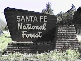
NEAREST CITY/TOWN: Santa Fe
RESERVATIONS: 1-877-444-6777 or make on-line reservation
DIRECTIONS:
In Santa Fe, NM, at intersection of Paseo de Peralta and US Rt.
84/St. Francis Dr. and Santa Fe Ski Basin sign, take Paseo de
Peralta east 1 mile to State Rt. 475 and Ski Basin signs. At
signs, turn left and go 0.2 miles to another State Rt. 475
sign/Artist Rd. Turn right at sign onto Artist Rd. (becomes Hyde
Park Rd. in 0.6 miles) and go 7.2 miles to campground sign. Turn
right at sign into campground.
NOTE: For RVrs, the right turn onto Artist Rd. is tight and
requires slipping briefly into the oncoming lane.
GENERAL COMMENTS:
The elevation 8,400 ft.
The campground is located along scenic Rt. 475 in a canyon among
a nice mixture of Ponderosa pine, aspen and fir. Each site has a
lantern pole. Some parking aprons are slopped and the interior road
is narrow in places. The campground stretches along Tesuque
Creek with some sites overlooking the creek. The tent sites are
walk-in. It is a good location for day trips into Santa Fe and up to
the Ski Basin where there are several trails and magnificent views
of the valley below and aspen groves.
SEASONS
Open Seasonal: Yes
Open All Year: No
Seasonal Comment:
Open May 1 through October 18
RATE AND MAXIMUM STAY PERMITTED
Rate: $10 per day, per vehicle
Maximum Stay Permitted (days): 14
CAMPGROUND SITE CONFIGURATION
No. RV Sites: 0
No. Tent Sites: 6
No. Combined Sites (Tent or RV): 29
Total Sites: 35
Tent Pads: Yes
Open Sites: Yes
Wooded Sites: Yes
No. Tables on Sites: 35
No. Grilles on Sites: 35
Equestrian Camping: No
RV INFORMATION
Hookups: None
No. RV Pull Throughs: 1
Waste Station: No
Average Parking Apron Size: 9' X 50'
Comments:
The parking aprons are paved. Some aprons are "V" shaped, one
side for trailer the other for tow vehicle, etc. A state-owned waste
station with potable water is available for a fee across from
campground entrance.
FACILITIES
Vaults: Yes
Flush Toilets: No
Hot Showers: No
Wheelchair Friendly Toilets: Yes
Public Phone: Yes
Playground: No
No. Water Spigots (non-site): 9
No. Threaded: 9
NOTE: 3/8/2024 - Campground is experiencing a temporary water outage.
Bring all the water you'll need for your visit, including drinking water.
Contact ranger district office for status.
WATER SPORTS - None
HIKING
Borrego Trail - 22 miles
Black Canyon Trail (loop) - 1.5 miles
Both trails are foot, mountain bike & horse)
FISHING - No

CAMPGROUND NAME: Clear Creek
VISIT DATE: 06/08/1999
UPDATE DATE: 3/8/2024
STATE: New Mexico
REGION: Southwestern
RANGER DISTRICT: Cuba
NEAREST CITY/TOWN: Cuba
RESERVATIONS: 1-877-444-6777 or make on-line reservation
DIRECTIONS:
In Cuba, NM, take State Rt. 126 east 11 miles to campground on
left.
GENERAL COMMENTS:
The elevation is 8,300 ft.
The campground stretches up Clear Creek among Douglas fir and
other conifers. The understory is grass and wild flowers with
good separation between sites.
SEASONS
Open Seasonal: Yes
Open All Year: No
Seasonal Comment:
Open May 10 through November 24
RATE AND MAXIMUM STAY PERMITTED
Rate: $10 per day, per vehicle
Maximum Stay Permitted (days): 14
CAMPGROUND SITE CONFIGURATION
No. RV Sites: 0
No. Tent Sites: 0
No. Combined Sites (Tent or RV): 13
Total Sites: 13
Tent Pads: No
Open Sites: Yes
Wooded Sites: Yes
No. Tables on Sites: 13
No. Grilles on Sites: 13
Equestrian Camping: No
RV INFORMATION
Hookups: None
No. RV Pull Throughs: 0
Waste Station: No
Average Parking Apron Size: 13.5' X 46'
Comments:
The parking aprons are paved.
FACILITIES
Vaults: Yes
Flush Toilets: No
Hot Showers: No
Wheelchair Friendly Toilets: Yes
Public Phone: No
Playground: No
No. Water Spigots (non-site): 1
No. Threaded: 0
Comments:
The water spigot is a handpump.
WATER SPORTS - None
HIKING - No
FISHING
Stocked Rainbow trout
CAMPGROUND NAME: El Porvenir
VISIT DATE: 06/04/1999
UPDATE DATE: 3/8/2024
STATE: New Mexico
REGION: Southwestern
RANGER DISTRICT: Pecos/Las Vegas
NEAREST CITY/TOWN: Las Vegas
RESERVATIONS: No
DIRECTIONS:
In Las Vegas, NM, take State Rt. 65 north 13 miles to campground
sign (Forest Rt. 261). Turn right onto Rt. 261 and go 2.6 miles
to campground on right.
NOTE: After Montezuma, NM, road becomes winding and narrow two-
lane.
GENERAL COMMENTS:
The elevation is 7,600 ft.
The campground is located near Hollinger Creek among heavily
wooded Ponderosa pine, Gambel oak, Douglas fir and some Spruce.
It is convenient to the Pecos Wilderness. Some sites have
attractive stone terracing. All tent only sites are walk-in.
This is bear country; practice safe food protection techniques.
SEASONS
Open Seasonal: Yes
Open All Year: No
Seasonal Comment:
Open May 1 through December 31
NOTE: 03/08/2024 - Campground closed in 2024 due to fire damage.
Forest Service hoping to have it reopened in 2025. Contact ranger district
office for status.
RATE AND MAXIMUM STAY PERMITTED
Rate: $8 per day
Maximum Stay Permitted (days): 14
CAMPGROUND SITE CONFIGURATION
No. RV Sites: 0
No. Tent Sites: 3
No. Combined Sites (Tent or RV): 10
Total Sites: 13
Tent Pads: No
Open Sites: No
Wooded Sites: Yes
No. Tables on Sites: 14
No. Grilles on Sites: 14
Equestrian Camping: No
RV INFORMATION
Hookups: None
No. RV Pull Throughs: 5
Waste Station: No
Average Parking Apron Size: 15.5' X 44'
Comments:
The parking aprons are dirt.
FACILITIES
Vaults: Yes
Flush Toilets: No
Hot Showers: No
Wheelchair Friendly Toilets: No
Public Phone: No
Playground: No
No. Water Spigots (non-site): 0
WATER SPORTS - None
HIKING
Herman's Peak (foot & horse) - 4 miles
Porvenir Trail #219 (foot & horse) - leads to network of trails
in the Pecos Wilderness.
FISHING
Rainbow (stocked) and Brown trout
CAMPGROUND NAME: EV Long
VISIT DATE: 06/04/1999
UPDATE DATE: 3/9/2024
STATE: New Mexico
REGION: Southwestern
RANGER DISTRICT: Pecos/Las Vegas
NEAREST CITY/TOWN: Las Vegas
RESERVATIONS: No
DIRECTIONS:
In Las Vegas, NM, take State Rt. 65 north 15.2 miles to Johnson
Mesa sign (at end of pavement). Turn left at sign and go 0.1
miles to campground on right.
NOTE: After Montezuma, NM, road is winding and narrow two-lane.
GENERAL COMMENTS:
The elevation is 7,500 ft.
The campground is located alongside Gallings Creek among
Ponderosa pine, Gambel oak and Douglas fir. Sites are well
separated, but there are some parking aprons with low overhanging
branches.
This is bear country; practice safe food protection techniques.
SEASONS
Open Seasonal: Yes
Open All Year: No
Seasonal Comment:
Open May 1 through October 31.
NOTE: 03/09/2024 - Campground closed in 2024 due to severe damage
from Hermits Peak/Calf Canyon Fire. May not reopen in future. Contact
ranger district office for status.
RATE AND MAXIMUM STAY PERMITTED
Rate: $8 per day
Maximum Stay Permitted (days): 14
CAMPGROUND SITE CONFIGURATION
No. RV Sites: 0
No. Tent Sites: 15
No. Combined Sites (Tent or RV): 6
Total Sites: 21
Tent Pads: No
Open Sites: Yes
Wooded Sites: Yes
No. Tables on Sites: 21
No. Grilles on Sites: 21
Equestrian Camping: No
RV INFORMATION
Hookups: None
No. RV Pull Throughs: 5
Waste Station: No
Average Parking Apron Size: 21' X 32'
Comments:
The parking aprons are dirt and irregular.
FACILITIES
Vaults: Yes
Flush Toilets: No
Hot Showers: No
Wheelchair Friendly Toilets: Yes
Public Phone: No
Playground: No
No. Water Spigots (non-site): 0
WATER SPORTS - None
HIKING - No
FISHING
Rainbow (stocked) and Brown trout
CAMPGROUND NAME: Field Tract
VISIT DATE: 06/03/1999
UPDATE DATE: 3/9/2024
STATE: New Mexico
REGION: Southwestern
RANGER DISTRICT: Pecos/Las Vegas
NEAREST CITY/TOWN: Pecos
RESERVATIONS: 1-877-444-6777 or make on-line reservation
DIRECTIONS:
From Pecos, NM, take State Rt. 63 north 7.8 miles to campground
sign. Turn right at sign into campground.
GENERAL COMMENTS:
The elevation is 7,400 ft.
It is reported if you listen carefully, the Pecos River will talk
to you. Six of the camping sites have log lean-to shelters with
stone fireplaces. The campground is a single loop with a grassy
open center and nicely shaded by Ponderosa and deciduous trees on
the outer edge. The Pecos River runs along the back edge of the
campground. With the grass and pine needle understory and
shelters, the campground has a special character.
SEASONS
Open Seasonal: Yes
Open All Year: No
Seasonal Comment:
May 1 through October 31.
NOTE: 3/8/2024 - Campground temporarily closed in 2024
for restroom rebuild. Contact ranger district office for status.
RATE AND MAXIMUM STAY PERMITTED
Rate: $8 per day
Maximum Stay Permitted (days): 14
CAMPGROUND SITE CONFIGURATION
No. RV Sites: 0
No. Tent Sites: 0
No. Combined Sites (Tent or RV): 14
Total Sites: 14
Tent Pads: No
Open Sites: Yes
Wooded Sites: Yes
No. Tables on Sites: 14
No. Grilles on Sites: 14
Equestrian Camping: No
RV INFORMATION
Hookups: None
No. RV Pull Throughs: 10
Waste Station: No
Average Parking Apron Size: 11.5' X 45'
Comments:
The parking aprons are paved.
FACILITIES
Vaults: Yes
Flush Toilets: Yes
Hot Showers: No
Wheelchair Friendly Toilets: No
Public Phone: No
Playground: No
No. Water Spigots (non-site): 3
No. Threaded: 3
WATER SPORTS - None
HIKING - No
FISHING
Rainbow (stocked) and Brown trout
CAMPGROUND NAME: Holy Ghost
VISIT DATE: 06/03/1999
UPDATE DATE: 3/9/2024
STATE: New Mexico
REGION: Southwestern
RANGER DISTRICT: Pecos/Las Vegas
NEAREST CITY/TOWN: Pecos
RESERVATIONS: No
DIRECTIONS:
From Pecos, NM, take State Rt. 63 north 12 miles to "Y"
intersection (Forest Rt. 122). Bear left at intersection (toward
Holy Ghost, NM) onto Rt. 122 and go 2.5 miles to campground.
NOTE: Forest Rt. 122 is a single-lane, paved roadway loaded with
potholes.
GENERAL COMMENTS:
The elevation is 8,100 ft.
The campground has two sections, upper and lower loops. The
upper loop stretches up a mountainside - all sites are walk-in.
The lower loop runs along Holy Ghost Creek with some sites
overlooking the creek. Generally, the campground extends up a
grassy valley surrounded by Aspen, spruce and a few Ponderosa
pine. This is a tranquil campground with sounds of the creek and
birds all around.
SEASONS
Open Seasonal: Yes
Open All Year: No
Seasonal Comment:
Open May 1 through October 31.
RATE AND MAXIMUM STAY PERMITTED
Rate: $8 per day
Maximum Stay Permitted (days): 14
CAMPGROUND SITE CONFIGURATION
No. RV Sites: 0
No. Tent Sites: 5
No. Combined Sites (Tent or RV): 18
Total Sites: 23
Tent Pads: No
Open Sites: Yes
Wooded Sites: Yes
No. Tables on Sites: 0
No. Grilles on Sites: 22
Equestrian Camping: No
RV INFORMATION
Hookups: None
No. RV Pull Throughs: 2
Waste Station: No
Average Parking Apron Size: 12' X 43'
Comments:
The parking aprons are gravel.
FACILITIES
Vaults: Yes
Flush Toilets: No
Hot Showers: No
Wheelchair Friendly Toilets: Yes
Public Phone: No
Playground: No
No. Water Spigots (non-site): 0
WATER SPORTS - None
Comments:
Wading is possible in Holy Ghost Creek, but should be adult
supervised.
HIKING
Holy Ghost Trail #283 (foot & horse) - 3.3 miles
Provides access to a 350-mile network of trails in the Pecos
Wilderness.
FISHING
Rainbow (stocked) and Brown trout
CAMPGROUND NAME: Jacks Creek
VISIT DATE: 06/03/1999
UPDATE DATE: 3/9/2024
STATE: New Mexico
REGION: Southwestern
RANGER DISTRICT: Pecos/Las Vegas
NEAREST CITY/TOWN: Pecos
RESERVATIONS: No
DIRECTIONS:
From Pecos, NM, take State Rt. 63 north 12 miles to "Y"
intersection. Bear right at intersection (toward Cowles, NM) and
go 8.3 miles to campground.
NOTE: Although the entire route is paved, some portions are
narrow, two-lane curvy roadway.
GENERAL COMMENTS:
The elevation 8,900 ft.
The campground is composed of two sections. One section is
equestrian oriented with trail head. The other is for RVs and
tents. The equestrian section is more open, has long parking
aprons and corrals at most sites. The RV and tent section
stretches out across an Aspen-encircled mountain meadow with a
spectacular view of the Pecos Wilderness and snow-capped Round
Mountain. There are double occupancy sites but with only one
grille. Wildlife visiting the campground include coyote, elk and
deer. Wild flowers such as iris, raspberry, wild roses and
paintbrush are abundant. Although Aspen is the dominant tree,
Spruce and Ponderosa pine are plentiful.
SEASONS
Open Seasonal: Yes
Open All Year: No
Seasonal Comment:
Open May 1 through October 31.
RATE AND MAXIMUM STAY PERMITTED
Rate: $10 per day
Maximum Stay Permitted (days): 14
CAMPGROUND SITE CONFIGURATION
No. RV Sites: 0
No. Tent Sites: 0
No. Combined Sites (Tent or RV): 43
Total Sites: 43
Tent Pads: No
Open Sites: Yes
Wooded Sites: Yes
No. Tables on Sites: 43
No. Grilles on Sites: 36
Equestrian Camping: Yes
RV INFORMATION
Hookups: None
No. RV Pull Throughs: 0
Waste Station: No
Average Parking Apron Size: 16' X 51.5'
Comments:
The parking aprons are gravel.
FACILITIES
Vaults: Yes
Flush Toilets: No
Hot Showers: No
Wheelchair Friendly Toilets: Yes
Public Phone: No
Playground: No
No. Water Spigots (non-site): 7
No. Threaded: 3
WATER SPORTS - None
HIKING
Jacks Creek Trail # 25 - 0.75 miles
Provides access to a 350-mile network of trails in the
Pecos Wilderness
(To) Pecos River - 1.5 miles
(To) Iron Gate Campground - 3.75 miles
All trails are foot and horse only
FISHING - No
CAMPGROUND NAME: Jemez Falls
VISIT DATE: 06/07/1999
UPDATE DATE: 3/9/2024
STATE: New Mexico
REGION: Southwestern
RANGER DISTRICT: Jemez
NEAREST CITY/TOWN: San Ysidro
RESERVATIONS: No
DIRECTIONS:
From San Ysidro, NM, take State Rt. 4 north 24.5 miles to "Y"
intersection. Bear right at intersection, staying on Rt. 4, and
go 5.5 miles to campground sign. Turn right at sign and go 0.8
miles to campground entrance. Turn right into campground.
GENERAL COMMENTS:
The elevation is 7,900 ft.
The campground is composed of four loops among Ponderosa pine.
Each loop features a single water spigot, a wheelchair friendly
vault and a pull-through. The campground is conveniently located
on the scenic Jemez Mountain Trail (State Rt. 4). A few day
trips from the campground are the Jemez Falls, Gilman Tunnels
(old railroad tunnels) and the Bandelier National Monument
(prehistoric volcanic ruins).
SEASONS
Open Seasonal: Yes
Open All Year: No
Seasonal Comment:
Open May 14 through November 29
RATE AND MAXIMUM STAY PERMITTED
Rate: $10 per day, per vehicle
Maximum Stay Permitted (days): 14
CAMPGROUND SITE CONFIGURATION
No. RV Sites: 0
No. Tent Sites: 0
No. Combined Sites (Tent or RV): 51
Total Sites: 51
Tent Pads: No
Open Sites: Yes
Wooded Sites: Yes
No. Tables on Sites: 51
No. Grilles on Sites: 51
Equestrian Camping: No
RV INFORMATION
Hookups: None
No. RV Pull Throughs: 5
Waste Station: No
Average Parking Apron Size: 13' X 50'
Comments:
The parking aprons are paved with a gravel surface. An RV waste
station is available for a fee at Trail's End RV Campground (private)
located 1.2 miles north of the State Rts. 4 and 126 intersection.
FACILITIES
Vaults: Yes
Flush Toilets: No
Hot Showers: No
Wheelchair Friendly Toilets: Yes
Public Phone: No
Playground: No
No. Water Spigots (non-site): 4
Comments:
Each loop has wheelchair friendly vaults.
WATER SPORTS - None
HIKING
Jemez Falls trail head is 0.5 miles beyond the campground
entrance (foot) - 0.3 miles
FISHING - No
CAMPGROUND NAME: Paliza
VISIT DATE: 06/06/1999
UPDATE DATE: 3/11/2024
STATE: New Mexico
REGION: Southwestern
RANGER DISTRICT: Jemez
NEAREST CITY/TOWN: San Ysidra
RESERVATIONS: 1-877-444-6777 or make on-line reservation
DIRECTIONS:
From San Ysidro, NM, take State Rt. 4 north 4.4 miles to State
Rt. 290. Turn right onto Rt. 290 and go 6.9 miles to end of
pavement. Continue straight onto Forest Rt. 10 (gravel) and go
2.2 miles to "Y" intersection. Bear right and then turn right
(almost immediately) into one section of the campground. Or,
bear left and turn left (almost immediately) into second section
of campground.
NOTE: There is no sign representing the campground.
GENERAL COMMENTS:
The elevation is 7,500 ft.
The campground, composed of two sections, is set in a large stand
of Ponderosa pine. Civilian Conservation Corps (CCC) influence
can be found in the log lean-to's scattered throughout the
campground. A small stream runs alongside the campground, which
must be crossed to reach some walk-in tent sites. The section of
campground on the right of the "Y" is a loop containing the
walk-in tent sites and only pull-throughs. The section on the
left side of the "Y" has slightly larger camping sites and no
walk-ins.
SEASONS
Open Seasonal: Yes
Open All Year: No
Comment:
Open May 14 through September 13
RATE AND MAXIMUM STAY PERMITTED
Rate: $8 per day
Maximum Stay Permitted (days): 14
CAMPGROUND SITE CONFIGURATION
No. RV Sites: 0
No. Tent Sites: 3
No. Combined Sites (Tent or RV): 23
Total Sites: 26
Tent Pads: No
Open Sites: No
Wooded Sites: Yes
No. Tables on Sites: 26
No. Grilles on Sites: 26
Equestrian Camping: No
RV INFORMATION
Hookups: None
No. RV Pull Throughs: 3
Waste Station: No
Average Parking Apron Size: 21' X 21'
Comments:
The parking aprons are gravel and dirt. There is an RV waste
station available for a fee at Ponderosa RV Park, Ponderosa, NM.
FACILITIES
Vaults: Yes
Flush Toilets: No
Hot Showers: No
Wheelchair Friendly Toilets: Yes
Public Phone: No
Playground: No
No. Water Spigots (non-site): 0
Comments:
The only wheelchair friendly vaults are on right side of "Y".
WATER SPORTS - None
HIKING - No
FISHING - No
CAMPGROUND NAME: Redondo
VISIT DATE: 06/07/1999
UPDATE DATE: 3/11/2024
STATE: New Mexico
REGION: Southwestern
RANGER DISTRICT: Jemez
NEAREST CITY/TOWN: San Ysidro
RESERVATIONS: No
DIRECTIONS:
From San Ysidro, NM, take State Rt. 4 north 24.5 miles to "Y"
intersection. Bear right, staying on Rt. 4, and go 2.2 miles to
campground sign. Turn left at sign into campground.
GENERAL COMMENTS:
The elevation is 8,100 ft.
The campground is composed of three unnamed loops. The western
side of the campground features "V" shaped parking aprons and lots
of shade. The eastern side has the traditional straight parking aprons
and more open sites. All the loops are located among Ponderosa pine
and some Douglas fir. The campground is conveniently located on the
scenic Jemez Mountain Trail (State Rt. 4). A few day trips from the
campground are the Jemez Falls, Gilman Tunnels (old railroad tunnels)
and the Bandelier National Monument (prehistoric volcanic ruins). Also,
hot springs are located south of campground along State Rt. 4 toward
Jemez Springs. There are hot springs in Jemez Springs too.
SEASONS
Open Seasonal: Yes
Open All Year: No
Seasonal Comment:
Open May 1 through October 22.
RATE AND MAXIMUM STAY PERMITTED
Rate: $10 per day, per vehicle
Maximum Stay Permitted (days): 14
CAMPGROUND SITE CONFIGURATION
No. RV Sites: 0
No. Tent Sites: 0
No. Combined Sites (Tent or RV): 59
Total Sites: 59
Tent Pads: No
Open Sites: Yes
Wooded Sites: Yes
No. Tables on Sites: 59
No. Grilles on Sites: 59
Equestrian Camping: No
RV INFORMATION
Hookups: None
No. RV Pull Throughs: 1
Waste Station: No
Average Parking Apron Size: 13.5' X 36'
Comments:
The parking aprons are paved.
FACILITIES
Vaults: Yes
Flush Toilets: No
Hot Showers: No
Wheelchair Friendly Toilets: No
Public Phone: No
Playground: No
No. Water Spigots (non-site): 0
No. Threaded: 0
WATER SPORTS - None
HIKING - No
FISHING - No
CAMPGROUND NAME: Rio Chama
VISIT DATE: 06/11/1999
UPDATE DATE: 3/11/2024
STATE: New Mexico
REGION: Southwestern
RANGER DISTRICT: Coyote
NEAREST CITY/TOWN: Abiquiu
RESERVATIONS: No
DIRECTIONS:
From Abiquiu, NM, take US Rt. 84 north 15.5 miles to Rio Chama
sign (Forest Rt. 151). Turn left onto Rt. 151 (dirt) and go 11.6
miles to sign ("no camping or picnicking beyond this point").
Turn left into campground.
NOTE: Forest Rt. 151 is eroded, deeply rutted, rough, mostly
single-lane and NOT RV friendly. It is not safe for any vehicle
to travel this road during inclement weather.
GENERAL COMMENTS:
The elevation is 6,400 ft.
The campground, located in a canyon among juniper and oak trees,
is adjacent to the Rio Chama Wild and Scenic River with the Chama
River Canyon Wilderness on both sides. The Rio Chama is
floatable with some sites overlooking the river. The canyon has
been occupied by different cultures since 9500 BC. Contact the
Bureau of Land Management (BLM) on (505) 761-8700 for information
on the river and licensed outfitters. Multi-colored canyon
walls tower some 2,000 feet above the river in places and provide
breathtaking vistas throughout the campground. There are several
interesting day trips from the campground:
(1) Monastery of Christ in the Desert - about 2 miles up from the
campground.
(2) Ghost Ranch Living Museum - on US Rt. 84 about 12 miles north
of Abiquiu, NM.
(3) Ghost Ranch Conservation Center (Paleontology and
Archeological museums) - south of the Ghost Ranch Living Museum
on US Rt. 84.
(4) Drive US Rt. 84 between Abiquiu and Cebolla, NM and take in
the magnificent views of the "Red Rocks" canyons.
SEASONS
Open Seasonal: Yes
Open All Year: No
Seasonal Comment:
Open April 1 through November 30.
NOTE: Not accessible during inclement weather, e.g., monsoons.
RATE AND MAXIMUM STAY PERMITTED
Rate: No charge
Maximum Stay Permitted (days): 14
NOTE: Currently only ten (10) campsites are available to campers.
CAMPGROUND SITE CONFIGURATION
No. RV Sites: 0
No. Tent Sites: 0
No. Combined Sites (Tent or RV): 18
Total Sites: 18
Tent Pads: No
Open Sites: Yes
Wooded Sites: Yes
No. Tables on Sites: 10
No. Grilles on Sites: 8
Equestrian Camping: No
RV INFORMATION
Hookups: None
No. RV Pull Throughs: 0
Waste Station: No
Average Parking Apron Size: 12' X 49'
Comments:
The parking aprons are gravel. Access road (Forest Rt. 151) is
not RV friendly.
FACILITIES
Vaults: Yes
Flush Toilets: No
Hot Showers: No
Wheelchair Friendly Toilets: Yes
Public Phone: No
Playground: No
No. Water Spigots (non-site): 0
No. Threaded: 0
WATER SPORTS
Lake: No
Swimming (provided): No
Sailing: No
Boat Ramp: No
Boat Carry Down Access: Yes
Power Boating: No
Boating (no power): Yes
Water Skiing: No
Rafting (whitewater): Yes
Kayaking (whitewater): Yes
Comments:
The Big Eddy Takeout for the Rio Chama is 3.3 miles downstream
from the campground on Forest Rt. 151.
HIKING - No
FISHING
Brown and Rainbow Trout
CAMPGROUND NAME: Rio de Las Vacas
VISIT DATE: 06/08/1999
UPDATE DATE: 3/11/2024
STATE: New Mexico
REGION: Southwestern
RANGER DISTRICT: Cuba
NEAREST CITY/TOWN: Cuba
RESERVATIONS: 1-877-444-6777 or make on-line reservation
DIRECTIONS:
In Cuba, NM, take State Rt. 126 east 12.2 miles to campground on
left.
GENERAL COMMENTS:
The elevation is 8,160 ft.
Under Ponderosa and other conifer trees, the campground is a
single loop with one side adjacent to Rio Las Vacas (river). The
understory is grass and pine needles. The San Pedro Park
Wilderness is 5 miles away with a 37-mile network of trails.
Some sites overlook the river and others overlook a park-like
meadow.
SEASONS
Open Seasonal: Yes
Open All Year: No
Seasonal Comment:
Open May 10 through November 22 - weather dependent
RATE AND MAXIMUM STAY PERMITTED
Rate: $10 per day, per vehicle
Maximum Stay Permitted (days): 14
CAMPGROUND SITE CONFIGURATION
No. RV Sites: 0
No. Tent Sites: 0
No. Combined Sites (Tent or RV): 15
Total Sites: 15
Tent Pads: No
Open Sites: Yes
Wooded Sites: Yes
No. Tables on Sites: 15
No. Grilles on Sites: 15
Equestrian Camping: No
RV INFORMATION
Hookups: None
No. RV Pull Throughs: 0
Waste Station: No
Average Parking Apron Size: 15.5' X 50'
Comments:
The parking aprons are paved. The interior road is a tear-drop
shape making it difficult for RVrs to make a second pass.
FACILITIES
Vaults: Yes
Flush Toilets: No
Hot Showers: No
Wheelchair Friendly Toilets: Yes
Public Phone: No
Playground: No
No. Water Spigots (non-site): 1
No. Threaded: 0
Comments:
The water spigot is a handpump.
WATER SPORTS - None
Comments:
Wading is possible in the Rio Las Vacas.
HIKING - No
FISHING
Rainbow (stocked) and Brown trout.
CAMPGROUND NAME: San Antonio
VISIT DATE: 06/07/1999
UPDATE DATE: 3/11/2024
STATE: New Mexico
REGION: Southwestern
RANGER DISTRICT: Jemez
NEAREST CITY/TOWN: San Ysidro
RESERVATIONS: 1-877-444-6777 or make on-line reservation
DIRECTIONS:
From San Ysidro, NM, take State Rt. 4 north 24.5 miles to "Y"
intersection. Bear left at intersection onto State Rt. 129 and
go 1.6 miles to campground sign. Turn left into campground.
GENERAL COMMENTS:
The elevation is 7,800 ft.
The campground stretches along San Antonio Creek under a young
stand of Ponderosa pines. Some sites are adjacent to the creek.
Sites 1 through 9 are walk-ins next to an open grassy area -
ideal for group gatherings. Sites 36 through 43 are wheelchair
friendly walk-ins with two communal fire pits for group
gatherings. Some sites located to the left of entrance have "V"
shaped parking aprons and grey water disposal facility.
NOTE: Campground fills quickly; reservations are recommended.
SEASONS
Open Seasonal: Yes
Open All Year: No
Seasonal Comment:
Open April 14 through October 28
RATE AND MAXIMUM STAY PERMITTED
Rate: $10 per day - no hookups
$15 per day - electric and water hookups
Maximum Stay Permitted (days): 14
CAMPGROUND SITE CONFIGURATION
No. RV Sites: 0
No. Tent Sites: 12
No. Combined Sites (Tent or RV): 18
Total Sites: 30
Tent Pads: No
Open Sites: Yes
Wooded Sites: Yes
No. Tables on Sites: 30
No. Grilles on Sites: 30
Equestrian Camping: No
RV INFORMATION
No. Full Hookups (includes waste): 0
No. Water and Electric Only: 0
No. Water Only: 0
No. Electric Only: 6
No. RV Pull Throughs: 0
Waste Station: No
Average Parking Apron Size: 14' X 35'
Comments:
The parking aprons are paved. There is grey water disposal
facility at some sites. An RV waste station is available for a
fee at Trail's End RV Campground (private) located 1.2 miles
north of the State Rts. 4 and 126 intersection.
FACILITIES
Vaults: Yes
Flush Toilets: No
Hot Showers: No
Wheelchair Friendly Toilets: Yes
Public Phone: No
Playground: No
No. Water Spigots (non-site): 4
No. Threaded: 0
Comments:
The only wheelchair friendly toilet is located in the cluster of
walk-in tent sites, 36 through 43. Check ranger district office
for potable water availability.
WATER SPORTS - None
Comments:
Wading is possible in San Antonio Creek
HIKING - No
FISHING
Stocked Rainbow trout.
CAMPGROUND NAME: Vista Linda
VISIT DATE: 06/07/1999
UPDATE DATE: 3/11/2024
STATE: New Mexico
REGION: Southwestern
RANGER DISTRICT: Jemez
NEAREST CITY/TOWN: San Ysidro
RESERVATIONS: No
DIRECTIONS:
From San Ysidro, NM, take State Rt. 4 north 11.5 miles to
campground sign. Turn left at sign into campground.
GENERAL COMMENTS:
The elevation is 5,800 ft.
The campground, among juniper, cholla, prickly pear and
cottonwoods, stretches along the Jemez River with some sites
overlooking the river. Each site has a panoramic view of the
multi-colored walls of Jemez Canyon. The campground is
conveniently located off State Rt. 4 (Jemez Mountain Trail), a
designated scenic route. A wheelchair friendly paved walkway
provides easy access for all to the river and bank fishing.
Several sites have ramada-like structures. The campground is
well laid out and is almost as attractive as the view. Several
day trips should be considered, such as Jemez Springs Bathhouse,
Jemez Pueblo, Jemez State Monument and others.
SEASONS
Open Seasonal: No
Open All Year: Yes
RATE AND MAXIMUM STAY PERMITTED
Rate: $10 per day, per vehicle
Maximum Stay Permitted (days): 14
CAMPGROUND SITE CONFIGURATION
No. RV Sites: 0
No. Tent Sites: 0
No. Combined Sites (Tent or RV): 13
Total Sites: 13
Tent Pads: Yes
Open Sites: Yes
Wooded Sites: No
No. Tables on Sites: 13
No. Grilles on Sites: 13
Equestrian Camping: No
RV INFORMATION
Hookups: None
No. RV Pull Throughs: 1
Waste Station: No
Average Parking Apron Size: 16' X 45'
Comments:
The parking aprons are paved.
FACILITIES
Vaults: Yes
Flush Toilets: No
Hot Showers: No
Wheelchair Friendly Toilets: Yes
Public Phone: No
Playground: No
No. Water Spigots (non-site): 2
No. Threaded: 0
WATER SPORTS - None
HIKING - No
FISHING
Rainbow trout (stocked). There are wheelchair friendly fishing
locations along the bank of the Jemez River.
|