Campground List
CAMPGROUND NAME: Coal Mine Canyon
VISIT DATE: 05/28/1999
UPDATE DATE: 02/21/2024
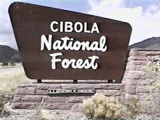
STATE: New Mexico
REGION: Southwestern
RANGER DISTRICT: Mt. Taylor
NEAREST CITY/TOWN: Grants
RESERVATIONS: 1-877-444-6777 or make on-line reservation
DIRECTIONS:
In Grants, NM, at intersection of State Rt. 122 (Santa Fe Ave.)
and First St., take First St. north and go 0.9 miles to Roosevelt
Ave. (State Rt. 547). Turn right onto Rt. 547 and go 0.4 miles
to Lobo Canyon. Turn left, staying on Rt. 547, and go 9.7 miles
to campground sign. Turn right at sign into campground.
GENERAL COMMENTS:
The elevation is 7,400 ft.
The campground is a single loop with sites on an uphill and
downhill side. The downhill side has sites with some shade from
mature Ponderosa pine, juniper and Gambel oaks. The uphill sites
lack shade, but are dotted with with juniper and Gambel oaks. The
uphill sites also feature stone walls for table and grille area.
A deep sink is located at the bathroom for dish washing.
SEASONS
Open Seasonal: Yes
Open All Year: No
Seasonal Comment:
Open May 15 through October 15
RATE AND MAXIMUM STAY PERMITTED
Rate: $5 per day
Maximum Stay Permitted (days): 14
CAMPGROUND SITE CONFIGURATION
No. RV Sites: 0
No. Tent Sites: 0
No. Combined Sites (Tent or RV): 15
Total Sites: 17
Tent Pads: No
Open Sites: Yes
Wooded Sites: Yes
No. Tables on Sites: 16
No. Grilles on Sites: 15
Equestrian Camping: No
RV INFORMATION
Hookups: None
No. RV Pull Throughs: 6
Waste Station: No
Average Parking Apron Size: 11' X 45'
Comments:
Some parking aprons are paved and others are gravel. An RV
waste station is available for a fee at the Lavaland Campground
(private), south of Interstate 40 just off Exit 85.
FACILITIES
Vaults: Yes
Flush Toilets: No
Hot Showers: No
Wheelchair Friendly Toilets: Yes
Public Phone: No
Playground: No
No. Water Spigots: 0
WATER SPORTS - None
HIKING
Coal Mine Nature Trail (foot) - 0.25 miles
FISHING - No

CAMPGROUND NAME: Fourth of July

VISIT DATE: 05/25/1999

UPDATE DATE: 02/21/2024

STATE: New Mexico

REGION: Southwestern

RANGER DISTRICT: Mountainair

NEAREST CITY/TOWN: Tajique

RESERVATIONS: No

DIRECTIONS:
In Tajique, NM, take AO13/Forest Rt. 55 (gravel) west 7.1 miles
to an intersecting road on the right.  Turn right (campground
sign will be visible after turn) into campground.

NOTE: Forest Rt. 55 becomes dirt, rough and single-lane roadway.

GENERAL COMMENTS:
The elevation is 7,500 ft.

The campground is composed of two loops - Gallo and Masca.  The
sites are nestled among a leafy middlestory of maple and oak and
an overstory of Ponderosa pine.  The variety and density of the
maples and oaks make this campground a delightful fall forest
experience.

NOTE: Only pop-up tent trailers and tents are permitted.

This is bear and cougar country; practice safe food storage
techniques.

SEASONS
Open Seasonal: Yes
Open All Year: No

Seasonal Comment:
Open April 1 through November 30 - weather dependent

RATE AND MAXIMUM STAY PERMITTED
Rate: $7 per day
Maximum Stay Permitted (days): 14

CAMPGROUND SITE CONFIGURATION
No. RV Sites: 0
No. Tent Sites: 5
No. Combined Sites (Tent or RV): 20

   Total Sites: 25

Tent Pads: No
Open Sites: Yes
Wooded Sites: Yes

No. Tables on Sites: 24
No. Grilles on Sites: 24
Equestrian Camping:  No

RV INFORMATION
Hookups: None
No. RV Pull Throughs: 0
Waste Station: No
Average Parking Apron Size: 12' X 33'

Comments:
The parking aprons are gravel.  Only pop-up tent
trailers (and tents) are permitted.

FACILITIES
Vaults: Yes
Flush Toilets: No
Hot Showers: No
Wheelchair Friendly Toilets: Yes

Public Phone: No
Playground: No
No. Water Spigots: 0
  No. Threaded: 0

WATER SPORTS - None

HIKING
Crimson Maple Trail (foot) - 0.5 miles
Spring Trail Loop (foot) - 0.25 miles
Fourth of July Trail #173 (foot and horse) - 1.3 miles
    Provides access to Manzano Mountain Wilderness

FISHING - No
CAMPGROUND NAME: McGaffey

VISIT DATE: 05/29/1999

UPDATE DATE: 2/22/2024

STATE: New Mexico

REGION: Southwestern

RANGER DISTRICT: Mt. Taylor

NEAREST CITY/TOWN: Gallup

RESERVATIONS: No

DIRECTIONS:
From the east side of Gallup, NM, on State Rt. 118, take
Interstate 40 east 7.6 miles to Exit 33 (McGaffey - State Rt.
400).  At end of exit ramp, turn right onto Rt. 400 and go 7.8
miles to campground sign.  Turn right at sign onto a gravel road
and go 0.4 miles to campground entrance.

GENERAL COMMENTS:
The elevation is 7,640 ft.

The campground, one of two in the McGaffey Lake Recreation Area,
is located 0.5 miles from McGaffey Lake.  The sites are
comfortably located in Ponderosa pine with good separation.  Some
sites have a scenic view of grassy fields.  All sites have
attractive fire pits with a stone ledge around them.  All tent
sites are walk-in.  Historic US Rt. 66 passes through Gallup, NM.

SEASONS
Open Seasonal: Yes
Open All Year: No

Seasonal Comment:
Open May 15 through October 15

RATE AND MAXIMUM STAY PERMITTED
Rate: $10 per day
Maximum Stay Permitted (days): 14

CAMPGROUND SITE CONFIGURATION
No. RV Sites: 0
No. Tent Sites: 19
No. Combined Sites (Tent or RV): 10

   Total Sites: 29

Tent Pads: No
Open Sites: Yes
Wooded Sites: Yes

No. Tables on Sites: 29
No. Grilles on Sites: 29
Equestrian Camping:  No

RV INFORMATION
Hookups: None
No. RV Pull Throughs: 10
Waste Station: No
Average Parking Apron Size: See RV Comments

Comments:
The parking aprons are gravel.  The pull-throughs will
accommodate almost any size RV.

FACILITIES
Vaults: Yes
Flush Toilets: No
Hot Showers: No
Wheelchair Friendly Toilets: Yes

Public Phone: No
Playground: No
No. Water Spigots: 0

WATER SPORTS
Lake: Yes
Swimming (provided): No
Sailing: No
Boat Ramp: No
Boat Carry Down Access: No
Power Boating: Yes
Boating (no power): Yes
Water Skiing: No
Rafting (whitewater): No
Kayaking (whitewater): No

Comments:
McGaffey Lake is 3 acres.  Electric motors only.

HIKING
Strawberry Canyon Nature Trail (foot, mountain bike &
interpretive) - 1.5 miles

FISHING
Catfish, Rainbow and Triploid trout
CAMPGROUND NAME: New Canyon

VISIT DATE: 05/25/1999

UPDATE DATE: 2/22/2024

STATE: New Mexico

REGION: Southwestern

RANGER DISTRICT: Mountainair

NEAREST CITY/TOWN: Tajique

RESERVATIONS: No

DIRECTIONS:
From Tajique, NM, take State Rt. 55 south 8.8 miles to campground
sign (County Rt. B065).  Turn right onto Rt. B065 and go 0.3
miles to "Y" intersection.  Bear right onto Forest Rt. 245 and go
4.5 miles to campground.

NOTE: Starting with County Rt. B065, the roads are dirt.  Forest
Rt. 245 is rough, single-lane and steep in places.

GENERAL COMMENTS:
The elevation is 7,800 ft.

The campground, rustic and secluded, is located along the side of
a canyon among a mixture of pine and oak trees.  Some sites have
good separation providing privacy.  Stonework created by the
Civilian Conservation Corps (CCC) is evident throughout the
campground.  There are some rather pleasant disbursed camping
sites along Forest Rt. 245 on the way to campground.

SEASONS
Open Seasonal: Yes
Open All Year: No

Seasonal Comment:
Open April 1 through November 30

RATE AND MAXIMUM STAY PERMITTED
Rate: No charge
Maximum Stay Permitted (days): 14

CAMPGROUND SITE CONFIGURATION
No. RV Sites: 0
No. Tent Sites: 10
No. Combined Sites (Tent or RV): 0

   Total Sites: 10

Tent Pads: No
Open Sites: No
Wooded Sites: Yes

No. Tables on Sites: 10
No. Grilles on Sites: 9
Equestrian Camping:  No

FACILITIES
Vaults: Yes
Flush Toilets: No
Hot Showers: No
Wheelchair Friendly Toilets: No

Public Phone: No
Playground: No
No. Water Spigots: 0

WATER SPORTS - None

HIKING
New Canyon Trail #101 (foot and horse) - 2.1 miles
   Provides access to the Manzano Mountain
   Wilderness

FISHING - No
CAMPGROUND NAME: Ojo Redondo

VISIT DATE: 05/29/1999

UPDATE DATE: 02/22/2024

STATE: New Mexico

REGION: Southwestern

RANGER DISTRICT: Mt. Taylor

NEAREST CITY/TOWN: Thoreau

RESERVATIONS: No

DIRECTIONS:
In Thoreau, NM, take State Rt. 612 south 13.9 miles to end of
pavement.  Continue straight onto gravel roadway (unmarked Forest
Rt. 178) and go 9.2 miles to "T" intersection and campground
sign.  Turn left at intersection and go 2.7 miles on unmarked
Forest Rt. 480 to campground sign.  Turn right into campground.

NOTE: Forest Rt. 480 is single-lane with few turnouts.

GENERAL COMMENTS:
The elevation is 8,900 ft.

The campground, pack it in, pack it out, is located at the end of
a scenic drive beside a very pretty meadow among Ponderosa pine,
Douglas fir and aspen.  The campground name is old Spanish name
meaning "round spring."  The adjacent meadow features a
meandering stream which attracts a variety of wild life.

SEASONS
Open Seasonal: No
Open All Year: Open May 15 to October 15

RATE AND MAXIMUM STAY PERMITTED
Rate: No charge
Maximum Stay Permitted (days): 14

CAMPGROUND SITE CONFIGURATION
No. RV Sites: 0
No. Tent Sites: 13
No. Combined Sites (Tent or RV): 2

   Total Sites: 15

Tent Pads: No
Open Sites: Yes
Wooded Sites: Yes

No. Tables on Sites: 15
No. Grilles on Sites: 15
Equestrian Camping:  No

RV INFORMATION
Hookups: None
No. RV Pull Throughs: 2
Waste Station: No
Average Parking Apron Size: Not Applicable

Comments:
The parallel parking aprons are gravel.

FACILITIES
Vaults: Yes
Flush Toilets: No
Hot Showers: No
Wheelchair Friendly Toilets: No

Public Phone: No
Playground: No
No. Water Spigots: 0

WATER SPORTS - None

HIKING - No

FISHING - No
CAMPGROUND NAME: Quaking Aspen

VISIT DATE: 05/29/1999

UPDATE DATE: 02/22/2024

STATE: New Mexico

REGION: Southwestern

RANGER DISTRICT: Mt. Taylor

NEAREST CITY/TOWN: Gallup

RESERVATIONS: No

DIRECTIONS:
From the east side of Gallup, NM, on State Rt. 118, take
Interstate 40 east 7.6 miles to Exit 33 (McGaffey - State Rt.
400).  At end of exit ramp, turn right onto Rt. 400 and go 5.3
miles to campground sign.  Turn right at sign into campground.

GENERAL COMMENTS:
The elevation is 7,600 ft.

The campground, one of two in the McGaffey Lake Recreation Area,
is located 3 miles from McGaffey Lake.  It is rustic with
Ponderosa pine and Gambel oak.  Grassy fields in the area make
for potential wild life viewing.  Tear-drop interior road
makes it difficult for RVs to make a second pass.  Historic US
Rt. 66 passes through Gallup, NM.

SEASONS
Open Seasonal: Yes
Open All Year: No

Seasonal Comment:
Open May 15 through October 15

RATE AND MAXIMUM STAY PERMITTED
Rate: $5 per day
Maximum Stay Permitted (days): 14

CAMPGROUND SITE CONFIGURATION
No. RV Sites: 0
No. Tent Sites: 0
No. Combined Sites (Tent or RV): 13

   Total Sites: 13

Tent Pads: Yes
Open Sites: Yes
Wooded Sites: Yes

No. Tables on Sites: 13
No. Grilles on Sites: 13
Equestrian Camping:  No

RV INFORMATION
Hookups: None
No. RV Pull Throughs: 8
Waste Station: No
Average Parking Apron Size: 18' X 32'

Comments:
The parking aprons are gravel.  Pull-throughs can
accommodate large RVs.

FACILITIES
Vaults: Yes
Flush Toilets: No
Hot Showers: No
Wheelchair Friendly Toilets: No

Public Phone: No
Playground: No
No. Water Spigots: 0

WATER SPORTS
Lake: Yes
Swimming (provided): No
Sailing: No
Boat Ramp: No
Boat Carry Down Access: No
Power Boating: Yes
Boating (no power): Yes
Water Skiing: No
Rafting (whitewater): No
Kayaking (whitewater): No

Comments:
McGaffey Lake is 3 acres; electric motors only.

HIKING
Strawberry Canyon Nature Trail (foot, mountain bike,
interpretive) - 1.5 miles.  The trail is located in McGaffey
campground, about 2 miles further down State Rt. 400.

FISHING
Catfish, Rainbow and Triploid trout
CAMPGROUND NAME: Red Canyon

VISIT DATE: 05/27/1999

UPDATE DATE: 02/22/2024

STATE: New Mexico

REGION: Southwestern

RANGER DISTRICT: Mountainair

NEAREST CITY/TOWN: Tajique

RESERVATIONS: No

DIRECTIONS:
From Tajique, NM, take State Rt. 55 south 9.1 miles to campground
sign at "Y" intersection.  Bear right at sign onto State Rt. 131
and go 2.4 miles to another campground sign.  Turn right at sign
and go 2.4 miles to another "Y" intersection.  Bear right and go
0.8 miles to equestrian section.  Bear left and go 0.1 miles to
RV/tent section.

NOTE: Access road is single-lane and turns into gravel after 0.5
miles.

GENERAL COMMENTS:
The elevation is 8,000 ft.

The campground is composed of two sections - Upper/Horse camp and
Lower/RV and tent camp.  The equestrian section is the smaller section
and includes small corrals.   Horses are not permitted in the larger
Lower section but all campers are welcomed in the Upper section.  The
campground is nicely wooded with Ponderosa, juniper and a variety of other
conifers and is convenient to Manzano Mountain Wilderness. It seems
undiscovered and is excellent destination for hikers and horseback riders.

SEASONS
Open Seasonal: Yes
Open All Year: No

Seasonal Comment:
Open April 1 through November 30

RATE AND MAXIMUM STAY PERMITTED
Rate: $7 per day
Maximum Stay Permitted (days): 14

CAMPGROUND SITE CONFIGURATION
No. RV Sites: 0
No. Tent Sites: 0
No. Combined Sites (Tent or RV): 38

   Total Sites: 38

Tent Pads: No
Open Sites: Yes
Wooded Sites: Yes

No. Tables on Sites: 11
No. Grilles on Sites: 11
Equestrian Camping:  Yes

RV INFORMATION
Hookups: None
No. RV Pull Throughs: 9
Waste Station: No
Average Parking Apron Size: 12' X 36'

Comments:
The parking aprons are gravel.  An RV waste station with
potable water is available for a fee at the nearby Manzano
State Park.

FACILITIES
Vaults: Yes
Flush Toilets: No
Hot Showers: No
Wheelchair Friendly Toilets: Yes

Public Phone: No
Playground: No
No. Water Spigots: 0

WATER SPORTS - None

HIKING
Spruce Spring Trail #189 - 3.4 miles
Red Canyon Trail #89 - 2.4 miles
Box Canyon Trail #99 - 1.4 miles

All trails are foot and horse and access the Manzano Mountain
Wilderness.

FISHING - No
|