Forest Information
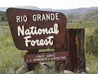
The Rio Grande National Forest is located in south central
Colorado and consists of 1,849,414 acres. There are 36 developed
campgrounds of which 27 meet the selection criteria.
The Rio Grande National Forest is a land of variety and it is that variety which gives this Forest its recreational diversity. From rugged, jagged peaks to fast flowing waterways, forested table lands to glacial canyons, high mountain lakes to open prairies, the outdoor enthusiast will find many activities supported by some fabulous camping locations from which to choose.
The Rio Grande National Forest holds the headwaters for the third longest river in the United States of America, the Rio Grande del Norte. Here, the Rio Grande is a fast flowing stream that winds down mountainsides, through woods, and across wide valleys on its long trip to the Gulf of Mexico. Early on it journey, the Rio Grande, full of trout for the angler and whitewater to challenge kayakers, flows past Thirty-Mile and River Hill campgrounds and the Weminuche Wilderness. While small recreational vehicles (RV) and motorhomes might be accommodated, these campgrounds are well-suited to car and tent camping enthusiasts.
Further downstream the Rio Grande widens in appearance to become a lazy flowing river. Here are two more campgrounds,Marshall Park
and Palisade.. Located between State Route 149 and the Rio, these campgrounds provide on/off access for overnight campers as well as easy access to the challenge of fly fishing on this portion of the Rio and pleasant locations to explore the area. A nice day trip from either camping location is the community of Creede. From its tiny Museum to the Creede Fire Station, which is actually a man-made cave carved into the mountain's side, Creede is an interesting example of a former booming Colorado mining town.
Creede is just one example of where history and nature merge on the Rio Grande National Forest. Another place is near the Cathedral campground - Fremont's Christmas Camp. The long drive to this campground adds to the understanding of the history and drama of this location. In 1848, John Charles Fremont, attempted a winter crossing of the Rocky Mountains in search of a transcontinental railroad route. The expedition was a disaster; 11 of the 36 men and all 120 mules perished. (A permanent exhibit of this disastrous expedition, open to the public, is located at the Rio Grande County Museum in Del Norte, Colorado.) Concern for Colorado's harsh winter conditions continued through the 19th century and well into the 20th. Several additional "ghost" towns can be found within the Rio Grande National Forest's boundaries. (Check with the Ranger District Office or a local bookstore for literature on locations and history.)
Rock-climbers and four-wheel drive enthusiasts might find the area around the Poso campground their "pot of gold." The nearby Penitente Canyon, once a place of worship for a small sect of Catholic men, contains perhaps the best concentration of high quality rock climbing routes in the region. This site attracts climbers from around the world and has received their glowing critiques. In addition, the adjacent BLM and Forest lands offer miles upon miles of 4WD designated routes (for those who prefer their routes to be a little more horizontal than vertical).
Although no developed campgrounds will be found in any of the Rio Grande National Forest's three wilderness areas (only dispersed, or undeveloped camping, is permitted and therefore not included in this campground review), several campgrounds provide access to these areas. As stated earlier, Thirty-Mile and River Hill campgrounds are adjacent to the Weminuche Wilderness. Named for the native people who used this area long before the appearance of the white man, Weminuche is the largest and by far the most popular of the Rio Grande's wildernesses. This Wilderness contains a spectacular region of the San Juan Mountains, the youngest and most rugged of Colorado's mountain ranges. The average elevation in this Wilderness is 10,000 feet with the Mt. Aeoulus, Sunlight and Windom well above that. Some 400 miles of trails, such as Squaw Creek Trail #814 and the Continental Divide National Scenic Trail, criss-cross the area and provide visitors a great way to discover the wonders of this Wilderness.
The Sangre de Cristo Wilderness, to the east, runs north to south as do the mountains that give this Wilderness its name. These mountains, Sangre de Cristo, were named, so the legend says, by a Spanish priest who, as he lay dying, remarked the mountains at sunset were as red as the Blood of Christ. These mountains are older than ones in the Weminuche and do not have the same spectacular rugged appearance but have a special beauty of their own. North Crestonee campground is an excellent base camp from which to explore the Sangre de Cristo Wilderness, the Luis Maria Baca No.4 Grant, and the uniquely different town of Crestone.
La Garita Wilderness is the smallest wilderness area within the Rio Grande National Forest and probably the least "discovered." There are no developed campgrounds within six miles of this Wilderness so one can wander around La Garita Wilderness' pristine environment with its unusual geological formations and not see another person for perhaps days.
The Rio Grande's headwaters have given this National Forest its name but there is a lot more to this place than just a river. The Rio Grande National Forest combines nature with history, challenges with success, solitude with a sense of community. It is a land where the rugged beauty of mountains meet the gentle strength of water to provide a great variety of recreation opportunities.
ADDRESSES
SUPERVISOR ADDRESS
1055 9th St.
Del Norte, Colorado 81132
719-657-5017

RANGER DISTRICT ADDRESSES
Conejos Peak
15571 County Road T-5
La Jara, Colorado 81140
719-274-8971

Divide
13308 W. Hwy 160
Del Norte, Colorado 81132
719-657-3321

Saguache
46525 St Hwy. 114
Saguache, Colorado 81149
719-655-2547 |