Campground List
CAMPGROUND NAME: Bessey Recreation Area
VISIT DATE: 06/19/1997
UPDATE DATE: 9/29/2025
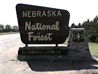
STATE: Nebraska
REGION: Rocky Mountain
RANGER DISTRICT: Bessey
NEAREST CITY/TOWN: Dunning
RESERVATIONS: 1-877-444-6777 or make on-line reservation
DIRECTIONS:
From Dunning, NE, take State Rt. 2 west 10 miles to Halsey, NE. Continue west
on Rt. 2 for 1.1 miles to Nebraska Recreation Area sign (State Spur 86B). Turn
left onto State Spur 86B and go 0.2 miles to campground entrance.
GENERAL COMMENTS:
The elevation is 2,880 ft.
The campground, a.k.a. Bessey Recreation Complex, is adjacent to Middle
Loup River. It is not just simply a recreation area but a recreation complex
with tubing opportunities, volleyball, basketball, horseshoe pits, and baseball
field. An interpretive program may be provided upon request. Drive or
hike to the Scott Lookout Tower. There, one has a wonderful panoramic view
of Nebraska's sand hills and prairie. Most of the plants and trees in the
campground are not native. Many, such as Douglas fir, Ginkgo and Norway
spruce, were planted just to see if they would grow and thrive in Nebraska's
sandy soil.
The campground is composed of three loops - Hardwood, Cedar and River and
is next to the oldest tree nursery in the United States Forest Service. The
Nebraska National Forest represents the largest hand-planted forested area in
the United States. The forest provides access to OHVs. Dirt bikes and ATVs
can be ridden from the campground site to trailhead only and back -
no free-wheeling in the campground.
SEASONS
Open Seasonal: No
Open All Year: Yes
Comments:
Reservations April 1 through October 31. Showers and flush toilets
avaialable mid-May to mid-October - weather dependent.
RATE AND MAXIMUM STAY PERMITTED
Rate: $15 per day - no electric hookups
$20 per day - w/ electric hookups
NOTE: Scan and Pay used for on-site payments through Rec.gov app.
Load and setup app before arrival.
Maximum Stay Permitted (days): 14
CAMPGROUND SITE CONFIGURATION
No. RV Sites: 0
No. Tent Sites: 4
No. Combined Sites (Tent or RV): 30
Total Sites: 34
Tent Pads: Yes
Open Sites: Yes
Wooded Sites: Yes
Equestrian Camping: No
No. Tables on Sites: 34
No. Grilles on Sites: 34
RV INFORMATION
No. Full Hookups (includes waste): 0
No. Water and Electric Only: 0
No. Water Only: 0
No. Electric Only: 22
No. RV Pull Throughs: 1
Waste Station: Yes
Potable Water at Waste Station: Yes
Average Parking Apron Size: 12' X 45'
Comments:
Hardwood Loop has paved aprons has one electric hookup. Cedar
and River Loops have sand, dirt and cement aprons, some with
electric hookups.
FACILITIES
Vaults: Yes
Flush Toilets: Yes
Hot Showers: Yes
Wheelchair Friendly Toilets: Yes
Public Phone: Yes
Playground: No
No. Water Spigots (non-site): 4
No. Threaded: 4
Comments:
Hot showers are wheelchair facilities.
WATER SPORTS
Lake: No
Swimming (provided): No
Sailing: No
Boat Ramp: No
Boat Carry Down Access: Yes
Power Boating: No
Boating (no power): Yes
Water Skiing: No
Rafting (whitewater): No
Kayaking (whitewater): No
Comments:
Middle Loup River is shallow and steady flowing. It is good for
tubing and fair for canoeing. Campers can bring their own
equipment. There is one outfitter; call the the Ranger District
Office for information.
HIKING
Scott Lookout Tower Trail (foot only) - 3 miles
Forest is unlimited to foot and horseback but OHVs are limited to
designated trails.
FISHING
There is 7-acre pond with stocked Largemouth bass, sunfish, crappie
and catfish. There is also a cleaning station and wheelchair friendly
fishing pier.

CAMPGROUND NAME: Natick Horse Camp
VISIT DATE: 10/27/2011
UPDATE DATE: 9/29/2025
STATE: Nebraska
REGION: Rocky Mountain
RANGER DISTRICT: Bessey
NEAREST CITY/TOWN: Dunning
RESERVATIONS: No
DIRECTIONS:
From Dunning, NE, take State Rt. 2 west 10 miles to Halsey, NE. Continue
west on Rt. 2 for 2 miles to a "Y" intersection. Bare right onto Circle Rd.
and go 6 miles to Natick Rd sign. Turn right, onto Natick Rd. and go 0.7 miles
to campground on right.
NOTE: Route is based on provided GPS coordinates. Circle and Nantack roads
are gravel.
GENERAL COMMENTS:
The elevation is 2900 feet.
The campground stretches along Natick Rd. Although there are Ponderosa pine
providing some shade, the lack of middlestory and sites located close to each
other, results in poor privacy. This campground features post stalls, a stock
water tank and lots of open prairie for riding.
NOTE: This campground came on-line after the authors visit. Data provided by
the Bessey Ranger District office.
SEASONS
Open Seasonal: No
Open All Year: Yes
RATE AND MAXIMUM STAY PERMITTED
Rate: $15 per day
Maximum Stay Permitted (days): 14
CAMPGROUND SITE CONFIGURATION
No. RV Sites: 0
No. Tent Sites: 0
No. Combined Sites (Tent or RV): 17
Total Sites: 17
Tent Pads: Yes
Open Sites: Yes
Wooded Sites: Yes
Equestrian Camping: Yes
No. Tables on Sites: 17
No. Grilles on Sites: 2
RV INFORMATION
Hookups: None
No. RV Pull Throughs: 0
Waste Station: No
Average Parking Apron Size: 10' by 37'
Comments:
The parking aprons are gravel. An RV waste station is available at Bessey
Recreation Area.
FACILITIES
Vaults: Yes
Flush Toilets: No
Hot Showers: No
Wheelchair Friendly Toilets: Yes
Public Phone: No
Playground: No
No. Water Spigots (non-site): 1
No. Threaded: 0
Comments:
The water spigot is a handpump.
WATER SPORTS - None
HIKING
Hiking: Yes
Comments:
There are no designated trails but the whole forest is open for riding and
hiking.
FISHING - No
CAMPGROUND NAME: Red Cloud
VISIT DATE: 06/24/1997
UPDATE DATE: 9/29/2025
STATE: Nebraska
REGION: Rocky Mountain
RANGER DISTRICT: Pine Ridge
NEAREST CITY/TOWN: Chadron
RESERVATIONS: No
DIRECTIONS:
In Chadron, NE, at the intersection of US Rts. 20 and 385, take
Rt. 385 south for 9.3 miles to campground on right.
GENERAL COMMENTS:
The elevation is 3,800 ft.
The campground is a single spur ending in a loop stretching along US Rt. 385.
The dense vegetation, Ponderosa pines at the south end of the campground
and a thick stand of various hardwoods on the north end, between the highway
and campsites, blocks any views of the passing traffic but not the noise.
The dense vegetation as well as separation between sites provides fair to
good privacy. The groomed grass understory gives the campground a manicured
appearance. Several campsites have pedestal grilles. This campground is the
only one in the Nebraska National Forest with a playground.
Possible day trips are Oglala National Grassland, Toadstool Geologic Park in
Oglala National Grassland, Hudson-Meng Bison Bonebed, Chadron State Park,
Soldier Creek Wilderness, and the various attractions around Chadron, NE.
SEASONS
Open Seasonal: No
Open All Year: Yes
RATE AND MAXIMUM STAY PERMITTED
Rate: $10 per day
Maximum Stay Permitted (days): 14
CAMPGROUND SITE CONFIGURATION
No. RV Sites: 0
No. Tent Sites: 3
No. Combined Sites (Tent or RV): 10
Total Sites: 13
Tent Pads: No
Open Sites: Yes
Wooded Sites: Yes
Equestrian Camping: No
No. Tables on Sites: 13
No. Grilles on Sites: 13
RV INFORMATION
Hookups: None
No. RV Pull Throughs: 3
Waste Station: No
Average Parking Apron Size: 13' X 35'
Comments:
The parking aprons are gravel. An RV waste station, with potable water,
is available for a fee at Chadron State Park, 1 mile north of campground
on US Rt. 385. Leveling an RV on some parking aprons might be a challenge.
FACILITIES
Vaults: Yes
Flush Toilets: No
Hot Showers: No
Wheelchair Friendly Toilets: No
Public Phone: No
Playground: Yes
No. Water Spigots (non-site): 0
WATER SPORTS - None
HIKING - No
FISHING
The Chadron Reservoir is located 3 miles south of campground on
US Rt. 385 where fishing is available.
CAMPGROUND NAME: Soldier Creek
VISIT DATE: 05/08/2015
UPDATE DATE: 11/21/2025
STATE: Nebraska
REGION: Rocky Mountain
RANGER DISTRICT: Pine Ridge
NEAREST CITY/TOWN: Crawford
RESERVATIONS: No
DIRECTIONS:
In Crawford, NE, at the intersection of State Rts. 2, 71 and 20,
take SR 20 west for 3.3 miles to Soldier Creek Rd and Ft. Robinson
State Park. Turn right onto Soldier Creek Rd. (gravel) and go 6
miles into campground.
NOTE: A low-water bridge is located just before the entrance to
campground.
GENERAL COMMENTS:
The elevation is 4,100 feet.
This pack it in/pack it out campground has two spurs that meet near
where South Fork Soldier Creek and Middle Fork Soldier Creek join to
became Solider Creek. The nearby Soldier Creek Wilderness makes the
campground a good base camp for hiking and exploring the area. With
a semi-dispersed feel, the campground is like camping in the wilderness
but with a few amenities such as a vault toilet, designated campsites
and corrals (plus15 paddocks) for equestrian campers. Although open
year-round, drifting snow in the winter can temporarily close the
campground.
SEASONS
Open Seasonal: Yes
Open All Year: Yes
Seasonal Comment:
Services provided mid-May through mid-November - weather dependent
RATE AND MAXIMUM STAY PERMITTED
Rate: $15 per day
Maximum Stay Permitted (days): 14
CAMPGROUND SITE CONFIGURATION
No. RV Sites: 0
No. Tent Sites: 3
No. Combined Sites (Tent or RV): 7
Total Sites: 10
Tent Pads: No
Open Sites: Yes
Wooded Sites: No
No. Tables on Sites: 6
No. Grilles on Sites: 3
Equestrian Camping: Yes
RV INFORMATION
Hookups: None
No. RV Pull Throughs: 3
Waste Station: No
Average Parking Apron Size: 15' X 35'
Comments:
The parking aprons are gravel. An RV waste station is available
for a fee at the nearby Ft. Robinson State Park.
FACILITIES
Vaults: Yes
Flush Toilets: No
Hot Showers: No
Wheelchair Friendly Toilets: Yes
Public Phone: No
Playground: No
No. Water Spigots (non-site): 1
No. Threaded: 0
Comments:
Hot showers are available for a fee at nearby Fort Robinson State
Park. The water spigot is a hand pump.
WATER SPORTS - None
HIKING
Trooper Trail (foot and horse) - 10.5 miles
Boots and Saddle Trail (foot and horse) - 7 miles
FISHING
Trout
CAMPGROUND NAME: Whitetail
VISIT DATE: 06/19/1997
UPDATE DATE: 9/29/2025
STATE: Nebraska
REGION: Rocky Mountain
RANGER DISTRICT: Bessey
NEAREST CITY/TOWN: Dunning
RESERVATIONS: No
DIRECTIONS:
From Dunning, NE, take State Rt. 2 west 10 miles to Halsey, NE. Continue
straight on Rt. 2 1.1 miles to Nebraska National Forest Recreation Area sign
(State Spur 86B). Turn left onto State Spur 86B and go 3.1 miles to Whitetail
campground sign (Forest Rt. 203). Turn left onto Rt. 203 (sand and dirt) and
go 7.8 miles to another Whitetail campground sign (Forest Rt. 277). Turn left
onto Rt. 277 and go 3 miles to campground.
NOTE: Forest Rt. 277 is a sand-based, rutted, narrow single lane road, which
crosses a prairie. Horse trailers should be pulled with a 4-wheel drive truck.
GENERAL COMMENTS:
The elevation is 2,840 ft.
The campground, overlooks the Dismal River and is designed as a horse camp.
It is also popular with ATV enthusiasts. There are ample, well-constructed
stalls and a corral. A windmill supplies water for the livestock. There are
excellent views of the Dismal River, prairie and sand hills. Cottonwoods and
other deciduous trees provide shade. Although the campground accommodates
most any size RV/horse trailer, Forest Rt. 277 is not RV friendly.
SEASONS
Open Seasonal: No
Open All Year: Yes
RATE AND MAXIMUM STAY PERMITTED
Rate: $15 per day
Maximum Stay Permitted (days): 14
CAMPGROUND SITE CONFIGURATION
No. RV Sites: 0
No. Tent Sites: 10
No. Combined Sites (Tent or RV): 0
Total Sites: 10
Tent Pads: No
Open Sites: Yes
Wooded Sites: Yes
Equestrian Camping: Yes
No. Tables on Sites: 10
No. Grilles on Sites: 8
FACILITIES
Vaults: Yes
Flush Toilets: No
Hot Showers: No
Wheelchair Friendly Toilets: No
Public Phone: No
Playground: No
No. Water Spigots (non-site): 2
No. Threaded: 0
Comments:
Water spigots are hand pumps. Water for horses at windmill is
not tested.
WATER SPORTS
Lake: No
Swimming (provided): No
Sailing: No
Boat Ramp: No
Boat Carry Down Access: Yes
Power Boating: No
Boating (no power): Yes
Water Skiing: No
Rafting (whitewater): No
Kayaking (whitewater): No
Comments:
Dismal River is shallow - limited tubing and canoeing.
HIKING
Dismal Trail (multi-use) - 9 miles
Forest is unlimited to foot and horseback but OHVs and
motorized bikes are limited to designated trails.
FISHING - No
|