|
Click here to transmit an email to the authors with corrections or
updates. Please include your name and telephone number for the
authors so they may communicate with you if there are questions. If
you wish to speak with the authors by telephone, call 520-432-5783.
. . . Thank you . . .
Grassland Information
Visit Date: 9/14/2011
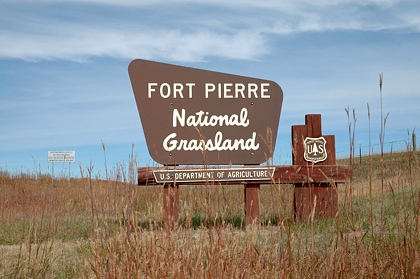
Fort Pierre (fort pier) National Grassland (NG), located in
central South Dakota, is 115,997 acres. It is administered by the
Nebraska National Forest supervisor's office, Rocky Mountain Region.
There are no developed campgrounds.
Fort Pierre National Grassland (NG) feels like the little
grassland "that could." It is a patchwork of quilt consisting of
federal, state, private and Indian land. There isn't much in the
way of formal developed recreation; it is more a place were you
develop your own recreational opportunities. The grassland's
focus on wildlife habitat provides visitors with recreational
opportunities of hiking, mountain biking, hunting, fishing, bird-
watching, dispersed camping, and wildlife photography.
The Fort Pierre National Grassland (NG) was settled in the 1800s
under a variety of "Homestead Acts," which opened the land to
people, generally farmers, and helped to settle the west. A
prolonged period of drought in the late 1920s into the 1930s
caused some homesteads on sub-marginal farmland (a location
receiving 15 or less inches of annual moisture) to literally dry
up. During this time, Congress established the Land Utilization
Program (LUP) which bought homesteads from bankrupt private
owners and returned it to public land status. In the 1950s, the
LUP holdings were assigned to the USDA Forest Service who was
tasked with management of these sub-marginal lands. Over the
years the Forest Service has established some twenty National
Grasslands, including Thunder Basin, from sub-marginal lands.
"The designation of the area as National Grassland is not a
description of the area as much as a statement of policy and
effort to restore the area to a multiple of uses and benefits."
Considered to have the "best huntable populations of Greater
prairie chicken and Sharptail grouse in South Dakota," Fort
Pierre NG also offers visitors something unique to national
grasslands good fishing for bass, bluegill, and crappie. It
is estimated Fort Pierre NG has 261 ponds and about 25% of those
ponds have fish. (Here's a tip: If the pond has a name, it
probably has fish.) An added plus of having that "huntable
populations of Greater prairie chicken and Sharptail grouse," is
the bird-watching opportunities. Contact the Fort Pierre NG
office for information about reserving a blind for watching the
display behavior of these birds. For all the other birds,
especially raptors, all you need is patience.
One of the reasons homesteaders were unsuccessful in the area now
known as Fort Pierre NG was the high levels of selenium in the
soil. Basically, selenium accumulated in the animals, poisoning
them and causing their death. Today, alternating crops and
rotating livestock grazing frequently has made the land
productive for both dominate crops and wildlife. These land
management practices and being at the edge of the midgrass
prairie, with an average rainfall of about 18 inches, the Fort
Pierre NG enjoys forage production approximately double that of
other national grasslands. For any one recreating on the Fort
Pierre NG, this means a wide array of recreational opportunities
from hiking to hunting, fishing to bird-watching, and dispersed
camping to wildlife photography.
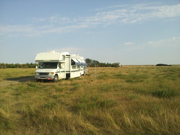
A few suggested dispersed campsites can be found in the table
below. However, most areas of the grassland are open to
dispersed tent camping. The Motor Vehicle Use Map (MVUM)
identifies routes where dispersed camping with a vehicle is
permitted and there are many. The only restriction is you must
not park your vehicle more than 30 feet from the road's
centerline. Otherwis, there are no restrictions for enjoying the
Fort Pierre NG's many recreational opportunities.
ADDRESSES
SUPERVISOR ADDRESS
125 North Main Street
Chadron, Nebraska 69337
308-432-0300

RANGER DISTRICT ADDRESS
Ft. Pierre
1020 North Deadwood Street
Ft. Pierre, SD 57532
605-224-5517
DISPERSED CAMPING LOOKUP TABLE*
| Name |
GPS Coordinates |
Comments |
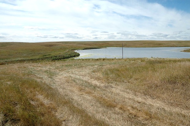
| Monument Dam |
N44 01.981,
W100 23.754
Elev. 2100' |
Isolated; outstanding vista; Largemouth bass, bluegill, etc.; tent/high clearance vehicles |
| Sheriff Dam |
N44 06.333,
W100 25.553
Elev. 1900' |
Mowed open field on west side of pond; Largemouth bass, bluegill, etc.; good vista; tent/high clearance vehicles |
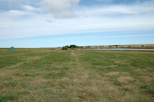
| Richland Dam |
N44 08.808,
W100 24.500
Elev. 1900' |
Mowed open field on east side of pond; Largemouth bass, bluegill, etc.; adjacent to Richland Wildlife Area; any size RV |
Click on a site name for picture.

*The following are suggested dispersed campsites.
However, subject to Forest Service rules, one can
camp most anywhere on the grassland.

(Return to Top)
|


