Campground List
CAMPGROUND NAME: Arapaho Bay
VISIT DATE: 06/08/2000
UPDATE DATE: 7/11/2018
STATE: Colorado
REGION: Rocky Mountain
RANGER DISTRICT: Sulphur
NEAREST CITY/TOWN: Granby
RESERVATIONS: 1-877-444-6777 or make on-line reservation
DIRECTIONS:
In Granby, CO, at intersection of US Rt. 40 and US Rt. 34, take
Rt. 34 east 5.5 miles to Arapaho Bay sign (County Rt. 6/Forest
Rt. 125). Turn right onto Rt. 125 and go 8.9 miles to campground
sign. Turn left into campground.
NOTE: Forest Rt. 125 becomes dirt after 1.2 miles.
GENERAL COMMENTS:
The elevation is 8,320 ft.
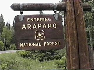
The campground, one of five in the Arapaho National Recreation Area, is
composed of three loops - Big Rock, Moraine and Roaring Fork. It is
generally strung out along a bay at the southeastern end of Lake Granby
and is convenient to Rocky Mountain National Park and Indian Peaks
Wilderness. Big Rock is the first loop and has ample shade. It is
located in a nice stand of Lodgepole pines and is flat with no understory
and no privacy between camping sites. The other loops are very sunny
with little shade. About 0.5 miles further is the Moraine loop, which
features a rolling topography and enough understory to provide good
privacy between sites. Most sites are either on the shore of the lake
or have a good view of it. The Roaring Fork Loop is another 0.3 miles
further and stretches out along the lake. This loop provides some very
private tent sites, some of which are right on the shore.
Tents are permitted on hard surfaces only. This is bear country;
practice safe food storage techniques. Use the provided bear-proof
food storage boxes.
SEASONS
Open Seasonal: Yes
Open All Year: No
Seasonal Comment:
Open May 24 through October 14
NOTE 1: Potable water available June 11 through September 30.
RATE AND MAXIMUM STAY PERMITTED
Rate: $21 per day - single
$42 per day - double
Maximum Stay Permitted (days): 7
CAMPGROUND SITE CONFIGURATION
No. RV Sites: 0
No. Tent Sites: 6
No. Combined Sites (Tent or RV): 74
Total Sites: 80
Tent Pads: Yes
Open Sites: Yes
Wooded Sites: Yes
Equestrian Camping: No
No. Tables on Sites: 80
No. Grilles on Sites: 80
RV INFORMATION
Hookups: None
No. RV Pull Throughs: 0
Waste Station: No
Average Parking Apron Size: 13' X 40'
Comments:
The parking aprons are gravel. There is an RV waste station, with potable
water, availabel at the Stillwater (National Forest) campground 8.6 miles
east of Granby, CO on US Rt. 34.
FACILITIES
Vaults: Yes
Flush Toilets: No
Hot Showers: No
Wheelchair Friendly Toilets: Yes
Public Phone: No
Playground: No
No. Water Spigots (non-site): 9
No. Threaded: 9
WATER SPORTS
Lake: Yes
Swimming (provided): No
Sailing: Yes
Boat Ramp: Yes
Boat Carry Down Access: Yes
Power Boating: Yes
Boating (no power): Yes
Water Skiing: Yes
Rafting (whitewater): No
Kayaking (whitewater): No
Comments:
Lake Granby is 7,029 acres. No motor restrictions except in
Osprey habitat areas.
HIKING
Roaring Fork (accesses the Indian Peaks Wilderness - foot and
horse) - 7 miles
The following trails are located elsewhere in the National
Recreation Area:
East Shore Trail (part of the Continental Divide National Scenic
Trail - foot and horse) - 9 miles
Trail provides access to a network of trails in the
Rocky Mountain National Park
AA Barn Loop Trail (foot and horse) - 1.5 miles
Monarch Lake Trail (loop - foot and horse) - 3.2 miles
FISHING
Rainbow, Brown, Mackinaw and Cutthroat trout and Kokanee salmon

CAMPGROUND NAME: Cold Springs
VISIT DATE: 06/02/2000
UPDATE DATE: 3/27/2018
STATE: Colorado
REGION: Rocky Mountain
RANGER DISTRICT: Clear Creek
NEAREST CITY/TOWN: Idaho Springs
RESERVATIONS: 1-877-444-6777 or make on-line reservation
DIRECTIONS:
From Idaho Springs, CO, take Interstate 70 east 3.2 miles to US
Rt. 6/Golden (Exit 244). Take Exit 244 onto Rt. 6 and go 5.1
miles to State Rt. 119. Turn left onto Rt. 119 and go 12.6 miles
to campground sign. Turn left after sign into campground.
GENERAL COMMENTS:
The elevation is 9,100 ft.
The campground, located on the side of a mountain, is composed of
one large loop with a tiny loop inside it. Lodgepole pine and
Aspen shelter the sites, while Douglas fir and other conifers
surround the campground. The understory is grass with good
privacy between camping sites. Some sites have delightful views
of the peaks in the Mt. Evans Wilderness. The campground is
convenient to Golden Gate Canyon State Park and historic mining
town of Central City, CO. Both Central City (and Black Hawk, CO)
are known for their scores of casinos. Be sure to hike the short
(but steep) Vista Trail for incredible views of the Mt. Evans
Wilderness and valley below.
SEASONS
Open Seasonal: Yes
Open All Year: No
Seasonal Comment:
Open May 11 through September 23
RATE AND MAXIMUM STAY PERMITTED
Rate: $20 per day
Maximum Stay Permitted (days): 14
CAMPGROUND SITE CONFIGURATION
No. RV Sites: 0
No. Tent Sites: 3
No. Combined Sites (Tent or RV): 33
Total Sites: 36
Tent Pads: Yes
Open Sites: Yes
Wooded Sites: Yes
Equestrian Camping: No
No. Tables on Sites: 36
No. Grilles on Sites: 36
RV INFORMATION
Hookups: None
No. RV Pull Throughs: 9
Waste Station: No
Average Parking Apron Size: 12.5' X 48'
Comments:
The parking aprons are gravel. There is a RV waste station
available with potable water at the Texaco gas station at
the intersection of Glenwood and US Rt. 36/28th St. in Boulder, CO.
FACILITIES
Vaults: Yes
Flush Toilets: No
Hot Showers: No
Wheelchair Friendly Toilets: Yes
Public Phone: No
Playground: Yes
No. Water Spigots (non-site): 6
No. Threaded: 3
WATER SPORTS - None
HIKING
Vista Trail (foot) - 0.2 miles
FISHING - No
CAMPGROUND NAME: Columbine
VISIT DATE: 06/03/2000
UPDATE DATE: 3/27/2018
STATE: Colorado
REGION: Rocky Mountain
RANGER DISTRICT: Clear Creek
NEAREST CITY/TOWN: Idaho Springs
RESERVATIONS: 1-877-444-6777 or make on-line reservation
DIRECTIONS:
From Idaho Springs, CO, take Interstate 70 east 3.2 miles to US
Rt. 6/Golden (Exit 244). Take Exit 244 onto Rt. 6 and go 5.1
miles to State Rt. 119. Turn left onto Rt. 119 and go 7.4 miles
to Central City sign in Black Hawk, CO (traffic light). Turn
left at traffic light onto Gregory St. (to Central City) and go
2.2 miles to "Y" intersection. Bear left and go a short distance
(about 150 ft.) to another "Y" intersection. Bear right onto a
narrow, rough dirt road and go 1.3 miles to campground sign.
Turn right at sign into campground.
NOTE: Gregory St. changes to Lawrence, then Eureka before
becoming a gravel road at 1.8 miles.
GENERAL COMMENTS:
The elevation is 9,020 ft.
The campground is composed of two loops. The first loop is to
the left of the campground entrance and has a more rustic feel.
There is little understory, privacy between camping sites is
minimal and the parking aprons are generally shorter and not as
level as the second loop. The second loop, straight ahead from
the entrance, is in denser stand of Lodgepole pine and is more RV
friendly. Mature Aspen are scattered throughout the campground
and provide a lacy shade to a few camping sites. The campground
is convenient to the historic mining town of Central City, CO.
Both Central City (and Black Hawk, CO) are known for their scores
of casinos.
This is bear country; practice safe food storage techniques.
SEASONS
Open Seasonal: Yes
Open All Year: No
Seasonal Comment:
Open May 18 through September 23
RATE AND MAXIMUM STAY PERMITTED
Rate: $19 per day
Maximum Stay Permitted (days): 14
CAMPGROUND SITE CONFIGURATION
No. RV Sites: 0
No. Tent Sites: 6
No. Combined Sites (Tent or RV): 41
Total Sites: 47
Tent Pads: No
Open Sites: Yes
Wooded Sites: Yes
Equestrian Camping: No
No. Tables on Sites: 47
No. Grilles on Sites: 47
RV INFORMATION
Hookups: None
No. RV Pull Throughs: 0
Waste Station: No
Average Parking Apron Size: 13' X 47'
Comments:
The parking aprons are dirt. There is a RV waste station available with
potable water at the Texaco gas station at the intersection of Glenwood
and US Rt. 36/28th St. in Boulder, CO.
FACILITIES
Vaults: Yes
Flush Toilets: No
Hot Showers: No
Wheelchair Friendly Toilets: Yes
Public Phone: No
Playground: No
No. Water Spigots (non-site): 7
No. Threaded: 3
WATER SPORTS - None
HIKING - No
FISHING - No
CAMPGROUND NAME: Denver Creek
VISIT DATE: 06/12/2000
UPDATE DATE: 3/27/2018
STATE: Colorado
REGION: Rocky Mountain
RANGER DISTRICT: Sulphur
NEAREST CITY/TOWN: Granby
RESERVATIONS: No
DIRECTIONS:
From Granby, CO, take US Rt. 40 west 1.9 miles to State Rt. 125.
Turn right onto Rt. 125 and go 12.6 miles to campground sign.
Turn right into first section of campground or continue on Rt.
125 for another 0.2 miles to the second section on the left.
GENERAL COMMENTS:
The elevation is 8,600 ft.
The campground is composed of two separate sections on the east
and west side of State Rt. 125. The first section (on the east
side) loops through a heavy stand of Lodgepole pines. Camping
sites 10, 11 and 12, located along Denver Creek, are on a dead-
end spur with no turnaround. The second section (on the west
side) stretches out along the banks of Willow Creek and although
mature conifer trees provide some shade, this section is more
open. Although both sections hug State Rt. 125, it is lightly
traveled making traffic noise minimal. Willow Creek is a
favorite location for the area's moose population. Firewood is
available from the host for a fee.
SEASONS
Open Seasonal: Yes
Open All Year: No
Seasonal Comment:
Open May 24 through September 23
RATE AND MAXIMUM STAY PERMITTED
Rate: $19 per day
Maximum Stay Permitted (days): 14
CAMPGROUND SITE CONFIGURATION
No. RV Sites: 0
No. Tent Sites: 4
No. Combined Sites (Tent or RV): 17
Total Sites: 21
Tent Pads: No
Open Sites: Yes
Wooded Sites: Yes
Equestrian Camping: No
No. Tables on Sites: 21
No. Grilles on Sites: 21
RV INFORMATION
Hookups: None
No. RV Pull Throughs: 2
Waste Station: No
Average Parking Apron Size: 11' X 37'
Comments:
Some parking aprons are dirt and some are gravel.
FACILITIES
Vaults: Yes
Flush Toilets: No
Hot Showers: No
Wheelchair Friendly Toilets: Yes
Public Phone: No
Playground: No
No. Water Spigots (non-site): 2
No. Threaded: 2
Comments:
The second or west section has the only wheelchair friendly
toilet.
WATER SPORTS - None
HIKING - No
FISHING
Rainbow trout
CAMPGROUND NAME: Echo Lake
VISIT DATE: 06/05/2000
UPDATE DATE: 3/27/2018
STATE: Colorado
REGION: Rocky Mountain
RANGER DISTRICT: Clear Creek
NEAREST CITY/TOWN: Idaho Springs
RESERVATIONS: 1-877-444-6777
DIRECTIONS:
In Idaho Springs, CO, take State Rt. 103 (Mt. Evans Scenic Byway)
south 13 miles to State Rt. 5. Turn right onto Rt. 5, then left
at campground sign into campground.
GENERAL COMMENTS:
The elevation is 10,600 ft.
The campground, in a stand of mature Engelmann spruce, is
composed of a single loop at the entrance to the access road to
Mt. Evans, the highest auto road in North America. All the tent
sites are walk-in. Most of the combined camping sites have side-
by-side parking aprons, providing little privacy. State Rt. 103
was part of the original Peak to Peak Highway, construction on
which began in 1915 and completed in 1926. Taking a drive up
State Rt. 5 to Mt. Evans, the highest auto road in North America
(14,265 ft.), is a must day trip. View the distant mountains and
watch for wildlife, particularly mountain sheep. The campground
is convenient to Echo Lake for fishing and the Mt. Evans
Wilderness.
This is bear country; practice safe food storage techniques.
SEASONS
Open Seasonal: Yes
Open All Year: No
Seasonal Comment:
Open June 8 through September 3
RATE AND MAXIMUM STAY PERMITTED
Rate: $19 per day
Maximum Stay Permitted (days): 14
CAMPGROUND SITE CONFIGURATION
No. RV Sites: 0
No. Tent Sites: 4
No. Combined Sites (Tent or RV): 13
Total Sites: 17
Tent Pads: Yes
Open Sites: Yes
Wooded Sites: Yes
Equestrian Camping: No
No. Tables on Sites: 17
No. Grilles on Sites: 17
RV INFORMATION
Hookups: None
No. RV Pull Throughs: 1
Waste Station: No
Average Parking Apron Size: 10' X 34'
Comments:
The parking aprons are dirt. An RV waste station, with potable water,
is available for a fee at the Visitors Center in Idaho Springs, CO.
FACILITIES
Vaults: Yes
Flush Toilets: No
Hot Showers: No
Wheelchair Friendly Toilets: Yes
Public Phone: No
Playground: No
No. Water Spigots (non-site): 1
No. Threaded: 0
Comments:
The water spigot is a hand pump. The only wheelchair friendly
toilet is located adjacent to the walk-in tent sites.
WATER SPORTS - None
Comments:
The nearby Echo Lake is 5 acres where no boats of any type are
permitted.
HIKING
Chicago Lake Trail #52 (foot) - 4.5 miles
Resthouse Trail #57 (foot) - 6.5 miles
Captain Mountain Trail #46 (foot) - 9 miles
All the trails access the Mt. Evans Wilderness.
FISHING - No
Comments:
Rainbow trout at the nearby Echo Lake.
CAMPGROUND NAME: Green Ridge
VISIT DATE: 06/08/2000
UPDATE DATE: 7/10/2018
STATE: Colorado
REGION: Rocky Mountain
RANGER DISTRICT: Sulphur
NEAREST CITY/TOWN: Granby
RESERVATIONS: 1-877-444-6777 or make on-line reservation
DIRECTIONS:
In Granby, CO, at intersection of US Rt. 40 and US Rt. 34, take
Rt. 34 east 11.7 miles to campground sign (County Rt. 66/Forest
Rt. 274). Turn right onto Rt. 66/274 and go 1.5 miles to another
campground sign. Turn left at sign into campground.
GENERAL COMMENTS:
The elevation is 8,400 ft.
The campground, one of five in the Arapaho National Recreation
Area, is composed of two loops - A and B. It is located in a
stand of Lodgepole pines along the south shore of the Shadow
Mountain Reservoir. A tall bern obscures any view of the
reservoir. Loop B's camping sites are a bit longer, more RV
friendly and have more double-wide sites. Some consider the area
below the dam as having the best fly fishing in the Arapaho
National Forest. The East Shore Trail part of the 3,200-mile
Continental Divide National Scenic Trail is adjacent to the
campground. The Colorado River is nearby the campground's west
side. Tents are permitted on hard surfaces only.
The campground is convenient to the Rocky Mountain National Park
and a visitor's center. There is a wheelchair friendly
observation ramp (with telescopes) for observing Bald Eagles and
Osprey.
This is bear country; practise safe food storage technique.
Use provided bear-proof food storage box.
SEASONS
Open Seasonal: Yes
Open All Year: No
Seasonal Comment:
Open May 11 through October 14
RATE AND MAXIMUM STAY PERMITTED
Rate: $21 per day - single
$42 per day - double
Maximum Stay Permitted (days): 7
CAMPGROUND SITE CONFIGURATION
No. RV Sites: 0
No. Tent Sites: 4
No. Combined Sites (Tent or RV): 70
Total Sites: 74
Tent Pads: Yes
Open Sites: Yes
Wooded Sites: No
Equestrian Camping: No
No. Tables on Sites: 74
No. Grilles on Sites: 74
RV INFORMATION
Hookups: None
No. RV Pull Throughs: 6
Waste Station: Yes
Average Parking Apron Size: 11.5' X 35'
Comments:
The parking aprons are gravel. There are numerous double-wide
parking aprons.
FACILITIES
Vaults: No
Flush Toilets: Yes
Hot Showers: No
Wheelchair Friendly Toilets: Yes
Public Phone: No
Playground: No
No. Water Spigots (non-site): 3
No. Threaded: 2
WATER SPORTS
Lake: Yes
Swimming (provided): No
Sailing: Yes
Boat Ramp: Yes
Boat Carry Down Access: No
Power Boating: Yes
Boating (no power): Yes
Water Skiing: Yes
Rafting (whitewater): No
Kayaking (whitewater): No
Comments:
Shadow Mountain Reservoir is 1,852 acres. No motor restrictions
except in Osprey habitats
HIKING
East Shore Trail (part of the Continental Divide National Scenic
Trail - foot and horse) - 9 miles
Trail provides access to a network of trails in the
Rocky Mountain National Park
AA Barn Loop Trail (foot and horse) - 1.5 miles
The following trails are located elsewhere in the National
Recreation Area:
Roaring Fork (foot and horse) - 7 miles
Monarch Lake Trail (loop - foot and horse) - 3.2 miles
FISHING
Rainbow, Brown, Mackinaw and Cutthroat trout and Kokanee Salmon
CAMPGROUND NAME: Guanella Pass
VISIT DATE: 06/04/2000
UPDATE DATE: 2/26/2019
STATE: Colorado
REGION: Rocky Mountain
RANGER DISTRICT: Clear Creek
NEAREST CITY/TOWN: Georgetown
RESERVATIONS: 1-877-444-6777 or make on-line reservation
DIRECTIONS:
In Georgetown, CO, take Guanella Pass Rd. south 8.6 miles to
campground sign. Turn either left or right into campground.
GENERAL COMMENTS:
The elevation is 10,900 ft.
The campground, nestled in a dense stand of Engelmann spruce and
other conifers, is composed of two loops separated by Guanella
Pass Road. The camping sites in both loops have breathtaking
views of the surrounding mountains. The South Fork of the Clear
Creek runs alongside both loops with some sites adjacent to the
creek. The campground is convenient to the Mt. Evans Wilderness
and Pike National Forest. Take a two-mile drive to the 11,669-
foot Guanella Pass where, besides the great scenery, there are
some marvelous trails. One of them goes to Mt. Bierstadt
(14,060 ft.) and on to Mt. Evans.
This is bear country; practice safe food storage techniques.
SEASONS
Open Seasonal: Yes
Open All Year: No
Seasonal Comment:
Open June 8 through September 3
RATE AND MAXIMUM STAY PERMITTED
Rate: $19 per day
Maximum Stay Permitted (days): 14
CAMPGROUND SITE CONFIGURATION
No. RV Sites: 0
No. Tent Sites: 7
No. Combined Sites (Tent or RV): 11
Total Sites: 18
Tent Pads: Yes
Open Sites: Yes
Wooded Sites: Yes
Equestrian Camping: No
No. Tables on Sites: 18
No. Grilles on Sites: 18
RV INFORMATION
Hookups: None
No. RV Pull Throughs: 0
Waste Station: No
Average Parking Apron Size: 13' X 41'
Comments:
The parking aprons are gravel. An RV waste station, with potable water
is available for a fee at the Visitor Center in Idaho Springs, CO.
FACILITIES
Vaults: Yes
Flush Toilets: No
Hot Showers: No
Wheelchair Friendly Toilets: Yes
Public Phone: No
Playground: No
No. Water Spigots (non-site): 2
No. Threaded: 0
Comments:
The water spigots are hand pumps.
WATER SPORTS - None
HIKING - No
Comments:
Convenient to several trails at the Guanella Pass and the 2-mile
Silver Dollar Trail.
FISHING
Brown, Brook and Rainbow trout
CAMPGROUND NAME: Idlewild
VISIT DATE: 06/07/2000
UPDATE DATE: 7/10/2018
STATE: Colorado
REGION: Rocky Mountain
RANGER DISTRICT: Sulphur
NEAREST CITY/TOWN: Winter Park
RESERVATIONS: No
DIRECTIONS:
In Winter Park, CO, south of downtown on US Rt. 40, turn left at
campground sign into campground.
NOTE: Left turn off US Rt. 40 may be difficult for some RVs.
GENERAL COMMENTS:
The elevation is 9,000 ft.
The campground is adjacent to Fraser River in a very thick stand
of mixed conifers. Traffic noise from US Rt. 40 and passing
freight trains can be heard throughout the campground. Fraser
River Trail runs through the campground. Privacy between camping
sites is fair to good with some sites overlooking the river. The
Fraser River is a tributary of the Colorado River.
This is bear country; practise safe food storage technique.
Use provided bear-proof food storage box.
SEASONS
Open Seasonal: Yes
Open All Year: No
Seasonal Comment:
Open May 25 through September 25
RATE AND MAXIMUM STAY PERMITTED
Rate: $20 per day
Maximum Stay Permitted (days): 14
CAMPGROUND SITE CONFIGURATION
No. RV Sites: 0
No. Tent Sites: 10
No. Combined Sites (Tent or RV): 13
Total Sites: 23
Tent Pads: No
Open Sites: No
Wooded Sites: Yes
Equestrian Camping: No
No. Tables on Sites: 23
No. Grilles on Sites: 23
RV INFORMATION
Hookups: None
No. RV Pull Throughs: 2
Waste Station: No
Average Parking Apron Size: 13' X 33'
Comments:
The parking aprons are gravel. There is an RV waste station at
the Green Ridge and Stillwater National Forest campgrounds. They
are both east of Granby, CO off US Rt. 34. No fee for Forest
Service campers and there is potable water at each station.
There is no turnaround for sites 23 and 24 and the loop for sites
9,10 and 11 is not RV-friendly.
FACILITIES
Vaults: Yes
Flush Toilets: No
Hot Showers: No
Wheelchair Friendly Toilets: Yes
Public Phone: No
Playground: No
No. Water Spigots (non-site): 0
WATER SPORTS - None
HIKING
Fraser River Trail (paved - foot, mountain bike and roller blade)
- 5 miles
FISHING
Rainbow and Brown trout
CAMPGROUND NAME: Mizpah
VISIT DATE: 06/05/2000
UPDATE DATE: 3/27/2018
STATE: Colorado
REGION: Rocky Mountain
RANGER DISTRICT: Clear Creek
NEAREST CITY/TOWN: Empire
RESERVATIONS: No
DIRECTIONS:
From Empire, CO, take US Rt. 40 west 5.9 miles to campground
sign. Turn left into campground.
GENERAL COMMENTS:
The elevation is 9,200 ft.
The campground is a single loop in a dense stand of Engelmann
spruce and other conifers. Although just off US Rt. 40, traffic
noise is minimal, but the South Fork of the Clear Creek can be
heard throughout the campground. This is a nice campground for
an overnight stop. One pull-through may be occupied by the
campground host. Good privacy between camping sites. Firewood
is available from the host for a fee.
This is bear country; practice safe food storage techniques.
SEASONS
Open Seasonal: Yes
Open All Year: No
Seasonal Comment:
Open May 19 through September 10.
NOTE: 2017: Campground closed for culvert repair;
contact ranger district office for status.
RATE AND MAXIMUM STAY PERMITTED
Rate: $14 per day.
Maximum Stay Permitted (days): 14
CAMPGROUND SITE CONFIGURATION
No. RV Sites: 0
No. Tent Sites: 2
No. Combined Sites (Tent or RV): 8
Total Sites: 10
Tent Pads: No
Open Sites: No
Wooded Sites: Yes
Equestrian Camping: No
No. Tables on Sites: 10
No. Grilles on Sites: 10
RV INFORMATION
Hookups: None
No. RV Pull Throughs: 2
Waste Station: No
Average Parking Apron Size: 12' X 38'
Comments:
The parking aprons are gravel and dirt.
FACILITIES
Vaults: Yes
Flush Toilets: No
Hot Showers: No
Wheelchair Friendly Toilets: Yes
Public Phone: No
Playground: No
No. Water Spigots (non-site): 1
No. Threaded: 0
Comments:
The water spigot is a hand pump.
WATER SPORTS - None
HIKING - No
FISHING
Brown, Brook and Rainbow trout
CAMPGROUND NAME: Robbers Roost
VISIT DATE: 06/07/2000
UPDATE DATE: 7/10/2018
STATE: Colorado
REGION: Rocky Mountain
RANGER DISTRICT: Sulphur
NEAREST CITY/TOWN: Winter Park
RESERVATIONS: No
DIRECTIONS:
From Winter Park, CO, take US Rt. 40 south 2.3 miles to
campground on left.
NOTE: The campground sign is not visible on approach to the
campground.
GENERAL COMMENTS:
The elevation is 9,826 ft.
The campground, adjacent to Fraser River, is located in a thick
stand of Engelmann spruce trees. It is a single loop and
attractive. However, traffic noise from US Rt. 40, is heard
throughout campground. Most of the camping sites overlook the
river.
This is bear country; practise safe food storage technique.
Use provided bear-proof food storage box.
SEASONS
Open Seasonal: Yes
Open All Year: No
Seasonal Comment:
Open June 15 through September 4
RATE AND MAXIMUM STAY PERMITTED
Rate: $20 per day
Maximum Stay Permitted (days): 14
CAMPGROUND SITE CONFIGURATION
No. RV Sites: 0
No. Tent Sites: 3
No. Combined Sites (Tent or RV): 8
Total Sites: 11
Tent Pads: No
Open Sites: No
Wooded Sites: Yes
Equestrian Camping: No
No. Tables on Sites: 11
No. Grilles on Sites: 11
RV INFORMATION
Hookups: None
No. RV Pull Throughs: 0
Waste Station: No
Average Parking Apron Size: 13' X 26'
Comments:
The parking aprons are gravel. There is an RV waste station at
the Green Ridge and Stillwater National Forest campgrounds. They
are both east of Granby, CO off US Rt. 34. No fee for Forest
Service campers and there is potable water at each station.
FACILITIES
Vaults: Yes
Flush Toilets: No
Hot Showers: No
Wheelchair Friendly Toilets: No
Public Phone: No
Playground: No
No. Water Spigots (non-site): 0
WATER SPORTS - None
HIKING - No
FISHING
Rainbow and Brown trout
CAMPGROUND NAME: South Fork
VISIT DATE: 06/09/2000
UPDATE DATE: 3/27/2018
STATE: Colorado
REGION: Rocky Mountain
RANGER DISTRICT: Sulphur
NEAREST CITY/TOWN: Hot Sulphur Springs
RESERVATIONS: No
DIRECTIONS:
From Hot Sulphur Springs, CO, take US Rt. 40 west 4.1 miles to
Williams Fork Reservoir sign. Turn left at sign onto County Rt.
3 and go 18.2 miles to a "Y" intersection. Bear left onto County
Rt. 30 and go 5.5 miles to another "Y" intersection. Bear right,
passing through a Henderson Mill Industrial Area tunnel, to a "T"
intersection. Turn left and go 0.2 miles to campground sign.
Turn right at sign and go 0.1 miles to another campground sign.
Turn right at sign into campground.
Note: County Rt. 3 becomes a gravel and dirt road after 4.5 miles.
GENERAL COMMENTS:
The elevation is 8,940 ft.
The campground is a large single loop that meanders through a
stand of mature Lodgepole pines. Although there is little
understory, the camping sites have good privacy. The Darling
Creek runs along one side of the campground with some sites on
the creek bank. Even with the long drive over a well-maintained
dirt road, this campground is well worth the trip. For RVrs, the
parking aprons are long and level with very nice pull-throughs as
well. The campground is convenient to the Darling Creek Trail
#18 which accesses the Byers Park Wilderness. Although there are
no equestrian facilities in the campground, there are horse
corrals near site #14 at the South Fork trailhead.
This is bear country; practice safe food storage techniques.
SEASONS
Open Seasonal: Yes
Open All Year: No
Seasonal Comment:
Open June 1 through October 14
RATE AND MAXIMUM STAY PERMITTED
Rate: $17 per day
Maximum Stay Permitted (days): 14
CAMPGROUND SITE CONFIGURATION
No. RV Sites: 0
No. Tent Sites: 0
No. Combined Sites (Tent or RV): 21
Total Sites: 21
Tent Pads: No
Open Sites: Yes
Wooded Sites: No
Equestrian Camping: Yes
No. Tables on Sites: 21
No. Grilles on Sites: 20
RV INFORMATION
Hookups: None
No. RV Pull Throughs: 4
Waste Station: No
Average Parking Apron Size: 13' X 50'
Comments:
The parking aprons are rock and gravel.
FACILITIES
Vaults: Yes
Flush Toilets: No
Hot Showers: No
Wheelchair Friendly Toilets: Yes
Public Phone: No
Playground: No
No. Water Spigots (non-site): 0
WATER SPORTS - None
HIKING
South Fork Trail #21 (foot, horse and mountain bike) - 21 miles
South Fork/Sugar Loaf campgrounds connector trail (foot and
mountain bike) - 0.5 miles. This trail connects the two
campgrounds and is wheelchair friendly.
FISHING
Rainbow and Brook trout
CAMPGROUND NAME: St. Louis Creek
VISIT DATE: 06/07/2000
UPDATE DATE: 3/27/2018
STATE: Colorado
REGION: Rocky Mountain
RANGER DISTRICT: Sulphur
NEAREST CITY/TOWN: Fraser
RESERVATIONS: No
DIRECTIONS:
In Fraser, CO, take Eisenhower Dr. west 0.2 miles to Norgran Rd.
Turn left onto Norgran Rd. and go 0.1 miles to Mill Ave. Turn
right onto Mill Ave., which becomes County Rt. 73 in 0.1 miles,
and go 2.4 miles to a "Y" intersection (Forest Rt. 1601). Bear
left onto Rt. 1601 and go 0.3 miles to campground.
NOTE: County Rt. 73 becomes dirt after 0.7 miles.
GENERAL COMMENTS:
The elevation is 8,900 ft.
The campground, located in the Fraser Experimental Forest, is
adjacent to St. Louis Creek. None of the camping sites overlook
the creek, but it is within easy walking distance. The
understory is grass and pine needles with the sites located among
mature Lodgepole pines. This is a sweet little campground that
is popular with mountain bikers. Privacy between sites is fair
to good. Firewood is available from the host for a fee.
SEASONS
Open Seasonal: Yes
Open All Year: No
Seasonal Comment:
Open May 25 through October 23
RATE AND MAXIMUM STAY PERMITTED
Rate: $20 per day
Maximum Stay Permitted (days): 14
CAMPGROUND SITE CONFIGURATION
No. RV Sites: 0
No. Tent Sites: 0
No. Combined Sites (Tent or RV): 15
Total Sites: 15
Tent Pads: No
Open Sites:Yes
Wooded Sites: No
Equestrian Camping: No
No. Tables on Sites: 15
No. Grilles on Sites: 15
RV INFORMATION
Hookups: None
No. RV Pull Throughs: 4
Waste Station: No
Average Parking Apron Size: 14' X 36'
Comments:
The parking aprons are gravel. There are RV waste stations, with
potable water, available at Green Ridge and Stillwater National Forest
campgrounds. They are both east of Granby, CO off US Rt. 34.
The pull-throughs can accommodate almost any size RV, except high-
profile RVs may have difficulty with low-hanging branches.
FACILITIES
Vaults: Yes
Flush Toilets: No
Hot Showers: No
Wheelchair Friendly Toilets: Yes
Public Phone: No
Playground: No
No. Water Spigots (non-site): 2
No. Threaded: 1
Comments:
One water spigot is a hand pump.
WATER SPORTS - None
HIKING
Creekside Trail (foot and mountain bike) - 1.5 miles. This trail
accesses the Winter Park/Grand Lake mountain bike network of
trails - over 600 miles of trails.
FISHING
Brook trout
CAMPGROUND NAME: Stillwater
CAMPGROUND NAME: Stillwater
VISIT DATE: 06/06/2000
UPDATE DATE: 3/27/2018
STATE: Colorado
REGION: Rocky Mountain
RANGER DISTRICT: Sulphur
NEAREST CITY/TOWN: Granby
RESERVATIONS: 1-877-444-6777 or make on-line reservation
DIRECTIONS:
In Granby, CO, at intersection of US Rt. 40 and US Rt. 34, take Rt. 34
east 8.6 miles to campground sign. Turn right into campground.
GENERAL COMMENTS:
The elevation is 8,300 ft.
NOTE: The West Entrance to the Rocky Mountain National Park is about 6.7
miles north of campground.
The campground, adjacent to Lake Granby and one of five in the Arapaho
National Recreation Area, is composed of three overlapping loops - A, B
and C. Portions of Loops B and C are next to (or in) meadows covered
with grass and sagebrush. These sites are in the open with several on
the lake shore. Each loop has camping sites with privacy ranging from
fair to poor. Tent camping in Loop B sites, 76 through 83, is not
permitted because they have have no tent pads. These sites are
well-suited for pop-up tent trailers or other very small RVs. The
electric and water hook-up sites are found in Loop A, most of which face
the lake. This campground is very popular because of the wide range of
water sports, availability of hot showers and flush toilets and convenience
to the Rocky Mountain National Park. Tents are permitted only on hardened
surfaces. Pine beetle infestation has caused massive "hazard-tree" removal
resulting in shadeless campsites but fabulous views of the Rocky Mountain
National Park and Lake Granby. New growth of Lodgepole pine where trees
were removed gives the campground a lush green carpet appearance.
Firewood is available for a fee.
SEASONS
Open Seasonal: Yes
Open All Year: Yes
Seasonal Comment:
Open May 18 through September 22
RATE AND MAXIMUM STAY PERMITTED
Rate: $24 per day - basic site
$28 per day - sites near lake
$44 per day - double site
$7 per day additional for water & electric hookups
NOTE: Golden Age/Access Passport discount does not apply to water &
electric hookup surcharge.
Maximum Stay Permitted (days): 7
CAMPGROUND SITE CONFIGURATION
No. RV Sites: 8
No. Tent Sites: 33
No. Combined Sites (Tent or RV): 83
Total Sites: 124
Tent Pads: Yes
Open Sites: Yes
Wooded Sites: No
No. Tables on Sites: 124
No. Grilles on Sites: 124
Equestrian Camping: No
RV INFORMATION
No. Full Hookups (includes waste): 0
No. Water and Electric Only: 20
No. Water Only: 0
No. Electric Only: 0
No. RV Pull Throughs: 8
Waste Station: Yes
Potable Water at Waste Station: Yes
Average Parking Apron Size: 13' X 36'
Comments:
The parking aprons are gravel. Most pull-through sites are parallel parking.
Parking aprons in Loop A will accommodate Class A motorhomes while aprons in
Loops B and C are better suited to car, tent, Class B and C campers
FACILITIES
Vaults: No
Flush Toilets: Yes
Hot Showers: Yes
Wheelchair Friendly Toilets: Yes
Public Phone: No
Playground: No
No. Water Spigots (non-site): 8
No. Threaded: 0
Comments:
The showers are located in Loops A and B and are wheelchair friendly.
WATER SPORTS
Lake: Yes
Swimming (provided): No
Sailing: Yes
Boat Ramp: Yes
Boat Carry Down Access: Yes
Power Boating: Yes
Boating (no power): Yes
Water Skiing: Yes
Rafting (whitewater): No
Kayaking (whitewater): No
Comments:
Lake Granby is 7,029 acres. No motor restrictions except in Osprey
habitat areas. Sailing is a major activity on the lake.
HIKING
No trails in this campground, but the following are located in the National
Recreation Area:
East Shore Trail (part of the Continental Divide National Scenic Trail) -
foot and horse, 9 miles
Trail provides access to a network of trails in the Rocky Mountain
National Park
AA Barn Loop Trail (foot and Horse) - 1.5 miles
Roaring Fork Trail (foot and horse) - 7 miles
Monarch Lake Trail (loop - foot and horse) - 3.2 miles
FISHING
Rainbow, Brown, Mackinaw and Cutthroat trout and Kokanee salmon
CAMPGROUND NAME: Sugar Loaf
VISIT DATE: 06/09/2000
UPDATE DATE: 3/27/2018
STATE: Colorado
REGION: Rocky Mountain
RANGER DISTRICT: Sulphur
NEAREST CITY/TOWN: Hot Sulphur Springs
RESERVATIONS: No
DIRECTIONS:
From Hot Sulphur Springs, CO, take US Rt. 40 west 4.1 miles to
Williams Fork Reservoir sign. Turn left at sign onto County Rt.
3 and go 18.2 miles to a "Y" intersection. Bear left onto County
Rt. 30 and go 5.5 miles to another "Y" intersection. Bear right,
passing through a Henderson Mill Industrial Area tunnel, to a "T"
intersection. Turn left and go 0.2 miles to campground sign.
Turn right at sign and go 0.6 miles into the campground.
Note: County Rt. 3 becomes a gravel and dirt roadafter 4.5 miles.
GENERAL COMMENTS:
The elevation is 8,970 ft.
The campground is composed of a single oval-shaped loop in a
dense stand of Lodgepole pines, spruce and fir trees. This is a
delightful, tranquil campground well worth the long drive down a
well maintained dirt road. The campground is bound on one side
by a heavily wooded steep mountainside and the other by Williams
Fork Creek. Large spacious camping sites provide good privacy.
There are horseshoe pits.
This is bear country; practice safe food storage techniques.
SEASONS
Open Seasonal: Yes
Open All Year: No
Seasonal Comment:
Open June 1 through October 14
RATE AND MAXIMUM STAY PERMITTED
Rate: $17 per day
Maximum Stay Permitted (days): 14
CAMPGROUND SITE CONFIGURATION
No. RV Sites: 0
No. Tent Sites: 1
No. Combined Sites (Tent or RV): 10
Total Sites: 11
Tent Pads: No
Open Sites: Yes
Wooded Sites: No
Equestrian Camping: No
No. Tables on Sites: 11
No. Grilles on Sites: 11
RV INFORMATION
Hookups: None
No. RV Pull Throughs: 1
Waste Station: No
Average Parking Apron Size: 14' X 38'
Comments:
The parking aprons are rock and dirt.
FACILITIES
Vaults: Yes
Flush Toilets: No
Hot Showers: No
Wheelchair Friendly Toilets: Yes
Public Phone: No
Playground: No
No. Water Spigots (non-site): 0
WATER SPORTS - None
HIKING
Williams Fork Boardwalk Trail (wheelchair friendly, foot) - 0.5
miles
South Fork Trail #21 (loop, foot and horse) - 21 miles
Darling Creek Trail # 18 (foot and horse) - 7 miles
South Fork/Sugar Loaf campgrounds connector trail (foot and
mountain bike) - 0.5 miles. This trail connects the two
campgrounds and is wheelchair friendly.
FISHING
Brook trout
CAMPGROUND NAME: Sunset Point
VISIT DATE: 06/08/2000
UPDATE DATE: 3/27/2018
STATE: Colorado
REGION: Rocky Mountain
RANGER DISTRICT: Sulphur
NEAREST CITY/TOWN: Granby
RESERVATIONS: No
DIRECTIONS:
In Granby, CO, at the intersection of US Rt. 40 and US Rt. 34,
take Rt. 34 east 5.5 miles to Arapaho Bay/Forest Rt. 125 signs.
Turn right and go 1 mile to campground sign. Turn left at sign
and go 0.2 miles to another campground sign. Turn left at sign
into campground.
GENERAL COMMENTS:
The elevation is 8,200 ft.
The campground, one of five in the Arapaho National Recreation
Area, stretches out along Lake Granby in a thinned stand of
Lodgepole pines. Some camping sites are on the lakeside and have
views of the Rocky Mountain National Park's many mountain peaks.
Other sites overlook a large meadow with towering meadows in the
distance. Overall, the panoramic views from most of the sites
are delightful. The campground is convenient to the Rocky
Mountain National Park and a visitor center. Lupin plants are
prevalent throughout the campground.
SEASONS
Open Seasonal: Yes
Open All Year: No
Seasonal Comment:
Open May 11 through September 23
RATE AND MAXIMUM STAY PERMITTED
Rate: $24 per day - single
$48 per day - double
Maximum Stay Permitted (days): 7
CAMPGROUND SITE CONFIGURATION
No. RV Sites: 0
No. Tent Sites: 4
No. Combined Sites (Tent or RV): 20
Total Sites: 24
Tent Pads: Yes
Open Sites: Yes
Wooded Sites: Yes
Equestrian Camping: No
No. Tables on Sites: 24
No. Grilles on Sites: 24
RV INFORMATION
Hookups: None
No. RV Pull Throughs: 0
Waste Station: No
Average Parking Apron Size: 14' X 50'
Comments:
The parking aprons are gravel. There is an RV waste station 3.1
miles east on US Rt. 34 at the Stillwater campground (National
Forest). There is no charge for Forest Service campers and there
is potable water.
FACILITIES
Vaults: Yes
Flush Toilets: No
Hot Showers: No
Wheelchair Friendly Toilets: Yes
Public Phone: No
Playground: No
No. Water Spigots (non-site): 3
No. Threaded: 0
WATER SPORTS
Lake: Yes
Swimming (provided): No
Sailing: Yes
Boat Ramp: Yes
Boat Carry Down Access: Yes
Power Boating: Yes
Boating (no power): Yes
Water Skiing: Yes
Rafting (whitewater): No
Kayaking (whitewater): No
Comments:
Lake Granby is 7,029 acres. There are no restrictions except in
Osprey habitat areas.
HIKING
No trails in this campground, but the following are located in
the National Recreation Area:
East Shore Trail (part of the Continental Divide National Scenic
Trail - foot and horse) - 9 miles
Trail provides access to a network of trails in the
Rocky Mountain National Park
AA Barn Loop Trail (foot and horse) - 1.5 miles
Roaring Fork Trail (foot and horse) - 7 miles
Monarch Lake Trail (loop - foot and horse) - 3.2 miles
FISHING
Rainbow, Brown, Mackinaw and Cutthroat trout and Kokanee salmon
CAMPGROUND NAME: West Chicago Creek
VISIT DATE: 06/05/2000
UPDATE DATE: 3/27/2018
STATE: Colorado
REGION: Rocky Mountain
RANGER DISTRICT: Clear Creek
NEAREST CITY/TOWN: Idaho Springs
RESERVATIONS: 1-877-444-6777 or make on-line reservation
DIRECTIONS:
From Idaho Springs, CO, take State Rt. 103 south 6.3 miles to an
intersection and a small campground sign. Continue straight onto
W. Chicago Cr. Rd. (dirt) and go 2.8 miles to another campground
sign. Turn left at sign into campground.
GENERAL COMMENTS:
The elevation is 9,600 ft.
The campground, convenient to the Mt. Evans Wilderness, is a
tightly configured "D" shape with sites along the main road in a
stand of Lodgepole pines. Closeness of camping sites and trees
having been thinned provide little privacy. Young Aspen trees
provide a pleasant lacy shade for some sites. The understory is
grass. Taking a drive up State Rt. 5 to Mt. Evans, the highest
auto road in North America (14,265 ft.), is a must day trip.
View the distant mountains and watch for wildlife, particularly
mountain sheep. Firewood is available from the host for a fee.
This is bear country; practice safe food storage techniques.
SEASONS
Open Seasonal: Yes
Open All Year: No
Seasonal Comment:
Open May 18 through September 23
RATE AND MAXIMUM STAY PERMITTED
Rate: $18 per day.
Maximum Stay Permitted (days): 14
CAMPGROUND SITE CONFIGURATION
No. RV Sites: 0
No. Tent Sites: 0
No. Combined Sites (Tent or RV): 15
Total Sites: 15
Tent Pads: No
Open Sites: Yes
Wooded Sites: Yes
Equestrian Camping: No
No. Tables on Sites: 15
No. Grilles on Sites: 15
RV INFORMATION
Hookups: None
No. RV Pull Throughs: 1
Waste Station: No
Average Parking Apron Size: 12' X 47'
Comments:
The parking aprons are dirt and gravel. A RV waste station, no potable
water, is available at the Visitor Center in Idaho Springs, CO.
FACILITIES
Vaults: Yes
Flush Toilets: No
Hot Showers: No
Wheelchair Friendly Toilets: Yes
Public Phone: No
Playground: No
No. Water Spigots (non-site): 2
No. Threaded: 1
WATER SPORTS - None
HIKING
Hells Hole Trail #53 (foot) - 3.5 miles; access to Mt. Evans
Wilderness
FISHING - No
CAMPGROUND NAME: Willow Creek
VISIT DATE: 06/08/2000
UPDATE DATE: 7/10/2018
STATE: Colorado
REGION: Rocky Mountain
RANGER DISTRICT: Sulphur
NEAREST CITY/TOWN: Granby
RESERVATIONS: No
DIRECTIONS:
From Granby, CO, at the intersection of US Rt. 40 and US Rt. 34,
take Rt. 34 east 5.2 miles to campground sign (County Rt. 40).
Turn left at sign onto Rt. 40 (dirt) and go 2.7 miles to the
Willow Creek Reservoir sign at "T" intersection. Turn left and
go 1.1 miles to campground sign. Turn right at sign into
campground.
GENERAL COMMENTS:
The elevation is 8,400 ft.
The campground, one of five in the Arapaho National Recreation
Area, meanders down a hillside through Aspen, Lodgepole pines and
Sagebrush to the Willow Creek Reservoir. Some sites have a
pleasant vista of the reservoir. Well away from the crowds of
Lake Granby, the campground offers a quiet and rustic camping
experience. Some walk-in tent sites are on the shore of the
reservoir. Lupin plants are found throughout the campground.
Firewood is available from the host for a fee.
This is bear country; practise safe food storage technique.
Use provided bear-proof food storage box.
SEASONS
Open Seasonal: Yes
Open All Year: No
Seasonal Comment:
Open May 24 through October 14
NOTE 1: Potable water available May 27 through September 30.
RATE AND MAXIMUM STAY PERMITTED
Rate: $21 per day
Maximum Stay Permitted (days): 7
CAMPGROUND SITE CONFIGURATION
No. RV Sites: 0
No. Tent Sites: 15
No. Combined Sites (Tent or RV): 17
Total Sites: 32
Tent Pads: Yes
Open Sites: Yes
Wooded Sites: Yes
Equestrian Camping: No
No. Tables on Sites: 32
No. Grilles on Sites: 31
RV INFORMATION
Hookups: None
No. RV Pull Throughs: 0
Waste Station: No
Average Parking Apron Size: 9' X 37'
Comments:
The parking aprons are dirt and gravel. A RV waste station, with
potable water, is available at Stillwater campground (National Forest),
8.6 miles east of Granby, CO on US Rt. 34.
FACILITIES
Vaults: Yes
Flush Toilets: No
Hot Showers: No
Wheelchair Friendly Toilets: Yes
Public Phone: No
Playground: No
No. Water Spigots (non-site): 3
No. Threaded: 3
WATER SPORTS
Lake: Yes
Swimming (provided): No
Sailing: No
Boat Ramp: Yes
Boat Carry Down Access: Yes
Power Boating: Yes
Boating (no power): Yes
Water Skiing: No
Rafting (whitewater): No
Kayaking (whitewater): No
Comments:
Willow Creek is 300 acres and is a no-wake lake. The boat ramp is
located 0.4 miles east of campground on County Rt. 40. Boat
carry-down access available only from some walk-in tent sites.
HIKING
No trails in this campground, but the following are located in
the National Recreation Area:
East Shore Trail (part of the Continental Divide National Scenic
Trail - foot and horse) - 9 miles
Trail provides access to a network of trails in the
Rocky Mountain National Park
AA Barn Loop Trail (foot and horse) - 1.5 miles
Roaring Fork Trail (foot and horse) - 7 miles
Monarch Lake Trail (loop - foot and horse) - 3.2 miles
FISHING
Rainbow, Brown and Brook trout
|