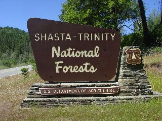
Campground List
CAMPGROUND NAME: Antlers

VISIT DATE: 06/28/2005

UPDATE DATE: 4/16/2025

STATE: California

REGION: Pacific Southwest

RANGER DISTRICT: Shasta Lake

NEAREST CITY/TOWN: Lakehead

RESERVATIONS: 1-877-444-6777 or make on-line reservation

DIRECTIONS:
In Lakehead, CA, at intersection of I-5 and Lakehead Dr./Antlers
Rd. (Exit 702), take Exit 702 to stop sign.  Turn east at sign
and go to next stop sign.  Turn south at stop sign and go 0.7
miles to campground on right.

GENERAL COMMENTS:
The elevation is 1,100 ft.

The campground is a series of three overlapping loops forming one
large loop next to Shasta Lake and adjacent to a large boat ramp,
marina and train track on opposite side.  The campsites are
tucked in among oak, pine, and Manzanita with dirt and leaf
litter understory.  Middlestory provides only fair privacy
between campsites.  Some of the campsites have a view of the
lake.  Poison Oak is present in campground.

This is bear country; practice safe food storage techniques.
Bear-proof food containers are available at most campsites.

SEASONS
Open Seasonal: Yes
Open All Year: No

Comments:
Open April 1 through October 31

RATE AND MAXIMUM STAY PERMITTED
Rate: $30 per day - single
$60 per day - double
NOTE: Scan and Pay used for on-site payments through Rec.gov app.
Maximum Stay Permitted (days): 14

CAMPGROUND SITE CONFIGURATION
No. RV Sites: 0
No. Tent Sites: 0
No. Combined Sites (Tent or RV): 59

   Total Sites: 59

Tent Pads: No
Open Sites: Yes
Wooded Sites: Yes

No. Tables on Sites: 59
No. Grilles on Sites: 59
Equestrian Camping:  No

RV INFORMATION
Hookups: None
No. RV Pull Throughs: 0
Waste Station: No
Average Parking Apron Size: Any size

Comments:
The parking aprons are paved and will accommodate most any size
RV.  However, single-site aprons are only 10 ft. wide.

FACILITIES
Vaults: Yes
Flush Toilets: Yes
Hot Showers: No
Wheelchair Friendly Toilets: Yes

Public Phone: No
Playground: No
No. Water Spigots (non-site): 20
  No. Threaded: 4

WATER SPORTS
Lake: Yes
Swimming (provided): No
Sailing: No
Boat Ramp: Yes
Boat Carry Down Access: Yes
Power Boating: Yes
Boating (no power): Yes
Water Skiing: Yes
Rafting (whitewater): No
Kayaking (whitewater): No

Comments:
Shasta Lake is 29,500 acres.

HIKING - No

FISHING
Brown and Rainbow trout, catfish, Smallmouth, Largemouth, and
Kentucky Spotted bass

CAMPGROUND NAME: Cattle Camp

VISIT DATE: 06/27/2005

UPDATE DATE:  4/16/2025

STATE: California

REGION: Pacific Southwest

RANGER DISTRICT: McCloud

NEAREST CITY/TOWN: McCloud

RESERVATIONS: No

DIRECTIONS:
From McCloud, CA, take State Rt. 89 south 9 miles to campground
sign.  Turn right onto Forest Rt. 40N44 and go 0.2 miles to
another campground sign.  Turn left into campground.

GENERAL COMMENTS:
The elevation is 3,400 ft.

The campground has two unnamed loops in a stand of mixed
conifers.  Some campsites have large cement pads for picnic table
and grille area.  Other sites have pedestal grilles and drum-
style fire rings.  The campground is convenient to the 6-mile
McCloud Loop Drive and its three waterfalls.

This is bear country; practice safe food storage techniques.

SEASONS
Open Seasonal: Yes
Open All Year: No

Seasonal Comment:
Open May through October.

RATE AND MAXIMUM STAY PERMITTED
Rate: $15 per day
Maximum Stay Permitted (days): 14

CAMPGROUND SITE CONFIGURATION
No. RV Sites: 0
No. Tent Sites: 0
No. Combined Sites (Tent or RV): 27

   Total Sites: 27

Tent Pads: No
Open Sites: Yes
Wooded Sites: Yes

No. Tables on Sites: 27
No. Grilles on Sites: 27
Equestrian Camping:  No

RV INFORMATION
Hookups: None
No. RV Pull Throughs: 1
Waste Station: No
Average Parking Apron Size: 12' X 35'

Comments:
The parking aprons are paved.

FACILITIES
Vaults: Yes
Flush Toilets: No
Hot Showers: No
Wheelchair Friendly Toilets: Yes

Public Phone: No
Playground: No
No. Water Spigots (non-site): 11
  No. Threaded: 4

WATER SPORTS - None

HIKING - Yes
McCloud River trail (foot, horse, mountain bike) - 12 miles
  provides access to waterfalls

FISHING -
Rainbow, Brown, and Brook trout

CAMPGROUND NAME: Deadlun

VISIT DATE: 06/30/2005

UPDATE DATE: 4/16/2025

STATE: California

REGION: Pacific Southwest

RANGER DISTRICT: Shasta Lake

NEAREST CITY/TOWN: Round Mountain

RESERVATIONS: No

DIRECTIONS:
From Round Mountain, CA, take State Rt. 299 east 5.2 miles to Big
Bend Rd.  Turn left onto Big Bend Rd. and go 17.6 miles to a "T"
intersection and Iron Canyon Reservoir sign.  Turn left onto
Forest Rt. 11 and go 4.7 miles to a "Y" intersection.  Bear left
and go 0.7 miles to campground sign.  Turn left at sign into
campground.

NOTE: Forest Rt. 11 begins just north of Big Bend, CA and is
paved, single-lane with turnouts and full of potholes.

GENERAL COMMENTS:
The elevation is 2,700 ft.

The campground, pack it in, pack it out, is a single loop through
a stand of mixed cedar and Douglas fir.  This under maintained
campground has a wilderness feel without all the challenges.  The
campsites are, in most cases, informal.  Bring insect repellant
and toilet paper.

This is bear country; practice safe food storage techniques.

SEASONS
Open Seasonal: No
Open All Year: Yes

RATE AND MAXIMUM STAY PERMITTED
Rate: No charge
Maximum Stay Permitted (days): 14

CAMPGROUND SITE CONFIGURATION
No. RV Sites: 0
No. Tent Sites: 24
No. Combined Sites (Tent or RV): 0

   Total Sites: 24

Tent Pads: No
Open Sites: No
Wooded Sites: Yes

No. Tables on Sites: 24
No. Grilles on Sites: 22
Equestrian Camping:  No

RV INFORMATION
Slide-ins and camper vans will work on some campsites.  Interior
road is badly eroded and rough.

FACILITIES
Vaults: Yes
Flush Toilets: No
Hot Showers: No
Wheelchair Friendly Toilets: No

Public Phone: No
Playground: No
No. Water Spigots (non-site): 0

WATER SPORTS
The 300-acre Iron Canyon Reservoir is nearby.

HIKING - No

FISHING - No

CAMPGROUND NAME: Ellery Creek

VISIT DATE: 06/29/2005

UPDATE DATE: 4/16/2025

STATE: California

REGION: Pacific Southwest

RANGER DISTRICT: Shasta Lake

NEAREST CITY/TOWN: Lakehead

RESERVATIONS: 1-877-444-6777 or make on-line reservation

DIRECTIONS:
From Lakehead, CA, take I-5 south 2.7 miles to Salt Creek
Rd./Gilman Rd. exit (Exit 698).  Take Exit 698 and at stop sign,
turn left onto Gilman Rd. and go 14.5 miles to campground sign.
Turn right into campground.

GENERAL COMMENTS:
The elevation is 1,100 ft.

The campground is a single loop stretching along the west side of
the McCloud River Arm of Shasta Lake.  The loop is is terraced so
some campsites on the upper side have a view of lake, while all
sites along lower side of loop have a view of lake.  Privacy
between campsites is fair to good; shade provided by deciduous
trees is ample during the afternoon sun.  Informal mooring of
boats is possible.  Water skiing and jet skiing could be noisy.
Parking in campsites 13 through 18 is diagonal and is best suited
for small motor homes and slide-ins.

This is bear country; practice safe food storage techniques.
Bear boxes for storing food are provided at some campsites.

SEASONS
Open Seasonal: Yes
Open All Year: No

Seasonal Comment:
Open April 1 through September 11

RATE AND MAXIMUM STAY PERMITTED
Rate: $30 per day
NOTE: Scan and Pay used for on-site payments through Rec.gov app.
Maximum Stay Permitted (days): 14

CAMPGROUND SITE CONFIGURATION
No. RV Sites: 0
No. Tent Sites: 0
No. Combined Sites (Tent or RV): 18

   Total Sites: 18

Tent Pads: Yes
Open Sites: Yes
Wooded Sites: Yes

No. Tables on Sites: 18
No. Grilles on Sites: 18
Equestrian Camping:  No

RV INFORMATION
Hookups: None
No. RV Pull Throughs: 0
Waste Station: No
Average Parking Apron Size: 10' X 35'

Comments:
The parking aprons are paved

FACILITIES
Vaults: Yes
Flush Toilets: No
Hot Showers: No
Wheelchair Friendly Toilets: Yes

Public Phone: No
Playground: No
No. Water Spigots (non-site): 3
  No. Threaded: 0

WATER SPORTS
Lake: Yes
Swimming (provided): No
Sailing: No
Boat Ramp: No
Boat Carry Down Access: Yes
Power Boating: Yes
Boating (no power): Yes
Water Skiing: Yes
Rafting (whitewater): No
Kayaking (whitewater): No

Comments:
Shasta Lake is 29,500 acres.  The nearest boat ramp is at Hirz
Bay campground, 5.3 miles south of campground.

HIKING - No

FISHING
Brown and Rainbow trout, catfish, and Smallmouth, Largemouth, and
Kentucky Spotted bass

CAMPGROUND NAME: Fowlers Camp

VISIT DATE: 06/27/2005

UPDATE DATE:  4/16/2025

STATE: California

REGION: Pacific Southwest

RANGER DISTRICT: McCloud

NEAREST CITY/TOWN: McCloud

RESERVATIONS: 1-877-444-6777 or  make on-line reservation

DIRECTIONS:
From McCloud, CA, take State Rt. 89 south 4.5 miles to Fowler and
Lower Falls sign.  Turn right at sign onto Forest Rt. 40N44 and
go 0.6 miles to a "Y" intersection.  Bear left and go 0.2 miles
to campground.

GENERAL COMMENTS:
The elevation is 3,400 ft.

The campground has two loops - A and B, in a stand of various
conifers including cedar and fir.  The area's volcanic history
can be seen in the chunky or porous rock scattered throughout the
campground.  Loop A has a more open feel, while loop B is more
heavily wooded with deciduous trees and Manzanita.  The
campground is next to McCloud River making it ideal for anglers.
The campground is on the 6-mile McCloud River (motor) Drive.
This drive has three waterfalls - Lower, Middle, and Upper.  From
the campground, Lower Falls is a five minute walk, Middle Falls
is 20 minutes and Upper Falls is 40 minutes.

This is bear country; practice safe food storage techniques.

SEASONS
Open Seasonal: Yes
Open All Year: No

Seasonal Comment:
Open May 15 through October 15

RATE AND MAXIMUM STAY PERMITTED
Rate: $15 per day - single
$30 per day - double
Maximum Stay Permitted (days): 14

CAMPGROUND SITE CONFIGURATION
No. RV Sites: 0
No. Tent Sites: 0
No. Combined Sites (Tent or RV): 39

   Total Sites: 39

Tent Pads: No
Open Sites: Yes
Wooded Sites: Yes

No. Tables on Sites: 39
No. Grilles on Sites: 39
Equestrian Camping:  No

RV INFORMATION
Hookups: None
No. RV Pull Throughs: 0
Waste Station: No
Average Parking Apron Size: 12' X 34'

Comments:
Loop A has gravel parking aprons and loop B has paved parking
aprons.

FACILITIES
Vaults: Yes
Flush Toilets: No
Hot Showers: No
Wheelchair Friendly Toilets: Yes

Public Phone: No
Playground: No
No. Water Spigots (non-site): 10
  No. Threaded: 5

WATER SPORTS - None

HIKING
McCloud River Trail (foot) - 10 miles
     accesses the Lower, Middle and Upper Waterfalls -
     paved in campground.

FISHING
Brown, Brook, and Rainbow trout

CAMPGROUND NAME: Hirz Bay

VISIT DATE: 06/29/2005

UPDATE DATE: 4/16/2025

STATE: California

REGION: Pacific Southwest

RANGER DISTRICT: Shasta Lake

NEAREST CITY/TOWN: Lakehead

RESERVATIONS: 1-877-444-6777 or make on-line reservation

DIRECTIONS:
From Lakehead, CA, take I-5 south 2.7 miles to Salt Creek
Rd./Gilman Rd. exit (Exit 698).  Take Exit 698 and at stop sign,
turn left onto Gilman Rd. and go 9.2 miles to campground sign.
Turn right at sign and go 0.5 miles to a "Y" intersection.  Bear
left into campground.

GENERAL COMMENTS:
The elevation is 1,100 ft.

The campground loops through oak and Manzanita meandering over a
hilltop above the McCloud River Arm of Shasta Lake.  The dense
Manzanita middlestory limits views of the lake but the sounds of
power boats can be heard throughout campground.  Privacy between
campsites is fair to poor.  Boat trailer parking is available in
campground.

This is bear country; practice safe food storage techniques.
Bear-proof food containers are available.

SEASONS
Open Seasonal: No
Open All Year: Yes

Comments:
None

RATE AND MAXIMUM STAY PERMITTED
Rate: $30 per day - single
$60 per day - double
Maximum Stay Permitted (days): 14

CAMPGROUND SITE CONFIGURATION
No. RV Sites: 0
No. Tent Sites: 0
No. Combined Sites (Tent or RV): 47

   Total Sites: 47

Tent Pads: No
Open Sites: Yes
Wooded Sites: Yes

No. Tables on Sites: 47
No. Grilles on Sites: 47
Equestrian Camping:  No

RV INFORMATION
Hookups: None
No. RV Pull Throughs: 1
Waste Station: No
Average Parking Apron Size: 10' X 55'

Comments:
The parking are paved and all are about same size.

FACILITIES
Vaults: No
Flush Toilets: Yes
Hot Showers: No
Wheelchair Friendly Toilets: No

Public Phone: Yes
Playground: No
No. Water Spigots (non-site): 11
  No. Threaded: 1

Comments:
Threaded spigot is at fee board.

WATER SPORTS
Lake: Yes
Swimming (provided): No
Sailing: No
Boat Ramp: Yes
Boat Carry Down Access: No
Power Boating: Yes
Boating (no power): Yes
Water Skiing: Yes
Rafting (whitewater): No
Kayaking (whitewater): No

Comments:
Shasta Lake is 29,500 acres.

HIKING
 Hirz Bay Trail (foot) - 2 miles

FISHING
Brown and Rainbow trout, catfish, Smallmouth, Largemouth, and
Kentucky Spotted bass

CAMPGROUND NAME: Lakeshore East

VISIT DATE: 06/29/2005

UPDATE DATE: 4/16/2025

STATE: California

REGION: Pacific Southwest

RANGER DISTRICT: Shasta Lake

NEAREST CITY/TOWN: Lakehead

RESERVATIONS: 1-877-444-6777 or make on-line reservation

DIRECTIONS:
In Lakehead, CA, at intersection of I-5 and Lakehead Dr./Antlers
Rd (Exit 702), take Exit 702 to stop sign.  Turn left (west) and
at next stop sign, turn left onto Lakeshore Dr.  Go 1.2 miles to
campground on left.

GENERAL COMMENTS:
The elevation is 1,000 ft.

The campground stretches out between Lakehead Dr. and Shasta Lake
under pine and oak.  Grass and raspberry bushes are abundant
providing fair privacy to some campsites.  Many sites have direct
access to lake offering informal mooring locations.  Nearby train
tracks mean train sounds throughout campground.

NOTE:  Yurts are available through recreation.gov May 15 through
September 12.

SEASONS
Open Seasonal: No
Open All Year: Yes

Comments:
None

RATE AND MAXIMUM STAY PERMITTED
Rate: $25 per day - single
$50 per day - double
NOTE: Scan and Pay used for on-site payments through Rec.gov app.
Maximum Stay Permitted (days): 14

CAMPGROUND SITE CONFIGURATION
No. RV Sites: 0
No. Tent Sites: 0
No. Combined Sites (Tent or RV): 26

   Total Sites: 26

Tent Pads: Yes
Open Sites: No
Wooded Sites: Yes

No. Tables on Sites: 26
No. Grilles on Sites: 26
Equestrian Camping:  No

RV INFORMATION
Hookups: None
No. RV Pull Throughs: 0
Waste Station: No
Average Parking Apron Size: 11.5' X 40'

Comments:
The parking aprons are paved.

FACILITIES
Vaults: No
Flush Toilets: Yes
Hot Showers: No
Wheelchair Friendly Toilets: Yes

Public Phone: No
Playground: No
No. Water Spigots (non-site): 8
  No. Threaded: 2

WATER SPORTS
Lake: Yes
Swimming (provided): No
Sailing: No
Boat Ramp: No
Boat Carry Down Access: Yes
Power Boating: Yes
Boating (no power): Yes
Water Skiing: Yes
Rafting (whitewater): No
Kayaking (whitewater): No

Comments:
Shasta Lake is 29,500 acres. Nearest boat ramp is Sugarloaf, 1
mile south of campground on Lakeshore Dr. - primitive.

HIKING - No

FISHING
Brown and Rainbow trout, catfish, Smallmouth, Largemouth, and
Kentucky Spotted bass

CAMPGROUND NAME: McBride Springs

VISIT DATE: 06/27/2005

UPDATE DATE:  4/16/2025

STATE: California

REGION: Pacific Southwest

RANGER DISTRICT: Mt. Shasta

NEAREST CITY/TOWN: Mt. Shasta

RESERVATIONS: No

DIRECTIONS:
In Mt. Shasta, CA, at intersection of Lake St. and Everitt
Memorial Hwy, take Everitt Memorial Hwy. 3.9 miles to campground
on left.

GENERAL COMMENTS:
The elevation is 4,800 ft.

The campground is a large single loop through cedar and other
species of trees.  At the foot of Mt. Shasta, McBride Springs
runs through the campground providing a pleasant riparian
environment among the conifers.  The campground is a good base
camp for exploring Mt. Shasta.  Contact the Ranger District
Office for information about nearby trailheads and Mt. Shasta
Wilderness.  The campsites are secluded and offer good privacy.
This is a very picturesque location with views of Mt. Shasta
through the trees.

SEASONS
Open Seasonal: Yes
Open All Year: No

Seasonal Comment:
Open June through October - opening and
closing depends on snow conditions

RATE AND MAXIMUM STAY PERMITTED
Rate: $10 per day
Maximum Stay Permitted (days): 7

CAMPGROUND SITE CONFIGURATION
No. RV Sites: 0
No. Tent Sites: 1
No. Combined Sites (Tent or RV): 9

   Total Sites: 10

Tent Pads: No
Open Sites: Yes
Wooded Sites: Yes

No. Tables on Sites: 10
No. Grilles on Sites: 9
Equestrian Camping:  No

RV INFORMATION
Hookups: None
No. RV Pull Throughs: 0
Waste Station: No
Average Parking Apron Size: 12' X 39'

Comments:
The parking aprons are gravel

FACILITIES
Vaults: Yes
Flush Toilets: No
Hot Showers: No
Wheelchair Friendly Toilets: Yes

Public Phone: No
Playground: No
No. Water Spigots (non-site): 1
  No. Threaded: 0

Comments:
The water spigot is a hand pump - located 420 feet up a trail at
upper end of campground.

WATER SPORTS - None

HIKING
See General Comments.

FISHING - No

CAMPGROUND NAME: McCloud Bridge

VISIT DATE: 06/29/2005

UPDATE DATE: 4/16/2025

STATE: California

REGION: Pacific Southwest

RANGER DISTRICT: Shasta Lake

NEAREST CITY/TOWN: Lakehead

RESERVATIONS: No

DIRECTIONS:
From Lakehead, CA, take I-5 south 2.7 miles to Salt Creek
Rd./Gilman Rd. exit (Exit 698).  Take Exit 698 and at stop sign,
turn left onto Gilman Rd. and go 16.7 miles to campground on
right.

GENERAL COMMENTS:
The elevation is 1,100 ft.

The campground spans the McCloud River Arm of Shasta Lake among
mature oak trees.  The understory is composed of gorgeous
wildflowers and an abundance of raspberry shrubs.  Boats can be
moored close to campsites.  Lots of singing birds - very
picturesque campground.

This is bear country; practice safe food storage techniques.
Bear box containers are available at some campsites for storing
food.

SEASONS
Open Seasonal: No
Open All Year: Yes

Seasonal Comment:
Open April 1 through October 31

RATE AND MAXIMUM STAY PERMITTED
Rate: $28 per day - single
$56 per day - double
Maximum Stay Permitted (days): 14

CAMPGROUND SITE CONFIGURATION
No. RV Sites: 0
No. Tent Sites: 0
No. Combined Sites (Tent or RV): 14

   Total Sites: 14

Tent Pads: Yes
Open Sites: Yes
Wooded Sites: Yes

No. Tables on Sites: 14
No. Grilles on Sites: 14
Equestrian Camping:  No

RV INFORMATION
Hookups: None
No. RV Pull Throughs: 2
Waste Station: No
Average Parking Apron Size: 12' X 45'

Comments:
The parking aprons are paved and all about same size.

FACILITIES
Vaults: Yes
Flush Toilets: No
Hot Showers: No
Wheelchair Friendly Toilets: Yes

Public Phone: No
Playground: No
No. Water Spigots (non-site): 3
  No. Threaded: 1

WATER SPORTS
Lake: Yes
Swimming (provided): No
Sailing: No
Boat Ramp: No
Boat Carry Down Access: Yes
Power Boating: Yes
Boating (no power): Yes
Water Skiing: Yes
Rafting (whitewater): No
Kayaking (whitewater): No

Comments:
Shasta Lake is 29,000 acres.  Nearest boat ramp is at Hirz Bay
campground, 7.5 miles south of campground.

HIKING - No

FISHING
Brown and Rainbow trout, catfish, and Smallmouth, Largemouth, and
Kentucky Spotted bass

CAMPGROUND NAME: Sims Flat

VISIT DATE: 06/27/2005

UPDATE DATE:  4/16/2025

STATE: California

REGION: Pacific Southwest

RANGER DISTRICT: Mt. Shasta

NEAREST CITY/TOWN: Dunsmuir

RESERVATIONS: No

DIRECTIONS:
From Dunsmuir, CA, take I-5 south 10 miles to Simms Rd (Exit
718).  Take Exit 718 and turn left at stop sign onto Simms Rd.
Follow Simms Rd. south 0.7 miles to campground.

GENERAL COMMENTS:
The elevation is 1,700 ft.

Once a stop on a winter Native American trade route, then the
site of Sims Trading Post, and later a Civilian Conservation
Corps (CCC) camp, the campground stretches along the Sacramento
River and Hazel Creek.  It loops back through a nice mixture of
conifer and deciduous trees.  Wild sweet peas add color while
remnants left by CCC Camp 978 (Camp Sims) and fast flowing river
give the camp character.  This is a nice campground for overnight
stop by most any size RV.  Take a moment to admire the steel
suspension bridge built in 1933 by the CCC, the first major CCC
project in the U.S.  Parts were provided for the bridge without
any instructions on how to construct it - existing testimony of
the CCC's incredible capabilities.

Train enthusiasts enjoy watching the Union Pacific freight train
wind its way thru the Upper Sacramento River Canyon.

SEASONS
Open Seasonal: Yes
Open All Year: No

Seasonal Comment:
Open April 15 through November 15.

RATE AND MAXIMUM STAY PERMITTED
Rate: $15 per day
Maximum Stay Permitted (days): 14

CAMPGROUND SITE CONFIGURATION
No. RV Sites: 0
No. Tent Sites: 0
No. Combined Sites (Tent or RV): 19

   Total Sites: 19

Tent Pads: No
Open Sites: Yes
Wooded Sites: Yes

No. Tables on Sites: 19
No. Grilles on Sites: 19
Equestrian Camping:  No

RV INFORMATION
Hookups: None
No. RV Pull Throughs: 0
Waste Station: No
Average Parking Apron Size: 13' X 45'

Comments:
The parking aprons are a mixture of paved, grass, and gravel.

FACILITIES
Vaults: No
Flush Toilets: Yes
Hot Showers: No
Wheelchair Friendly Toilets: Yes

Public Phone: No
Playground: No
No. Water Spigots (non-site): 4
  No. Threaded: 0

WATER SPORTS - None

HIKING
Riverside Trail (foot) - 0.2 miles

FISHING
World renown fishing on a classic trout stream.
|