Forest Information
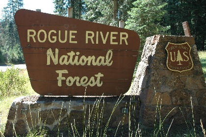
The Rogue River National Forest (of Rogue River-Siskiyou National
Forest) is located in south western Oregon with a small section
in northern California. In Oregon, the Forest consists of
575,445 acres; in California, it consists of 53,796 acres. There are
54 developed campgrounds of which 11 meet the selection criteria.
The beauty of the land and power of the river make the Rogue
River National Forest a great place for a forest camping
experience. Whether used by a family for a fun vacation or an
individual looking for solitude or a challenge, the Rogue River
National Forest has many camping locations and a wide variety of
recreational opportunities. Glorious scenery, fascinating
geology, and an interesting history combine with miles of trails,
numerous developed campgrounds, Rogue River-Umpqua Scenic Byway
(a.k.a. State Route 230) and Crater Lake National Park, make
Rogue River National Forest a place worth visiting.
The geology of Rogue River National Forest gives it two distinct
areas. There are narrow canyons, high grass-covered steep
ridges, and Applegate Lake reservoir in the Forest's southern
area. In the northeast, the Cascade Range's gentle slopes, dense
forest of magnificent pine, and a volcanic past, give a very
different look to the Forest.
The Applegate Lake Reservoir offers visitors a variety of
excellent water play opportunities. The scenic area surrounding
the Lake contains many trails, a few special places, and a couple
of nice developed campgrounds. One is campground is a tent-only campground called Watkins. Here, sites
are scattered up a hillside and are tucked in among towering
Douglas fir trees. There is no direct access to Applegate Lake
but the Da-Ku-Be-Te-De (pronounced Daw-Kew-Bee-Tee-Dee) trail,
with its pleasant up-close views of the Applegate area, make this
a popular campground. Da-Ku-Be-Te-De trail was named for a small
band of Native people who lived in the area. The nearby Collings
Mountain Trail, named for two brothers who mined in the vicinity,
and Grouse Loop Trail, a pleasant three-mile hike through an old-
growth forest, offer access to another perspective of the area.
Two day trips in the Applegate Lake area illustrate the area's
diverse history and varied vegetation. Gin Lin Mining trail
commemorates the gold fever that swept through the area, the use
of hydraulic mining techniques, and the Chinese mining boss by
the same name. This interpretative trail is a walk through "Gold
Rush" history. By contrast, Miller Lake Trail celebrates the
area's botanical diversity. Here, Sugar pine, White and Douglas
fir thrive and rare Brewers spruce, along with brush species of
Oracle and Saddlers Oak, can also be found along this trail.
Where the Applegate Lake area has steep ridges and views that go
on forever, the area to the northeast, in the Cascade Range,
features gentler slopes, dense forests, and clear views of its
volcanic history. This history is clearly seen in the pumice
rock dotting Doe Point and Fish Lake campgrounds and in the lava
flows beside the adjacent highway. Mt. Brown's gentle profile
fills the southern horizon while, to the north, the towering Mt.
McLoughlin, centerpiece of the Sky Lakes Wilderness, watches over
the campgrounds. These now quiet volcanoes are so young they are
almost unmarked by erosion.
Following the Cascade Range northward, tucked in among grand old
Douglas fir and cedars is a sweet little campground named Whiskey
Springs. With its beaver-made pond and thick stand of fir, the
campground has a pleasantly tranquil feel. The tiny
Willow Prairie Horse Camp campground is designed for equestrian campers;
it has a network of horse trails, some leading into the Sky Lakes
Wilderness.
Along the Rogue River-Umpqua Scenic Byway, as it follows the Wild
and Scenic Upper Rogue River, are a series of delightful
developed campgrounds. Little Mill Creek campground, the closest
campground to the community of Prospect, is rustic but since it
stretches along Mill Creek in a pleasant mixture of fir, cedar,
and maple tree, some consider it the most attractive
campground along the Byway. River Bridge campground, off the
beaten path and next to a "lazy flowing" section of the Rogue
River, could challenge that statement. Even further off the
beaten track is Abbott Creek campground. Here, some camp sites
are tucked in among large conifers with others bordering large
open meadows making it spectacular in the Fall. Natural Bridge
campground has been a popular camping and day use area for
decades. Stretching almost a mile along Rogue River, the
campground has a lava tube where the river flows through, thus,
Natural Bridge.
Of the Byway's campgrounds, Union Creek and Farewell Bend are
closest to Crater Lake National Park and are good base camps from
which to explore the Park. Union Creek campground, in the Union
Creek Historic District, is within walking distance of Union
Creek with its Civilian Conservation Corp (CCC) era structures.
The CCC Community Kitchen structure, located behind the pre-CCC
era Becky's Cafe (known for its homemade pies), is a great
example of the enrollee's workmanship. Close by is a trail where
the Rogue River tumbles through basalt rock in a narrow canyon
called Rogue Gorge.
While the Byway is a beautiful drive through a cathedral of
towering pines on the way to Crater Lake National Park, there is
much to see just off the route. Spectacular waterfalls, such as
Mill Creek Falls and Natural Creek Falls, are worth the hike to
them. Each of the area's hiking trails seems to have some
special feature. The longest and most popular trail is the Upper
Rogue River trail that follows the river through old-growth
forests, past rapids and quiet pools. And unique geological
features, such as Rabbit Ears and 400 foot banks of white pumice
ash, seem to be all around.
Visitors to the Rogue River National Forest find much to do
besides exploring Crater Lake National Park. This is a place of
breathtaking beauty, amazing geology, and wonder. With each
trip to Rogue River National Forest, visitors discover another
reason to return. Come and discover a few reasons for yourself.
ADDRESSES
SUPERVISOR ADDRESS
3040 Biddle Rd.
Medford, Oregon 97504
541-618-2200

RANGER DISTRICT ADDRESSES
Siskiyou Mountains
Star Ranger Station
6941 Upper Applegate Rd.
Jacksonville, Oregon 97530
541-899-3800

High Cascades - Butte Falls Office
P.O. Box 227
730 Laurel St.
Butte Falls, Oregon 97522
541-865-2700

High Cascades - Prospect Office
47201 Highway 62
Prospect, Oregon 97536
541-560-3400 |