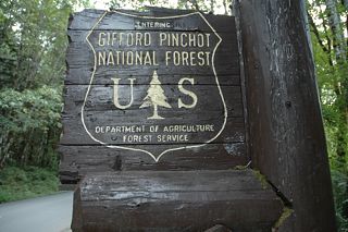
Campground List
CAMPGROUND NAME: Adams Fork

VISIT DATE: 08/28/2007

UPDATE DATE: 8/13/2024

STATE: Washington

REGION: Pacific Northwest

RANGER DISTRICT: Cowlitz Valley

NEAREST CITY/TOWN: Randle

RESERVATIONS: 1-877-444-6777 or make on-line reservation

DIRECTIONS:
In Randle, WA, at intersection of US Rt. 12 and State Rt. 131
(Cispus Rd), take Cispus Rd south 0.9 miles to a "Y"
intersection.  Bear left, staying on Cispus Rd (Forest Rt. 23)
and go 17.7 miles to another "Y" intersection.  Bear left onto
Forest Rt. 21 and go 4.6 miles to campground sign.  Bear right
after sign, onto Forest Rt. 56, and go 0.1 miles to campground on left.

GENERAL COMMENTS:
The elevation is 2,500 ft.

The campground is a single loop in a stand of mixed conifers,
most are Douglas fir but there is a sprinkling of cedar and
hemlock.  A popular and attractive campground with dirt bike
enthusiasts, the campground has retained its "woodsy" appearance.
Cispus River and Adams Creek flow nearby and can be heard
throughout but not seen.  Nearby Valley trail network offers many
miles of multi-use trails and is the primary attraction for dirt
bikes and "quad."

SEASONS
Open Seasonal: Yes
Open All Year: No

Seasonal Comment:
Open May 24 through September 22.

RATE AND MAXIMUM STAY PERMITTED
Rate: $25 per day - single
$45 per day - double
Maximum Stay Permitted (days): 14

CAMPGROUND SITE CONFIGURATION
No. RV Sites: 0
No. Tent Sites: 0
No. Combined Sites (Tent or RV): 21

   Total Sites: 21

Tent Pads: No
Open Sites: Yes
Wooded Sites: Yes

No. Tables on Sites: 21
No. Grilles on Sites: 21
Equestrian Camping:  No

RV INFORMATION
Hookups: None
No. RV Pull Throughs: 1
Waste Station: No
Average Parking Apron Size: 11' X 31'

Comments:
The parking aprons are paved.

FACILITIES
Vaults: Yes
Flush Toilets: No
Hot Showers: No
Wheelchair Friendly Toilets: Yes

Public Phone: No
Playground: No
No. Water Spigots (non-site): 2
  No. Threaded: 0

Comments:
The water spigots are handpumps.

WATER SPORTS - None

HIKING
Valley Trail #270 (foot, horse, mountain bike, dirt bike, &
quads) - 50-mile network of trails

FISHING
Brook trout

CAMPGROUND NAME: Beaver

VISIT DATE: 09/12/2007

UPDATE DATE:  8/13/2024

STATE: Washington

REGION: Pacific Northwest

RANGER DISTRICT: Mt. Adams

NEAREST CITY/TOWN: Carson

RESERVATIONS: 1-877-444-6777 or make on-line reservation

DIRECTIONS:
In Carson, WA, at intersection of Wind River Rd (State Rt. 14
West) and Hot Spring (State Rt. 14 East), take Wind River Rd
north and go 11.9 miles to campground on left.

GENERAL COMMENTS:
The elevation is 1,100 ft.

The campground is a single loop with a small dead end spur in a
stand of Bigleaf and Vine maples, alders and a few Douglas fir
and cedar scattered around.  There is a large grassy area at the
campground's entrance, perfect for field games.  A horseshoe pit
is located in this area.  A few campsites overlook Wind River.
Vegetation provides ample shade and fair to good privacy.

SEASONS
Open Seasonal: Yes
Open All Year: No

Seasonal Comment:
Open May 24 through September 22

RATE AND MAXIMUM STAY PERMITTED
Rate: $27 per day - single
$50 per day - double
Maximum Stay Permitted (days): 14

CAMPGROUND SITE CONFIGURATION
No. RV Sites: 0
No. Tent Sites: 0
No. Combined Sites (Tent or RV): 23

   Total Sites: 23

Tent Pads: Yes
Open Sites: No
Wooded Sites: Yes

No. Tables on Sites: 23
No. Grilles on Sites: 23
Equestrian Camping:  No

RV INFORMATION
Hookups: None
No. RV Pull Throughs: 2
Waste Station: No
Average Parking Apron Size: 13' X 35'

Comments:
The parking aprons are paved.  Campsites 15, 16 and 17 are on a
dead end; RVs should back into these sites.  A waste station with
no potable water is available for a fee in Carson, WA at Wind
River Rd., mile post 2.4.

FACILITIES
Vaults: Yes
Flush Toilets: Yes
Hot Showers: No
Wheelchair Friendly Toilets:

Public Phone: No
Playground: Yes
No. Water Spigots (non-site): 6
  No. Threaded: 0

Comments:
The flush toilet is not wheelchair-friendly.  The threaded spigot
is near the playground.

WATER SPORTS - None

HIKING - No

FISHING
Chinook salmon and Steelhead trout

CAMPGROUND NAME: Big Creek

VISIT DATE: 08/29/2007

UPDATE DATE: 8/13/2024

STATE: Washington

REGION: Pacific Northwest

RANGER DISTRICT: Cowlitz Valley

NEAREST CITY/TOWN: Ashford

RESERVATIONS: 1-877-444-6777 or make on-line reservation

DIRECTIONS:
From Ashford, WA, take State Rt. 706 east 2 miles to Skate
Rd./Forest Rt. 52 signs.  Turn right after signs onto Forest Rt.
52 and go 1.8 miles to campground on right.

GENERAL COMMENTS:
The elevation is 1,900 ft.

The Nisqually entrance (southwest corner) to Mt. Rainier National
Park is 5.3 miles from campground.

The campground is a single loop in a semi-tropical environment.
Grand old Douglas fir and hemlock grow among Vine maple and
alders as well as shade-loving fern, moss, and other lush ground
covers.  Sites on one side of loop overlook Big Creek.  Each site
has a pedestal grille and enjoys good to excellent privacy.  The
lush vegetation and large rocks may make pitching a tent a
challenge at some sites but worth the effort.

SEASONS
Open Seasonal: Yes
Open All Year: No

Seasonal Comment:
Open May 24 through September 22

RATE AND MAXIMUM STAY PERMITTED
Rate: $25 per day - single
$45 per day - double
Maximum Stay Permitted (days): 14

CAMPGROUND SITE CONFIGURATION
No. RV Sites: 0
No. Tent Sites: 1
No. Combined Sites (Tent or RV): 27

   Total Sites: 28

Tent Pads: No
Open Sites: Yes
Wooded Sites: Yes

No. Tables on Sites: 28
No. Grilles on Sites: 28
Equestrian Camping:  No

RV INFORMATION
Hookups: None
No. RV Pull Throughs: 3
Waste Station: No
Average Parking Apron Size: 11' X 40'

Comments:
Most of the parking aprons are paved but a few are moss and dirt.
There are grey water disposals units scattered throughout
campground.

FACILITIES
Vaults: Yes
Flush Toilets: No
Hot Showers: No
Wheelchair Friendly Toilets: Yes

Public Phone: No
Playground: No
No. Water Spigots (non-site): 9
  No. Threaded: 1

WATER SPORTS - None

HIKING
Osborn Mountain Trail #250 (foot, horse, mountain bike & dirt
bike) -  5.5 miles

FISHING
Brook trout

CAMPGROUND NAME: Blue Lake Creek

VISIT DATE: 08/31/2007

UPDATE DATE: 8/13/2024

STATE: Washington

REGION: Pacific Northwest

RANGER DISTRICT: Cowlitz Valley

NEAREST CITY/TOWN: Randle

RESERVATIONS: 1-877-444-6777 or make on-line reservation

DIRECTIONS:
In Randle, WA, at intersection of US Rt. 12 and State Rt. 131,
take Rt. 131/Cispus Rd. south 0.9 miles to a "Y" intersection.
Bear left, staying on Cispus Rd (Forest Rt. 23) and go 15.2 miles
to campground on left.

GENERAL COMMENTS:
The elevation is 1,800 ft.

The campground is a single loop in a stand of maple.  It is
located on the Valley OHV Trail and a network of 50-plus miles of
OHV trails.  The campground is popular with dirt bike
enthusiasts.  A little brook flows quietly down the middle of the
campground.  Sites are grassy and have no privacy from other
campsites.

SEASONS
Open Seasonal: Yes
Open All Year: No

Seasonal Comment:
Open May 17 through September 22.

RATE AND MAXIMUM STAY PERMITTED
Rate: $20 per day

Maximum Stay Permitted (days): 14

CAMPGROUND SITE CONFIGURATION
No. RV Sites: 0
No. Tent Sites: 0
No. Combined Sites (Tent or RV): 11

   Total Sites: 11

Tent Pads: No
Open Sites: Yes
Wooded Sites: Yes

No. Tables on Sites: 11
No. Grilles on Sites: 11
Equestrian Camping:  No

RV INFORMATION
Hookups: None
No. RV Pull Throughs: 0
Waste Station: No
Average Parking Apron Size: 12' X 36'

Comments:
The parking aprons are paved.

FACILITIES
Vaults: Yes
Flush Toilets: No
Hot Showers: No
Wheelchair Friendly Toilets: Yes

Public Phone: No
Playground: No
No. Water Spigots (non-site): 0

Comments:
The water spigot is handpump.

WATER SPORTS - None

HIKING
Valley trail #270 (foot, horse, mountain bike, dirt bike & quad)
- 22 miles
High Log trail #295 (foot) - 0.3 miles

FISHING - No

CAMPGROUND NAME: Cody Horse Camp

VISIT DATE: 08/28/2007

UPDATE DATE:  8/13/2024

STATE: Washington

REGION: Pacific Northwest

RANGER DISTRICT: Cowlitz Valley

NEAREST CITY/TOWN: Randle

RESERVATIONS: No

DIRECTIONS:
In Randle, WA, at the intersection of U.S. Rt. 12 and State Rt.
131/Cispus Rd. take Cispus Rd. south .9 mile to a "Y"
intersection.  Bear left, staying on Cispus Rd/Forest Rt. 12 and
go 17.7 miles to another "Y" intersection.  Bear left onto Forest
Rt. 21 and go 4.6 mile to an intersection  and Walupt Lake sign.
Turn right onto Forest Rt. 56 (gravel) and go 4.7 miles to Cody
Horse Camp sign.  Turn right and go .2 miles to campground on
left.

GENERAL COMMENTS:
Elevation is 3,200 ft.

This "stock only" campground is a single loop through a stand of
mixed conifers which include cedar, hemlock, and White pine.
There are lots of trees providing lots of shade but leaving
little space for portable corrals.  Most sites have highline
poles and long pull-through parking aprons that can accommodate
big, multiple horse, trailers.  Pleasant, nicely designed
campground with trails nearby to keep equestrians with varied rides.

SEASONS
Open Seasonal: Yes
Open All Year: No

Seasonal Comment:
Open July 5 through September 22

RATE AND MAXIMUM STAY PERMITTED
Rate: $23 per day
Maximum Stay Permitted (days): 14

CAMPGROUND SITE CONFIGURATION
No. RV Sites: 0
No. Tent Sites: 0
No. Combined Sites (Tent or RV): 16

   Total Sites: 16

Tent Pads: No
Open Sites: Yes
Wooded Sites: Yes

No. Tables on Sites: 16
No. Grilles on Sites: 16
Equestrian Camping:  Yes

RV INFORMATION
Hookups: None
No. RV Pull Throughs: 16
Waste Station: No
Average Parking Apron Size: See Comments

Comments:
The long parking aprons are gravel and all are pull-throughs.

FACILITIES
Vaults: Yes
Flush Toilets: No
Hot Showers: No
Wheelchair Friendly Toilets: No

Public Phone: No
Playground: No
No. Water Spigots (non-site): 0

Comments:
Stock water is also provided.

WATER SPORTS - None

HIKING
Klackitat Loop trail # 7A (foot & horse) - connects to a 27-mile
network of trails

FISHING - No

CAMPGROUND NAME: Cultus Creek Forest Camp

VISIT DATE: 09/10/2007

UPDATE DATE:  3/15/2015

STATE: Washington

REGION: Pacific Northwest

RANGER DISTRICT: Mt. Adams

NEAREST CITY/TOWN: Trout Lake

RESERVATIONS: No

DIRECTIONS:
In Trout Lake, WA, at intersection of State Rt. 141 and Mt. Adams
Rec Hwy, take Rt. 141 north 7.9 miles to an intersection.  Turn
right, staying on Forest Rt. 24 and go 8.8 miles to campground on
both sides of the road.

NOTE:  State Rt. 141 becomes Forest Rt. 24 at the Forest's
boundary.

GENERAL COMMENTS:
The elevation is 4,000 ft.

The campground straddles Forest Rt. 24 with a section on both
sides of the road.  The sites in either sections enjoy ample
shade from the dense stand of mixed conifers including Engelmann
spruce and Silver fir.  Some sites in the west side section back
up on Cultus Creek. The campground has a rustic wilderness feel.
The lush vegetation provides most sites with good privacy .  This
rustic campground is on the east side of Indian Heaven Wilderness
making it a good base camp for exploring the area especially
during huckleberry picking time.

SEASONS
Open Seasonal: Yes
Open All Year: No

Seasonal Comment:
Open July 15 through October 15 - weather dependent

RATE AND MAXIMUM STAY PERMITTED
Rate: $10 per day - single
$20 per day - double
Maximum Stay Permitted (days): 14

CAMPGROUND SITE CONFIGURATION
No. RV Sites: 0
No. Tent Sites: 6
No. Combined Sites (Tent or RV): 40

   Total Sites: 46

Tent Pads: No
Open Sites:  No
Wooded Sites: Yes

No. Tables on Sites: 39
No. Grilles on Sites: 43
Equestrian Camping:  No

RV INFORMATION
Hookups: None
No. RV Pull Throughs: 4
Waste Station: No
Average Parking Apron Size: 13' X 50'

Comments:
The parking aprons are gravel and dirt.  A waste station with
potable water is available for a fee at Klickitat County Park off
Jenning Rd in Trout Lake, WA.  Caution: There are low branches
across aprons and the interior road is seriously eroded in places.

FACILITIES
Vaults: Yes
Flush Toilets: No
Hot Showers: No
Wheelchair Friendly Toilets: Yes

Public Phone: No
Playground: No
No. Water Spigots (non-site): 0

WATER SPORTS - None

HIKING
Cultus Creek trail #108 (foot) - 1.5 miles
Indian Heaven trail #33 (foot & horse) - 5.5 miles
  Provides access to the Indian Heaven Wilderness

FISHING - No

CAMPGROUND NAME: Forlorn Lakes

VISIT DATE: 09/09/2007

UPDATE DATE:  3/5/2018

STATE: Washington

REGION: Pacific Northwest

RANGER DISTRICT: Mt. Adams

NEAREST CITY/TOWN: Trout Lake

RESERVATIONS: No

DIRECTIONS:
In Trout Lake, WA, at intersection of State Rt. 141 and Mt. Adams
Rec Hwy, take Rt. 141 north 7.9 miles to Goose Lake/Forest Rt. 60
signs.  Continue straight onto Rt. 60 and go 1.5 miles to "T"
intersection.  Turn right, staying on Rt. 60 (gravel) and go 0.1
miles to a "Y" intersection.  Bear right, continuing on Rt. 60,
and go 1.7 miles to an intersection and Forlorn Lakes sign.  Turn
left at sign onto Forest Rt. 6030 and go 2 miles to campground
sign.  Turn left at sign onto Forest Rt. 6040 into the campground
or continue straight for another 0.2 miles to sites 22 through
25.

NOTE: Forest Rt. 6030 becomes Forest Rt 6035 and is a dirt, rough,
narrow roadway for last 1.8 miles.

GENERAL COMMENTS:
The elevation is 3,700 ft.

The campground winds 1.7 miles around, between, and along a
collection of some of the prettiest little lakes and ponds in the
forest.  Most sites are on a lake, making it easy to fish.  Many
sites are secluded, tucked in among the many types of conifers
which provide ample shade.  Huckleberry bushes suggest another
activity for campers.  The campground's dispersed camping origin
is reflected in its rugged, semi-wilderness feel and secluded
sites.  Only in sites 1, 2, and 3 are travel trailers permitted.
Sites 20 and 21 are walk-in tent sites while the remaining sites
are designated for tent and truck mounted (slide-in) campers.
There are 16 lakes and ponds in the Forlorn Lakes area and a
significant population of mosquitoes - bring repellent.  The
tranquil atmosphere of this campground and the area's beauty has
made this campground a favorite for generations.

SEASONS
Open Seasonal: Yes
Open All Year: No

Seasonal Comment:
Open July 15 through October 15 - weather dependent

RATE AND MAXIMUM STAY PERMITTED
Rate: $10 per day
Maximum Stay Permitted (days): 14

CAMPGROUND SITE CONFIGURATION
No. RV Sites: 0
No. Tent Sites: 21
No. Combined Sites (Tent or RV): 3

   Total Sites: 24

Tent Pads: No
Group Tent Sites: Yes
Wooded Sites: Yes

No. Tables on Sites: 24
No. Grilles on Sites: 24
Equestrian Camping:  No

RV INFORMATION
Hookups: None
No. RV Pull Throughs: 0
Waste Station: No
Average Parking Apron Size: See comments

Comments:
The parking aprons are dirt and irregular in shape.  Sites 1, 2 &
3 can accommodate any size RV.  All other sites are designated by
the Forest Service: "tent and truck mounted " (slide-in) campers
only.  A waste station with potable water is available for a fee
at Klickitat County Park off Jenning Rd. in Trout Lake, WA.

FACILITIES
Vaults: Yes
Flush Toilets: No
Hot Showers: No
Wheelchair Friendly Toilets: Yes

Public Phone: No
Playground: No
No. Water Spigots (non-site): 0

WATER SPORTS
Lake: Yes
Swimming (provided): No
Sailing: No
Boat Ramp: No
Boat Carry Down Access: Yes
Power Boating: No
Boating (no power): Yes
Water Skiing: No
Rafting (whitewater):
Kayaking (whitewater): No

Comments:
The five lakes with campsites are small, making them very nice
for canoeing.

HIKING

FISHING
German Brown, Tiger (in Lake #5 only) and Brook trout

CAMPGROUND NAME: Goose Lake

VISIT DATE: 09/09/2007

UPDATE DATE: 8/13/2024

STATE: Washington

REGION: Pacific Northwest

RANGER DISTRICT: Mt. Adams

NEAREST CITY/TOWN: Trout Lake

RESERVATIONS: No

DIRECTIONS:
In Trout Lake, WA, at intersection of State Rt. 141 and Mt. Adams
Rec Hwy, take Rt. 141 north 7.9 miles to Goose Lake/Forest Rt. 60
signs.  Continue straight onto Rt. 60 and go 1.5 miles to "T"
intersection.  Turn right, staying on Rt. 60 (gravel) and go 0.1
miles to a "Y" intersection.  Bear right, continuing on Rt. 60,
and go 3.7 miles to campground on right.

GENERAL COMMENTS:
The elevation is 3,100 ft.

The campground stretches along the east bank of Goose Lake and up
a hillside in a stand of mixed, mature conifers including Douglas
fir and cedar which provide ample shade.  Access to the campsites
are either up or down from precarious parking spots.  The
adjacent Big Lava Field might be worth exploring.

SEASONS
Open Seasonal: Yes
Open All Year: No

SeasonalComment:
Open June 14 through September 22 - weather dependent

RATE AND MAXIMUM STAY PERMITTED
Rate: $20 per day
Maximum Stay Permitted (days): 14

CAMPGROUND SITE CONFIGURATION
No. RV Sites: 0
No. Tent Sites: 19
No. Combined Sites (Tent or RV): 0

   Total Sites: 19

Tent Pads: No
Open Sites: No
Wooded Sites: Yes

No. Tables on Sites: 19
No. Grilles on Sites: 19
Equestrian Camping:  No

FACILITIES
Vaults: Yes
Flush Toilets: No
Hot Showers: No
Wheelchair Friendly Toilets: No

Public Phone: No
Playground: No
No. Water Spigots (non-site): 0

WATER SPORTS
Lake: Yes
Swimming (provided): No
Sailing: No
Boat Ramp: Yes
Boat Carry Down Access: No
Power Boating: Yes
Boating (no power): Yes
Water Skiing: No
Rafting (whitewater): No
Kayaking (whitewater): No

Comments:
Goose Lake is 58 acres.

HIKING - No

FISHING
Rainbow, Brook & Brown trout

CAMPGROUND NAME: Horseshoe Lake

VISIT DATE: 09/01/2007

UPDATE DATE: 8/13/2024

STATE: Washington

REGION: Pacific Northwest

RANGER DISTRICT: Cowlitz Valley

NEAREST CITY/TOWN: Randle

RESERVATIONS: No

DIRECTIONS:
In Randle, WA, at intersection of US Rt. 12 and State Rt.
131/Cispus Rd, take Cispus Rd. south 0.9 miles to a "Y"
intersection.  Bear left, staying on Cispus Rd/Forest Rt. 23 and
go 17.7 miles to another "Y" intersection.  Bear left onto Forest
Rt. 21 and go 4.6 miles to an intersection and Walupt Lake sign.
Turn right onto Forest Rt. 56 (gravel) and go 2.9 miles to
Horseshoe Lake sign.  Turn right at intersection onto Forest Rt.
5603 (gravel) and go 5.1 miles (last 2.1 miles is paved) to
another intersection and Horseshoe Lake sign.  Turn right onto
Forest Rt. 2329 (not signed) and go 2.9 miles (gravel) to
campground sign.  Turn right onto Forest Rt. 078 and go 1.3 miles
into campground.

GENERAL COMMENTS:
The elevation is 4,100 ft.

This rustic campground, hugging Horseshoe Lake, provides most
campsites with a view of the water.  A pleasant mix of conifers,
including Silver fir and hemlock, provide some shade.  The
campground has a "tight" configuration.  It has a developed,
dispersed feel but, with sites close together, privacy is poor.

SEASONS
Open Seasonal: Yes
Open All Year: No

Seasonal Comment:
Open June 14 through September 22

NOTE: 8/9/2024 - Campground  temporarily closed due to William Mine Fire.
Contact ranger district office for latest status.

RATE AND MAXIMUM STAY PERMITTED
Rate: $20 per day
Maximum Stay Permitted (days): 14

CAMPGROUND SITE CONFIGURATION
No. RV Sites: 0
No. Tent Sites: 10
No. Combined Sites (Tent or RV): 0

   Total Sites: 10

Tent Pads: No
Open Sites: Yes
Wooded Sites: Yes

No. Tables on Sites: 10
No. Grilles on Sites: 10
Equestrian Camping:  No

FACILITIES
Vaults: Yes
Flush Toilets: No
Hot Showers: No
Wheelchair Friendly Toilets: Yes

Public Phone: No
Playground: No
No. Water Spigots (non-site): 0

WATER SPORTS
Lake: Yes
Swimming (provided): No
Sailing: No
Boat Ramp: No
Boat Carry Down Access: Yes
Power Boating: Yes
Boating (no power): Yes
Water Skiing: No
Rafting (whitewater): No
Kayaking (whitewater): No

Comments:
Horseshoe Lake is 5 acres.  Powerboats are limited to electric
motors.

HIKING - No but hiking is nearby; check with campground
host for locations.

FISHING
Tiger, Brook and Brown trout

CAMPGROUND NAME: Iron Creek

VISIT DATE: 08/30/2007

UPDATE DATE: 8/13/2024

STATE: Washington

REGION: Pacific Northwest

RANGER DISTRICT: Cowlitz Valley

NEAREST CITY/TOWN: Randle

RESERVATIONS: 1-877-444-6777 or make on-line reservation

DIRECTIONS:
In Randle, WA, at intersection of US Rt. 12 and State Rt. 131,
take Rt. 131/Cispus Rd. south 0.9 miles to a "Y" intersection.
Bear right, staying on Forest Rt. 25, and go 7.6 miles to an
intersection.  Turn left, staying on Rt. 25, and go 0.9 miles to
campground on left.

NOTE:  There may be delays on Rt. 25 due to construction
until about September 15, 2008.  Check with Ranger District
Office for status.

GENERAL COMMENTS:
The elevation is 1,100 ft.

Observe Mount St. Helens from the Windy Ridge Viewpoint, 24
miles south of campground.

The campground has four loops (A, B, C & D) meandering through a
stand of old-growth trees.  Huge Douglas fir, towering hemlock,
and cedar help to provide ample shade.  Young hemlock, Devil's
Club, and maple fill the middlestory while shade loving plants
like Wood Sorrel and ferns provide ground cover.  Although Iron
Creek and Cispus River flow nearby, they aren't seen and heard
only in Loop D.  Moss, lichen and numerous nursery trees
illustrate the campground's comfortable temperatures and semi-
tropical environment.  Vegetation and spacing provide excellent
privacy to sites.

SEASONS
Open Seasonal: Yes
Open All Year: No

Seasonal Comment:
Open May 24 through September 22

NOTE: 1/16/2024. Loop A closed for 2024 season due to wildfire
damage. Contact ranger district office for status.

RATE AND MAXIMUM STAY PERMITTED
Rate: $27 per day - standard
$50 per day - double
Maximum Stay Permitted (days): 14

CAMPGROUND SITE CONFIGURATION
No. RV Sites: 0
No. Tent Sites: 1
No. Combined Sites (Tent or RV): 95

   Total Sites: 96

Tent Pads: No
Open Sites: Yes
Wooded Sites: Yes

No. Tables on Sites: 96
No. Grilles on Sites: 96
Equestrian Camping:  No

RV INFORMATION
Hookups: None
No. RV Pull Throughs: 4
Waste Station: No
Average Parking Apron Size: 13' X 47'

Comments:
The parking aprons are paved and all about the same size.  A
waste station with potable water is available for a fee at Randle
One Stop, 10114 US Rt 12, Randle, WA.

FACILITIES
Vaults: Yes
Flush Toilets: No
Hot Showers: No
Wheelchair Friendly Toilets: Yes

Public Phone: No
Playground: No
No. Water Spigots (non-site): 23
  No. Threaded: 1

WATER SPORTS - None

HIKING
Iron Creek Loop # 187 (foot) - 1.5 miles

FISHING
Rainbow, whitefish, and Cutthroat trout

CAMPGROUND NAME: Kalama Horse Camp

VISIT DATE: 09/06/2007

UPDATE DATE: 8/13/2024

STATE: Washington

REGION: Pacific Northwest

RANGER DISTRICT: Mount St. Helens National Volcanic Monument

NEAREST CITY/TOWN: Cougar

RESERVATIONS: No

DIRECTIONS:
From Cougar, WA take State Rt. 503 Spur west 0.3 miles to
Kalama Rec Area sign.  Turn right at sign onto Forest Rt. 8100
and go 8.5 miles to an intersection.  Turn right, staying on Forest Rt.
8100, and go .2 miles to campground on right.

GENERAL COMMENTS:
Elevation is 2,100 ft.

Observe Mount St. Helens from Windy Ridge Viewpoint, 68 miles
north of campground.

This horse camp has two large unnamed loops in a stand of Douglas
fir, hemlock, and other conifers.  Spacious sites, most including corrals
and high lines, and over 50 miles of horse trails to explore, make this
campground well suited to equestrian campers.  Most sites are
designed to accommodated two trucks with large horse trailers.  Ample
shade, a communal, enclosed shelter with wood burning stove, manure
bins and hitching rails scattered around the campground at convenient
locations, are other features of this campground.

SEASONS
Open Seasonal: Yes
Open All Year: No

Seasonal Comment:
Open May 24 through October 15 - weather dependent

Equestrian campsites can be reserved at Recreation.Gov

RATE AND MAXIMUM STAY PERMITTED
Rate: $23 per day
Maximum Stay Permitted (days): 14

CAMPGROUND SITE CONFIGURATION
No. RV Sites: 0
No. Tent Sites: 0
No. Combined Sites (Tent or RV): 27

   Total Sites: 27

Tent Pads: No
Open Sites: Yes
Wooded Sites: Yes

No. Tables on Sites: 27
No. Grilles on Sites: 27
Equestrian Camping:  Yes

RV INFORMATION
Hookups: None
No. RV Pull Throughs: 19
Waste Station: No
Average Parking Apron Size: See Comments

Comments:
The paved parking aprons can accommodate any size RV.

FACILITIES
Vaults: Yes
Flush Toilets: No
Hot Showers: No
Wheelchair Friendly Toilets: Yes

Public Phone: No
Playground: No
No. Water Spigots (non-site): 0

Comments:
Only stock water is available in each loop.

WATER SPORTS - None

HIKING
Toutle trail #238 (foot, horse & mountain bike) - 13.6 miles
Kalama trail #231 (foot & horse) - 11 miles
Blue Horse trail #237 (foot & horse) - 5.5 miles
Fossil trail #242 (foot & horse) - 7 miles
Cinnamon trail #204 (foot & horse) - 8.5 miles

FISHING - No

CAMPGROUND NAME: Keenes Horse Camp

VISIT DATE: 09/01/2007

UPDATE DATE:  8/13/2024

STATE: Washington

REGION: Pacific Northwest

RANGER DISTRICT: Cowlitz Valley

NEAREST CITY/TOWN: Randle

RESERVATIONS: No

DIRECTIONS:
In Randle, WA, at intersection of US Rt. 12 and State Rt.
131/Cispus Rd, take Cispus Rd. south 0.9 miles to a "Y"
intersection.  Bear left, staying on Cispus Rd/Forest Rt. 23 and
go 17.7 miles to another "Y" intersection.  Bear left onto Forest
Rt. 21 and go 4.6 miles to an intersection and Walupt Lake sign.
Turn right onto Forest Rt. 56 (gravel) and go 2.9 miles to
Horseshoe Lake sign.  Turn right at intersection onto Forest Rt.
5603 (gravel) and go 5.1 miles (last 2.1 miles is paved) to
another intersection and Horseshoe Lake sign.  Turn right onto
Forest Rt. 2329 (not signed) and go 2.1 miles (gravel) to
campground on left.

GENERAL COMMENTS:
The elevation is 4,400 ft.

This campground, for campers with stock only, has two sections
separated by North Fork Spring Creek.  One section (sites 1-8) is
in a stand of Lodgepole pine, has mostly pull-through sites and
high lines to picket horses.  The other section (sites 9-13)
features a wider variety of conifers and sites close together
with little privacy.  This section also has trailheads for
several of the areas trails.  Adjacent to Mt. Adams Wilderness,
the campground has lots to offer equestrian campers.

SEASONS
Open Seasonal: Yes
Open All Year: No

Seasonal Comment:
Open June 14 through September 22

RATE AND MAXIMUM STAY PERMITTED
Rate: $23 per day
Maximum Stay Permitted (days): 14

CAMPGROUND SITE CONFIGURATION
No. RV Sites: 0
No. Tent Sites: 0
No. Combined Sites (Tent or RV): 13

   Total Sites: 13

Tent Pads: No
Open Sites: Yes
Wooded Sites: Yes

No. Tables on Sites: 13
No. Grilles on Sites: 13
Equestrian Camping:  Yes

RV INFORMATION
Hookups: None
No. RV Pull Throughs: 7
Waste Station: No
Average Parking Apron Size: See comments

Comments:
The parking aprons are dirt and can accommodate any size rig.  A
waste station with potable water is available for a fee at Randle
One Stop, 10114 US Rt 12, Randle, WA.

FACILITIES
Vaults: Yes
Flush Toilets: No
Hot Showers: No
Wheelchair Friendly Toilets: Yes

Public Phone: No
Playground: No
No. Water Spigots (non-site): 0

Comments:
Only stock water is available.

WATER SPORTS - None

HIKING
Muddy Meadows trail #13 (foot and horse) - 4 miles
     Provides access to a network of trails in the Mt.
    Adams Wilderness
Keenes Camp trail #120 - (foot and horse) - 2 miles
Connector trail #113A (foot and horse) - 1.5 miles
    Links Keenes and Killen Horse camps

FISHING - No

CAMPGROUND NAME: La Wis Wis

VISIT DATE: 08/29/2007

UPDATE DATE: 8/13/2024

STATE: Washington

REGION: Pacific Northwest

RANGER DISTRICT: Cowlitz Valley

NEAREST CITY/TOWN: Packwood

RESERVATIONS: 1-877-444-6777 or make on-line reservation

DIRECTIONS:
In Packwood, WA, at intersection of US Rt. 12 and Skate Rd., take
US Rt 12 east 6.6 miles to campground sign.  Turn left at sign
and go 0.4 miles into campground.

GENERAL COMMENTS:
The elevation is 1,300 ft.

The southeast entrance (Stevens Canyon) to Mt. Rainier National
Park is 7 miles from campground.

The campground, near Ohanapecosh River, has four sections (A,B,C
& D) meandering through a stand of old-growth trees.  Some of the
larger trees are Douglas fir and cedar.  Maples and young hemlock
fill the middlestory.  Shade-loving plants like moss, fern and
Oregon ivy make up the understory.  Sites near Ohanapecosh River
are in the sunniest location.  With narrow interior roadways and
close growing trees, this pretty campground is not particularly
travel trailer-friendly but great for tent and car campers or
truck campers with a slide-in.  The campground is a good base
camp for visiting Mt Rainier National Park and Packwood's huge
Flea Market on Labor Day weekend.

Infrastructure improvements and renovations were completed in 2023.

SEASONS
Open Seasonal: Yes
Open All Year: No

Seasonal Comment:
Open May 24 through September 22.

RATE AND MAXIMUM STAY PERMITTED
Rate: $27 per day - single
$50 per day - double
Maximum Stay Permitted (days): 14

CAMPGROUND SITE CONFIGURATION
No. RV Sites: 0
No. Tent Sites: 7
No. Combined Sites (Tent or RV): 82

   Total Sites: 89

Tent Pads: No
Open Sites: Yes
Wooded Sites: Yes

No. Tables on Sites: 89
No. Grilles on Sites: 89
Equestrian Camping:  No

RV INFORMATION
Hookups: None
No. RV Pull Throughs: 14
Waste Station: No
Average Parking Apron Size: 11' X 30'

Comments:
The parking aprons are paved, pull-throughs are short.  Grey
water disposal sites are scattered around the campground.

FACILITIES
Vaults: Yes
Flush Toilets: Yes
Hot Showers: No
Wheelchair Friendly Toilets: No

Public Phone: No
Playground: No
No. Water Spigots (non-site): 26
  No. Threaded: 0

WATER SPORTS - None

HIKING
Blue Hole trail #167 (foot) - 0.1 miles
Purcell Falls (foot) - 0.1 miles

FISHING - No

CAMPGROUND NAME: Lower Falls Recreation Area

VISIT DATE: 09/06/2007

UPDATE DATE: 8/15/2024

STATE: Washington

REGION: Pacific Northwest

RANGER DISTRICT: Mt. Adams

NEAREST CITY/TOWN: Cougar

RESERVATIONS: 1-877-444-6777 or make on-line reservationo

DIRECTIONS:
From Cougar, WA take State Rt. east 3.1 miles where it becomes
Forest Rt. 90.  Continue on Forest Rt. 90 for 18.4 miles to an
intersection.  Turn right, staying on Forest Rt. 90, and go 14.1
miles to Lower Falls Recreation Area sign.  Turn right into
campground.

NOTE:  There is a 0.5 mile stretch of rough, gravel road with a
roller coaster profile about a mile west of campground.

GENERAL COMMENTS:
The elevation is 1,700 feet.

Observe Mount St. Helens from Windy Ridge Viewpoint, 54 miles
northwest of campground.

This attractive campground has two loops (Lower and Upper) in a
stand of towering conifers including Douglas fir and hemlock.
These trees provide ample shade as the abundant shade loving
plants, such as moss, fern, and Oregon ivy suggest.  Vine maples
and alders provide some middlestory and suggest good fall color.
The Lower Loop stretches along a bluff above North Fork of Lewis
River.  Although none of the sites have a view of water, it can
be heard throughout this loop.  The Upper Loop has all the
campground's pull-through sites and only operating handpump.  One
unique feature of the campground is the multi-tiered  Lower Falls
with it almost jungle-like appearance.  This is an attractive and
scenic campground worth the long drive.

SEASONS
Open Seasonal: Yes
Open All Year: No

Seasonal Comment:
Open May 15 through September 23

RATE AND MAXIMUM STAY PERMITTED
Rate: $20 per day - single
$35 per day - premium single
$40 per day - double

Maximum Stay Permitted (days): 14

CAMPGROUND SITE CONFIGURATION
No. RV Sites: 0
No. Tent Sites: 0
No. Combined Sites (Tent or RV): 43

   Total Sites: 43

Tent Pads: No
Open Sites: No
Wooded Sites: Yes

No. Tables on Sites: 43
No. Grilles on Sites: 43
Equestrian Camping:  No

RV INFORMATION
Hookups: None
No. RV Pull Throughs: 4
Waste Station: No
Average Parking Apron Size: 15' X 45'

Comments:
The parking aprons are paved.

FACILITIES
Vaults: Yes
Flush Toilets: No
Hot Showers: No
Wheelchair Friendly Toilets: Yes

Public Phone: No
Playground: No
No. Water Spigots (non-site): 1
  No. Threaded: 0

Comments:
The water spigot is a handpump.

WATER SPORTS - None

HIKING
Lewis River trail #31 (foot and mountain bike) - 13.6 miles

FISHING
Rainbow and Bullhead (catch and release only) trout

CAMPGROUND NAME: Moss Creek

VISIT DATE: 09/14/2007

UPDATE DATE:  8/15/2024

STATE: Washington

REGION: Pacific Northwest

RANGER DISTRICT: Mt. Adams

NEAREST CITY/TOWN: White Salmon

RESERVATIONS: 1-877-444-6777 or make on-line reservation

DIRECTIONS:
In White Salmon, WA, at intersection of State Rt.14 and Hood
River Toll Bridge, take Rt. 14 West 8.7 miles to White Salmon Rec
Area sign.  Turn right after sign onto Cook-Underwood Rd and go
5.1 miles to Willard Rd.  Turn left onto Willard Rd. and go 2.4
miles to campground on right.

GENERAL COMMENTS:
The elevation is 1,300 ft.

This rustic campground has two unnamed loops meandering through a
stand of Douglas fir, cedar, maple, and alder.  The smaller loop
has two sites on the Little White Salmon River while the  larger
loop has only a few sites that overlook the river.  Privacy
between most sites is good.

SEASONS
Open Seasonal: Yes
Open All Year: No

Seasonal Comment:
Open May 24 through September 22

RATE AND MAXIMUM STAY PERMITTED
Rate: $25 per day
Maximum Stay Permitted (days): 14

CAMPGROUND SITE CONFIGURATION
No. RV Sites: 0
No. Tent Sites: 4
No. Combined Sites (Tent or RV): 12

   Total Sites: 16

Tent Pads: Yes
Open Sites: No
Wooded Sites: Yes

No. Tables on Sites: 16
No. Grilles on Sites: 16
Equestrian Camping:  No

RV INFORMATION
Hookups: None
No. RV Pull Throughs: 3
Waste Station: No
Average Parking Apron Size: 12' X 30'

Comments:
The parking aprons are gravel and dirt.

FACILITIES
Vaults: Yes
Flush Toilets: No
Hot Showers: No
Wheelchair Friendly Toilets: No

Public Phone: No
Playground: No
No. Water Spigots (non-site): 9
  No. Threaded: 1

WATER SPORTS
Wading possible in Little White Salmon.

HIKING - No

FISHING
Trout

CAMPGROUND NAME: Mt. Adams Horse Camp

VISIT DATE: 09/09/2007

UPDATE DATE:  8/15/2024

STATE: Washington

REGION: Pacific Northwest

RANGER DISTRICT: Mt. Adams

NEAREST CITY/TOWN: Trout Lake

RESERVATIONS: No

DIRECTIONS:
In Trout Lake, WA, at intersection of State Rt. 141 and Mt Adams
Rec Hwy, take Mt Adams Rec Hwy north 1.9 miles to a "Y"
intersection and South Clinch trail/Forest Rt. 80 signs.  Bear
left onto Forest Rt. 80 and go 2.1 miles to campground sign.
Turn left at sign onto gravel roadway and go 0.5 miles to another
campground sign.  Turn right at sign into campground.

GENERAL COMMENTS:
Elevation is 2,700 ft.

The campground is a single loop for equestrian campers in a large
meadow and next to a stand of conifers including Douglas fir and
a few Ponderosa pine.  The campground is also a trailhead for a
couple of trails that lead into a network of trails in and around
Mt. Adams Wilderness.  Sites are large and spacious with room for
portable corrals.  Every site has an unobstructed view of the
towering, snow-capped Mt. Adams.

SEASONS
Open Seasonal: Yes
Open All Year: No

Seasonal Comment:
Open May 1 through October 31 - weather dependent

NOTE: 8/8/2024 - Campground temporarily closed due to Williams Mine fire.
Contact ranger district office for latest status.

RATE AND MAXIMUM STAY PERMITTED
Rate: $15 per day
Maximum Stay Permitted (days): 14

CAMPGROUND SITE CONFIGURATION
No. RV Sites: 0
No. Tent Sites: 0
No. Combined Sites (Tent or RV): 12

   Total Sites: 12

Tent Pads: No
Open Sites: Yes
Wooded Sites: No

No. Tables on Sites: 12
No. Grilles on Sites: 12
Equestrian Camping:  Yes

RV INFORMATION
Hookups: None
No. RV Pull Throughs: 6
Waste Station: No
Average Parking Apron Size: See Comments

Comments:
The parking aprons are dirt and can accommodate any size RV.  A
waste station with potable water is available for a fee at
Klickitat Country Park off Jenning Rd in Trout Lake, WA.

FACILITIES
Vaults: Yes
Flush Toilets: No
Hot Showers: No
Wheelchair Friendly Toilets: Yes

Public Phone: No
Playground: No
No. Water Spigots (non-site): 0

Comments:
Only stock water is available.

WATER SPORTS - None

HIKING
Buck Creek trail #54 (foot & horse) - 2.4 miles
Wicky Creek trail #38 (foot & horse) - 2 miles
     Both trails provide access to a network of trails and Mt.
     Adams Wilderness

FISHING - No

CAMPGROUND NAME: North Fork Forest Camp

VISIT DATE: 08/31/2007

UPDATE DATE:  8/15/2024

STATE: Washington

REGION: Pacific Northwest

RANGER DISTRICT: Cowlitz Valley

NEAREST CITY/TOWN: Randle

RESERVATIONS: 1-877-444-6777 or make on-line reservation

DIRECTIONS:
In Randle, WA, at intersection of US Rt. 12 and State Rt. 131,
take Rt. 131/Cispus Rd. south 0.9 miles to a "Y" intersection.
Bear left, staying on Cispus Rd/Forest Rt. 23 and go 10.9 miles
to campground on left.

GENERAL COMMENTS:
The elevation is 1,400 ft.

The campground stretches along North Fork Cispus River and then
meanders through a stand of hemlock and Douglas fir.  Maples are
scattered around suggesting nice fall color.  There is little
middlestory or understory so privacy is poor.  Old North Fork
Guard Station indicates the location has been a popular camping
spot for a long time.  Some aprons are at 90 degree angle to
interior road making backing in a challenge for some.  Firewood
is available for a fee.

SEASONS
Open Seasonal: Yes
Open All Year: No

Seasonal Comment:
Open May 24 through September 22

NOTE: Check with ranger district office to confirm open and
close date.

RATE AND MAXIMUM STAY PERMITTED
Rate: $25 per day
Maximum Stay Permitted (days): 14

CAMPGROUND SITE CONFIGURATION
No. RV Sites: 0
No. Tent Sites: 0
No. Combined Sites (Tent or RV): 30

   Total Sites: 30

Tent Pads: Yes
Open Sites: Yes
Wooded Sites: Yes

No. Tables on Sites: 30
No. Grilles on Sites: 30
Equestrian Camping:  No

RV INFORMATION
Hookups: None
No. RV Pull Throughs: 3
Waste Station: No
Average Parking Apron Size: 15' X 40'

Comments:
The parking aprons are paved.  The interior road is narrow. A
waste station with potable water is available for a fee at Randle
One Stop, 10114 US Rt. 12, Randle, WA.

FACILITIES
Vaults: Yes
Flush Toilets: No
Hot Showers: No
Wheelchair Friendly Toilets: Yes

Public Phone: No
Playground: No
No. Water Spigots (non-site): 6
  No. Threaded: 0

WATER SPORTS - None

HIKING
North Fork Loop #122 (foot)
Valley Trail #270 (foot and dirt bike) - 22 miles

FISHING - No

CAMPGROUND NAME: Oklahoma

VISIT DATE: 09/14/2007

UPDATE DATE: 8/15/2024

STATE: Washington

REGION: Pacific Northwest

RANGER DISTRICT: Mt. Adams

NEAREST CITY/TOWN: Cook

RESERVATIONS: 1-877-444-6777 or  make on-line reservation

DIRECTIONS:
In White Salmon, WA, at intersection of State Rt.14 and Hood
River Toll Bridge, take Rt. 14 West 8.7 miles to White Salmon Rec
Area sign.  Turn right after sign, onto Cook-Underwood Rd and go
5.1 miles to Willard Rd.  Turn left onto Willard Rd. and go 8.9
miles to campground on left

GENERAL COMMENTS:
The elevation is 1,700 ft.

This rustic campground stretches along the Little White Salmon
River ending in a "T" shaped dead-end.  This dead-end limits RVs
to motorhomes without a towable (recommend disconnecting at fee
board) and pick-up trucks with slide-ins.  Travel trailers are
not recommended.  Sites are tucked in among Douglas fir and maple
trees that line the river's bank.  The maples block views of
water but provide a nice display of fall color. The campground
has a dispersed camping feel with sites clustered in small
groups.  Privacy in these clusters is poor.  However, single
sites with separation from clusters, offer better privacy.

SEASONS
Open Seasonal: Yes
Open All Year: No

Seasonal Comment:
Open May 24 through September 22

RATE AND MAXIMUM STAY PERMITTED
Rate: $25 per day - single
$45 per day - double
Maximum Stay Permitted (days): 14

CAMPGROUND SITE CONFIGURATION
No. RV Sites: 0
No. Tent Sites: 6
No. Combined Sites (Tent or RV): 9

   Total Sites: 15

Tent Pads: No
Open Sites: No
Wooded Sites: Yes

No. Tables on Sites: 15
No. Grilles on Sites: 15
Equestrian Camping:  No

RV INFORMATION
Hookups: None
No. RV Pull Throughs: 2
Waste Station: No
Average Parking Apron Size: 14' X 35'

Comments:
The parking aprons are dirt and lumpy making leveling a
challenge.  Sites 7 and 8 are recommended for tent campers only.
There may be low overhanging branches over interior road and
across parking aprons.

FACILITIES
Vaults: Yes
Flush Toilets: No
Hot Showers: No
Wheelchair Friendly Toilets: Yes

Public Phone: No
Playground: No
No. Water Spigots (non-site): 2
  No. Threaded: 0

WATER SPORTS - None

HIKING
Monte Carlo trail #52 (foot, horse & mountain bike) - 6.8 miles

FISHING - No

CAMPGROUND NAME: Panther Creek

VISIT DATE: 09/12/2007

UPDATE DATE:  8/15/2024

STATE: Washington

REGION: Pacific Northwest

RANGER DISTRICT: Mt. Adams

NEAREST CITY/TOWN: Carson

RESERVATIONS: 1-877-444-6777 or make on-line reservation

DIRECTIONS:
In Carson, WA, at intersection of Wind River Rd (State Rt. 14
West) and Hot Spring (State Rt. 14 East) take Wind River Rd north
and go 4.8 miles to Panther Creek sign.  Turn right after sign
onto Old State Rd. and immediately left onto Panther Crk Rd.  Go
2.7 miles to campground on right.

NOTE: Panther Creek Rd, which becomes Forest Rt. 65, is paved but
single-lane.

GENERAL COMMENTS:
The elevation is 1,000 ft.

The campground has three unnamed overlapping loops in a stand of
pleasantly mixed conifers and deciduous trees.  There are some
huge Douglas fir and cedar trees but more of the campground
enjoys ample shade from smaller hemlock, maple and alder.  Shade-
loving plants provide good privacy and moss, fern, and lichen
suggest the campground has a moist forested environment.
Although not seen from any of the sites, Panther Creek can be
heard throughout campground.

SEASONS
Open Seasonal: Yes
Open All Year: No

Seasonal Comment:
Open May 24 through September 22

RATE AND MAXIMUM STAY PERMITTED
Rate: $25 per day - single
$45 per day - double
Maximum Stay Permitted (days): 14

CAMPGROUND SITE CONFIGURATION
No. RV Sites: 0
No. Tent Sites: 0
No. Combined Sites (Tent or RV): 32

   Total Sites: 32

Tent Pads: Yes
Group Tent Sites: Yes
Wooded Sites: Yes

No. Tables on Sites: 32
No. Grilles on Sites: 32
Equestrian Camping:  No

RV INFORMATION
Hookups: None
No. RV Pull Throughs: 1
Waste Station: No
Average Parking Apron Size: 14' X 35'

Comments:
The parking aprons are gravel.  There may be low branches across
some aprons.  A waste station, with no potable waster, is
available for a fee in Carson, WA on Wind River Rd., milepost
2.4.

FACILITIES
Vaults: Yes
Flush Toilets: No
Hot Showers: No
Wheelchair Friendly Toilets: No

Public Phone: No
Playground: No
No. Water Spigots (non-site): 2
  No. Threaded: 0

WATER SPORTS - None

HIKING - No

FISHING - No

CAMPGROUND NAME: Paradise Creek

VISIT DATE: 09/12/2007

UPDATE DATE:  8/15/2024

STATE: Washington

REGION: Pacific Northwest

RANGER DISTRICT: Mt. Adams

NEAREST CITY/TOWN: Carson

RESERVATIONS: No

DIRECTIONS:
In Carson, WA, at intersection of Wind River Rd (State Rt. 14
West) and Hot Spring (State Rt. 14 East) take Wind River Rd north
for 13.3 miles to an intersection.  Turn right, staying on Wind
River Rd (County Rt. 30) and go 6.1 miles to campground on right.

GENERAL COMMENTS:
The elevation is 1,600 ft.

The campground is two overlapping loops beside the confluences of
Paradise Creek and Wind River in a stand of old-growth cedar and
Douglas fir, Vine maple and alder.  Moss, fern and other shade-
loving plants provide sites along the river with a lush forest
feel and good privacy.  The portion of the loop not on the river
have a more open, less tropical feel.  With little groundcover
and more open space between trees, this part of the campground
has only fair privacy but a more spacious feel.

SEASONS
Open Seasonal: Yes
Open All Year: No

Seasonal Comment:
Open May 17 through September 22

RATE AND MAXIMUM STAY PERMITTED
Rate: $25 per day - single
$45 per day - double
Maximum Stay Permitted (days): 14

CAMPGROUND SITE CONFIGURATION
No. RV Sites: 0
No. Tent Sites: 0
No. Combined Sites (Tent or RV): 41

   Total Sites: 41

Tent Pads: Yes
Open Sites: No
Wooded Sites: Yes

No. Tables on Sites: 41
No. Grilles on Sites: 41
Equestrian Camping:  No

RV INFORMATION
Hookups: None
No. RV Pull Throughs: 1
Waste Station: No
Average Parking Apron Size: 14' X 45'

Comments:
The parking aprons are paved.  A waste station, with no potable
water, is available for a fee in Carson, WA at Wind River Rd.,
milepost 2.4.

FACILITIES
Vaults: Yes
Flush Toilets: No
Hot Showers: No
Wheelchair Friendly Toilets: Yes

Public Phone: No
Playground: No
No. Water Spigots (non-site): 2
  No. Threaded: 0

Comments:
The water spigots are handpumps.

WATER SPORTS
Wading may be possible in Paradise Creek.

HIKING
Lava Butte trail #200 (foot) - 0.6 miles

FISHING - No

CAMPGROUND NAME: Peterson Prairie

VISIT DATE: 09/08/2007

UPDTAE DATE:  8/15/2024

STATE: Washington

REGION: Pacific Northwest

RANGER DISTRICT: Mt. Adams

NEAREST CITY/TOWN: Trout Lake

RESERVATIONS: 1-877-444-6777 or make on-line reservation

DIRECTIONS:
In Trout Lake, WA, at intersection of State Rt. 141 and Mt. Adams
Rec Hwy, take Rt. 141 north 7.6 miles to campground on left.

NOTE:  State Rt. 141 becomes Forest Rt. 24 at the Forest's
boundary.

GENERAL COMMENTS:
The elevation is 3,000 ft.

The campground is a single loop with the seasonal, man-made, Lost
Creek Ditch in the middle.  Except for the challenge of leveling,
this campground is an RVrs delight.  Spacious, well-shaded sites,
50-plus foot parking aprons, good access road and lots of
threaded spigots are some of the reasons.  A pleasant variety of
conifers, including Douglas fir, Engelmann spruce, and Lodgepole
pine, give the campground shade and character.  A lack of middle
and understory limits privacy to fair.  The campground has two
large group sites and a group camping area which aren't included
here.  The little community of Trout Lake is close enough for a
cook's night out or to sample some of the local huckleberry
goodies.  The campground is also a good base camp for huckleberry
picking (reservations recommend August through Labor Day) and
exploring the forest's attractions such as Ice Cave,
Natural Bridges, and Bird Creek Meadows for its beautiful
wildflower displays.

SEASONS
Open Seasonal: Yes
Open All Year: No

Seasonal Comment:
Open June 14 through September 22

RATE AND MAXIMUM STAY PERMITTED
Rate: $25 per day - single
$45 per day - double
Maximum Stay Permitted (days): 14

CAMPGROUND SITE CONFIGURATION
No. RV Sites: 0
No. Tent Sites: 0
No. Combined Sites (Tent or RV): 27

   Total Sites: 27

Tent Pads: No
Open Sites: No
Wooded Sites: Yes

No. Tables on Sites: 27
No. Grilles on Sites: 26
Equestrian Camping:  No

RV INFORMATION
Hookups: None
No. RV Pull Throughs: 9
Waste Station: No
Average Parking Apron Size: See Comments

Comments:
The dirt and gravel parking aprons can accommodate any size RV
but most are "lumpy," posing a challenge to leveling.  A waste
station with potable water is available for a fee at Klickitat
County Park off Jenning Rd in Trout Lake, WA.

FACILITIES
Vaults: Yes
Flush Toilets: No
Hot Showers: No
Wheelchair Friendly Toilets: Yes

Public Phone: No
Playground: No
No. Water Spigots (non-site): 14
  No. Threaded: 1

Comments:
The campground's only wheelchair-friendly vault is located near
Site 12.

WATER SPORTS - None

HIKING - No

FISHING - No

CAMPGROUND NAME: Sunset

VISIT DATE: 09/06/2007

UPDATE DATE:  8/15/2024

STATE: Washington

REGION: Pacific Northwest

RANGER DISTRICT: Mt. Adams

NEAREST CITY/TOWN: Yacolt

RESERVATIONS: 1-877-444-6777 or make on-line reservation

DIRECTIONS:
In Yacolt, WA, at intersection of Railroad Ave and Yacolt Rd.,
take Railroad Ave. 2.4 miles to Sunset sign.  Turn left onto NE
Sunset Falls Rd and go 7.3 miles to campground on right.

GENERAL COMMENTS:
The elevation is 1,000 ft.

The campground stretches along East Fork Lewis River in two
sections.  One section, to the right of entrance, has all pull-
through sites while section to left has all walk-in tent sites.
A pleasant mix of Douglas fir, cedar, maple, and alders provide
ample shade.  The abundant shade-loving shrub gives tent sites
good privacy but the grass understory of the pull-through sites
provides little privacy.  The river can be heard throughout
campground.  An after dinner stroll to the attractive Sunset
Falls is a nice way to end the day.

SEASONS
Open Seasonal: No
Open All Year: Yes

Comments:
Services provided May 24 through September 29

RATE AND MAXIMUM STAY PERMITTED
Rate: $20 per day
Maximum Stay Permitted (days): 14

CAMPGROUND SITE CONFIGURATION
No. RV Sites: 0
No. Tent Sites: 8
No. Combined Sites (Tent or RV): 10

   Total Sites: 18

Tent Pads: Yes
Open Sites: Yes
Wooded Sites: Yes

No. Tables on Sites: 18
No. Grilles on Sites: 18
Equestrian Camping:  No

RV INFORMATION
Hookups: None
No. RV Pull Throughs: 10
Waste Station: No
Average Parking Apron Size: See Comments

Comments:
The parking aprons are paved and all are pull-throughs that can
accommodate any size RV.  RVs should arrive with full fresh water
tank.  A waste station with no potable water is available for no
fee at the Gee Creek Rest Area between mile markers 11 and 12 on
Interstate 5.

FACILITIES
Vaults: Yes
Flush Toilets: No
Hot Showers: No
Wheelchair Friendly Toilets: Yes

Public Phone: No
Playground: No
No. Water Spigots (non-site): 1
  No. Threaded: 0

Comments:
Water provided by campground host.

WATER SPORTS - None

HIKING
Sunset Falls trail (foot and wheelchair-friendly) - 0.1 mile

FISHING - No

CAMPGROUND NAME: Takhlakh Lake

VISIT DATE: 09/01/2007

UPDATE DATE: 8/15/2024

STATE: Washington

REGION: Pacific Northwest

RANGER DISTRICT: Cowlitz Valley

NEAREST CITY/TOWN: Randle

RESERVATIONS: 1-877-444-6777 or make on-line reservation

DIRECTIONS:
In Randle, WA, at intersection of U.S. Rt. 12 and State Rt.
131/Cispus Rd, take Cispus Rd. south 0.9 miles to a "Y"
intersection.  Bear left, staying on Cispus Rd/Forest Rt. 23 and
go 17.7 miles to another "Y" intersection and Takhlakh Lake sign.
Bear right, staying on Forest Rt. 23 and go 12.8 miles to another
Takhlakh Lake sign.  Turn left after sign onto Forest Rt. 2329 (paved)
and go 0.7 miles to an intersection.  Turn right, staying on Forest
Rt. 2329,and go 0.7 miles to campground on right.

NOTE:  Last 6.9 miles of Forest Rt. 23 is intermittently single
lane gravel road with significant washboard surface.

GENERAL COMMENTS:
The elevation is 4,400 ft.

The campground has a loop and spur along the banks of the scenic
Takhlakh Lake near the Mt. Adams Wilderness.  A pleasant variety
of fir, including Douglas and Silver, provide ample shade.  Sites
in the loop are close together, and with little under or
middlestory, privacy is poor.  The spur is for tent campers only.
Tent sites are close but vegetation provides better privacy.  The
imposing sight of Mt. Adams towers over the Lake.  The beauty of
this campground makes the long dusty trip worthwhile.  Some sites
on the loop have a view of the lake with fewer having a view from
the spur.

SEASONS
Open Seasonal: Yes
Open All Year: No

Seasonal Comment:
Open July 1 through September 22 - weather dependent

RATE AND MAXIMUM STAY PERMITTED
Rate: $25 per day - single
$45 per day - double
Maximum Stay Permitted (days): 14

CAMPGROUND SITE CONFIGURATION
No. RV Sites: 0
No. Tent Sites: 13
No. Combined Sites (Tent or RV): 40

   Total Sites: 53

Tent Pads: Yes
Open Sites: Yes
Wooded Sites: Yes

No. Tables on Sites: 53
No. Grilles on Sites: 53
Equestrian Camping:  No

RV INFORMATION
Hookups: None
No. RV Pull Throughs: 3
Waste Station: No
Average Parking Apron Size: 14' X 37'

Comments:
The parking aprons are gravel and dirt and all about the same
size.  The interior road is narrow and tight.  Gray water
disposal sites are scattered around campground.

FACILITIES
Vaults: Yes
Flush Toilets: No
Hot Showers: No
Wheelchair Friendly Toilets: Yes

Public Phone: No
Playground: No
No. Water Spigots (non-site): 0

WATER SPORTS
Lake: Yes
Swimming (provided): No
Sailing: No
Boat Ramp: No
Boat Carry Down Access: Yes
Power Boating: No
Boating (no power): Yes
Water Skiing: No
Rafting (whitewater): No
Kayaking (whitewater): No

Comments:
Takhlakh Lake is 30 acres.

HIKING
Takhlakh Loop #134 (foot and wheelchair-friendly) - 1.1 mile
Takhlakh Meadow trail #136 (foot) - 1.5 miles

FISHING
Rainbow trout

CAMPGROUND NAME: Tillicum Forest Camp

VISIT DATE: 09/10/2007

UPDATE DATE: 8/15/2024

STATE: Washington

REGION: Pacific Northwest

RANGER DISTRICT: Mt. Adams

NEAREST CITY/TOWN: Trout Lake

RESERVATIONS: No

DIRECTIONS:
In Trout Lake, WA, at intersection of State Rt. 141 and Mt. Adams
Rec Hwy, take Rt. 141 north 7.9 miles to "Y" intersection.  Bear
left onto Forest Rt. 8851 (paved, single lane) and go 3.2 miles
to another "Y" intersection.  Bear left onto Forest Rt. 24 and go
1 mile to campground sign.  Turn right onto gravel road and go
0.2 miles to campground on right.

GENERAL COMMENTS:
The elevation is 4,000 ft.

The campground (a.k.a. Tillicum campground) is a loop with a
small spur in a stand of mixed conifers.  This is a very rustic
campground popular with hunters.  Sites can accommodate tents and
truck mounted (slide-in) campers and is not recommended for RVs.
Privacy is considered good and shade ample.  Although in the
Mount St. Helens National Volcanic Monument District, the campground
is administered by Mt. Adams Ranger District.

SEASONS
Open Seasonal: Yes
Open All Year: No

Seasonal Comment:
Open July 15 through October 15

RATE AND MAXIMUM STAY PERMITTED
Rate: $10 per day
Maximum Stay Permitted (days): 14

CAMPGROUND SITE CONFIGURATION
No. RV Sites: 0
No. Tent Sites: 21
No. Combined Sites (Tent or RV): 0

   Total Sites: 21

Tent Pads: No
Open Sites: No
Wooded Sites: Yes

No. Tables on Sites: 21
No. Grilles on Sites: 21
Equestrian Camping:  No

FACILITIES
Vaults: Yes
Flush Toilets: No
Hot Showers: No
Wheelchair Friendly Toilets: Yes

Public Phone: No
Playground: No
No. Water Spigots (non-site): 0

WATER SPORTS - None

HIKING
Squaw Butte trail #21 (foot, horse & mountain bike) - 13 miles

FISHING - No

CAMPGROUND NAME: Tower Rock

VISIT DATE: 08/31/2007

UPDATE DATE:  8/15/2024

STATE: Washington

REGION: Pacific Northwest

RANGER DISTRICT: Cowlitz Valley

NEAREST CITY/TOWN: Randle

RESERVATIONS: 1-877-444-6777 or make on-line reservation

DIRECTIONS:
In Randle, WA, at intersection of US Rt. 12 and State Rt. 131,
take Rt. 131/Cispus Rd. south 0.9 miles to a "Y" intersection.
Bear right onto Forest Rt. 25 and go 7.6 miles to an
intersection. Turn left, staying on Forest Rt. 25, and go 1.1
miles to campground sign.  Turn left onto Forest Rt. 76 and go
5.5 miles to a "T" intersection.  Turn right, staying on Forest
Rt. 76 (Cispus Rd), and go 0.7 miles to campground sign.  Turn
left at sign onto gravel road and go 0.3 miles into campground.

GENERAL COMMENTS:
The elevation is 1,300 ft.

Observe Mount St. Helens from Windy Ridge Viewpoint, 41
miles south of campground.

The campground is single loop beside the Cispus River.  Large
Douglas fir and cedar provide shade to sites located away from
the river.  River-front sites get some shade from young maples
trees which should provide nice fall color.  Wood sorrel and fern
provide a pleasant ground cover but provide only fair privacy.

SEASONS
Open Seasonal: Yes
Open All Year: No

Seasonal Comment:
Open May 24 through September 22.

RATE AND MAXIMUM STAY PERMITTED
Rate: $25 per day
Maximum Stay Permitted (days): 14

CAMPGROUND SITE CONFIGURATION
No. RV Sites: 0
No. Tent Sites: 0
No. Combined Sites (Tent or RV): 21

   Total Sites: 21

Tent Pads: Yes
Open Sites: Yes
Wooded Sites: Yes

No. Tables on Sites: 21
No. Grilles on Sites: 21
Equestrian Camping:  No

RV INFORMATION
Hookups: None
No. RV Pull Throughs: 0
Waste Station: No
Average Parking Apron Size: 14' X 34'

Comments:
The parking aprons are paved.

FACILITIES
Vaults: Yes
Flush Toilets: No
Hot Showers: No
Wheelchair Friendly Toilets: No

Public Phone: No
Playground: No
No. Water Spigots (non-site): 7
  No. Threaded: 0

WATER SPORTS - None

HIKING - No

FISHING - No

CAMPGROUND NAME: Trout Lake Creek

VISIT DATE: 09/10/2007

UPDATE DATE:  3/5/2018

STATE: Washington

REGION: Pacific Northwest

RANGER DISTRICT: Mt. Adams

NEAREST CITY/TOWN: Trout Lake

RESERVATIONS: No

DIRECTIONS:
In Trout Lake, WA, at intersection of State Rt. 141 and Mt Adams
Rec Hwy, Take State Rt. 131 north 1.6 miles to Forest Rt. 88
sign.  Turn right at sign onto Trout Lake Cr Rd (Forest Rt. 88)
4.5 miles to Trout Creek campground sign.  Turn right after sign
onto Forest Rt. 8810 (gravel) and go 1.4 mile to campground on
right.

GENERAL COMMENTS:
Elevation is 2,200 ft.

The campground (a.k.a. Trout Creek)  is a single lazy loop in a
stand of Douglas fir, maples, and deciduous shrubs which suggest
pleasant fall color.  This vegetation provides good privacy.  Some
sites are along Trout Lake Creek, reportedly good for fly fishing.  Only
site 18 remains of the original campground.

Possible day trips:  Ice Cave, Natural Bridges, Bird Creek Meadow
for its beautiful wildflower displays, and of course huckleberry
picking.

SEASONS
Open Seasonal: Yes
Open All Year: No

Seasonal Comment:
Open May 1 through November 15 - weather dependent

RATE AND MAXIMUM STAY PERMITTED
Rate: $10 per day - single
$20 per day - double
Maximum Stay Permitted (days): 14

CAMPGROUND SITE CONFIGURATION
No. RV Sites: 0
No. Tent Sites: 2
No. Combined Sites (Tent or RV): 16

   Total Sites: 18

Tent Pads: No
Open Sites: Yes
Wooded Sites: Yes

No. Tables on Sites: 18
No. Grilles on Sites: 18
Equestrian Camping:  No

RV INFORMATION
Hookups: None
No. RV Pull Throughs: 0
Waste Station: No
Average Parking Apron Size: 11' X 40'

Comments:
The parking aprons are gravel.  A waste station with potable
water is available for a fee at Klickitat County Park off
Jenning Rd in Trout Lake, WA.

FACILITIES
Vaults: Yes
Flush Toilets: No
Hot Showers: No
Wheelchair Friendly Toilets: Yes

Public Phone: No
Playground: No
No. Water Spigots (non-site): 0

WATER SPORTS - None

HIKING
Riverwalk trail (foot) - 0.5 mile

FISHING
Rainbow trout

CAMPGROUND NAME: Walupt Lake

UPDATE DATE:  2/8/2008

VISIT DATE:  8/17/2024

STATE: Washington

REGION: Pacific Northwest

RANGER DISTRICT: Cowlitz Valley

NEAREST CITY/TOWN: Randle

RESERVATIONS: 1-877-444-6777 or make on-line reservation

DIRECTIONS:
In Randle, WA, at intersection of US Rt. 12 and State Rt. 131
(Cispus Rd) take Cispus Rd south 0.9 mile to a "Y" intersection.
Bear left, staying on Cispus Rd (Forest Rt 23), and go 17.7 miles
to another "Y" intersection.  Bear left onto Forest Rt. 21 and go
6.5 miles to still another "Y" intersection where Rt. 21 becomes
gravel.  Bear right staying on Rt. 21 and go 6 miles to Walupt
Lake sign.  Turn right at signs onto Forest Rt. 2160 (paved) and
go 4.6 miles to campground.

Alternative: In Packwood, WA, at intersection of U.S. Rt. 12 and
Main St, take US Rt. 12 west 2.6 miles to Walupt Lake sign.  Turn
left at sign onto Forest Rt. 12, which is hilly, rough, and
gravel, and go 15.8 miles to another Walupt Lake sign.  Turn left
at sign onto paved roadway and go 4.6 miles to campground

GENERAL COMMENTS:
The elevation is 3,900 ft.

The campground, on Walupt Lake and surrounded by the Goat Rocks
Wilderness, offers a pleasant forest experience without the need to
hike any distance.  Pretty campground with lots of conifers
including Silver fir, cedar and hemlock, it provides ample shade
and good privacy.  The campground has two unnamed loops.  One
loop is tucked well back into the forest while the other loop
stretches along the lakeshore.  The sites on the shoreline are
all walk-in tent only and each has its own little beach area.
Overall, this campground is worth the long drive.  With numerous
trailheads at the campground, this location is good for exploring
the Goat Rocks Wilderness.

Note:  Industrial strength bug spray recommended in late
Spring/early Summer.

SEASONS
Open Seasonal: Yes
Open All Year: Yes

Seasonal Comment:
Services provided July 1 through September 22 - weather dependent

RATE AND MAXIMUM STAY PERMITTED
Rate: $25 per day - single
$45 per day - double
Maximum Stay Permitted (days): 14

CAMPGROUND SITE CONFIGURATION
No. RV Sites: 0
No. Tent Sites: 6
No. Combined Sites (Tent or RV): 36

   Total Sites: 42

Tent Pads: No
Open Sites: Yes
Wooded Sites: Yes

No. Tables on Sites: 42
No. Grilles on Sites: 42
Equestrian Camping:  No

RV INFORMATION
Hookups: None
No. RV Pull Throughs: 0
Waste Station: No
Average Parking Apron Size: 15' X 40'

Comments:
The parking aprons are gravel.

FACILITIES
Vaults: Yes
Flush Toilets: No
Hot Showers: No
Wheelchair Friendly Toilets: Yes

Public Phone: No
Playground: No
No. Water Spigots (non-site): 9
  No. Threaded: 0

WATER SPORTS
Lake: Yes
Swimming (provided): No
Sailing: No
Boat Ramp: Yes
Boat Carry Down Access: Yes
Power Boating: No
Boating (no power): Yes
Water Skiing: No
Rafting (whitewater): No
Kayaking (whitewater): No

Comments:
Walupt Lake is 125 acres with a 10mph speed limit.

HIKING
Walupt Lake trail #101 (foot & horse) - 4 miles
Nannie Ridge trail (foot & horse) - 4.5 miles
Coleman Weedpatch trail (foot & horse) - 3 miles
     These trails provide access to a network of trails in the
     Goat Rocks Wilderness.

FISHING
Brook trout
|