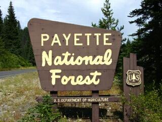
Campground List
CAMPGROUND NAME: Big Flat

VISIT DATE: 09/15/2001

UPDATE DATE: 7/15/2025

STATE: Idaho

REGION: Intermountain

RANGER DISTRICT: Council

NEAREST CITY/TOWN: Cambridge

RESERVATIONS: No

DIRECTIONS:
From Cambridge, ID, take US Rt. 95 north 10.3 miles to Indian
Valley/W Indian Valley Rd/Big Flat campground signs.  Turn right
onto W Indian Valley Rd. and go 5.4 miles to a "Y" intersection
(campground sign and Forest Rt. 206).  Bear left onto Rt. 206 and
go 1.6 miles to another "Y" intersection (Little Weiser River
Rd.).  Bear left onto Little Weiser River Rd. and go 11.8 miles
to campground sign.  Turn right into campground.

NOTE: Forest Rt. 206 becomes gravel in 0.1 miles and is mostly
single-lane with some turnouts.

GENERAL COMMENTS:
The elevation is 4,080 ft.

The campground, adjacent to Little Weiser River, is a single loop
in a heavy understory and middlestory of grass and deciduous
vegetation.  The overstory is heavy in Ponderosa pine and Douglas
fir.  Some camp sites are next to the river and privacy is
excellent.  The campground is pack it in, pack it out.  There are
gas and limited groceries at the intersection of W Indian Valley
Rd. and US Rt. 95.

SEASONS
Open Seasonal: Yes
Open All Year: No

Seasonal Comment:
Open May 15 through October 1 - weather dependent.

NOTE: 6/23/2025 - Campground infrastructure and surrounding vegetation
completely burned in the Lava Fire (2024). The site is expected to be
closed through 2026. Contact ranger district for status.

RATE AND MAXIMUM STAY PERMITTED
Rate: $10 per day - single
$15 per day - double
NOTE: Scan and Pay used for on-site payments through Rec.gov app.
Load / setup app before arrival.
Maximum Stay Permitted (days): 14

CAMPGROUND SITE CONFIGURATION
No. RV Sites: 0
No. Tent Sites: 0
No. Combined Sites (Tent or RV): 12

   Total Sites: 12

Tent Pads: Yes
Open Sites: No
Wooded Sites: Yes

No. Tables on Sites: 12
No. Grilles on Sites: 12
Equestrian Camping:  No

RV INFORMATION
Hookups: None
No. RV Pull Throughs: 0
Waste Station: No
Average Parking Apron Size: 13' X 45'

Comments:
The parking aprons are gravel. An RV waste station with no potable
water is located in Cambridge, ID at the Washington County Fairgrounds
- follow signs.  Fee is a donation.

FACILITIES
Vaults: Yes
Flush Toilets: No
Hot Showers: No
Wheelchair Friendly Toilets: Yes

Public Phone: No
Playground: No
No. Water Spigots (non-site): 1

Comments:
The water spigots is a handpump.

WATER SPORTS - None

HIKING - No

FISHING
Rainbow trout

CAMPGROUND NAME: Brownlee

VISIT DATE: 09/15/2001

UPDATE DATE: 7/10/2025

STATE: Idaho

REGION: Intermountain

RANGER DISTRICT: Council

NEAREST CITY/TOWN: Cambridge

RESERVATIONS: No

DIRECTIONS:
In Cambridge, ID, at intersection of US Rt. 95 and State Rt. 71,
take Rt. 71 west 16.7 miles to campground sign.  Turn right at
sign onto a gravel and dirt road and go 1.2 miles to campground.

NOTE: Last 1.2 miles is single-lane with few turnouts.

GENERAL COMMENTS:
The elevation is 4,580 ft.

The campground, pack it in, pack it out, stretches along the East
Fork of Brownlee Creek.  Most camp sites are adjacent to the
creek.  The understory and middlestory are heavy with grass and
deciduous vegetation, especially maple trees.  The overstory is
comprised of very large Ponderosa pine and Douglas fir.  Privacy
between camp sites is excellent.  Visit the historic sites that
are marked along the last 1.2 miles to the campground.  One is an
old structure for holding crude oil used for operating the smelt
for mining.

SEASONS
Open Seasonal: Yes
Open All Year: No

Seasonal Comment:
Open mid-May through early October.  Potable water available starting
with the Memorial Day weekend, weather dependent.

RATE AND MAXIMUM STAY PERMITTED
Rate: $10 per day
NOTE: Scan and Pay used for on-site payments through Rec.gov app.
Load / setup app before arrival.

Maximum Stay Permitted (days): 14

CAMPGROUND SITE CONFIGURATION
No. RV Sites: 0
No. Tent Sites: 2
No. Combined Sites (Tent or RV): 9

   Total Sites: 11

Tent Pads: No
Open Sites: No
Wooded Sites: Yes

No. Tables on Sites: 11
No. Grilles on Sites: 11
Equestrian Camping:  No

RV INFORMATION
Hookups: None
No. RV Pull Throughs: 3
Waste Station: No
Average Parking Apron Size: 12' X 40'

Comments:
The parking aprons are dirt.  An RV waste station with no potable
water is located in Cambridge, ID at the Washington County
Fairgrounds - follow signs.  Fee is a donation.

FACILITIES
Vaults: Yes
Flush Toilets: No
Hot Showers: No
Wheelchair Friendly Toilets: No

Public Phone: No
Playground: No
No. Water Spigots (non-site): 1
  No. Threaded: 0

Comments:
The water spigot is a hand pump.

WATER SPORTS - None

HIKING - No

Comments:
The East Fork Brownlee Trail is 1 mile north of the campground
(foot and horse).

FISHING
Rainbow trout

CAMPGROUND NAME: Cabin Creek

VISIT DATE: 09/05/2001

UPDATE DATE: 7/10/2025

STATE: Idaho

REGION: Intermountain

RANGER DISTRICT: Council

NEAREST CITY/TOWN: Council

RESERVATIONS: No

DIRECTIONS:
From Council, ID, take US Rt. 95 south 4.4 miles to Middle Fork
Rd. (mile post 130).  Turn left onto Middle Fork Rd. (gravel) and
go 11.2 miles to campground sign.  Turn left at sign and left
again into campground.

GENERAL COMMENTS:
The elevation is 4,500 ft.

The campground, pack it in, pack it out, is a single tear-drop
shaped loop through a dense stand of mixed conifers.  Several
camp sites are so well shaded there is no understory, while other
sites, due to the middlestory, are jungle-like in appearance.
Privacy between camp sites is very good.  This is a very quiet,
tranquil campground.

NOTE: 7/10/2025: Cabin Creek campground is being renovated. The south loop
now has 6 equestrian themed sites with space for horse trailers, hitching
posts, and a corral.

SEASONS
Open Seasonal: Yes
Open All Year: No

Seasonal Comment:
Open May 15 through October 1 - weather dependent

RATE AND MAXIMUM STAY PERMITTED
Rate: $10 per day
NOTE: Scan and Pay used for on-site payments through Rec.gov app.
Load / setup app before arrival.
Maximum Stay Permitted (days): 14

CAMPGROUND SITE CONFIGURATION
No. RV Sites: 0
No. Tent Sites: 0
No. Combined Sites (Tent or RV): 12

   Total Sites: 12

Tent Pads: No
Open Sites: Yes
Wooded Sites: Yes

No. Tables on Sites: 12
No. Grilles on Sites: 12
Equestrian Camping:  Yes

RV INFORMATION
Hookups: None
No. RV Pull Throughs: 0
Waste Station: No
Average Parking Apron Size: 13' X 37'

Comments:
The parking aprons are dirt.  Because of the interior road's
tear-drop shape, RVrs may have difficulty making a second pass.

FACILITIES
Vaults: Yes
Flush Toilets: No
Hot Showers: No
Wheelchair Friendly Toilets: No

Public Phone: No
Playground: No
No. Water Spigots (non-site): 1
  No. Threaded: 0

Comments:
The water spigot is a hand pump.

WATER SPORTS - None

HIKING - No

FISHING - No

CAMPGROUND NAME: Cold Springs

VISIT DATE: 09/05/2001

UPDATE DATE: 7/10/2025

STATE: Idaho

REGION: Intermountain

RANGER DISTRICT: New Meadows

NEAREST CITY/TOWN: New Meadows

RESERVATIONS: 1-877-444-6777 or make on-line reservation

DIRECTIONS:
From New Meadows, ID, take US Rt. 95 south 7.9 miles to Lost
Valley Reservoir Rd. (next to Pineridge Tavern Cafe).  Turn right
onto Lost Valley Reservoir Rd. and go 2.6 miles to an
intersection (Forest Rt. 89).  Continue straight onto Rt. 89 and
go 0.7 miles to campground sign.  Turn left at sign into
campground.

GENERAL COMMENTS:
The elevation is 5,100 ft.

The campground, pack it in, pack it out, is configured as one
large loop through a stand of mixed conifers which include
Lodgepole pine and Douglas fir.  The camp sites are widely spaced
providing good privacy.  Grass and low-growing shrubs make up the
campground's understory.  Horseshoe pits are available for the
camper's enjoyment.  Visit the Pineridge Tavern Cafe for gas
and snacks.

SEASONS
Open Seasonal: Yes
Open All Year: No

Seasonal Comment:
Open June 1 through September 15 - weather dependent

RATE AND MAXIMUM STAY PERMITTED
Rate: $10 per day - single
$15 per day - double
NOTE: Scan and Pay used for on-site payments through Rec.gov app.
Load / setup app before arrival.

Maximum Stay Permitted (days): 18

CAMPGROUND SITE CONFIGURATION
No. RV Sites: 0
No. Tent Sites: 1
No. Combined Sites (Tent or RV): 28

   Total Sites: 29

Tent Pads: No
Open Sites: Yes
Wooded Sites: Yes

No. Tables on Sites: 29
No. Grilles on Sites: 29
Equestrian Camping:  No

RV INFORMATION
Hookups: None
No. RV Pull Throughs: 0
Waste Station: No
Potable Water at Waste Station: No
Average Parking Apron Size: 11' X 50'

Comments:
The parking aprons are gravel.

FACILITIES
Vaults: Yes
Flush Toilets: No
Hot Showers: No
Wheelchair Friendly Toilets: Yes

Public Phone: No
Playground: No
No. Water Spigots (non-site): 2
  No. Threaded: 0

Comments:
The water spigots are hand pumps.

WATER SPORTS - None

Comments:
The 200-acre Lost Valley Reservoir is 1 mile from the campground.
There, one can enjoy fishing and boating opportunities.

HIKING - No

FISHING - No

Comments:
See Water Sports comments.

CAMPGROUND NAME: Evergreen

VISIT DATE: 09/05/2001

UPDATE DATE: 7/10/2025

STATE: Idaho

REGION: Intermountain

RANGER DISTRICT: Council

NEAREST CITY/TOWN: New Meadows

RESERVATIONS:  1-877-444-6777 or make on-line reservation

DIRECTIONS:
From New Meadows, ID, take US Rt. 95 south 11.6 miles to
campground sign.  Turn left at sign into campground.

GENERAL COMMENTS:
The elevation is 4,160 ft.

The campground, pack it in, pack it out, stretches along the Weiser River
next to U.S. Rt. 95.  The open middlestory provides fair privacy and Douglas
fir and spruce give camp sites ample shade.  The campground is convenient
for overnight stops or longer.  Traffic noise from Rt. 95 is distracting.

SEASONS
Open Seasonal: Yes
Open All Year: No

Seasonal Comment:
Open May 15 through October 1 - weather dependent

RATE AND MAXIMUM STAY PERMITTED
Rate: $10 per day - single
$15 per day - double
NOTE: Scan and Pay used for on-site payments through Rec.gov app.
Load / setup app before arrival.

Maximum Stay Permitted (days): 14

CAMPGROUND SITE CONFIGURATION
No. RV Sites: 0
No. Tent Sites: 3
No. Combined Sites (Tent or RV): 8

   Total Sites: 11

Tent Pads: Yes
Open Sites: Yes
Wooded Sites: Yes

No. Tables on Sites: 11
No. Grilles on Sites: 11
Equestrian Camping:  No

RV INFORMATION
Hookups: None
No. RV Pull Throughs: 1
Waste Station: No
Average Parking Apron Size: 13' X 40'

Comments:
The parking aprons are gravel.

FACILITIES
Vaults: Yes
Flush Toilets: No
Hot Showers: No
Wheelchair Friendly Toilets: Yes

Public Phone: No
Playground: No
No. Water Spigots (non-site): 1
  No. Threaded: 0

Comments:
The water spigots is a handpump.

WATER SPORTS - None

HIKING - Yes
Weiser River Trail (foot, horse, mountain bike) - 84 miles

FISHING
Rainbow trout

CAMPGROUND NAME: Grouse

VISIT DATE: 02/20/2008

UPDATE DATE: 7/10/2025

STATE: Idaho

REGION: Intermountain

RANGER DISTRICT: New Meadows

NEAREST CITY/TOWN: McCall

RESERVATIONS: 1-877-444-6777 or make on-line reservation

DIRECTIONS:
From McCall, ID, take State Rt. 55 west 2.4 miles to Brundage
Mtn Ski Area sign (Goose Lake Rd.).  Turn right at sign onto
Goose Lake Rd. and go 6.8 miles to a "Y" intersection (Hazard
Lake sign/Forest Rt. 257/Goose Lake Rd.).  Bear left at sign onto
Rt. 257 and go 4.1 miles to campground on left.

NOTE: Goose Lake Rd. turns to gravel in 3.9 miles.  Forest Rt.
257 is gravel, likely washboard and mostly single-lane.

GENERAL COMMENTS:
The elevation is 6,500 ft.

NOTE: This campground was upgraded from 6 sites to 21 sites
after the authors completed their research of the Forest.  All
information is provided by the McCall Ranger District Office.

The campground, located within walking distance of Goose Lake, is
comprised of two sections, not named but considerd upper and
lower.  The lower section is closest to lake and has the fewest
campsites.  The overstory is comprised of Lodgepole pine and
Engleman spruce trees.  The understory is mainly shrubs and
meadow-like grasses with some marshy areas.  Privacy between
campsites is fair to good.  A few campsites have views of the
lake but are filtered by the trees.  There are scenic views of
the nearby mountains and peaks.

Consider a day trip to Granite Mountain Lookout.  The trailhead
is a couple miles up the road from the campground.  The trail
length is about 2 miles and is considered a very rewarding hike.

SEASONS
Open Seasonal: Yes
Open All Year: No

Seasonal Comment:
Open July 1 through September 15 - weather dependent

RATE AND MAXIMUM STAY PERMITTED
Rate: $10 per day - single
$15 per day - double
NOTE: Scan and Pay used for on-site payments through Rec.gov app.
Load / setup app before arrival.
Maximum Stay Permitted (days): 14

CAMPGROUND SITE CONFIGURATION
No. RV Sites: 0
No. Tent Sites: 0
No. Combined Sites (Tent or RV): 21

   Total Sites: 21

Tent Pads: Yes
Open Sites: Yes
Wooded Sites: Yes

No. Tables on Sites: 21
No. Grilles on Sites: 21
Equestrian Camping:  No

RV INFORMATION
Hookups: None
No. RV Pull Throughs: 0
Waste Station: No
Potable Water at Waste Station: No
Average Parking Apron Size: 11' X 40'

Comments:
The parking aprons are gravel.  An RV waste station is available
in New Meadows, ID and at the Forest Service Cold Springs
campground.

FACILITIES
Vaults: Yes
Flush Toilets: No
Hot Showers: No
Wheelchair Friendly Toilets: Yes

Public Phone: No
Playground: No
No. Water Spigots (non-site): 2
  No. Threaded: 0

Comments:
The water spigots are handpumps.

WATER SPORTS
Lake: Yes
Swimming (provided): No
Sailing: No
Boat Ramp: Yes
Boat Carry Down Access: Yes
Power Boating: Yes
Boating (no power): Yes
Water Skiing: No
Rafting (whitewater): No
Kayaking (whitewater): No

Comments:
Goose Lake is about 80 acres and is a no-wake lake.

HIKING
Six-Mile Trail (foot and horse) - 8 to 10 miles.
   Parking for horse trailers is available.

FISHING
Rainbow and Brook trout (stocked)

CAMPGROUND NAME: Hazard Lake

VISIT DATE: 08/31/2001

UPDATE DATE: 7/11/2025

STATE: Idaho

REGION: Intermountain

RANGER DISTRICT: New Meadows

NEAREST CITY/TOWN: McCall

RESERVATIONS: No

DIRECTIONS:
From McCall, ID, take State Rt. 55 west 2.4 miles to Brundage Mtn
Ski Area sign (Goose Lake Rd.).  Turn right at sign onto Goose
Lake Rd. and go 6.8 miles to a "Y" intersection (Hazard Lake
sign/Forest Rt. 257).  Bear left at sign onto Rt. 257 and go 15.4
miles to Day Use sign.  Turn right at sign into campground.

NOTE: Goose Lake Rd. turns to gravel in 3.9 miles.  Forest Rt.
257 is gravel and mostly single-lane.

GENERAL COMMENTS:
The elevation is 7,040 ft.

The campground, pack it in, pack it out, is composed of two loops
on the west bank of Hazard Lake.  Lodgepole pine and Englemann
spruce provide shade to most camp sites.  Most of the camp sites
have a pleasant view of the lake and some are adjacent to it.
The far shore of the campground was devastated by fire.  This is
a tranquil campground far from the crowds.  There are numerous
lakes to explore nearby.

SEASONS
Open Seasonal: Yes
Open All Year: No

Seasonal Comment:
Open July 1 through September 15 - weather dependent

RATE AND MAXIMUM STAY PERMITTED
Rate: $10 per day - single
$15 per day - double
NOTE: Scan and Pay used for on-site payments through Rec.gov app.
Load / setup app before arrival.
Maximum Stay Permitted (days): 18

CAMPGROUND SITE CONFIGURATION
No. RV Sites: 0
No. Tent Sites: 0
No. Combined Sites (Tent or RV): 12

   Total Sites: 12

Tent Pads: No
Open Sites: Yes
Wooded Sites: Yes

No. Tables on Sites: 12
No. Grilles on Sites: 12
Equestrian Camping:  No

RV INFORMATION
Hookups: None
No. RV Pull Throughs: 2
Waste Station: No
Average Parking Apron Size: 13' X 40'

Comments:
The parking aprons are dirt.

FACILITIES
Vaults: Yes
Flush Toilets: No
Hot Showers: No
Wheelchair Friendly Toilets: No

Public Phone: No
Playground: No
No. Water Spigots (non-site): 1
  No. Threaded: 0

Comments:
The water spigot is a hand pump.

WATER SPORTS
Lake: Yes
Swimming (provided): No
Sailing: No
Boat Ramp: Yes
Boat Carry Down Access: Yes
Power Boating: No
Boating (no power): Yes
Water Skiing: No
Rafting (whitewater): No
Kayaking (whitewater): No

Comments:
Hazard Lake is 125 acres.

HIKING
Upper Hazard Lake #169 (foot, horse & mountain bike) - 5 miles

FISHING
Rainbow trout

CAMPGROUND NAME: Kennally Creek

VISIT DATE: 09/04/2001

UPDATE DATE: 7/11/2025

STATE: Idaho

REGION: Intermountain

RANGER DISTRICT: McCall

NEAREST CITY/TOWN: Donnelly

RESERVATIONS: No

DIRECTIONS:
From Donnelly, ID, take State Rt. 55 north 2.7 miles to Paddy
Flat Rd.  Turn right onto Paddy Flat Rd. and go 1.4 miles to an
intersection.  Continue straight, staying on Paddy Flat Rd.
(gravel), and go 3.9 miles to a "Y" intersection.  Bear left,
following Kennally Creek campground sign, and go 10.1 miles to
campground.

GENERAL COMMENTS:
The elevation is 5,800 ft.

The campground, pack it in, pack it out, is a single, small loop
in a dense stand of conifers next to Kennally Creek - spruce and
Western larch are the dominant trees.  A couple camp sites are
adjacent to the creek, but most are tucked in among trees away
from it.  There is a horse loading ramp and hitching rails at two
camp sites near the campground's entrance.  This is a pretty,
woodsy campground with a semi-wilderness feel.

SEASONS
Open Seasonal: Yes
Open All Year: No

Seasonal Comment:
Open June 1 through September 30 - weather dependent

RATE AND MAXIMUM STAY PERMITTED
Rate: $10 per day - single
$15 per day - double
NOTE: Scan and Pay used for on-site payments through Rec.gov app.
Load / setup app before arrival.

Maximum Stay Permitted (days): 18

CAMPGROUND SITE CONFIGURATION
No. RV Sites: 0
No. Tent Sites: 0
No. Combined Sites (Tent or RV): 11

   Total Sites: 11

Tent Pads: No
Open Sites: Yes
Wooded Sites: Yes

No. Tables on Sites: 11
No. Grilles on Sites: 11
Equestrian Camping:  Yes

RV INFORMATION
Hookups: None
No. RV Pull Throughs: 2
Waste Station: No
Average Parking Apron Size: 14' X 36'

Comments:
The parking aprons are dirt and irregularly shaped.

FACILITIES
Vaults: Yes
Flush Toilets: No
Hot Showers: No
Wheelchair Friendly Toilets: No

Public Phone: No
Playground: No
No. Water Spigots (non-site): 1
  No. Threaded: 0

Comments:
The water spigot is a hand pump.

WATER SPORTS - None

HIKING
East Fork Kennally Trail #99 (foot, horse, mountain bike, and
dirt bike) - 1 mile
      Leads to a network of trails

FISHING
Rainbow trout

CAMPGROUND NAME: Last Chance

VISIT DATE: 08/31/2001

UPDATE DATE: 7/11/2025

STATE: Idaho

REGION: Intermountain

RANGER DISTRICT: New Meadows

NEAREST CITY/TOWN: McCall

RESERVATIONS: No

DIRECTIONS:
From McCall, ID, take State Rt. 55 west 4.9 miles to Last Chance
sign (Forest Rt. 453).  Turn right onto Rt. 453 (dirt) and go 2.2
miles to campground on right.

NOTE: Forest Rt. 453 is a narrow, rough mountain road with few
turnouts.

GENERAL COMMENTS:
The elevation is 4,900 ft.

The campground, pack it in, pack it out, stretches along Goose
Creek through a delightfully dense stand of mixed conifers
comprised of towering Ponderosa pine, Douglas fir and Englemann
spruce.  These huge trees protect a lacy middlestory of younger
trees and plants.  The campground has three well separated loops
connected by spurs.  The smallest loop has two camp sites in
dense woods.  Another loop is at the end of the campground and is
next to Goose Creek trail head.  This loop has the shortest
parking aprons.  The third loop is next to the Group Area which
features a large communal campfire area.  The camp sites in this
loop are not as well shaded but do have the largest parking
aprons.  Privacy is good throughout the campground.

SEASONS
Open Seasonal: Yes
Open All Year: No

Seasonal Comment:
Open June 1 through September 15 - weather dependent.

RATE AND MAXIMUM STAY PERMITTED
Rate: $10 per day - single
$15 per day - double
NOTE: Scan and Pay used for on-site payments through Rec.gov app.
Load / setup app before arrival.
Maximum Stay Permitted (days): 18

CAMPGROUND SITE CONFIGURATION
No. RV Sites: 0
No. Tent Sites: 0
No. Combined Sites (Tent or RV): 23

   Total Sites: 23

Tent Pads: No
Open Sites: Yes
Wooded Sites: Yes

No. Tables on Sites: 23
No. Grilles on Sites: 18
Equestrian Camping:  No

RV INFORMATION
Hookups: None
No. RV Pull Throughs: 0
Waste Station: No
Average Parking Apron Size: 11' X 45'

Comments:
The parking aprons are gravel with a paved interior road.

FACILITIES
Vaults: Yes
Flush Toilets: No
Hot Showers: No
Wheelchair Friendly Toilets: Yes

Public Phone: No
Playground: No
No. Water Spigots (non-site): 2
  No. Threaded: 0

Comments:
The water spigots are hand pumps.

WATER SPORTS - None

HIKING - No

FISHING - No

CAMPGROUND NAME: Mann Creek

VISIT DATE: 09/15/2001

UPDATE DATE: 7/11/2025

STATE: Idaho

REGION: Intermountain

RANGER DISTRICT: Weiser

NEAREST CITY/TOWN: Weiser

RESERVATIONS:  1-877-444-6777 or make on-line reservation

DIRECTIONS:
From Weiser, ID, take US Rt. 95 north 11.1 miles to Mann Creek Rd
sign (Upper Manns Creek Rd).  Turn left onto Upper Manns Creek
Rd. and go 2.9 miles to campground sign.  Turn left at sign and
go 0.2 miles to campground.

GENERAL COMMENTS:
The elevation is 3,300 ft.

NOTE: The campground is "owned" by the Bureau of Reclamation and
administered by the Payette National Forest.

The campground has one with few trees and limited shade from some
delightful deciduous trees and Ponderosa pines.  A few sites have ramadas
providing additional shade.  The manicured grass understory give the
campground a park-like appearance.  There is a panoramic view of the
surrounding grass-covered hillsides.  Privacy between camp sites is minimal.
Although there is no direction access to the Mann Creek Reservoir, this
campground is popular with power boat and jet ski users and anglers
(Large and Smallmouth bass, Rainbow trout and crappie are in Mann Creek
Reservoir).  In the Spring, nearby Mann Creek has good fishing.

NOTE:  A word of caution:  Snakes, including rattlesnakes, do occasionally
visit the campground.

SEASONS
Open Seasonal: Yes
Open All Year: No

Seasonal Comment:
Open April 15 through October 15

RATE AND MAXIMUM STAY PERMITTED
Rate: $10 per day - single
$15 per day - double
NOTE: Scan and Pay used for on-site payments through Rec.gov app.
Load / setup app before arrival.
Maximum Stay Permitted (days): 14

CAMPGROUND SITE CONFIGURATION
No. RV Sites: 0
No. Tent Sites: 0
No. Combined Sites (Tent or RV): 12

   Total Sites: 12

Tent Pads: No
Open Sites: Yes
Wooded Sites: Yes

No. Tables on Sites: 12
No. Grilles on Sites: 12
Equestrian Camping:  No

RV INFORMATION
Hookups: None
No. RV Pull Throughs: 1
Waste Station: No
Average Parking Apron Size: 10' X 46'

Comments:
The parking aprons are gravel and most are the same size.
An RV waste station is located in Weiser, ID at the Cenex gas
station on US Rt. 95 - no fee.

FACILITIES
Vaults: Yes
Flush Toilets: No
Hot Showers: No
Wheelchair Friendly Toilets: Yes

Public Phone: No
Playground: No
No. Water Spigots (non-site): 1
  No. Threaded: 0

Comments:
The water spigot is a hand pump.
NOTE: Drinking water is often not available in late summer and fall.
Plan accordingly.  Contact ranger district to confirm availability.

WATER SPORTS - None

Comments:
The campground is convenient to Mann Creek Reservoir, about 0.8
miles to boat ramp.  The level will drop significantly as the
camping season progresses.

HIKING - No

FISHING - No

CAMPGROUND NAME: Ponderosa

VISIT DATE: 09/15/2001

UPDATE DATE: 7/11/2025

STATE: Idaho

REGION: Intermountain

RANGER DISTRICT: Krassel

NEAREST CITY/TOWN: Cascade

RESERVATIONS: No

DIRECTIONS:
In Cascade, ID, at the intersection of State Rt. 55 and Warm Lake
Rd., take Warm Lake Rd. east 24.3 miles to Yellow Pine sign.
Turn left after sign onto a paved, single-lane road (with
turnouts) and go 28.9 miles to campground sign.  Turn right at
sign into campground.

GENERAL COMMENTS:
The elevation is 4,500 ft.

The campground, pack it in, pack it out, is a single loop on the
banks of Secesh River among Ponderosa pine and Douglas fir.  The
campground is rocky making pitching a tent at some camp sites a
challenge.  Some camp sites are adjacent to the river which can
be heard throughout the campground.  This is a very quiet,
secluded campground.  Sites away from the river have good
privacy.

SEASONS
Open Seasonal: Yes
Open All Year: Yes

Comments:
Services provided May 1 through October 31

RATE AND MAXIMUM STAY PERMITTED
Rate: $10 per day
NOTE: Scan and Pay used for on-site payments through Rec.gov app.
Load / setup app before arrival.
Maximum Stay Permitted (days): 18

CAMPGROUND SITE CONFIGURATION
No. RV Sites: 0
No. Tent Sites: 0
No. Combined Sites (Tent or RV): 11

   Total Sites: 11

Tent Pads: No
Open Sites: No
Wooded Sites: Yes

No. Tables on Sites: 11
No. Grilles on Sites: 11
Equestrian Camping:  No

RV INFORMATION
Hookups: None
No. RV Pull Throughs: 2
Waste Station: No
Average Parking Apron Size: 12' X 38'

Comments:
The parking aprons are dirt.

FACILITIES
Vaults: Yes
Flush Toilets: No
Hot Showers: No
Wheelchair Friendly Toilets: No

Public Phone: No
Playground: No
No. Water Spigots (non-site): 2
  No. Threaded: 0

Comments:
No water available October 1 through 4th week in May.

WATER SPORTS - None

HIKING
Secesh River Trail #80 (foot, horse, dirt bike) - 15 miles

FISHING
Bull and Steelhead trout and Chinook salmon

CAMPGROUND NAME: Spring Creek

VISIT DATE: 09/15/2001

UPDATE DATE: 7/11/2025

STATE: Idaho

REGION: Intermountain

RANGER DISTRICT: Weiser

NEAREST CITY/TOWN: Weiser

RESERVATIONS: 1-877-444-6777 or make on-line reservation

DIRECTIONS:
From Weiser, ID, take US Rt. 95 north 11.1 miles to Mann Creek Rd
sign (Upper Manns Creek Rd).  Turn left onto Upper Manns Creek
Rd. and go 11 miles to a "Y" intersection (Forest Rt. 009).  Bear
right onto Rt. 009 and go 2.8 miles to an intersection.  Continue
straight for 1.5 miles to campground sign.  Turn right at sign
into campground.

NOTE: Upper Mann Creek Rd. becomes gravel in 2.9 miles.  The
last 1.5 miles are intermittently single-lane with ample
turnouts.

GENERAL COMMENTS:
The elevation is 5,300 ft.

The campground, adjacent to the seasonal Spring Creek, is a
single loop in a heavy mixture of Grand fir, Ponderosa pine, and
Douglas fir.  The camp sites are well shaded but privacy between
them is fair.  The campground is pack it in, pack it out.

SEASONS
Open Seasonal: Yes
Open All Year: Yes

Seasonal Comment:
Services provided May 15 through October 25.

RATE AND MAXIMUM STAY PERMITTED
Rate: $10 per day - single
$15 per day - double
NOTE: Scan and Pay used for on-site payments through Rec.gov app.
Load / setup app before arrival.

Maximum Stay Permitted (days): 10

CAMPGROUND SITE CONFIGURATION
No. RV Sites: 0
No. Tent Sites: 1
No. Combined Sites (Tent or RV): 12

   Total Sites: 13

Tent Pads: Yes
Open Sites: No
Wooded Sites: Yes

No. Tables on Sites: 13
No. Grilles on Sites: 13
Equestrian Camping:  No

RV INFORMATION
Hookups: None
No. RV Pull Throughs: 0
Waste Station: No
Average Parking Apron Size: 12' X 45'

Comments:
Most of the parking aprons are gravel but a few are paved.  Tear-drop
shape of loop makes a second pass for RVs difficult without exiting
the campground.  An RV waste station is located in Weiser, ID at
the Cenex gas station on US Rt. 95 - no fee.

FACILITIES
Vaults: Yes
Flush Toilets: No
Hot Showers: No
Wheelchair Friendly Toilets: Yes

Public Phone: No
Playground: No
No. Water Spigots (non-site): 3
  No. Threaded: 2

WATER SPORTS - None

HIKING
Sleeping Spring Interpretive Trail (foot) - 1.5 miles

FISHING - No

Comments:
Mann Creek is nearby for some Rainbow trout fishing.

CAMPGROUND NAME: Upper Payette Lake

VISIT DATE: 08/31/2001

UPDATE DATE: 7/11/2025

STATE: Idaho

REGION: Intermountain

RANGER DISTRICT: McCall

NEAREST CITY/TOWN: McCall

RESERVATIONS: 1-877-444-6777 or make on-line reservation

DIRECTIONS:
In McCall, ID, at the intersection of State Rt. 55 (W. Lake Rd.)
and Warren Wagon Rd., take Warren Wagon Rd. north 15.5 miles to
campground sign (Forest Rt. 495).  Bear left at sign onto Rt. 495
(gravel) and go 0.9 miles to campground on right.

GENERAL COMMENTS:
The elevation is 5,900 ft.

The campground, pack it in, pack it out, is on the west bank of
Upper Payette Lake.  It is composed of two loops under a pleasant
mixture of conifers, but mostly Englemann spruce.  Many of the
camp sites are adjacent to the lake and others are found along
Camp Creek.  The view across the lake is dominated by a 1984 burn
area and provides an interesting contrast to the lush wooded area
of the campground.  Privacy between camp sites is poor to fair.
Possible day trips from the campground are various activities
offered in McCall (such as live theater and music festivals) and
the Auto Tour to the historic Warren area.  Check with the McCall
Ranger District Office for a tape or CD about the Auto Tour.

SEASONS
Open Seasonal: Yes
Open All Year: No

Seasonal Comment:
Open July 1 through September 15 - weather dependent
NOTE: May open in June. Call ranger district office.

RATE AND MAXIMUM STAY PERMITTED
Rate: $10 per day - single
$15 per day - double
NOTE: Scan and Pay used for on-site payments through Rec.gov app.
Load / setup app before arrival.

Maximum Stay Permitted (days): 18

CAMPGROUND SITE CONFIGURATION
No. RV Sites: 0
No. Tent Sites: 0
No. Combined Sites (Tent or RV): 19

   Total Sites: 19

Tent Pads: No
Open Sites: Yes
Wooded Sites: Yes

No. Tables on Sites: 19
No. Grilles on Sites: 19
Equestrian Camping:  No

RV INFORMATION
Hookups: None
No. RV Pull Throughs: 2
Waste Station: No
Average Parking Apron Size: 15' X 49'

Comments:
The parking aprons are gravel.

FACILITIES
Vaults: Yes
Flush Toilets: No
Hot Showers: No
Wheelchair Friendly Toilets: Yes

Public Phone: No
Playground: No
No. Water Spigots (non-site): 2
  No. Threaded: 0

Comments:
The water spigots are hand pumps.

WATER SPORTS
Lake: Yes
Swimming (provided): No
Sailing: No
Boat Ramp: Yes
Boat Carry Down Access: Yes
Power Boating: Yes
Boating (no power): Yes
Water Skiing: No
Rafting (whitewater): No
Kayaking (whitewater): No

Comments:
Upper Payette Lake is 125 acres and is a no-wake lake.

HIKING
Shoreline Path (foot - paved and wheelchair friendly) - 0.25
miles

FISHING
Rainbow trout
|