Campground List
CAMPGROUND NAME: Beaver Creek
VISIT DATE: 08/04/2001
UPDATE DATE: 8/14/2025
STATE: Idaho
REGION: Intermountain
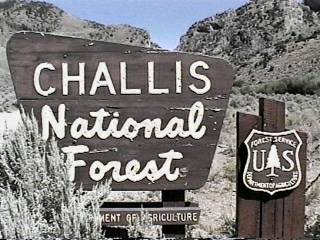
RANGER DISTRICT: Challis-Yankee Fork
NEAREST CITY/TOWN: Stanley
RESERVATIONS: No
DIRECTIONS:
In Stanley, ID, at the intersection of State Rts. 75 and 21, take
Rt. 21 west 18.9 miles to campground sign (Forest Rt. 831). Turn
right at sign, then immediately turn right again onto a one-lane
dirt road (with turnouts) and go 0.3 miles to a "Y" intersection.
Bear left and go 1.9 miles to campground sign. Turn right into
campground.
GENERAL COMMENTS:
The elevation is 6,500 ft.
This is a quiet, scenic campground on the banks of Beaver Creek
and located near the Frank Church-River of No Return Wilderness.
Most of the camp sites back up to and overlook the creek. About
half of them are in the open. Although Lodgepole pines provide
some shade, the grass understory and closeness of the camp sites
provide little privacy.
This is bear country; practice safe food storage techniques.
SEASONS
Open Seasonal: Yes
Open All Year: No
Seasonal Comment:
Open June through October - weather dependent
RATE AND MAXIMUM STAY PERMITTED
Rate: $10 per day
Maximum Stay Permitted (days): 16
CAMPGROUND SITE CONFIGURATION
No. RV Sites: 0
No. Tent Sites: 0
No. Combined Sites (Tent or RV): 10
Total Sites: 10
Tent Pads: No
Open Sites: Yes
Wooded Sites: Yes
No. Tables on Sites: 10
No. Grilles on Sites: 10
Equestrian Camping: No
RV INFORMATION
Hookups: None
No. RV Pull Throughs: 0
Waste Station: No
Average Parking Apron Size: 14' X 40'
Comments:
The parking aprons are gravel. A Forest Service RV waste station
is available for a donation at the Stanley Ranger District Office,
4.5 miles south of Stanley, ID off State Rt. 75.
FACILITIES
Vaults: Yes
Flush Toilets: No
Hot Showers: No
Wheelchair Friendly Toilets: Yes
Public Phone: No
Playground: No
No. Water Spigots (non-site): 1
No. Threaded: 0
Comments:
The water spigot is a hand pump.
WATER SPORTS - None
HIKING
Beaver Creek Trail (foot & horse) - 14 miles
Provides access to a network of trails in the Frank
Church-River of No Return Wilderness. There are pole
stalls with feed troughs at trail head.
FISHING
Rainbow trout - catch and release

CAMPGROUND NAME: Boundary Creek
VISIT DATE: 08/14/2001
UPDATE DATE: 7/8/2025
STATE: Idaho
REGION: Intermountain
RANGER DISTRICT: Middle Fork
NEAREST CITY/TOWN: Stanley
RESERVATIONS: 1-877-444-6777 or make on-line reservation
DIRECTIONS:
In Stanley, ID, at the intersection of State Rts. 75 and 21, take
Rt. 21 west 21.7 miles to Boundary Creek sign. Turn right at
sign onto a dirt road and go 9.6 miles to an intersection with
Boundary Cr/Dagger Falls sign (Forest Rt. 568). Turn right onto
Rt. 568 and go 9.7 miles to another intersection. Turn left and
go 1.1 miles to campground on left.
NOTE: Forest Rt. 568 is rocky and rough in places.
GENERAL COMMENTS:
The elevation is 5,800 ft.
This attractive, small campground is popular with campers as a
staging point for floating the Middle Fork of the Salmon River.
It is a single loop through a pleasant stand of Lodgepole pine
and a few other conifers. While "boaters" like this campground
for its convenience to the river, hikers also use it as a base
camp for exploring the surrounding Frank Church-River of No
Return Wilderness. The campground is pack it in, pack it out.
SEASONS
Open Seasonal: Yes
Open All Year: No
Seasonal Comment:
Open June 1 through August 15
RATE AND MAXIMUM STAY PERMITTED
Rate: $10 per day
Maximum Stay Permitted (days): 14
CAMPGROUND SITE CONFIGURATION
No. RV Sites: 0
No. Tent Sites: 0
No. Combined Sites (Tent or RV): 14
Total Sites: 14
Tent Pads: No
Open Sites: No
Wooded Sites: Yes
No. Tables on Sites: 14
No. Grilles on Sites: 14
Equestrian Camping: No
RV INFORMATION
Hookups: None
No. RV Pull Throughs: 0
Waste Station: No
Average Parking Apron Size: 13' X 33'
Comments:
The parking aprons are fine gravel. Besides tent campers, the
campground is best suited for small RVs. A Forest Service RV
waste station is available for a donation at the Stanley Ranger
District Office, 4.5 miles south of Stanley, ID off State Rt. 75.
FACILITIES
Vaults: Yes
Flush Toilets: No
Hot Showers: No
Wheelchair Friendly Toilets: Yes
Public Phone: No
Playground: No
No. Water Spigots (non-site): 3
No. Threaded: 3
WATER SPORTS
Lake: No
Swimming (provided): No
Sailing: No
Boat Ramp: Yes
Boat Carry Down Access: No
Power Boating: No
Boating (no power): Yes
Water Skiing: No
Rafting (whitewater): Yes
Kayaking (whitewater): Yes
Comments:
The Middle Fork of the Salmon River is 0.2 miles from the
campground. The boat ramp or put-in is a wooden ski jump-like
structure that reaches down to the river. A permit is required
to access the river.
HIKING - No
Comments:
The campground is convenient to Transfer Camp's Middle Fork Trail
into the Frank Church-River of No Return Wilderness (foot &
horse) - 77.9 miles
FISHING
Cutthroat trout - catch and release
CAMPGROUND NAME: Iron Bog
VISIT DATE: 08/15/2000
UPDATE DATE: 7/8/2025
STATE: Idaho
REGION: Intermountain
RANGER DISTRICT: Lost River
NEAREST CITY/TOWN: Mackay
RESERVATIONS: No
DIRECTIONS:
From Mackay, ID, take US Rt. 93 south 15 miles to Iron Bog
C.G./Antelope Rd. signs. Turn left at signs onto Antelope Rd.
and go 11.2 miles to a "Y" intersection. Bear left, staying on
Antelope Rd., and go another 13.7 miles to campground sign. Turn
left at sign into campground.
NOTE: After 4 miles, Antelope Rd. becomes gravel.
GENERAL COMMENTS:
The elevation is 6,500 ft.
The campground is a single loop with one spur on a sage-covered
bluff above Iron Bog Creek. Except for camping sites along the
creek, the remaining campsites are under-maintained. The parking
aprons on the under-maintained sites are hardly visible because of
heavy growth of sagebrush. Most sites are in the open, but some
shade is provided by Douglas fir trees and several sites have
ramada-style picnic tables. The campground is pack it in, pack
it out.
This is bear country; practice safe food storage techniques.
SEASONS
Open Seasonal: Yes
Open All Year: No
Seasonal Comment:
Open May 25 through September 30 - weather dependent
RATE AND MAXIMUM STAY PERMITTED
Rate: $10 per day
Maximum Stay Permitted (days): 16
CAMPGROUND SITE CONFIGURATION
No. RV Sites: 0
No. Tent Sites: 0
No. Combined Sites (Tent or RV): 18
Total Sites: 18
Tent Pads: No
Open Sites: Yes
Wooded Sites: Yes
No. Tables on Sites: 18
No. Grilles on Sites: 18
Equestrian Camping: No
RV INFORMATION
Hookups: None
No. RV Pull Throughs: 0
Waste Station: No
Average Parking Apron Size: 13' X 41'
Comments:
The parking aprons are gravel with some covered with weed and
sagebrush.
FACILITIES
Vaults: Yes
Flush Toilets: No
Hot Showers: No
Wheelchair Friendly Toilets: Yes
Public Phone: No
Playground: No
No. Water Spigots (non-site): 1
No. Threaded: 0
Comments:
The water spigot is a hand pump. According to the Forest
Service, the water is rust colored but safe to drink.
WATER SPORTS - None
HIKING - No
FISHING - No
CAMPGROUND NAME: Lola Creek
VISIT DATE: 08/04/2001
UPDATE DATE: 8/14/2025
STATE: Idaho
REGION: Intermountain
RANGER DISTRICT: Challis-Yankee Fork
NEAREST CITY/TOWN: Stanley
RESERVATIONS: No
DIRECTIONS:
In Stanley, ID, at the intersection of State Rts. 75 and 21, take
Rt. 21 west 18.9 miles to campground sign (Forest Rt. 831). Turn
right at sign onto Rt. 831 (dirt) and go 0.9 miles to another
campground sign. Turn right at sign into campground.
GENERAL COMMENTS:
The elevation is 6,400 ft.
The campground, in a dense stand of Lodgepole pine, stretches
along the cold and clear Marsh Creek. Some camp sites are near
the creek, but none overlook it. The campground has a wilderness
feel, without the inconvenience, and is within 300 yards of Frank
Church-River of No Return Wilderness. This is a nice base camp
for hiking into the wilderness.
This is bear country; practice safe food storage techniques.
SEASONS
Open Seasonal: Yes
Open All Year: No
Seasonal Comment:
Open June through September - weather dependent
RATE AND MAXIMUM STAY PERMITTED
Rate: $15 per day
Maximum Stay Permitted (days): 16
CAMPGROUND SITE CONFIGURATION
No. RV Sites: 0
No. Tent Sites: 1
No. Combined Sites (Tent or RV): 20
Total Sites: 21
Tent Pads: No
Open Sites: No
Wooded Sites: Yes
No. Tables on Sites: 21
No. Grilles on Sites: 21
Equestrian Camping: No
RV INFORMATION
Hookups: None
No. RV Pull Throughs: 0
Waste Station: No
Average Parking Apron Size: 14' X 45'
Comments:
A Forest Service RV waste station is available for a donation at
the Stanley Ranger District Office, 4.5 miles south of Stanley,
ID off State Rt. 75.
FACILITIES
Vaults: Yes
Flush Toilets: No
Hot Showers: No
Wheelchair Friendly Toilets: Yes
Public Phone: No
Playground: No
No. Water Spigots (non-site): 2
No. Threaded: 0
Comments:
The water spigots are hand pumps.
WATER SPORTS - None
HIKING
Marsh Creek Trail (foot & horse) - 12 miles
Provides access to a network of trails in the Frank
Church-River of No Return Wilderness. There are pole
stalls with feed troughs at trail head.
FISHING
Rainbow trout (catch and release)
CAMPGROUND NAME: Mosquito Flat
VISIT DATE: 08/03/2001
UPDATE DATE: 8/14/2025
STATE: Idaho
REGION: Intermountain
RANGER DISTRICT: Challis-Yankee Fork
NEAREST CITY/TOWN: Challis
RESERVATIONS: No
DIRECTIONS:
In Chalis, ID, at the intersection of State Rt. 75 and Main St.,
take Main St. west 5.1 miles to the pavement's end at a "Y"
intersection (Custer Motorway). Bear right onto Custer Motorway
(dirt) and go 8.3 miles to "Mosquito Flat Res" sign. Turn right at
sign and go 3.5 miles to "Challis Cr Lakes" sign (Forest Rt. 091).
Turn left at sign and go 0.1 miles to campground.
GENERAL COMMENTS:
The elevation is 7,180 ft.
The campground, located above and alongside the Mosquito Flat
Reservoir, is comprised of three unnamed sections. The first
section, overlooking the reservoir with views of the mountains,
has five camp sites. The second section is below and across the
road on the left with four camp sites and is the most heavily
wooded. The third section is 0.1 miles below the first two
sections along the shore of the reservoir and has two camp sites.
Both sites are in the open and have views of the reservoir and
surrounding mountains. Lodgepole pines dominate the campground
with grass understory and it is pack it in, pack it out. This is
an attractive campground with access to it via the Custer
Motorway with interpretive signs along the way.
Custer Motorway was built in 1879 as a toll road from Challis to
Bonanza. Its prime purpose was for hauling freight for the
various mine operations. In 1933, the Civilian Conservation
Corps (CCC) reconstructed the road which was then named Custer
Motorway. It is dirt and mostly single-lane - a good day trip is
to continue on to Bonanza.
SEASONS
Open Seasonal: Yes
Open All Year: No
Seasonal Comment:
Open June through October - weather dependent
RATE AND MAXIMUM STAY PERMITTED
Rate: No Charge
Maximum Stay Permitted (days): 16
CAMPGROUND SITE CONFIGURATION
No. RV Sites: 0
No. Tent Sites: 2
No. Combined Sites (Tent or RV): 9
Total Sites: 11
Tent Pads: No
Open Sites: Yes
Wooded Sites: Yes
No. Tables on Sites: 11
No. Grilles on Sites: 11
Equestrian Camping: No
RV INFORMATION
Hookups: None
No. RV Pull Throughs: 1
Waste Station: No
Average Parking Apron Size: 14' X 32'
Comments:
The parking aprons are gravel. Travel trailers are not
recommended in the third section. An RV waste station, with no
potable water, is available in Challis, ID at the Cenex gas
station - $4 fee. Another waste station is available, with potable
water and no fee, at Land of the Yankee Fork Interpretive Center,
just south of Challis at intersection of State Rt. 75 and US Rt. 93.
FACILITIES
Vaults: Yes
Flush Toilets: No
Hot Showers: No
Wheelchair Friendly Toilets: Yes
Public Phone: No
Playground: No
No. Water Spigots (non-site): 0
WATER SPORTS
Lake: Yes
Swimming (provided): No
Sailing: No
Boat Ramp: Yes
Boat Carry Down Access: Yes
Power Boating: Yes
Boating (no power): Yes
Water Skiing: No
Rafting (whitewater): No
Kayaking (whitewater): No
Comments:
Mosquito Flat Reservoir is 25 acres.
HIKING - No
FISHING
Rainbow trout
CAMPGROUND NAME: Park Creek
VISIT DATE: 08/21/2001
UPDATE DATE: 7/8/2025
STATE: Idaho
REGION: Intermountain
RANGER DISTRICT: Lost River
NEAREST CITY/TOWN: Ketchum
RESERVATIONS: No
DIRECTIONS:
In Ketchum, ID (downtown), at intersection of State Rt. 75 (Main
St.) and Sun Valley Rd. (sign to Sun Valley), go north on Sun
Valley Rd. (no sign) for 13.2 miles to campground sign. Turn
left into campground.
NOTE: Sun Valley Rd. becomes dirt, rocky, rough, and steep in 9.4
miles. At this point, the road climbs dramatically for 2.8 miles
to Trail Creek Summit where it levels off to the campground.
Although mostly two-lane up to the summit, the road is not RV
friendly.
GENERAL COMMENTS:
The elevation is 7,800 ft.
The campground, adjacent to a River willow-covered marsh area and
Summit Creek, is a single loop in a stand of Lodgepole pine and
spruce. There are some nice vistas of the mountains - good place
to get away from the summer heat. Although there is little
understory and middlestory, well spaced camp sites provide good
privacy. The campground is pack it in, pack it out.
This is bear country; practice safe food storage techniques.
SEASONS
Open Seasonal: Yes
Open All Year: No
Seasonal Comment:
Open June 1 through September 30 - weather dependent
RATE AND MAXIMUM STAY PERMITTED
Rate: $10 per day
Maximum Stay Permitted (days): 16
CAMPGROUND SITE CONFIGURATION
No. RV Sites: 0
No. Tent Sites: 1
No. Combined Sites (Tent or RV): 11
Total Sites: 12
Tent Pads: No
Open Sites: No
Wooded Sites: Yes
No. Tables on Sites: 12
No. Grilles on Sites: 12
Equestrian Camping: No
RV INFORMATION
Hookups: None
No. RV Pull Throughs: 0
Waste Station: No
Average Parking Apron Size: 12' X 45'
Comments:
The parking aprons are dirt and rocky. An RV waste station, with
potable water, is available at the Forest Service Sawtooth
National Recreation Area Headquarters Office, 6.1 miles north of
Ketchum, ID on State Rt. 75 - fee is a donation.
FACILITIES
Vaults: Yes
Flush Toilets: No
Hot Showers: No
Wheelchair Friendly Toilets: No
Public Phone: No
Playground: No
No. Water Spigots (non-site): 1
No. Threaded: 0
Comments:
The water spigot is a hand pump.
WATER SPORTS - None
HIKING - No
FISHING
Rainbow and Brook trout
CAMPGROUND NAME: Phi Kappa
VISIT DATE: 08/21/2001
UPDATE DATE: 7/8/2025
STATE: Idaho
REGION: Intermountain
RANGER DISTRICT: Lost River
NEAREST CITY/TOWN: Ketchum
RESERVATIONS: No
DIRECTIONS:
In Ketchum, ID (downtown), at intersection of State Rt. 75 (Main
St.) and Sun Valley Rd. (sign to Sun Valley), go north on Sun
Valley Rd. (no sign) for 15.9 miles to campground sign. Turn
right into campground.
NOTE: Sun Valley Rd. becomes dirt, rocky, rough and steep in 9.4
miles. At this point, the road climbs dramatically for 2.8 miles
to Trail Creek Summit where it levels off to the campground.
Although mostly two-lane up to the summit, the road is not RV
friendly.
GENERAL COMMENTS:
The elevation is 7,600 ft.
This attractive, underused campground is configured as a spur
leading into a loop. Lodgepole pine is the dominant vegetation
with little understory and middlestory providing fair privacy,
but good vistas of the surrounding mountains, meadows and a
marsh. Phi Kappa Creek runs through the marsh. Some parking
aprons are overgrown with weeds and other vegetation. The
campground is pack it in, pack it out.
This is bear country; practice safe food storage techniques.
SEASONS
Open Seasonal: Yes
Open All Year: No
Seasonal Comment:
Open May 31 through September 30 - weather dependent
RATE AND MAXIMUM STAY PERMITTED
Rate: $10 per day
Maximum Stay Permitted (days): 16
CAMPGROUND SITE CONFIGURATION
No. RV Sites: 0
No. Tent Sites: 0
No. Combined Sites (Tent or RV): 21
Total Sites: 21
Tent Pads: No
Open Sites: Yes
Wooded Sites: Yes
No. Tables on Sites: 21
No. Grilles on Sites: 21
Equestrian Camping: No
RV INFORMATION
Hookups: None
No. RV Pull Throughs: 1
Waste Station: No
Average Parking Apron Size: 12' X 45'
Comments:
The parking aprons are dirt. A Forest Service RV waste station
is available for a donation at the Stanley Ranger District Office,
4.5 miles south of Stanley, ID off State Rt. 75.
FACILITIES
Vaults: Yes
Flush Toilets: No
Hot Showers: No
Wheelchair Friendly Toilets: No
Public Phone: No
Playground: No
No. Water Spigots (non-site): 1
No. Threaded: 0
Comments:
The water spigot is a hand pump. The water is naturally rust
colored, but is safe to drink.
WATER SPORTS - None
HIKING - No
FISHING
Rainbow and Brook trout
CAMPGROUND NAME: Pole Flat
VISIT DATE: 08/07/2001
UPDATE DATE: 8/14/2025
STATE: Idaho
REGION: Intermountain
RANGER DISTRICT: Challis-Yankee Fork
NEAREST CITY/TOWN: Clayton
RESERVATIONS: No
DIRECTIONS:
From Clayton, ID, take State Rt. 75 west 20.3 miles to Sunbeam
sign (Forest Rt. 013). Turn right at sign onto Rt. 013 and go
3.1 miles to campground sign. Turn right into campground.
GENERAL COMMENTS:
The elevation is 6,200 ft.
The campground is a single loop in a stand of Lodgepole pines.
The Yankee Fork to the main Salmon River is within an easy walk
from the campground and can be heard throughout. Privacy beteen
camp sites is good. Interesting day trips from the campground
are to the Yankee Fork Dredge and ghost towns of Custer and
Bonanza.
SEASONS
Open Seasonal: Yes
Open All Year: No
Seasonal Comment:
Open June through September - weather dependent
RATE AND MAXIMUM STAY PERMITTED
Rate: $10 per day
Maximum Stay Permitted (days): 16
CAMPGROUND SITE CONFIGURATION
No. RV Sites: 0
No. Tent Sites: 0
No. Combined Sites (Tent or RV): 10
Total Sites: 10
Tent Pads: No
Open Sites: Yes
Wooded Sites: Yes
No. Tables on Sites: 10
No. Grilles on Sites: 10
Equestrian Camping: No
RV INFORMATION
Hookups: None
No. RV Pull Throughs: 0
Waste Station: No
Average Parking Apron Size: 13' X 50'
Comments:
The parking aprons are gravel. Some aprons are not level.
FACILITIES
Vaults: Yes
Flush Toilets: No
Hot Showers: No
Wheelchair Friendly Toilets: No
Public Phone: No
Playground: No
No. Water Spigots (non-site): 1
No. Threaded: 0
Comments:
The water spigot is a hand pump.
WATER SPORTS - None
HIKING - No
FISHING
Rainbow trout
CAMPGROUND NAME: Starhope
VISIT DATE: 08/05/2000
UPDATE DATE: 7/8/2025
STATE: Idaho
REGION: Intermountain
RANGER DISTRICT: Lost River
NEAREST CITY/TOWN: Mackay
RESERVATIONS: No
DIRECTIONS:
From Mackay, ID, take US Rt. 93 north 15.4 miles to Trail Creek
Rd. sign. Turn left at sign and go 18.7 miles to Copper
Basin/Wildhorse signs (Forest Rt. 135). Turn left onto Rt. 135
and go 2.2 miles to a "Y" intersection. Bear left, staying on
Rt. 135, and go 16.3 miles to an intersection at the Copper Basin
Guard Station (Copper Basin Loop Road). Turn right onto Copper
Basin Loop Road and go 8.2 miles to campground sign. Turn left
at sign into campground.
NOTE: The last 33.7 miles are unpaved.
GENERAL COMMENTS:
The elevation is 8,000 ft.
Built by the Youth Conservation Corps (YCC) in the 1970s, this
remote and rustic campground offers campers a heavily wooded
environment far from the crowds. The campground is composed of a
spur above the Starhope Creek and a large loop below. Although
no horse facilities are provided in the campground, a stock
loading platform and hitching rails are available at the
campground's entrance. Lodgepole pine provide ample shade and
although there is little understory and middlestory, camping
sites are well spaced providing good privacy. The access roads
to the campground are very scenic making the long drive
enjoyable. The campground is pack it in, pack it out.
This is bear country; practice safe food storage techniques.
SEASONS
Open Seasonal: Yes
Open All Year: No
Seasonal Comment:
Open May 30 through September 30 - weather dependent
RATE AND MAXIMUM STAY PERMITTED
Rate: $10 per day
Maximum Stay Permitted (days): 16
CAMPGROUND SITE CONFIGURATION
No. RV Sites: 0
No. Tent Sites: 0
No. Combined Sites (Tent or RV): 20
Total Sites: 20
Tent Pads: No
Open Sites: Yes
Wooded Sites: Yes
No. Tables on Sites: 20
No. Grilles on Sites: 20
Equestrian Camping: No
RV INFORMATION
Hookups: None
No. RV Pull Throughs: 6
Waste Station: No
Average Parking Apron Size: 14' X 46'
Comments:
The parking aprons are rock and dirt. Some parking aprons have
low overhanging branches.
FACILITIES
Vaults: Yes
Flush Toilets: No
Hot Showers: No
Wheelchair Friendly Toilets: Yes
Public Phone: No
Playground: No
No. Water Spigots (non-site): 0
No. Threaded: 0
Comments:
The wheelchair friendly vault is located in the upper spur.
WATER SPORTS - None
HIKING - No
FISHING
Rainbow and Brook trout
CAMPGROUND NAME: Timber Creek
VISIT DATE: 08/14/2000
UPDATE DATE: 7/8/2025
STATE: Idaho
REGION: Intermountain
RANGER DISTRICT: Lost River
NEAREST CITY/TOWN: Mackay
RESERVATIONS: No
DIRECTIONS:
From Mackay, ID, take US Rt. 93 south 7.3 miles to Forest
Access/Pass Creek sign (3900W). Turn left onto 3900W (gravel)
and go 22.1 miles to a "Y" intersection. Bear left and go 6.6
miles to an intersection. Turn left and go 0.3 miles to Sawmill
Canyon sign. Bear right at sign and go 13.8 miles to campground
sign. Turn left at sign and go 0.5 miles to campground.
NOTE: 3900W becomes Forest Rt. 122 after 4.8 miles. The road is
gravel and often single-lane with turnouts.
Because of the road surface expect total drive to take 2.5 hours. Also
because of the road surface, bring spare tire and tire changing tools.
GENERAL COMMENTS:
The elevation is 8,000 ft.
The campground, located in a stand of mixed conifer trees beside
Timber Creek, is composed of one large and one small loop.
Although no horse facilities are located in or near the
campground, a stock loading platform is found in the smaller loop
near a gate in a fence surrounding the campground. The
campground is well-suited for large gatherings. It is heavily
wooded but has little privacy between most camping sites. The
campground, pack it in, pack it out, has a rustic and wilderness
feel. The drive to campground is scenic with dispersed camping
possible along the way.
This is bear country; practice safe food storage techniques.
SEASONS
Open Seasonal: Yes
Open All Year: No
Seasonal Comment:
Open May 20 through September 30 - weather dependent
RATE AND MAXIMUM STAY PERMITTED
Rate: $5 per day
Maximum Stay Permitted (days): 16
CAMPGROUND SITE CONFIGURATION
No. RV Sites: 0
No. Tent Sites: 0
No. Combined Sites (Tent or RV): 12
Total Sites: 12
Tent Pads: No
Open Sites: Yes
Wooded Sites: Yes
No. Tables on Sites: 12
No. Grilles on Sites: 12
Equestrian Camping: No
RV INFORMATION
Hookups: None
No. RV Pull Throughs: 3
Waste Station: No
Average Parking Apron Size: 13' X 33'
Comments:
The parking aprons are dirt and rock. Low overhanging branches
may limit RV parking at some camping sites.
FACILITIES
Vaults: Yes
Flush Toilets: No
Hot Showers: No
Wheelchair Friendly Toilets: No
Public Phone: No
Playground: No
No. Water Spigots (non-site): 2
No. Threaded: 0
NOTE: 6/22/2025 - No water avaiable in 2025. Plan accordingly. Contact
ranger district for latest status.
WATER SPORTS - None
HIKING - No
FISHING
Rainbow, Brook and Bull (catch and release) trout
CAMPGROUND NAME: Tin Cup
VISIT DATE: 08/03/2001
UPDATE DATE: 8/14/2025
STATE: Idaho
REGION: Intermountain
RANGER DISTRICT: Middle Fork
NEAREST CITY/TOWN: Clayton
RESERVATIONS: No
DIRECTIONS:
From Clayton, ID, take State Rt. 75 west 20.4 miles to Sunbeam
sign (Forest Rt. 013). Turn right at sign onto Rt. 013 and go
5.6 miles to pavement's end. Continue straight onto gravel and
dirt road for another 3 miles to River of No Return Wilderness
sign and an intersection just past the Yankee Fork Gold Dredge
(Forest Rt. 172). Turn left onto Rt. 172 (dirt) and go 4.4 miles
to another intersection. Continue straight, staying on Rt. 172,
for 16.6 miles to a "Y" intersection (Forest Rt. 007). Bear
right onto Rt. 007 and go 2.6 miles to a "T" intersection. Turn
right and go 1.2 miles to campground.
NOTE: The last 24.8 miles are single-lane (with turnouts), rough
and rocky in places. Numerous switchbacks and vertical drops
give this route a "white knuckle" classification.
GENERAL COMMENTS:
The elevation is 5,800 ft.
The campground, pack it in, pack it out, is located on a bluff
overlooking Loon Creek in a pleasant stand of Douglas fir.
Widely spaced camp sites provide good privacy, even though the
primary understory is grass. Although no horses are permitted in
the campground, hitching rails and small pole stalls with feed
troughs are located just across the road and within sight of
several camp sites. It is a long drive to this campground that
is tucked into the Frank Church-River of No Return Wilderness,
but well worth it.
SEASONS
Open Seasonal: Yes
Open All Year: No
Seasonal Comment:
Open July through September - weather dependent
RATE AND MAXIMUM STAY PERMITTED
Rate: No charge
Maximum Stay Permitted (days): 16
CAMPGROUND SITE CONFIGURATION
No. RV Sites: 0
No. Tent Sites: 13
No. Combined Sites (Tent or RV): 0
Total Sites: 13
Tent Pads: No
Open Sites: No
Wooded Sites: Yes
No. Tables on Sites: 13
No. Grilles on Sites: 9
Equestrian Camping: No
FACILITIES
Vaults: Yes
Flush Toilets: No
Hot Showers: No
Wheelchair Friendly Toilets: No
Public Phone: No
Playground: No
No. Water Spigots (non-site): 0
WATER SPORTS - None
HIKING
Loon Creek Trail (foot & horse) - 22 miles
FISHING
Cutthroat and Rainbow trout
CAMPGROUND NAME: Wildhorse
VISIT DATE: 08/15/2000
UPDATE DATE: 7/8/2025
STATE: Idaho
REGION: Intermountain
RANGER DISTRICT: Lost River
NEAREST CITY/TOWN: Mackay
RESERVATIONS: No
DIRECTIONS:
From Mackay, ID, take US Rt. 93 north 15.4 miles to Trail Creek
Rd. sign. Turn left at sign and go 18.7 miles to Copper
Basin/Wildhorse sign (Forest Rt. 135). Turn left onto Rt. 135
and go 2.2 miles to a "Y" intersection (Forest Rt. 136). Bear
right onto Rt. 136 and go 5.9 miles to campground.
NOTE: The last 15 miles is unpaved and single-lane with few
turnouts.
GENERAL COMMENTS:
The elevation is 7,400 ft.
The campground is a large single loop with most camping sites
located along the Wildhorse Creek side of the loop. A few sites
are adjacent to the creek and all are within walking distance of
the creek. The sites are shaded by Lodgepole pines with some
other conifers and Aspen trees mixed in. Although there is no
understory, the camping sites are widely spaced providing good
privacy. The campground is quiet with pleasant views of the
rugged Copper Basin landscape. The drive to campground is scenic
with dispersed camping possible along the way. The campground is
pack it in, pack it out.
This is bear country; practice safe food storage techniques.
SEASONS
Open Seasonal: Yes
Open All Year: No
Seasonal Comment:
Open June 15 through September 30
RATE AND MAXIMUM STAY PERMITTED
Rate: $10 per day
Maximum Stay Permitted (days): 16
CAMPGROUND SITE CONFIGURATION
No. RV Sites: 0
No. Tent Sites: 0
No. Combined Sites (Tent or RV): 11
Total Sites: 11
Tent Pads: No
Open Sites: No
Wooded Sites: Yes
No. Tables on Sites: 11
No. Grilles on Sites: 11
Equestrian Camping: No
RV INFORMATION
Hookups: None
No. RV Pull Throughs: 1
Waste Station: No
Average Parking Apron Size: 13' X 44'
Comments:
The parking aprons are dirt and gravel and the interior road is
rough. One camping site can accommodate more than one RV.
FACILITIES
Vaults: Yes
Flush Toilets: No
Hot Showers: No
Wheelchair Friendly Toilets: No
Public Phone: No
Playground: No
No. Water Spigots (non-site): 2
No. Threaded: 0
Comments:
The water spigots are hand pumps.
WATER SPORTS - None
HIKING - No
Comments:
The campground is convenient to the 2.5-mile foot only Boulder
Creek Trail #057.
FISHING
Rainbow and Brook trout
|