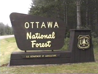
Campground List
CAMPGROUND NAME: Black River

VISIT DATE: 08/03/1996

UPDATE DATE: 11/24/2023

STATE: Michigan

REGION: Eastern

RANGER DISTRICT: Bessemer

NEAREST CITY/TOWN: Bessemer

RESERVATIONS: 1-877-444-6777 or make on-line reservation

DIRECTIONS:
In Bessemer, MI, take N. Moore St. (County Rt. 513) north for
15.2 miles to campground.

NOTE: N. Moore St. turns into Black River Rd., but continues as
County Rt. 513.

GENERAL COMMENTS:
The elevation is 840 ft.

This single loop campground is located on a bluff above Lake
Superior and near Black River Harbor.  The camp sites are nestled
in a pleasant mixture of hardwoods.  There are facilities for the
"transient" boat as well as gasoline, boat pumpout service and
private charter boat services.  The campground has a scenic
overlook of Lake Superior Apostle Islands, along with flush
toilets, RV waste station, and several hiking trails to the 5
nearby scenic waterfall of the Black River.  Some of these trails
are wheelchair friendly.

An unusual site is the Copper Peak Ski-Flying Hill, a short
driving distance from the campground.  It is a ski jump that is
built of steel and stands 17 stories high.  The longest recorded
jump is 505 feet.  One can take an elevator up to view the
surrounding area.

SEASONS
Open Seasonal: Yes
Open All Year: No

Seasonal Comment:
Open May 24 through September 30

RATE AND MAXIMUM STAY PERMITTED
Rate: $16 per day
Maximum Stay Permitted (days): 14

CAMPGROUND SITE CONFIGURATION
No. RV Sites: 0
No. Tent Sites: 0
No. Combined Sites (Tent or RV): 39

   Total Sites: 39

Tent Pads: Yes
Open Sites: Yes
Wooded Sites: Yes

No. Tables on Sites: 39
No. Grilles on Sites: 39
Equestrian Camping:  No

RV INFORMATION
Hookups: None
No. RV Pull Throughs: 0
Waste Station: No
Potable Water at Waste Station: No
Largest Parking Apron Size: 10.5' X 75'

Comments:
Parking aprons are gravel.

FACILITIES
Vaults: Yes
Flush Toilets: No
Hot Showers: No
Wheelchair Friendly Toilets: Yes

Public Phone: Yes
Playground: No
No. Water Spigots (non-site): 5
  No. Threaded: 0

  Comment:  The water system is temporarily off.
  Contact district ranger office cor current status.

WATER SPORTS
Lake: Yes
Swimming (provided): Yes
Sailing: Yes
Boat Ramp: Yes
Boat Carry Down Access: No
Power Boating: Yes
Boating (no power): Yes
Water Skiing: Yes
Rafting (whitewater): No
Kayaking (whitewater): No

Comments:
Boat ramp is full-service, i.e., gas, some groceries, etc.

HIKING
Self-Guided Neotropical Breeding Bird Tour

FISHING
Steelhead, Lake Brook, Brown and Rainbow trout and salmon


CAMPGROUND NAME: Bob Lake

VISIT DATE: 07/22/1996

UPDATE DATE: 11/24/2023

STATE: Michigan

REGION: Eastern

RANGER DISTRICT: Ontonagon

NEAREST CITY/TOWN: Nisula

RESERVATIONS: No

DIRECTIONS:
From Nisula, MI take State Rt. 38 west 5.5 miles to FH-16.  Turn
left onto FH-16 and go 6.3 miles to FH-1460 (Pori Rd.).  Turn
right onto FH-1460 and go 2.3 miles to campground sign.  Turn
left onto Forest Rt. 1470 and go 1.1 miles to Forest Rt. 1478.
Turn left onto Rt. 1478 and go 0.7 miles to campground.

GENERAL COMMENTS:
The elevation is 1,280 ft.

The campground is located at the edge of Bob Lake with some
lakefront sites.  The parking aprons of lakefront sites are
shorter than other sites but are wider.  An unmarked connector
trail links the campground with the North Country Scenic Trail.

SEASONS
Open Seasonal: Yes
Open All Year: No

Seasonal Comment:
Open May 10 through October 31 - weather permitting.

NOTE:  No servics provided after 9/1.

RATE AND MAXIMUM STAY PERMITTED
Rate: $14 per day
Maximum Stay Permitted (days): 14

CAMPGROUND SITE CONFIGURATION
No. RV Sites: 0
No. Tent Sites: 0
No. Combined Sites (Tent or RV): 17

   Total Sites: 17

Tent Pads: Yes
Open Sites: No
Wooded Sites: Yes

No. Tables on Sites: 17
No. Grilles on Sites: 17
Equestrian Camping:  No

RV INFORMATION
Hookups: None
No. RV Pull Throughs: 0
Waste Station: No
Largest Parking Apron Size: 12' X 60'

Comments:
The parking aprons are gravel and grass.

FACILITIES
Vaults: Yes
Flush Toilets: No
Hot Showers: No
Wheelchair Friendly Toilets: Yes

Public Phone: No
Playground: No
No. Water Spigots (non-site): 1
  No. Threaded: 0

Comments:
The water spigot is a hand pump.

WATER SPORTS
Lake: Yes
Swimming (provided): Yes
Sailing: No
Boat Ramp: Yes
Boat Carry Down Access: Yes
Power Boating: Yes
Boating (no power): Yes
Water Skiing: No
Rafting (whitewater): No
Kayaking (whitewater): No

Comments:
Bob Lake is 133 acres.

HIKING
Interpretive trail

FISHING
Walleye and panfish


CAMPGROUND NAME: Bobcat Lake

VISIT DATE: 08/01/1996

UPDATE DATE: 11/24/2023

STATE: Michigan

REGION: Eastern

RANGER DISTRICT: Bessemer

NEAREST CITY/TOWN: Marenisco

RESERVATIONS: No

DIRECTIONS:
In Marenisco, MI, take Kimberly Rd. (State Rt. 64 - not marked)
east 0.3 miles to campground sign (Forest Rt. 8500).  Turn right
and go 1.8 miles to campground.

GENERAL COMMENTS:
The elevation is 1,440 ft.

The campground is near the north shore of Bobcat Lake in a
pleasant mixture of trees.   Possible day trips are a drive to
Lake Gogebic and a hike to Nelson Canyon or Judson Falls.
Mountain bikers will enjoy Pomeroy/Henry Lake Mountain Bike
Complex.  Swimming, boating, and fishing round out the
attractions found at this campground.  Campground has an
under-maintained appearance with low tree branches throughout.

SEASONS
Open Seasonal: Yes
Open All Year: Yes

Seasonal Comment:
Open May 18 through October 9.
Area open after October 9 until roads inaccessible due to snow.
Limited services.

RATE AND MAXIMUM STAY PERMITTED
Rate: $13 per day
Maximum Stay Permitted (days): 14

CAMPGROUND SITE CONFIGURATION
No. RV Sites: 0
No. Tent Sites: 0
No. Combined Sites (Tent or RV): 12

   Total Sites: 12

Tent Pads: Yes
Open Sites: No
Wooded Sites: Yes

No. Tables on Sites: 12
No. Grilles on Sites: 12
Equestrian Camping:  No

RV INFORMATION
Hookups: None
No. RV Pull Throughs: 0
Waste Station: No
Largest Parking Apron Size: 10' X 40'

Comments:
Low hanging branches may be a problem for high
profile RVs

FACILITIES
Vaults: Yes
Flush Toilets: No
Hot Showers: No
Wheelchair Friendly Toilets: Yes

Public Phone: No
Playground: No
No. Water Spigots (non-site): 1
  No. Threaded: 0

Comments:
The water spigot is a hand pump.

WATER SPORTS
Lake: Yes
Swimming (provided): Yes
Sailing: No
Boat Ramp: Yes
Boat Carry Down Access: No
Power Boating: Yes
Boating (no power): Yes
Water Skiing: No
Rafting (whitewater): No
Kayaking (whitewater): No

Comments:
Bobcat Lake is 73 acres.  Beach is sandy and is located 0.5
miles from campground.  A change building is located by the beach.

HIKING - No

FISHING
Northern pike , bass and Bluegill


CAMPGROUND NAME: Clark Lake

VISIT DATE: 07/31/1996

UPDATE DATE: 3/25/2024

STATE: Michigan

REGION: Eastern

RANGER DISTRICT: Watersmeet

NEAREST CITY/TOWN: Watersmeet

RESERVATIONS: No

DIRECTIONS:
From Watersmeet, MI, take US Rt. 2 west 3.9 miles to Thousand
Island Rd. (County Rt. 535).  Turn left onto Thousand Island Rd.
and go south for 4 miles to Sylvania Wilderness and Recreation
Area.  The campground is located in this recreation area - follow
signs.

GENERAL COMMENTS:
The elevation is 1,700 ft.

Four loops form this campground at the edge of the Sylvania
Wilderness in an ancient woods.  Many sites have very old fallen
moss-covered trees that appear to be melting into the soil.
Lantern posts have been installed at each campsite. The only
"modern" facilities are available on Loops 3 & 4.  Campers on
Loops 1 & 2 share a handpump and vault toilet, giving these
loops a near-wilderness camping experience.  Besides the
campsites in this campground, there are almost a 100 designated
campsites for hiker and canoeists within the Wilderness.  This
is a very special campground and relatively undiscovered.

SEASONS
Open Seasonal: Yes
Open All Year: No

Seasonal Comment:
Open May 23 through September 30

RATE AND MAXIMUM STAY PERMITTED
Rate: $18 per day - no electric hookups
$23 per day - electric hookups

Maximum Stay Permitted (days): 14

CAMPGROUND SITE CONFIGURATION
No. RV Sites: 0
No. Tent Sites: 0
No. Combined Sites (Tent or RV): 47

   Total Sites: 47

Tent Pads: Yes
Open Sites: Yes
Wooded Sites: Yes

No. Tables on Sites: 47
No. Grilles on Sites: 47
Equestrian Camping:  No

RV INFORMATION
Hookups: None
No. RV Pull Throughs: 0
Waste Station: Yes
Potable Water at Waste Station: Yes
Largest Parking Apron Size: 12.5' X 40'

Comments:
The parking aprons are paved as are the interior roads.

FACILITIES
Vaults: No
Flush Toilets: Yes
Hot Showers: Yes
Wheelchair Friendly Toilets: Yes

Public Phone: No
Playground: No
No. Water Spigots (non-site): 7
  No. Threaded: 0

Comments:
Showers (9:00 AM to 9:00 PM) available at pavilion located at the
beach. Flush toilets located in Loops 3 & 4 while Loops 1 & 2 share
a vault toilet.

WATER SPORTS
Lake: Yes
Swimming (provided): Yes
Sailing: Yes
Boat Ramp: Yes
Boat Carry Down Access: Yes
Power Boating: No
Boating (no power): Yes
Water Skiing: No
Rafting (whitewater): No
Kayaking (whitewater): No

Comments:
Clark Lake is 820 acres.  The beach is sandy.

HIKING
Clark Lake Trail - 7 miles - leads around the lake and to
wilderness camps.

FISHING
Bass and trout


CAMPGROUND NAME: Courtney Lake

VISIT DATE: 07/22/1906

UPDATE DATE: 11/25/2023

STATE: Michigan

REGION: Eastern

RANGER DISTRICT: Ontonagon

NEAREST CITY/TOWN: Nisula

RESERVATIONS: No

DIRECTIONS:
From Nisula, MI, take State Rt. 38 west 7.3 miles to campground
sign.  Turn left at sign onto Forest Rt. 1960 and go 0.7 miles to
another campground sign.  Make right turn to campground.

GENERAL COMMENTS:
The elevation is 1,260 ft.

This is a pleasant campground with large secluded sites
overlooking Courtney Lake.  Just south of the Copper Country
State Forest, the campground provides visitors with a pretty
location in a  tranquil setting.

SEASONS
Open Seasonal: Yes
Open All Year: No

Seasonal Comment:
Open May 10 through October 31

RATE AND MAXIMUM STAY PERMITTED
Rate: $14 per day
Maximum Stay Permitted (days): 14

CAMPGROUND SITE CONFIGURATION
No. RV Sites: 0
No. Tent Sites: 3
No. Combined Sites (Tent or RV): 17

   Total Sites: 20

Tent Pads: No
Open Sites: No
Wooded Sites: Yes

No. Tables on Sites: 20
No. Grilles on Sites: 20
Equestrian Camping:  No

RV INFORMATION
Hookups: None
No. RV Pull Throughs: 0
Waste Station: No
Largest Parking Apron Size: 14' X 111'

Comments:
Parking aprons are gravel and dirt.

FACILITIES
Vaults: Yes
Flush Toilets: No
Hot Showers: No
Wheelchair Friendly Toilets: No

Public Phone: No
Playground: No
No. Water Spigots (non-site): 2
  No. Threaded: 2

WATER SPORTS
Lake: Yes
Swimming (provided): Yes
Sailing: No
Boat Ramp: Yes
Boat Carry Down Access: No
Power Boating: Yes
Boating (no power): Yes
Water Skiing: No
Rafting (whitewater): No
Kayaking (whitewater): No

Comments:
Courtney Lake is 33 acres.  No-wake lake.  Grass and sandy beach.

HIKING No

FISHING
Trout


CAMPGROUND NAME: Golden Lake

VISIT DATE: 07/24/1996

UPDATE DATE: 11/25/2023

STATE: Michigan

REGION: Eastern

RANGER DISTRICT: Iron River

NEAREST CITY/TOWN: Iron River

RESERVATIONS:No

DIRECTIONS:
From Iron River, MI, take US Rt. 2 west 13.1 miles to Forest Rt.
16.  Turn right onto Rt. 16 and go 0.7 miles to campground sign.
Turn left into campground.

GENERAL COMMENTS:
The elevation is 1,760 ft.

Convenient to U.S. Route 2, this campground is on Golden Lake.  A
nice lake for canoeing, Golden Lake also offers good fishing and
a restful atmosphere.  Sites adjacent to Golden Lake are not
tent-friendly.

SEASONS
Open Seasonal: Yes
Open All Year: No

Seasonal Comment:
Open May 19 through October 9 -  weather dependent

NOTE: Due to an extreme wind event in 2022, there is an extreme
 amount of downed vegetation.

RATE AND MAXIMUM STAY PERMITTED
Rate: $16 per day
Maximum Stay Permitted (days): 14

CAMPGROUND SITE CONFIGURATION
No. RV Sites: 1
No. Tent Sites: 2
No. Combined Sites (Tent or RV): 19

   Total Sites: 22

Tent Pads: No
Open Sites: No
Wooded Sites: Yes

No. Tables on Sites: 21
No. Grilles on Sites: 22
Equestrian Camping:  No

RV INFORMATION
Hookups: None
No. RV Pull Throughs: 3
Waste Station: No
Largest Parking Apron Size: 10' X 66'

Comments:
Parking aprons are paved.  An RV waste station is located at Lake
Ottawa (National Forest)campground.

FACILITIES
Vaults: Yes
Flush Toilets: No
Hot Showers: No
Wheelchair Friendly Toilets: No

Public Phone: No
Playground: No
No. Water Spigots (non-site): 1
  No. Threaded: 0

Comments:
The water spigot is a hand pump.

WATER SPORTS
Lake: Yes
Swimming (provided): No
Sailing: No
Boat Ramp: Yes
Boat Carry Down Access: No
Power Boating: Yes
Boating (no power): Yes
Water Skiing: No
Rafting (whitewater): No
Kayaking (whitewater): No

Comments:
Golden Lake is 285 acres.

HIKING No

FISHING
Northern pike, bass and trout


CAMPGROUND NAME: Henry Lake

VISIT DATE: 08/01/1996

UPDATE DATE: 11/25/2023

STATE: Michigan

REGION: Eastern

RANGER DISTRICT: Bessemer

NEAREST CITY/TOWN: Marenisco

RESERVATIONS: No

DIRECTIONS:
From Marenisco, MI, take State Rt. 64 south 5.6 miles to Forest
Rt. 8100.  Turn right onto Rt. 8100 and go 4.6 miles to
campground.

NOTE:  For the last two-miles, the access road narrows to a very
narrow two-lanes.

GENERAL COMMENTS:
The elevation is 1,480 ft.

At the end of a scenic drive down Forest Route 8100, the
campground has the feel of an angler's campground.  Some sites
overlook Henry Lake and all enjoy the shelter of a pleasant
mixture of hardwood and pine trees.  The campground is within the
Pomeroy/Henry Lake Mountain Bike Complex and convenient to the
floatable/canoeable Presque Isle River.

SEASONS
Open Seasonal: Yes
Open All Year: Yes

Seasonal Comment:
Services provided May 19 through October 9.

RATE AND MAXIMUM STAY PERMITTED
Rate: $13 per day
Maximum Stay Permitted (days): 14

CAMPGROUND SITE CONFIGURATION
No. RV Sites: 0
No. Tent Sites: 1
No. Combined Sites (Tent or RV): 10

   Total Sites: 11

Tent Pads: No
Open Sites: No
Wooded Sites: Yes

No. Tables on Sites: 11
No. Grilles on Sites: 11
Equestrian Camping:  No

RV INFORMATION
Hookups: None
No. RV Pull Throughs: 0
Waste Station: No
Largest Parking Apron Size: 10' X 35'

Comments:
The parking aprons are grass and gravel.

FACILITIES
Vaults: Yes
Flush Toilets: No
Hot Showers: No
Wheelchair Friendly Toilets: Yes

Public Phone: No
Playground: No
No. Water Spigots (non-site): 1
  No. Threaded: 0

Comments:
The water spigots are hand pumps.  Wheelchair-friendly vault
located next to boat ramp.

WATER SPORTS
Lake: Yes
Swimming (provided): No
Sailing: No
Boat Ramp: Yes
Boat Carry Down Access: No
Power Boating: Yes
Boating (no power): Yes
Water Skiing: No
Rafting (whitewater): No
Kayaking (whitewater): No

Comments:
Henry Lake is 43 acres.

HIKING No

FISHING
Largemouth bass, Bluegill, Pumpkinseed and perch.  A fishing pier
is wheelchair friendly.


CAMPGROUND NAME: Imp Lake

VISIT DATE: 07/31/1996

UPDATE DATE: 11/25/2023

STATE: Michigan

REGION: Eastern

RANGER DISTRICT: Watersmeet

NEAREST CITY/TOWN: Watersmeet

RESERVATIONS: No

DIRECTIONS:
From Watersmeet, MI, take US Rt. 2 east 5.5 miles to Forest Rt.
3978.  Turn right onto Rt. 3978 and go 0.8 miles to campground
sign.  Turn right into campground.

GENERAL COMMENTS:
The elevation is 1,660 ft.

Possibly the most appropriately name campground in the Ottawa
National Forest, it is just off U.S. Route 2.  Convenient to the
highway, the campground has two loops which offers visitors sites
among magnificent old hardwoods and pines on the shores of Imp
Lake.  Best suited for tent and campers with small recreation
vehicles.  It is quiet and rustic.  The Lake is a Loon nesting
area so campers have the added pleasure of hearing this bird's
mystical and haunting calls.  Bug repellant is recommended.

SEASONS
Open Seasonal: Yes
Open All Year: Yes

Seasonal Comment:
Services provided May 18 through October 9

RATE AND MAXIMUM STAY PERMITTED
Rate: $16 per day
Maximum Stay Permitted (days): 14

CAMPGROUND SITE CONFIGURATION
No. RV Sites: 0
No. Tent Sites: 0
No. Combined Sites (Tent or RV): 22

   Total Sites: 22

Tent Pads: Yes
Open Sites: Yes
Wooded Sites: Yes

No. Tables on Sites: 22
No. Grilles on Sites: 22
Equestrian Camping:  No

RV INFORMATION
Hookups: None
No. RV Pull Throughs: 0
Waste Station: No
Largest Parking Apron Size: 10' X 35'

Comments:
The parking aprons are gravel, grass and asphalt.  Many spurs are narrow
with drop offs - Use caution when stepping out of vehicle.

FACILITIES
Vaults: Yes
Flush Toilets: No
Hot Showers: No
Wheelchair Friendly Toilets: No

Public Phone: No
Playground: No
No. Water Spigots (non-site): 2
  No. Threaded: 0

Comments:
The water spigots are hand pumps.

WATER SPORTS
Lake: Yes
Swimming (provided): Yes
Sailing: No
Boat Ramp: Yes
Boat Carry Down Access: Yes
Power Boating: Yes
Boating (no power): Yes
Water Skiing: No
Rafting (whitewater): No
Kayaking (whitewater): No

Comments:
Imp Lake is 111 acres and no-wake.

HIKING No

FISHING
Trout and perch


CAMPGROUND NAME: Lake Ottawa

VISIT DATE: 07/24/1996

UPDATE DATE: 3/29/2024

STATE: Michigan

REGION: Eastern

RANGER DISTRICT: Iron River

NEAREST CITY/TOWN: Iron River

RESERVATIONS: 1-877-444-6777 or  make on-line reservation

DIRECTIONS:
From Iron River, MI, take State Rt. 73 south 0.8 miles to
campground sign and turn right onto Lake Ottawa Rd.  Follow Lake
Ottawa Rd. for 4.1 miles to campground sign and turn right into
campground.

NOTE:  Low branches across Lake Ottawa Rd.

GENERAL COMMENTS:
The elevation is 1,660 ft.

The campground is located on the east side of Lake Ottawa in a
new growth forest.  Some older growth trees and a pavilion in the
dayuse area give campground character.  The pavilion was
converted from a Civilian Conservation Corps (CCC) - built
structure.  There are some lakefront sites.  Fishing, camping,
and good hiking trails make this a popular campground.

SEASONS
Open Seasonal: Yes
Open All Year: No

Seasonal Comment:
Open May 23 through September 30

RATE AND MAXIMUM STAY PERMITTED
Rate: $18 per day
Maximum Stay Permitted (days): 14

CAMPGROUND SITE CONFIGURATION
No. RV Sites: 0
No. Tent Sites: 3
No. Combined Sites (Tent or RV): 28

   Total Sites: 31

Tent Pads: Yes
Open Sites: No
Wooded Sites: Yes

No. Tables on Sites: 31
No. Grilles on Sites: 31
Equestrian Camping:  No

RV INFORMATION
Hookups: None
No. RV Pull Throughs: 0
Waste Station: Yes
Potable Water at Waste Station: Yes
Largest Parking Apron Size: 12' X 40'

Comments:
The parking aprons are paved.

FACILITIES
Vaults: No
Flush Toilets: Yes
Hot Showers: No
Wheelchair Friendly Toilets: Yes

Public Phone: No
Playground: Yes
No. Water Spigots (non-site): 7
  No. Threaded: 0

WATER SPORTS
Lake: Yes
Swimming (provided): Yes
Sailing: No
Boat Ramp: Yes
Boat Carry Down Access: Yes
Power Boating: Yes
Boating (no power): Yes
Water Skiing: Yes
Rafting (whitewater): No
Kayaking (whitewater): No

Comments:
Lake Ottawa is 550 acres.  Beach is grass and sand.

HIKING
Ge-Che - 9 miles

FISHING
Northern pike, Walleye and bass.  Fishing pier located in picnic
area - wheelchair friendly.


CAMPGROUND NAME: Lake Sainte Kathryn

VISIT DATE: 07/23/1996

UPDATE DATE: 1/25/2024

STATE: Michigan

REGION: Eastern

RANGER DISTRICT: Kenton

NEAREST CITY/TOWN: Sidnaw

RESERVATIONS: No

DIRECTIONS:
In Sidnaw, MI, take Ontario Rd. (Norway campground sign provided)
south 8.4 miles to campground.

GENERAL COMMENTS:
The elevation is 1,680 ft.

Located on Lake Sainte Kathryn and near several other good
fishing lakes, this campground is popular with anglers of all
ages.  Some lakefront sites.  All the sites enjoy shade from a
pleasant mix of hardwoods.  Lots of mosquitoes.

SEASONS
Open Seasonal: Yes
Open All Year: No

Seasonal Comment:
Open May 10 through October 31

RATE AND MAXIMUM STAY PERMITTED
Rate: $14 per day
Maximum Stay Permitted (days): 14

CAMPGROUND SITE CONFIGURATION
No. RV Sites: 0
No. Tent Sites: 0
No. Combined Sites (Tent or RV): 23

   Total Sites: 23

Tent Pads: Yes
Open Sites: No
Wooded Sites: Yes

No. Tables on Sites: 23
No. Grilles on Sites: 22
Equestrian Camping:  No

RV INFORMATION
Hookups: None
No. RV Pull Throughs: 0
Waste Station: No
Largest Parking Apron Size: 10' X 40'

Comments:
The parking aprons are dirt and grass and some
are overgrown.

FACILITIES
Vaults: Yes
Flush Toilets: No
Hot Showers: No
Wheelchair Friendly Toilets: No

Public Phone: No
Playground: No
No. Water Spigots (non-site): 2
  No. Threaded: 0

Comments:
The water spigot is a hand pump.

WATER SPORTS
Lake: Yes
Swimming (provided): Yes
Sailing: No
Boat Ramp: Yes
Boat Carry Down Access: Yes
Power Boating: Yes
Boating (no power): Yes
Water Skiing: No
Rafting (whitewater): No
Kayaking (whitewater): No

Comments:
Grass and sand beach.  Lake Sainte Kathryn is 150 acres.

HIKING
Deer Marsh - interpretive trail

FISHING
Walleye, bass, Northern pike, Bluegill, perch and Sunfish

Fishing cleaning tables provided.


CAMPGROUND NAME: Marion Lake

VISIT DATE: 07/31/1996

UPDATE DATE: 1/25/2024

STATE: Michigan

REGION: Eastern

RANGER DISTRICT: Watersmeet

NEAREST CITY/TOWN: Watersmeet

RESERVATIONS: No

DIRECTIONS:
From Watersmeet, MI, take US Rt. 2 east 3.9 miles to campground
sign.  Turn left onto Marion Lake Rd. and go 1.7 miles to another
campground sign.  Turn right onto Forest Rt. 3985 and go 0.4
miles to campground.

GENERAL COMMENTS:
The elevation is 1,560 ft.

The campground, nestled in a stand of mixed hardwoods, has three
widely spaced loops with some sites adjacent to Marion Lake.
Lantern posts at each campsite.  With two boat ramps and robust
populations of Walleye and Muskie, this campground is popular
with anglers. Private residences are co-located with campground
on lake.  Mosquito repellant is suggested.

SEASONS
Open Seasonal: Yes
Open All Year: Yes

Seasonal Comment:
Services provided May 18 through October 9

RATE AND MAXIMUM STAY PERMITTED
Rate: $16 per day
Maximum Stay Permitted (days): 14

CAMPGROUND SITE CONFIGURATION
No. RV Sites: 0
No. Tent Sites: 8
No. Combined Sites (Tent or RV): 30

   Total Sites: 38

Tent Pads: No
Open Sites: No
Wooded Sites: Yes

No. Tables on Sites: 38
No. Grilles on Sites: 38
Equestrian Camping:  No

RV INFORMATION
Hookups: None
No. RV Pull Throughs: 5
Waste Station: No
Largest Parking Apron Size: 10' X 35'

Comments:
The parking aprons are gravel and grass.

FACILITIES
Vaults: Yes
Flush Toilets: No
Hot Showers: No
Wheelchair Friendly Toilets: No

Public Phone: No
Playground: No
No. Water Spigots (non-site): 4
  No. Threaded: 0

Comments:
Loops 1 and 3 have hand pumps while Loop 2 has
water spigots

WATER SPORTS
Lake: Yes
Swimming (provided): Yes
Sailing: Yes
Boat Ramp: Yes
Boat Carry Down Access: Yes
Power Boating: Yes
Boating (no power): Yes
Water Skiing: Yes
Rafting (whitewater): No
Kayaking (whitewater): No

Comments:
Marion Lake is 317 acres with sand and grass beach.

HIKING No

FISHING
Walleye, bass, muskie and perch


CAMPGROUND NAME: Moosehead Lake

VISIT DATE: 08/01/1996

UPDATE DATE: 3/29/2024

STATE: Michigan

REGION: Eastern

RANGER DISTRICT: Bessemer

NEAREST CITY/TOWN: Watersmeet

RESERVATIONS: No

DIRECTIONS:
From Watersmeet, MI, take US Rt. 2 west 17.4 miles to Forest Rt.
7100.  Turn left onto Rt. 7100 and go south 6.6 miles to County
Rt. 527.  Turn right onto Rt. 527 and go west 2 miles to
campground sign.  At campground sign, turn left onto County Rt.
525 and go 1.6 miles to next campground sign.  (This campground
sign is located at the intersection for County Rt. 525, Forest
Rt. 7300 and Forest Rt. 6860.)  Continue straight onto Forest Rt.
6860 and go 1.9 miles to still another campground sign.  Turn
left onto Forest Rt. 6862 and go 1.5 miles to campground.

NOTE:  Last 14.6 miles are gravel.

GENERAL COMMENTS:
The elevation is 1,520 ft.

Near the Wisconsin and Michigan border, this rustic campground is
on Moosehead Lake.  Some camp sites are adjacent to the Lake.  It
is far away from the crowds.

SEASONS
Open Seasonal: Yes
Open All Year: Yes

Seasonal Comment:
Services provided May 19 through November 30

RATE AND MAXIMUM STAY PERMITTED
Rate: $13 per day
Maximum Stay Permitted (days): 14

CAMPGROUND SITE CONFIGURATION
No. RV Sites: 0
No. Tent Sites: 0
No. Combined Sites (Tent or RV): 13

   Total Sites: 13

Tent Pads: Yes
Open Sites: No
Wooded Sites: Yes

No. Tables on Sites: 13
No. Grilles on Sites: 13
Equestrian Camping:  No

RV INFORMATION
Hookups: None
No. RV Pull Throughs: 0
Waste Station: No
Largest Parking Apron Size: 10' X 35'

Comments:
The parking aprons are uneven and comprised of grass, dirt and
gravel.  RV waste stations are located at Lake Gogebic State Park
and Gogebic County Park on State Rt. 64.

FACILITIES
Vaults: Yes
Flush Toilets: No
Hot Showers: No
Wheelchair Friendly Toilets: No

Public Phone: No
Playground: No
No. Water Spigots (non-site): 1
  No. Threaded: 0

Comments:
The water spigot is a solar powered.

WATER SPORTS
Lake: Yes
Swimming (provided): No
Sailing: No
Boat Ramp: Yes
Boat Carry Down Access: Yes
Power Boating: Yes
Boating (no power): Yes
Water Skiing: No
Rafting (whitewater): No
Kayaking (whitewater): No

Comments:
Moosehead Lake is 43 acres.

HIKING No

FISHING
Northern pike, bass and Bluegill


CAMPGROUND NAME: Norway Lake

VISIT DATE: 07/23/1996

UPDATE DATE: 11/25/2023

STATE: Michigan

REGION: Eastern

RANGER DISTRICT: Kenton

NEAREST CITY/TOWN: Sidnaw

RESERVATIONS: No

DIRECTIONS:
In Sidnaw, MI, take Ontario St. (campground sign also provided)
south for 5.8 miles to Forest Rt. 2400.  Turn left onto Rt. 2400
and go 2 miles to campground.

NOTE:  Last two miles can be rough.

GENERAL COMMENTS:
The elevation is 1,680 ft.

Majestic Norway pines dominate this sweet campground.  Most sites
are spacious with some adjacent to Norway Lake.  The Lake is a
loon nesting area and the magical call of this bird can be heard
at all times of the day and night.  The beauty and serenity makes
this a delightful place.

SEASONS
Open Seasonal: Yes
Open All Year: No

Seasonal Comment:
Open May 26 through October 31

RATE AND MAXIMUM STAY PERMITTED
Rate: $14 per day
Maximum Stay Permitted (days): 14

CAMPGROUND SITE CONFIGURATION
No. RV Sites: 0
No. Tent Sites: 0
No. Combined Sites (Tent or RV): 27

   Total Sites: 27

Tent Pads: Yes
Open Sites: No
Wooded Sites: Yes

No. Tables on Sites: 27
No. Grilles on Sites: 27
Equestrian Camping:  No

RV INFORMATION
Hookups: None
No. RV Pull Throughs: 0
Waste Station: No
Largest Parking Apron Size: 10' X 45'

Comments:
The parking aprons are paved.

FACILITIES
Vaults: Yes
Flush Toilets: No
Hot Showers: No
Wheelchair Friendly Toilets: No

Public Phone: Yes
Playground: No
No. Water Spigots (non-site): 2
  No. Threaded: 0

Comments:
The water spigots are hand pumps.

WATER SPORTS
Lake: Yes
Swimming (provided): Yes
Sailing: No
Boat Ramp: Yes
Boat Carry Down Access: No
Power Boating: Yes
Boating (no power): Yes
Water Skiing: No
Rafting (whitewater): No
Kayaking (whitewater): No

Comments:
Small sand and grass beach.

Note: 2016 - beach area was being re-built.


HIKING No

FISHING
Bass, Bluegill, sunfish, perch and Walleye


CAMPGROUND NAME: Perch Lake

VISIT DATE: 07/23/1996

UPDATE DATE: 1/25/2024

STATE: Michigan

REGION: Eastern

RANGER DISTRICT: Kenton

NEAREST CITY/TOWN: Sidnaw

RESERVATIONS:No

DIRECTIONS:
In Sidnaw, MI, take Ontario Rd. ( at Norway campground sign)
south 10.8 miles to campground sign (no route number is
provided).  Turn left and go 1.3 miles to campground.

NOTE: Last 1.3 miles can be rough.

GENERAL COMMENTS:
The elevation is 1,680 ft.

One of several campgrounds in the area, this campground is
adjacent to Perch Lake, the largest lake in the cluster.  Sites
are surrounded by mature mixed woods with some sites adjacent to
the lake.  Perch Lake is the warmest lake in the cluster and
boasts a healthy and diverse population of fish.

SEASONS
Open Seasonal: Yes
Open All Year: No

Seasonal Comment:
Services provided May 10 through October 31

RATE AND MAXIMUM STAY PERMITTED
Rate: $14 per day
Maximum Stay Permitted (days): 14

CAMPGROUND SITE CONFIGURATION
No. RV Sites: 0
No. Tent Sites: 0
No. Combined Sites (Tent or RV): 19

   Total Sites: 19

Tent Pads: Yes
Open Sites: No
Wooded Sites: Yes

No. Tables on Sites: 19
No. Grilles on Sites: 19
Equestrian Camping:  No

RV INFORMATION
Hookups: None
No. RV Pull Throughs: 2
Waste Station: No
Largest Parking Apron Size: 10' X 40'

Comments:
Parking aprons are gravel and dirt and some
are overgrown.

FACILITIES
Vaults: Yes
Flush Toilets: No
Hot Showers: No
Wheelchair Friendly Toilets: No

Public Phone: No
Playground: No
No. Water Spigots (non-site): 2
  No. Threaded: 0

Comments:
The water spigots are hand pumps.

WATER SPORTS
Lake: Yes
Swimming (provided): No
Sailing: Yes
Boat Ramp: Yes
Boat Carry Down Access: Yes
Power Boating: Yes
Boating (no power): Yes
Water Skiing: Yes
Rafting (whitewater): No
Kayaking (whitewater): No

Comments:
Perch Lake is warmest lake in the Ranger District and is 1,030
acres.

HIKING
Lake Shore Trail

FISHING
Walleye, bass, Northern pike, perch and Bluegill


CAMPGROUND NAME: Pomeroy Lake

VISIT DATE: 08/01/1984

UPDATE DATE: 11/25/2023

STATE: Michigan

REGION: Eastern

RANGER DISTRICT: Bessemer

NEAREST CITY/TOWN: Watersmeet

RESERVATIONS: No

DIRECTIONS:
From Watersmeet, MI, take US Rt. 2 west 17.4 miles to Forest Rt.
7100.  Turn left onto Rt. 7100 and go south 6.6 miles to County
Rt. 527.  Turn right onto Rt. 527 and go 2 miles to campground
sign.  Turn left at the sign and go 0.5 miles to campground.

GENERAL COMMENTS:
The elevation is 1,580 ft.

This small campground is near the north shore of Pomeroy Lake in
a pleasantly dense mixture of trees.  Some sites overlook the
lake.   Possible day trips are a drive to Lake Gogebic or hike to
Nelson Canyon or Judson Falls.  Mountain bikers will enjoy
exploring the forest on the trail in the Pomeroy/Henry Lake
Mountain Bike Complex.  Swimming, boating, and fishing round out
the attractions found at this campground.

SEASONS
Open Seasonal: Yes
Open All Year: Yes

Seasonal Comment:
Services provided May 19 through October 9

RATE AND MAXIMUM STAY PERMITTED
Rate: $13 per day
Maximum Stay Permitted (days): 14

CAMPGROUND SITE CONFIGURATION
No. RV Sites: 0
No. Tent Sites: 1
No. Combined Sites (Tent or RV): 16

   Total Sites: 17

Tent Pads: Yes
Open Sites: No
Wooded Sites: Yes

No. Tables on Sites: 17
No. Grilles on Sites: 17
Equestrian Camping:  No

RV INFORMATION
Hookups: None
No. RV Pull Throughs: 0
Waste Station: No
Largest Parking Apron Size: 10' X 35'

Comments:
The parking aprons are grass.  There are RV waste stations available
at Lake Gogebic State Park and Gogebic County Park on State Rt. 64.

FACILITIES
Vaults: Yes
Flush Toilets: No
Hot Showers: No
Wheelchair Friendly Toilets: No

Public Phone: No
Playground: No
No. Water Spigots (non-site): 1
  No. Threaded: 0

Comments:
The water spigot is a hand pump.

WATER SPORTS
Lake: Yes
Swimming (provided): No
Sailing: No
Boat Ramp: Yes
Boat Carry Down Access: No
Power Boating: Yes
Boating (no power): Yes
Water Skiing: Yes
Rafting (whitewater): No
Kayaking (whitewater): No

Comments:
Pomeroy Lake is 303 acres.

HIKING No

FISHING
Bass and Bluegill
|