Campground List
CAMPGROUND NAME: Choctaw Lake
VISIT DATE: 04/21/1997
UPDATE DATE: 8/28/2020
STATE: Mississippi
REGION: Southern
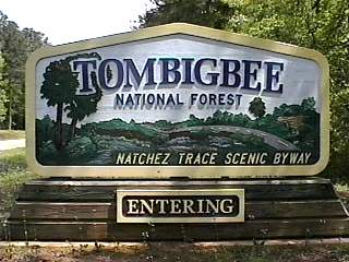
RANGER DISTRICT: Tombigbee
NEAREST CITY/TOWN: Ackerman
RESERVATIONS: 1-877-444-6777 or make on-line reservation
DIRECTIONS:
In Ackerman, MS, at the intersection of State Rts. 9, 12 and 15,
take Rt 15 south 3.3 miles to campground sign. Turn left at sign
onto Choctaw Lake Rd (Forest Rt. 967) and go 1.2 miles into campground.
GENERAL COMMENTS:
The elevation is 500 ft.
This outstanding, picturesque campground is located on the west bank of
the 100-acre Choctaw Lake. Two loops, named A and B, wind over rolling
hills and under towering Loblolly pines, Sweet gum, beech and some oak.
A grass understory has a manicured appearance. It is separation between
sites rather than vegetation that provides good privacy. Sites in Loop A
overlook Cabin Lake with some next to one of the several jetties used
for bank fishing. Loop B's campsites are a short walk from the water
and have a view of Choctaw Lake. The campground also features a little
gazebo, a pleasant day use area with a small swim beach, and an extensive
network of trails for hikers and mountain bike enthusiasts.
At the entrance to the campground, just off Choctaw Lake Rd, and off to the
left in the woods, you'll see a structure about 600 feet away. With your
camera, walk to it and you'll discover the district ranger residence built
by the Works Progress Administration (WPA) in the 1930s. It is well preserved
by the Forest Service and a wonderful example of period architecture, known
as "National Park Rustic." It was placed on the National List of Historic Places
in 2001. Although not the case at the time of the authors' visit, please comply
with any trespassing signs. Click on "Pictures" at top of page for a slide show
that includes the residence.
SEASONS
Open Seasonal: Yes
Open All Year: No
Comment:
Open March 10 through November 26
RATE AND MAXIMUM STAY PERMITTED
Rate: $20 per day
Senior Discount - $13 per day
Maximum Stay Permitted (days): 14
CAMPGROUND SITE CONFIGURATION
No. RV Sites: 0
No. Tent Sites: 0
No. Combined Sites (Tent or RV): 20
Total Sites: 20
Tent Pads: Yes
Open Sites: Yes
Wooded Sites: Yes
No. Tables on Sites: 20
No. Grilles on Sites: 20
Equestrian Camping: No
RV INFORMATION
No. Full Hookups (includes waste): 0
No. Water and Electric Only: 20
No. Water Only: 0
No. Electric Only: 0
No. RV Pull Throughs: 1
Waste Station: Yes
Potable Water at Waste Station: Yes
Average Parking Apron Size: 13.5' X 45'
Comments:
The parking aprons are gravel.
BATH AND SHOWER FACILITIES
Vaults: No
Flush Toilets: Yes
Hot Showers: Yes
Comments:
Wheelchair friendly showers
OTHER FACILITIES
Playground: Yes
Public Phone: Yes
No. Water Spigots (non-site): 0
No. Threaded: 0
Wheelchair Friendly Toilets: Yes
WATER SPORTS
Lake: Yes
Swimming (provided): Yes
Sailing: Yes
Boat Ramp: Yes
Boat Carry Down Access: Yes
Power Boating: Yes
Boating (no power): Yes
Water Skiing: No
Rafting (whitewater): No
Kayaking (whitewater): No
Comments:
Choctaw Lake is 100 acres and no wake. The beach is small and sandy.
HIKING
Choctaw Trails System (multiple loops} - 7 miles.
FISHING
Largemouth bass, bream and crappie. Good bank fishing. Wheelchair
friendly fishing pier.

CAMPGROUND NAME: Davis Lake
VISIT DATE: 04/22/1997
UPDATE DATE: 8/28/2020
STATE: Mississippi
REGION: Southern
RANGER DISTRICT: Tombigbee
NEAREST CITY/TOWN: Tupelo
RESERVATIONS: 1-877-444-6777 or make on-line reservation
DIRECTIONS:
In Tupelo, MS, at intersection of State Rt. 6 and Natchez Trace Parkway,
take Natchez Trace Parkway south 16.7 miles to the Davis Lake Recreation
Area sign. Bear right at sign and go to stop sign. Turn right at sign
and go 3.7 miles to campground on left.
GENERAL COMMENTS:
The elevation is 400 ft.
This picturesque campground, situated in a stand of mixed hardwoods and
pine, stretches along the east shore of Davis Lake ending in a loop. Every
campsite has a view of the water and most of the campsites in the loop are
on the water's edge so informal boat mooring may be possible. The grass
understory and lack of middle-story plus sites being close together make
privacy between sites poor in the loop. Campsites not in the loop have fair
to good privacy. All the campsites have a pedestal grill, small preparation
table, lantern poles, picnic table and fire-ring. Numerous jetties and piers
are provided for bank fishing enthusiasts.
Possible day trips are Owl Creek Mounds, an archaeological site containing
Indian Mounds dating to the early Mississippian period (A.D. 1000 to 1200);
the town of Tupelo, MS; and Natchez Trace Parkway.
SEASONS
Open Seasonal: Yes
Open All Year: Yes
Comment:
Services provided March 8 through October 30
RATE AND MAXIMUM STAY PERMITTED
Rate: $20 per day
Senior Discount - $13 per day
Maximum Stay Permitted (days): 14 & 28
CAMPGROUND SITE CONFIGURATION
No. RV Sites: 0
No. Tent Sites: 0
No. Combined Sites (Tent or RV): 27
Total Sites: 27
Tent Pads: Yes
Open Sites: Yes
Wooded Sites: Yes
No. Tables on Sites: 27
No. Grilles on Sites: 27
Equestrian Camping: No
RV INFORMATION
No. Full Hookups (includes waste): 0
No. Water and Electric Only: 27
No. Water Only: 0
No. Electric Only: 0
No. RV Pull Throughs: 0
Waste Station: Yes
Potable Water at Waste Station: Yes
Average Parking Apron Size: 15' X 50'
Comments:
The parking aprons are paved.
BATH AND SHOWER FACILITIES
Vaults: No
Flush Toilets: Yes
Hot Showers: Yes
OTHER FACILITIES
Playground: Yes
Public Phone: No
No. Water Spigots (non-site): 0
Wheelchair Friendly Toilets: Yes
WATER SPORTS
Lake: Yes
Swimming (provided): Yes
Sailing: No
Boat Ramp: Yes
Boat Carry Down Access: Yes
Power Boating: Yes
Boating (no power): Yes
Water Skiing: Yes
Rafting (whitewater): No
Kayaking (whitewater): No
Comments:
Davis Lake is 200 acres. Water skiing is permitted on the
weekends and federal holidays - after noon on each day only.
HIKING
Fishing Trail - 0.25 miles
FISHING
Largemouth bass, bream, catfish and crappie
|