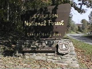
Campground List
CAMPGROUND NAME: Bark Camp Lake

VISIT DATE: 10/22/1996

UPDATE DATE: 8/28/2020

STATE: Virginia

REGION: Southern

RANGER DISTRICT: Clinch

NEAREST CITY/TOWN: Coeburn

RESERVATIONS: No

DIRECTIONS:
From Coeburn, VA, take US Rt. 58A west 2.4 miles to "High Knob"
sign (in Tacoma, VA).  Turn left onto State Rt. 706 (Stone
Mountain Rd.) and go 4 miles to "Bark Camp" sign.  Turn left and
go 0.3 miles to "Bark Camp Lake" sign (Bark Camp Rd.).  Turn
right onto Bark Camp Rd. and go 1.8 miles to another campground
sign.  Turn right and go 0.7 miles to campground.

GENERAL COMMENTS:
The elevation is 2,780 ft.

The campground, located near Bark Camp Lake, is situated in mature
hardwoods.  Sites are well spaced.

SEASONS
Open Seasonal: Yes
Open All Year: No

Seasonal Comment:
Open May 15 through September 15 - weather dependent

NOTE:  (2020) No drinking water is temporarily available; conact
ranger district office for status.

RATE AND MAXIMUM STAY PERMITTED
Rate: $18 per day  - single
$36 per day - double
  $5 additional surcharge per day for electric hookups - no discount.
Maximum Stay Permitted (days): 14

NOTE: (2018) Rate is reduced to $6 per day while drinking water
system is closed; contact ranger district office for status.

CAMPGROUND SITE CONFIGURATION
No. RV Sites: 0
No. Tent Sites: 2
No. Combined Sites (Tent or RV): 19

   Total Sites: 21

Tent Pads: Yes
Open Sites: No
Wooded Sites: Yes

No. Tables on Sites: 21
No. Grilles on Sites: 21
Equestrian Camping: No

RV INFORMATION
No. Full Hookups (includes waste): 0
No. Water and Electric Only: 0
No. Water Only: 0
No. Electric Only: 9

No. RV Pull Throughs: 0
Waste Station: Yes
Potable Water at Waste Station: Yes
Largest Parking Apron Size: 13.5' X 65'

Comments:
Parking aprons are grass and gravel.

BATH AND SHOWER FACILITIES
Vaults: No
Flush Toilets: Yes
Hot Showers: Yes

OTHER FACILITIES
Playground: No
Public Phone: No
No. Water Spigots (non-site): 3
  No. Threaded: 1
Wheelchair Friendly Toilets: Yes

WATER SPORTS
Lake: Yes
Swimming (provided): No
Sailing: No
Boat Ramp: Yes
Boat Carry Down Access: No
Power Boating: Yes
Boating (no power): Yes
Water Skiing: No
Rafting (whitewater): No
Kayaking (whitewater): No

Comments:
Bark Camp Lake is 40 acres.  Power boats limited to electric
motors.

HIKING
Lakeshore Trail (Bark Camp Loop) - 2.3 miles
Kitchen Rock Trail

FISHING
Northern pike, Largemouth bass, Sunfish, Crappie, Catfish and
Rainbow trout

CAMPGROUND NAME: Beartree

VISIT DATE: 10/20/1996

UPDATE DATE: 8/26/2020

STATE: Virginia

REGION: Southern

RANGER DISTRICT: Mount Rogers National Recreation Area

NEAREST CITY/TOWN: Damascus

RESERVATIONS: 1-877-444-6777 or make on-line reservation

DIRECTIONS:
From Damascus, VA, take US Rt. 58 east for 7.6 miles to
campground sign (Beartree Gap Trail Recreation Area).  Turn left
and go 0.8 miles to the entrance.  Proceed through the entrance
and go 3.9 miles to the camping area.

GENERAL COMMENTS:
he elevation is 3,400 ft.

The campground, one of 11 in the Mount Rogers National Recreation Area,
is composed of two loops, Chipmunk Circle and Beaver Flat, with a
playground in between.  The campsites are secluded and private; some are
nestled in Rhododendrun groves.  Chipmunk Circle seems to have larger
parking aprons, while Beaver Flat might be a little more tent-friendly.
There are numerous little streams and creeks crisscrossing both loops
and the sound of running water can be heard throughout.  There are a
few spots were wadding is possible.  Nestled between two mountains, the
campground enjoys ample shade and a lush forest environment of  hemlock,
wild Magnolia, pines and a variety of shrubs, strawberries, wildflowers
and grasses.  Wildlife, including various song birds and rabbits, can be
found in the campground.  There is a public phone at the entrance booth.

The Appalachian and Virginia Creeper Trails are nearby.  US Rt. 58 is a
scenic road that overlooks a stocked trout stream along much of the way.

The Virginia Creeper Trail is 33.4 miles long and is for non-motorized use
only.  It stretches from Abingdon, VA to the Virginia-North Carolina state
line.  The trail began as a Native American footpath, then pioneers
including Daniel Boone used the trail.  In 1907, a railroad was constructed
for hauling lumber, iron ore, supplies and passengers.  The Virginia Creeper
ran its last train on March 31, 1977.  There exist today over 100 trestles
and bridges, all accessible by foot or bicycle.  The Virginia Creeper Trail
is considered one of the most beautiful trails on the continent.  Bike rentals
are available from several outfitters in the area.

NOTE:  This is bear country; practise safe food storage technique.

SEASONS
Open Seasonal: Yes
Open All Year: No

Seasonal Comment:
Open April 28 through October 30

RATE AND MAXIMUM STAY PERMITTED
Rate: $24 per day - single
$48 per day - double

CAMPGROUND SITE CONFIGURATION
No. RV Sites: 0
No. Tent Sites: 0
No. Combined Sites (Tent or RV): 73

   Total Sites: 73

Tent Pads: Yes
Open Sites: Yes
Wooded Sites: Yes

No. Tables on Sites: 73
No. Grilles on Sites: 73
Equestrian Camping: No

RV INFORMATION
Hookups: None
No. RV Pull Throughs: 0
Waste Station: Yes
Potable Water at Waste Station: No
Largest Parking Apron Size: 10' X 75'

Comments:
The parking aprons are gravel and many can accommodate any size
recreation vehicle.  Gray water disposal stations at the rest rooms.

BATH AND SHOWER FACILITIES
Vaults: No
Flush Toilets: Yes
Hot Showers: Yes

OTHER FACILITIES
Playground: Yes
Public Phone: No
No. Water Spigots (non-site): 14
  No. Threaded: 14
Wheelchair Friendly Toilets: Yes

WATER SPORTS
Lake: Yes
Swimming (provided): Yes
Sailing: No
Boat Ramp: No
Boat Carry Down Access: No
Power Boating: No
Boating (no power): No
Water Skiing: No
Rafting (whitewater): No
Kayaking(whitewater): No

Comments:
Beartree Lake is 14 acres and is 3 miles south of campground
entrance.  There is a 300 ft. sandy beach; two bathhouses.

HIKING
Shaw Gap Trail - 1 mile
Beaver Flats Trail - 0.5 miles
Straight Branch Trail - 1.5 miles
Lum Trail - 1 mile
Beartree Lake Trail (wheelchair friendly) - 1 mile

FISHING
Smallmouth Bass, Sunfish, Rainbow and Brown Trout.

There are two wheelchair friendly fishing piers.

CAMPGROUND NAME: Cane Patch

VISIT DATE: 10/22/1996

UPDATE DATE: 8/28/2020

STATE: Virginia

REGION: Southern

RANGER DISTRICT: Clinch

NEAREST CITY/TOWN: Pound

RESERVATIONS: No

DIRECTIONS:
In Pound, VA, at intersection of Main St. (US 23 Business) and
South Fork Rd. (State Rt. 671) take State Rt. 671 west 6.3 miles
to campground sign.  Bear right at sign to campground.

NOTE: South Fork Rd. becomes North Fork Rd. before reaching
campground.

GENERAL COMMENTS:
The elevation is 1,770 ft.

This undiscovered campground near Pound Lake, originally Corps
of Engineers, is situated in a "hollar" surrounded by mature mixed
woods which provide good Fall colors.  There are two sections: a
small loop beside the North Fork of Pound Lake (thick growth of
cat's tail plants hide lake from view), while the second section
stretches out along Bad Creek.  Although the grass understory in
entire campground is nicely manicured, the second section features
grass parking aprons in the open and undefined, providing a more
rustic feel.  On the other hand, the first section is newer and features
partial cement parking aprons, large rock-dust pads and pedestal
grilles.  Each campsite in campground has a lantern pole.

SEASONS
Open Seasonal: Yes
Open All Year: No

Seasonal Comment:
Open May 15 through September 15

RATE AND MAXIMUM STAY PERMITTED
Rate: $12 per day - no electric hookups
$5 additional surcharge per day for electric hookups - no discount.
Maximum Stay Permitted (days): 14

CAMPGROUND SITE CONFIGURATION
No. RV Sites: 0
No. Tent Sites: 0
No. Combined Sites (Tent or RV): 35

   Total Sites: 35

Tent Pads: No
Open Sites: Yes
Wooded Sites: No

No. Tables on Sites: 35
No. Grilles on Sites: 35
Equestrian Camping: No

RV INFORMATION
No. Full Hookups (includes waste): 0
No. Water Only:  0
No. Water and Electric Only: 0
No. Electric Only: 8

No. RV Pull Throughs: 0
Waste Station: Yes
Potable Water at Waste Station: Yes
Largest Parking Apron Size: 12' X 55'

Comments:
Some parking aprons are gravel, part gravel and cement, and
undefined grass.

BATH AND SHOWER FACILITIES
Vaults: Yes
Flush Toilets: Yes
Hot Showers: Yes

Comments:
The flush toilets and showers are accessed by climbing 60 steps.

OTHER FACILITIES
Playground: Yes
Public Phone: No
No. Water Spigots (non-site): 3
  No. Threaded: 0
Wheelchair Friendly Toilets: No

WATER SPORTS - None

Comments:
There is a boat ramp at Wise Landing, about a mile from the
campground.  The ramp provides access to North Fork (150 acres)
of Pound Reservoir.

HIKING - Yes
1/2-mile connector trail to Phillip Creek Day Use, Phillips Creek
Loop trail and swim beach

FISHING - No

Comments:
Fishing is available at North Fork of the Pound Reservoir - about
a mile from the campground.  Muskie, Largemouth Bass and Catfish
are available.

CAMPGROUND NAME: Cave Mountain Lake

VISIT DATE: 10/15/1996

UPDATE DATE: 2/28/2020

STATE: Virginia

REGION: Southern

RANGER DISTRICT: Glenwood/Pedlar

NEAREST CITY/TOWN: Natural Bridge

RESERVATIONS:  1-877-444-6777 or make on-line reservation

DIRECTIONS:
In Natural Bridge, VA, take State Rt. 130 for 3.2 miles through
Natural Bridge Station, VA to Cave Mountain Lake sign (State Rt.
759).  Turn right at sign onto Rt. 759 and go 3.2 miles to
another Cave Mountain sign (State Rt. 781).  [Caution: you will
pass a State Rt. 781 sign at about 1.6 miles.  Do not turn there,
but rather later at the aforementioned sign.]  Turn right onto
Rt. 781 and go 1.6 miles to the Recreation Area sign and turn
right.  Follow signs to campground.

GENERAL COMMENTS:
The elevation is 1,060 ft.

The campground is situated in mature mixed woods.  Some sites
are adjacent to a fast flowing creek, which can be heard from all
sites.  Cave Mountain Lake and picnic area were constructed by
the Civilian Conservation Corps (CCC) in the late thirty's.  Some
sites have stone terraces.

SEASONS
Open Seasonal: Yes
Open All Year: No

Seasonal Comment:
Open April 3 through October 30

RATE AND MAXIMUM STAY PERMITTED
Rate: $18 per day - single
$36 per day - double
Maximum Stay Permitted (days): 21

CAMPGROUND SITE CONFIGURATION
No. RV Sites: 0
No. Tent Sites: 6
No. Combined Sites (Tent or RV): 35

   Total Sites: 41

Tent Pads: Yes
Open Sites: No
Wooded Sites: Yes

No. Tables on Sites: 41
No. Grilles on Sites: 41
Equestrian Camping: No

RV INFORMATION
Hookups: None
No. RV Pull Throughs: 1
Waste Station: Yes
Potable Water at Waste Station: Yes
Largest Parking Apron Size: 10' X 56'

Comments:
Parking aprons are gravel and dirt.  Sites 32 through 35 are
limited to travel trailers no more then 12 ft. long.

BATH AND SHOWER FACILITIES
Vaults: No
Flush Toilets: Yes
Hot Showers: Yes

Comments:
Showers are wheelchair-friendly.

OTHER FACILITIES
Playground: No
Public Phone: No
No. Water Spigots (non-site): 9
  No. Threaded: 0
Wheelchair Friendly Toilets: No

WATER SPORTS
Lake: Yes
Swimming (provided): Yes
Sailing: No
Boat Ramp: No
Boat Carry Down Access: No
Power Boating: No
Boating (no power): No
Water Skiing: No
Rafting (whitewater): No
Kayaking (whitewater): No

Comments:
Cave Mountain Lake is 5 acres.  There is large sandy beach.
The bathhouse is wheelchair friendly with flush toilets,
showers and change rooms.

HIKING
Wildcat Mountain Trail - 4.1 miles
Panther Knob Nature Trail - 0.5 miles

FISHING - No

CAMPGROUND NAME: Cave Springs

VISIT DATE: 10/22/1996

UPDATE DATE: 8/28/2020

STATE: Virginia

REGION: Southern

RANGER DISTRICT: Clinch

NEAREST CITY/TOWN: Dryden

RESERVATIONS: No

DIRECTIONS:
From Big Stone Gap, VA, take US Rt. 58 Alternate west 2.4 miles
to State Rt. 621.  Turn right onto Rt. 621 and go 2.1 miles to a "T"
intersection.  Turn right, staying on Rt. 621, and go 4.4 miles to
campground sign.  Turn right and go 0.3 miles to campground entrance.

GENERAL COMMENTS:
The elevation is 1,500 feet.

This nice undiscovered campground has two overlapping loops
meandering up, around and over hills in a dense hardwood forest.
Much of the stonework is covered in moss and lichen.  Rhododendrons,
holly and pine trees are scattered throughout campground.  There is a
lot of stone work forming terraces, steps and walls.  Privacy between
campsites is good.

SEASONS
Open Seasonal: Yes
Open All Year: No

Seasonal Comment:
Open May 15 through September 15

RATE AND MAXIMUM STAY PERMITTED
Rate: $12 per day plus $5 per day surcharge for electric hookups.
NOTE:  No discount of surcharge
Maximum Stay Permitted (days): 14

CAMPGROUND SITE CONFIGURATION
No. RV Sites: 0
No. Tent Sites: 0
No. Combined Sites (Tent or RV): 40

   Total Sites: 40

Tent Pads: Yes
Open Sites: No
Wooded Sites: Yes

No. Tables on Sites: 40
No. Grilles on Sites: 40
Equestrian Camping: No

RV INFORMATION
No. Full Hookups (includes waste): 0
No. Water and Electric Only: 0
No. Water Only: 0
No. Electric Only: 19

No. RV Pull Throughs: 0
Waste Station: Yes
Potable Water at Waste Station: Yes
Average Parking Apron Size: 13' X 53'

Comments:
Parking aprons are half-paved and half-rock dust.  Interior road
is narrow.

BATH AND SHOWER FACILITIES
Vaults: No
Flush Toilets: Yes
Hot Showers: Yes

OTHER FACILITIES
Playground: No
Public Phone: No
No. Water Spigots (non-site): 8
  No. Threaded: 0
Wheelchair Friendly Toilets: No

WATER SPORTS
Lake: No
Swimming (provided): Yes
Sailing: No
Boat Ramp: No
Boat Carry Down Access: No
Power Boating: No
Boating (no power): No
Water Skiing: No
Rafting (whitewater): No
Kayaking (whitewater): No

Comments:
Swimming is actually in man-made, stream-fed pond

HIKING
Little Stone Mountain Trail (foot) - 7 miles
Cave Overlook Trail - (foot) 1 mile

FISHING - No

CAMPGROUND NAME: Collins Cove Horse Camp

VISIT DATE: 09/09/2010

UPDATE DATE: 8/28/2020

STATE: Virginia

REGION: Southern

RANGER DISTRICT: Mt. Rogers National Recreation Area

NEAREST CITY/TOWN: Speedwell

RESERVATIONS: No

DIRECTIONS:
In Speedwell, VA, at the intersection of State Rt. 21 and 619
(Saint Peters Rd.), take Rt. 619 east 0.1 miles to a "Y"
intersection.  Bear left, staying on Rt. 619, and go 4.1 miles to
a "T" intersection.  Turn right and go 0.4 miles to another "Y"
intersection.  Bear left, staying on Rt. 619 (Gleaves Rd.), to a
another "T" intersection.  Turn right at intersection, still on
Rt.619, and go 0.1 miles to still another "Y" intersection.  Bear
right, onto Pope Rd., and go 0.9 miles to another "T"
intersection.  Turn right onto Collins Cove Rd and go 0.4 miles
to campground on right.

GENERAL COMMENTS:
The elevation is 2,100 ft.

The campground is one of 11 in the Mt. Rogers National Recreation
Area.  This small equestrian campground has a single loop
stretching up a hillside.  Grass understory and no middlestory
provide ample space for horse trailers, tow vehicles and portable
corrals.  The lack of clearly defined parking aprons gives the
campground a group campground feel.  A dense, mature forest,
which includes oak and pine, provide scenic views and suggest
nice fall color.   High-line poles and hitching rails are
provided at most campsites.

SEASONS
Open Seasonal: Yes
Open All Year: No

Seasonal Comment:
Open April 1 through November 30

RATE AND MAXIMUM STAY PERMITTED
Rate: $5 per day
Maximum Stay Permitted (days): 14

CAMPGROUND SITE CONFIGURATION
No. RV Sites: 0
No. Tent Sites: 0
No. Combined Sites (Tent or RV): 10

   Total Sites: 10

Tent Pads: No
Open Sites: Yes
Wooded Sites: No

No. Tables on Sites: 10
No. Grilles on Sites: 9
Equestrian Camping: Yes

RV INFORMATION
Hookups: None
No. RV Pull Throughs: 1
Waste Station: No
Average Parking Apron Size: See RV Comments

Comments:
The parking aprons are grass and not well designated.  The
campground will accommodate any size RV.

FACILITIES
Vaults: Yes
Flush Toilets: No
Hot Showers: No
Wheelchair Friendly Toilets: No

Public Phone: No
Playground: No
No. Water Spigots (non-site): 0

Comments:
A manure dump station is provided in the campground.

WATER SPORTS - None

HIKING
Ewing Mountain Trail (foot and horse) - 2 miles

Provides access to the 200-mile Virginia Highland Horse trail
network

FISHING
A creek across from campground entrance is stocked with trout.

CAMPGROUND NAME: Fox Creek

VISIT DATE: 09/09/2010

UPDATE DATE: 8/28/2020

STATE: Virginia

REGION: Southern

RANGER DISTRICT: Mt. Rogers National Recreation Area

NEAREST CITY/TOWN: Grant

RESERVATIONS: 1-877-444-6777 or make on-line reservation

DIRECTIONS:
In Grant, VA, at the intersection of State Rts. 16 and 658
(Flatridge Rd.), take Rt. 16 north 3.8 miles to Grindstone
campground sign.  Turn left after sign onto State Rt. 603 and go
3.8 miles to the campground on right.

GENERAL COMMENTS:
The elevation is 3,400 feet.

The campground, one of 11 in the Mount Rogers National Recreation
Area, has two unnamed sections straddling Fox Creek.  Sites on
the south side of Fox Creek are sandwiched between the creek and
Rt 603 and will experience traffic noise.  Sites of Fox
Creek may hear Rt 603's traffic but will not see any passing
vehicles. Although campsites are open and on grass, with a
dispersed camping feel, the campground is surrounded by a
pleasant dense forest of mixed hemlock, oak, poplar and variety
of other trees.  The occasional apple tree attests to the area's
agricultural past.  A popular equestrian campground on the 200-
mile network of Virginia Highlands Horse trails, it can be
crowded on weekends.  The provided equestrian amenities are
limited to "high-line" poles but visitors can use portable
corrals on their campsite.  Fishing is allowed in Fox Creek
outside the campground.  Horses may be watered only at designated
"hardened" places along the creek.

This is bear country; practice safe food storage techniques.

SEASONS
Open Seasonal: Yes
Open All Year: No

Seasonal Comment:
Open April 1 through November 30

RATE AND MAXIMUM STAY PERMITTED
Rate: $5 per day per vehicle
Maximum Stay Permitted (days): 21

CAMPGROUND SITE CONFIGURATION
No. RV Sites: 0
No. Tent Sites: 0
No. Combined Sites (Tent or RV): 24

   Total Sites: 24

Tent Pads: No
Open Sites: Yes
Wooded Sites: No

No. Tables on Sites: 27
No. Grilles on Sites: 0
Equestrian Camping: Yes

RV INFORMATION
Hookups: None
No. RV Pull Throughs: 0
Waste Station: No
Average Parking Apron Size: See RV Comments

Comments:
The parking aprons are gravel or grass and can accomodate any
size RV.  An RV waste station with potable water is available for
a fee at the nearby national forest Grindstone campground.

FACILITIES
Vaults: Yes
Flush Toilets: No
Hot Showers: No
Wheelchair Friendly Toilets: Yes

Public Phone: No
Playground: No
No. Water Spigots (non-site): 0

Comments:
Only stock water is available and the vaults are port-a-potties.
Hot showers are available for a fee at Grindstone campground.

WATER SPORTS - None

HIKING
Virginia Highlands Horse Trail (foot and horse) - a 200-mile
network of trails.

FISHING
Native trout

CAMPGROUND NAME: Grindstone

VISIT DATE: 10/20/1996

UPDATE DATE: 8/28/2020

STATE: Virginia

REGION: Southern

RANGER DISTRICT: Mount Rogers National Recreation Area

NEAREST CITY/TOWN: Troutdale

RESERVATIONS: 1-877-444-6777 or make on-line reservation

DIRECTIONS:
In Troutdale, VA, at the intersection of State Rts. 16 and 603,
take Rt. 603 west 2.9 miles to campground sign.  Turn left at
sign into campground.

GENERAL COMMENTS:
The elevation is 3,700 ft.

The campground, one of 11 in the Mount Rogers National Recreation
Area in a dense stand of mixed hardwood trees, has three loops -
Cottontail Patch, Groundhog Den and Opossum Hollow.  Opossum loop
is the smallest loop and, with no hookups, the least developed.
It also has the majority of the campground's water spigots and
many sites are tucked in among dense towering rhododendrons.  All
the sites in Cottontail loop have electric and water hookups and
some sites are in a stand of hemlock.  Groundhog loop has a mix
of sites, some with no hookups and some with electric and water
hookups.  There is an amphitheater, interpretive program each
weekend and church services on Sunday during the summer.  This is
an older campground when steeply sloped parking aprons and narrow
interior roads were not a problem for car campers but may pose a
challenge for RV campers.  The campground has not only a playground
but a half basketball court and a volleyball court.

This is bear country; practice safe food storage techniques.

SEASONS
Open Seasonal: Yes
Open All Year: No

Seasonal Comment:
Open April 28 through November 26

RATE AND MAXIMUM STAY PERMITTED
Rate: $24 per day for single
$48 per day for double.

NOTE: $8 additional surcharge per day for electric & water hookups -
no discount
Maximum Stay Permitted (days): 14

CAMPGROUND SITE CONFIGURATION
No. RV Sites: 0
No. Tent Sites: 5
No. Combined Sites (Tent or RV): 82

   Total Sites: 87

Tent Pads: Yes
Open Sites: No
Wooded Sites: Yes

No. Tables on Sites: 87
No. Grilles on Sites: 87
Equestrian Camping: No

RV INFORMATION
No. Full Hookups (includes waste): 0
No. Water and Electric Only: 50
No. Water Only: 0
No. Electric Only: 0

No. RV Pull Throughs: 0
Waste Station: Yes
Potable Water at Waste Station: Yes
Average Parking Apron Size: See RV Comments

Comments:
Some parking aprons are gravel and some are paved.  Most campsites
accommodate any size RV.

BATH AND SHOWER FACILITIES
Vaults: No
Flush Toilets: Yes
Hot Showers: Yes

Comments:
Bathrooms are heated.

OTHER FACILITIES
Playground: Yes
Public Phone: No
No. Water Spigots (non-site): 10
  No. Threaded: 7
Wheelchair Friendly Toilets: Yes

WATER SPORTS - None

HIKING
Mt. Rogers Trail (foot) - 7.5 miles
Whispering Waters Nature Trail (foot) - 0.6 miles

FISHING
There are trout streams in the area outside the campground.

CAMPGROUND NAME: High Knob

VISIT DATE: 10/22/1996

UPDATE DATE: 8/28/2020

STATE: Virginia

REGION: Southern

RANGER DISTRICT: Clinch

NEAREST CITY/TOWN: Norton

RESERVATIONS: No

DIRECTIONS:
From Coeburn, VA, take US Rt. 58A west 2.4 miles to "High Knob"
sign in Tacoma, Va (State Rt. 706).  Turn left onto Rt. 706
(Stone Mtn. Rd.) and go 4 miles to another High Knob sign.
Continue straight on Rt. 706 until it changes into Forest Rt. 238
(gravel road, single lane with turnouts).  Go 5.6 miles on Rt.
238 to High Knob Recreational Area sign.  Turn left at sign and
go 1.7 miles to campground.

ALTERNATIVE ROUTE:  From Norton, VA, take State Rt. 619 south
for 3.7 miles to campground sign (Forest Rt. 238).  Turn left onto
Rt. 238 and go 1.6 miles to another campground sign.  Turn right
at sign and go 1.7 miles to campground.

NOTE: Both of these routes are not RV friendly.  Forest Rt. 238
is single lane, gravel, washboard and steep in places.  State Rt.
619, on the other hand, is a paved two-lane road but very steep
with severe switchbacks.  Long motor homes may have to back
up to negotiate some switchbacks.

GENERAL COMMENTS:
The elevation is 3,520 ft.

A nice campground, located on a ridge in mature hardwoods near
High Knob Lake, was built by the Civilian Conservation Corps (CCC).
The interior road is "tear" shaped and narrow making it difficult
to drive the loop when looking for site.  Because of the difficult
access and interior roads, campground is not RV friendly.

A scenic hike is the High Knob Tower Trail.  It goes up to the High
Knob Tower with spectacular views from the tower of the forest,
Virginia, Tennessee and Kentucky.  The High Knob Tower is also
accessible by car not far from the campground.

SEASONS
Open Seasonal: Yes
Open All Year: No

Seasonal Comment:
Open May 15 through September 15

RATE AND MAXIMUM STAY PERMITTED
Rate: $10 per day.
Maximum Stay Permitted (days): 14

NOTE: (2020) Call ranger district office to confirm campground
is open and water is available.

CAMPGROUND SITE CONFIGURATION
No. RV Sites: 0
No. Tent Sites: 2
No. Combined Sites (Tent or RV): 11

   Total Sites: 13

Tent Pads: Yes
Open Sites: No
Wooded Sites: Yes

No. Tables on Sites: 13
No. Grilles on Sites: 13
Equestrian Camping: No

RV INFORMATION
Hookups: None
No. RV Pull Throughs: 0
Waste Station: Yes
Potable Water at Waste Station: Yes
Largest Parking Apron Size: 11' X 42'

Comments:
The parking aprons are grass.

BATH AND SHOWER FACILITIES
Vaults: No
Flush Toilets: Yes
Hot Showers: Yes

Comments:
Showers available at the bath house.

OTHER FACILITIES
Playground: No
Public Phone: No
No. Water Spigots (non-site): 3
  No. Threaded: 1
Wheelchair Friendly Toilets: No

WATER SPORTS
Lake: Yes
Swimming (provided): Yes
Sailing: No
Boat Ramp: No
Boat Carry Down Access: No
Power Boating: No
Boating (no power): No
Water Skiing: No
Rafting (whitewater): No
Kayaking (whitewater): No

Comments:
300-ft. sandy beach on 5-acre cold water lake is available.
There is bath house with flush toilets, changing rooms and
shower.

HIKING
High Knob Shoreline Trail - 1 mile
High Knob Tower - 1 mile
Chief Benge's Scout Trail - 16.3 miles

NOTE: Access Chief Benges Scout Trail from High Knob Tower Trail
or from High Knob Tower parking lot.

FISHING - No

CAMPGROUND NAME: Hurricane

VISIT DATE: 10/20/1996

UPDATE DATE: 8/28/2020

STATE: Virginia

REGION: Southern

RANGER DISTRICT: Mount Rogers National Recreation Area

NEAREST CITY/TOWN: Sugar Grove

RESERVATIONS: 1-877-444-6777 or make on-line reservation

DIRECTIONS:
In Sugar Grove, VA, take State Rt. 16 south for 6 miles to "Hurricane" sign
(State Rt. 650).  Turn right onto Rt. 650 (gravel, single lane) and go 1.4
miles to campground sign (Forest Rt. 84).  Turn left onto Rt. 84 (paved)
and go 0.3 miles to another campground sign.  Bear right at sign into the
campground.

GENERAL COMMENTS:
The elevation is 2,880 ft.

This attractive campground, one of 11 in the Mount Rogers National Recreation
Area, stretches along Hurricane Branch and Comer Branches (a.k.a. creeks)
through mature mixed woods of oak, hemlock and popular suggesting great fall
color.  Many sites are located among rhododendron that line the creeks and each
has a lantern pole.  The campground has several groomed grassy open fields but
all the campsite enjoy ample shade and excellent privacy.  Although it is a drive
to this campground, the distance is well-worth it.

SEASONS
Open Seasonal: Yes
Open All Year: No

Seasonal Comment:
Open April 1 through November 30

RATE AND MAXIMUM STAY PERMITTED
Rate: $18 per day - single
$36 per day - for double
Maximum Stay Permitted (days): 14

CAMPGROUND SITE CONFIGURATION
No. RV Sites: 0
No. Tent Sites: 3
No. Combined Sites (Tent or RV): 22

   Total Sites: 25

Tent Pads: Yes
Open Sites: No
Wooded Sites: Yes

No. Tables on Sites: 25
No. Grilles on Sites: 25
Equestrian Camping: No

RV INFORMATION
Hookups: None
No. RV Pull Throughs: 3
Waste Station: No
Average Parking Apron Size: 14' X 45'

Comments:
The parking aprons are paved.  An RV waste station is located at Raccoon
Branch (national forest) campground.

BATH AND SHOWER FACILITIES
Vaults: Yes
Flush Toilets: Yes
Hot Showers: Yes

OTHER FACILITIES
Playground: No
Public Phone: No
No. Water Spigots (non-site): 4
  No. Threaded: 0
Wheelchair Friendly Toilets: Yes

WATER SPORTS
Wading is possible in the creek.

HIKING
Hurricane Knob Trail (foot) - 1 mile
Hurricane Knob Nature Trail (foot) - 1.1 miles
Comers Creek Trail (foot and mountain bike) - 0.5 miles

FISHING
Hurricane and Comers Creeks run through the area, providing
trout fishing (stocked).

CAMPGROUND NAME: Hussy Mtn. Horse Camp

VISIT DATE: 09/09/2010

UPDATE DATE: 8/28/2020

STATE: Virginia

REGION: Southern

RANGER DISTRICT: Mt. Rogers National Recreation Area

NEAREST CITY/TOWN: Speedwell

RESERVATIONS: No

DIRECTIONS:
In Speedwell, VA, at the intersection of State Rts. 21, 619 and
749, take Rt. 21 south 3.2 miles to Forest Rt. 14 (C.C.C. Camp
Rd.).  Turn left onto Rt. 14 and go 2 miles to campground on
right.

NOTE:  There are numerous dispersed campsites along Forest Rt. 14.

GENERAL COMMENTS:
The elevation is 2,900 ft.

The campground, one of 11 in the Mount Rogers National Recreation
Area, has three unnamed sections up a hillside and along a creek.
The campsites are tucked in among a stand of mixed hardwoods and
pines.  It appears to be a good campground for small groups that
want to camp close to each other.  Horse facilities are limited to
poles for highlining horses and a manure dump station.

SEASONS
Open Seasonal: Yes
Open All Year: No

Seasonal Comment:
Open April 1 through October 31

RATE AND MAXIMUM STAY PERMITTED
Rate: $7 per day
Maximum Stay Permitted (days): 14

CAMPGROUND SITE CONFIGURATION
No. RV Sites: 0
No. Tent Sites: 0
No. Combined Sites (Tent or RV): 13

   Total Sites: 13

Tent Pads: No
Open Sites: Yes
Wooded Sites: Yes

No. Tables on Sites: 13
No. Grilles on Sites: 13
Equestrian Camping: Yes

RV INFORMATION
Hookups: None
No. RV Pull Throughs: 2
Waste Station: No
Average Parking Apron Size: 15' X 42'

Comments:
The parking aprons, some poorly defined, are gravel and grass.

FACILITIES
Vaults: Yes
Flush Toilets: No
Hot Showers: No
Wheelchair Friendly Toilets: No

Public Phone: No
Playground: No
No. Water Spigots (non-site): 2
  No. Threaded: 2

Comments:
Stock water is available from the creek and there is a manure
dump station.

WATER SPORTS - None

HIKING
East Fork trail (foot and horse) - 2.7 miles

There are two trailheads for East Fork trail.  One inside the
campground and the other at the campground entrance.  The trail
connects to the Virginia Highlands Horse trail, a 200 mile
network of trails.

FISHING - No

CAMPGROUND NAME: North Creek

VISIT DATE: 10/15/1996

UPDATE DATE: 8/28/2020

STATE: Virginia

REGION: Southern

RANGER DISTRICT: Glenwood/Pedlar

NEAREST CITY/TOWN: Buchanan

RESERVATIONS: No

DIRECTIONS:
From Buchanan, VA, take Interstate 81 north for 0.8 miles to Exit
168 (State Rt. 614).  Follow Rt. 614 for 2.9 miles to Forest Rt.
59.  Turn left onto Rt. 59 and go 2.4 miles to campground sign.
Turn right into campground.

GENERAL COMMENTS:
The elevation is 1,100 ft.

The campground is located at the base of the Blue Ridge Mountains,
the areas is heavily wooded with hemlock and pine.  Located along
the edge of North Creek, some sites are "creek side" and all are
nestled among the trees.  Some sites are adjacent to and some are
built with stone terraces. North Creek flows through the campground
and campers can listen to the water as it splashes and flows by or
fish from their tent door.

SEASONS
Open Seasonal: Yes
Open All Year: No

Comments:
Open March 15 through December 1

RATE AND MAXIMUM STAY PERMITTED
Rate: $12 per day - single
$24 per day - double
Maximum Stay Permitted (days): 21

CAMPGROUND SITE CONFIGURATION
No. RV Sites: 0
No. Tent Sites: 0
No. Combined Sites (Tent or RV): 15

   Total Sites: 15

Tent Pads: Yes
Open Sites: No
Wooded Sites: Yes

No. Tables on Sites: 15
No. Grilles on Sites: 15
Equestrian Camping: No

RV INFORMATION
Hookups: None
No. RV Pull Throughs: 0
Waste Station: No
Largest Parking Apron Size: 10.5' X 57'

Comments:
The parking aprons are gravel.  A Forest Service RV
waste station, with no potable water, is available about
0.9 miles west of campground on Forest Rt. 59.

BATH AND SHOWER FACILITIES
Vaults: Yes
Flush Toilets: No
Hot Showers: No

OTHER FACILITIES
Playground: No
Public Phone: No
No. Water Spigots (non-site): 3
  No. Threaded: 0
Wheelchair Friendly Toilets: Yes

WATER SPORTS - None

HIKING
White Trail (loop) - 2.5 miles

FISHING
Rainbow and native Trout

CAMPGROUND NAME: Raccoon Branch

VISIT DATE: 10/18/1996

UPDATE DATE: 8/28/2020

STATE: Virginia

REGION: Southern

RANGER DISTRICT: Mount Rogers National Recreation Area

NEAREST CITY/TOWN: Sugar Grove

RESERVATIONS: 1-877-444-6777 or make on-line reservation

DIRECTIONS:
From Sugar Grove, VA, take State Rt. 16 south 1.8 miles to campground
on right.

GENERAL COMMENTS:
The elevation is 2,780 ft.

This very pleasant, comfortable campground, one of 11 in the Mount Rogers
National Recreation Area, is a single loop around an open grassy area
surrounded by pines, hardwoods, rhododendrons and mountains; a very pleasant
little campground.  Some sites are adjacent to either Dickey Creek or Raccoon
Branch.  Each site also has a lantern pole and level parking aprons.  There
is some traffic noise from Rt. 16 but not distracting. This is a good
campground to use as a home base for exploring the area and enjoying the fall
colors.  The lack of middlestory results in only fair privacy between sites.
Free WiFi access is provided at the water and electric campsites.

SEASONS
Open Seasonal: Yes
Open All Year: No

Comment:
Open April 15 through November 30

RATE AND MAXIMUM STAY PERMITTED
Rate: $16 per day
  An additional $6 per day surcharge for electric hookups - no discount
Maximum Stay Permitted (days): 14

CAMPGROUND SITE CONFIGURATION
No. RV Sites: 0
No. Tent Sites: 1
No. Combined Sites (Tent or RV): 18

   Total Sites: 19

Tent Pads: Yes
Open Sites: Yes
Wooded Sites: Yes

No. Tables on Sites: 19
No. Grilles on Sites: 19
Equestrian Camping: No

RV INFORMATION
No. Full Hookups (includes waste): 0
No. Water and Electric Only: 6
No. Water Only: 0
No. Electric Only: 0

No. RV Pull Throughs: 0
Waste Station: Yes
Potable Water at Waste Station: Yes
Average Parking Apron Size: 9' X 41'

Comments:
Parking aprons are paved.  Some sites have "V" aprons, e.g., one
for trailer, one for towing vehicle.

BATH AND SHOWER FACILITIES
Vaults: No
Flush Toilets: Yes
Hot Showers: No

OTHER FACILITIES
Playground: No
Public Phone: No
No. Water Spigots (non-site): 1
  No. Threaded: 1
Wheelchair Friendly Toilets: No

WATER SPORTS
Wading is possible in Dickey Knob Creek.

HIKING
Dickey Knob Trail (foot & mountain bike) - 2.4 miles.

FISHING
Trout

CAMPGROUND NAME: Raven Cliff

VISIT DATE: 10/18/1996

UPDATE DATE: 8/28/2020

STATE: Virginia

REGION: Southern

RANGER DISTRICT: Mount Rogers National Recreation Area

NEAREST CITY/TOWN: Speedwell

RESERVATIONS: No

DIRECTIONS:
In Speedwell, VA, at the intersection of State Rt. 21 and 619
(Saint Peters Rd.), take Rt. 619 east 0.1 miles to a "Y" intersection.
Bear left, staying on Rt. 619, and go 4.1 miles to a "T" intersection.
Turn right and go 0.4 miles to another "Y" intersection.  Bear left,
staying on Rt. 619 (Gleaves Rd.), and go 1.6 miles to campground sign.
Turn right at sign and go 0.6 miles to another campground sign.  Turn
left at sign into campground.

Note: Last 0.6 miles are rough, single lane with some low hanging
branches.

GENERAL COMMENTS:
The elevation is 2,200 ft.

This quiet campground, one of 11 in the Mount Rogers National
Recreation Area, stretches along a ridge above Cripple Creek in
a hemlock and pine grove.  The campground has a well-groomed
appearance providing a pleasant wilderness forest camping
experience.  It is far from the crowds and the ample vegetation
and space between sites provide good privacy.

SEASONS
Open Seasonal: Yes
Open All Year: No

Seasonal Comment:
Open April 15 through October 31

RATE AND MAXIMUM STAY PERMITTED
Rate: $5 per day
Maximum Stay Permitted (days): 14

CAMPGROUND SITE CONFIGURATION
No. RV Sites: 0
No. Tent Sites: 5
No. Combined Sites (Tent or RV): 15

   Total Sites: 20

Tent Pads: Yes
Open Sites: No
Wooded Sites: Yes

No. Tables on Sites: 20
No. Grilles on Sites: 20
Equestrian Camping: No

RV INFORMATION
Hookups: None
No. RV Pull Throughs: 0
Waste Station: No
Average Parking Apron Size: 12' X 38'

Comments:
The parking aprons are grass and gravel.  Low hanging branches
and uneven aprons may make leveling a challenge.

BATH AND SHOWER FACILITIES
Vaults: Yes
Flush Toilets: No
Hot Showers: No

OTHER FACILITIES
Playground: No
Public Phone: No
No. Water Spigots (non-site): 0
Wheelchair Friendly Toilets: No

WATER SPORTS - None

HIKING - No

FISHING
Trout in the spring.

CAMPGROUND NAME: Stony Fork

VISIT DATE: 10/17/1996

UPDATE DATE: 8/28/2020

STATE: Virginia

REGION: Southern

RANGER DISTRICT: Mt. Rogers National Recreation Area

NEAREST CITY/TOWN: Wytheville

RESERVATIONS: 1-877-444-6777 or make on-line reservation

DIRECTIONS:
From Wytheville, VA, take US Rt. 52 north 8 miles to "camping"
sign (State Rt. 717).  Turn right onto Rt. 717 and go 0.4 miles
to campground sign.  Turn right into campground.  An alternative
route is Interstate 77 to State Rt. 717 turn off.

GENERAL COMMENTS:
The elevation is is 2,220 ft.

The campground is a single loop with the East Fork of Stony Fork
River meandering throughout.  It is situated in hardwoods and pines
at the foot of Big Walker Mountain.  Lantern post are situated at each
campsite. Horseshoe pits are located next to site 43.  Privacy
between campsites is fair to good.  A cabin is available for rent -
call the Ranger District Office.  This is a very comfortable campground
friendly to both RVrs and tenters.

SEASONS
Open Seasonal: Yes
Open All Year: No

Seasonal Comment:
Open April 1 through November 30

RATE AND MAXIMUM STAY PERMITTED
Rate: $16 per day - no hookups
$6 additional surcharge for electric hookups - no discount
$10 additional surcharge for electric and water hookups - no discount
Maximum Stay Permitted (days): 14

CAMPGROUND SITE CONFIGURATION
No. RV Sites: 0
No. Tent Sites: 0
No. Combined Sites (Tent or RV): 49

   Total Sites: 49

Tent Pads: Yes
Open Sites: Yes
Wooded Sites: Yes

No. Tables on Sites: 49
No. Grilles on Sites: 49
Equestrian Camping: No

RV INFORMATION
No. Full Hookups (includes waste): 0
No. Water and Electric Only: 11
No. Water Only: 0
No. Electric Only: 23

No. RV Pull Throughs: 1
Waste Station: Yes
Potable Water at Waste Station: Yes
Average Parking Apron Size: 13' X 60'

Comments:
Parking aprons are paved.  The campground will accommodate
most any size RV.

BATH AND SHOWER FACILITIES
Vaults: No
Flush Toilets: Yes
Hot Showers: Yes

Comments:
The bathhouse next to site 38 has a family room with toilet and
shower; the shower is wheelchair friendly.  Water spigots at
 bathhouses are not included in spigot count.

OTHER FACILITIES
Playground: No
Public Phone: Yes
No. Water Spigots (non-site): 9
  No. Threaded: 0
Wheelchair Friendly Toilets: Yes

WATER SPORTS - None

HIKING
Stony Fork Nature Trail (loop - foot*) - 1 mile
Seven Sisters Trail (foot & mountain bike) - 5
  miles; access is 0.4 miles from campground off
  the Stony Fork Nature Trail.

* Mountain bikes are permitted on the first 0.4 miles.

FISHING
Rainbow trout (stocked)

East Fork of Stony Fork River may dry up during dry seasons; check
with Ranger District Office. There are other trout streams nearby.

CAMPGROUND NAME: The Pines

VISIT DATE: 10/16/1996

UPDATE DATE: 2/10/2017

STATE: Virginia

REGION: Southern

RANGER DISTRICT: Eastern Divide

NEAREST CITY/TOWN: New Castle

RESERVATIONS: No

DIRECTIONS:In New Castle, VA, take State Rt. 615 north
2.6 miles to State Rt. 609.  Turn left onto Rt. 609 and go 2.2 miles
to State Rt. 611.  Turn left onto Rt. 611 and go 3.3 miles to campground
sign (State Rt. 617).  Turn right onto Rt. 617 and go 5.1 miles to
another campground sign.  Turn left into campground.

GENERAL COMMENTS:
The elevation is 1,740 ft.

The campground, located in hardwood and pine woods, is adjacent to
an area called "Horse Corral."  In the latter is a horse unloading
ramp and corral with a small area for trailers and dispersed camping.
Both the corral and ramp are in need of repair.  The Pines campground
is under maintained; no horses are allowed in the campground.

SEASONS
Open Seasonal: Yes
Open All Year: No

Open April 1 through December 7

RATE AND MAXIMUM STAY PERMITTED
Rate: No charge
Maximum Stay Permitted (days): 14

CAMPGROUND SITE CONFIGURATION
No. RV Sites: 0
No. Tent Sites: 4
No. Combined Sites (Tent or RV): 10

   Total Sites: 14

Tent Pads: No
Open Sites: Yes
Wooded Sites: Yes

No. Tables on Sites: 14
No. Grilles on Sites: 12
Equestrian Camping: No

RV INFORMATION
Hookups: None
No. RV Pull Throughs: 1
Waste Station: No
Largest Parking Apron Size: 11.5' X 37'

Comments:
Parking aprons are gravel and dirt.  Water spigot is a hand pump.

BATH AND SHOWER FACILITIES
Vaults: Yes
Flush Toilets: No
Hot Showers: No

OTHER FACILITIES
Playground: No
Public Phone: No
No. Water Spigots (non-site): 1
  No. Threaded: 0
Wheelchair Friendly Toilets: No

WATER SPORTS - None

HIKING - No

Comments:
There is unnamed horse and hiking trail.

FISHING
Barbours Creek provides fishing for native trout.

CAMPGROUND NAME: White Cedar Horse Camp

VISIT DATE: 04/10/2007

UPDATE DATE: 2/10/2017

STATE: Virginia

REGION: Southern

RANGER DISTRICT: Eastern Divide

NEAREST CITY/TOWN: Dublin

RESERVATIONS: No

DIRECTIONS:
From Dublin, VA, take State Route 100 west 8.5 miles to an
intersection and State Rt. 42.  Turn left onto Rt. 42 and
go 10 miles to another intersection and State Rt. 606.
Turn right onto Rt. 606 and go 1 mile to Forest Rt. 201
(just passed Trent Store).  Continue on Rt. 201 (gravel)
and go 2.5 miles, passing the small Walnut Flat campground
(where horses are not permitted) to campground on left.

GENERAL COMMENTS:
Elevation is 2,700 feet.

Note: This campground came online after the authors researched
Jefferson National Forest.  All the information for this campground
provided by Eastern Divide Range District Office.

The campground has two loops, Stormy and Misty (like in the
book), in Virginia's Appalachian Mountains.  The nearby Flat Top
Mountain offers several trails for an up-close-and personal
opportunity to explore the area.  Large spacious campsites,
tucked in among grand old oak and maple trees, feature nice views,
good privacy, a lantern pole, and corral for horses.  While the
campground is designed for equestrian campers, all campers are
welcomed.  Dismal Creek is a short walk from campground and is
especially attractive when the wildflowers and rhododendrons are
in bloom.  The Appalachian Trail is nearby, offering hikers, but
not equestrians, a chance to explore this ancient trail.  The
campground includes a Group Area (not included in this survey),
which does not permit horses, but does have a nice little
playground.

A hike to a little waterfall on Dismal Creek offers a pleasant
outing.  Basic groceries and supplies are available at Trent
Store on State Rt. 606.

NOTE:  The state requires a Coggins certificate when
transporting a horse.

SEASONS
Open Seasonal: Yes
Open All Year: No

Seasonal Comment:
Open April 1 through December 7 - potable water off late October.

RATE AND MAXIMUM STAY PERMITTED
Rate: $15 per day - single
$25 per day - double
Maximum Stay Permitted (days): 14

CAMPGROUND SITE CONFIGURATION
No. RV Sites: 0
No. Tent Sites: 0
No. Combined Sites (Tent or RV): 16

   Total Sites: 16

Tent Pads: Yes
Open Sites: No
Wooded Sites: Yes

No. Tables on Sites: 16
No. Grilles on Sites: 16
Equestrian Camping: No

RV INFORMATION
Hookups: None
No. RV Pull Throughs: 3
Waste Station: No
Average Parking Apron Size: 25' X 60'

Comments:
The parking aprons are gravel.

FACILITIES
Vaults: Yes
Flush Toilets: No
Hot Showers: No
Wheelchair Friendly Toilets: Yes

Public Phone: No
Playground: Yes
No. Water Spigots (non-site): 0

Comments:
A water buffalo or mobile stock tank provides water for stock
only.  Hot showers are available for a fee at Trent Store located
on State Route 606.

WATER SPORTS None

HIKING
Flat Top Mountain Trail System (foot/horse/mountain bike) - 20
miles

FISHING
Nearby Dismal Creek has stocked Rainbow trout

CAMPGROUND NAME: White Rocks

VISIT DATE: 10/17/1996

UPDATE DATE: 4/8/2019

STATE: Virginia

REGION: Southern

RANGER DISTRICT: Eastern Divide

NEAREST CITY/TOWN: Pembroke

RESERVATIONS: No

DIRECTIONS:
From Pembroke, VA, take US Rt. 460 for 1.5 miles to campground
sign (State Rt. 635).  Turn right onto Rt. 635 and go 16.2 miles
to another campground sign (Forest Rt. 645).  Turn right onto Rt.
645 and go 1.6 miles to campground.

GENERAL COMMENTS:
The elevation is 3,000 ft.

The campground, located near Minnie Ball Hill - Civil War site
and the Appalachian Trail, is close to Mountain Lake; highest
natural lake in Virginia.  The campground is comprised of two
loops.  Loop A is located in hardwoods and loop B in rhododendrons.
Overall, the campground is under maintained.

SEASONS
Open Seasonal: Yes
Open All Year: No

Seasonal Comment:
Open April 1 through December 7 - potable water off late October.

RATE AND MAXIMUM STAY PERMITTED
Rate: $8 per day
Maximum Stay Permitted (days): 14

CAMPGROUND SITE CONFIGURATION
No. RV Sites: 0
No. Tent Sites: 11
No. Combined Sites (Tent or RV): 21

   Total Sites: 32

Tent Pads: Yes
Open Sites: Yes
Wooded Sites: Yes

No. Tables on Sites: 40
No. Grilles on Sites: 47
Equestrian Camping: No

RV INFORMATION
Hookups: None
No. RV Pull Throughs: 11
Waste Station: Yes
Potable Water at Waste Station: Yes
Largest Parking Apron Size: 21' X 51'

Comments:
Parking aprons are gravel, dirt and grass.  Most aprons are
uneven - wear and tear and erosion.

BATH AND SHOWER FACILITIES
Vaults: Yes
Flush Toilets: Yes
Hot Showers: No

Comments:
Flush toilets available May 1 through October 1.

OTHER FACILITIES
Playground: No
Public Phone: No
No. Water Spigots (non-site): 9
  No. Threaded: 2
Wheelchair Friendly Toilets: No

WATER SPORTS - None

HIKING
Virginia's Walk - 1.25 miles

FISHING - No

Comments:
Native Trout streams are nearby
|