Grassland Information
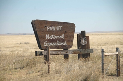
Pawnee National Grassland (NG), located in northern Colorado at the southeastern border of Wyoming and southwestern border of Nebraska, is 193,060 acres. It is administered by the Arapaho-Roosevelt National Forests supervisor's office, Rocky Mountain Region. There is one developed campground.
Less than 100 miles from the Front Range megalopolis which includes Denver, Greeley and Ft. Collins, Pawnee National Grassland (NG) is the closest grassland to several major metropolitan areas. It offers visitors opportunities for camping, hiking, hunting, bird watching, and "studying nature." The grassland has numerous oil and natural gas wells and uranium mines and provides grazing land for livestock.
The Pawnee NG was settled in the 1800s under a variety of "Homestead Acts," which opened the land to people, generally farmers, and helped to settle the west. A prolonged period of drought in the late 1920s into the 1930s caused some homesteads on sub-marginal farmland (a location receiving 15 or less inches of annual moisture) to literally dry up. During this time, Congress established the Land Utilization Program (LUP) which bought homesteads from bankrupt private owners and returned it to public land status. In the 1950s, the LUP holdings were assigned to the USDA Forest Service who was tasked with management of these sub-marginal lands. Over the years the Forest Service has established some twenty National Grasslands, including Pawnee, from sub-marginal lands. "The designation of the area as National Grassland is not a description of the area as much as a statement of policy and effort to restore the area to a multiple of uses and benefits."
The Pawnee Buttes, the grassland's most famous landmark, were discovered by John Charles Fremont during his 1842 expedition. It has long been an important guidepost to travelers through the area. Pawnee Buttes are actually remnants of an 70 to 90 million year ago inland sea's bottom. Over the eons, the deposited minerals hardened into sandstone and siltstone which are grouped into three formations - White River, Arikaree, and Ogallala. Wind, rain, ice, and snow have eroded must of the surrounding landscape away but the tops of the Buttes represent the pre-erosion ground surface. There are actually two Pawnee Buttes called East and West. The East Butte is on private property but the West Butte is on the grassland. A 1.5 mile trail provides access to the base of this butte but Pawnee Butte Overlook offers visitors spectacular views of the landmark. This view is even more inspiring at sunset.
While dispersed camping is permitted along designated routes1 campsites are permitted for up to 300 feet from the centerline of the road. A few suggested dispersed campsites are displayed in the home page for this grassland. The Pawnee's only developed campground is Crow Valley. It is part of a pleasant recreation area that includes two hiking trails2, a group campsite, one of the most developed picnic areas, a farm equipment museum, an "education center," and ball-field. The campground is conveniently located as a base camp for exploring all the Pawnee.
The Pawnee NG is relatively flat but dissected by steep-sided ravines, also referred to as "woody draws." These ravines provide great habitat for wildlife, especially birds, making the Pawnee popular with bird-watchers. The grassland has over 200 species of birds that live in the area at least for part of the year. Some bird populations, like the Lesser prairie chicken, Mountain plover, and Ferriginous hawk, are in decline but efforts are being made to support these birds. The Pawnee has one of the highest densities of raptors (birds of prey) in North America. The importance of supporting all bird population is illustrated by the grassland's closing of the Main OHV area when raptor pairs are nesting.
Another memorable aspect of Pawness NG is wildlife. Pronghorn antelope, deer, hawks, and eagles are often seen on grassland. A robust population of jackrabbits, desert cottontails and other small mammals support the grassland's population of coyotes, badgers, weasels, red fox and bobcats. Over 4,500 acres of the grassland have been dedicated to Prairie dog colonies. These colonies, while not welcomed by ranchers, are a natural part of the grassland and provide hours of viewing for visitors. A word of caution, although Prairie dogs are cute and fun to watch, they can carry various illnesses dangerous to both humans and pets. Maintain a safe distance from these cute critters and NEVER touch one whether alive or dead. It is suggested, if you walk through a Prairie dog colony, spray a quality DEET product on your clothes and shoes as a repellent to ticks and fleas; fleas are the primary vector for plague bacteria.
Like most grasslands, the Pawnee NG is a patchwork of federal, state, and private land working together to improve the land. Their achievements might be measured by the robust populations of various wildlife species or the obvious recovery of the prairie or maybe in the healthy condition of the crops. In any case, the successful recovery of the Pawnee National Grassland is most definitely to the benefit of the recreating public from the nearby Front Range megalopolis as well as more distant locations.
______________
1See the grassland's free Motor Vehicle Use Map (MVUM), obtained from ranger district office, for specifics.
2Dogs are not permitted on the Birding trail.
ADDRESSES
SUPERVISOR ADDRESS
2150 Centre Avenue
Building E
Fort Collins, Colorado 80526
970-295-6600

RANGER DISTRICT ADDRESS
Pawnee
115 2nd Ave.
Ault, Colorado 80610
970-295-6600 |