CAMPGROUND NAME: Bald Mountain
VISIT DATE: 08/26/1998
UPDATE DATE: 4/4/2018
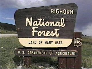
STATE: Wyoming
REGION: Rocky Mountain
RANGER DISTRICT: Medicine Wheel-Paintrock
NEAREST CITY/TOWN: Lovell
RESERVATIONS: 1-877-444-6777 or make on-line reservation*
DIRECTIONS:
From Lovell, WY, take US Rt. 14A (Medicine Wheel Passage Scenic
Byway) east 31.7 miles to campground sign. Turn right at sign
into campground.
NOTE: The last 14 miles of US Rt. 14A are steep and winding with
a 10% to 12% grade. Suggested alternative routes are US Rt. 14
west from Dayton, WY or US Rt. 14 east from Greybull, WY to US
Rt. 14A, then west to campground.
GENERAL COMMENTS:
The elevation is 9,200 ft.
*NOTE: No reservations after summer season.
The campground is located at the edge of a huge mountain-top
meadow with Bald Mountain Creek through the middle of it. The
sites are spacious and nestled among mature Engleman spruce with
each having a view of the surrounding meadow and mountain peaks.
The Medicine Wheel, a National Historic Site and Landmark and the
Bald Mountain City Historic Site, are nearby for pleasant day
trips. While stock are not allowed in the campground, there are
hitching rails and a loading ramp available just outside the
campground entrance. This is a very photogenic campground with
abundent wildlife and birds. There is a lantern post at each
site.
SEASONS
Open Seasonal: Yes
Open All Year: No
Seasonal Comment:
Open June 15 through September 10 - weather dependent
RATE AND MAXIMUM STAY PERMITTED
Rate: $16 per day
Maximum Stay Permitted (days): 14
CAMPGROUND SITE CONFIGURATION
No. RV Sites: 0
No. Tent Sites: 0
No. Combined Sites (Tent or RV): 15
Total Sites: 15
Tent Pads: No
Open Sites: Yes
Wooded Sites: Yes
Equestrian Camping: No
No. Tables on Sites: 15
No. Grilles on Sites: 15
RV INFORMATION
Hookups: None
No. RV Pull Throughs: 1
Waste Station: No
Average Parking Apron Size: 12' X 48'
Comments:
The parking aprons are gravel. There is an RV waste station 26.6
miles east of campground on US Rt. 14 (Burgess Junction). No fee
or potable water.
FACILITIES
Vaults: Yes
Flush Toilets: No
Hot Showers: No
Wheelchair Friendly Toilets: Yes
Public Phone: No
Playground: No
No. Water Spigots (non-site): 2
No. Threaded: 0
Comments:
The water spigots are hand pumps.
WATER SPORTS - None
HIKING - No
FISHING
Rainbow and Brook Trout

CAMPGROUND NAME: Boulder Park
VISIT DATE: 08/28/1998
UPDATE DATE: 4/4/20186
STATE: Wyoming
REGION: Rocky Mountain
RANGER DISTRICT: Powder River
NEAREST CITY/TOWN: Ten Sleep
RESERVATIONS: 1-877-444-6777 or make on-line reservation
DIRECTIONS:
From Ten Sleep, WY, take US Rt. 16 east 17.5 miles to Forest Rt.
27 and Deerhaven Lodge signs. Turn left at sign onto Rt. 27
(dirt), cross a bridge and go 0.2 miles to campground sign. Turn
left at sign and 0.1 miles to campground.
NOTE: The drive up US Rt. 16 is steep and curvy. There are ample
turnouts to cool the engine if needed.
GENERAL COMMENTS:
The elevation is 8,000 ft.
The campground is adjacent to Tensleep Creek and surrounds an
open meadow among Lodgepole pines. There is little understory
providing minimal privacy between sites, some of which are close
together. The drive up US Rt. 16 affords beautiful vistas of the
surrounding mountains. There are turnouts with interesting
interpretive signs along the way.
SEASONS
Open Seasonal: Yes
Open All Year: No
Seasonal Comment:
Open June 1 through September 9
RATE AND MAXIMUM STAY PERMITTED
Rate: $16 per day
Maximum Stay Permitted (days): 30
CAMPGROUND SITE CONFIGURATION
No. RV Sites: 0
No. Tent Sites: 0
No. Combined Sites (Tent or RV): 33
Total Sites: 33
Tent Pads: No
Open Sites: Yes
Wooded Sites: Yes
Equestrian Camping: No
No. Tables on Sites: 33
No. Grilles on Sites: 33
RV INFORMATION
Hookups: None
No. RV Pull Throughs: 0
Waste Station: No
Average Parking Apron Size: See comments below
Comments:
The parking aprons are dirt and all are the same size - 14'
X 60'. An RV waste station, with potable water and donation
requested, is located about 11 miles east of Forest Rt. 27
on US Rt. 16 just past mile marker 53.
FACILITIES
Vaults: Yes
Flush Toilets: No
Hot Showers: No
Wheelchair Friendly Toilets: Yes
Public Phone: No
Playground: No
No. Water Spigots (non-site): 5
No. Threaded: 5
WATER SPORTS - None
HIKING - No
FISHING
Rainbow Trout
CAMPGROUND NAME: Circle Park
VISIT DATE: 09/01/1998
UPDATE DATE: 4/4/2018
STATE: Wyoming
REGION: Rocky Mountain
RANGER DISTRICT: Powder River
NEAREST CITY/TOWN: Buffalo
RESERVATIONS: 1-877-444-6777 or make on-line reservation
DIRECTIONS:
From Buffalo, WY, take US Rt. 16 west 13.4 miles to campground
sign (Forest Rt. 20/Circle Park Rd.). Turn right at sign onto
Circle Park Rd. (dirt) and go 2.1 miles to campground.
GENERAL COMMENTS:
The elevation is 7,900 ft.
The campground is at the edge of meadow with sites tucked into
the treeline. Lodgepole pines and Aspen provide shade and
privacy for widely spaced sites. The campground is convenient to
the South Fork Trail (#182) trailhead, which accesses the Cloud
Peak Wilderness and a network of trails. There are dispersed
sites for camping along Forest Rt. 20.
SEASONS
Open Seasonal: Yes
Open All Year: No
Seasonal Comment:
Open June 8 through September 3
RATE AND MAXIMUM STAY PERMITTED
Rate: $15 per day
Maximum Stay Permitted (days): 14
CAMPGROUND SITE CONFIGURATION
No. RV Sites: 0
No. Tent Sites: 3
No. Combined Sites (Tent or RV): 7
Total Sites: 10
Tent Pads: No
Open Sites: Yes
Wooded Sites: Yes
Equestrian Camping: No
No. Tables on Sites: 10
No. Grilles on Sites: 10
RV INFORMATION
Hookups: None
No. RV Pull Throughs: 0
Waste Station: No
Average Parking Apron Size: 15' X 40'
Comments:
The parking aprons are dirt and gravel. An RV waste station, with
potable water and no fee, is located 11 miles east of Forest Rt. 27
on US Rt. 16 just past mile marker 53. There is also a waste station
east of Buffalo at the Conex gas station near the intersection of US
Rt. 16 and Interstate 25. No fee and no potable water.
FACILITIES
Vaults: Yes
Flush Toilets: No
Hot Showers: No
Wheelchair Friendly Toilets: No
Public Phone: No
Playground: No
No. Water Spigots (non-site): 1
No. Threaded: 0
Comments:
The water spigot is a hand pump.
WATER SPORTS - None
HIKING - No
Comments:
See General Comments.
FISHING - No
CAMPGROUND NAME: Dead Swede
VISIT DATE: 08/22/1998
UPDATE DATE: 4/4/2018
STATE: Wyoming
REGION: Rocky Mountain
RANGER DISTRICT: Tongue
NEAREST CITY/TOWN: Dayton
RESERVATIONS: 1-877-444-6777 or make on-line reservation
DIRECTIONS:
From Dayton, WY, take US Rt. 14 west 40.2 miles to Tie Flume/Dead
Swede and Forest Rt. 26 signs (Forest Rt. 26). Turn left at
signs onto Rt. 26 (dirt) and go 4.7 miles to campground sign.
Turn left at sign into campground.
GENERAL COMMENTS:
The elevation is 8,400 ft.
The campground is composed of two sections. The upper section is
a loop along the hillside. The lower section is a spur which
parallels the South Tongue River. Most of the lower section
sites overlook the river. All of the sites are shaded by
Lodgepole pines and have little understory providing minimal
privacy between them. Campground is popular for fisherman. This
is bear country; practice safe food protection techniques.
SEASONS
Open Seasonal: Yes
Open All Year: No
Seasonal Comment:
Open June 8 through September 10 - weather dependent
RATE AND MAXIMUM STAY PERMITTED
Rate: $16 per day
Maximum Stay Permitted (days): 14
CAMPGROUND SITE CONFIGURATION
No. RV Sites: 0
No. Tent Sites: 4
No. Combined Sites (Tent or RV): 18
Total Sites: 22
Tent Pads: No
Open Sites: No
Wooded Sites: Yes
Equestrian Camping: No
No. Tables on Sites: 22
No. Grilles on Sites: 22
RV INFORMATION
Hookups: None
No. RV Pull Throughs: 0
Waste Station: No
Average Parking Apron Size: 12' X 43'
Comments:
The parking aprons are gravel. There is a Forest Service waste
station 5.5 miles north of Forest Rt. 26 on US Rt. 14 (Burgess
Junction). No fee or potable water.
FACILITIES
Vaults: Yes
Flush Toilets: No
Hot Showers: No
Wheelchair Friendly Toilets: Yes
Public Phone: No
Playground: No
No. Water Spigots (non-site): 3
No. Threaded: 0
Comments:
The water spigot is a hand pump.
WATER SPORTS - None
Comments:
Wading is possible in South Tongue River.
HIKING - No
FISHING
Brown, Brook and Rainbow Trout
CAMPGROUND NAME: Lower Doyle
VISIT DATE: 09/01/1998
UPDATE DATE: 4/4/2018
STATE: Wyoming
REGION: Rocky Mountain
RANGER DISTRICT: Powder River
NEAREST CITY/TOWN: Buffalo
RESERVATIONS: 1-877-444-6777 or make on-line reservation
DIRECTIONS:
From Buffalo, WY, take US Rt. 16 west 24 miles to County Rt. 3
(Hazelton Rd.). Turn left onto Hazelton Rd. and go 6.2 miles to
campground sign (Doyle). Turn left at sign and go 0.3 miles to
campground.
NOTE: Hazelton Rd. is unpaved (dirt) after 3.6 miles.
GENERAL COMMENTS:
The elevation 8,100 ft.
The campground is a large single loop. One side overlooks Doyle
Creek and a meadow while the other sides are in a dense stand of
Lodgepole pines. This is a rustic campground far from busy US
Rt. 16. The resident squirrels provide most of the sounds in
this peaceful location.
NOTE: Most literature identifies this campground simply as "Doyle."
SEASONS
Open Seasonal: Yes
Open All Year: No
Seasonal Comment:
Open June 8 through September 3
RATE AND MAXIMUM STAY PERMITTED
Rate: $15 per day
Maximum Stay Permitted (days): 14
CAMPGROUND SITE CONFIGURATION
No. RV Sites: 0
No. Tent Sites: 0
No. Combined Sites (Tent or RV): 19
Total Sites: 19
Tent Pads: No
Open Sites: Yes
Wooded Sites: Yes
Equestrian Camping: No
No. Tables on Sites: 19
No. Grilles on Sites: 19
RV INFORMATION
Hookups: None
No. RV Pull Throughs: 1
Waste Station: No
Average Parking Apron Size: 16' X 55'
Comments:
The parking aprons are dirt and rocky and the interior road is
rough. An RV waste station, with potable water and no fee, is
located 11 miles east of Forest Rt. 27 on US Rt. 16 just past
mile marker 53. There is also a waste station east of Buffalo
at the Conex gas station near the intersection of US Rt.
16 and Interstate 25. No fee and no potable water.
FACILITIES
Vaults: Yes
Flush Toilets: No
Hot Showers: No
Wheelchair Friendly Toilets: No
Public Phone: No
Playground: No
No. Water Spigots (non-site): 1
No. Threaded: 0
Comments:
The water spigot is a hand pump.
WATER SPORTS - None
HIKING - No
FISHING
Brook Trout
CAMPGROUND NAME: East Fork
VISIT DATE: 08/22/1998
UPDATE DATE: 4/4/2018
STATE: Wyoming
REGION: Rocky Mountain
RANGER DISTRICT: Tongue
NEAREST CITY/TOWN: Big Horn
RESERVATIONS: No
DIRECTIONS:
From Big Horn, WY, take County Rt. 335 south 9.9 miles where it
becomes Forest Rt. 26. Continue straight on Rt. 26 and go 8.7
miles to campground sign. Turn left at sign and go
0.5 miles to campground.
NOTE: After the first 6.2 miles this route is unpaved (dirt), steep
and eroded and is not RV friendly.
An alternative RV friendly route is from Dayton, WY, take US Rt.
14 west 40.2 miles to the signs for /Dead Swede Campgrounds
and Forest Rt. 26 signs. Turn left at sign onto Rt. 26 (dirt) and
go 24.4 miles to campground sign. Turn right at sign and go 0.5
miles to campground.
GENERAL COMMENTS:
The elevation is 7,600 ft.
The campground is composed of a single loop in a grove of
Lodgepole pines surrounded by meadows. Density of Lodgepole
pines prevents growth of much understory so there is minimal
privacy between sites.
SEASONS
Open Seasonal: Yes
Open All Year: No
Seasonal Comment:
Open June 4 through September 8
RATE AND MAXIMUM STAY PERMITTED
Rate: $14 per day
Maximum Stay Permitted (days): 14
CAMPGROUND SITE CONFIGURATION
No. RV Sites: 0
No. Tent Sites: 0
No. Combined Sites (Tent or RV): 11
Total Sites: 11
Tent Pads: No
Open Sites: No
Wooded Sites: Yes
Equestrian Camping: No
No. Tables on Sites: 11
No. Grilles on Sites: 11
RV INFORMATION
Hookups: None
No. RV Pull Throughs: 0
Waste Station: No
Average Parking Apron Size: 12' X 38'
Comments:
The parking aprons are dirt. There is a Forest Service waste
station 5.5 miles north of Forest Rt. 26 on US Rt. 14 (Burgess
Junction). No fee or potable water.
FACILITIES
Vaults: Yes
Flush Toilets: No
Hot Showers: No
Wheelchair Friendly Toilets: No
Public Phone: No
Playground: No
No. Water Spigots (non-site): 1
No. Threaded: 0
Comments:
The water spigot is a hand pump.
WATER SPORTS - None
HIKING - No
FISHING - No
CAMPGROUND NAME: Island Park
VISIT DATE: 08/28/1998
UPDATE DATE: 4/4/2018
STATE: Wyoming
REGION: Rocky Mountain
RANGER DISTRICT: Powder River
NEAREST CITY/TOWN: Ten Sleep
RESERVATIONS: 1-877-444-6777 or make on-line reservation
DIRECTIONS:
From Ten Sleep, WY, take US Rt. 16 east 17.5 miles to Forest Rt.
27 and Deerhaven Lodge signs. Turn left at sign onto Rt. 27
(dirt), cross a bridge and go 1.1 miles to "Y" intersection .
Bear right, continueing on Rt. 27, and go 1.9 miles to campground
sign. Turn right at sign into campground.
NOTE: The drive up US Rt. 16 is steep and curvy. There are ample
turnouts to cool the engine if needed.
GENERAL COMMENTS:
The elevation is 8,600 ft.
The campground is located at the edge of a large open park/meadow
with the West Tensleep Creek running through it. The sites are
nestled among mature Lodgepole pines with views of the park area.
There is little understory providing minimal privacy between
sites. Gas is available at the Deerhaven Lodge, intersection of
US Rt. 16 and Forest Rt. 27.
The drive up US Rt. 16 affords beautiful vistas of the
surrounding mountains. There are turnouts with interesting
interpretive signs along the way.
SEASONS
Open Seasonal: Yes
Open All Year: No
Seasonal Comment:
Open June 8 through September 9
RATE AND MAXIMUM STAY PERMITTED
Rate: $16 per day
Maximum Stay Permitted (days): 14
CAMPGROUND SITE CONFIGURATION
No. RV Sites: 0
No. Tent Sites: 0
No. Combined Sites (Tent or RV): 10
Total Sites: 10
Tent Pads: No
Open Sites: Yes
Wooded Sites: Yes
Equestrian Camping: No
No. Tables on Sites: 10
No. Grilles on Sites: 10
RV INFORMATION
Hookups: None
No. RV Pull Throughs: 1
Waste Station: No
Average Parking Apron Size: 16' X 56'
Comments:
The parking aprons are gravel. An RV waste station, with potable
water and no fee, is located 11 miles east of Forest Rt. 27 on US Rt.
16 just past mile marker 53.
FACILITIES
Vaults: Yes
Flush Toilets: No
Hot Showers: No
Wheelchair Friendly Toilets: No
Public Phone: No
Playground: No
No. Water Spigots (non-site): 1
No. Threaded: 0
Comments:
The water spigot is a hand pump.
WATER SPORTS - None
HIKING - No
FISHING
Rainbow and Brook Trout
CAMPGROUND NAME: Lakeview
VISIT DATE: 08/29/1998
UPDATE DATE: 4/4/2018
STATE: Wyoming
REGION: Rocky Mountain
RANGER DISTRICT: Powder River
NEAREST CITY/TOWN: Ten Sleep
RESERVATIONS: 1-877-444-6777 or make on-line reservation
DIRECTIONS:
From Ten Sleep, WY, take US Rt. 16 east 20.3 miles to campground
sign. Turn right at sign and go 0.1 miles to campground.
NOTE: The drive up US Rt. 16 is steep and curvy. There are ample
turnouts to cool the engine if needed.
GENERAL COMMENTS:
The elevation is 8,300 ft.
The campground is located on the northern shore of Meadowlark
Lake. Lodgepole and Douglas fir provide shade and some sites
have a view of the lake. There are gas, boat rentals and a
restaurant at the Meadowlark Lake Resort.
The drive up US Rt. 16 affords beautiful vistas of the
surrounding mountains. There are turnouts with interesting
interpretive signs along the way.
SEASONS
Open Seasonal: Yes
Open All Year: No
Seasonal Comment:
Open Jume 8 through September 16
RATE AND MAXIMUM STAY PERMITTED
Rate: $15 per day
Maximum Stay Permitted (days): 14
CAMPGROUND SITE CONFIGURATION
No. RV Sites: 0
No. Tent Sites: 6
No. Combined Sites (Tent or RV): 5
Total Sites: 11
Tent Pads: No
Open Sites: Yes
Wooded Sites: Yes
Equestrian Camping: No
No. Tables on Sites: 11
No. Grilles on Sites: 11
RV INFORMATION
Hookups: None
No. RV Pull Throughs: 0
Waste Station: No
Average Parking Apron Size: 12' X 40'
Comments:
The parking aprons are dirt. An RV waste station, with potable
water and no fee, is located 11 miles east of Forest Rt. 27 on
US Rt. 16 just past mile marker 53.
FACILITIES
Vaults: Yes
Flush Toilets: No
Hot Showers: No
Wheelchair Friendly Toilets: Yes
Public Phone: No
Playground: No
No. Water Spigots (non-site): 2
No. Threaded: 2
WATER SPORTS
Lake: Yes
Swimming (provided): No
Sailing: No
Boat Ramp: No
Boat Carry Down Access: No
Power Boating: Yes
Boating (no power): Yes
Water Skiing: No
Rafting (whitewater): No
Kayaking (whitewater): No
Comments:
There is boat ramp (no fee) at the Meadowlark Lake Resort.
HIKING - No
FISHING
Cutthroat, Brown, Brook and Rainbow Trout.
CAMPGROUND NAME: Leigh Creek
VISIT DATE: 08/28/1998
UPDATE DATE: 4/4/2018
STATE: Wyoming
REGION: Rocky Mountain
RANGER DISTRICT: Powder River
NEAREST CITY/TOWN: Ten Sleep
RESERVATIONS: 1-877-444-6777 or make on-line reservation
DIRECTIONS:
From Ten Sleep, WY, take US Rt. 16 east 7.5 miles to State Rt.
435 stop sign. Bear right onto Rt. 435 and go 0.9 miles to
campground sign. Turn right at sign into campground.
NOTE: State Rt. 435 becomes Forest Rt. 18 almost immediately.
GENERAL COMMENTS:
The elevation is 5,400 ft.
The campground is a adjacent to Tensleep Creek in a riparian
environment featuring Juniper, Aspen, Cottonwood and some
Ponderosa. The understory and middlestory is heavy providing
privacy between sites. The campground is a delightful location
for tenters and somewhat of a challenge for RVrs. It is
surrounded by towering cliffs of Ten Sleep Canyon and is
convenient to Cloud Peak Scenic Byway (US Rt. 16).
SEASONS
Open Seasonal: Yes
Open All Year: No
Seasonal Comment:
Open May 18 through September 16
RATE AND MAXIMUM STAY PERMITTED
Rate: $15 per day
Maximum Stay Permitted (days): 14
CAMPGROUND SITE CONFIGURATION
No. RV Sites: 0
No. Tent Sites: 0
No. Combined Sites (Tent or RV): 11
Total Sites: 11
Tent Pads: No
Open Sites: No
Wooded Sites: Yes
Equestrian Camping: No
No. Tables on Sites: 11
No. Grilles on Sites: 10
RV INFORMATION
Hookups: None
No. RV Pull Throughs: 0
Waste Station: No
Average Parking Apron Size: 11' X 46'
Comments:
The Parking aprons are dirt. There is no turn around for sites
9,10 and 11 - immediately on left at entrance to campground.
An RV waste station, with potable water and no fee, is located 11
miles east of Forest Rt. 27 on US Rt. 16 just past mile marker 53.
FACILITIES
Vaults: Yes
Flush Toilets: No
Hot Showers: No
Wheelchair Friendly Toilets: No
Public Phone: No
Playground: No
No. Water Spigots (non-site): 1
No. Threaded: 0
Comments:
The spigot is a hand pump.
WATER SPORTS - None
HIKING - No
FISHING
Rainbow, Brown and Brook Trout
CAMPGROUND NAME: Lost Cabin
VISIT DATE: 09/01/1998
UPDATE DATE: 4/4/2018
STATE: Wyoming
REGION: Rocky Mountain
RANGER DISTRICT: Powder River
NEAREST CITY/TOWN: Buffalo
RESERVATIONS: Yes*
DIRECTIONS:
From Buffalo, WY, take US Rt. 16 west 25 miles to campground
sign. Turn right at sign onto gravel road and go 0.3 miles to
campground.
GENERAL COMMENTS:
The elevation 8,200 ft.
*Reservations are taken only for long term stay up to 30 days.
Call the Ranger District Office for information.
The campground meanders up a hillside among a thick grove of
Lodgepole pines and is convenient to US Rt. 16. There are nice
long parking aprons that can accommodate almost any size RV.
SEASONS
Open Seasonal: Yes
Open All Year: No
Seasonal Comment:
Open June 8 through September 3
RATE AND MAXIMUM STAY PERMITTED
Rate: $16 per dayh
Maximum Stay Permitted (days): 30
CAMPGROUND SITE CONFIGURATION
No. RV Sites: 0
No. Tent Sites: 1
No. Combined Sites (Tent or RV): 17
Total Sites: 18
Tent Pads: No
Open Sites: Yes
Wooded Sites: Yes
Equestrian Camping: No
No. Tables on Sites: 18
No. Grilles on Sites: 18
RV INFORMATION
Hookups: None
No. RV Pull Throughs: 9
Waste Station: No
Average Parking Apron Size: 12.5' X 65'
Comments:
The parking aprons are gravel. An RV waste station, with potable water
and no fee, is located at Leigh Creek, 9.2 west on US Rt. 16 near
mile marker 53. There is also a waste station east of Buffalo
at the Conex gas station near the intersection of US Rt. 16 and
Interstate 25. No fee and no potable water.
FACILITIES
Vaults: Yes
Flush Toilets: No
Hot Showers: No
Wheelchair Friendly Toilets: No
Public Phone: No
Playground: No
No. Water Spigots (non-site): 2
No. Threaded: 0
Comments:
The water spigots are hand pumps.
WATER SPORTS - None
HIKING - No
FISHING - No
CAMPGROUND NAME: North Tongue
VISIT DATE: 08/26/1998
UPDATE DATE: 4/4/2018
STATE: Wyoming
REGION: Rocky Mountain
RANGER DISTRICT: Tongue
NEAREST CITY/TOWN: Dayton
RESERVATIONS: 1-877-444-6777 or make on-line reservation
DIRECTIONS:
From Dayton, WY, take US Rt. 14 west for 26 miles to US Rt. 14A.
On Rt. 14A, go 0.4 miles to first street on the right (Forest Rt.
15 - no sign identifying it). Turn right onto Rt. 15 and go 1.1
miles to campground sign. Turn left at sign into campground.
NOTE: Forest Rt. 15 is unpaved (dirt) after 0.2 miles.
GENERAL COMMENTS:
The elevation is 8,400 ft.
The campground is composed of two spurs. The shorter spur is
adjacent to a fast flowing creek, which enters the North
Tongue River just outside the campground entrance. Some of the
sites overlook the creek. The longer spur climbs up a heavily
wooded hillside and contains the two pull through sites. The
dominant tree is Lodgepole pine with a few Engleman spruce and
Douglas fir sprinkled throughout the campground. The campground
has a quiet, tranquil feel to it. There is a lantern pole at
each site.
This is bear country; practice good food protection techniques.
SEASONS
Open Seasonal: Yes
Open All Year: No
Seasonal Comment:
Open June 8 through September 17 - weather dependent
RATE AND MAXIMUM STAY PERMITTED
Rate: $16 per day
Maximum Stay Permitted (days): 14
CAMPGROUND SITE CONFIGURATION
No. RV Sites: 0
No. Tent Sites: 0
No. Combined Sites (Tent or RV): 12
Total Sites: 12
Tent Pads: No
Open Sites: Yes
Wooded Sites: Yes
Equestrian Camping: No
No. Tables on Sites: 12
No. Grilles on Sites: 12
RV INFORMATION
Hookups: None
No. RV Pull Throughs: 2
Waste Station: No
Average Parking Apron Size: 16' X 60'
Comments:
The parking aprons are gravel. There is a Forest Service waste
station 0.5 miles east of campground on US Rt. 14 (Burgess
Junction).
FACILITIES
Vaults: Yes
Flush Toilets: No
Hot Showers: No
Wheelchair Friendly Toilets: Yes
Public Phone: No
Playground: No
No. Water Spigots (non-site): 2
No. Threaded: 0
Comments:
The water spigots are hand pumps.
WATER SPORTS - None
HIKING - No
FISHING
Brook, Brown and Rainbow Trout in the nearby North Tongue River
CAMPGROUND NAME: Porcupine
VISIT DATE: 08/26/1998
UPDATE DATE: 4/4/2018
STATE: Wyoming
REGION: Rocky Mountain
RANGER DISTRICT: Medicine Wheel-Paintrock
NEAREST CITY/TOWN: Lovell
RESERVATIONS: 1-877-444-6777 or make on-line reservation
DIRECTIONS:
From Lovell, WY, take US Rt. 14A (Medicine Wheel Passage Scenic
Byway) east 32.1 miles to Forest Rt. 13 sign. Turn left at sign
onto Rt. 13 (dirt) and go 1.8 miles to campground sign. Turn
left at sign into campground.
NOTE: The last 14 miles of US Rt. 14A are steep and winding with
a 10% to 12% grade. Suggested alternative routes are US Rt. 14
west from Dayton, WY or US Rt. 14 east from Greybull, WY to US
Rt. 14A, then west to campground.
GENERAL COMMENTS:
The elevation is 8,900 ft.
The campground is a single loop through a stand of Lodgepole
pines. Sites are spacious, generally well shaded and have level,
long parking aprons. There is great wildlife viewing in and
around the campground. Porcupine and Bucking Mule Falls are
nearby and offer challenging and scenic hikes. The campground is
scenic, surrounded by meadows and groves of Engleman spruce and
Lodgepole pines. Medicine Wheel, a National Historic Site and
Bald Mountain City Historic Site, are nearby for interesting day
trips. Each site has a lantern pole and firewood is available
for a fee.
SEASONS
Open Seasonal: Yes
Open All Year: No
Seasonal Comment:
Open June 15 through September 10
RATE AND MAXIMUM STAY PERMITTED
Rate: $16 per day
Maximum Stay Permitted (days): 14
CAMPGROUND SITE CONFIGURATION
No. RV Sites: 0
No. Tent Sites: 2
No. Combined Sites (Tent or RV): 13
Total Sites: 15
Tent Pads: No
Open Sites: Yes
Wooded Sites: Yes
Equestrian Camping: No
No. Tables on Sites: 15
No. Grilles on Sites: 15
RV INFORMATION
Hookups: None
No. RV Pull Throughs: 1
Waste Station: No
Average Parking Apron Size: 16' X 66'
Comments:
The parking aprons are gravel. There is an RV waste station about
26.6 miles east of intersection of Forest Rt. 13 and US Rt. 14A/14
on US Rt. 14 (Burgess Junction). No fee or potable water.
FACILITIES
Vaults: Yes
Flush Toilets: No
Hot Showers: No
Wheelchair Friendly Toilets: Yes
Public Phone: No
Playground: No
No. Water Spigots (non-site): 1
No. Threaded: 0
Comments:
The water spigot is a hand pump.
WATER SPORTS - None
HIKING - No
FISHING - No
Comments:
There is fishing in the nearby Porcupine Creek - Rainbow, Brook,
Brown, Cutthroat Trout
CAMPGROUND NAME: Prune Creek
VISIT DATE: 08/26/1998
UPDATE DATE: 4/4/2018
STATE: Wyoming
REGION: Rocky Mountain
RANGER DISTRICT: Tongue
NEAREST CITY/TOWN: Dayton
RESERVATIONS: 1-877-444-6777 or make on-line reservation
DIRECTIONS:
From Dayton, WY, take US Rt. 14 west 22.1 miles to campground
sign. At sign, turn left and then immediately right into the
campground.
GENERAL COMMENTS:
The elevation is 7,700 ft.
The campground is composed of two loops. One loop is below US
Rt. 14 among Lodgepole pines. The other loop is adjacent to
South Tongue River with some sites overlooking the river. Prune
Creek meanders through the campground and flows into the South
Tongue River at the intersection of the two loops. The
campground is very convenient to US Rt. 14 with easy on/off
access. The understory is grass providing minimal privacy
between sites. There is a lantern pole at each site. Firewood
is available for a fee.
SEASONS
Open Seasonal: Yes
Open All Year: No
Seasonal Comment:
Open June 8 through September 17 - weather dependent
RATE AND MAXIMUM STAY PERMITTED
Rate: $17 per day
Maximum Stay Permitted (days): 14
CAMPGROUND SITE CONFIGURATION
No. RV Sites: 0
No. Tent Sites: 0
No. Combined Sites (Tent or RV): 21
Total Sites: 21
Tent Pads: No
Open Sites: No
Wooded Sites: Yes
Equestrian Camping: No
No. Tables on Sites: 21
No. Grilles on Sites: 21
RV INFORMATION
Hookups: None
No. RV Pull Throughs: 0
Waste Station: No
Average Parking Apron Size: 14' X 60'
Comments:
The parking aprons are gravel. There is a Forest Service waste
station 3.8 miles west of the campground on US Rt. 14 (Burgess
Junction).
FACILITIES
Vaults: Yes
Flush Toilets: No
Hot Showers: No
Wheelchair Friendly Toilets: Yes
Public Phone: No
Playground: No
No. Water Spigots (non-site): 3
No. Threaded: 0
Comments:
The water spigots are hand pumps.
WATER SPORTS - None
HIKING - No
FISHING
Brook, Brown and Rainbow Trout
CAMPGROUND NAME: Ranger Creek
VISIT DATE: 08/22/1998
UPDATE DATE: 4/4/2018
STATE: Wyoming
REGION: Rocky Mountain
RANGER DISTRICT: Tongue
NEAREST CITY/TOWN: Big Horn
RESERVATIONS: No
DIRECTIONS:
From Big Horn, WY, take County Rt. 335 south 9.9 miles where it
becomes Forest Rt. 26. Continue straight on Rt. 26 for 8.1 miles
to Ranger Creek sign. Turn right at sign and immediately left
and go 0.1 miles to campground.
NOTE: After the first 6.2 miles this route is unpaved (dirt), steep,
rough and eroded and is not RV friendly.
An alternative RV friendly route is from Dayton, WY - take US Rt.
14 west 40.2 miles to the signs for the Tie Flume/Dead Swede
Campgrounds and Forest Rt. 26 signs. Turn left at sign onto
Rt. 26 (dirt) and go 23.8 miles to campground sign. Turn left
and left again into campground.
GENERAL COMMENTS:
The elevation is 7,800 ft.
The campground is a single loop in a grove of mature Lodgepole
pines and located on a very scenic drive. It is near the Big
Goose Ranger Station, which was built by the Civilian
Conservation Corps (CCC) in the 1930s. The campground is next to
a large meadow where wildlife may be viewed. This is bear
country; use safe food storage techniques
SEASONS
Open Seasonal: Yes
Open All Year: No
Seasonal Comment:
Open June 4 through September 8 - weather dependent
RATE AND MAXIMUM STAY PERMITTED
Rate: $14 per day
Maximum Stay Permitted (days): 14
CAMPGROUND SITE CONFIGURATION
No. RV Sites: 0
No. Tent Sites: 6
No. Combined Sites (Tent or RV): 5
Total Sites: 11
Tent Pads: No
Open Sites: Yes
Wooded Sites: Yes
Equestrian Camping: No
No. Tables on Sites: 11
No. Grilles on Sites: 11
RV INFORMATION
Hookups: None
No. RV Pull Throughs: 0
Waste Station: No
Average Parking Apron Size: 12' X 39'
Comments:
The parking aprons are dirt, irregular and show signs of
errosion. There is a Forest Service waste station 5.5 miles
north of Forest Rt. 26 on US Rt. 14 (Burgess Junction). No fee
or potable water.
FACILITIES
Vaults: Yes
Flush Toilets: No
Hot Showers: No
Wheelchair Friendly Toilets: No
Public Phone: No
Playground: No
No. Water Spigots (non-site): 1
No. Threaded: 0
Comments:
The water spigot is a hand pump.
WATER SPORTS - None
HIKING - No
FISHING - No
CAMPGROUND NAME: Shell Creek
VISIT DATE: 08/26/1998
UPDATE DATE: 4/4/2018
STATE: Wyoming
REGION: Rocky Mountain
RANGER DISTRICT: Medicine Wheel-Paintrock
NEAREST CITY/TOWN: Greybull
RESERVATIONS: 1-877-444-6777 or make on-line reservation
DIRECTIONS:
From Greybull, WY, take US Rt. 14 east 30.7 miles to Forest Rt.
17 sign. Turn right at sign onto Rt. 17 (dirt) and go 1.7 miles
to campground sign. Turn right at sign and go 0.2 miles to
campground.
GENERAL COMMENTS:
The elevation is 7,500 ft.
The campground is located in a riparian area between Shell Creek
and a sage brush hillside. The sites, each with a lantern pole,
are adjacent to the creek and have delightful views with fir, Aspen and
a few Cottonwood trees. The understory is grass providing minimal
privacy between sites for RVrs. Tenters have more privacy. The
fast moving Sheel Creek can be heard throughout the campground.
Nearby is the Shell Falls Interpretive Site, which is a nice day trip
to learn about the area's geology.
SEASONS
Open Seasonal: Yes
Open All Year: No
Seasonal Comment:
Open May 25 through September 17
RATE AND MAXIMUM STAY PERMITTED
Rate: $16 per day
Maximum Stay Permitted (days): 14
CAMPGROUND SITE CONFIGURATION
No. RV Sites: 0
No. Tent Sites: 2
No. Combined Sites (Tent or RV): 13
Total Sites: 15
Tent Pads: Yes
Open Sites: Yes
Wooded Sites: Yes
Equestrian Camping: No
No. Tables on Sites: 15
No. Grilles on Sites: 15
RV INFORMATION
Hookups: None
No. RV Pull Throughs: 2
Waste Station: No
Average Parking Apron Size: 13' X 70'
Comments:
TThe parking aprons are dirt and they are all about the same size.
The campground will accommodate any size RV.
There is an RV Forest Service waste station 17.1 miles north of
campground on US Rt. 14 (Burgess Junction)- no fee or potable water.
FACILITIES
Vaults: Yes
Flush Toilets: No
Hot Showers: No
Wheelchair Friendly Toilets: Yes
Public Phone: No
Playground: No
No. Water Spigots (non-site): 4
No. Threaded: 0
WATER SPORTS - None
HIKING - No
FISHING
Rainbow and Brook Trout
CAMPGROUND NAME: Sibley Lake
VISIT DATE: 08/26/1998
UPDATE DATE: 4/4/2018
STATE: Wyoming
REGION: Rocky Mountain
RANGER DISTRICT: Tongue
NEAREST CITY/TOWN: Dayton
RESERVATIONS: 1-877-444-6777 or make on-line reservation
DIRECTIONS:
From Dayton, WY, take US Rt. 14 west 20.5 miles to campground
sign. Turn left at sign and go 0.4 miles to campground.
GENERAL COMMENTS:
The elevation is 7,900 ft.
The campground is near Sibley Lake and is composed of two loops
in a grove of Lodgepole pines. One loop has electric hookups and
the other does not. The Lodgepoles provide lots of shade, but
the grass understory provides minimal privacy between sites.
Medicine Wheel, a National Historic Site, Bald Mountain City
Historic Site and the Burgess Junction Visitor Center, are nearby
for interesting day trips.
Sibley Lake was constructed by Camp 853 of the Civilian
Conservation Corps (CCC) during 1937. The lake was named for Lt.
Sibley, leader of a cavalry scouting party which was attacked on
July 7, 1876 by Sioux and Cheyenne Indians. Lt. Sibley and his
troop of 26 men and a news reporter survived and returned to
their main camp.
SEASONS
Open Seasonal: Yes
Open All Year: Yes
Seasonal Comment:
Services provided June 8 through September 17 - weather dependent
RATE AND MAXIMUM STAY PERMITTED
Rate: $17 per day without electric hookups
$21 per day with electric hookups
Maximum Stay Permitted (days): 14
CAMPGROUND SITE CONFIGURATION
No. RV Sites: 0
No. Tent Sites: 1
No. Combined Sites (Tent or RV): 24
Total Sites: 25
Tent Pads: No
Open Sites: No
Wooded Sites: Yes
Equestrian Camping: No
No. Tables on Sites: 25
No. Grilles on Sites: 25
RV INFORMATION
No. Full Hookups (includes waste): 0
No. Water and Electric Only: 0
No. Water Only: 0
No. Electric Only: 15
No. RV Pull Throughs: 0
Waste Station: No
Average Parking Apron Size: 13' X 59'
Comments:
The parking aprons are gravel. There is a Forest Service waste
station 5.4 miles west of campground on US Rt. 14 (Burgess
Junction).
FACILITIES
Vaults: Yes
Flush Toilets: No
Hot Showers: No
Wheelchair Friendly Toilets: Yes
Public Phone: No
Playground: No
No. Water Spigots (non-site): 5
No. Threaded: 0
WATER SPORTS
Lake: Yes
Swimming (provided): No
Sailing: No
Boat Ramp: Yes
Boat Carry Down Access: No
Power Boating: No
Boating (no power): Yes
Water Skiing: No
Rafting (whitewater): No
Kayaking (whitewater): No
Comments:
Sibley Lake is 25 acres. Only non-motorized boats permitted on
the lake.
HIKING
A small sign identifies a Blue Creek Loop at campground turnoff
just off US Rt. 14. Call the Tongue River District Ranger's
Office for information.
FISHING
Brown, Brook and Rainbow Trout. There is a wheelchair friendly
fishing pier.
CAMPGROUND NAME: Sitting Bull
VISIT DATE: 08/29/1998
UPDATE DATE: 4/4/2018
STATE: Wyoming
REGION: Rocky Mountain
RANGER DISTRICT: Powder River
NEAREST CITY/TOWN: Ten Sleep
RESERVATIONS: 1-877-444-6777 or make on-line reservation
DIRECTIONS:
From Ten Sleep, WY, take US Rt. 16 east 19.9 miles to campground
sign (Forest Rt. 432). Turn left at sign onto Rt. 432 (dirt) and
go about a mile to campground.
GENERAL COMMENTS:
The elevation is 8,600 ft.
The campground is located in the treeline edge of an expansive
mountain meadow. The campground is composed of a spur
along the meadow's edge and a loop nestled back in a thick stand
of Lodgepole pines. Each site has a lantern post. This is an
attractive campground that will accommodate almost any size RV.
Wildlife viewing is likely from this campground.
Gas, limited groceries, boat, bike rentals, boat ramp (no fee)
and restaurant are available at the nearby Meadowlark Lake
Resort.
SEASONS
Open Seasonal: Yes
Open All Year: No
Seasonal Comment:
Open June 8 through September 16
RATE AND MAXIMUM STAY PERMITTED
Rate: $17 per day - single
Maximum Stay Permitted (days): 14
CAMPGROUND SITE CONFIGURATION
No. RV Sites: 0
No. Tent Sites: 0
No. Combined Sites (Tent or RV): 42
Total Sites: 42
Tent Pads: No
Open Sites: No
Wooded Sites: Yes
Equestrian Camping: No
No. Tables on Sites: 42
No. Grilles on Sites: 42
RV INFORMATION
Hookups: None
No. RV Pull Throughs: 0
Waste Station: No
Average Parking Apron Size: 16.5' X 63'
Comments:
The parking aprons are gravel. An RV waste station, with potable water
and no fee, is located at Leigh Creek, 8.6 miles east of campground on
US Rt. 16 (mile marker 53).
FACILITIES
Vaults: Yes
Flush Toilets: No
Hot Showers: No
Wheelchair Friendly Toilets: Yes
Public Phone: No
Playground: No
No. Water Spigots (non-site): 5
No. Threaded: 0
Comments:
The wheelchair friendly toilet is located between sites 4 and 5.
WATER SPORTS - None
Comments:
Nearby Meadowlark Lake provides boating opportunities.
HIKING
Nature Trail
FISHING - No
Comments:
Fishing is possible at nearby Meadowlark Lake.
CAMPGROUND NAME: South Fork
VISIT DATE: 09/01/1998
UPDATE DATE: 4/4/2018
STATE: Wyoming
REGION: Rocky Mountain
RANGER DISTRICT: Powder River
NEAREST CITY/TOWN: Buffalo
RESERVATIONS: 1-877-444-6777 or make on-line reservation
DIRECTIONS:
From Buffalo, WY, take US Rt. 16 west 13.9 miles to campground
sign. Turn left at sign and go 0.1 miles to campground.
GENERAL COMMENTS:
The elevation is 7,800 ft.
The campground stretches along the South Fork of Clear Creek in a
dense grove of Lodgepole pines. Little understory provides
minimal privacy between sites. All tent sites are walk-in at far
end of campground across the South Fork. The pleasant sound of
the creek can be heard throughout the campground. The South Fork
Inn, located across US Rt. 16 from the campground entrance,
offers a restaurant, trail rides, pack trips plus a fishing pond
for small children.
SEASONS
Open Seasonal: Yes
Open All Year: No
Seasonal Comment:
Open May 25 through September 16
RATE AND MAXIMUM STAY PERMITTED
Rate: $17 per day
Maximum Stay Permitted (days): 14
CAMPGROUND SITE CONFIGURATION
No. RV Sites: 0
No. Tent Sites: 5
No. Combined Sites (Tent or RV): 9
Total Sites: 14
Tent Pads: No
Open Sites: No
Wooded Sites: Yes
Equestrian Camping: No
No. Tables on Sites: 14
No. Grilles on Sites: 14
RV INFORMATION
Hookups: None
No. RV Pull Throughs: 0
Waste Station: No
Average Parking Apron Size: 11.5' X 49'
Comments:
The parking aprons are dirt and gravel. There is a Forest
Service waste station, with potable water and no fee, at Leigh
Creek, 21.5 miles west on US Rt. 16 (mile marker 53). There is
also a waste station east of Buffalo at the Conex gas
station near the intersection of US Rt. 16 and Interstate 25. No
fee and no potable water.
FACILITIES
Vaults: Yes
Flush Toilets: No
Hot Showers: No
Wheelchair Friendly Toilets: Yes
Public Phone: No
Playground: No
No. Water Spigots (non-site): 2
No. Threaded: 0
Comments:
The water spigots are hand pumps.
WATER SPORTS - None
HIKING - No
FISHING
Brook, Brown, Rainbow and Cutthroat Trout
CAMPGROUND NAME: Tie Flume
VISIT DATE: 08/22/1998
UPDATE DATE: 4/4/2018
STATE: Wyoming
REGION: Rocky Mountain
RANGER DISTRICT: Tongue
NEAREST CITY/TOWN: Dayton
RESERVATIONS: 1-877-444-6777 or make on-line reservation
DIRECTIONS:
From Dayton, WY, take US Rt. 14 west 40.2 miles to Tie Flume/Dead
Swede and Forest Rt. 26 signs (Forest Rt. 26). Turn left at
signs onto Rt. 26 (dirt) and go 2.7 miles to "Y" intersection and
campground sign (Forest Rt. 16). Bear left onto Rt. 16 and go
0.2 miles to campground sign. Turn left at sign into campground.
GENERAL COMMENTS:
The elevation is 8,400 ft.
The campground is scenic and composed of two loops. One loop is
along South Tongue River and the other is not. Both loops enjoy
shade from Lodgepole pines. Firewood is available for a fee.
SEASONS
Open Seasonal: Yes
Open All Year: Yes
Seasonal Comment:
Services provided -
Open June 8 through September 17
RATE AND MAXIMUM STAY PERMITTED
Rate: $16 per day
Maximum Stay Permitted (days): 14
CAMPGROUND SITE CONFIGURATION
No. RV Sites: 0
No. Tent Sites: 1
No. Combined Sites (Tent or RV): 25
Total Sites: 26
Tent Pads: No
Open Sites: Yes
Wooded Sites: Yes
Equestrian Camping: No
No. Tables on Sites: 26
No. Grilles on Sites: 26
RV INFORMATION
Hookups: None
No. RV Pull Throughs: 2
Waste Station: No
Average Parking Apron Size: 16' X 40'
Comments:
The parking aprons are gravel. There is a Forest Service waste
station 5.5 miles north of Forest Rt. 26 on US Rt. 14 (Burgess
Junction). No fee or potable water.
FACILITIES
Vaults: Yes
Flush Toilets: No
Hot Showers: No
Wheelchair Friendly Toilets: Yes
Public Phone: No
Playground: No
No. Water Spigots (non-site): 2
No. Threaded: 0
Comments:
The water spigots are hand pumps.
WATER SPORTS - None
Comments:
Wading is possible in South Tongue River.
HIKING - No
FISHING
Brown, Brook and Rainbow Trout
CAMPGROUND NAME: Tie Hack
VISIT DATE: 01/28/2001
UPDATE DATE: 4/4/2018
STATE: Wyoming
REGION: Rocky Mountain
RANGER DISTRICT: Powder River
NEAREST CITY/TOWN: Buffalo
RESERVATIONS: 1-877-444-6777 or make on-line reservation
DIRECTIONS:
From Buffalo, WY, take US Rt. 16 west 13.4 miles to Forest Rt. 21
(campground sign). Turn left onto Rt. 21 and go 0.5 miles to
campground sign. Turn right at sign into campground.
GENERAL COMMENTS:
The elevation is 7,900 feet.
NOTE: Information about this campground provided by the Powder River
Ranger District Office.
The campground is located in a dense stand of Lodgepole pine.
Although a grass understory, good spacing between camp sites
provides fair privacy. Besides the usual picnic tables and
grilles, each camp site has a lantern pole. The nearby Tie Hack
Reservoir is excellent for canoeing.
SEASONS
Open Seasonal: Yes
Open All Year: No
Seasonal Comment:
Open May 25 through September 16
RATE AND MAXIMUM STAY PERMITTED
Rate: $17 per day
Maximum Stay Permitted (days): 14
CAMPGROUND SITE CONFIGURATION
No. RV Sites: 0
No. Tent Sites: 0
No. Combined Sites (Tent or RV): 20
Total Sites: 20
Tent Pads: Yes
Open Sites: No
Wooded Sites: Yes
Equestrian Camping: No
No. Tables on Sites: 20
No. Grilles on Sites: 20
RV INFORMATION
Hookups: None
No. RV Pull Throughs: 0
Waste Station: No
Average Parking Apron Size: 13' X 70'
Comments:
The parking aprons are gravel and are all about the same size.
FACILITIES
Vaults: Yes
Flush Toilets: No
Hot Showers: No
Wheelchair Friendly Toilets: Yes
Public Phone: No
Playground: No
No. Water Spigots (non-site): 4
No. Threaded: 0
WATER SPORTS - None
Comments:
Tie Hack Reservoir is 0.75 miles from the campground. It is
about 50 acres, has a boat ramp, and is limited to non-motorized
boats.
HIKING - No
FISHING - No
CAMPGROUND NAME: West Tensleep Lake
VISIT DATE: 08/28/1998
UPDATE DATE: 4/4/2018
STATE: Wyoming
REGION: Rocky Mountain
RANGER DISTRICT: Powder River
NEAREST CITY/TOWN: Ten Sleep
RESERVATIONS: 1-877-444-6777 or make on-line reservation
DIRECTIONS:
From Ten Sleep, WY, take US Rt. 16 east 17.5 miles to Forest Rt.
27 and Deerhaven Lodge signs. Turn left at sign onto Rt. 27
(dirt), cross a bridge and go 1.1 miles to a "Y" intersection.
Bear right, continueing on Rt. 27, and go 6.3 miles to
campground.
NOTE: The drive up US Rt. 16 is steep and curvy. There are ample
turnouts to cool the engine if needed.
GENERAL COMMENTS:
The elevation is 9,100 ft.
The campground hugs the West Tensleep Lake southern shore and is
convenient to the Cloud Peak Wilderness. The sites are nestled
among Lodgepole pines and other conifers. It is very picturesque
with spacious sites, but limited understory minimizes privacy
between sites. There are horse corrals and loading ramp
available at the trailhead. Gas is available at the Deerhaven
Lodge - intersection of US Rt. 16 and Forest Rt. 27.
The drive up US Rt. 16 affords beautiful vistas of the
surrounding mountains. There are turnouts with interesting
interpretive signs along the way.
SEASONS
Open Seasonal: Yes
Open All Year: No
Seasonal Comment:
Open June 8 through September 9
RATE AND MAXIMUM STAY PERMITTED
Rate: $16 per day
Maximum Stay Permitted (days): 14
CAMPGROUND SITE CONFIGURATION
No. RV Sites: 0
No. Tent Sites: 0
No. Combined Sites (Tent or RV): 10
Total Sites: 10
Tent Pads:
Open Sites: Yes
Wooded Sites: Yes
Equestrian Camping: Yes
No. Tables on Sites: 10
No. Grilles on Sites: 10
RV INFORMATION
Hookups: None
No. RV Pull Throughs: 0
Waste Station: No
Average Parking Apron Size: 15.5' X 45'
Comments:
The parking aprons are gravel. An RV waste station, with
potable water and no fee, is located 11 miles east of
Forest Rt. 27 on US Rt. 16 just past mile marker 53.
FACILITIES
Vaults: Yes
Flush Toilets: No
Hot Showers: No
Wheelchair Friendly Toilets: Yes
Public Phone: No
Playground: No
No. Water Spigots (non-site): 1
No. Threaded: 0
Comments:
The water spigot is a hand pump.
WATER SPORTS
Lake: Yes
Swimming (provided): No
Sailing: No
Boat Ramp: No
Boat Carry Down Access: Yes
Power Boating: No
Boating (no power): Yes
Water Skiing: No
Rafting (whitewater): No
Kayaking (whitewater): No
Comments:
No motor boats on West Tensleep Lake.
HIKING
Middle Tensleep Trail #65 - 5 miles
West Tensleep Trail #63 - 5 miles
Both trails are foot and horse and access Cloud Peak Wilderness
and a network of trails. Contact the Buffalo/Tensleep District
Ranger's Office for more details.
FISHING
Rainbow, Brook and Brown Trout